

Hike #1556; 6/18/23 High Falls to Kingston with Matthew Davis, Kirk Rohn, Diane Reider, Violet and Sam Chen, Russ and Ewa Nelson, Brittany Weider, and Bill Merchant
This next trip would be a long-awaited return to the Delaware and Hudson series we started several years ago.

Matt Davis had the original idea to follow the journey of a single piece of coal, from mines to the Hudson, which I loved.
His original concept was to use Morris Canal or a railroad that was closer to home, but I'd already done all of that stuff for the most part, so I suggested we try to Delaware and Hudson Canal, which he liked as well.
I'd done sections of it before and very much liked it, and I purchased David Barber's guide book on the route. The canal stretched from Kingston on the Hudson out to Honesdale PA, and from there was a gravity railroad system.

We had done the entire loaded Delaware and Hudson gravity line, then all of the canal from Honesdale to High Falls. Matt missed the segments from Ellenville to High Falls.

When I do these different series, I always hope to have a group that's done all of it with me, and that would make it so much more special. We were doing pretty well with this, but then people slowly dropped off until it was just Matt, Russ, and his wife Ewa and I. Ewa skipped the last one before High Falls and only Russ came along, so by the time of this hike, it was only Russ and I that had done everything so far.
A couple of things set us behind in this series. First of all, the pandemic stuff stopped me from doing the one per month that I had been.

After that, I did the bit to High Falls, but wanted to be sure we had the availability of Bill Merchant from the D&H Canal Museum available.

When I had everything in place, and Russ and Matt's availability again (Matt could easily go back and make up the segment he missed from Ellenville to High Falls), I scheduled the hike.
This one would not be only on the Delaware and Hudson. Since we were getting down to the last few miles in the series, I decided we could just do it up and cover all of the interesting stuff around it as well.
The hike would be a loop around High Falls first, which would cover the original 1928 route of the canal, and then the 1950 realignment.

I was also counting on Mr. Merchant's participation to visit a couple of lock sites on private land for whom he had good rapport, and I didn't want to skip doing them.

After that, we would follow the former Kingston Branch of the New York, Ontario, and Western Railroad north to Kingston Plaza.
I had hiked this line before, but so many in the group had not, and there were certainly changes to it at this time. We had also covered most of this line as part of this series, anyway, because the railroad was very much built over the Delaware and Hudson Canal further south. Even though it was a post canal thing, in the early 1900s after the canal was abandoned in 1899, it was very much tied into this series. The previous hike was nearly a loop that covered a lot of the O&W line, and so it felt appropriate that I include the upper segment of it again.

We met at our end point, Kingston Plaza, and then shuttled south to our start point, which would be the small lot adjacent to the D&H Canal Museum in High Falls, where we'd meet with Bill Merchant.

I'd never met Mr. Merchant in person yet, but we'd become Facebook friends and were following each others posts. He is very dedicated and incredibly enthusiastic about this work, and so in the week prior, when we had a phone conversation about the event, it must have been over an hour. It was really great to engage with someone who has such a great invested interest in this history. It's probably also uncommon for him to meet anyone who has as much a frame of reference to this route as I do, because not many people have followed the entire thing.
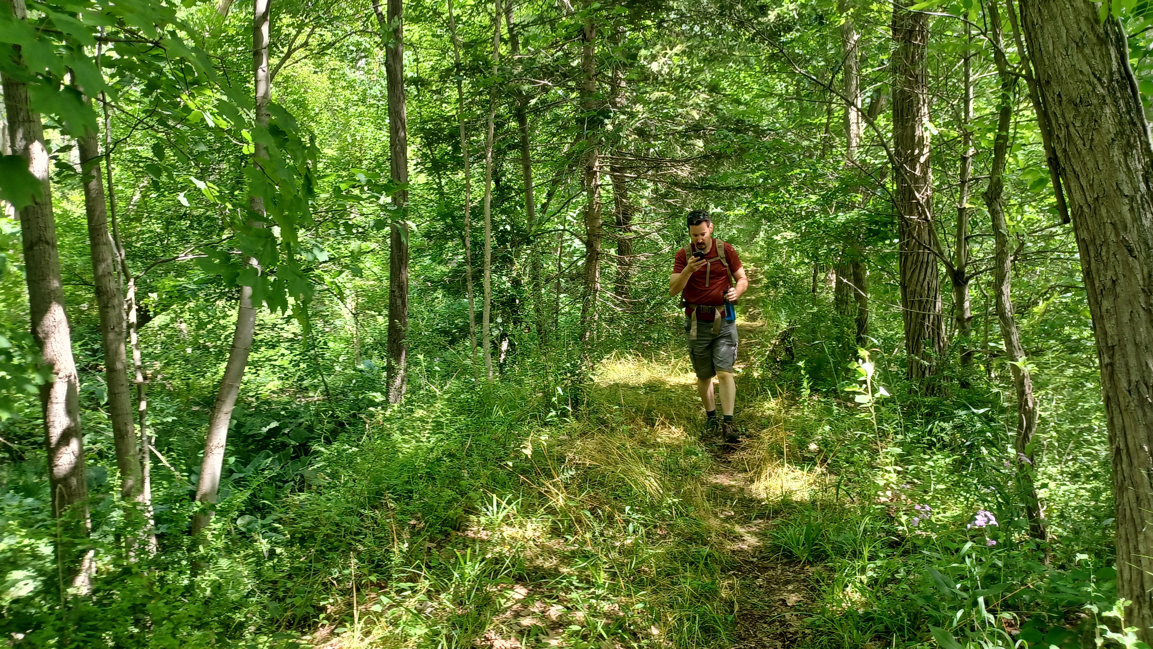
The hike was Father's Day, and I'd been looking forward to spending the day hiking this with my son Everen, because it's a good route for the stroller, and he's good with that kind of terrain as well on his own.

Unfortunately, his mother made plans with him that day, which she tends to do whenever there is something important to me. I didn't make a huge fuss about it because I ended up taking him on Mother's Day.

About a year ago, there was a big change to the Delaware and Hudson Canal museum, in that it moved from another nearby building to the Depue Canal house, which until somewhat recently had been used as an upscale restaurant.


After getting our act together, we started the hike heading down along the creek at High Falls. This crossed over the site of old Lock 15 from the original canal alignment.
Just to the north of this spot was the site of the Rondout Aqueduct. The original 1827 structure was a masonry arch that utilized Rosendale Cement, a hydraulic limestone concrete that used local dolomite and made something that was even harder than the modern Portland Cement we use today.

We discussed that perhaps Rosendale Cement isn't used so much today specifically because it could not easily be demolished!

The original aqueduct actually outlived its 1850 replacement and was even used by vehicles until the 1950s when it was demolished for a supposed flood control issue, because it was claimed to have been undermined. This is widely believe to have been false, because demolition was so difficult. A wrecking ball just bounced off of the thing, and it ended up taking some serious dynomite to remove it.
The replacement aqueduct was a John Roebling designed suspension structure, one of four he made for the D&H Canal. He had already implemented this on the Pennsylvania Canal in Pittsburgh with great success.

It was interesting that not only at the aqueduct, but for a good distance to the west, the canal was entirely rerouted.

An access lane down to the creek passed right over the former site of old Lock 15. There is a narrow stone section east of the lock that would have been a lead in/out, and it appears the lock was where the gravel road is today. It is possible to see stonework narrowing just below the road crossing site.
Just to the west of the gravel road, some fine cut stone can be seen, which might be a remnant of a gate pocket, but we're not totally sure.
Mr. Merchant led us down to the creek, where we could look downstream to the aqueduct sites, and walk upstream past the old mill ruins.

This is a beautiful area used as a trail today. There was a foundation of an office building in this area, along the old canal as well.

Old Lock 16 is apparently buried beneath Rt 213. I haven't seen any remnants of this one. We'd end up coming back around later to visit old locks 17 and 18. This time, we continued past the old mill, and then to a point where we had a good view of the High Falls themselves.
We soon made our way out to Rt 213 where the current concrete bridge is. It replaced an old Pratt through truss bridge in recent years sadly, because I really loved that old bridge. Our group stopped and climbed it on a hike not even a decade ago.

We turned to cross the bridge, with more nice views of the Rondout Creek, and then turned right on the other side on the old Lucas Turnpike. This brought us uphill for a bit until we got to the intersection with Fairview Ave.

This dead end road leads back down to the old canal, as well as some private homes.
As we started walking the road, there was some sort of event going on at a farm property that had a sign reading no cell phones were permitted at the event. That was rather odd, and as we went by the place, there were clearly hippies up in there smoking, and one scantily clad girl out by a truck. I'm not sure if it was a psychedelic convention, or a swinger's event.
Soon, the road turned hard to the right and had some steep switchbacks downhill to eventually come up beside the old canal.

We didn't get on it right away, but rather continued up the road to the homes of the people Mr. Merchant knows. We'd get on the canal when we'd gone as far down the road as we were planning to go.

We could see the end of Fairview Ave, and there were cars parked out there, so we didn't go any farther out to respect their privacy. At around that last house was the site of Lock 12, and the lock house still remains as a residence near the end of the road.
Locks 12 through 14 were in close proximity and were known as the "N***er Locks". Each of the locks typically have names other than just the numbers, but this one was left out of the guidebook certainly because of the sensitive nature of the slur word.
These three locks were pretty well secluded from the other locks around High Falls, so it might have been a sort of prejudice thing that had the canal company putting the black lock tenders over in that spot.
The nearer house before the end of the road for whom Mr. Merchant knows the owners is probably an old lock house as well, as it is adjacent to lock 13.
We continued to the next yard, turned to the right toward the creek, and then crossed a footbridge over a breach in the canal, which was a bit tilted, and then came to Lock 13.
This was in interesting one because the creek side of the wall had been eroded away to reveal what would normally be hidden by the ground.

Much of the lock was in reasonable shape with some metal hardware in place on the berm wall. The lift of this lock was ten feet.

We continued on the towpath in pretty good condition for another tenth of a mile to Lock 14, the last of the N word locks, which was right next to Fairway Ave where we had walked before. This lock was crumbling pretty badly, but still recognizable as a lock. These three locks were of composite material like most of the D&H locks, which would have been wood lined during active days. High Falls flight of locks built in 1850 were all fine cut stone.
There was also a nice snubbing post along the towpath in this area, where boats could be tied off.

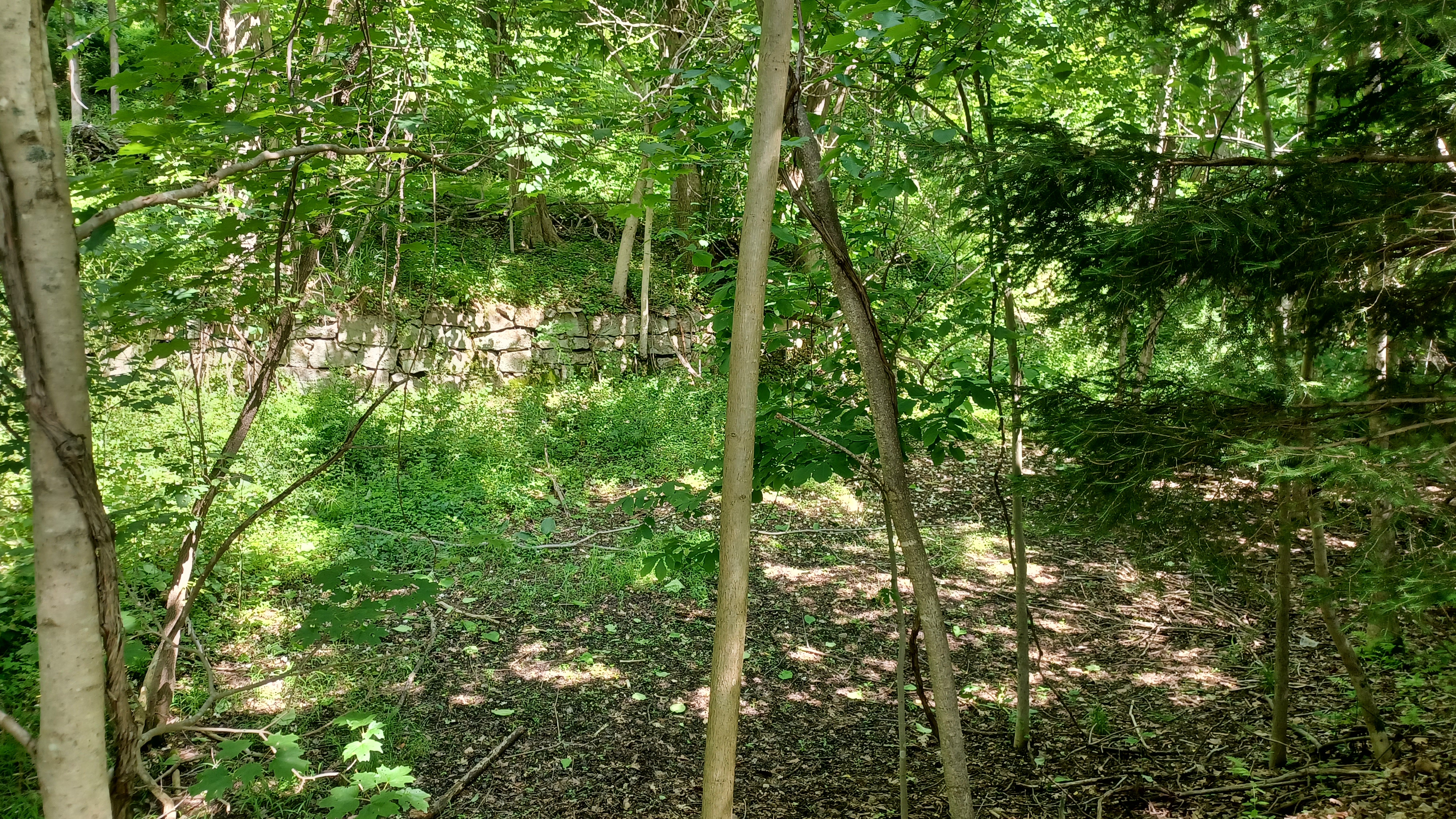
We continued ahead from here to the former site of the High Falls Aqueducts. The old canal route prism was somewhat visible just to the right of where we were walking west, and we soon reached the edge of the site, with the fine cut stone still in nice shape.

The anchors for the cables were all still in place in the walls. Ewa made her way down ahead of us and was sitting down in the trunk area of the aqueduct.
Roebling's suspension aqueduct burned I think in 1913, and that was the end of it. I was rather intrigued to find out that the canal was still used in this section until around 1913, for industrial purposes, while the rest of it was taken out of service in 1899.
From this point, we had to turn back the way we came. We backtracked to lock 14, and there is a foot path down and up through the prism at the upper end of the lock back to Fairview Ave.

We climbed back up Fairview Ave, passed by more of the people from the party milling about along the road, and then headed back to the Lucas Turnpike, then back across the bridge.

We headed backout to Rt 213, at around the site of old Lock 19. Apparently, there is some of this old lock to be seen, and I don't recall seeing it before. I'd forgotten about it because we were involved in such good conversation. One of these days I'll have to check for it again.
We headed west on Berme Road, which is on or right next to the old canal route here. I had hiked this section once before as bonus miles to a hike, but it was better to be out there with Mr. Merchant.

We passed by an enormous old kiln on the left, which Mr. Merchant explained was one of the first of the Rosendale Cement mine operations.

Canvass White first discovered the Rosendale style cement in America, further north around 1818, and then in Rosendale it was found by him or assistant engineer James McEntee during the construction of the canal through here.
This kiln was one owned by a Mr. Robinson, one of two area kilns he owned.
Just past the kiln, out in the woods behind, was supposedly the first of the cement mines. As we walked by up Berme Road to the west, we could see the original mine opening. I'd love to check it out more, but we didn't have the time really.

We did have the ability to do some more looking around since I didn't have little Ev and his stroller, but I'd still have preferred to have him with me.

We continued along the road, and there was a point where a small stream flowed through a washed-out area to the right side of the road. There would certainly have had to be some sort of waste weir or spillway in the old canal at that point, but there was no evidence.
In the next private yard to the right, we saw what was very likely the former site of old lock 20. It seemed pretty obvious to be there, but completely buried and not visible.

We continued on along Berme Road, and the old canal route apparently turns away from the road toward the creek more, then comes back. I'd already seen old lock 21, which is in amazing shape for its age, although badly deteriorating.

We turned to the left onto Canal Road ahead, where the 1850 route turns off. We turned hard to the left to begin following the later canal route along that road.

Along this route, and to the right, there was a large building off in the woods. I didn't know what it was at first, but Mr. Merchant informed us that it was the route of the Catskill Aqueduct
The building was the Catskill Aqueduct Siphon House, completed as part of the project in 1916.
This was the end of a vertical loop siphon that gets waters of the aqueduct beneath the Rondout Creek.
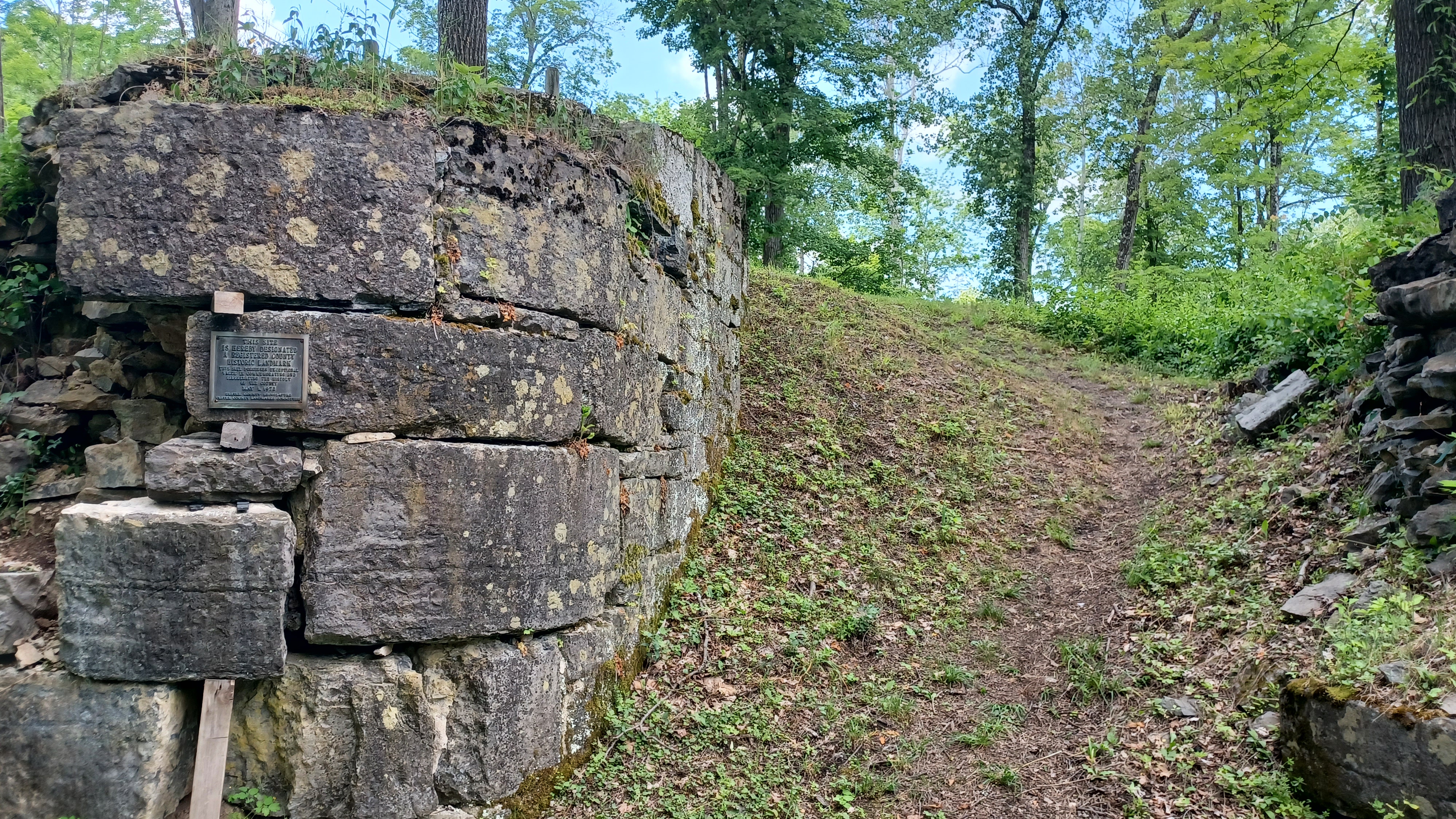
We continued just ahead to the intersection with Depew Road, and got on the trail along the north side towpath to Lock 20, the uppermost of the High Falls lock flight, which had a lift of 12.63 feet.

There were towpaths on both sides of the canal for convenience at this point, and there are foundations of canal related stores and buildings on either end as the canal passes through this impressive cut.

Just ahead we reached lock 19, which had a lift of 12.47 feet. It is the best preserved of the High Falls flight of locks. I think it was lock 19 that Mr. Merchant mentioned the lock house is still standing for, up on the slope to the right.
Lock 18 was just after this, which had a lift of 12.67 feet, and then Lock 17 with a lift of 12.62 feet. All of the High Falls flight are fine cut stone, and in really nice shape overall. A lock house was on the slope above to the right, still lived in.

Beyond Lock 17 was an old basin area above the Depue Canal House and Lock 16, which had a lift of 12.66 feet.

A lot of this got disturbed after a flood a few years back, and I don't even know where to begin describing what we saw in terms of what was there before. Mr. Merchant described everything while we were there, and it was quite something. There was a basin there, so the area was a good center for commerce. To this day, especially with the activities of the museum, there is still good stuff going on. In fact, the evening following this hike, Mr. Merchant was to take part in a live theatrical production to take place along the canal in this area.
We made our way to the back of the museum and toured the exhibits, which included a really great working model of a canal lock.

The locks in this area all originally had miter gates with wickets for opening and closing, and changing water levels, but the upper end gates were replaced by drop gate locks similar to what were used on the Morris Canal and Lehigh Canal over near where I live.

I was quite impressed with how nice the museum looked. It was my first time in since they had opened it, and I believe it was the one-year anniversary of its opening.

Before we left, we set up a date for the next D&H hike pending availability of Matt, Russ, and Mr. Merchant.
Brittany was feeling sick and decided to cut the hike short at the museum and head home early. Russ and Ewa seemed to disappear at this point, but only for a short while, as we'd see them again soon.
From here, the hike would take us to the west, at first on the old canal route again.

We walked through the lots, and then out to the flea market area along Rt 213. The market takes place at the lower end of old lock 17. The entire entrance to the look is well visible, but filled in to the top.

I checked out the flea market and there was a guy selling books. In the inventory I found a few history books I couldn't resist picking up, including one on the Bronx, and another one on a Jersey shore town.
They also had several humorous things maybe I should have picked up but didn't.
We climbed up Lock 17, and looked straight on to old Lock 18, which is also very apparent with some stonework in place, narrower than the 1850 locks.


The O&W system was the first major rail line in America to abandon all at the same time, in March of 1957.
The Kingston Branch started in 1871, when the predecessor to the O&W, the New York Oswego Midland Railroad, built a branch from Summitville north to Ellenville.
This was the end of the line for a while, as the D&H Canal was still in service, but when that was given up in 1899, the line was sold to the O&W.

The tracks were laid in or beside the canal from Ellenville north almost the entire way to Accord. From there, the O&W turned to the north and crossed the Rondout Creek, then went to Kyserike Station.

From there, the line continued north to High Falls and the station there, which was a farm implement dealership after abandonment, and before becoming a private home.
We continued along the trail to the north, which became quite pleasant in some deep woods. Immediately, we crossed over a small missing bridge site on a wooden foot bridge.
The right of way continued on a nice shelf above the roads below, passed closely by a couple of houses, then another little wooden bridge, and eventually came across Leggetts Road.
We skirted some field areas that are typically very wet. When I walked this in the past, it was completely frozen over in the section. This time it wasn't so bad.
Russ and Ewa appeared ahead of us, as they'd moved forward, and we were all caught up again by the time we got to the Cottekill crossing ahead.
We continued through the woods, and came to the south abutment of the Cottekill trestle.


The O&W once crossed the Cottekill at this point, but the bridge today is long gone.

Matt was being silly hanging on Russ, which was hilarious. Silly Matt is always a wonderful time.
The trail has been graded to descend from the upper level down to the bottom where there is a much lower bridge over the Cottekill. The pier to the former bridge is still there.
We headed steeply up the other side and paused, where there was an historic marker that hadn't been there the last time I was there. It had an historic photo of the bridge in place, which used for a then and now compilation.

We continued on the rail bed from the bridge site, and headed toward the settlement of Cottekill itself.

The Shyder Feed Mill once stood to the left side of the rail right of way before crossing Cottekill Road ahead.
This was a feed, coal, and lumber supply business started by Harry Snyder in 1923. A second silo for product had been added in 1937.
The feed mill caught fire and burned in July of 1941, thought to have been the result of a spark from a locomotive on the O&W line.
I remember when we walked through here previously, there was definitely some kind of building still standing to the left side of the trail that we were able to go in. Today, only the two concrete Rosendale Portland cement kilns remain in place, and it seems the rest of the stuff has been demolished. The signs there read that it was preserved in 2015.
Ahead, we crossed Cottekill Road, and continued past the old railroad station.
The old Cottekill Station is still standing as a private home, and in wonderful shape. The trail leaves the railroad bed at the station, and weaves to the east a bit, then regains it agian on the north side of the station. We continued ahead into the woods. Around back of the Cottekill Volunteer Fire Company garage.

We continued through pleasant woods to the north, and crossed Marcott Road next.
Somewhere in this vicinity, Russ and Ewa soon appeared behind us. They had apparently stashed bicycles in the weeds or something somewhere, and were going to bike the remainder of the distance back to Kingston! We didn't see them again after that, but they did stop at the Hurley Mountain Inn for food, but were long gone by the time we got there.
The next part was the longest and most secluded stretch of the entire hike, and it was quite beautiful.
We crossed little bridges and passed through cuts, and then came to a point where the right of way skirted some beautiful ponds long the left side. There was a beaver lodge in plain sight out on one of them.
Beyond the ponds, we gained more elevation, and rose along a shelf with a slope to our left.
Soon, we reached the Hurley-Marbletown Trailhead along Rt 209.
The trail emerged onto Rt 209, where the tracks used to go right beside the road. In the area ahead, the Hurley Station used to stand on the right side of the highway near the intersectios with Russel Road and Wynkoop Road. It was at this point that we had the option to go and have a bite to eat at the Hurley Mountain Inn.


The Hurley area was first settled in 1662 by Petrus Stuyvesant, and named Niew Dor, but the village was destroyed by Esopus Native Americans just a year later.

The English acquired the colony in 1664, rebuilt the settlement, and named it Hurley out of some sort of British origins.
Most of the group was not so keen on stopping for food this late in the day with only a few miles left back to Kingston Plaza, and so it was just Kirk, Matt, and I that went for the food.
Our group actually attended one of these St Patricks Day Celebrations, and the parade went right through the inside of the building.


I think our buddy Lerch hugged the Grand Marshall while we were in there. It was definitely quite a busy place to be at the time. I still don't know if the claim that it is the largest celebration is totally correct, but I have nothing to go by to refute that.


We continued out of the restaurant, and made our way north along the paved path. The trail continues up along the road, and when I'd done it in the past, it was just a grassy path between Kingston and where it turns off near Hurley.

I spotted where the right of way turned off to the right, and we got on it. It was the same old grassy path as before (although I'd done it in the Winter and it was more snowy), until just ahead.
A new path had recently been made from the paved path along Rt 209, down to the railroad bed a little north of where it diverges from the highway. There was new pavement, but the right of way was blocked off. We absolutely could not be going way out of the way at this point, so we went through anyway.


It was nice, but it was way too much pavement. We passed by some pretty ponds, and the lighting was perfect for viewing. Soon, we came to a spot where it had not yet been paved yet, where the right of way comes to a power line clearing. We continued past that on the gravel, and were afforded a nice view of the Esopus Creek to the left of us.


We made our way past a substation, and then on to a business acess road off of Hurley Road where several more piece of equipment were staged.


We crossed the road, and then soon passed beneath the NY Thru Way via an underpass. From the road on, the trail is paved again, all the way out almost to the former junction with the Ulster and Delaware Railroad.


We continued to follow the tracks from there, where there was some equipment parked. The O&W's Kingston Station was somewhere in this vicinity, but I'm not sure the exact spot where it stood.
We continued along the tracks out into the area skirting Kingston Plaza, and got off of them at the mile post 4 from Kingston Point.
The others really had no problem getting back. It seems they all followed the same route that the rest us did on the under construction trail and got back well before the rest of us.
I very much enjoyed this hike, and although I wish I could have had my son with me, he at least got to see his grandfather (Jillane's dad) for this day, and I would spend lots more time and miles with him in the days to come.


It's hard to believe that we're finally coming to an end to the series on the Delaware and Hudson, and although we don't quite have the following I'd hoped we'd generate by this time in the series, maybe in the future there will be more buildup. If not, the group size is just fine as it is and I'm having a great time.
No comments:
Post a Comment