Hike #1545; 4/30/23 Lawrenceville and Ewing Loop with Shane Blische, Evan "Joe Millionaire" Van Rossum, and Everen
This next hike would be a large loop between Lawrenceville and Ewing in Mercer County NJ.
This was a time in my life where things were often not going quite as planned, and I had to sort of roll with it. I figure I do better than average at this, but sometimes it can be a bit tough.
The hike part of it wasn't so bad at all. I was just glad to have friends there willing to go anyway.
The original planned route was from the meeting place in Pennington NJ, at the grocery store. We were going to walk directly from that spot in a large loop that featured the Lawrence-Hopewell Trail and its connections. The trail is 25 miles, and perfect for doing hikes with Ev.
I had done one of them somewhat recently, and wanted to cover the entire trail on group hikes again, but in three segments that would feature the other area sites.
My original planned route would have been a variation of a hike I had done with Ev and Jillane last year, with a couple of new things added in that I had wanted to do.
Unfortunately, the weather forecast was looking grim. It never scares me off, but it certainly scared off everyone except Joe Millionaire and Shane.
I went and picked up Shane at his place in New Hope on my way down, and we met Joe Millionaire at Pennington Market.
I asked if they'd be cool with changing up the route, and they were. The main reason for this was to do some trails that would be less concern in muddy conditions, as well as some more urban conditions I'd prefer not to do in the warmer weather when I wanted to take a dip in streams.
We drove on down to Lawrenceville, and parked at a lot across the intersection from James Street and Gordon Avenue, which is partially built on the historic right of way of the Johnson Trolley Line.
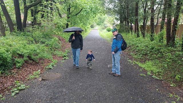
It was a real relief to be out and walking at the start, even though it started raining almost right away. I loaned Joe Millionaire my umbrella to use, for which he was thankful.
As soon as I started walking across Gordon Street and along the right of way along James Street, a lot of my stress just started to fall away.
We soon passed by the combination station, office, and power house for the line on the next corner, which I pointed out. It is now home to other businesses.
When we got to Philips Avenue, I let Ev down out of the stroller to walk for a while. He was quite happy and handled walking early on very well.
We continued west across Craven Lane, Titus Avenue, and Green Avenue, and crossed over a small stream held in place by a concrete sluice.
Around that time, the rain started coming down a bit harder, and so I put Ev in his stroller with the rain cover over it. He was happy enough to deal with it at this point.
We continued onward to the next crossing with Lawrenceville-Pennington Road. To the right at that crossing, a white painted brick office building to the right is a re-purposed old power house for the trolley.
We continued across, and made our way to Denow Road, where there was no choice but to turn left to the east. This was where the right of way was obliterated by the Interstate 95 construction. We had to continue on the road for a bit, and then pass through a campus of senior care facilities.
We cut to the right on one of their access roads and walked around some of the buildings, along sidewalks, until we came out to Rt 206.
We turned right on 206, which had a limited but still doable shoulder to head south on. There were at least crosswalks over the Interstate 295 ramps ahead. This area has a major cloverleaf interchange, and what used to be 95 is now designated 295 (interstate 95 was never completed across NJ).
We continued past the Lawrenceville police station, and cut through their parking lot under their solar panels in the parking lots as a break from rain. This brought us out to West Long Drive. I didn't realize right away that this would not take us into the campus of Rider University as I was planning. We had to walk back out to 206, turn right, and then turn right again into the campus.
We followed directly across the very northernmost way through the campus, through lots. There wasn't really anyone around that we could see since it was raining so much. I'd only ever walked through this campus once when it wasn't dark, and at that time it was very snowy. I don't think I've ever been there in good conditions.
We continued on to the very last parking lot, and I checked the woods a bit to see if there was a way to cut through, but it was really swampy. The Little Shabakunk Creek comes through here, and is one of the impediments to getting away from the college buildings.
We cut through the grass at the end of the far lot and reached the main road through the campus. At that point, it was only a hundred feet or so to the railroad bed, which is open as a trail from that point again.
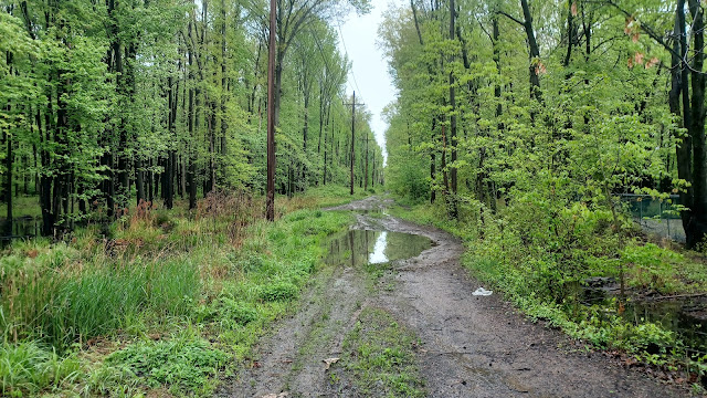
This section was surfaced with crushed stone aggregate, but it was full of giant mud puddles, which I just walked on through.
We crossed over a power line clearing, and then passed through a nice wooded area known as Loveless Nature Preserve.
We continued on through to Eggert Crossing Road, and to the left there was a building that I thought looked almost station-like, but probably isn't. I'm not sure where all of the station stops were on this line, but this would have been a convenient location.
From this crossing, the trail becomes paved and is more closely parallel with Johnson Ave. It was a nice and easy walk for a bit, and I pointed out a little further down that there was the hilariously named Short Johnson Road on the left side. I can't believe they ever decided to name the road this.
Interestingly, the road name does not appear on Google Maps as that name.
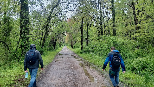
After this section of development, the rail bed went back into woods, which was quite nice again. We crossed over the Shabakunk Creek on a bridge, and then skirted Drexel Woods as we continued to head south. This section of trail was definitely the worst, because it was heavily rutted with potholes.
Eventually, we emerged at 5th Street in Ewing, which is built over the right of way. We continued on 5th to the south, across Spruce Street, and then further down to the Aldi on the corner of Olden Ave. I wanted to go in and get something for Ev to eat, some snacks and maybe some milk or something. I think I also had to go in and change his diaper since there were so few other opportunities.
We had a little break outside under the awnings of the building for a bit before moving onward.
We continued to the east for a bit on Olden Ave, and I pointed out where the old railroad used to cross. We had bushwhacked a bit on that the first time I tried to trace it. I was surprised a little further up the road to see that there were some old rail served businesses that once operated here off of Olden, and that the rails were still in place through the pavement. These all would have been connected off of what was formerly the Johnson Trolley.
When we reached the Capital Plaza, we turned to the left, went under the awnings of those buildings, and headed to the north along the west side of the building.
We followed this out to Spruce Street, which was really busy with traffic compared to how it was before.
There was a woman that was walking just ahead of us, and she hurried across with no problem. Cars were not slowing down, even though I was obviously pushing the little guy in the stroller. We had to wait until just the right time to dash across.
We made our way uphill and into the parking area with a smoke shop in it, adjacent to the Trenton Farmers Market. We continued through the lot to the access road out the back. This brought us out to Princeton Avenue.
A short turn right and then left would take us onto Mulberry Street, which would be our route all the way down to the Delaware and Raritan Canal.
The crosswalk at this intersection was ridiculous. We had stripes painted at one spot for walking over, but the electric walk sign was on the wrong side.
Some of the heaviest downpours we were walking through were on this street, but we were in high spirits anyway. I was feeling particularly great knowing how close we were getting to the canal.
We crossed over Brunswick Avenue near the top of a hill, then descended gradually until we reached the Delaware and Raritan Canal, where it goes underground beneath Rt 1. There is a bracing work that goes over the canal in this area just before it disappears.
I had not walked this bit in quite a while, so it was nice to get back on it, despite the rain.
There was one fallen tree down when we got there, which I texted a photo of to my former superintendent Lauren, who is now the superintendent for D&R Canal State Park.
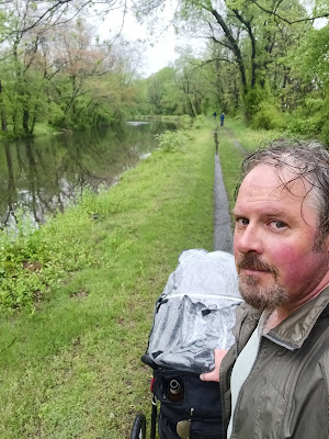
Pretty soon after getting on the canal, the rain let up. It was the perfect time for this, and the canal was absolutely beautiful.
This section was of good interest because the canal, built in 1832, was on the near side, but a branch of the old Camden and Amboy Railroad, built in 1839, followed the berm side, which to a degree is also a trail through this area.
The very first part has Rt 1 directly parallel, so that would have destroyed the railroad bed at least through that part, but much of it was recognizable.
We continued on and crossed over Whitehead Road, then passed beneath the on ramp to Rt 1, then beneath Rt 1 itself.
We continued ahead and reached Carnegie Road, and the towpath ahead disappears. It goes into an area that is built over by a landscape supply place, and so the trail that is maintained goes across the canal on Carnegie Road, and then turns left on the old Camden and Amboy Railroad right of way.
There is an old bridge keepers house on the railroad side of the canal, still standing, but basically vacant. It's a really nice looking place, and was an important thing in canal days because a bridge keeper needed to be on site to lift the bridge every time a boat came by.
There should really be someone living in and caring for that house. There are blue with clouds painted on boards on the lower windows, but all of the upstairs windows are busted out and looking horrible. These historic buildings are going to be lost if left open to the elements like this.
The railroad on this side was only in use until about 1865, because the muddy berm side of the canal was prone to washouts and sinking mud.
We continued ahead on the railroad bed to Bakers Basin Road, where the main trail switched sides back to the towpath again. It is another disappointment that this area was allowed to be let go. At least we have the through route, but the towpath should be the route the entire way. It looks to me like business was allowed to get in the way of history and recreation once again.
We continued on the towpath ahead, and soon reached the crossing of Rt 1.
Not so many years ago, this was a terrible crossing. There was no bridge, and people just had to dash across Rt 1 and test their luck. When the bridge was put in, it opened up a whole new world of connections here.
I let Ev out of the stroller in this area, and he happily dashed to the top of the pedestrian bridge, and then looked out at the cars going beneath on Rt 1.
After we got off of the bridge, we soon passed under Rt 295 and its on and off ramps. There was a label underneath the bridge on the piers stating there was an anti graffiti coating, which looked like an invitation, because there was graffiti on the wall just next to it.
Ev continued to walk along the trail for quite a while, with lovely wetlands of the Shipetauken Creek to the left and the canal to the right.
We remained on the canal until the Lawrence-Hopewell Trail made its connection to the left. This section was called the Brearly Great Meadow Trail.
The trail was a crushed stone surface, and followed a berm out onto the wetland where there was a nice observation platform to the right.
We soon entered a swath of woods, crossed over the Shipetauken Creek on a foot bridge, and then came to the open old farm land with the historic Brearley House in view.
The lovely old brick farm house was built in 1761 by James Brearley, who was the third generation of farmers to work the Brearley Meadows.
With the road access to the house to the right, the Lawrence-Hopewell Trail used to go through the meadows to the left, but there was a sign here reading that the thing was closed.
Indeed, the entire area was under heavy construction just outside of the preserved area. There is a new Ryan Homes development going in there, and so the trail is closed through the original route.
We had to turn right and head out the driveway for a bit, which was nice because it was another way I hadn't walked before. The area here was once known as Princessville, and there was an old cemetery just off of the driveway I'd yet to see, so I figured we would stop and have a look at that.
We went around a left turn in the road, and then I was surprised to see another trail section already developed to the left, a temporary, or maybe permanent rerouting of the Lawrence-Hopewell Trail. I'd not been on this bit before either, so we decided to go that way.
The trail weaved through the woods a bit, and then emerged next to a corporate building and across from the Hilton Garden Inn. The Lawrence-Hopewell Trail turned right on the other side of the road and brought us out to Princeton Pike parallel with Lenox Drive. The trail turned left along Princeton Pike, then crossed over at the other intersection with Lenox Drive.
Immediately on the other side, we came upon the beautiful Brearley Oak.
I understand this may be a Champion Tree, the largest of the species Black Oak on New Jersey. The tree may be quite old, between 250 and 410 years.
We paused a few moments to admire the magnificent tree, which sits on the property of Bristol-Meyers-Squibb. I heard that they wanted to cut this tree down to build something at that spot, but that it was saved somehow through local opposition.
From here, the trail weaved to the right, around close to 360 degrees, then back to the west a bit to cross the four lanes of the Bristol-Meyers-Squibb entrance road. I had walked this section of trail while it was being built back in 2009 or 10 I recall, and got some photos of the work being done. This was the first time I had been on it in daylight since then.
The trail skirted the wood line in view of the buildings, one of which had a lot of giant glass windows. When it turned right, another trail goes left out and around all of the meadows, which maybe I'll get back to walking one day.
We continued north across Lewisville Road and into a park associated with the Lawrenceville School. We were so close to the end, and yet we were coming into more problems. Signs were reading that the trail was closed here.
It was pouring again, and we needed to get through somehow. We'd have to avoid construction sites and such, and I didn't know how we were going to get through.
We opted to follow the trail around the fields, which were still open, and that took us to a main road that goes through the Lawrenceville School property. The trail officially turns right on the road, which we did briefly, but then made the first left on another trail that goes west through the campus.
This was really pretty nice, and a route I had never followed before. We followed it along the south side of a pond, past buildings that were obviously being worked on along the other side, and then to another trail that went sort of north/south.
We meandered, and found our way to The Circle, which had some lovely giant trees in it. I have been told that the giant trees here were the original Frederick Law Olmstead plantings brought down from Massachusetts in 1890.
We eventually found our way out of the gated campus by way of a regular walkway to the north. We had done pretty well on timing, and were pretty soaked.
We decided to celebrate our early finishing by heading to TJ's Pizza and Pasta, a place I've liked every time I've visited Lawrenceville, and had some food.
Ev behaved himself well enough and ate some, so we were all pretty happy closing off the day with this.
From there, we had only a couple of blocks to the north and east to reach the Johnson Trolley line and the spot we had parked. I got Shane home and we were finished.
These hikes get me feeling pretty well, but lately so much stuff is weighing on me, haunting the back of my mind during the day, its hard to come off of such a great experience to not so great.
During the course of this hike, we had some good discussions about what I'd been through.
Joe Millionaire and I talked about the time he disappeared from the group and how we hadn't heard from him for an entire decade. He told me what he was going through, and I talked about what I had gone through in the years following the fire.
I was glad that I had this opportunity to extend my gratitude once more about how much he helped Jillane and I in the days after the fire that took our home and pets. He was there with others, ready to help out in whatever way he could. He burned a bunch of DVDs for us to watch, television shows to keep our minds occupied, and gave us a bunch of money when we had nothing. He wasn't rich, but he and others were willing to help out with everything they could.
Because of all of this, I often feel as though I owe people my presence at all of these different events taking place, almost all on Sundays. This was another one of those weekends that, if I had attended things I was expected to, I would not have been able to get out at all. I figured out that if I attended all of these obligatory engagements, I would not have hiked in April at all. And I can't live that way.
Friend's funerals, my dad's birthday, my grandfather's belated birthday event, all big things, and if I attend one of them, I could get crap for not attending the next thing and so on.
Then, my mind goes back to how I used to be treated at work, where if I changed my hike to a different day just once, the supervisor would in tern schedule me for every Sunday to follow, citing that if I didn't hike one Sunday, then clearly, I could deal with working every Sunday.
I've had to take a stance, and ask that everyone respect my self-imposed obligation to organize these hikes.
I've been doing a lot of thinking about loss lately. The day after this hike, I went to attend a memorial service for one of my former Phys Ed teachers from school, Stephen Fritts. As usual, if I'm not at work, I have Ev with me, and he was going a little too crazy for me to wait in line. The place was packed with cars, and the line went out the front door. I came back later and the line was the same length.
I knew exactly what I would say if anyone were asked to come up and speak a few words, but I take greater comfort in the fact that I already expressed those words to Mr. Fritts the last time I saw him.
Mr. Fritts attended something I was speaking at; it was either a presentation on Warren Highlands Trail or one of my then and now history ventures, I forget for sure which it was. Anyway, I spoke with him briefly, and mentioned something that stood out about him to me all those 25 plus years ago. When we were doing the mile run, which was something that happened every year, I remember vividly Mr. Fritts coming out and running a couple of the laps with the students. I think he was the eldest of the phys ed teachers at the time, but he came out and jogged it, and he did so with a bright smile on his face. I never cared for sports, and didn't get to know him a fraction as well as my peers who had him as a coach did, but this really stood out to me, as well as his good demeanor with the students. I told him this myself, and he seemed kind of surprised, laughed a second, and said "that must have been a loooong time ago!". Maybe he only did it that one time, but I remembered it being encouraging. There are so many times in life where we might think something, but we never express it until the time of a memorial service. Certainly, the family and friends might take comfort in such reminiscing, but I think when you appreciate someone, you should express that to them while they're alive to appreciate it. I feel very good that I didn't hold back from sharing this with Mr. Fritts, and I hope it gave him some joy. He was only 72, which really isn't all that old. We just never know when our time is coming, which is why it's so important to speak up when the opportunity arises.
I've been living my life trying to take those opportunities and allow appreciation to be felt. I achieved more of that through this hike, and I am fortunate to both to have the experiences and the opportunities to express gratitude.


No comments:
Post a Comment