

Hike #1547; 5/7/23 Churchville to Fern Rock Philadelphia with Professor John DiFiore, Brittany Weider, Ricardo Alejandro Furstein, Kirk Rohn, Craig Craig Fredon, Justin Gurbisz, Evan "Joe Millionaire" Van Rossum, Shane Blische, Diane Reider, Robin Deitz, ?, Kevin Kowalik, Kathryn Cataldo, Pete Fleszar, and Everen
This next hike would be a point to point, focusing on tracing mostly the historic Newtown Branch of the Reading Railroad between Churchville and Philadelphia.

I had hiked the entire line from Fox Chase north to Newtown, some sections of it more than once, but I also wanted to try to walk at least parallel with the sections that were still active, so I could say I'd walked the entire branch.
I also wanted to get back and see segments that had been made into trail since the last time I'd been out there. The sections around the County Line, I had hiked when it was simply overgrown, as wall as just after the rails were removed. Now, they were totally removed and a trail was in place.

The line was first built through to Newtown in 1878 as the Philadelphia, Newtown, and New York, Railroad.

It was built to sort of block the “National Railway” which later became the main Reading Railroad line to New York city.
This was not the only line to be built in such a way.
We had done a series to trace the route of the Somerset and Mercer Railroad, which broke off of the Bel Del Railroad below Washington’s Crossing, and connected to other lines in Millstone. Some of that was rather haphazard construction, done fast to block the other line.

This similar line was funded by the Pennsylvania Railroad, and it was planned that it would continue north of Newtown and connect with the Somerset and Mercer in NJ, but this never came to fruition.

The National Railway’s Delaware and Bound Brook project was built anyway, and the line was taken over by the North Pennsylvania Railroad, which was also built by the National Railway, and so it really became part of the Reading system. It makes for an interesting history, built by the Pennsy, and then became part of the Reading.
In 1876 the Great Frog War of Hopewell took place and D&BB came out as victors destroying Newtown & New York Railroad's chance of ever reaching to New York City. The Mercer and Somerset was abandoned in 1880. That dream was over.
 |
| 1972 by Martin Zak |

Service continued through to Newtown, even after Reading Railroad merged into Conrail in 1976 and railroad traffic was reaching a national low. The line had been electrified as far as the Fox Chase Station by 1966, and diesel shuttles continued through the early eighties.


Despite some major upgrades, such as replacing all of the spikes with expensive pendrol clips, and replacing ties, the line was given up on.

Up to Fox Chase remained in service and still remains so to this day, but everything north of there was abandoned. At the Montgomery County line, it was made a trail through to almost the next county border. In recent years, it was extended further north as trail beyond the Bucks County line and past Southampton to almost Churchville.
I went over and over the route I wanted to plan for this. We couldn't do the entire Newtown Branch in one day because it would come out to be too long, but I'd already done enough of it at the north end in the past, and there were more serious obstacles there.


The part that was most important to see is the part that I hadn't seen in its new trail state, and the stuff I could do with Ev and the stroller.

Finding parking near the end in Philadelphia was rather difficult to do as well, so I would have to figure out how we were going to do it.
I figured out that Fern Rock Transportation Center was a pretty good spot, not too far from the line we would be following, still related to the Reading Railroad, and it would allow me to slap together another little greenway bit using a few other parks.
Parking is free at the SEPTA lots on Sundays, and this one seemed pretty welcome when there was a sign literally welcoming the rail trail to the town. At first, I questioned it because I didn't think there had been any trail develpment done this far down.

It seems there had been no trail development, and I have no idea what any of those signs were saying.

I had never been to Fern Rock before. I had actually never been to that part of Philadelphia at all before. The drive down was pleasant enough, and Ev and I took it just the two of us. That's always a little tougher because it takes more time at the stores and such to get ready, but I still made it on time.
Some of the group assumed we would be in Philadelphia or something like it most of the day, and I trust they were pleasantly surprised by the feeling of seclusion on most of this hike. Joe Millionaire in particular was thinking it would be mostly city.
Once we were all together at the station, we shuttled with as few cars as we could to our starting point, which I planned to be the North and Southampton Reformed Church near Churchville PA.
 |
| 1972 |

There was a Churchville Station on the former Newtown Branch, which is still standing as a private residence, but we couldn't' really start there. The trail ends at Bristol Road, which is the road the church was on. Beyond, it is totally overgrown and rough to get through. I bushwhacked it once and I'm happy not to do it again.
 |
| 1985 |

There is former station parking along the line in Churchville, but my understanding is that is now private parking for the residence, so we were not going to start there. Knowles Avenue goes right along the railroad bed from that station to Bristol Road, but there just wasn't a good place to park up there.


We headed to the church parking area and used a spot closer to Bristol Road to head right out. This was not the best road walk to be doing, but it was the best thing I could find close to the very end of the rail section to do the entire thing.

Shane brought some official Reading Railroad lanterns to carry burning during the hike, as a sort of homage to the old line.
We made our way west on Bristol Road, which really sucked because it was so narrow. I had to wait for cars to go by, within sight, so I could push Ev in the stroller out to the next bit where I had enough shoulder to walk. It was actually only a very short distance from the church to the start of the rail trail, but required a lot of attention to be safe.
When we reached the intersection with Churchville Road on the left and Knowles Ave on the right, it was an easy and quick jump over to the railroad bed.
 |
| 1979 |

Immediately, I was shocked at the amount of people using this trail. Often, when a rail trail goes in, they seem to balloon the numbers of expected usage.

In the case of the O&W up by Kingston New York, the local governments were using numbers that would be one person on the trail literally every hour of the day, 24 hours a day, every day of the year. This was of course way off, even when considering averages.
If they put out a number like this on the Newtown Branch, I'm afraid it would not be a good argument, because they trail was pretty heavily used.
Once everyone was together, we began walking the new trail to the south. I let Ev out of the stroller to walk on his own for a while, but we had to watch him due to the amount of bikes going by. They were all coming to the end of the trail, some just turning back, and others stopping there for a break.

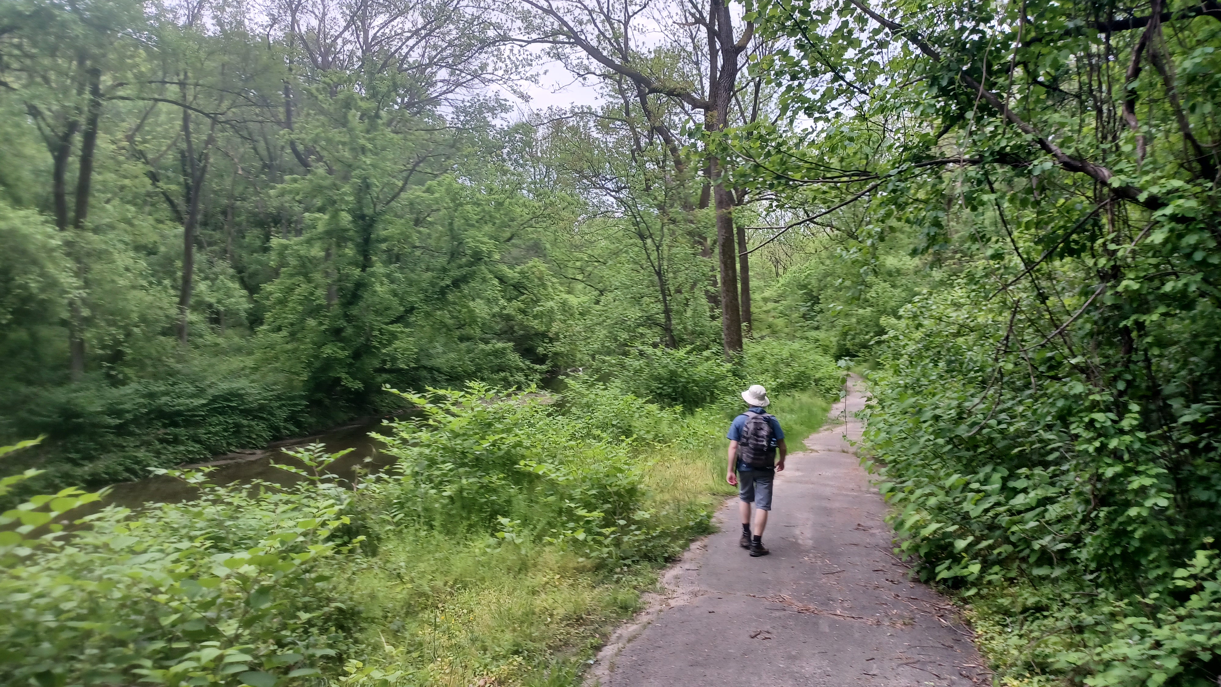
I was happy to see the trail was not paved here, but rather a crushed stone surface, which is much better for the feet to be walking on for a good distance.

As it was my third time on this specific stretch, it was entirely different than the last two times I had been on it. The first time we still had rails in place, and the segment had some serious washout from Mill Creek, and the second time was the day rails were being removed north of Southampton.
There was almost nothing to recognize from before. The only thing I thought to watch for other than Mill Creek was if they had made a connection to the trails in Tamanend Upper Southampton Park.
They did in fact create a connecting trail to one that had been mowed in close proximity to the rail bed.
We continued to the south, and I let Ev walk along with everyone for a while as long as myself or one of the others was holding his hand to keep him from the fast cyclists.

We passed beneath Street Road underpass, and soon after reached Southampton Station. We re-grouped there, and Shane and I did a history dissertation for everyone on the rail line and station stop.

Once we were done there, we had discussed stopping by a Mexican place up the street for margheritas, but it was actually more out of the way than I had realized. After we started walking it, I called it and we headed back because there would be other places to stop and eat along the way. It was actually too early to be getting food I think, and we had enough drink going on already.
Kat had handed me a bottle of Orange Jubilee MD20/20, which was a big favorite of the rot gut variety from the past, so we indulged generously in that.
The next section of the rail bed paralleled Knowles Ave, and I had only walked this bit once.


The first time there, it was so terribly overgrown, that we decided to forego it and walk the parallel road, which was cool because that revealed all of the industrial spurs that this line once had, some of which still has that infrastructure in place.

The second time out was the day the rails were removed, and so it had been cleared and was easy to walk.

Once again, this was like being in a totally different place. It was a relaxing walk, and it felt rather secluded when Knowles Ave moved off to the south a bit more and we were in a bit of a cut.
It wasn't all that long before we reached County Line Road, where we left Bucks County and entered Montgomery. This was kind of a point of contention with the line, because Bucks County seemed to favor the reactivation of the railroad more at one time, while Montgomery had a lot of people that just wanted the trail.
County Line Road was once a station stop called County Line Station, where there was a small shanty shelter for passengers. That shelter reportedly lasted into the early 2000s, but was demolished due to liability concerns.


We could kind of pick out where it used to stand on the previous two trips out there, and there was a pole that still had insulators on it. Shane climbed up it this time and was able to retrieve some of them.

The scene was so much different than before, because even though the tracks had been removed the previous time, we were still masked from everything off of the trail by a heavy shroud of briars and weeds.
Now, the property immediately to the northwest of the rail bed, right about where the station shelter once stood, has been completely cleared, a split rail fence erected, and the lawn was extended almost to the edge. Bicycle jumps were built just inside the fence on the private land.
We continued on ahead and passed beneath the Pennsylvania Turnpike, Rt 276, and then beyond to the underpass of the former Pennsylvania Railroad's Trenton Cutoff, which was built in 1892. It is still active today.


The trail was interesting here, because they erected a sort of walkway beneath the active track in case anything came falling down from the bridge above.
Shane and I did another little history talk under the bridge about the rail lines, and then continued on to the south. Shane lit his historic Reading lantern, which he carried out in the open much of the first portion of the day.
Brittany had her bluetooth speakers going, and everyone behind me turned the hike into an all out dance party.
There weren't as many cyclists the farther we got to the south, but that was still a pretty good amount of them. Pushing Ev, I was staying to the right out of their way, but the group behind us were walking side by side and taking up most of the trail. With all of the music and dancing, they couldn't hear easily when someone was saying they were coming up on them, so I tried to stay away from that part of the group for a bit.


Pretty soon, we reached Byberry Road, which was where the trail ended for many years. There is a parking lot at the site now, and this was formerly the site of the Woodmont Station on the Newtown Branch. The station is of course long gone, and a retention pond and little trail meanders around parallel with the rail trail at this point.
We passed over to the south, and continued on the rail bed, and soon came to Creek Road. The road was open to traffic to the left, but closed and open only to pedestrians to the right. As we walked on further down the rail bed, a splendid view of the Pennypack Creek and the Creek Road bridge came into view to the right.
The bridge was a 34 foot, single arch span constructed in 1840, now open only to pedestrians. We had visited this bridge on the Pennypack Hike I did last Summer.

Most of the group was overall pretty respectful, but the more time went by, the more belligerent toward them Shane got, to the point where he was hollering at they as they went by. At that point we needed to calm him down a bit.

The worst came when we were all walking, but the group behind me was taking up the entire trail. A young kid crashed his bike into Shane and fell off of the trail. I think that was the moment of realization that they needed to calm down a bit.
We continued south through lovely woods, with the Pennypack Creek often in view to the right of us.
Along the way, we crossed the former grade crossing with Paper Mill Road, which is now also pedestrian only and crosses over the creek to the right on another historic stone arch bridge.
We crossed Pennypack Creek on a bridge, passed through a meadow area, and then crossed the creek yet again a bit beyond.


While in this stretch, we passed through an impressive, deep rock cut on the right of way. There were paths going up the sides for better views of the area and trail.

Not well known, especially not to the cyclists speeding through at over thirty miles per hour through this cut, is the fact that the site was the location of one of the worst train wrecks in American history.
On December 5th, 1921, two locomotives crashed head on in this cut, and the lives of 27 people were lost, with seventy others injured.
Train 151 was traveling north from Philadelphia and pulled onto the Bryn Athyn siding to allow a milk train to pass, but there was another passenger train coming after. Despite having written orders not to proceed until the other train had passed, 151 continued on to the north. About a half mile north of the station, the collision with train 156 occurred. Hot coals flew back and caused major fire in the wooden floors of the passenger cars.

We continued on through the cut, and then made our way toward Bryn Athyn Station.
This station stop was established early on, when the railroad was first developed, and the original station was across to the west side of the tracks. It was I guess three stories, and served as a station agent's home as well as station itself.
When live-in station agents fell out of favor, the stations similar to what we usually see became prominent. The station still standing at Bryn Athyn was built in 1902, and serves as the post office to this day.
The station closed to railroad use along with all of the stations north of Fox Chase in 1983.

The original station was sold to private interest and became a residence until sadly, just a little over a year ago, it burned down. They are apparently going to rebuild on the site, possibly using some of the original station foundation. It's just a shame because it was a lovely historic station building.
We crossed over Fetter's Mill Road, a nice spot with a pratt through truss bridge over the Pennypack to the right, and then stopped at the All Aboard Cafe. This food truck parking spot directly accessible from the trail is a great spot to stop. I got some sort of sandwich I recall, but I don't remember quite what it was. I think I got some fries for Ev as well. He's starting to get a bit pickier with food than he used to be.


We had a very nice little break here and Ev was able to run around for a bit. Kat headed down to the creek and got sick, so she and Kevin would leave us at this point and head out.

We continued to the south on the trail from here, and while we were on the stretch along the Pennypack Creek south of Bryn Athyn, Pete Fleszar showed up on his bike to greet us!
Pete had been randomly showing up on many of our past hikes, from the Standing Stone Trail to Tuscarora Trail and others, and sometimes delivers us cold beers. On this occasion, he had a good IPA I recall.
Pete rode with us for a while to the south until eventually he had to turn off to continue on with his day.
We headed south and crossed the Pennypack Creek yet again, then immediately crossed Terwood Road. The rail bed then passes through a swath of grass near a real estate place, and then crosses over Welch Road at Bethayres.

It seems like this spot, with the big parking lot, should have been a station spot at one time, but I understand that it wasn't.

We continued to the south from this lot, and there was a signal tower to the right that was surprisingly left in place and easy to climb up. Shane climbed up it this time.
Just a little to the south, we reached the grade crossing with the Trenton Division, which is still heavily active. We just missed a train going through at this time, which was too bad because Ev is really starting to love trains.
The line was the Reading Railroad's New York Division, and today is SEPTA's West Trenton Line, as well as CSX's Trenton Subdivision.
I got another then and now from this spot with an old photo of a locomotive going by on the New York Division.

The line crosses the Pennypack Creek yet again just after Bethayres Junction. Note that this is called "junction", when really it was no such thing. The lines crossed at grade, but didn't have a connection.

We passed beneath the Huntingdon Pike, and then continued downstream along the Pennypack Creek into Lorimer Park. There is a side trail off to the left that leads down to a camp area where there was a good spot to take a dip and let Ev throw stones.
This would be I think my first real time completely down in the water for the season, and I think only John and I got completely submerged in there, which is pretty typical.
There were other people down in my favorite spot to go in in the area, but we were able to just go downstream slightly from there and had another very good rocky beach.
We hung out there for a while and cooled off, and I considered heading downstream along the creek from there, then heading back up to the railroad bed, but I figured with the stroller it might be harder, so we just went back the way we came on the side trail.

We got back to the railroad bed and continued to the south and passed a couple more old signals. We crossed Moredon Road in Lorimer Park, and continued south on the shelf above the creek, or in the occasional cut.

There was one really big cut before we reached the end of the official trail by Shady Lane. At that point, the trail cut off to the right and headed up to another access point off of Rockledge Avenue.
I was thinking we were going to have to go around and bypass this section, because the last time I had walked through on it with Shane, James, and Dan Asnis, it was really very rough walking.
This time, it looked very clear. There was a good, well worn foot path through that just looked totally inviting, so we took to it and continued on the railroad bed to the south.
We were on a fill at first, and then went into a bit of a cut. We came close to some homes, and then went into a very deep cut as we approached the underpass for Pine Road.

The path had been really good up until we got into the deeper part of the cut, and I was able to push Ev's stroller with no problem at all.

The deeper part closer to the underpass got horrible. The houses directly up above the railroad bed dump all of their trash directly down and onto the rail bed, and it was a complete mess. I had to be very careful pushing through all of this. There were also a couple of trees down which required some assistance to lift the stroller over.
A cyclist that was on the trail from before was riding into the mess, and he asked if it was passable. We told him we'd help him through and that we should be able to get through all of it.
We continued through the cut, over branches, and through weeds, until it eventually started to open up approaching the active track again. There was no canopy of trees over us then, and everything was covered in vines.

I think there was one signal that was completely embedded in vines. We navigated through this mess, and the cyclist made it through to the other end just ahead of us.

We reached the end of the track and Rhawn Street, where we crossed to Fox Chase Station.
The station here dated back to the early days, but the current building was rebuilt by SEPTA in 2010, of brick, but the original station was a handsome wooden structure that stood almost on the same spot.
While I love the trail, and it is heavily used, I can't help but think that Fox Chase is the seventh busiest station on the entire SEPTA regional system. How could furthering this line into the suburbs for direct Philadelphia connection have been a bad idea?
We headed out through the station lot to Oxford Ave and went left for a bit, and then stopped at the Taco Bell for a lunch break. We were getting pretty hungry at this point.

I let Ev run loose, which is pretty easy to do in fast food establishments because no one seems to mind. He kept going up to the digital order kiosk, hitting buttons, and then running away.

After eating, Oxford Avenue took us to the south for a while pretty closely parallel with the tracks. We crossed them at grade, and then were on the left side of them. We turned right into an apartment parking lot, and I was going to try to go around the outside of the buildings to stay closer to the tracks on the sidewalk, but a lady there told us that it didn't go through, and that we'd just have to go back, so we turned around.
We turned right on Rockwell Avenue in a bit, and continued on it through a developed area to Cottman Avenue, and then turned right to pass beneath the through girder bridge that carried the railroad over at Ryers Station.

The Ryers Station is a modern concrete platform station, and I really don't know what the original one looked like. I could not find any photos of it online.

After passing beneath the tracks, we turned left and paralleled them on Hasbrook Ave, past a trucking company or tire company or something that had nice murals on the walls of kids sitting in a tire and a truck.
I was hoping there would be a way through from Hasbrook Ave to Laurel Ave, as the road used to go through, but it no longer does. We had to turn right on Franklin Ave to the north, then go left on on Ryers, and then left again on Laurel.
On this stretch of road, we did pass by the only Desert Storm Memorial Park I have ever seen, called Desert Storm Oasis, dedicated in 1991.
We didn't have much of a look at the Cheltenham Station, which was just to our left uphill. It is a newer brick building as well, which replaced another handsome wooden structure that apparently lasted until more modern days, but was also taken down.

This area was also the site of a junction between the Newtown Branch and a post-1900 cutoff of the Reading Railroad that traveled east through Ryers and then out to the New York line connecting at Neshaminy Station. That line is still active as well, but I'm not sure its name officially.

We walked Woodland Ave to the west a bit, and soon came to the entrance to Tookany Park, which follows a part of the Tacony Creek, which apparently derives from the same word.
The park property had some developed paths through it, and we eventually started to skirt the part to the left, closest to the tracks. My google maps showed that there was a church just beyond the park area, and I just figured we would make our way through the church property, then into more parkland beyond.
We got to the end of the farthest baseball field, and I figured there would be a pretty good path over into the church yard, but there was nothing. We continued around along the tree line that skirted the edge of the park, and found nothing.

I was so disappointed, not only because I wanted to find a way through, but because we were in one of the most densely populated parts of the entire country, and kids are not bullying their way through making paths between prominent points.

The next disappointment were all of the no trespassing signs to get in to the church area. The "house of god" thing, and "everyone welcome" just isn't the case these days. Fortunately, we found some sort of break through the trees, which wasn't particularly easy, but we were able to lift Ev and his stroller up and over some branches and such to get out to the lawn, and then we just skirted all of that to the far left as to avoid having any conflicts.
Pretty soon, we reached Ashmead Road, and there was no good way of going directly across into what I thought looked like it might be park land.
It turned out to be a golf course, and there was no good way. We had to turn right down Ashmead Road to the north, which took us over the Tacony Creek at the bottom of the hill.

The creek was lined with handsome stones, which were probably part of a Works Progress Administration project from the 1930s.

We turned left, and the adjacent road was called the Tookany Parkway, so I assumed there would be some sort of nice swath of public land along the Tacony Creek through the section that would be pleasant for walking, but this was also a disappointment.
There was some grass in some cases, but overall we were often close to the road. There was a foot bridge over the creek and to the golf course, but this one had giant chain link fencing with cyclone barbed wire on top.
We pushed on along the edge of the road for a while, and I was able to keep the stroller out of the street for the most part until we got to the entrance to the Melrose Country Club, where the cart paths cross the road.

Beyond that point, there weren't really very good shoulders. We had to be very careful along Tookany Creek Parkway heading uphill, past the Cheltenham Presbyterian Church.


When we got to the intersection with Crescentville Road and Cheltenham Ave, there was a paved trail that started going downhill to the left into Tacony Creek Park. This park has a trail section that goes several miles to the south.


I had considered doing a hike that would be more heavily focused on the Tacony Creek greenway for this weekend, but decided in favor of the Newtown Branch instead, which I think was the better choice at the time.

I do want to do the Tacony Creek trip, but that will be more appropriate in cooler weather, because I don't think I really want to swim in that creek.
The trail went surprisingly steeply downhill to the edge of the Tacony Creek, and began following it downstream.
Pretty soon, we came to a footbridge over the creek. From here, there were trails on both sides of the creek, but we kept to the one on the near side.
We continued walking downstream a bit more, and I think Brittany and Joe Millionaire went ahead a bit more and then weren't sure it was the correct direction.

The trail meandered along the creek a bit, with a lot of encroaching weeds. It was obvious that the city parks don't pay attention to anything out this way like the other areas.
We continued on ahead until we reached a good view of the Adams Avenue Bridge over the creek, a lovely triple span, closed spandrel arch structure completed in 1901. Philadelphia and the surrounding area have very impressive stone arch bridges, and this one is particularly impressive to me not because it is not nearly as old, but because they were still constructing stone arch bridges of high quality as recently as 1901.


From Adams Avenue, my intended route was to head into the Olney Recreation Center. In retrospect, I should have had the hike end at the Shop Rite of Olney. It would have been a more convenient place to end, but I saw this opportunity to meander though a few other parks that wouldn't fit in with anything else.
To stay true to the Newtown Branch route, we would have had to continue further, but admittedly, I hadn't quite figured out its original route by the time the hike started.

These days, I'm usually busy with my son the night before the hikes, and the in depth amount of research I used to do sometimes falls short in the days before the hike as a result.
Now, I know that the original line ran down from the Coopersville section on the Pennsylvania Railroad, at the time the Connecting Railway, then up through Feltonville to Olney. The Reading used that route until about 1892 when it built its own route to the west from Olney to connect with the Tabor Branch just to the west. The meeting spot at Fern Rock is just north of there along the Tabor branch.

In a way, some of the Newtown Branch did see a part in being a line connecting to New York City, as it was double tracked from the Tabor Junction out to Cheltenham Junction. I now know that the line to the east of there was built in 1906 as a cutoff connection.

So, there are a couple of different ways I need to walk in order to complete the Newtown Branch, but for all intents and purposes, we've pretty much done it.
We walked uphill a bit on Crescentville Road, past some apartments, and I planned to cut to the right on a paved path into Olney Recreation Center, only to find the path blocked off by a huge chain link fence. As we walked, the entire park was blocked off with such fencing.
This was just the next disappointment in all of this. We ended up having to walk roads all the way around this nice big park.

I found out the park was closed for some sort of major renovation. Honestly, there is no reason that this giant grassy swath needed to be closed down for a building renovation.

These fences could have been erected just around the building, but instead they've closed off a huge swath of open space to all public use.
We turned right on A Street, and then left on Spencer Street, still parallel with the recreation area, with no way in. The only way was through a passage that was forced open by people who didn't recognize the city's choice to close it off. I was tempted to go in, but we didn't have the time to be doing out and back stuff at this point.
We continued west on Spencer, which went on for far too long, but when we got to the intersection with 5th Street, there was a paved trail that went downhill at the southwest corner of that intersection.

We followed this downhill through the park, and then slightly up on the other side, and along a height of land with more mature forest to the right. Pretty soon, we dipped down into deeper woods.

This was all part of Fisher Park. Not a huge park by any means, but still very nice with some large trees growing through it. We descended to a point where the trail emerged on Nedro Avenue.
Some of the group decided to continue walking to the west and skipped the park section, but I had a feeling we'd be able to get through to Fern Rock Transportation Center easily from over here.
This would lead to my final disappointment of the day regarding the segments after Fox Chase, of which there were many.

We headed out to a corner store, the New Life Grocery, and asked if there was access to the train station from over there. I figured there had to be a tunnel or bridge, or something there.

There was nothing. This large developed area, and they had no access to public transportation. I am still kind of shocked that nothing was ever put in with such close proximity.
We walked out Nedro Ave, then through the alleys behind the homes and out to Franklin Street, and there was really nothing. Without the stroller, there might have been some sort of way through at the intersection of Franklin and Champlost Avenue, but we saw nothing.
Justin, Craig, and I forget who else decided to try to take the tiny herd path we saw up and over the tracks. It turns out, they did manage to get through, but I didn't want to take any chances crossing the tracks with the stroller if I could avoid it.
Instead, we turned right on Champlost Street, and then left into another trail into the woods, which took us gradually uphill through the Fisher Park again.
We headed through some pretty nice woods, and where we reached the north side of the park again, and exited onto Spencer Avenue, there was an absolutely enormous Red Oak tree to the right.
I decided to regroup whatever of the group I still had left at this point so no one would make any more wrong turns, since it seems like that's all I had been doing anyway.
We continued left on Spencer, and then right on Franklin Street, which took us out to Godfrey Avenue.

We turned left, passed under railroad tracks, and then continued to the south across the corner of Godfrey Garden, and then eventually out to 11th Street where we'd have to go forward and backward to keep pretty much straight back to the station area.

We soon reached the ramp back down into Fern Rock, where the majority of the group had already arrived, and we found that the others had indeed made it across the tracks, but that it would not have been easy with the stroller.
The extra stuff we ended up doing around the outsides of parks, and other indirect stuff along the way between Fox Chase and Fern Rock, ended up putting us pretty close to twenty miles.
Still, it was a really great trip, and I thoroughly enjoyed it, save for the couple of frustrating things.

We shuttled back to the cars at the start with no problem, and were on our way out.
I hope one of these days to get back and re-do the stuff to the north side of the Newtown Branch, but right now it is far too overgrown to entertain such a hike, especially with the stroller.

I could see doing a repeat, but with stuff added to the south side to formally do all of the original line, either from the 1892 connection to the Tabor Junction, or to the south, in what later became known as the Olney Branch, which is all abandoned today.
There is always so much more to see, and I'd like to have a better look at all of the station sites, so maybe we'll get around to it again.
No comments:
Post a Comment