

Hike #1549; 5/14/23 Hackensack/Teaneck Loop with Sarah Jones, Jack Lowry, Sam and Violet Chen, Professor John DiFiore, Diane Reider, Evan "Joe Millionaire" Van Rossum, Tina Chen, and Everen
This pretty awesome loop hike would be the next in our Hackensack River series, and the last before cool weather would put us on hold from doing it again.

Honestly, I probably should have waited for more cool weather for this one as well, but I was so excited and enamored with the previous one in the series, I just couldn't wait to go back.
I really had no connection to Hackensack for many years, and in fact I rather didn't like it due to comparisons people would make.
When I was on a trip to Las Vegas with my ex girlfriend Cathy, I would often spend time in a casino that had a fake waterfall in it, just because it reminded me of New Jersey (I got homesick pretty quickly).
 |
| J E Bailey 1910 |

While there, I would read and let my mind wander. Two girls came up to me one day there, and asked what I was reading, where I was from, etc. I told them about where I was from and that I loved this spot for that particular reason.

Of course, they hadn't heard about New Jersey. Often, I'll say I'm fifteen minutes from Pennsylvania, and Easton in particular, and that seems to resonate with some people. These girls had never heard of that, and so I mentioned also fifteen minutes from Hackettstown. I figured since all M&Ms were made there, some may have heard of that as well. I also noted that it was where I was born.
The first girl immediately corrected me:
"You mean Hackensack."

"No.." I replied, "I mean Hackettstown".
"No no, you mean Hackensack New Jersey" she asserted annoyingly and immediately.
I asserted that I was born in Hackettstown, and that I know where I was born.
The tune changed immediately, and she responded "Well I've been to New Jersey, and I happen to know there IS NO Hackettstown New Jersey."
I responded whatever or something. But this was one of the reasons I hated the attitudes of people I met in the western states, but it may have also made me averse to visiting Hackensack. I really never felt much of anything toward it at the time.
 |
| 2011 by Adam Moss |

Further, Bill Joel sang "Mama Leoni left a note on the door, said sonny move out to the country", and then referred to a house out in Hackensack.
Actually, Mama Leoni of the famous restaurants did in fact move out to the country, but she moved to the Helbing Farm where my cousin Dorothy lives, because she used to stay at my family's boarding house there and loved it. She bought the property across the street (another side note, the Leoni tract recently sold to NYNJ Trail Conference, which allowed for more completion of the Highlands Trail).
My interest in the area really started rather late in my life, when I started work for NJ State Park Service. I was sent once a week to work at the Von Steuben House at Historic New Bridge Landing, which I'll get into more later in this journal, but I found a great love for the place, and learned about the greater Hackensack River Greenway. I knew immediately I wanted to hike it.
 |
| 1937, George Conrad Collection |

For this hke, I chose as a meeting point a place where we had visited on our previous trip, the parking lot of the Costco Business Center. A section of greenway trail is along the edge of the lot as we pass through.

The lot was huge, and it worked perfectly to do a loop out of this area. Part of what we would do on this hike would be doubling back on what we had already done on the previous one in the series, but I found it to be so nice that it warranted doing it again.
We parked in the lot, and as soon as everyone was together, we headed out. Tina was expecting that this would only be a morning hike, because someohow Meetup.com screwed up my postng and had it end as their automatic four hour events.

She would have to leave early possibly, or at least I think it was her son who she brought along would have to cut out early.

We started walking directly north from the parking area onto the path, which soon turned to the right and closely paralleled the Hackensack River to the north. In a very short distance, we came within view of the lovely Court Street Bridge, also known as the Harold J Dillard Memorial Bridge.
This is a center-bearing swing span Warren through truss with steel girder approaches and concrete substructure. It opened to traffic in 1908 to replace an earlier swing span structure. It is the uppermost bridge remaining on the river reportedly to have the ability to open upon request. Navigation was once prominent well upstream from this point, but even today, it is almost non-existent there.


We turned left on Main Street, and in a short while, at a bend, we turned left into Oscar E. Olsen Park. The paved trail here led us around some beautiful, enormous Cottonwood trees.

We followed the trail out to the Hackensack River, and then walked north. Pretty soon, we came to a ramp and boardwalk area which provided for some lovely views of the area.
Downstream, we got more good views of the NYS&W Railroad bridge, and upstream, we were looking to the Midtown Bridge.
The Midtown Bridge has an interesting history in that it started its existence as a rail bridge, or rather, a trolley bridge.

The bridge was constructed for the Hackensack Trolley in 1900. The line operated under several different names through its existence, until it was abandoned in 1938.

The bridge was converted to a motor vehicle bridge in 1940, and served in that capacity until it was replaced with the modern bridge in 2017.
The original bridge was of course a swing span, and the new bridge utilizes the one round pier from when that function was still there.
When we got to the bridge, the intent was not to cross it as a group, but I had to go across with Ev really quickly because I had the historic 1937 photo of a trolley coming across the bridge I wanted to emulate for one of my then and now history compilations.

I got my shot, and we were on our way. We had to turn right on Main Street again, just for a bit, to the next crosswalk. We turned to the left there, followed a paved path, and then came out to Feller Place.

We turned left along this parkside road, then turned right on Park Place. This took us uphill to River Road.
We followed the road to the north for a while, about three blocks, and then the greenway trail, labeled Teaneck Greenway here, turned into the woods to the left.
It is a rather obscure spot, and it would be very easy to miss if we didn't know to look for it.
I love the fact that most everything in this area is always improved paved or crushed stone surfaces, but so much of this trail is natural surface. As soon as we got out in it, I wouldn't have known I was in such an urbanized area.
I had just done this section a month ago, but I really loved it. We made our way through, and the vegetation was all much larger than it had been previously, but it was still great.
There were occasional nice views out to the Hackensack River, and we soon skirted the back of Terhune Park. The foot path continued, and only came out to the grassy field area once as we started to leave the park on the north side.
We headed downhill at the end of a lawn, and then to a small lollipop loop trail where it is necessary to climb back up to River Road. The nice trail provides views both up and downstream from a spot where the river curves to provide such a view.

We went up a gradual path to a kiosk and access point along River Road, and turned left again.

Just a block to the north, on the end of Cadmus Court, we saw the historic Zabriskie-Kipp-Cadmus House, built in 1751. It sustained some heavy damage during the American Revolution, but was rebuilt in the 1780s.
We continued along River Road to the north, and then turned left on Pomander Walk after about a block.
Pomander Walk is actually a road, not a walkway, but at the bottom of a small hill, to the left was the historic Teaneck Burial Ground.

This was a cemetery for native Americans and slaves, and only a few pieces of a tomb stones still remains, as well as a bunch of broken shards of what might be other tomb stones. This property was preserved by the municipality in 2006 so that it can never be developed on.

There is a splendid view down the Hackensack River from this point, with a nice bench closer to the waterfront.
Here, the trail continues as a footpath once again, along the waterfront, in the most rustic place I've seen on the entire greenway.
Getting Ev through in the stroller here was not easy, but it was doable. I actually had a lot of fun with it. Some of the group fell behind reading the grave site stuff, which I'd already read, and so some fell behind, and Joe Millionaire ended up going the wrong way up a gravel road that parallels the trail from above, but comes to an end.

He ended up calling me up in a short while, and we paused to let him catch us.

I pushed through some rather crazy undergrowth, but none of it was really abrasive. The trail goes up and down a bit, and the roots were the worst part to get over.
Eventually, the trail comes close to the river and picks up an old service road with a buried utility under it. The walking got easier, but it also got muddier. There was an enormous mud puddle I was able to push Ev and the stroller right through, but everyone else had to take some time to get around it.
Once Joe Millionaire caught back up with us, we continued ahead close to the river.

We next emerged at Cedar Lane, with a bridge over the Hackensack. Our greenway, as per the maps, goes straight across and into the campus of Fairleigh Dickinson University.

There is a chain link fence which at first looks like you can't even get through it, but fortunately it opens right up.
I had walked this last time, and there is really no marking or anything to say there is a trail there at all. It is just walking along the edges of parking lots for a bit.
We had to wait for the traffic to clear to hurry across, and then skirted the lawn on the left side adjacent to parking lots. Then, the trail dips down through a drainage and climbs back up the other side.

This was not something I could just go and do with the stroller, so I had to have the group help me down and up this spot.

Once on the other side, we were in easy parking lot edge for a while, then reaches buildings and dorms.
I guess the greenway officially goes right out to Lone Pine Lane, and the map shows it passes through an area with about ten dormitories, on the walkways between them.
We eventually got to that, but this time we kept to the left of the first building, closer to the river in the grass. This was the Linden 7 building I guess. Once we got around to the other side, we had to go steeply up a grassy slope to get to Lone Pine Lane, then crossed over to head to the pedestrian paths between the buildings.
 |
| River House |

The last time we were out, we cut to the right after these buildings and into Phelps Park to close in our loop by heading east. This time, we'd continue on the greenway to the north along the river.

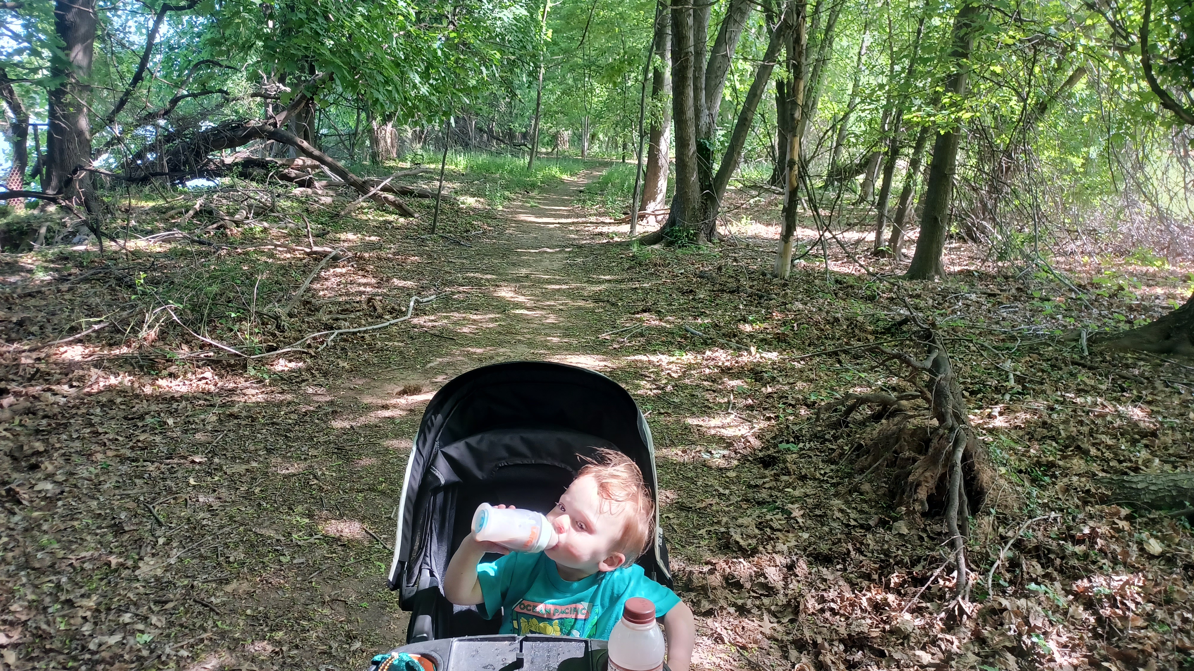
We had to cut to the left, and then head down some steps below Becton Hall. The path went right down along the river, which was just beautiful. I let Ev out of the stroller to walk through this area, and he was quite happy. He's always finding stones and such to throw, and there's constantly water to throw it into.
We headed north a bit more, and it was quite sunny, so we took a break at their book store building under one of the awnings, and Ev grabbed mulch and whatever other stuff he could find around the area to throw around. I checked over the maps to see what we had coming up.

The next bit was pretty cool, because there was a beautiful footbridge over the Hackensack River, to campus properties on the other side. The plan wasn't to cross it this time, but rather to continue north a bit more, so we moved on soon.

There was a good historic marker about the history of boating on the river, and then I spotted something odd: there was a vertical stone on the shore. I wondered if it was possibly a grave stone, and if not that an old road or native trail marker. It looked like it didn't have any business situated the way it was, and it looked like vegetation had been somewhat cleared from around it.
We continued to the north, along parking lots, and then beneath the Rt 4 bridge, which provided us with a degree of shade.

On the other side of the underpass, the trail turned to the left and skirted the soccar fields, where there was a major game going on. We paused for a break beneath the bleachers again. It was getting really hot, and I think there was a restroom there for people to use.

While we were waiting, and kids were playing on the field, there was one father on the sidelines that was pacing and shouting almost maniacally at his son, who was playing.
I don't know that I'll ever understand that kind of behavior. That has to be a major stress on the poor kid who is supposed to be out there playing for fun. This father looked like he was ready to shit himself and have an aneurism at the same time. It was actually kind of embarrassing to see such behavior. I suppose it is a culture I just don't understand, having such a crazy amount of energy invested in such contrived conflict.

We eventually moved on around the outside of the ball field, and then entered the woods on more footpath heading to the east. My google maps were showing me that we could continue on through to what was called Indian Pond to the north, but we didn't see a turn off for it.

There is apparently a narrow footpath that will lead through to the next trail section I wanted to be on, but we didn't see it, so we continued on by it.
As we started making our way to the east a bit, toward River Road again, above us was the historic River House, home to the Ackerman Family for over 200 years. The main building was built in 1734, with an addition from 1787. David Ackerman first settled the area in 1662 from Holland. The farm on site was known for its peaches and sweet melons.

We continued gradually uphill to the River Road and turned left, where we were afforded better views of the nice old stone house.

We followed River Road for maybe four or so blocks to the north, where there was an entrance road down to the left that took us to Indian Pond. Because we arrived there farther north than I had anticipated to be doing the trails around Indian Pond, I decided to add the loop around it into the hike.
We turned to the left, and began walking the bit between the Hackensack River and the pond. Views opened up in both directions along the way, and it was quite lovely. I had Ev in the stroller at the start of this, but then I let him get out to throw rocks and walk on his own.

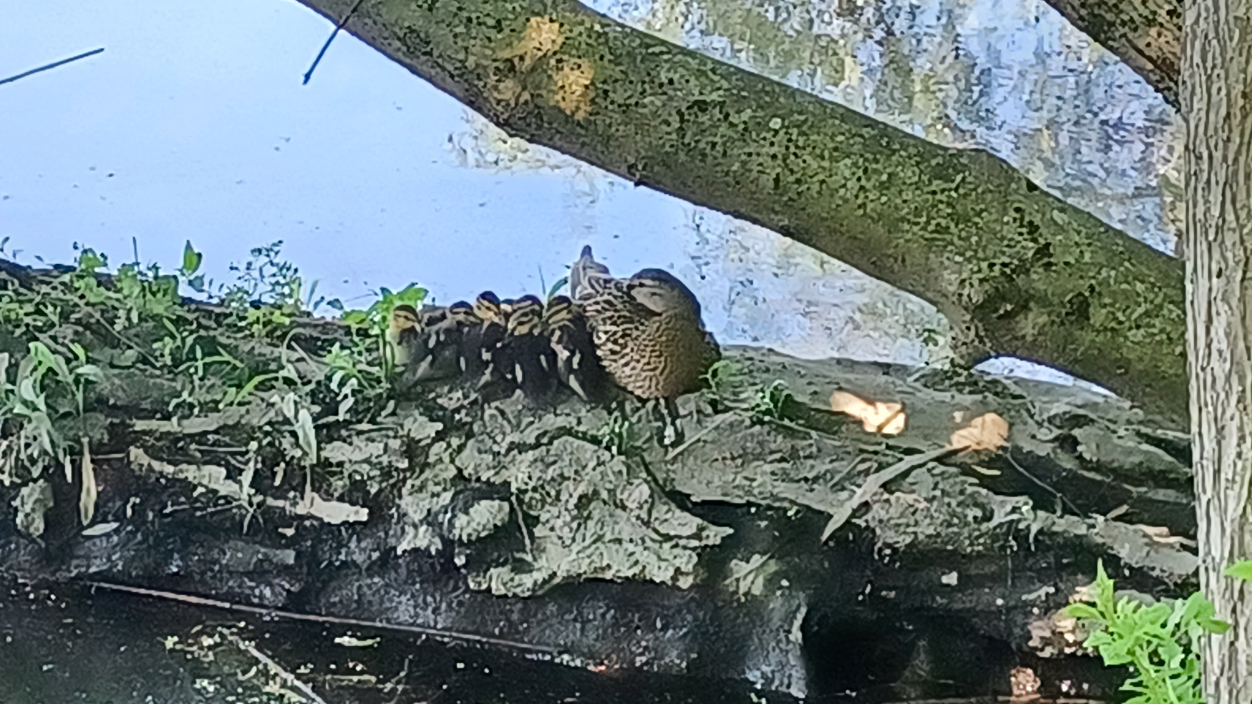
There were a lot of turtles in the pond, as well as Great Blue Heron and Great White Egret.

We reached the far side of the pond, the south, and turned to close in the loop. In this stretch, we came upon a mother duck with her adorable, very young ducklings sitting on a log.
Just a little further up the log, the father duck acted as a guard. I have never seen ducks so tiny. They were absolutely adorable.
Just beyond there, a snapping turtle was close by, just waiting for the ducks to enter the water. We quietly waited and watched them, and surprisingly even Ev kept quiet enough to enjoy them. I suppose maybe some of this appreciation is instinct.

We came back out of the parking area at Indian Pond, and I goofed up and missed the actual trail, which remained along the Hackensack River in this section.

We went up through the parking area to the right, and then turned left into a wide open and grassy field into Andreas Park. This was okay, because we stopped by a playground to hang out and cool off for a bit.
Once we were done there, we moved to the north side of the lawn area, and I could see that the actual greenway trail was ascending from the waterfront below to the road again. It was unavoidable that we would have to walk River Road again for at least a little bit, but I had missed that turn. Maybe we'll go back and do the section over again at some point, but it was otherwise pretty negligible distance.

We followed the road north, and this section was about the worst. There was no good shoulder on river side, so we had to cross over and use the sidewalk on the other after a short bit.

In this stretch, we came upon one interesting spot, the site of a former church.
The Lutheran Van Buskirk Church and Cemetery were established in 1716.
I spotted it from across the street and decided to head over to take a look. I pushed Ev up the steep slope to the site, but no graves were noticeable.
There was a bit of stone work to the right that might have been the footings of the old church, but there was really nothing else there to see.

We continued north on River Road for just a bit more, and then turned to the left and were pretty soon back in another very natural landscape on a simple footpath.


There was a route that stays closer to the waterfront that I missed, but I figured we can hit that another time.
My plan when we got to this point was to continue further north to Riveredge Road, and then come back from there, but I checked with John on our mileage up to that point, and I think it was like six or something.
I considered that the distance ahead might not be as direct as what we'd already done, and so it would make more sense to turn back at New Bridge Landing rather than go overboard, and probably over fifteen miles, if we continued to the north.

This turned out to be a really solid plan. We did more than 15 in the end, so it was a good thing we turned back here.

We headed over to a left turn onto Old New Bridge Road, and passed a nice looking, but expensive eatery, then approached the old pony truss bridge over the Hackensack River.
The through pony truss bridge was erected in 1889 over the river at exactly the spot where it ceases being as wide, and is less tidal. That was why that location was chosen back in colonial days.

It is the oldest extant swing bridge in the State of New Jersey. Today, it is open to pedestrian traffic only on the Hackensack River Greenway. The last car drove across it in 1959.


Only the old Zabriskie homestead is a state historic site, and the rest of it is part of the local historical society, although they historically have treated it as though it were theirs, as they have the lease.

We stepped out onto the bridge, where I started giving the group some of the aforementioned history. The trail where I had intended to emerge came out just to the left before the bridge.
In Colonial days, and not so distant modern days, large vessels still navigated up the Hackensack River to this point, and wooden moorings were still visible in the river here because the tide was at a low level.
On the other side of the bridge, we approached the Zabriskie/Steuben House, which was a typical gabled roof Dutch colonial style building similar to others seen through the area.

My first time to this site was the beginning of a new life for me. It was early 2011, and I'd just been through more shit than probably many people would have survived.

All in 2010, my best friend Kyle took his own life. The day after I buried his ashes on a greenway we worked on together, my house burned down and nearly took my life with it. I gained a lifetime worth of smokers lung in minutes, and was not expected to survive.
After a week in intensive care, I was improving (although I was nearly lost in the hospital on my third day in). I was out of work on doctors orders for a long while, and had to go through regular lung treatment and doctors appointments.

Then, I got laid off from my job with Hunterdon County Parks Department. I was losing my benefits, and at a time that I needed them so badly. This was life or death.

My friends within the hiking group came together, and raised over ten thousand dollars in under a week. It carried me through everything I needed while I was out of work.
My connections through Warren County through which I served on a board got me a free home for two and a half years, and I acted as care taker and trail steward to the White Lake property.
Finally, my former Hunterdon boss had shifted jobs to a State Director position, and I met him for a dinner interview with the Northern Region Superintendent, Steve Ellis. The meeting went well, and I went to work for Steve on special projects.


To say Steve was over his head with big issues was a massive understatement, and it must have been hard for him at the time to get this guy he knew little of, and told to put him into complicated situations.

Thankfully, I suppose I proved my worth to these decision makers with delicate situations in parks throughout the region, and one of them ended up being at Historic New Bridge Landing.
I accompanied Steve to the site one day, and he let me know I would be heading there once per week to do cleanup in the building, and when necessary, greet public coming by. I was given a state car and tasks to do on each visit. Sometimes, I'd be called after hours to run down there and check on things.


At the time, I didn't mind, and actually felt honored to be entrusted with such an important position.

In the past, personnel sent to take care of issues at the site were captured on video, with their each and every move critiqued and judged to great extents. It got to the point that some employees were refusing to go there because they felt harassed.
My meeting on site was with former state employee and historian Kevin Wright.
Mr. Wright had a somewhat tumultuous relationship with the State of New Jersey. His expectations of the DEP versus what was actually possible with low staffing levels was always a point of contention, but it was not the fault of Steve or really anyone in the chain of command he was dealing with directly, but unfortunately, they felt the sting of his criticism.


I must have made an impression on Mr. Wright as a big fan of history, and in retrospect, I think it was just inside the old house and a comment I made that impressed him.

There was a painting of an army working their way up the Palisades formation, and I simply asked if that was a representation of the British coming up Huyler's Landing, and cited that it should have an additional switchback if it were to be an accurate representation.
Now, Huyler's Landing Trail is a rather obscure trail going up the Palisades, and there are no signs on it stating that it was believed to be the historic route. I had read it in a book.
Mr. Wright lightened up and we had some great discussions there in the Zabriskie homestead.

When I'd earned his trust, he opened up the attic to show me what he said might be the most important native American artifact in the State of New Jersey.

Up in that attic was a perfect Indian dugout canoe, just sitting on the floor. Mr. Wright explained to me that one during dredging, it was lifted off of the floor of the river. It was decided that it was a handy thing, and it could be used to slop the pigs, so they hammered it to the side of the house.
After many decades went by, it was realized how significant this piece of wood was, and someone said "maybe we ought to bring that inside", and it has supposedly been in the attic ever since.
I would see Mr. Wright on the site pretty often. In fact, I would almost always see someone there often.

I would be sweeping out the front door, or cleaning up something outside, maybe weed whacking or something, and someone would come up in a vehicle, recording me, or watching intently.

I was always busy with something, so these critics came to like me. I found out from Steve after a short while that he'd had a meeting with the folks at Historic New Bridge Landing, and they actually wanted to hire me themselves!
I think I may also have made an impression, perhaps because someone may have been sent to test me, when I was there to clean and public would come up and ask questions.
I would drop what I was doing and share the history of the site as I'd remembered it, take them inside, and point out what room was what.

I spent a good amount of time asking questions of Mr. Wright, so I had a lot of answers for them. Mr. Wright actually lived as a tenant in the house for some time, and so he knew it all intimately.

On some occasions, based on the level of interest in the discussions, I would take patrons up into the attic to see the dugout canoe, and it always was a great thrill for me to impart what I'd learned from Kevin Wright.
It wasn't just a mutual respect; I felt like I had accomplished something much greater, by sort of bridging the gap between the people at New Bridge Landing and the State of New Jersey. I was one of "them", in the green state shirt, but I was also one of "them", someone who thrives on learning and sharing history. It was all genuine, and both parties knew it.

This was just one of the many things about my new position with the state that gave me purpose and kept me pushing on after going through so much difficult stuff.

Here I was, in this nationally significant landmark, which became something so personally significant to me.
When I got the permanent position at Spruce Run, the level of importance of what I was doing was not even a small fraction of what I had been doing in the northern region, or at least it felt that way at the time, and it was very difficult letting go of everything I built up in a short six months.
Mr. Wright and I talked here and there over the next couple of years. He told me some really interesting historic points about different sites including Waterloo Village, and he was also very much involved in the history along the Old Mine Road, and we would have exchanges there via facebook.

Sadly, Mr. Wright passed away a few years later, and that connection at New Bridge Landing was gone.

I'm pretty certain none of the same people are involved there today, and if they are, they probably wouldn't remember me because it was such a short period of time.
The site always needed a lot of attention with the flooding, and so I had to clean floors quite a lot. On one flood occasion, several koi fish were stuck in pools of water, and I waded through all of it to save them. I ended up being in some video showing a state employee saving these fish. Little things like that were really special experiences.

When we got over the bridge, I had several 1947 images of the Steuben/Zabriskie house I wanted to emulate, and I think I got pretty good representations of them.

The area was sort of intended by the local group to turn into its own version of Colonial Williamsburg, but it'll never be that. It's not big enough, and the location on the river is too prone to flooding.
Still, there are several different structures that have found their way to New Bridge Landing that are pretty cool and significant.
Behind the Zabriskie home is an old barn, known as the Westervelt-Thomas Barn. It was built about 1889 in the Township of Washington, Bergen County.

It was moved to New Bridge Landing in 1954-55, and is now used to house several local historic artifacts.

The next significant building was a pretty cool one, known as the Demarest House. It is a name in error, but still a very cool building.
For years, it was thought that this was a Demarest homestead, built in the late 1600s, due to its proximity to the locations in New Milford where the house once stood. However, those dwellings were all gone by the 1920s.
This home was actually constructed about 1791 for John J Paulison in style consistent with "starter homes" of the time. The Demarest name is not terribly inappropriate as the property was conveyed by a Demarest, and Paulison himself was descended from Demarests two different ways.

The homestead was moved to New Bridge Landing behind the Zabriskie-Steuben House in 1955-56.

In front of the building, there was an old roadway mile marker carved in stone, denoting either ten or twenty miles to Hackensack, I'm not sure which.
The mile marker was set in an old brownstone mill wheel. There were several old mill wheels placed in front of the homestead, mostly of brownstone, but there was at least one of the material that had been imported from Scotland.
Just past the Demarest House, the last house at Historic New Bridge Landing was the Campbell-Christie House.

The home was built in 1774 by Jacob Campbell at about the time of his marriage to Altche Westervelt.

The property changed hands which included the Christie family from1795 to the 1900s. It was moved to New Bridge Landing in 1977 when it was in danger of being demolished like the others.
We cut directly to the south from the Campbell-Christie House into the Steuben Arms apartment complex. We cut into the complex from the east side, on sidewalks, then turned to the left, south, through a sort of courtyard area, then to the east, then south, then west, then south again, then finally east again out to an access road along a tributary to the Hackensack River. It was a neat little jog through paths that probably no one else would find interesting.

We continued back out to Hackensack Avenue over the tributary, and then headed into the next parking lot, which I thought was funny that had both Mavis and Staples in view closely. I tried to think of a good caption with "I'll Take You There" on it for Metrotrails, but I couldn't quite do it.

We cut to the left through the lot, and we decided to stop for lunch at the strip mall on the south side of the lot. When I was working at New Bridge Landing, I used to stop at the Quiznos Subs they had there.
I went to the place that probably used to be the Quiznos, called Firehouse Subs, which was alright. It wasn't the greatest thing ever, but I was happy with it, and it was something Ev would eat.
A lot of the group went over to Chipotle, and I knew that might not be a good thing to bring Ev to, because he might not eat it, so I went alone to the sub place.

We took a good amount of time here, and when I was finished with the sub with Ev, we headed out over to the other places where the rest of the group had stopped. Some waited outside.

When everyone was together, we continued to the east through the parking lot, to the right. There was a concrete ramp over there that brought pedestrians up to the level of the apartment buildings above, so we headed up that. I had to get a little help for a brief stair section.
Once at the top, we walked through a bit of the development, and then descended via a walkway at the end of the buildings, next to a cul de sac.
Below, there was actually a grassy swath going back toward the parking lot, which I didn't think was an option before, and a sidewalk going along the edge of the lower lots below a parking deck.

Pretty soon, there was a path going into the woods off the back of the place to the left. This was the entrance to Hackensack River County Park.

I had seen some boardwalks on aerial images prior to this hike, so I knew something was in there, but it turned out to be far more interesting than I'd expected.
It turns out this was a park area that Dan Lurie had told me about several times, and how it's just this sort of awful place, but that I'd love it. He was definitely sort of right, but I wouldn't consider it to be at all awful.
It is neglected, I can say that.
Tina had to cut out at some point here due to some previous engagements and got a ride out I recall.

The first bit of it was fine. The trail went onto a boardwalk and weaved around and over a bridge a bit. Some of the work was replacement work that looked to have been done pretty recently.

The boardwalk part was the only part that looked like it had any degree of maintenance. We headed onto the next bit of footpath, which was nice and reasonably clear, but it also had an abandoned feel to it.
Just ahead, we came to an amazing outlook platform unlike anything I was expecting to find. There were two giant, three legged shelter buildings, one of which had the roof entirely gone from it, the other one rotting away, and between them was an observation platform out on the wetlands.

There were trash cans and the wood was in alright shape on the platform. Someone must do some degree of maintenance up there, but it is certainly infrequent.

I understand this park is known for drug deals and hook ups, or whatever other underhanded behavior. Still, it was really quite awesome.
The trail continued past the little sitting area, and then led us out to an amazing dock out onto the Hackensack River with great 180 degree views. There was another side trail out there that led to an observation blind.
We spent some time on the dock, but there wasn't a trail that continued to loop along from there, so we had to backtrack the same way we came in past the old shelters and platform.

We made our way back the way we came, went through the shelters again, and then over the section of the boardwalk back almost to where we had been.

We skirted the edge of the grass and then onto a walkway that continued on the east side of the Shops at Riverside shopping mall. There were often parking garages to the right of us.
The improved paver walkways often had grass growing through them, and benches were rotting pretty badly.
We came to a wide open area with very ornate looking railings around it, and a pier out onto the river that was closed off with chain link fences due to some collapses occurring on it.

We moved on from this onto a grassy area without as much of a delineated path heading to the south a bit. We continued around the parking garage on the east side until we came upon another side path to the left.

The sort of floating walkway led out onto the water, with nice chain guide rails on the sides, to another wonderful outlook of the river.
We turned around and headed back the way we came from here, and then had to skirt the south side of the shopping center and parking garages. We headed west for a bit, and then came out to the access road to these garages. We soon cut across an access from Rt 4,
Then, we continued further through parking lots, and skirted an exit to Hackensack Ave. We continued through a narrow bit on up to Hackensack Ave, and then turned to the left to cross over top of Rt 4.

We had to walk along the edge of the highway for a little bit with a limited shoulder, but then turned to the left on Carol Court, and we were immediately away from any major traffic.

We soon reached a ball field behind Bergen County Academics, and a paved trail segment started again on the river side. Pretty soon, there were more trees including another amazing giant Cottonwood. We continued to the south along them, and pretty soon reached the big pedestrian bridge of Fairleigh Dickinson University we had passed earlier in the day.
This time, I decided it would be a good idea to take a little break there and walk out onto the bridge. It had some really great benches and views from it, so it was the perfect spot to sit down and take a break.

There was no break for Ev. He just wanted to run around like crazy as usual. Violet took him walking around the area, all the way across.

I took some photos of the river through here, and then chased after Ev on the other side. He went all the way down, then to the left and was heading onto the trail in the direction we had gone in the morning!
I had to rally him back in so we could continue on our way.
The group was looking extra comfortable on the benches, but we got up and continued on anyway. The bridge had planters and pots with different kinds of vegetation all across it, and the benches in the middle had a big shade over top of them.

There was a nice Martin Luther King Jr. statue just on the east side of the bridge, and the walkway became much more prominent.

A lot of money had gone into these sections of walkway, with benches, trash cans, and interpretive signs, but the first interpretive signs we came across had the panels destroyed beyond legibility.
The walkway continued south past the Rothman Center, and then had a section of wooden boardwalk around an inlet area closer to a parking area. We then entered Johnson Park and continued on the pathway to the south, then the west a bit out to Anderson Street.
We had to come up to the road at that point, and start to walk River Street to the south for a bit because there was no greenway along the waterfront here.

Just ahead, we came to something I had been wanting to visit for a very long time: The White Manna Burger. This is one of the most famous diners in America.

There are currently two White Manna Burgers, one spelled with only one "N". It takes its name from the biblical food, but the one location had a misspelling.

The eatery finds its roots in the 1939 Worlds Fair, which was held in Flushing Meadows Park, Queens.
Louis Bridges purchased the diner building that was featured in the Worlds Fair, built by Paramount Diners of Oakland New Jersey that year.
I had been under the impression that the Hackensack location was the original building, but it was not. It was apparently also built in 1939, and moved to its current location in 1946, but the original Worlds Fair building was the one in Jersey City.

Louis Bridges owned five diners at one time, all of them named White Manna, and eventually the two that remain came into separate ownerships. Both for a long while claimed to be the original location.

One of my favorite articles Mark Moran of Weird New Jersey wrote was one of the very early magazine articles called "The Tale of Two Mannas", and he goes over everything in great detail. I'd heard of the place, but that article had me really wanting to try both locations.
I had heard that you'd be lucky to get into one because the lines are so long.
As we approached the White Manna, I saw no line out the door. I knew I had to go in and take the opportunity to try some. After all, it was the original chain to introduce the miniature burgers we today have come to know as "sliders".

I hurriedly ordered two of them for myself, and Jack, Sarah, and Joe Millionaire all came in to try some as well. It was a good thing we made it into the establishment when we did, because it wasn't long after that the tiny standing area just inside was completely full and the line stretched out the door again.

The building was tiny inside, but one could really feel the nostalgia of it all. I wondered if my grandfather had been to the original, because he had attended that Worlds Fair with his father when he was a little boy.

It took a really long time to get just two sliders, but they were really tasty. I hurried outside as soon as they came down and hogged them down. I offered a bit to Ev, which he accepted. They were not really too hot, but for him they were and he ended up spitting it out.
I was glad to have made this stop, and we continued to the south, and soon there was a large gravel parking lot to the left. I could see on aerial images that there was a path that went into Foschini Park from the eastern end of the lot.

We headed out into the gravel lot, and reached all the way to the back. There was a guy there working on a truck, who looked a bit surprised to see anyone walking back that way.

When we got to where we should have been able to cut into Foschini Park, there was no way. There were chain link fences separating the lot with the park.
Right where the path should have been, it was a mass of weeds and we couldn't get through there either. I probably could have done it with only a little difficulty if it weren't for the stroller, but I wasn't going to go to that trouble when we could just go around.
We walked all the way back out through the lot again, and turned into Foshcini Park by way of Camden Street.

We turned to the left into the park to get to where I was planning on entering. It had some sort of composite fake wood material walkway for the first section of it, and pretty soon we reached where I had been planning to enter the park.

There was indeed a trail that went from the gravel lot, but it was grown over and piles with debris, closed off. From there, we continued around the east side of Foschini Park.
Ahead, there was an opening to the Hackensack River with a bit of a view. I walked out into the water, which was fine, and I got a bit of a wider view from it as well as getting cooled off.
The walkway continued along the east side of the park with the composite wood material walkway, and there were more giant Cottonwood trees.

We continued on the pathway out to Salem Street Extension where we turned left and reached the Midtown Bridge again, where we had been earlier.

There is a building called the Ice House right next to the Mid Town Bridge, and we turned to the south along the river, with the NYS&W Railroad bridge in clear view. The narrow access road continued directly alongside the river almost to the railroad tracks, but we couldn't go beyond. Court Street is just below that spot, so we were getting close to the end.
There is construction going on before Court Street on some new development, so we couldn't just continue on, but I had other plans anyway. Although it was not directly along the river, I wanted to head inland and walk through Hackensack.

We turned right, parallel with the tracks for a bit, and then turned right on the other side of the building. It had receiving bays, at least three of them I think, with ramps up and down them.
I pushed Ev up and down each ramp ahead of the rest of the group because it was kind of fun. Then, we turned to the left through some lots to River Street.
We cut to the north parallel with the railroad tracks out to Main Street. We then turned to the left to head to the south through town, and passed by where we'd eaten lunch on our last visit.

We continued south to The Green, which is quite an historic site, to the left of the main intersection with the court house straight ahead.

When we reached the intersection, we could see clearly across The Green to the left of us. In the very center was was the Hackensack War Memorial, erected in 1924. This memorial, with a soldier standing and facing the court house, replaced an earlier fountain structure in a similarly round base to what is seen there today.
Beneath the soldier, the monument depicts famous War scenes including the American Revolution with Washington at the Battle of Monmouth, the Civil War with General Robert E Lee surrendering to Ulysses S Grant, the Spanish American War with Col Theodore Roosevelt leading Rough Riders at the Battle of San Juan Hill, and the World War I panel, then called the Great War, the War to end all wars.

Directly across, the Bergen County Courthouse, a stately building, towered over the Green.


It was designed by civil engineer James Riely Gordon who won a competition for the project. The American Renaissance style building was completed in 1912. It was the sixth building to serve as courthouse for the county, and second on this site.
 |
| 1904 |

We turned to the left from Main Street through The Green, and I set up some of my then and now history compilations as we went.

At the far side of The Green, the Enoch Poor monument stands in the center of the intersection between Court Street and Moore Street.
Poor served in the Continental Army under General George Washington. Washington attended his funeral at this site in 1780. Poor is buried a few feet away from his monument at the green.
Based on two of my historic photos, the General Poor monument has been shifted two different ways since it has been on the same site.
The statue of the General himself faces west, but the historic images show him facing to the south. Further, the entire monument structure upon which the figure is perched appears to have been shifted one hundred eighty degrees.
Just barely beyond this intersection is the old First Dutch Reformed Church of Hackensack NJ, also known as the Old Church on the Green, built in 1791.
It is the oldest church in Bergen County, on one of the oldest community greens in New Jersey.
The east wall incorporates some of the stones of the original church on this site built in 1696, which contain the monogram of several founding families. It is amazing that this building remains on this site unscathed for so many years. I was really enamored with the downtown epicenter of Hackensack.
As we walked, we could ear the whistle of a train going by. I tried to hurry over so that Ev could see some of the train from a distance, but we barely got a view of it.
We continued on out Court Street to the edge of the bridge, and then turned to the right along the walkway beside the river, on the same route we had taken at the very beginning of the day.
In no time, we had reached the Costco business center and the end of the hike.
We had actually finished this one kind of early, despite having gone slightly over the planned amount of miles I was looking at.
I finished feeling pretty happy and energized.


My day wouldn't nearly be over; I thought I was going to head on home and feel relaxed, but as Ev and I were riding back, Jillane called me and asked me to meet up with them near Panther Valley to go dumpster diving in rich people's trash.

I ended up hanging out there walking around with Ev even more while his mom searched through stuff and I suppose got some good items.
Still, this had been possibly my favorite hike in the Hackensack River series so far. Once again in a place that almost no one would consider to be a serious destination, we had a really fantastic hike that was more off road than not.
No comments:
Post a Comment