

Hike #1558; 7/2/23 Marlin Hills to O'Sakame Preserve with Justin Gurbisz, Evan "Joe Millionaire" Van Rossum, Scott "Tea Biscuit" Helbing, Professor John DiFiore, Stephen Argentina, Christian Bykovets, Luke Freselone, Robin Deitz, Diane Reider, Violet Chen, and Kirk Rohn

This next hike would be a point to point a bit closer to home, this time between Kingston Park in an area known as the Marlin Hills, a little northeast of Hellertown PA, and the O'Sakame Preserve, a place that Shane Blische had told me about recently, a new park between Riegelsville and Milford NJ.
I decided to try to slap something together in the same way I used to do the night hikes, all through the are of southern Northampton County, and then through Riegelsville and back to Warren County.
I had high hopes for what we'd be doing and tried to plan for a visit to a winery in Riegelsville, but it was super hot out and would have run far too many more miles, and it was already brutally hot out enough without any of that.

We met at the O'Sakame Preserve, which was along River Road south of Riegelsville. I'm certain the lot for this little park has never been more full as when we did this hike.

We shuttled with as few vehicles as possible to the west, to Kingston Park in Lower Saucon Township, an area known as the Marlin Hill a ways northeast of Hellertown.
I had found out about this area randomly driving roads to the west from my dad's place on Morgan Hill. I happened upon the old school house adjacent to the park on that drive, and really liked a lot of the roads through that area.
I discovered the Woodland Hills Preserve by accident looking at Google maps of the area, and then looked over other stuff I'd like to explore around the area.

After parking in Kingston Park, we followed the path through the woods to the old school house.

This was the Lutz Franklin School, built in 1880 in Late Victorian Style. The one room school house was used for education until 1958.
The building was restored 2004-2006, connected to Kingston Park. It is now home to Lower Saucon Township Historical Society Museum.
I looked over the historic atlas maps of the area, and found that there was a school on site prior to the construction of the current school house, in 1874.

We headed out to Countryside Lane to the south of the school and turned right, slightly uphill to the south.
We continued up the road, and turned left into the Woodland Hills Nature Preserve.
This was a former golf course that closed, and then was preserved by Lower Saucon Township in 2014.
I decided that the route we would take through the preserve, from the parking area, would be an interesting one that weaved through the preserve to get as much good distance out of it as we could. We went straight through the first intersection of trails, and into the preserve.

This area had paved golf cart paths, but not all of those were used when it was made into a preserve. Some of the mowed paths are more direct, but others appear to be much more circuitous than what it would have been in golf days.

I let Ev out of the stroller almost immediately because he wanted to get out so bad. He ended up having a whole lot of energy, and didn't get back in the stroller until we were done with the preserve, which was quite a while.
We eventually made our way from the central section of the preserve to the southern, then headed east. We reached the eastern end, and then began heading north through the preserve, which was quite pretty, but unshaded and terribly humid.
This was probably the most hot and humid day of the year so far, and Ev was the most sweaty I'd ever seen him. Still, he insisted on pushing on and walking himself, even when it came to the uphill stuff.

He was at the point of doing two miles unassisted, which is great for a child not yet even two years old.

At a low point, we had a couple of trees down over the trail. We had to go around them to the left, and Ev let me pick him up to get him around those.
When we got to the northeast corner of the preserve, we re-grouped, as we would be leaving this area and I didn't want anyone to miss the turn.
We went slightly left, and then a somewhat overgrown golf cart path went to the right out to a driveway, and probably a former east entrance to the club.

The building, which I think was formerly the golf club is now the Shri Swaminarayan Mandir religious place. We turned to the right, and there was a sort of gate area of stone, but next to it what looked to be another entrance.

I put Ev back in the stroller, and then pushed him out to Lower Saucon Road from there, and confirmed that it was the former entrance because there's still a faded stop sign there.
We turned left on Lower Saucon Road to the north, and followed that to a hard right turn on Valley View Road.
We continued slightly up and past a beautiful old farmstead on the left. Historic 1870s Beers atlas maps of Northampton County say that this was the home of S. H. Rufe.

It was really rough walking through this area. The back road route I chose was pleasant, but it didn't have enough shade at first.

They were calling for cloudy and a very good possibility of road, but we never really got any rain at all, and were often in direct sun.
We continued down the road, and there was an abandoned house on the left. It was pretty well out in the open, so I didn't bother trying to go into it or look any closer.
We reached sort of an intersection, then veered right onto Buttermilk Road to continue generally east. On the right side of the road ahead was an old school house, now a private residence.


I forget what the name of the school was, but it was on a plaque in front along with the date. I remember Tea Biscuit reading it off to me, but I've since forgotten what he said it was called. I tried looking it up but didn't find any information, except that it was already standing there by 1874.

We came around a corner in the road, and there was an older gentleman doing landscaping work on a beautiful piece of property. I said hello to him, but missed out on some of the stuff the rest of the group got out of him.

He was working on a lower piece of land to the left, and apparently his grandfather had a sawmill down there, and footings of where it stood are still visible down there.
He explained that the beautifully manicured lawn and garden was a memorial to his son, who was among the first killed in the most recent Iraq War.
I think this must have been Christopher Seifert, who was apparently killed in 2003 by a fellow soldier gone mad. Seifert was a Williams Township resident, so I suspect it must have been for him.
This area was rather nice to walk through. The road wasn't busy, and we had a good amount of shade for a while.

We continued on downhill to the intersection with Hexenkopf Road. Here, we turned left, and began heading gradually uphill for a bit.

Hexenkopf Rock is reportedly a rock formation on private property, but the owners are either giving or have given to Williams Township.
The rumor I have heard is that the Saylor and Wilhelm families were practitioners of some sort of Pennsylvania Dutch Powwow magic, and that they would "send" illnesses and "bad juju" into it.
As we continued walking the road, we spotted a location that had some nice new split rail fencing, which looked like a little park, but no signs that looked inviting, and I think there were some no trespassing signs. I suspect that must be the new park entrance. We'll have to go back and check again.

Some of this road had shade, and some of it did not. It was alright to walk.

We came eventually to Morgan Hill Road, which is the road my brother lives on. He felt some temptation to just walk home, but he didn't.
We went across and continued on Springfield Road, which is another pleasant backroad heading east. There was not a lot of tree cover on this one, but there were some fine views of farmland around.
As we reached a couple of the only trees on this road, we came upon more black mulberry trees with ripe fruits. Little Ev has found out he loves them, and so we stopped to pick and eat them for a while. Ev ate tons of them before we moved on down the road.

Black Mulberries are native to the mountains of Mesopotamia, and surrounding area, and were cultivated elsewhere with hopes of growing silkworms, but it was found that silkworms go for white mulberry, and so the black variety has been used just for jellies, jams, and snacks ever since.

We have a black mulberry tree right across the street from my house, and so Ev likes eating them there too, although I have to try to get him to stop eating them from the ground.

We headed down to Raubsville Road and turned left. There was a giant white oak there along the road, and we headed to the east a bit, and there were beautiful old farmsteads and barns along the way as we walked.
I think one of the properties on the right might be new park land judging by the look of some aerial images, because it looks like it has mowed trails in it, but I can't be sure.
One of the historic stone homes in 1874 was the home of an I. Deemer.

We turned to the right on Kressman Road, which was a very pleasant back road through farmland to the south. I had walked part of this road before during a night hike, but never during the good daylight.

At the intersection with Ridge Road, Kressman got narrower, turned hard to the left, and started going downhill in a sort of switchback to the small community of Coffeetown.
At the bottom of the hill is the historic Laubach's Coffeetown Gristmill, along Fry's Run.
The mill, which is on the east side of Kressman, was built in 1762, and added to in the 19th century. It served as a fertilizer store in the 1920s, and was even used as a school house and post office. In 1874, it was operated by A. Laubach.

The miller's house, which is directly across Kressman Road to the west side, and was visible all the way coming down the hill, may be close to the same age. Both today are private residences.

At the intersection with Coffeetown Road, Luke met up with us. He parked over closer to the Delaware River at a community park, and then headed to meet up with us to the west.
Luke was right on time to help with the toughest part of the entire hike, which was far tougher than I'd anticipated as well.
We turned right on Coffeetown Road, which at first was level and easy along Fry's Run, but then we turned to the left on Bougher Hill Road.

We headed up Bougher Hill steeply on the road until we were closely parallel with the boundary of the Mariton Sanctuary along the left side of the road.

The preserve was established in 1969 as the Mariton Wildlife Sanctuary and Wilderness Trust by Mary and Tony Guerrero, who wanted it to serve as an environmental education center for local schools, colleges, and the greater community. The name of the preserve was a combination of both of their names, Mary and Tony. In 1992, an agreement for long term management of the property was made with Natural Lands.
The 200 acre preserve only has one entrance, but in the past, I had found my way out of it, on a night hike, out to Bougher Hill Road off trail for just a short bit. It wasn't at all difficult I recall at that time, so I figured we could go in the same fashion.

We headed uphill, and I watched the map for where the property boundary was. There is an old woods road that does come down out of the property, but it emerges sort of onto private land, or at least close to private land near a driveway. I also figured that if we were going to get into the property, because it has so much elevation, we should probably make our way in further uphill.

We continued up the hill, and when I could see it was the sanctuary on the left, and that there was a short spur trail that came closer to the road, I decided that would be the spot to go in. It looked like there was limited understory in this area, so it would be good.

This proved to be a tough situation.

It was actually a cool property corner, and I have some questions about it that I haven't had answered and might never.
There was a large boulder with several rocks piled on it as if it were a sort of wall. That seems to be right on the property corner, and is probably the actual corner. This might be an old property corner from a century or more ago.
There was also a very uniform white paint blaze, maybe two by three inches. I suppose it was just to mark the property boundary, because there didn't seem to be many more of them, but it looked just like the blazes I make when I mark trails.

I waited by the big rock with Ev and his stroller for the others to make their way into the woods with me.

Once everyone was in there, I pointed out what trajectory I planned to take, and we started heading uphill.
It was immediately too hard to keep going with the stroller, so I had to have Ev out of it.
The group helped me to keep the stroller going up the hill in this section. I had my bowling shoes on because I wasn't anticipating that I would need much traction on this one, but that was wrong.
This area was far steeper that I would have ever have thought. Soon, we were going over some really rough rocks.

Ev held my hand, and can get over some of these rocks pretty well, but it eventually got too rough and I had to carry him.

The steepness got worse. I kept watching my phone and GPS to see how close were were, but it was just too steep. Some of it was almost like a cliff.
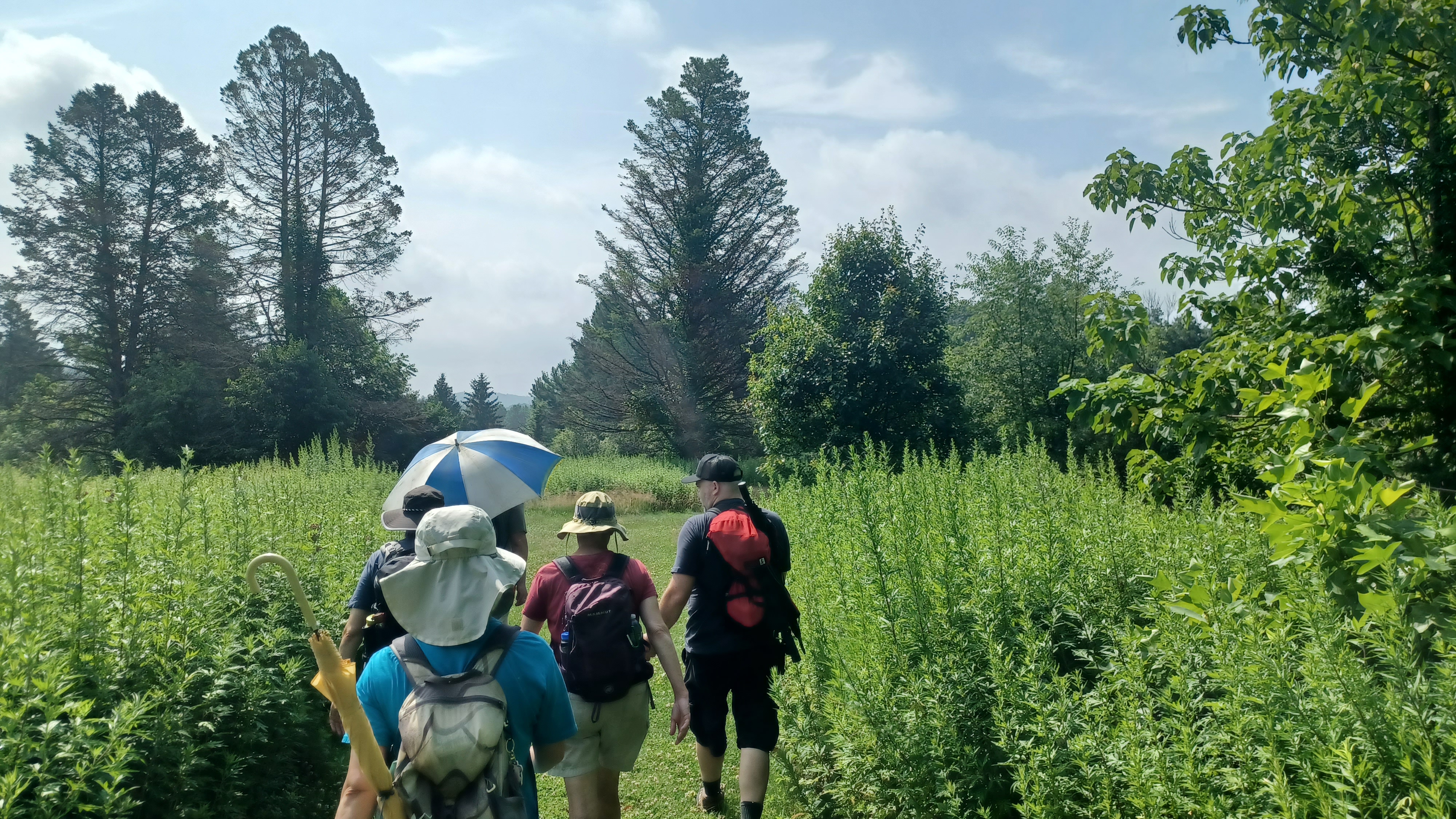
I included a couple of the photos Violet sent of this craziness along with mine seen here.
Trying to get up this slope while holding Ev was no simple task. With two free arms, I'd have no problem, but I was getting a bit scared. I couldn't go a way that I might fall and in doing so, hurt him, so I went a longer way and made every step very calculated.
At the very steep part, the rest of the group was going up one steep way, but I worked to the right and then the left past trees I could grip onto. I couldn't risk falling down the slope. At times, I would put Ev down so that I could rest enough for the next bit up.

I stress that this was not more than really two tenths of a mile, but the conditions, with Ev especially and his stroller, were very difficult.

Eventually, we got closer to the top. Ev hung out with Luke for a lot of the part after the steep stuff, and I was completely out of breath.
We were pretty close to the actual trail system, and there was an informal path up the remaining bit of elevation to that. We decided to take a break there, which turned into a bit of an extended one because I actually needed it.
When I was well rested up enough, we continued walking slightly uphill to the south to the short spur trail that overlooks the Stoudts Valley.

From there, we headed out to the Turnpike Trail north a bit to the Fox Trail. There was Fox Trail North and Fox Trail South, and I chose that we would do the Fox Trail South.

I actually figured we should do more mileage in some of these preserves, but the distance we'd hit at this point made me think we needed to change up the hike a bit. We could do slightly more here, and then probably skip the winery at Riegelsville. Although I'd never done either of them over there, we could incorporate that into future trips and not bother with the extra craziness on the hot day.
Ev stayed out of the stroller for the entire Mariton Wildlife Sanctuary section.

Fox Trail continued gradually uphill to the very middle of Bougher Hill, and Ev walked up the entire thing. From the top, it was basically a gradual descent all the way out of the preserve.

We headed through very pleasant woods, and then came close to a power line clearing. From here, we cut over to the right onto Main Trail, and then descended across the power line, through a line of trees, and then down through a pleasant meadow to another woodline where we turned left. The meadow had some impressive orange Butterfly Milkweed growing in it.
From there, it was a gradual downhill, and I think we turned right on the Spruce Trail, which gently descended to the right and left, then came down to an intersection with the Woods Trail. We turned hard right here, and then it was nearly level all the way to the nature center.

We took a really nice break here. The restrooms were open, and really great. They were clean and no one was around. The water from the tap at this place was absolutely delicious, so we all filled our water bottles up after a long stretch of heat. I was glad that Ev was actually drinking as well.

Once we were good and rested up, we headed from the parking area to the far side and down a short mowed path directly to Sunnyside Drive where we turned right.

This road was once a through road, which went from County Line Road directly to what is now Rt 611. The abandoned road is still clearly visible along 611, and in fact I'd like to use it as part of a hike in the future, because the Mueller's General Store and Kitchen is located close to where it came out. We actually stopped at that store on our drive out because I had to get some snacks for Ev, and some of the others needed stuff as well. Stephen bought a toy that blew a bubbly thing for Ev and a big cookie for me in there. And some chocolate milk which was great.

We continued downhill on the road, and there were slight views through the trees from Bougher Hill to the countryside to the south. There was also a yard that had lots of stones in cages. Not like a gabion basket, but like just cages.
We continued on the road to the intersection with County Line Road, and there was a lovely old stone building with stucco facade on the right. This was historically the Hartman residence according to the Beers Atlas from 1874. In addition, a tannery was once directly across the intersection from it, but nothing of this former industry remains today.
From Sunnyside Road, we went left on Spring Hill Road to the east a bit. This was a nice route, which had some lovely pastoral views to the south, and a nice big tree before we turned off. Ev fell asleep pretty much as soon as we got on this road.

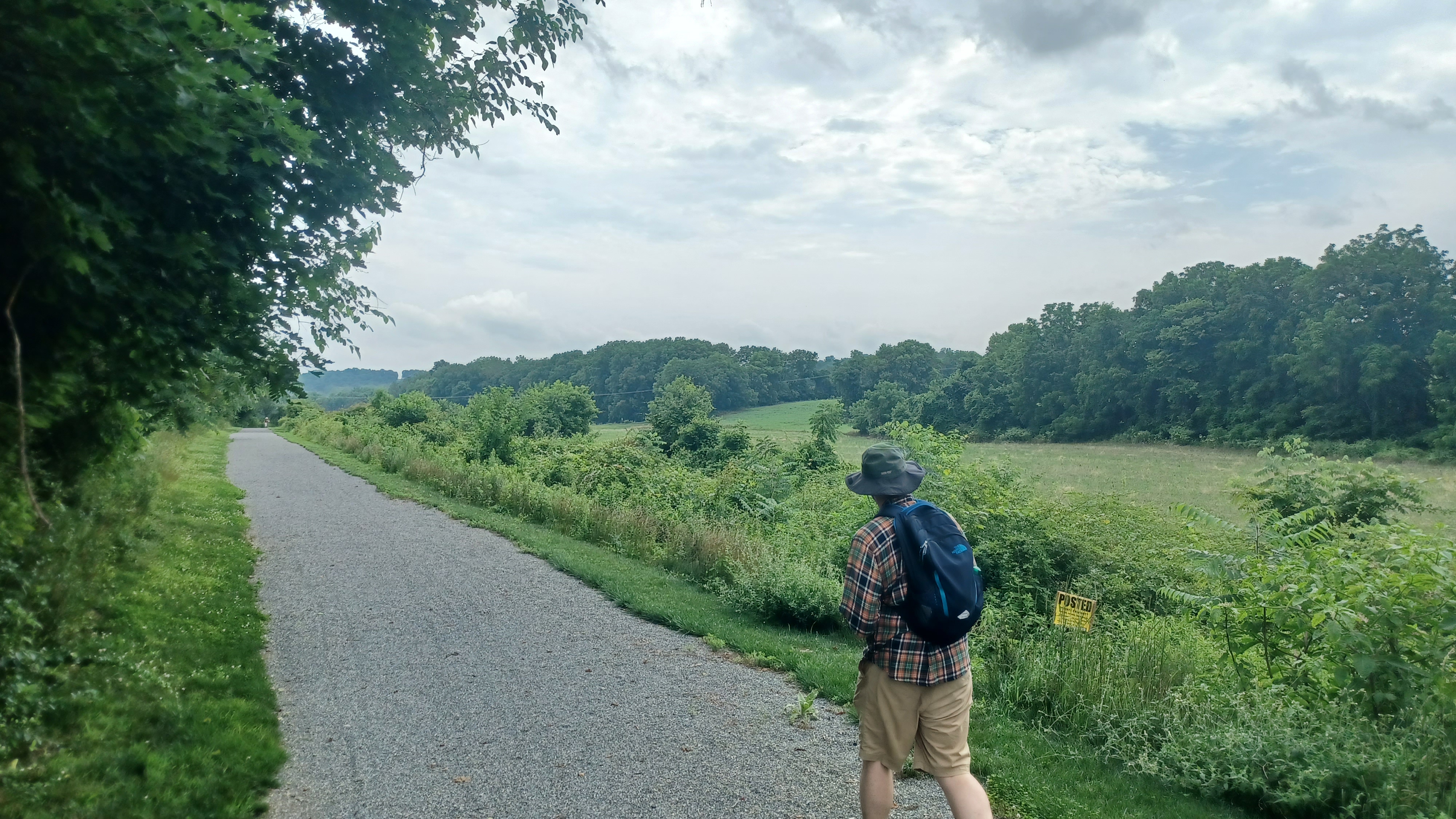
After a little ways, we came to the next trail I'd never done before, the Riegelsville Walking/Biking Trail. This crushed stone, easy trail leads from Spring Hill Road south all the way about 1.3 miles to the south side of town.

Although it's not a particularly long trail, the fact that a trail like this exists so close to where I live and I'd never done it before is a pretty big deal.
It was weird at the very start because they had constructed this totally outlandish bridge with steps up to it and down from it, over really nothing. I suppose it might wash out along the edges of the fields from time to time, but really doesn't seem to warrant a bridge like that. I suppose there was probably a scout that needed a project, and someone that just wanted to give off a throwaway project, or more likely, grant money that just needed to be spent. Maybe they slapped it there with the idea that one day they'll need it elsewhere, and just dismantle and move it.

Anyway, I was able to push the stroller around the right side of it in the grass, so I didn't have to bother with the steps.

The trail took us south through the field, and then moved to the left to skirt that side of the fields. Soon, it made a ninety degree turn to the left and then to the right to keep with those field perimeters.
There was another ninety degrees to the left, then the right and we headed through a swath of woods, and made a connection to the dead end Linden Lane in Riegelsville.
Pretty soon, the trail emerged into the Riegelsville Union Cemetery.

This cemetery has a cool setup, because around the outside is the St Lawrence Roman Catholic Church (which we emerged from behind), St John United Church of Christ, St Peter's Lutheran Church, as well as the first hall and public library. A convenient setup for congregation and memorial, and a community area with all of this stuff so close together.
I wasn't totally sure where the trail was supposed to go, so I had to check the aerial images. It seemed to show it going to the right on a cemetery road, known as Elmwood Lane.

Sure enough, that road led to the next bit of trail, which cut through the tree line and then turned to the left along the east side of fields.

We continued south and crossed over Delaware Road. Luke thought to take a side trip because I think he said it was his grandmother that lived somewhere very close by here.
We continued across, and this section almost looked like a rail trail, but I know of no rails that ever went through this area. I believe the trolley was closer to Rt 611 at this point.
The trail took us right through the center of this next field, to the south side, then turned to the left and headed back to the east again. This took us out at Edgewood Avenue, where it reaches Fern Road.

From here, we turned briefly right on Rt 611, and then turned to the left onto an alley lane to head directly to the Delaware Canal.

Once we reached the canal, we had to turn to the right, and then walk a short distance to a foot bridge over the canal to the towpath. Once on the towpath, we turned left to the north.

I was hoping that there might be a some sort of access over to the Delaware River in this stretch, but there was nothing.
We were hungry, and I decided we wouldn't be visiting the winery because it was too much extra time. Instead, we went for our late lunch break at the Riegelsville Inn.
This is a very historic location on the Pennsylvania side of Riegelsville. The Delaware Canal, or Pennsylvania Canal Delaware Division was completed between Bristol and Easton in 1832, and the inn was built in 1838 by Benjamin Riegel to serve the travelers on that nearly sixty mile route.

We waited around outside, and it seemed like there was no good room inside. We were outside on the south side of the building, and let the servers know we had be hiking all day, and as such, we were far too gross to be admitted inside around well dressed, high society people.
At first, the servers seemed insistant that the only way to do it was to come inside. If that was to be the case, I wasn't going to stay. I was feeling quite disgusting.
They didn't want to serve us outside on the side of the building, but we were allowed to stay out in the very front, which was agreeable to us.

Some of the group decided they didn't want to sit down for lunch, and others simply left. I think Robin and Diane crossed the river and followed the Bel Del tracks the entire way back to the preserve on the other side.
It took a little while to get food, but the burger I got was really good. Ev of course had my fries, some of the burger and other stuff that went around. It ended up being a pretty nice visit.
While we sat there, excursion trains on the former Belvidere Delaware Railroad on the other side of the river could be seen. The whistles were obvious, and Ev was very happy to see and hear them. He's becoming very fond of trains.

On the other side of the bridge, Riegelsville NJ is really going through some major changes. The Hoots bar has been revitalized and is looking great, and the Riegelsville Staion, which burned down before I was born, has been rebuilt to historic specifications.
This station project came to the Warren County Municipal and Charitable Conservancy Trust while I was serving on it, but we chose not to fund it because it was historic reconstruction rather than just preservation. It was a good project, and I loved it, but we had so many historic buildings apply for this that we could not just go for reconstruction. Eventually, that project was funded through a later board when things were more favorable in terms of money.

I was amazed to see that on this trip, the station was complete. The facade was all about done. Windows and paint needed to come, and the inside wasn't finished, but it was looking outstanding, and almost an identical match for the one that had been there before that burned down.
When we finished eating, we walked directly across the Roebling Riegelsville Bridge to the NJ side. The route is also where the Highlands Trail crosses into NJ. It's a beautiful, historic bridge, opened in 1904 after the covered bridge on the site washed away in the Pumpkin Flood of 1903.

On the other side, turned right and passed the new station. We continued a shot distance to where the road crossed over the old Bel Del tracks, and then turned on those at the abandoned old Blue Knot grocery store. We crossed the Musconetcong River, the descended a steep path to the right down to the nice boat launch along the Delaware.
The place didn't have a ton of people, and so we went down to the boat ramp to cool off in the river. I didn't want to hang out here for too long, because I figured that was just asking for trouble, but John and I got in and cooled off.
Ev was happy to throw stones and such into the river from the docks, and he kept running back and forth on and off of them.
When we were ready to go, we continued out of the lot to the south on Old River Road through Holland Township, above the Delaware.
This is a beautiful back road route with lovely historic homes along the way. One of the stone homes on the road was in 1874 a T. P. Tinsman tract.
One of the homes, recently restored, sits back off of the road a bit and is quite lovely. Just past this house, there is a smaller old house badly collapsing, after work was apparently started and stalled. There was still scaffolding up against it.
Everyone got far ahead except for Kirk, John, Ev, and I. They were barely in sight in a short while, and then totally out of sight before we got to the ninety degree bend to head out to Riegelsville-Milford Road.
We headed across the tracks, and then up to the Riegelsville-Milford Road, which we walked to the south a bit more.
It was a long walk along the road from here, but overall pretty pleasant. I got to have a look at the stone frame of a long collapsed house on the right, which the 1874 maps seen to show was the Moore House.
We headed a bit uphill, and eventually came to the O'Sakame Preserve. We turned to the right, and walked along the edge of it nearest to the road, which provided us with some good views of the Nockamixon Cliffs on the Pennsylvania side.
Most of the group was still waiting on us in their cars at the lot, and we figured out the shuttles back to the start point pretty easily.
It had been a really great day of wandering around, although a little hotter than I'd have liked it to be. Still, it's always great to explore the nuances of the places so close to home that I visit rather regularly, and get to know it with newer eyes.