

Hike #1546; 5/4/23 Easton Area Loop with Brittany Weider and Everen
This next hike would be a weekday loop around Easton PA. I wanted to get some walking in, after I had a day off doing some different errands that needed running with Ev in the morning.

It was a nice Spring day, and I figured it would be nice to do a little loop around the Easton area again. I always love doing hikes around Easton, and they're just perfect for the stroller.


I had a few more then and now photo compilations I wanted to try to get around Easton, and so I saved them to my phone or put them in favorites or something, and planned on a route that would both hit some of those spots, as well as be really good with the stroller.


We met over at the parking lot where the National Canal Museum used to be, where the Lehigh Canal and Delaware Canal meet. The Lehigh Canal follows a slack water section in easternmost bit, to the connection with the Delaware Canal. The dam at the forks of the Delaware and the Lehigh provides and has provided the slack water for river nagivation in this segment.

The towpath is still in place, and is a great walkway along the river, beneath the Rt 611 bridge, as well as the former Jersey Central Railroad over top of that.

From there, we were out along the water directly only a short time more before retreating to the shade in a wider shelf along the river.
Pretty soon, we reached the unnumbered Outlet Lock of the Lehigh Canal, which spills into the Lehigh River just to the right.
We walked over to the lock, which is an interesting one in that it is the only fully concrete lock on the entire Lehigh Canal. The reason for this was the fact that it was built so much later than the rest of the locks, and at a slightly larger scale, to replace the original locks 48 and 49, which were buried over during the construction of the Lehigh Valley Railroad.
 |
| Lehigh Valley Live image |
I had recently read that the metal wickets that operated on one of the original locks were salvaged and re-used on the floor of the new lock on the upper drop gate, so I wanted to have a look at them. Sure enough, they were still there in the floor of the lock.

The old vault for the tolling on the canal is still standing on ruins adjacent to the outlet lock, and I suppose the original locks 48 and 49 would have been situated on the opposite side of the toll house.
Just ahead of the Outlet Lock, the Easton and Northern Railroad bridge, part of the Lehigh Valley Railroad system, came into view ahead. It is a 2,121 foot behemoth of a bridge with six main spans and 16 approach spans, with combination pin-connected deck truss and through truss sections, as well as deck girder. The bridge was built in 1899 by the Athens Bridge Company of Athens Pennsylvania for the Easton and Northern Railroad, which became part of the Lehigh Valley system.

The line connected from the Lehigh Valley main to the north through Wilson, then up along the Bushkill Creek through Tatamy and Stockertown to Belfast Junction where it made connection with the Bangor and Portland (Lackawanna) as well as the Lehigh and New England.

The line was abandoned in 1986, and most of it to the north has been turned into a trail, but the bridge and two smaller bridges over roads, and the right of way in between, has not.
When I was with the Country Gate Players, I befriended former Easton city councilman Michael Fleck, who told me there was dedicated funds for that to happen, but we've not seen anything of it. I was told later that Mike ended up in jail due to some sort of questionable deal, which is sad because he seemed like a good guy. Probably just ended up in the wrong situation.

We walked around the lock, back onto the improved path, and then up to Lock 47, which was apparently once a double lock, with the second one filled in.

We turned around, and I got another then and now compilation using a historic photo from the days before the Easton and Northern was taken out of service, with a train crossing the bridge.

When we got to the other side of Lock 47, I asked Brittany if she preferred to walk on the towpath, which was unpaved, or on the D&L Trail, which was paved and inside the parallel woods. She went for the woods section, which I kind of agreed with this time.
It was a nice walk down through there, and the overflow for the watered section of Hugh Moore Park ahead was flowing very strong. I brought Ev over close to it to check it out, and he liked it.

It's always kind of depressing going through this section these days, because there used to be some ruins between this trail and the towpath that could be entered.

While most of the overhead buildings were gone, there was a nice old nineteenth century stone archway, and some other concrete structures that one could crawl through. It was really some neat ruins, but they were all somewhat recently demolished, I understand because so many homeless people were living in them.
Not only was history destroyed, but shelter for the already homeless people was also destroyed.
As we headed along the waterfront, through the trees we could see some of the wreckage of a three alarm five that took place along Lehigh Drive in West Easton April 3rd into 4th.
 |
| The crossing from my hike in Feb 2002 |
 |
| Wood Ave crossing today |
It supposedly was reported at 5 something AM, and quickly spread through multiple buildigs at the site, which had various businesses segmented out of the industrial complex. There was no way of connecting between these individual buildings now, and so it made it harder for fire fighters.

Some of these building sections were part of the Ingersoll Rand industry and at least part of the complex dated back to the 1800s.
We could just barely see some of the mess through the trees as we walked through.
We continued along the trail from here, which eventually turned and made its way up to the edge of the Lehigh Canal towpath again. In this stretch, we could see the former Lehigh Valley Railroad tracks, and a train went by that Ev loved watching.

We continued on to the next bit of Hugh Moore Park where the trail turned down. We passed through the former site of Glendon Ironworks, and then came to a rather new skill course for bikes and such. I pushed Ev's stroller up onto the woops they had created for bikes to go up and down on, and then made our way back out onto the main trail again.


This brought us onto the service road up to the old Glendon Bridge site. The bridge over the canal, a through truss, is still standing, but closed off to public. We turned right and crossed the old Glendon Bridge over the Lehigh, and then took the switchbacks uphill to reach the former Central Railroad of New Jersey grade.

The D&L Trail turns left and follows the paved railroad bed from here to the west, beneath 25th Street, across the road at the Lehigh River park where the firing range is, and then on to the west past ball fields.

We stopped in the ball fields to see if the restrooms were open, but they weren't, so I had to do Ev's diaper changes on the ground. He didn't seem to mind a whole lot.
I pushed Ev in the stroller for a bit longer, and we came to the Chain Dam area, where we had a good view of the guard lock and lock house on the Lehigh Canal across the river. Originally, there was a chain ferry here, which is why it was called Chain Dam, and Lehigh Canal boats were ferried across to a towpath on the north shore. In later years, the canal was shifted, and the towpath crossed a swinging bridge to Island Park, then a causeway over the rest of the river beyond to near the present site of the boat launch near Rt 33 and Hope Lock.

At Chain Dam, there is a big stone culvert that used to be a trolley underpass. We paused there for a moment, and then I let Ev out to walk for a while on his own, which made him pretty happy.

He walked a good while along the paved railroad bed, and eventually got tired enough to get back in.
We continued west through pleasant woods until we came to the former site of the junction with a Jersey Central branch that weaved west and then north and east to eventually connect with the Easton and Northern line. This is all a paved trail as well, which I've of course followed many many times, and we took it gradually uphill to the right.
Pretty soon, we passed beneath Rt 33, which we used to climb beneath on the cat walks, and then continued to the north, closely parallel with Hope Lock Road.

The road is named for the lock below that is given the nickname Hope Lock. We continued on the rail bed as it traveled above the road, then weaved to the east again to pass beneath Rt 33 a second time.

Everything was getting so lush and green, it was quite beautiful. Near 33, there was a field looking toward the hospital complex to the northwest that was growing over pretty quickly. I realized how much different that will look in less than a decade, and knowingly took a photo for future comparison. Nothing beyond that will be visible in just a few years, because it will be young forest, or at the very least a mess of impenetrable Autumn Olive thickets.
We crossed the somewhat new hospital campus entrance, and then soon made our way over top of Freemansburg Ave. The rail bed then passes pleasantly between buildings heading back to the east.

We crossed Sheridan's Drive and Stones Crossing Road, then skirted the north side of Fairview Park.

The miles just rolled away quickly on all of this, being paved and so easy to move. We crossed Mine Lane Road, followed by Greenwood, and then Milford Road. Beyond that point, the trail turns to the left of the original right of way a bit, on what I think was actually an industrial spur. The original main through route I think is developed over, just to the south of the trail, and it would have joined the Easton and Northern near a present day retention pond.
The trail passes by some industrial sites, and then dips down steeply on non-former rail to the Eastern and Northern bed. We turned left to begin following that to the north.

Pretty soon, we came out on William Penn Highway.
This is a weird spot because there is no crosswalk. We just have to dash across when convenient.
The railroad bed was developed over for a Walgreens, but the trail was developed along the side of it to the west. We made our way on to that, and then out to 25th Street where we crossed. There was a bridge at this point when I first started doing these hikes, but it was soon demolished after that first group hike I did over it in 2002.

The trail climbed uphill to the rail bed again, and we passed by the old Dixie Cup factory, which opened at this location in 1921. There is a cut on the south side of the building which used to be a double tracked trolley line.

Dixie Cup remained in business here until the 1980s when it closed this location and moved to another in Forks Township. Sadly, in 2021, the Forks site too closed its doors.
There have been a lot of talks of creative re-use of the Dixie Cup factory, including upscale apartments with some retail, but apparently that fell through and there is now another plan.
We continued on a bit more, and soon passed by the Taco Bell and Wendy's. I don't think I got anything there this time, and we instead talked about grabbing something a little further down.

We crossed over Northampton Street at grade, which is also way different than it once looked. There was a Wonderbread distribution place I recall on the left back in 2002, and now the entire building is gone, replaced with a medical facility.
We continued on the trail ahead, which followed the railroad bed parallel with Wood Avenue a bit going gradually downhill, but then left the rail bed, which continued straight a bit. The trail dipped down, crossed Wood Ave, and then paralleled the north side of it until we reached Lower Hackett Park. From there, the trail goes up and over Rt 78 on a foot bridge, but we instead continued straight through Lower Hackett Park in the grass. There was a lovely new community garden area in this section now.

It was a pleasant walk ahead, through the grass, down one steep slope with the stroller I had to be careful with, and then past some bleachers. We cut through a parking area at the ball field section of the park, and then out to the edge of Wood Avenue to the west.
In this stretch, the former Easton and Northern was just to the right. We could see one of the former rail served buildings with the high bay doors to accept cars in place to the right.
Just ahead, Wood Avenue passes beneath Rt 22, and at that same point, the Easton and Northern used to cross the road at grade. The first time I walked it, rails were still exposed in the road.

The right of way used to be clear on the other side not so long ago, and while I could still bully through it, I wasn't about to try to push Ev through. We continued on Wood Ave, and then turned left on Hackett Ave to check out the former rail crossing ahead.
The rail bed goes into the former Harcros Pigment Plant property, previously Huntsman Pigments, which had been recently demolished. The business was still going until a few years ago, a behemoth of a site visible from Rt 22, with giant rusty metal stacks and framework commanding the view. It closed I think in 2017.

The site dated way back to the 1870s, when iron oxide production started there. Supposedly the first structures were built by C. K. Williams. Several different entities owned the pigment plan over the years, including Pfizer in the 1960s.
There were workers that lived on site in company homes, on a street that was known as Lucy Street just above, now all demolished as well. Only a bit of one of the buildings was still remaining the last time I walked Ev through in the fall I think it was.
I wanted to go through and have a better look at the demolition site, but everything was pretty well fenced in.

When the railroad was abandoned, and acquired for trail use, it was open and one could walk right through the facility, but the pigment plant made a deal that they would fund the trail to go up a slope and into Upper Hackett Park, then down over the footbridge over Rt 78 into Lower Hackett, then return to the rail bed. This would keep them off of the property.

That worked for a while, but I at least got one good walk through the facility before that happened.
I had my own photos of the site with which to make historic comparisons, but I had recently found some more, so I wanted to get in there and try to take them.
We checked out an old foot bridge over a tributary to the Bushkill Creek, the name of which I can't find. There was no way in, so we walked back out to Wood Ave and walked that for a bit past the main entrance, which was also gated and secured.

A little bit further up Wood Ave, all fencing ended, and we were easily able to just walk on down into the site, which was pretty surprising. I just casually rolled the stroller down the slope and onto one of the old roadways through the site. This was pretty cool looking.

One of the points of interest was the fact that the Bushkill Creek tributary wet underground beneath the facility. All of the earth had been removed from on top of the creek, down to the concrete ceiling that had been placed over top of it, so it looks to me like they are going to daylight the creek in the near future.
We walked to the west a bit, just to check out where the creek first goes underground.
There was a bit of a steep spillway down, and then a long oblong tunnel that went straight as an arrow out under the complex. Brittany stayed with Ev for a few moments while I climbed down and went inside the tunnel. We could probably easily walk all the way through it, as long as it doesn't get too deep. The only thing I'm concerned about is finding a body down there or something. It's probably been a very long time since anyone has tried to walk through this thing, and this wasn't going to be the first time.
I climbed back out, and we continued through the site to the east again, close to where the Easton and Northern used to go. I tried to emulate some of my own photographs of the site looking toward the woods where it continued to the north, as well as another I found online uncredited.
I tried to hike through northbound before, and it involved a very tough climb around a fence at the dam on the creek, so we were not going to do this.
The Easton and Northern had a spur line to the east, which followed Bushkill Creek downstream to a depot closer to the middle of Easton, which is how I'd gotten in in the past. We followed that right of way out, which took us to the former emergency services area and an old railroad coaling location just off of 13th Street by the Simon Silk Mill.

We did not cross to continue directly on the rail right of way, which at 13th Street becomes the Karl Stirner Arts Trail; we turned left on 13th, and then right into the former silk mill property.
I had been exploring this property for many years, while it was abandoned. I'd been through most of the buildings, from floor to basement, and it seemed unlikely that anything would ever come of a redevelopment plan.


I never get tired of walking through this property, and so it was great to pass through.
We went to the Bozergeist Brewery to see if they were open yet, but we were far too early. I had come in with Ev a while back and heard about a super extra strong special drink they would be making, and I hoped to get a sample of it, but I never made it back, and it pretty certainly is all gone by the time of this writing.
Still, we decided to do something, because we hadn't eaten yet. We were talking about eating in town, but the Easton Wine Project had food served, so we decided to go there and do a tasting.

I of course tried most of the sweet stuff, and I quite enjoyed it. This was a very nice relaxing break, and the food was pretty good too. I'd definitely go back. I think Ev ended up breaking one of the glasses before we headed out, because he's always grabbing for something.
The place was really nice, with some tin ceilings installed, certainly from some other place, but pretty cool. I love the ambiance of it all. I hope to go back with the larger group one day.
We made our way out of here and through the rest of the silk complex, then to the new foot bridge that crosses the Bushkill Creek back to the railroad bed.
Pretty soon, the railroad bed turns to the left to cross the creek. An old service road is the Stirner Arts Trail from that point.
We continued along, and made our way past all of the new art installations, which are always changing, making this trail one to visit over and over again.
Brittany walked the labyrinth area as we went by, and we continued past the two entrances to the Easton Cemetery. We crossed the Bushkill Creek on the former cemetery bridge, and then continued along the trail up along Bushkill Drive on the old railroad bed once again. The railroad terminated just ahead, after passing beneath Rt 22, and the trail stays along the edge of the road for a bit. We crossed to the left side, and then the trail turns left to follow Bushkill Drive along the creek at the base of the hill below Lafayette College.
It was rather shocking to see this area as it is now. My memories are always that this was just a road along the creek, lightly used, but always cars around. Now, the road is closed off to all traffic in the middle section, with only a little dead end section to get to the one remaining house out on it.
The road is strickly trail now beyond, and it's really nice.
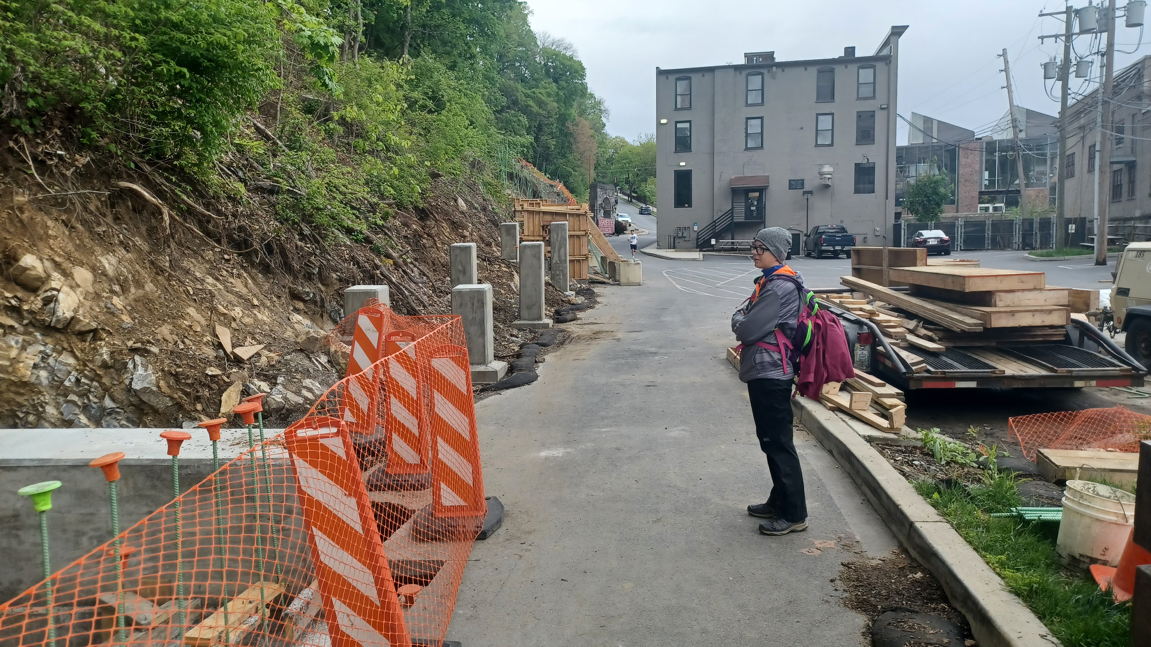
We continued along on our route, and soon reached the base of the Lafeyette College steps, which were gone. They had ripped up all of the steps up to the college, to be replaced with new ones. All of the trees had also been removed. It seems to me they have far too much money to waste. They can't make the thing ADA accessible because no matter what it will be too steep. The steps were in fine shape, and they just ripped it all out.
Now, the hillside looks hideous. It really is amazing how much waste there is. I'm sure it'll be pretty when it's done, but that's going to be a long ways off, and I'd love to be able to go up those steps with Ev now.
We could see the footings of some of the new steps as we went by. It was definitely a trip to see.
We turned right and headed into Easton, straight for the main Easton Circle. This too has changed over the years, and it had been closed off for some time. It only just was finished where the new walkways have been put in place. The cool thing is that some of the Declaration of Independence has been inscribed into the concrete. This was the location of one of the very first public readings of the Declaration, and so it is quite special that this was included in the redesign.
We continued from here to the west, then crossed the Lehigh on Rt 611, turned left, and headed back to the forks of the Delaware and Lehigh where our cars were.
The lighting was great, and the view up from the northern terminus of the Delaware Canal was awesome, with the Northampton Street free bridge prominent in view.


Brittany had some places to be, but I wasn't done walking, so I walked with Ev all the way back to the Outlet Lock and back for some bonus time, made a couple of history videos, and then we made our way home.
It was just such a nice day to be out, good exercise, and also relaxing, exactly the kind of day I needed.
No comments:
Post a Comment