This next hike would be an excellent lead-in to the big anniversary hike we ever every year to mark the starting of the group that would become Metrotrails.
I usually do the anniversary hike near the end of March, and it'll shift weekends depending on the availability of some people.
However, I decided last year, since it was the 25 year anniversary, that we would do things a bit differently this year. I wanted to change up the route a bit and make it something a bit more exciting for those who have come out year after year, and might skip out because it would be the same old thing.
I carefully considered the route, and because the group wasn't looking too huge (just because it was posted so late compared to most years), and so I figured I'd do one that was a bit more daring, but would skip several of the sites we had done on previous hikes.
One of the sites that had traditionally been a part of the hike every year was the Portland-Columbia Footbridge. The first hike in 1997 started by crossing that bridge, and every time we did that hike we originally started it there.
It wasn't until around 2012 that I started cutting it back and not starting that far north, just because it got to be too much of a hassle to get so many people across the abandoned bridge over the Delaware River.
I felt we were really missing out by not having the foot bridge as part of the hike, and so it was great when Lerch asked me about having a hike ending at a party at he and his girlfriend's home in Stroudsburg, it gave us some unique opportunities including the foot bridge. The official anniversary hike wouldn't be for another week, but this gave us the excuse to have a sort of pre-game.
I had several things in mind that we could use as part of the hike we were planning, but the other great opportunity was to include the closed PA Rt 611 through the Delaware Water Gap.
A major rock slide incident happened somewhat recently which led to the closure of the stretch of the road between Slateford and Delaware Water Gap. I wanted to walk this section and get now versions of several historic photos taken on the stretch, and during the time it was closed would obviously be the best time to accomplish that.
I also had a bunch I wanted to get at the Delaware Viaduct, which we'd also walk under.
In addition to all of this, I could include Godfrey Ridge, which is always a great time to hike over and include the old Water Gap Trolley right of way. Beyond there, there was some other stuff I'd considered using when we hiked to a party in Stroudsburg previously, but never got around to. This gave us the excuse also to make that happen.
Everything made it look like this was going to be an absolutely outstanding hike.
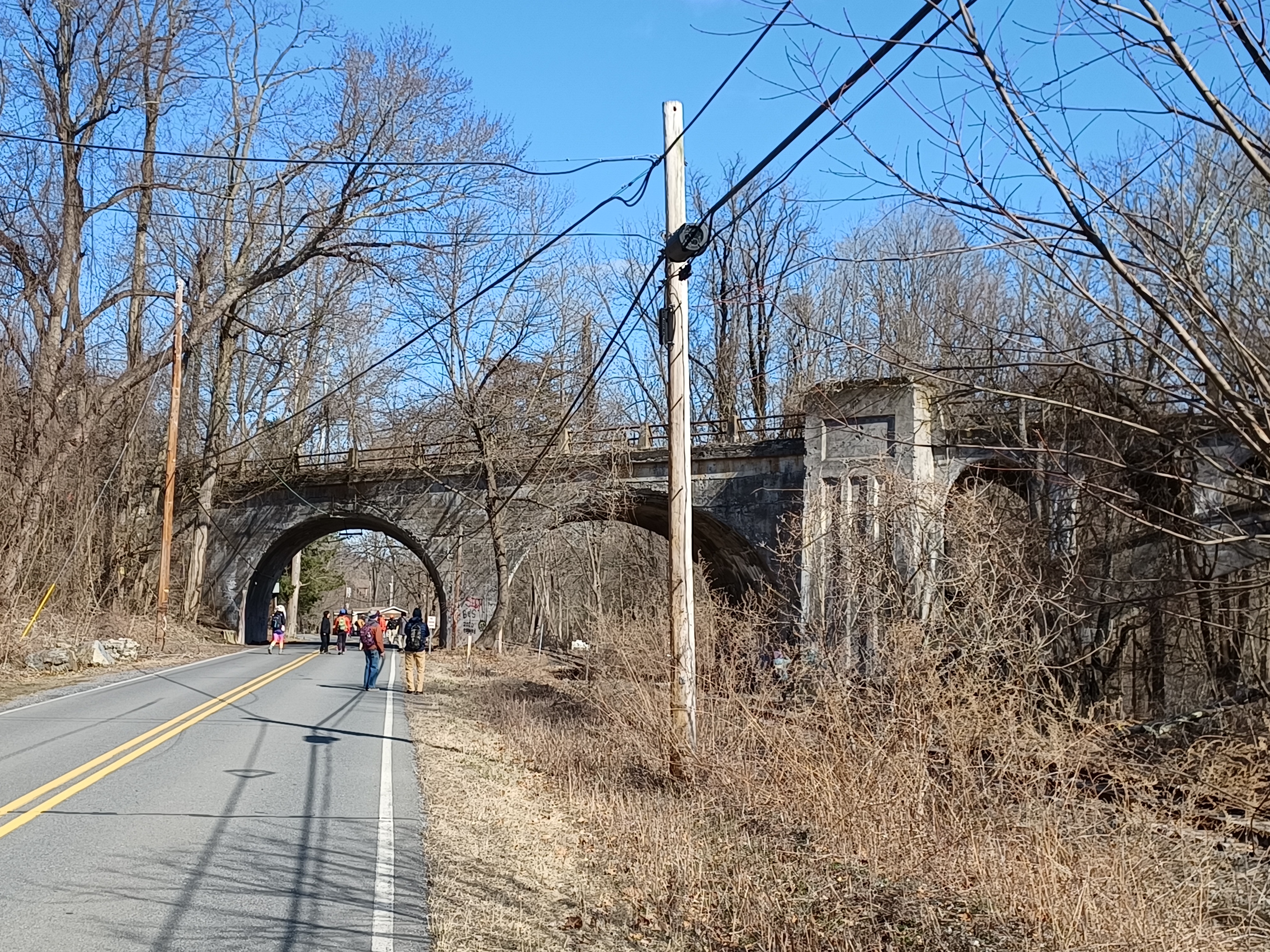
We met in the morning at the Aldi supermarket just down the street from the house, and then shuttled with as few cars as possible to our start point in Columbia NJ. There was a guy that talked to me there that follows the Metrotrails page when we started out. It's really cool how popular it's been getting.
As soon as I started getting stuff together from my car, some of the group took little Ev out and across the pedestrian bridge. He was happy to get out, although I found it somewhat alarming that he just went with Tina and others without worrying about me.
We eventually were headed across the bridge into Portland. I gave some historic dissertation on the area while crossing.
This was the site of the last covered bridge to span the Delaware, washed out in the Flood of 1955. The toll house on the Portland side still stands, but it was moved one hundred eighty degrees from its original alignment.
A lot of things have changed in Portland over the years. The railroad tracks look like they're not in line with the station building that still stands, because they were moved from the present 611 alignment in the 1900s when it was no longer needed as a double track main line. In more recent years, all of the hikes would always stop at the Port Mart for some chocolate milk, but it is now closed.
Once we were across the bridge, I related a bit more history, and then we headed to the right, and uphill on Delaware Avenue, which was old 611 before the current alignment took over the previous Lackawanna Railroad right of way.
The Lackawanna first came through in 1856, and it became a more important hub with the development of the Bangor and Portland Railroad after that, followed by the New York, Susquehanna, and Western on the New Jersey side (originally Blairstown Railroad in 1876, NYS&W extended it in 1881), and what became Lehigh and New England arrived in 1886.
As we headed up Delaware Ave, I stopped everyone to show the former grade crossing of the Lehigh and New England, which has been abandoned since October 31, 1961. It was the second major railroad in America after the New York, Ontario, and Western to abandon all in one day.
 |
| 1909 Watson Bunnell, Steamtown NHS Archives |
I don't know exactly when the bridge was taken down that carried the L&NE across the Delaware, but I understand it stood for some time after abandonment.
It was a deck truss structure, and today not much remains of it. On the Pennsylvania side, the west abutment remains in the slope below the highway, but it is quite obscured. The base of the first pier is still standing down next to the active railroad tracks below us, but it is easy to miss unless you know what you're looking for.
I had a ton of then and now history compilations I wanted to get on this hike, including several of this bridge site, but I only ended up getting two of them while we were out walking. I had Ev in the stroller, and I was falling behind just trying to get the ones I wanted to get, and so I figured some of these easy ones I could come back and get any time.
 |
| 1910 Watson Bunnell, Steamtown NHS Archives |
I actually would end up coming back during the following week with Ev and got a ton more of the photo compilations I intended to get on this trip.
The Lehigh and New England grade is still clear just to the west. I've followed it all the way through, but when I first started trying to trace it, it was way easier than it is today. It has since gotten pretty badly overgrown, and a lot of new people moved to the area that have so much more of the property posted as private.
We continued along the road, which still had the nice ambiance of the poured concrete slab look. It doesn't warrant re-paving much because it no longer gets the traffic that the main through route would get.
As we approached the intersection with present day 611, we passed the Short house, where my late friend Ron Short, and his brother Peeps, and their two sisters grew up. I would sometimes pick them up or drop them off there for hikes.
At this intersection, Russ and Ewa pointed out to me an old storm drain to the side, which was surprisingly made with old trolley rails. This is a pretty crafty way of making storm drains.
The Water Gap Trolley came through this area some time just after 1911, and was abandoned by 1928. It would make sense because I believe it was in the late twenties that the road improvements here took place.
We headed straight across on the former main road, which at this point becomes Slateford Road into the settlement of the same name.
Slateford actually dates back to colonial days, and the section we would be walking through was the part that grew mostly after the development of the railroad.
As we turned downhill, we could see some of the remnants of the Water Gap Trolley bed, which ran immediately to the right of the road as it headed slightly downhill.
 |
| 1909 Watson Bunnell, Steamtown NHS Archives |
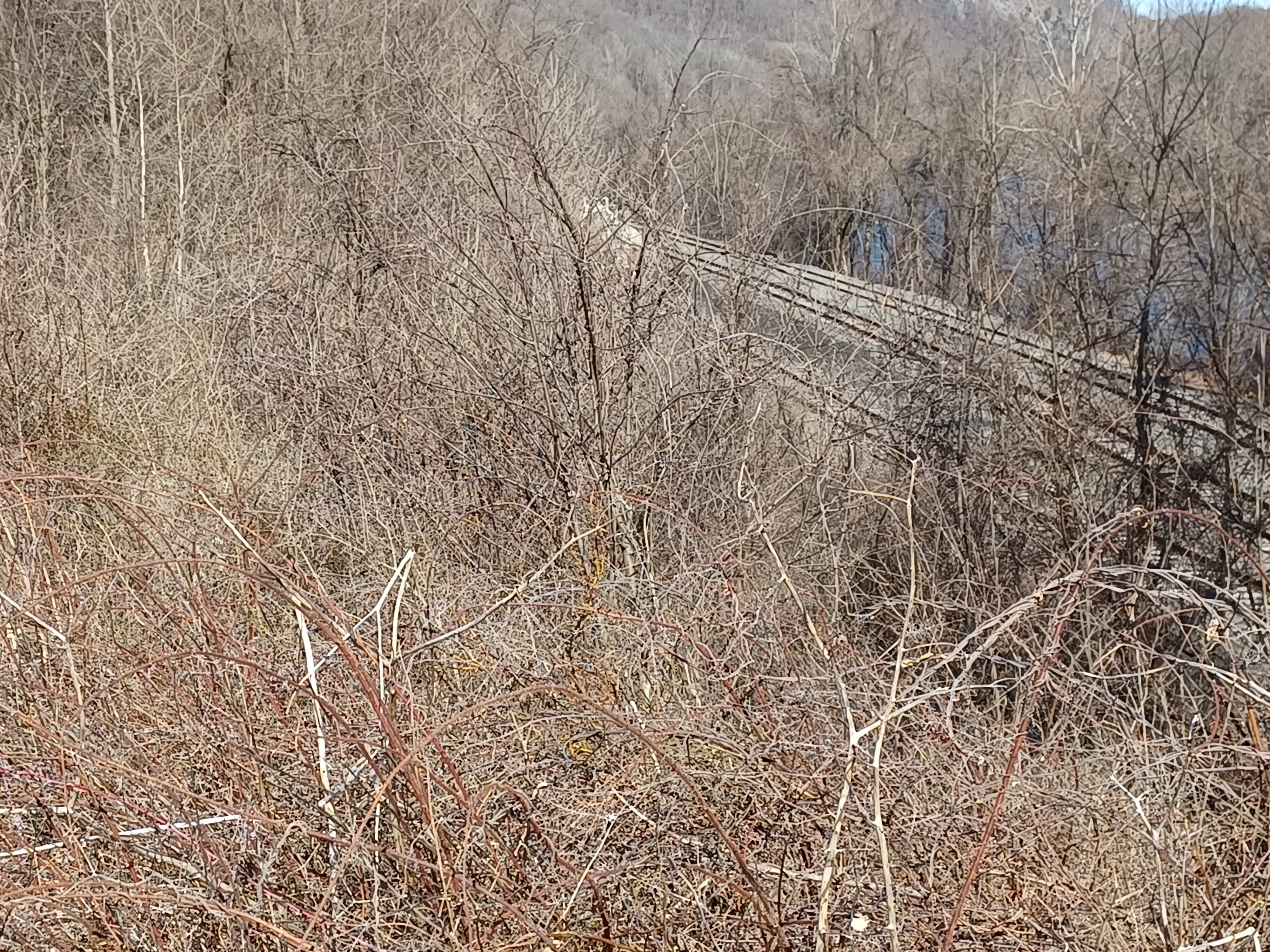
In this stretch, we came into plain view of the Lackawanna Cutoff's Delaware Viaduct, the first of four similar sister bridges built as part of corner cutting projects on the railroad.
There were several little cutoffs, and two major ones. Locally, we refer to this as the Lackawanna Cutoff, but out into Pennsylvania it is specifically referred to as the New Jersey Cutoff.
Construction began on the the cutoff soon after William Truesdale took over as President of the Lackawanna Railroad, and they were so wealthy that they kept a full time photographer on duty at all times.
Watson B. Bunnell took amazing photographs of the work beginning in 1909, and I had a plethera of images from 1909 and 1910 to set up compilations with. Unfortunately, I was already falling far behind the rest of the group from the first couple of them I was setting up, and they were already beyond the viaduct by the time I got there with tons more to do.
 |
| 1909 Watson Bunnell, Steamtown NHS Archives |
I had to shout out to them to wait up for me. I didn't want them to get too bored with the hike waiting for me to take photos, but I thought they'd like to see some of them a bit more.
The clarity of Bunnell's glass plate negatives, which are now property of the Steamtown National Historic Site archives, make for incredible compilations, and I got some really great ones this time.
After passing beneath the viaduct, we watched as the right of way descended a bit to the old main line, which was to our right. Much of the right of way has been annexed to people's back yards to the left of us, so it will be hard to reactivate this when the time comes.
I also watched to the left at a site where there used to be a church. I could see where the front step would have been, but what really gave it away was the existence of an old cemetery in the yard behind it, apparently taken care of by the adjacent neighbors.
 |
| 1975 Don Dorflinger |
We continued along the road to where it begins to climb up, and there used to be a bridge that carried it over the cutoff until the 1990s. It was removed claiming that it was structurally deficient or something.
I really don't believe any of that; it's something people tend to do to keep railroads from coming back. There's nowhere else on the entire line that was severed so badly as this spot, and it was right at Slateford Junction. In fact, there are still rails that go right up to where it was filled in, and are piled over with dirt.
We got up on where the bridge used to be, and I had several more then and now compilations to set up from on top of there.
Back when this area was still used, this was a very popular railroad photography location. It was perfectly situated above the tracks, pointed at the junction with the tower and cutoff and old main all in plain view.
I found several different photos taken from the spot, many of them uncredited. I have a feeling some of the uncredited ones were taken by Don Dorflinger, and if not, someone standing right next to him.
We came out from Slateford Road onto Rt 611, and the road blocks were up saying that there was no through traffic, but they could be passed around. It turns out, cars can still get all the way up to the Point of Gap Overlook and Arrow Island overlook for hiking, but not anywhere further than that.
We turned right on the road and began heading to the north. This was just great; a perfectly relaxing walk along a mostly closed off roadway. I wondered if maybe a ranger would be coming by telling us we couldn't be there, but no one came by at all.
When we got to the slope directly above the old tower along the railroad, several in the group went down to go inside it, but I didn't bother with it this time.
This was an absolutely perfect time to be walking this stretch because even though it had been very warm over the Winter, nothing was really budding yet and the views were very clear between the trees to see everything.
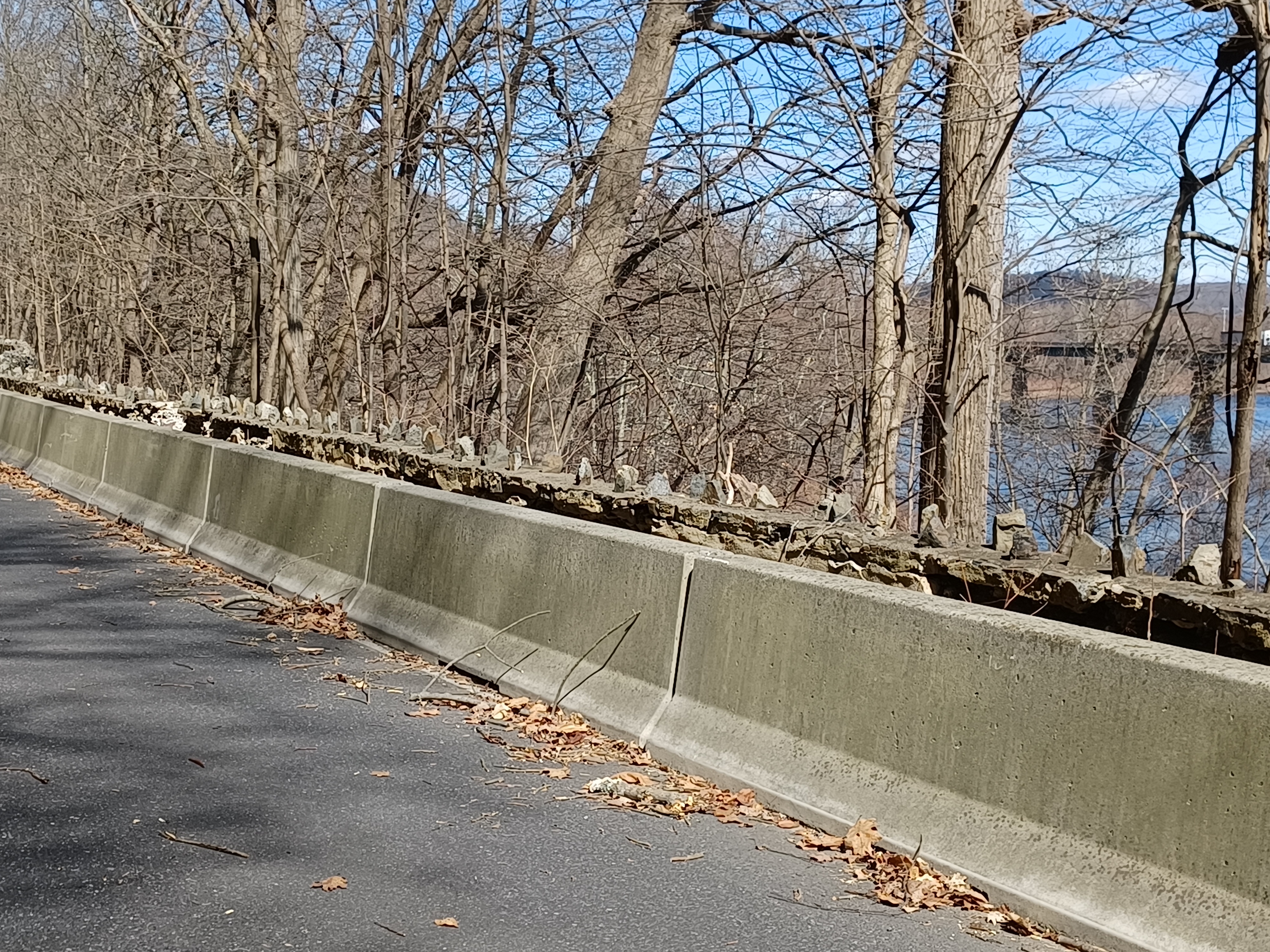
Along the left side of the road, there is a handsome stone wall that was apparently put in during one of the improvement projects in the 1920s, and my great grandfather, George Prall Allen, was on the crew of people that did the work on it. Amazingly, my grandfather, Eldon Allen, was on the crew that built the stone wall along what is now Rt 80 on the New Jersey side in the same area.
 |
| 1970s; found unlabeled, but looks very similar to another by Don Dorflinger |
We continued ahead to reach the Arrow Island overlook and checked out some of the views. This was a spot known as the Bear Stop before the National Park Service took the property over.
Many of the photos I wanted to emulate from this point on were known as stereoscopic views set up by famous photographer Jesse A. Graves, who moved to the Delaware Water Gap from Brooklyn in 1867. He set up a photography business, and is credited with not only immortalizing the early tourism of the Delaware Water Gap in photography, but also helping to promote the growing resort industry there. His photographs were in such high demand that he had to hire two assistants to help see to his business.
Graves befriended George W. Childs, and convinced him to fund the creation of Childs Arbor, which was a popular spot along what is now Rt 611, as well as other sites.
There are countless Graves views throughout the Gap, taken from when he first moved to the area to his death in 1895 from a blood clot in his brain.
I kept a very close watch on all of the landscapes throughout the time we walked these stretches of road to determine exactly where Graves might have taken some of his outstanding early photos.
The Graves photos are the oldest then and now comparison shots I've gotten to date, over 160 years apart.
The road that is now Rt 611 was at one time called the Mountain Road, and in years later was known as the "River Drive". It was a much rougher, unpaved route, much in the same area it is today.
 |
| J E Graves, late 1800s |
One photo I was unable to emulate was along the tracks more closely, so the original road was probably down the slope a bit more from what is there today, but otherwise I got most of them.
The first one I think I got was just of the road using a Graves postcard image, but there was another that had me puzzled. It may have been a Graves photo, because it was uncredited, but it looked on at a dip in the land, at the approach to the gap, and featured the railroad tracks, which were still single, a farmstead, and what must have been a water course.
I believe I found the correct location for comparison at this site, but it took a lot of looking and watching the profile of the mountains beyond to recognize where any of this might have taken place. It's just so hard to pick where exactly one might have built up all of this.
The road descended from high above the tracks to down beside them, just ahead. In this stretch, we came down closer to the railroad tracks, and the next point of interest was Cold Air Cave.
The Cold Air Cave was a popular tourist attraction in the years prior to the National Park Service taking over. Apparently, it was once deeper as well, but the NPS decided to collapse it at some point in time based on what I've read.
There was a building that sold gifts and such in front of it, and one would go through the building to reach the cave.
Now, there are signs on it to keep out because of bats and such, but I doubt anything is in that one. It really isn't deep enough to warrant any going in it unless there's some big nooks. Much of the group went up to check it out, but I'd already been up in there countless times so I remained down with Ev in the stroller.
We continued along just a little further, where the tracks come up to the road, and reached the Point of Gap Overlook, where it is probably the best spot to get a view of the "Indian Head" On the New Jersey side. It is said that the rock formation to the top shows the profile of Chief Tammany.
We paused here briefly, checked out the view, and then continued on.
It was still possible to get a car up to this point. The barricades further back on the road were such that one could easily just get around them and go to the parking areas which I guess were open.
There were ones like that initially at the curve, but then beyond there were some very significant ones that required some effort to get over. They probably didn't want anyone walking through either, but there were no signs saying that pedestrians should stay out, and actually, this is the route of the 911 National Memorial Trail.
It is possibly the most dangerous place on the entire designated 911 Memorial Trail because when it is open to traffic, walking that section of road is a death wish. Cars fly by far too fast, and there is not really a shoulder for people to get off if they are walking. The trail should never have even come to the Delaware Water Gap anyway, but the truth of the matter is it is all about money. Grants were available, and some of the county and municipal stakeholders to the west were hell bent on having the trail in their area. They showed support for it all, and they wanted it there, so the powers that be in control of the trail put it there.
I attended a meeting several years ago on the planning of it, and it was a slap in the face charade. They got a large group of us together and asked us where the trail should go, had no Pennsylvania stakeholders present, and told us no matter which way we chose, it had to go through Delaware Water Gap. Mind you, that meant traveling from down near near Hackettstown all the way to Columbia, then across and through the gap, then back down to Easton. I noted that their planned route meant more than 22 miles of road walking, and more than sixty grade crossings of vehicle roads.
If they had gone with the route I had suggested, there would have been less than ten miles of interspersed road walking and otherwise only about 20 at grade road crossings. My suggested route also hit dozens of sites that were important in the history of the country, and included more 911 memorials.
I left the meeting feeling sickened by how all of this works.
To this day, the Rt 611 section is still on the trail website as the official route, and it is absolutely horrible. It will be for years, because when and if the road opens, it will take years just to get a trail plan in place through there. They can't use the active railroad tracks with planned commuter service to Scranton coming back. There are not many options, and they'll continue having people walk a dangerous route in the meantime.
Of course, the site is geared more toward bicycles than pedestrians these days. Most all trail plans are, because that's where the money is.
I had several more historic postcard images to emulate through this section, featuring the Water Gap trolley tracks as well as the vertical rock outcrop at the Point of Gap. There used to be a service station and store at this location as well, now long gone since NPS took over. I really don't have a problem with those buildigs being gone as it is better left in its natural state through there.
I had tried to get photos at the rock outcrop location in the past, but it was always really tough to do with the volume of traffic coming through. I usually got them mid week day.
The Mountain View Trolley offered rides between Delaware Water Gap, Portland and Stroudsburg PA skirting the edge of Godfrey Ridge for fifteen cents starting in July of 1907, and then another line was run into Portland after 1911.
The trolley, unlike other services that were similar, ran year-round. It served not only the local tourism, but also as a school bus for the local children. Other trolley lines during the following years of “trolley fever” came to the Delaware Water Gap region, but it was all short lived. Buses soon arrived and eliminated the interests in this form of transport.
The trolley operated under different names during its relatively short existence. Under its last name, Stroudsburg Traction Company, the last trolley ran over the Godfrey Ridge to Stroudsburg in September of 1928.
Today, they run little bus tours through Delaware Water Gap in buses that are made to look like trolleys, and I remember very well my grandfather taking me for the tour on one, and the nice old man driving it let me ring the bell in the front.
There's not much evidence that trolleys came through the gap, but it is informally used as an ATV trail over Godfrey Ridge in places, which was my planned route. Other locations are completely grown over and almost unrecognizable.
We went around the corner on the road, which had some great views, and I fell behind once again taking more then and now history photo compilations.
I think many of the photos I was using were taken in the twenties because there were nice new concrete walls alongside the road, but these were replaced by ornamental stone ones, which had pointy vertical rocks placed in the tops of them later. I think these were done as a WPA project in the 1930s.
The dramatic curves in the road looked amazing ahead, and once again I had to watch very closely to make sure I could emulate the photos in the same way they were back in the day.
As we started making the curve to the left, heading toward the right, there were several historic images that had been taken at that point.
It was in this area that the grand hotels from the days when the Delaware Water Gap was the vacation capital of the world started to come into view.
Only a couple of the old hotels still stand, and they're in the town of Delaware Water Gap itself, but the most grand one of all was the Kittatinny House, which would have been perched within view from these points we were walking by. The second most famous was the Water Gap House, which sat perched on an outcrop almost directly above the Kittatinny.
The amazing Kittatinny House has its history dating back to the late 1820s with Antoine Dutot, who built the first structure. At the time, the town of Delaware Water Gap, Pennsylvania was known as Dutotsville.
 |
| 1880s J. E. Graves |
The hotel was sold and expanded upon, and in either the 1880s or 1890s, the original building was razed in favor of an even larger structure.
Amazingly, the Caldeno Creek (named as an amalgam of the names of the men who discovered it) flowed right through the kitchen of the hotel, and then spilled gracefully over the rock ledges as a picturesque waterfall.
The Kittatinny House came to it’s end when it burned to the ground in 1931. Similar fates befell many of the great old hotels of the Water Gap.
Today, the foundation of the Kittatinny House is known as Resort Point Overlook, a parking area and trail head for the Appalachian Trail. The fountain base from the hotel is still in an island of grass in the lot.
The Water Gap House above met a simlar fate, and only foundations can be found today.
Resort Point Overlook was our goal location, where the road blocks are on the other side of the closed highway.
Washouts like the one that happened last year are not a new thing in this area. Unlike the New Jersey side of the river, where the cliffs are composed of tough Shawangunk Conglomerate, the stuff beyond the point of gap shifts to a softer shale material, and the road is in a narrow spot where lots of little tributaries flow over into the Delaware. It has all of the makings of a bad rock fall situation that in the past was just accepted as something that happens in that area. Modern liability concerns force areas like this to close down in ways that even in my youth would seem preposterous.
 |
| 1875 Monroe County Historical Society |
One such incident of rock fall occurred during a storm in 1913, possibly the same one that took out the railroad yards in Manunka Chunk several miles to the south.
Apparently, there is a big debacle surrounding the rock fall situation.
As we walked the section, we were expecting to see a major mess of rocks all over the road that we might have to climb over, or worse, climb down to the tracks and back up to get around.
There was one small rock the size of maybe two fists in the road through the entire section. I wondered if the entire thing was some farce, or did they already clean it up?
No one else was back there, so who would know any better? I had been told there was an enormous mess.
It turns out there was a major rock fall situation, but it had already been cleaned up. the roadway remained closed because there was more loose rock up the slope from it, and it was possible that much more could come falling down, and they couldn't re-open the road knowing that.
They've always kept it open in the past, and I wonder if this might have been some sort of a move to make a statement to New Jersey.
When the rockfall mitigation project started over there, it was stated that they were going to reroute all traffic onto PA 611.

They apparently made these decisions without consulting anyone from PENNDOT about it, and so the stance was taken that it should not be done.
It gets more complicated because the highway is state owned, but all of the land around it is National Park Service. As such, they must go through them if they want to do any mitigation that might effect any of the natural resources at the site, and that takes a long time.
I wouldn't mind if they never open the stretch to traffic again and just make it into a pedestrian route. There's no one who lives on the stretch all the way from Delaware Water Gap to Slateford. At the very least, the entire section should be closed to all truck traffic.
Down on the railroad tracks below, one can see that the shelf on which the highway is built, there are cracks everywhere, and truthfully it should have had a four ton weight limit on the entire stretch at the time it was built. It was never intended for large vehicles to come through on it at all.
I set up yet another history compilation using a photo from the 1913 collapse.
We moved on ahead, and one of the spots I had wanted to get a better look at was Child's Arbor on the left.
The former site had a nice little building, wooden walkways and benches and such, and a trail that went up to what is now the Appalachian Trail farther up the Eureka Creek in Eureka Glen.
 |
| 1913 land slide |
There was even a concession stand in the narrow section of roadway back in the days when there was less traffic, beside a scenic cascade. Sadly, some of that cascade was scaled back with road widening.
 |
| 1900 Library of Congress Archives |
Childs Arbor was erected as a gift from Philadelphia publisher and philanthropist George W. Childs.
 |
| Probably a Graves stereo view taken at time of rail double tracking |
The bright and charitable Mr. Childs built great success from a young age, starting life as an illegitimate child of unknown parents to being so respected he was
offered Republican Presidential candidacy (which he declined).
Childs is noted as having said "Meanness is not necessary to success in business, but economy is."
Mr. Childs was a guest at the nearby Kittatinny House (now Resort Point), and funded both the lovely access to the Eureka Glen and Childs Park at Dingman's Ferry.
Sadly, Childs Arbor is gone today, and none but informal trails of questionable footing remain in the Eureka Glen today.
One of these days I want to get out there and try to climb up the glen from bottom to top. I know I can do it, but some of these things have to hold off for a couple of years until little Ev is big enough to handle them as well.
We continued on along 611, and as we got past Childs Arbor, there were more people walking. They were parking at Resort Point and heading to the south, so I felt better about being there at least. They certainly didn't venture too far since we didn't see anyone further down.
We stopped at the Resort Point for a little break, and I pointed out where things used to be in the parking lot.
Across the street, there is a rock, which in the past had a very old metal plaque on the Appalachian Trail.
Up until the 1990s, the Appalachian Trail came to Resort Point. In fact, my first hike on the Appalachian Trail when I was very little was out of this parking lot.
The trail used to go up the 611 shoulder, then turned right up the Caldeno Creek, then left along the path along the cliff to Council Rock.


 |
| X marks the spot of rock fall? |
 |
| Old Kittatinny House carriage road |
I think the trail was officially moved both to eliminate having hikers walk on busy Rt 611, and to offer more parking over near Lake Lenape off of Mountain Road.
The old trail, which follows very old walkways that went up to Lake Lenape from the Kittatinny House, complete with beat up old steps, is now a blue blazed trail to where it meets the current AT route.
Matt and I were walking together in this section, which was really nice because I hadn't seen him in so long, and we noticed that the remnants of the old carriage road to the Kittatinny House were still standing on the slope above to the left. It had been cut off through widening of the highway, but just a little further up, the stone retaining wall for the road was very obvious and prominent. It makes me want to go up and try to explore that further as well.
We continued downhill into the town of Delaware Water Gap, and the Deer Head Inn was on the left where the Appalachian Trail goes uphill. It is known as the oldest Jazz Club in America, and is one of the few historic hotels of the town still standing and in use.
We continued downhill through the town, and we could see the roof of the Water Gap station on the old Lackawanna Railroad beyond the Rt 80 toll bridge below us as we came to civilization. It's in pretty bad shape unfortunately.
Another old hotel that is still standing down to the right is the Castle Inn from the early 1900s, along the AT route.
We reached the intersection with Broad Street, and I announced it would be our lunch stop. I figured everyone would probably want something like pizza, and Doughboy's Pizza is right there on the corner.
I went in and Jack treated me to a slice or two there, which Ev shared with me.
Amazingly, hardly anyone wanted to go in for pizza. They all went over to the hot dog and pie place just across the street and down a bit.
We almost always get hot dog and pie when we go through the Delaware Water Gap, because it's sort of a tradition, but I didn't think everyone would want to make that their lunch!
We all went over to the place and sat down for some yummy food. I of course had hot dog and pie and shared with Ev.
The place has one of those silly things made of wood, where people can put their heads in the holes and have their photos taken looking silly.
Serious Sean decided this was an opportunity to be a level up of silly, and he went in and purchased an entire pie. He then instructed Lerch to smash the pie in his face while his head was through the hole.
Once this was done, Sean went back into the pie bakery and asked for napkins and said something like "they hurt me" or something, in a very silly way.
It was actually pretty funny, but they just looked dumbfounded by the entire thing.
Jen met up with us at the apple pie place having run late in the morning, and some of the group also cut out early rather than take on Godfrey Ridge, which was the next big thing on the hike.
We walked back over to Rt 611 and began walking it uphill to the northwest. For some reason, this took the wind out of me more than it should have, which made what we had coming up that much worse.
We continued to the intersection with Foxtown Hill Road. If I didn't have the stroller, we would have cut through the cemetery to the right, but it would have been too hard to get it down the slope, and I didn't want to take forever on this. Godfrey Ridge would be hard enough.
We turned right on Foxtown Hill, and I pushed ahead looking for where the path would be into the woods to get on the trolley bed.
I was not finding anything good. I had been checking the google street views prior to the trip, and I knew this would be one of the most difficult spots on the entire hike.
We went back and forth for a bit on the road, and then found a faint path that was weedy where we went in, but more doable just a little further up. It was just the start of it that had some brush we had to get through.
We pushed ahead, and there was a large stone ruin on the right. I am not sure what it was, but I think I knew at one time and it had something to do with the trolley.
The climb up Godfrey Ridge was far more difficult than I figured it would be. We had to turn to the left up a washed out woods road, which I thought was the trolley bed at first, but then I remembered the trolley was just slightly below it, and the road joined it farther up.
I was sweating bullets. I was able to push Ev in the stroller, but I had to watch the front wheel closely. It constantly turns on me and makes it difficult. I also had one flat tire on the thing which made the going tougher.
As we reached a peak on the way up, I turned to the left where the profile of the Delaware Water Gap came into view between the trees. Just as I turned, it was the exact moment I recognized it was the same scene from one of the historic postcard shots I wanted to emulate. The trolley came up to reach the woods road at that exact spot, and I was certain I got it right. After all that struggle, I was elated that I'd found the view.
Around this location, the trolley made an incredible hairpin turn to the right into a huge cut, and then continued the climb up Godfrey Ridge.
Once we were through the cut, we were pretty much at grade with the ground surface, cut to the east for a bit, and then took another hairpin turn to the west around a corner. It was still tough going with the stroller, and at the end of the curve, I had to go off of the right of way to get around a bad fallen tree.
Everyone helped when I was really struggling by guiding the front of the stroller over the rocks. Ev actually fell asleep for a lot of this mess.
After that curve, there was another ascent, which seemed as bad as the first one. The many little rocks often made it hard to push. I tried to stay to the side a bit, and as long as I could keep the front wheel moving, I was okay.
The treadway started getting easier as we got closer to the crest of the ridge. We took a little break when we reached that point. It wasn't really the top of Godfrey Ridge, as the trolley went through a saddle.
The trail heading up deviates somewhat from the old trolley bed, which is grown over with some brush and Mountain Laurel, but then returns to it before reaching the north side.
This next section is the one that makes it all worth it, because the view is outstanding.
We made our way out from a cut and onto a shelf along the north side of the ridge. There was already a view through the trees of the Brodhead Creek making its way through the gorge below.
As we continued just a little further, there was an excellent view to the north over the Brodhead, with the old Lackawanna Railroad below.
A power line clearing has kept this overlook pretty intact over the years, in pretty much the same spot as the historic postcard images and Graves stereoscopics from the time.
I assume that one of Jesse Graves sons took over the photography business, as it reads "Jos Graves" on it, and Jesse apparently died before the trolley was put in place.
The section ahead was really nice. It continued along the shelf, gradually descending through the woods for a while, on a nice surface for pushing the stroller. Ev missed the views altogether because he slept through it all.
Eventually, we came to a point where the trolley bed was not passable, and probably eroded out of existence, and we had to turn to the right, downhill through woods toward the old New York, Susquehanna, and Western Railroad right of way.
We went downhill a bit different way than I had ever gone before, so I wasn't really sure of where we were going the entire time.
We headed down for a bit, and then I chose the more prominent path that stayed along a shelf of a ridge heading to the west a bit, then another steeper thing to the right which required some help with some friends to keep my balance. We also went around a wash area which required some fancy pushing.
Eventually, we reached the railroad bed below. This can be a bit complicated because it also has a major washout that took the entire right of way into the Brodhead Creek. At that point, it's necesseary to go uphill and back down again on the other side to regain the right of way.
A lot of the rail bed is so beat up, it is barely recognizable as such today, but that makes it interesting.
We continued along the NYS&W to the west, and we could see the tent cities of homeless people across the Brodhead. There are typically lots of them through this entire area, known as Glen Park.
We continued ahead out to the proper park area, and followed the right of way to where the road splits at the entrance.
From here, we the NYS&W used to continue to the right and crossed the McMichael Creek ahead, then the Brodhead Creek a little further up to its terminus at Gravel Place where it could interchange with the Lackawanna. After 1893, the wholly owned subsidiary, Wilkes Barre and Eastern was completed giving the line direct connections.
I'd hiked most all of the Wilkes Barre and Eastern as a series, but occasionally we get close to other pieces of it when we hike through these areas. Much of it was obliterated in Stroudsburg.
We continued uphill out of the park on Collins Street, who was named for a trader and businessman who made his home on the ridge above, and tried laying out a development community in this area. He failed in that attempt, and died poor after a while lot of drama, and the street name is all that remains of the grand plans. I detailed that more on the hike when we went near his home on his former estate, which is now Glen Run Nature Preserve.
At some point, we headed a block or two to the south and turned right on Bryant Street. We followed this to the west across Rt 611.
Once across, we passed through a nice neighborhood with a good sidewalk, passed Village Drive, and then reached the entrance to Laurelwood Cemetery.
From here, we meandered through the cemetery and let Ev out to walk around a bit more. He ran around and was checking out all of the American flags that were placed on the many graves.
I wasn't totally sure how we would get trough this, and I laid out our route using aerial images. In doing so, I made a couple of calls that could potentially be tough, but were only for short distances.
The google maps did not account for elevation, and so when I looked at the distance between Village Drive and the north end of the cemetery, I didn't consider that it might be a major drop.
It was quite a drop. We scouted a few edges of the place, but there was no good place to head down. There was also no choice but to go down or to turn back and add more mileage. I figured we could do it. Dave took the stroller, and I took Ev and slid down a leaf covered slope. It was actually a fun slide and we made it just fine. I didn't realize it, but I had cut my leg pretty bad on a stick.
It was amazing looking back and watching Dave navigating the way down the hill with the stroller. It actually made for an insane photo because one might assume that little Ev was in there, when he was on my lap.
We continued on the gently slope down to Village Drive, and there was surprisingly a park type area directly across the street down to the McMichael Creek.
It was a pretty good path on down to the edge of the creek, and we were able to walk out along the this bit of preserved land in the development for a bit. We made our way onto another road called Turtle Cove, and from the back of that, there was a paved trail that made its way up to Village Drive again, but we were able to turn to the right and follow the McMichael Creek some more.
I was really happy to have found these bits of green open space with at least some kind of delineated path. With these short sections, it makes the longer road walks seem like nothing. They go by more quickly and enjoyably.
We continued along the creek for a bit, and the trail emerged at a sort of yard area near townhouse homes. We turned right on Village Drive, and used it to cross over McMichael Creek.
We turned left on Katz Road, which took us out to Dreher Ave. We turned right there and followed that road beneath Interstate 80. After that, in a short distance, the Stroudsburg Cemetery was on the right. I wanted to walk through some of that, but it had big metal fences around it with no good way in, especially with the stroller, so I decided against using that and we just followed the edge of it on the road.
We followed this out to Main Street and turned right. We only followed that a short bit across the Pocono Creek bridge, and then turned left to head north on Elm and 10th Street a short distance.
We reached Rt 611, 9th Street, and turned left for a bit more, which took us right back to the Aldi and the end of the hike.
The road the party was on was only just behind the store, so it was perfect, just like it had been the last time we were up there.
I really enjoyed the route so much, and especially the Rt 611 stuff, that I wanted to go right back and do it all again because who knows how much longer I'll have the opportunity to go through there and get these shots. I'd have to take some time to find more of them and then try to emulate ahead of time. Unfortunately, I didn't get back up to that section, but within a couple of days of this hike, I had a day off and went up with Ev to try to get more of the shots I had missed on this hike including of the Delaware Viaduct, Slateford area, and lots of other stuff in the vicinity of Knowlton Township and Blairstown.
The party was a great time as always; we hung out and ate lots of food, and Ev had a great time because he's always the center of attention running around and playing with everyone.
It was a bit of a late night for Ev, but we were out by around 9 or 9:30 I think, so it wasn't all that terrible, and he'd had a really great day.