

Hike #1495; 7/10/22 Spotswood to Laurence Harbor with Justin Gurbisz, Stephen Argentina, Brittany Weider, Diane Reider, Tammy ?, Violet Chen, Gregory Andres, Susie Duncan (and Zip Line), and Serious Sean Dougherty
For this next hike, I decided we would visit some locales in New Jersey that have never been a part of our hikes in any way, as well as a few familiar places approached from a different angle.

There were honestly a whole lot of choices for this one, all of which would be hikes that hardly anyone would consider doing, but I decided on this one as sort of a gamble for swimming spots and for general interest.
There were a lot of trails through the area, and a whole lot of public lands for which I didn't know how access would be, but it all turned out to be great.

I came up with something that would take us to Laurence Harbor where
there was good parking, pass through Allaire State Park, which had more trails
I had never done before, as well as cover lots of other new stuff for more than
half of the trip.
We met in Laurence Harbor at an area known as Paul's Beach on the west side. We then shuttled to the starting point, which would be Mundy Avenue Park in Spotswood.
This was just a small on street parking type of thing, because Mundy Avenue Park was hardly anything at all.


Mundy Avenue took us to the west and soon changed names to Greystone Road. The road wasn’t too busy, and the short bit of road we had to walk on this hike made it all worth it to tie all of these different points together.

Sometimes the most complicated part of planning is just finding places we can leave cars at either end.
After we passed Brookside Road, we crossed Matchaponix Brook on the road bridge. A short distance beyond that, we turned left onto a path parallel with the road along the edge of a large pond.
The pond I believe had to do with the big industries that relied on the water source to the north of us: Dupont, Hercules, and National Lead.
The trail continued along the south side of the pond parallel with the road for a bit. It was really great because we had barely been on the paved road at all and were already into the woods sooner than even I expected.

We turned left into woods to the east side of the lake on the now closed Riverdale Avenue, as per what Google maps says.
This skirted the lake or pond for a little ways to the north. It was quite pleasant because it was unpaved.
The road weaved around to the north, and then turned to the east. We reached a gate and the road became open to regular traffic, and we continued walking.
It was odd walking through this neighborhood to the east. There were no signs saying to stay off of this property to the south where we got onto it, but at the end of the drivable section of Riverdale, it was prominently signed to keep out.


The lake name is an amalgam of the names of the industries that made use of its water, which dams the South River: Dupont, Hercules, and National Lead.
The first industry at the site was a factory for making imitation leather, but it closed due to the Great Depression.

In 1940, it was purchased and converted to a paper plant that specialized in creating the paper lining in cigarette containers. The plant closed in 2020 and is currently being demolished.

I seem to recall we chatted with a guy who was walking by when
we walked back up from this spot to Riverdale Ave again, where it changes names
to Brookside Ave. He wanted to know how far we were going and to where.
At this bend in the road, Brookside Avenue actually continues to the north but is abandoned and now used as a trail route.

The section of the road here was still paved to the north through some nice shade. I understand this area was known as East Spotswood.

Duhernal Lake, one would think, is very polluted and really should be drained off, but the area did capitalize on the body of water. It is part in Old Bridge Township, and on Metrotrails, Diana Smith Sieberg stated:

“I spent many summer days swimming at
Duhernal Lake in Old Bridge as a kid in the late 50s/early 60s. There was a
sandy beach, a refreshment stand with a jukebox, playground and a raft from
which to jump off if you passed the swimming test.”
There was another path east of where we were walking, that went
along the shore of yet another lake, but I missed the turn to go over to it. It’s
just as well, because this hike would have us going over mileage again since
there was so much we had never done and so much to explore.
We walked on further, and there were roads off along the edges
of this area.

I wondered I any of this area had been served by rail, but I couldn’t find any information on any such development on this side of the Duhernal Lake.

The original Camden and Amboy Railroad route runs on the other side, later part of the Pennsylvania Railroad system, and it was the one that served the plant there.
During this hike literally, that plant was being demolished. Justin had gone
and explored this area literally I think the day before. He had wanted to try
to get into the plant that was being torn down, but it was very highly guarded
and gated off.
There was a connection out to 6th Street in East Spotswood section of Old Bridge, where we could either continue ahead on the abandoned Brookside Ave, or we could go to the left over to the edge of Duhernal Lake. Justin knew where to go, because he had just explored this as well.

We all went left; this had not been part of my original plan for
the hike, and was a bit out of the way, but we had to do it. This entire area
could change quite a lot in the near future, and who knows when we’ll have the
opportunity to explore it again.
We passed through sandy woods, in sort of a Pine Barrens type of
environment, and soon approached the Duhernal Lake Dam.
The end of it was pretty heavily fenced off. There was a nice view out to the lake from where we were standing, some fishermen just below the dam on the South River, and a mucky looking spot where Justin said there had been tons of people swimming just the day before.

It was hot and I considered jumping all the way in, but then decided not to because no one else was going to go on. I just stood in it briefly.

We had to go back the way we came from this location to the
south a bit to get back to Brookside Ave.
We took a slight side path on the way back that was more in the
pines and the shade than the way we initially went, and eventually came back
out to Brookside Avenue, still abandoned at this point.
We walked on this to the north to around 4th Street or 3rd
Street, but then there was only a power line that continued parallel. We stayed
on this for just a little bit, but then had to head out to parallel Sunset
Avenue because we couldn’t get through another way.

Walking through this neighborhood was kind of nice. These were clearly newer buildings than many settlements we go through. Most all of them had to be early 20th century, but they were not cookie cutter homes. They had a lot of character to them, which was nice.

The first left we could take from this was onto Applebee Street,
a dead end.
When we reached the dead end, an abandoned road continued to the
left. I seem to recall there were some Japanese wine berries growing along the
way which is always good.
The road was rather overgrown and not entirely pleasant to follow. It was parallel with and steeply down below the level of Route 18, which is a major eastern NJ highway. It would probably have originally been at a lower level. It was a narrower road when it was first constructed in 1939, but has since been extended, and widened to the point that it is now in many places a limited access highway with exits and on ramps.

We made our way to where the path got to be somewhat overgrown, but soon came to the Route 18 bridge over the South River. It was completely clear beneath this.

This was a really cool spot; there was some impressive graffiti
under the bridge, and it was a nice shady spot to stop and relax or a few
moments. I climbed up the slanted southern abutment for a better view of the
superstructure.
From this point, I wasn’t sure what we were going to do. Actually, my original plan was not to go beneath the Rt 18 bridge. When it looked promising, I decided to continue that way. My back up plan that I figured would be the one to use was to head to the east a bit, where there is a foot bridge over Rt 18. I’ll still do that, only as part of a future hike.

If there was a way of going beneath the 18 bridge and then climbing up to the edge of the highway, that would be the much faster preferred way.

I was skeptical that it could be done.
I told the others to wait for me below the bridge while I climbed up the rest
of the slanted abutment to the corner, to see if we could get up to the road
level.
I was pleasantly surprised that we were able to get right
through! I called the others to follow me up, and we all soon emerged along the
westbound side of Rt 18.
Old Matawan Road soon came in on the left, very closely parallel with Rt 18. We
turned away and followed that for a ways to Kearney Ae on the left side. There
were a few houses at the start of it, but then it became Old Waterworks Road,
and was unpaved.

It was a trip to be on this unpaved road in Old Bridge. Probably not a lot of people other than locals know you can get through on it.

We continued on this pleasant road and I don’t think a single
other car came by. Apparently, some of the lands to the right of the road are
Middlesex County’s Deep Run Preserve, which is a whopping 905 acres. I suppose
this means we have the right to walk through it.
When Sandfield Road comes in from the left, and that is where
all traffic is directed, we continued straight on the old Waterworks Road,
which is closed to traffic ahead.
We continued along on the road, which jogged slightly left and right over a bridge, a tributary of Deep Run itself. It was a pleasant walk ahead, and I had considered remaining on this road, but there is a reservoir to the east a bit, and it was looking pretty welcoming.

We took to a sand path that went to the right, and it took us along the south
side of an enormous reservoir for which I cannot remember the name. I seem to
recall that the name was on google maps when I planned the hike and while we
were doing it, but now nothing appears of it on any google maps, open street
maps, or even the historic maps.
I don’t know the history of this reservoir, but it is not very old. USGS maps
don’t even have it existing in the 1980s. The earliest map I can find that
includes it is 1995.
We could see the edge of the water through the trees to the left
as we headed east. Then, there was a woods road that went to the right, away
from the lake. I wanted to check that out, so we turned here just to get a view
of a smaller reservoir on the Deep Run.

Based on what I was seeing, this must have been the older reservoir on the Deep
Run, and it looks like it was abandoned in favor of this newer one.
It was strange that there were no signs or no security around this place. We
headed back over to the woods road around it, and began walking east some more.
A path led down to the water, which was crystal clear where we could go for a dip.
There was not another person in sight anywhere.
We returned to the woods road and continued around the east side of this lake, then headed to the north around it’s perimeter.

This was absolutely gorgeous. We came back to the shore on this other side as well. There was a peninsula going off into the middle of this lake, with some kind of building on it, but I’m not sure what.

We continued around the perimeter to the north, and there was another
very nice and peaceful spot where there was a group of people out swimming as
well. They had a utility ATV with them.
My plan was amended at this point since we were heading to the
north side of this reservoir. We would continue on and then cut through the
woods to a woods road to the north, then head out to an all new development at
the Glenwood area I guess it’s called. Google maps has labels for both The Oaks
at Glenwood and Glenwood Green.
Regardless of the way we went, I was planning on taking the abandoned road over
Tennent Pond to reach that development.
The problem with the north side of the property was that it was now surrounded
by chain link fence. There was nothing where we walked in, but this was a
rather imposing fence. I tried looking for holes in it from fallen trees, but
most of the woods were not looking so good for bushwhacking either.

I did find one spot to go into the woods, and in it was an interesting
abandoned car, but it wasn’t the direction we needed to go.
We continued further toward the north of the reservoir, and then there was a
sandy path leading to the north. We turned to the right from it, and then came
upon a guy’s tent out there. We went by it and skirted around this area, then bushwhacked
through woods to the north a bit until we finally reached the old road I had
intended to follow.
The sandy road was good and clear, and we followed it right through the woods
for quite a while, to the south side of Tennent Pond, and across Tennent Brook.

The sloppy water was looking very unhealthy and brown. The woods road had a lot of ballast rock laid across the crossing so we didn’t have to get wet. To the right, south, the sloppy muddy water was prominent, but to the north, to Tennent Pond, all we could see was a mud meadow.

We moved ahead a bit more, and soon emerged on new Vebana Lane,
one of the new development roads. I made a wrong turn on one of these roads to
a point where we had to turn back a bit, but the plan was to take Aster Circle
to a right on Schulmeister Road. That would bring us out to Route 9.
We wandered through the development, and not many houses had yet been built. The sidewalks were very very new, and they had patterns in them that I thought was something interesting, but it turned out it was just some sort of insulation cover they put over it while the concrete was setting up.

We continued on Schulmeister Road out to Route 9 and crossed carefully at the light. Directly across on the other side was the continuation of Schulmeister Road and the Cheesequake Baseball Club ball fields. We walked through the edge of the fields instead of on the road for a little of the time here.

Schulmeister Road took us out to Old Mill Road where we turned
right. Old Mill Road took us out to Route 34, where we continued straight to
follow it west a bit. We crossed as soon as was convenient, and then headed out
to the Pine Tavern on the corner of 34 and Dock Road. This would be our lunch
stop.
Lance Beden showed up to pick Susie up, but the two of them joined us for lunch
anyway. Serious Sean joined us for the rest of the hike at this point as well.
This was a perfect spot to pause for lunch, because we were
literally only two tenths of a mile from entering Cheesequake State Park.

Lunch was really great. I got a chicken and rice meal stir fry type of thing that was quite excellent, and some kind of beer I don’t remember exactly.

I had started out on one of the Triple Dog IPAs from Flying Dog Brewery just
shortly before reaching the bar, which I had to hide and try to drink on the
down low. It should be okay since I ordered a drink there anyway.
After the good lunch stop, we headed north on Dock Road to the entrance to the
park.
The road was more blocked at the entrance than the last time we had gone in
here. We had to turn to the right and go around the gate on a better trail
around it.
That previous time we came in through the development to the west after passing
through some wetland near all of the malls and such.

This Dock Road is also called Steamboat Landing Road in the
park. It leads down to a landing on the Cheesequake Creek, and the site might
also have been part of pier associated with the Morgan Munitions Depot which
exploded in 1918 and killed over 100 workers.
The old road went through nice woods and then passed through a
more open area before coming to the dock area, but we turned to the right prior
to that on Museum Road.
The park was first preserved with the first acquisition in 1937. It then became a Works Progress Administration park during the Great Depression. It opened fully to public in 1940.

The name Cheesequake is thought to come from the Lenape native language Cheseh-oh-ke, ("upland")Chichequaas ("upland village"), or Chiskhakink ("at the land that has been cleared").

I had originally intended to take a very roundabout route all
through the park, but the amount of distance it had come to already by this time
led me to cut things a bit short.
We continued on Museum Road only until the green trail turned to the left. I had followed this section of the trail previously, but we would do it again this time just in the name of saving some time. We took this on the undulating terrain, over boardwalks, and intersected with the blue trail. We turned left there out toward Perrine Pond.

I had walked that way on my previous trip to this park as well, and there used to be a trail all the way around Perrine Pond, but it was purged out.

When the tide is low, it is possible to cross down and back up that other
side, but this time, it was super deep and way over my head, so we had to go
back out and around to get around to the other side.
We continued then on the blue trail to the north. This picked up
the former route of the Perrine Road, which was nice and pleasant.
This wide route took us to a very lovely spot on what is known
as the Crabbing Bridge. It crosses over the lovely Hooks Creek just south of
where it joins the Cheesequake Creek.

We all stood on the bridge and took in the view, then continued a bit beyond the bridge where there was a side trail with another viewing area to the west.

We continued on the trail from this point and soon reached the recreation area
at Hooks Creek Lake. We all took a break here, and I went for a dip in the
water for a bit. I forget who else went in.
Once we were adequately cooled off, we headed to the east from
the beach into the Lakeside picnic grounds just to the east of the lake. There
is a cove of high elevation land with a restroom back in there. A lot of people
were around picnicking, but nothing too crazy.
Since admission fees were waived through the 2022 season, a lot of people who
wouldn’t normally have been patronizing parks have been showing up.

My
experience is that it’s caused quite a mess and brought in very destructive
people. Just when that happened, someone took our trash can at the front of our
park and yeeted it through the front kiosk, destroyed the plexiglass, as well
as the backing board. A single throw couldn’t do that. It had to have been
attempted many times to bust through the thickness of not only the plexi but
the back board, and the back board was busted off of its hinges.
We made our way through the crowd and then out the rear side of the picnic
area, off trail for a bit, and then came out to the main park entrance road.

We continued on this to the east on a parallel paved path. When the paved path turned right, we continued on the road, which turned hard to the left and passed beneath the Garden State Parkway.

My plan originally for this part of the park was much like the
rest, to try to cover just about everything. All of the little side trails to
viewing areas and such were going to be out and back trips, but we had already
done far too many miles, and so we skipped all of this as well. The plan at
this point was to walk up to the campgrounds, then continue out of the park at
the north end of the campgrounds.
I was a bit concerned walking this section of the road that we might come
across some park police who have weird ideas and didn’t want us going that way.
If they made us walk all the way to the south side of the park again, it would
have added quite a lot of miles to our trip.

Fortunately, we didn’t run into anyone, and we just walked past all of the camp
sites. We turned left at the first intersection after passing through, then
reached a chain link fence that blocked entry or exit from the park. We simply
continued to parallel that to the north, and when we had an opening, headed
directly out to Matawan Road.
This section went by pretty quickly. We walked Matawan Road to the north over the railroad tracks of the NJ Transit shore line, which was originally the New York and Long Branch Railroad at this point.

As we continued heading north from here into Laurence Harbor, there was an island in between the lanes of the road in which sits the Laurence Harbor Memorial Park. This was the better spot to walk as we made our way up toward our crossing of Rt 35.

As we reached the corner, Harbor Auto was on the right side, and
it is apparently owned by Stephen’s uncle.
Stephen and I went over first to the place, and his uncle and his buddies were all sitting around inside the bay doors. I suppose this is their social scene. I was surprised to see that this establishment was open on a Sunday at all. Maybe it wasn’t open, and they just like to hang around there on Sundays to get out of the house.
Either way, they were nice guys and we hung out and chatted with them for a bit.

From here, we continued north across Rt 35. Serious Sean ran over to a basketball court to the right and started breakdancing on it, which was quite humorous.

Just beyond this point, we reached Laurence Harbor Beach. Old
Bridge Waterfront Park was just to the west of us.
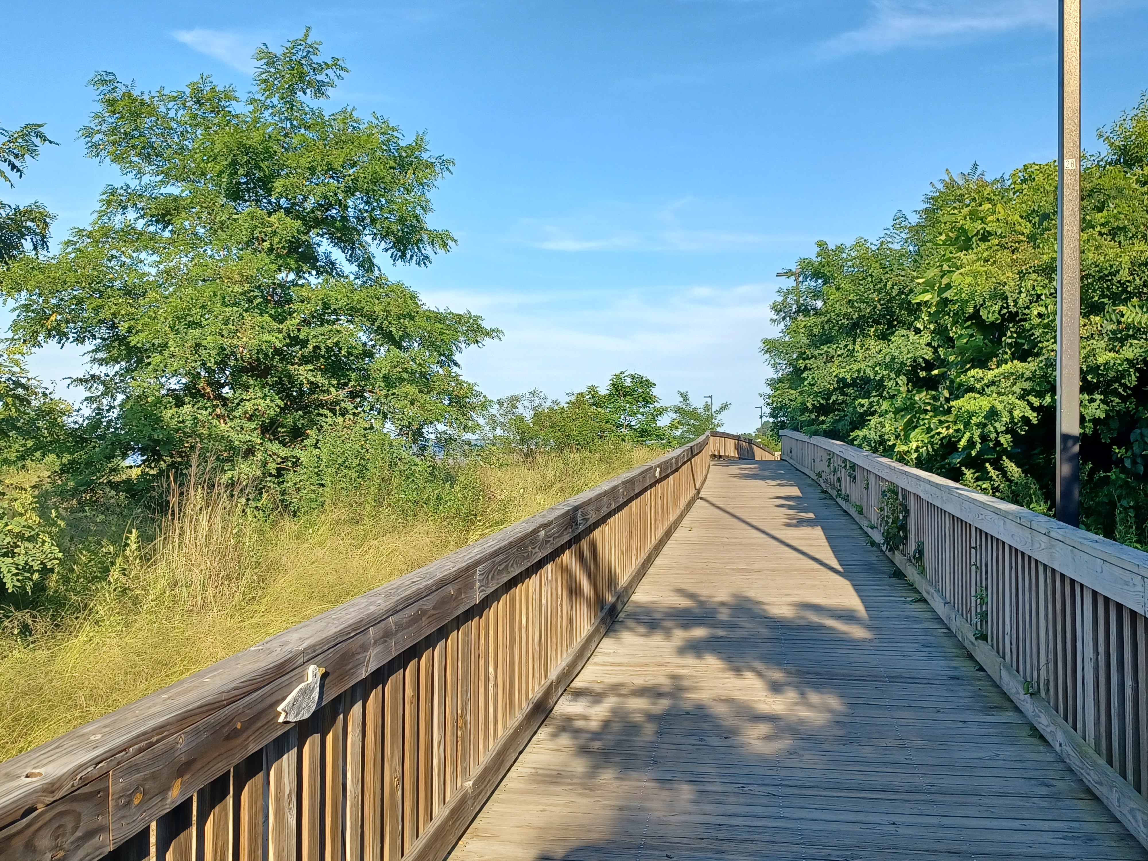
We turned left and followed a very nice section of board walk.
We also went all the way out to the first pier we came to, which afforded some
great views of the surrounding area.
After we went around one of the pier areas, we spotted a dead
dolphin on the shore line near the rocks, which was sad to see.
I got down in the water along the beach a little further ahead, just to cool off one more time before the end of the trip. I also walked on the beach for a bit rather than the boardwalk, but the group seemed to mostly go ahead of me.

I made my way back out to the board walk at one of the next accesses, and headed out to where the walkway turned more inland to Paul’s Beach where we were parked.

The others were walking up to the boardwalk from the final access point. There were signs saying not to feed the cats out on the jetties but I unfortunately did not see any felines.

There was a stone that read “Kyle”, eulogizing. It made me think
of my late best friend Kyle Zalinsky. And it was more odd because we had just
seen a dead dolphin, and Kyle used to pretend he was a dolphin all the time. It
put a little bit of a sad feeling behind it, but also serves as a reminder that
I’m still here keeping it going. Kyle used to say “Hold it together” to me a
lot, and it was always a help.
Pretty soon we were back at Paul’s beach and the hike was finished. It had been really great, and I could do the route we had gone, from place to place, and still have it be 75% a different hike.
That’s a lot to work with, and it’s exciting to think we have so much opportunity still ahead.