

Hike #1518; 11/27/22 Middle Smithfield to Shawnee on Delaware with Serious Sean Dougherty, Jenny Tull, Carolyn Gockel Gordon, Kirk Rohn, Robin Deitz, Diane Reider, Stephen Argentina and David Adams
This next hike would be a point to point between Route 209, at an address that is technically East Stroudsburg, is closer to Marshall's Creek, but actually closest to a location that was known as Turn Villa, a small station stop along the Delaware Valley Railroad, which was abandoned in 1938.

I planned out the hike so that it would incorporate some of the McDade Trail along the Delaware, which we've done before, but this time to end at Shawnee Inn, at Shawnee on Delaware PA.
I would plan the hike to follow some back roads as well as the trails around Hidden Lake on the Pocono Rim, atop what to the east is referred to as Hogback Mountain.
I figured if it were at all rainy, we might try walking through active golf courses because basically no one would stop us or even give us a hard time.
The hike was planned to end at the Shawnee Inn because Jillane had wanted to take Ev swimming, and they had an indoor pool there. I was planning on doing a hike up this way again anyway, and so I changed it up so that it would end at Shawnee Inn rather than continue past to my original intended ending at the Delaware Water Gap.

The forecast as the hike neared was looking pretty grim; 100% chance of precipitation most of the day. By the night before, heavy downpours were called for creating serious puddling and potentially dangerous conditions in roadways.

I was kind of thinking Jillane was going to say to me not to bring Ev with me on this one like she did the week before, because the "feels like" temperature was about as low as that week was.

Still, she said to take him, so I made sure he was bundled up, brought extra blankets, and had ready my cover for occasions of rain.

What exactly we would do for the first part of the hike would depend on whether I had Ev with me, what the forecast was, and what the mood of the group was.
With Ev and already drizzling weather, we went for the Turn Villa area. We met at the big parking lots of the old Shawnee Inn, and then shuttled north to right next to the Super Foodtown on Rt 209. I missed the entrance to the place heading there, so we parked over on the east side at the CVS.
I think this area is basically referred to as "Middle Smithfield" because that's the nearby school name and municipal building.
Shawnee was apparently once an overlord over a lot of this area as well, when it was bought up by a larger development company in the mid 1900s. That's when the time shares and such were constructed. The ski slopes and such were also added later.

It had taken some time to get going. I was running late, and then so were others, but I also had a lot of stuff to get together and put in the stroller.

We eventually got started and walked to the rear of the building with the CVS. Either the road right here, or the the grassy area right next to the road, was the original right of way of the Delaware Valley Railroad.
I find this line so interesting because the entire Delaware River, from tidal all the way up to Bushkill PA, had a railroad along it, but there was never one from Bushkill on to Matamoras, across from Port Jervis. It was intended that the lines would be extended and connect for through traffic, but that never happened.
The Delaware Valley Railroad was built in 1901, and connected with the Lackawanna Railroad in East Stroudsburg. It didn't follow right along the Delaware, but rather remained inland a bit, and made it sway out through Marshalls Creek where I understand the station still stands, and then continued to Turn Villa, followed eventually by Bushkill where it ended. It was extended just a bit as part of a logging operation, but that was it.

Passenger service continued through 1927, and was discontinued. Freight continued to run on the line through 1938, and then it was scrapped.
I did a hike way back I think in 2003 where we tried to trace the route, but we didn't get on nearly as much of it as I'd hoped we would.
This time we wouldn't cover any but a tiny bit of it either, but I told the group some of the history for the start anyway.
The road behind all of the stores that is apparently built over the railroad bed is Fox Chase Lane. We followed it past some abandoned golf cart entrances that used to be associated by what is now part of Great Bear Golf Club.

There is a large lake just beyond as well, which the cart paths used to go to or around, but the entire perimeter of it is completely overgrown now. The water isn't cared for, so it is so green that I didn't even recognize it as a water body on the Google maps.

We turned right on Keystone Lane and continued past the pond on our right, gradually to the east and slightly uphill.
We continued up the road until we came to the intersection with Sentinel Way. We turned right here, uphill briefly, and came to where a golf cart path crossed the road. No one was playing golf this day, and there were no signs saying we were not allowed to use the path. The only signs we saw at all were stop signs where it reached the road. We turned left and continued on the cart path parallel with the Keystone Road, and then away from it past some homes.
We continued along on these paths and eventually the paved cart path started heading to the golf club main building. Great Bear Way Road was to our right, and so we crossed that and continued across one of the greens to the right.

We crossed a bridge over a spring or something, went by one of the holes, and then there was another foot bridge off to the right closer to a tree line that took us over another spring flow.

Beyond that, we turned left, and cut directly across a sand trap. On the other side was another section of paved trail we picked up and turned right on. This contnued us on our gradual uphill trajectory, at this point heading southwest.
This section of path remained behind many homes, parallel with a road called Rising Meadow Way. We continued along that, and eventually the road, which we couldn't see, started turning to the left, south. The course also started turning a bit, but there was a cut through to the left prior to that where we were able to go up a knoll, across another hole and green, and onto the paved path on the other side. I think it goes into the woods and takes a more meandering route, but we made a shortcut.

The pathway soon got closer to Rising Meadow Way, and then crossed it directly to the east. The path continued to the east from here, directly parallel with Fairway Lane.

There was only one house through this entire section that I noticed had cars parked in front or anyone out making a sound. I figure most of these homes must be "weekend warriors" from the city who have them as second or weekend homes.
I figured if anyone said anything to us, we were walking a trail so close to a road that it wouldn't matter.
Almost everything up there was a huge mansion house, but then just a bit to the east, we came upon an old barn. It was in rough shape, with vegetation growing up along the sides of it. This was clearly here before the golf course or development.
Then, behind the barn, we could see the old farm house, a nice simple structure standing back off the road farther than the new houses, and still lived in.

I figure this must have been the original farm that was associated with this land before the development. Rather than rip the old place down, the barn and home were left up surrounded by the new development. I have seen that several times before, and it's always pretty cool.

Fairway Lane moved away and the path continued along the right side of the course still heading east. It was starting to drizzle just a little bit, but let up again, actually just as Carolyn was opening her umbrella. Ev was starting to get fussy around this point; we passed through a line of trees and kept to the right side of the course.
When we got to the next tree line, where the path turned hard to the left and cut into the woods, I stopped to check Ev's diaper and took him out of his stroller.
I was surprised that he had barely even peed. I think he doesn't pee or poop because he doesn't want to sit in it, so he's learning to control it. I gave him a little time out of the stroller here which made him feel a bit better.

I put him back in and we got moving again, and he seemed okay again.
The trail went into a tree line for a bit, then cut to the right, crossed a bridge over a wetland, and went through a small section of course.
We cut through another tree line, then out to more course where we shifted to the right side again. Near this point, Hidden Lake Road was starting to come into view to our right. The distance between the course path and the edge of the road got to be less and less until the next corner of the course where we turned right, cut through trees on a little herd path, and came out on Hidden Lake Road.
The parking area for Hidden Lake is very close to this point, but there is no good way uphill from here while pushing a stroller, so we followed the road to the right for a bit.

We went around a bend, and evetually an old abandoned road with a gate was on the left side. A truck was parked there, and there was a driveway for what looked like an abandoned house on the right side of the road with a car in it as well.

I later found out that this house was actually not abandoned; it was just that the lawn and such was not trimmed and kept up. I saw a light on in it when I went back later.
We turned left onto the old road and around the gate, and began ascending for a bit.
There used to be a beautiful old house abandoned off to the right of this road, also accessible from the main road, but it had somewhat recently been demolished.
We continued ahead further, and came to where the Hidden Lake Trail breaks off to the left. We continued straight on the abandoned road because for some reason I thought that would be easier, and because I wanted to see the old lodge building along it in this direction.

I think I must have missed the actual trail turn off to the left as we contnued, because we took this old woods road quite a ways uphill. It wasn't all that many years ago that the road was still driven by scouts or people from the YMCA using the building back there.

The road had a lot of branches and sticks on it that made pushing the stroller a bit more difficult, and most of the group continued well ahead of me in this section. Kirk hung back near me for a lot of this and helped me if I needed to do a team lift with the stroller.
I had never walked this road all the way up before; it was definitely the right day to do it because it was not raining at this point, and there was a splendid seasonal view to the west of Hidden Lake as it came into view.
I'm really not sure the history of the lake except that there was a camp on it. It might have been built solely for the purpose of the camp, which seems to make sense.
The road continued to a height of land, and then descended a bit more. The group was waiting at the bottom of a hill where the more well worn Hidden Lake Trail joins it from the left side. We continued ahead just a bit more, and then approached the lodge building. There was a ramp and former site of probably a bank barn at one time to the left just before the building.

I was happy to see the building was still standing and in fine shape. It was boarded up for safety, but was probably used not so long ago. Maybe just before the pandemic crap. There were picnic benches out front, but also on the front porch which had been completely redone with treks and looked good.
I gave Ev a chance to get out of the stroller again and gave him a diaper change, which was needed this time. I carried him up onto the porch with a nice view of the lake between the pine and hemlock trees.
I was shocked that it still wasn't pouring yet, but thankful that it wasn't.

The trail from this point was a lot more rough than the woods roads we'd been on, so I was thankful not to have to navigate that when slippery, muddy, and trying to hold a cover on the stroller.

We descended to a spot where there was some swampy stuff, and then there was a small but not so stable looking metal dock out onto Hidden Lake. Dave suggested we do group shot there, but no one looked too willing to join him on it for that. We opted to do our group shot later.
We continued around the lake and the treadway got a bit easier. The others helped me when there was any spot that the stroller couldn't quite navigate, but we handled most of it fine.
We reached the north end of the lake, and then there was a foot bridge over the top of the spillway with a splendid view over the water. We cut to the right on an informal path that leads back out to Hidden Lake Road, where we turned right.

The intersection with Churchill Drive was on the right, which leads down over Mosier's Knob. I was considering doing part of that as the hike for the day, but I altered it because it was too short at that point. I'll walk that some other time.
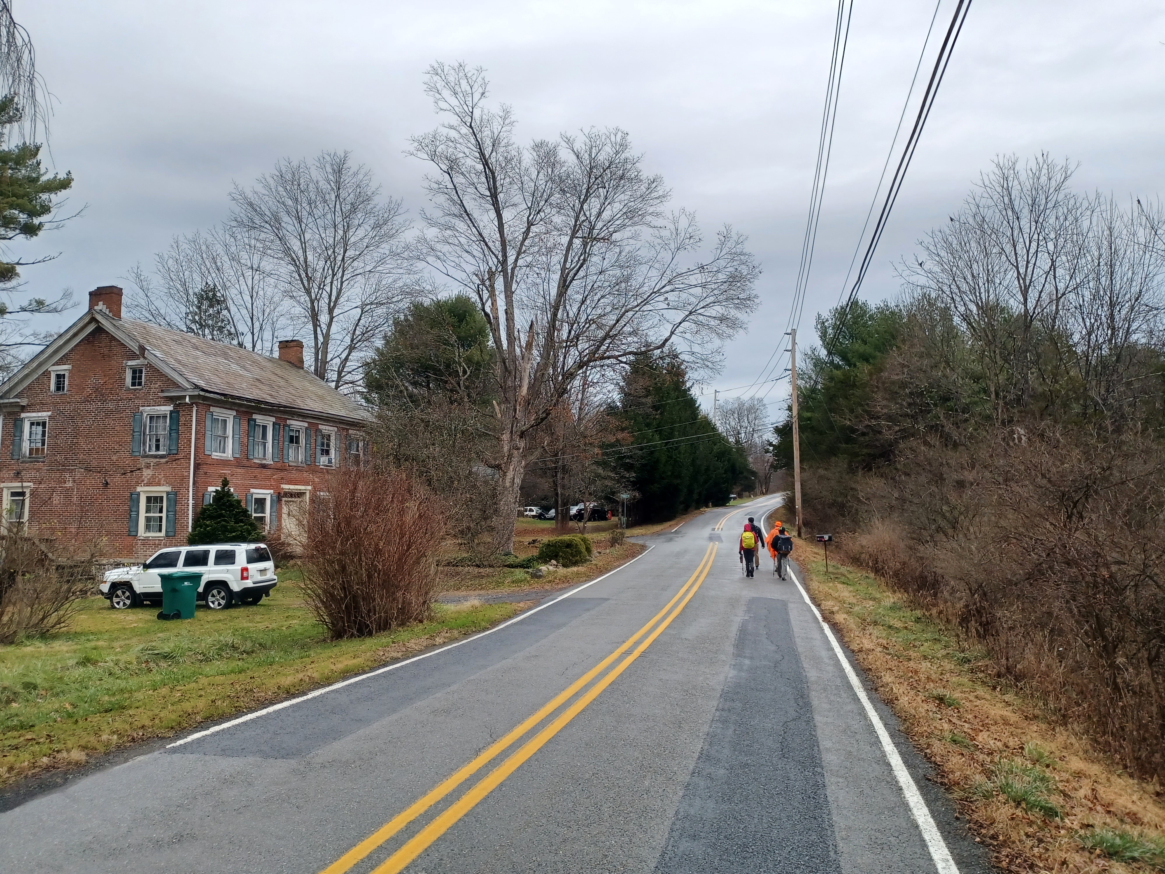
The worst part of the hike was the section ahead because it was just road walk on Hidden Lake Road.
There really isn't a great shoulder along this road, so the side we walked on depended on where the visibility was. Usually we were on the left, sometimes we were on the right because of the turns.

There was one nice old brick farm house on the left side of the road next to one last little development. There were a few side roads with smaller houses along it that are probably among the older of the "modern" developments there, along a road called Rangoon. I noted that they were unpaved, which makes them a bit more attractive perhaps for future walks.

We continued along the road to the east, and soon I could see the maintenances buildings of Delaware Water Gap National Recreation Area through the trees to the right. I knew that meant we were close to getting on the McDade Trail.
At one of the last houses on the left, a young guy came out onto his porch and asked where we were going and coming from. He seemed surprised that we were covering that much ground, which is pretty standard. We chatted for a few moments and then continued to the intersection with River Road and Community Drive.
We turned right briefly, and the cut into the woods at the end of a guard rail to get immediately onto the McDade Trail. We made sure everyone had found the way, and continued walking the southbound route of the trail.

We dipped down a bit, then climbed steeply up until we reached one of the access roads to the Delaware Water Gap NRA Headquarters. The trail turns left briefly on the road, then to the right through a swath of land before crossing the main entrance road.

We continued parallel with River Road ahead, and then the trail turned abruptly left and descended to the long section of boardwalk bridge that spans the edge of Headquarters Swamp.

This is really a very pretty area and unlike most of the rest of the trail, so I always like it.
We came to the end of the boardwalk section, then climbed to the height of the land on Hogback Mountain. An old woods road cuts to the left at the pinnacle there, which I've never tried to follow through, but I think it was probably once a through route.
The section of the trail ahead follows an old abandoned road that was known as Jag Road, which took a switchback route down from Hogback Mountain parallel with, and probably the predecessor to, modern day River Road.
We switched back and forth and soon crossed the cutoff road between River Road and Freeman Tract Road. At the bottom of this next descent, the foot path McDade Trail turns to the right parallel with Freeman Tract Road, while the bike route is on unpaved Freeman Tract Road itself.

I could get Ev up and down the step section through here easily, but it was even easier doing the Freeman Tract Road. I just did that while the rest of the group followed the foot path. We met back up just ahead where the foot path descends and both routes come together into former resort properties on the left side of Freeman Tract Road.
We entered the woods and passed through lines of planted trees on the trail, which used to be a road there. This section was known as the old Hibachi Road.
From here, it was all easy going to the end, and most of it would be trail, maybe 7 or so miles along.

There was a long stretch of hardwood forest the trail passes through ahead from here. We continued through these woods, and I fell behind everyone else trying to keep Ev happy. He was kind of miserable, and it didn't seem to be his diaper or that he was thirsty. He also didn't want much food along the way.


I tried giving him some of these couple slices of apples, and it seemed to appease him a bit. I assumed he was probably teething more, and I had some chewing things for him. It turned out that was exactly what the problem was, and he had two or three more teeth noticed over the next couple of days.

It started raining more steadily, and I had to have the plastic cover over the stroller. Ev wasn't really happy about it at first, but then he just got to be sort of lethargic. He took a nap a little earlier on the road, and then another on the stretch of the McDade Trail. While he was awake, he was quiet, but not really enthused by anything for a while.
The rain never ended up getting terrible. It got a little bit heavier for a bit, but then tapered to a light rain for the remainder of the day.
We passed through the Turn Farm trail head, and in that area I pointed out where the Shangri La building used to be. The group started talking about some seventies song about Shangra La, which was actually Shambala, but they'd misheard it for so long. Only Sean and I knew it correctly.
The trail was close to River Road for a bit, then turned off along the edge of cultivated fields to the left, then down along the Delaware more closely for a bit.

I pointed out to everyone where one of the old cemeteries used to be in view to the right as we walked along the fields.
The group got way ahead of me again because I stopped to try to fix Ev in his stroller better. It was a really peaceful bit where I recalled good memories from the past. The Old Ramp was to the left, where I like to stop and swim.
Pretty soon after that was the Smithfield Beach access, which I think used to be called Pardee's Beach in the past.
We went to the restroom and hung out there for a little bit. I took care of Ev's diaper again there, and we moved on along the trail, which skirted the picnic areas. I also made use of the various trash cans to get rid of junk. I had been saving up the small Burger King paper bags because they're good for holding one or two of Ev's diapers, and we don't have plastic grocery bags in New Jersey anymore. I got rid of all of those and some bottles.
We continued through the grounds and then out of the Smithfield area to the south, which had an annoyingly large bit of gravel on the trail.

We did pretty well moving along, and it ended up just being Kirk and I in the back of the group while everyone else moved ahead.

We went out through some lovely field edges, and over a little bridge, down into a gully and back up the other side. I mentioned to Kirk how great a day it was to be out, and how so many people wouldn't bother going out. It sure beat the alternative, staying inside. It was really a very fun and enjoyable day.
As we approached Hialeah Picnic Area, everyone wanted some of the beer I had left. Sean had a couple of Stone Imperial Stouts, which are a good Russian Imperial, but there were only two of those. I had my Double Dog 18 IPA, and everyone seems to love those a lot. Everyone was going through those pretty quickly until I was down to the last two. They had decided they were going to try to hide them from me in the end, and I kept having another to pull out.


In drinking all of my good beer, they decided the actually wanted my Bud Light that I'd thrown into the bottom of the stroller.

These were the Bud Lights we had found along the Old Croton Aqueduct on the hike a couple of weeks prior, which no one wanted to touch, but at this point they were happy to have anything I guess! I never got to that level.
We continued through the Hialeah Picnic Area, and I started to tell everyone about how some of the picnic area was built on an old cemetery.
There are what couple be multiple graves near the south side of the picnic area, most made of slate and set in pieces of concrete, assumingly to preserve them if they had built the Tocks Island Dam and flooded the area.
Although almost all of the stones through this area were illegible, one of them was very obviously a grave. I located it on a hike just last year after having looked for it for many years.

This was the grave of a 5 year old girl named Rhoda Shoemaker, who died in 1833. This was probably a family plot that was chosen for young Rhoda's resting place, because the property was owned by her maternal grandfather. I had to kneel down to uncover the tomb stone again for everyone to see, because it had been obscured by leaves.

We continued to the end of the picnic area and turned to the right out to River Road. In the past, we had continued through a field to the left out to the McManus House, another abandoned house in the Delaware Water Gap NRA. It is at least kept up a little better than the others in the park, with a mowed lawn. It is the last one before we were surrounded by private land again.
We continued up the road and I passed off the last Bud Light I'd brought. One of the park rangers went by while we were there, but we weren't asked what we were doing or where we were going.

We passed a foundation of an old building on the left, and then the first house that is lived in on the right. After a few more homes on the left, we could cut down through the grass onto a paved trail that led left to the end of Depuy Lane.

This area was first settled by Nicholas Depuy who came from New York City, at the time known as New Amsterdam, in 1727. The settlement was named Shawnee because a surveyor sent by William Penn mistook the local Lenape tribe as members of the Shawnee tribe.
Depuy built his house along the Delaware, and by 1736, a ferry was established over the river here. Depuy's home was used as a fort during the French and Indian War from 1754 to 1763. The village continued to grow through Depuy's descendants and others.
We did'nt get on the road, but rather cut onto a mowed path that led to the edge of the Delaware. I had never followed this bit just yet. I usually make my way down to the trails when walking through in this area, but around the buildings first so I miss this end. It was kind of nice.
The others had missed the turn and were ahead of me, so they had to backtrack. We didn't stay right on the river for too long, and followed mowed pathways a little further inland parallel with the rental homes.

We continued along this for a bit, and then had to come back up to the intersection of Depuy Road and Waring Drive.

It was here that we passed the historic homestead built in 1785 known as "Manwalamink", and erroneously labeled Fort Depuy in more recently years. There is a sign on it that reads "Fort Depuy".
The garrisoned, stockaded fort, built in 1755, was located a bit to the west and no longer exists.
The home was built by Nicholas Depuy, grandson of the original Nicholas Depuy.
We walked west on Depuy Road, which then turns ninety degrees right and heads back out to River Road. In the past, I've always taken this route, but for some reason, this time we chose to have a look down the driveway to the left, which goes toward the Delaware River again.

I was rather shocked to find out that there was a trail that continued along the river from there, crushed stone surface at least as nice as the McDade Trail! This would be a perfect connection if they chose to continue the trail.

We passed by the end of Minisink Avenue, and the trail continued on the other side for a bit more. We continued there, reached Hogan Drive, and Stephen pulled up in his car! He had hurried all the way to the end and decided to drive back to get whoever wanted a ride.
Well, it turned out that just about everyone wanted a ride!
Of course, drivers only took precedent because my car, Kirk's, and Diane's were at the start. Jenny offered to go back and get mine for me, and Carolyn went with her, and Diane and Kirk both went back which accounted for all of the seats. Serious Sean wanted to get in, but there wasn't enough room and we were almost to the cars anyway. It was less than a mile.
Sean wasn't even planning on staying for the entire hike because he wanted to check out real estate in the area, but he didn't have enough service for an Uber, and we were having too nice a time anyway.

The inn opened in 1911 as the Buckwood Inn, in Spanish Colonial Revival style with white-Moorish architecture and Spanish tile roof. It is amazingly the only remaining resort along the Delaware River.
The place was built by Charles Campbell Worthington. Worthington's father, Herny Rossiter Worthington, invented the first direct-acting steam pump in 1840. He found great success with the Worthington Pumping Engine Company, and Charles took over the business upon his father's death in 1880.
CC Worthington started spending more time at his country home in Shawnee on Delaware in the
late 1890s. He built his first small golf course there in 1898.

He purchased 8,000 acres of land on both sides of the Delaware, and began to establish the Buckwood Inn resort. Popular Sunfish Pond and Worthington State Forest were part of Worthington's estate and private deer park, and he had water piped from the pond down the mountain and across the Delaware for the use of Buckwood Inn. At the time, Sunfish Pond was called Buckwood Lake.

The golf course was an early design of A. W. Tillinghast who designed many notable courses. In 1912, Worthington invited professional golfers to compete on his course, which led to the creation of the Professional Golfers Association of America (PGA).
Worthington tried to have sheep on premises to keep the grounds in reasonable shape, but it was quite a chore. As a result, he invented the Gang Mower with three moving wheels. First based out of Shawnee, and then nearby Stroudsburg, Worthingtn found success with the Worthington Mower Factory, because not only his field of work, but also farmers had use for the new concept and design.
The golf course is still considered among the finest in America.

The resort was renamed Shawnee Inn in 1943 when it was purchased by band leader and radio personality Fred Waring. Frequent notable faces were Jackie Gleason, Ed Sullivan, Lucille Ball, Art Carney, Perry Como, and Arnold Palmer.
The Inn remains popular throughout the year for golf, river recreation, skiing, hiking, and more.
The McDade Trail could easily follow the route we had taken, cut over to the far building along the golf course, and then another old road, now trail, goes through the woods below River Road. I think it is an older alignment of River Road. It leads out to a Time Share area, where walking the road is necessary. Beyond that, I usually cut through a cemetery, then some other public lands to the Cherry Creek Trail to get to the Water Gap. There is really a pretty good but segmented route for the trail to continue.

Jillane was supposed to pick Ev up from my at about 4 pm, but we were getting finished just around that time. At the same time, she was nowhere near ready to come and get him, so we decided to go to the nearby bar, the Gem and Keystone, where we'd eaten before while hiking through the area.

Before heading over there, I pushed Ev over into the Shawnee Craft Brewery to see if they had the imperial I really loved from two or so years back, called Hair of the Bear. They did not have it, but told me that the Old Mine Road thing they had was similar. I tasted it, and it was good, but not nearly as strong or tasty.
Serious Sean came right over as I was heading out, and walked with me up the Shawnee drive to the Gem and Keystone. We got a table for five, but there ended up being six of us.
We had a really good spot off to the side at a nice round table, with a height chair for Ev. He was on very good behavior and very happy to be out of the stroller. Stephen sat down next to him, and he laughed and continued to grab his nose over and over.
I ordered the dinner special, and also sampled an IPA as well as the Old Mine brew I had before. Not too bad with dinner.
The dinner special was a chicken francias, which was delicious, and had mashed potatoes and I forget what else alongside of it. Ev had some as well and really liked it.

Stephen also gave him some of his fish which he liked, and he really liked the brownie a la mode dessert.

