

Hike #1494; 7/3/22 Wyoming Mountain to Wilkes Barre with Diane Reider, Justin Gurbisz, Brittany Weider, Professor John DiFiore, David Adams, Robin Deitz, Kirk Rohn, Russ Nelson, and Ewa
This next hike was one where the plan shifted quite a lot right from the start, but it certainly worked out well.

As a Summer hike, there were two things on my mind that led to
the planning of our route. The first would obviously be the necessity of
swimming spots.
The second was once again tying up loose ends with these series that we keep
doing and then walk away from.
I have so many of these things going on; we’ve been doing these hikes for over 25 years and some of the subjects of the earliest hikes are parts of a series we still had not yet finished.

One of those series was the main line of the Central Railroad of New Jersey.

We had covered the entire line from Elizabeth NJ all the way to White Haven,
and then I stopped with it for a long while. It wasn’t until the pandemic stuff
hit that we started getting back to it, just because it was appropriately
secluded from where other people would be.
I never got around to finishing the last bit of the original main line from Ashley to Wilkes-Barre where it ran alongside the Pennsylvania Canal.

Another milestone we would hit this time would be to formally finish the entire D&L Trail.

I planned out the hike with the meeting point at Kirby Park on
the north side of the Susquehanna River from Wilkes-Barre. I had finished a
hike there from the Wyoming Valley to the northeast not so long ago, and found
it to be a good spot. It was actually the northern terminus of the D&L
Trail, just there on the other side of the bridge, so it was perfect.
I decided that for the start of the hike we would again hike the amazing Ashley Planes, which were Lehigh and Susquehanna Railroad, leased to Central Railroad of New Jersey.

These three historic inclined planes carried rail cars up the steep slopes through Solomon Gap and then by gravity back to the Lehigh Canal above White Haven originally.

Since we were doing D&L
Trail, and because it was hot and there would be swim spots on it, I figured it’d
be perfect. I saved a ton of photos to my phone that I could set up
compilations on the planes with.
The night before the hike, I unexpectedly got a phone call from
a guy I didn’t know. He was calling on behalf of the new owner of the Ashley
Planes.
I found this to be strange and questionable, but I still called the guy back when I had a few moments.

He was very polite and genuinely concerned. I appreciated very much his respectful way of reaching out to me to discuss the issue.

He explained to me that the new owner had recently purchased the property,
which I had thought was more state game lands than not. It turns out those
lands are adjacent but that the planes themselves are only partially on that
property. The remainder are private.
I sympathized that I had seen the parties and such that take place back on the
planes and understand the concern about them being open. There was indeed a lot
of trash being left back there in the past.

He told me they were in the process as we spoke of installing new gates and such down near the bottom, and that the new owner was taking it seriously.

I was ready to just give up on it, but the guy was so good as to call the owner
himself to see if we could secure permission for this time to hike through on
the planes. Understanding we are a heavily history focused group, that might be
something considered to be alright.
When we hung up, the man was to call be back with an answer, but I never got a
call back, which I am assuming meant that we would not have permission.
Still, I was very thankful for the respectful exchange we had regarding the
issue, and I was able to change the plans a bit to involve other areas I wanted
to hit, but at the same time cover the final leg of the CNJ and the D&L
Trail.

The mid section of the hike would be a little of what I’d done before, but we would end up covering enough new stuff that it all ended up being worth it.

We met in the morning at Kirby Park, but it was odd because
there was a carnival all set up and ready to start. People were showing up and
getting stuff ready. There was no sign saying we couldn’t park there, so it was
a good thing we arrived when we did, or we’d certainly have not found a place
to park at all.
We shuttled from here to the new start point I had come up with, which was at the west end of Wyoming Mountain along Laurel Run Road. I found a lot used for access to State Game Lands 292 off of the road at a power line crossing, and that would be our start point.

The hike started with a climb. There is a service road along the power line which we had to climb directly up to the east.

As soon as we
started, I began powering up to the top of it. Brittany and Dave kept up with
me the most at the start.
When we got to the top of this bit of Wyoming Mountain, there was an
intersection of power lines. One went to the left and looked like the more
obvious way to go, but we were going to go to the right, or more straight. We
re-grouped there before continuing
We continued downhill for a bit, and eventually came upon an old woods road that went across the power line.

The aerial images looked like there was an old ruin off to the right as well as a pond, so we took to the woods road over there for a bit.

We passed through a section of woods, and then came to the
intersection with another woods road. We turned left here for a bit and came
out to a clearing with the small pond to the right. There was an old dam at the
site. I’m not sure how long this property was in use for or when it was
developed.
We continued on the road to the east a bit, and then came to a sort of brush
hogged area. I wasn’t sure if it was a state game lands thing at first or not,
but we continued to the left along the cleared area, toward the ruins as well
as another woods road seen on aerial images that would take us back to the
power line.

At the top of the hill, there was a magnificent stone ruin, a shell of a stone building with no roof.

The area around it looked to be rather recently cleared. I think
there was a piece of machinery nearby. The area came across as private, and
rather than invade on anyone’s site, we decided to continue on to the woods
road again.
There was a second old stone shell of a building to the northeast of the first
one that was much more prominent. I’m not sure any of the history of these
buildings. They are certainly not so old as to be from the 1800s, as the stone
work was not the fine cut stuff we’d see from that time. It looked more like a
1930s style stone construction like the CCC would build.

We passed the buildings and soon to the left there was the grassy woods road heading back to the north.

We followed this into dense young
forest and pretty soon came out to the power line again. To our left, there was
quite a down hill slope to the stream that flowed from the stone dam we had
passed. This was a southern leg of the Laurel Run. Our hike would trace this
down Wyoming Mountain for a while.
We turned left on the power line clearing for a bit, and then
close to the bottom we were able to turn right to follow the stream to the
north, down.
At first, it was an informal but clear trail along the right
side of the brook. We found out that some of this brook made up the boundary to
State Game Lands 292. There were white paint blazes along the way that marked
the boundary of these lands.
It wasn’t all that long before we came upon the first of several little mossy cascades on this brook.

It was really hot out, and the first one
that looked deep enough for me to get in, I was in.
There were boulders and narrow flumes of rock that this stream made its way
down.

I was pushing ahead of some of the others, and I was already in
the first pool of water before anyone else caught up. The water was insanely
cold but refreshing.
The first little cascade was a slide with a good pool at the bottom. We moved
on below this one, and there was another pool and small cascade below that one.
More sluices followed, and we came upon a crystal creek, very deep pool in a
narrow crack in rocks.
I had just gotten in the water, but this was just so beautiful I couldn’t pass
it up. I just had to get back in again and enjoy that moment.

There wasn’t even any kind of trail to this site. It was just a beautiful back woods location at this point. From time to time, a woods road appeared near to the left side of the stream, but it wasn’t really too close.

The stream became more of a layered succession of rock slides ahead from this
point. The mossy under-layer of these slides was such that it provided a degree
of traction while walking through it.
One particularly cool spot was where the steam dispersed into a very wide, flat rock slide. It was like the stream must have in the past couple hundred years taken a completely different course, and it found its way to where we were walking and hadn’t yet eroded it down yet.

The stream got a bit steeper, and we found our way to another woods road for a bit.

We crossed over the second power line that broke off to the left at the
beginning of our hike and continued into the woods to the south of it along the
creek.
This was as we were getting closer to the former Lehigh Valley Railroad. This route replaced the earlier through route, which became their passenger main west from Solomon’s Gap. This eastern route headed further into the valley to the east. There was a nice old stone culvert as we approached the tracks, and I went through it while the others went up and over the tracks.


On the other side of the tracks, there was sort of a parallel
woods road as I recall, but it wasn’t continuing along the creek. We ended up
bushwhacking a bit to get back down to it north of the tracks.
Russ was out looking for us at this point. I had guesstimated about the time it would take us to get to Seven Tubs Recreation Area, where Russ and Ewa would be waiting for us. I told Russ we were approaching the Lehigh Valley Railroad underpass, but we had a miscommunication about which precise underpass. It was soon apparent to me that he was nowhere near the underpass we had just gone under.

Staying on the creek started to get a bit messy. I walked in the creek, while the others started going off from it to the side or something.

Pretty soon, I was fighting through a far bigger mess than I’d have ever imaged
could happen in a creek. Slash wood was down literally everywhere, and climbing
over and under all of it was treacherous.
I had to step onto messes of sticks through which me feet would collapse, and
the strides were so long that I could not test my weight on it. Each leap could
mean a plunge through sticks or a form footing. I had to go under branches that
required me to crawl on my hands and knees in the water. The vegetation on
either side of the creek was impenetrable understory, because the overstory now
made up the slash that was impeding me from moving through the stream
gracefully.

It seems inappropriate to say I emerged from the mess into the woods, because I was entering woods from a clearing, but the level of relief to have no underbrush around me was unsurmountable.

Even better, a yellow blazed
trail was along the right side of the creek. It actually crossed the creek at
this point.
Right about at the crossing, there was yet another great pool of water and a
little cascade. This too could not be passed up, and some of us needed to cool
off just a bit more.
After the very nice cascades and one more dip in this great
pool, we exited the water to the east and began following the yellow trail.
There were two forks. The yellow trail goes up to the right, far away from the
Laurel Run, or down and right along the Laurel Run.

It was sometimes hard to say where exactly the trail went because blazes would stay higher above the creek, but the worn social trails were right beside it.

There were more and more people as we continued downstream and got closer to
the parking area. There were some really fantastic looking swimming holes out
there, but each of the good ones as we moved ahead were already full of people.
I tried to stay pretty much on the yellow blazes as to make our
way to the parking lot. I kept updating Russ on our progress as we moved along.
Pretty soon, we arrived at the main Seven Tubs area, named for sort of erosion
kettle hole formations in the brook. We couldn’t even get to see any of those
because the area was far too overrun.

We encountered two park rangers walking through while we were there. There were no swimming signs, but everyone was in the water and there was no way of enforcing it.

Loud music was blasting everywhere, but there was also no way of
dealing with that either. The rangers, one woman and one man, explained to me
that they basically just try to keep the peace and there was so very little
they could actually do.
The larger cascade was straight ahead of us to the right, and we could step across the flow of the stream on a natural rock formation. The Wheelbarrow Run flows into the Laurel Run here, and we were able to look up toward the falls and such, but there was no getting close without causing someone to move.

We continued on a trail that continued to grow narrower, and we seemed to be approaching a fill.

I thought we were getting to the railroad right of way, but
then I checked my GPS and it seemed we were going the wrong way. I was about to
turn back, but then somehow we ended up going up steeply to the top, and then a
right turn led to the parking area where Russ was. Ewa was at their car resting
at that time.
The road we came out to was well graded, and at first I thought maybe it was
once an old railroad spur. I then realized that it wasn’t a rail bed, but rather
the original alignment of PA Rt 115.

The current highway route is just to the east, but the original route is now the access road to Seven Tubs on the south side, and the north side is abandoned and sort of a trail now.

We caught up with Russ and chatted for a bit. We talked to the rangers a bit as well, and then I went over to say hi to Ewa, who wasn’t feeling well and was going to skip doing the hike at first.

But before we left,
she was feeling well enough and decided to try to give it a try doing the hike.
Russ knew right where to go. I had never headed through this way
before, but we needed to get to the Central Railroad of New Jersey Mountain
Cutoff. I’d hiked that before, but I didn’t know the way to get up from Seven
Tubs.
We had done that section during Covid, which was particularly nice because it wasn’t at all developed. It was just a pleasant path through the woods.

Russ led us to the left, up a super steep slope from abandoned old 115, and after just a bit of climbing, we emerged on the newly developed D&L Trail.

It looked so much different than it did when we walked it during the start of
the pandemic. A lot of money had gone into this bit of trail.
There was no crushed stone surface or any of the fences that existed at the slopes this time the previous time we were out there.
We continued to the north and then started to shift to the west around the outside of the Wilkes Barre Mountain.
There was a huge rock cut that we passed through as we shifted to the west which was nice.

We passed through pleasant woods, and then down below us to the right after a bit we came upon a bit of a clearing. I could see there was a bit of a view to the north.

Rather than continue directly on the right of way, we headed down a bit to
check out the view. There were ATV paths all through the area, and it brought us
right up to the edge with splendid views to the north.
The area was pretty well used with a fire pit at one of the best
view locations. There were several spots that afforded views over the stretch
of a couple hundred feet.
We returned to the railroad bed above, and Ewa had gone way ahead of the rest of us so she missed the overlook.

The trail was improved upon up until only a certain point, and it became an indistinct area of ATV trails. I had gone through this before tracing the railroad bed, but this time we would go more for the path of least resistance.

The crushed stone ends abruptly where the railroad used to go
straight into disturbed land, but the ATVs go to the right where maybe there
used to be a bridge, or the right of way was mined away. In the past, we had
gone through a mess of young birches through this area to get through, but this
time we would just follow the parallel ATV paths.
There were no trail signs at all to guide hikers through where to go. It was
just end of official trail.
We continued ahead on the ATV path, and I think at a certain point the right of
way re-joins.

I think Russ had his open street map app going and was able to determine just about where it should have been, and without effort we ended up back on it again ahead.

The entire area is so disturbed, it’s hard to figure
out anything. I think where streams came down, there was evidence of former
bridge sites.
Ahead, Interstate 81 had an on ramp area that had disturbed the
original right of way, so we went up and off of it there, and then back down.
It also afforded us a pretty good view.
After we got past this ramp area, I know we were on the right of
way for a bit, but somehow we lost some of it after a bit.
One of the things I wanted to get to on this one was a spot we had also visited
during the pandemic crap, and that was the underground mine fires of Laurel
Run.

Everyone always things about Centralia, with the mine fire under abandoned Rt 61, but Laurel Run has basically the same situation. The only difference is they didn’t have the graffiti covered highway.

The underground mine fire started in Laurel Run in 1915, in what
was known as the Red Ash Mine. 166 homes, two grocery stores, a church, a
school, and a lumber yard all had to be moved due to this fire. The fire area was excavated away and declared
extinguished in 1973, however the fire reappeared. It still burns to this day
directly under the railroad grade and can be seen with smoke emanating just
barely to the north of it in the slopes.
I think we might have passed that site, but it was too hot out for us to view
any of the smoke.

We also might have passed it, because this time, I didn’t realize it, but we lost the railroad bed and continued to the west a different way. I didn’t mind; this brought us to different areas I’d not been to before.

We emerged at the end of Saxe Street, part of the town area that
had been removed. There was still some pavement and such there.
We headed out along Saxe Street, which had a “no outlet” sign
facing toward Northampton Street; a weird thing since traffic would only be
coming FROM Northampton Street.
Northampton was the main drag into the still existing section of Laurel Run. I
believe that section is known as Georgetown.

We headed north and then turned hard left on Saxe Street to reach Northampton Street. At that bend, the old railroad bed comes in from the right. We hadn’t been all that far off of it.

We made our way out to the road and turned right. This was going
to be a little side trip into town to have lunch at the Breaker Brewing
Company. It was only about four blocks out of the way.
We turned down the road to the right, and there was an old brick building, abandoned, on the left side. Someone commented on my posting for it saying that it was an old garage that had been gutted by fire. The top of it however said that it was the “Toll Gate School”. I couldn’t find any more on it other than that it had been a local school.

We continued to a bend in the road, and the brewery was up slope to the left. We tried going up through the grass, but there actually was no good way to go in walking.

There was a walkway up into the place from the back
off of Lehigh Street, but we couldn’t get to it the way we were going.
When we finally did get in, we were seated at a nice long table where we could all site, and I ordered one of the more expensive pasta dishes because it sounded so good. I think I ended up eating some of the pizza that others in the group ordered as well because the serving side was so large. The pizza was good, and it wasn’t the “Old Forge Style” with the cheddar instead of normal cheese.

To drink, I ordered a tall bottle of the Black Mariah, which was a sort of coal country themed bottle, Belgian style dark ale brewed with cocoa. It was actually really great. I let everyone sample it and the consensus was all good.

When we finished the Black Mariah before even leaving, I got a second of another called the Belsnickler. Belsnickel is a Pennsylvania German form of Santa Clause, sort of. He’s sort of a drunken, ratty looking Santa that apparently beats bad children and throws them in a sack. I remember my old friend Randy Melick telling me that rather than milk and cookies, you leave out booze for him, and by the end of the night, it didn’t matter if you were good or not, Belsnickel would beat all of the kids!

This was one of those very busy holiday brews that are best cold, and have a whole lot going on, like the Troegs Mad Elf that is quite popular. I’ve never been a huge fan of the Mad Elf.

It’s good, but not the
favorite. This was very similar. Good, but hard to top the Black Mariah.
We headed out from here, pretty stuffed from all the food, back
up Northampton Street, and returned to the railroad bed. It runs adjacent to a
municipal park here, and is pretty clear. We followed it behind the homes on
parallel Shannon Street, and then passed through to Haul Road in a sort of
disturbed area.
We had to turn left on the road a bit, and then right I believe in order to get
through back to the railroad bed.

This was an odd area during the pandemic when we last hiked it. We had gotten out to a big clearing where there were lots of off duty police and prison guards having a back woods party, hidden away from everyone, driving ATVs. They were really nice, and they had guided us through where we needed to go to get to the next bit of the railroad bed.

The problem this time was that with all of the growth, it no longer looked like
the same place. It wasn’t getting nearly the ATV traffic that it was getting
back in 2020.
The railroad right of way ahead goes into a property known as Allan Industries.
We can’t get through the fence, and we had to go around it either to the left
or the right. We had gone to the left the last time, but this time it wasn’t
really as I remembered it. We went up slope to high above the fence, and then
paralleled it to the west for a bit. We then came out to a clearing that looked
kind of familiar but grown over, and there were more ATV trails to the right.
We followed one that came out closer to the ramp between Interstate 81 and
Route 309, or maybe the eastbound 81, I’m not sure which.

It weaved around and
came out to at or near the spot we had crossed the previous time.
We dashed across the highway, and then picked up a path to the right, more
across from the Allan Industries, and it brought us back to the railroad bed
pretty quickly.
There were still ties down in this part of it.
Pretty soon, we passed beneath the two bridges for Route 309, and then after
that the westbound, or rather southbound, 81.
Beyond that point, the there was a junction where a spur of the Jersey Central went left to a coal colliery or breaker or something, I can’t remember exactly what it was, but the through route went to the right. At this angle, it wasn’t obvious there was a junction there.

I made the mistake of continuing on the dead end route, and a trailer park now exists where the industry used to be. We emerged at that trailer park before I realized we had made the wrong turn, and had to turn back the way we came to that junction.

When we got on the correct right of way, it was overgrown a bit
at first, an then became terribly wet. The entire group other than me decided
to leave the right of way I think, and made their ways up to the nearest road.
I of course went right through the slop, which got rather deep. There were even
still some rails in this area. Maybe it was already too deep to remove them by
the time the line was abandoned.
I continued east and passed beneath Main Street. The bridge sits on the
original bridge’s abutments, and the Ashley Station used to stand just beyond
the bridge to the right.

Just past the station site, there is a path that ascends up to
the Ashley Borough police department lot.
It was in this area that the line we were walking had a northbound connection
to the original main line through, and the tracks are still in place on what
was directly parallel former Central Railroad of NJ and Lehigh Valley Railroad
to the north into Wilkes Barre. The two pretty much went side by side the
entire way, and I’m honestly not sure first which right of way is still active,
but I think it’s Lehigh Valley.

At the end of the vacant lot and behind the police building, there was a path that went down a slope to another path.

I assume that the
police building was built up on a fill, and that the original CNJ right of way
probably sat at a lower level as to make an easier connection to the line we
had come off.
We followed an abandoned bit of paved road to reach the
aforementioned path and then paralleled the active tracks for a bit. The path
then emerged next to the tracks just ahead.
The tracks looked pretty beat and non-uniform. It’s amazing that anything travels over them at all.

We continued along them to the north and crossed West Ashley Street at grade.
There was a fire house to the left that had some sort of an event going on with
I think rides and vendors, and definitely music. We considered going over to
that, but it was hot and I really wanted to get done with the hike anyway.
Just after we passed by the fireman’s thing, there was a path coming in from the left just off of a power line clearing. There were tracks of to the left, which we couldn’t see otherwise, because they were grown over with vegetation.

I figured this might be the former Lehigh Valley Railroad, and
maybe somewhere in this area it traded places with the Jersey Central.
Whatever the case, we were able to walk to the left onto that path, and then
there was a path parallel with these tracks and the active ones just to the
west. We followed that to the north for a bit.
This path took us a little ways, and Solomon Creek came in close to the tracks to the left. When the path ended, we had to parallel the tracks to the north again for a bit.

Ahead, we crossed over Division Street. It was brutally hot and I desperately
wanted to get down in the creek one more time, but there were no good ways down.
Just ahead, there was a former junction site. We didn’t notice it at all, but
maps show the area was known as Franklin Junction. Just ahead, when the Solomon
Creek came into better view, we could see the deck plate girder bridge of the
spur plainly. I understand this was the Buttonwood Branch of the Central
Railroad of New Jersey. I at first thought it was the Nanticoke Branch, but it
was probably not that.

We continued north into more of a cut and moved away from the rest of the group. I think I might have gone down to the creek or at least I tried to.

The others all got very far ahead of me in this next bit. Russ and
Ewa went ahead on the tracks I recall. Some of the group must have gone
different ways.
I passed beneath the Blackman Street underpass with some evil Donald Duck and
Happy Halloween graffiti, then continued ahead to cross Parrish Street at
grade. To the left then, former Pennsylvania Railroad came in from along the
Susquehanna River to the south. This route, and Pennsylvania Avenue directly to
the left of us, was the former Pennsylvania Canal.

The branch followed the Susquehanna River from the south having broken away from the “Main Line of Public Works” between Philadelphia and Pittsburgh at the Juniata River. There were canals that followed both the east and west branches of the Susquehanna.

This section according to the very old atlas maps was known as the Wyoming
Canal section.
The road section was obviously down in a gully that had been the former canal.
There was probably also a lock somewhere in this area I would think, but the
maps didn’t seem to show one.
We continued along to the east, and pushed ahead across Dana Street and Hazle Street. I think at this point only Robin and Diane were left. The tracks we were along were where the Lehigh Valley Railroad and Pennsylvania Railroad came in. Delaware and Hudson Railroad served this area as well later.

We continued along the tracks parallel with industrial buildings, with some
impressive graffiti on them, and passed beneath Bridge Street. The Pennsylvania
Canal would have been parallel with us to the left for most of this distance.
To the right after Bridge Street, we could see the old Jersey
Central Railroad station, looking quite nice.
The station was built in Victorian style in 1868 for the Lehigh and
Susquehanna, also leased to the CNJ. It served passengers at that site until
1963, and was closed for all railroad purposes in 1972.


I understand the building served several other purposes such as stores and such, and even a night club. It has been restored somewhat recently, and the plan is that it will become a center for local tourism information.

We continued ahead toward Market Street, and there was another building on the right that appeared to be a railroad station, but was not.

This
was a bank building built in a railroad station style to fit the ambiance of
the area, and quite a nice job was done. It even has one of those little turret
tower sections on it that make it easily mistakable as a former station.
We turned on Market Street to the west to head into the center
of the town of Wilkes-Barre from here.
The block to the east of Market Street is Union Street, and the Pennsylvania Canal turned ninety degrees near that street and paralleled it out to the edge of the Susquehanna River again, and then turned right to continue following it upstream.
We didn’t get to exploring for remnants of that this time.

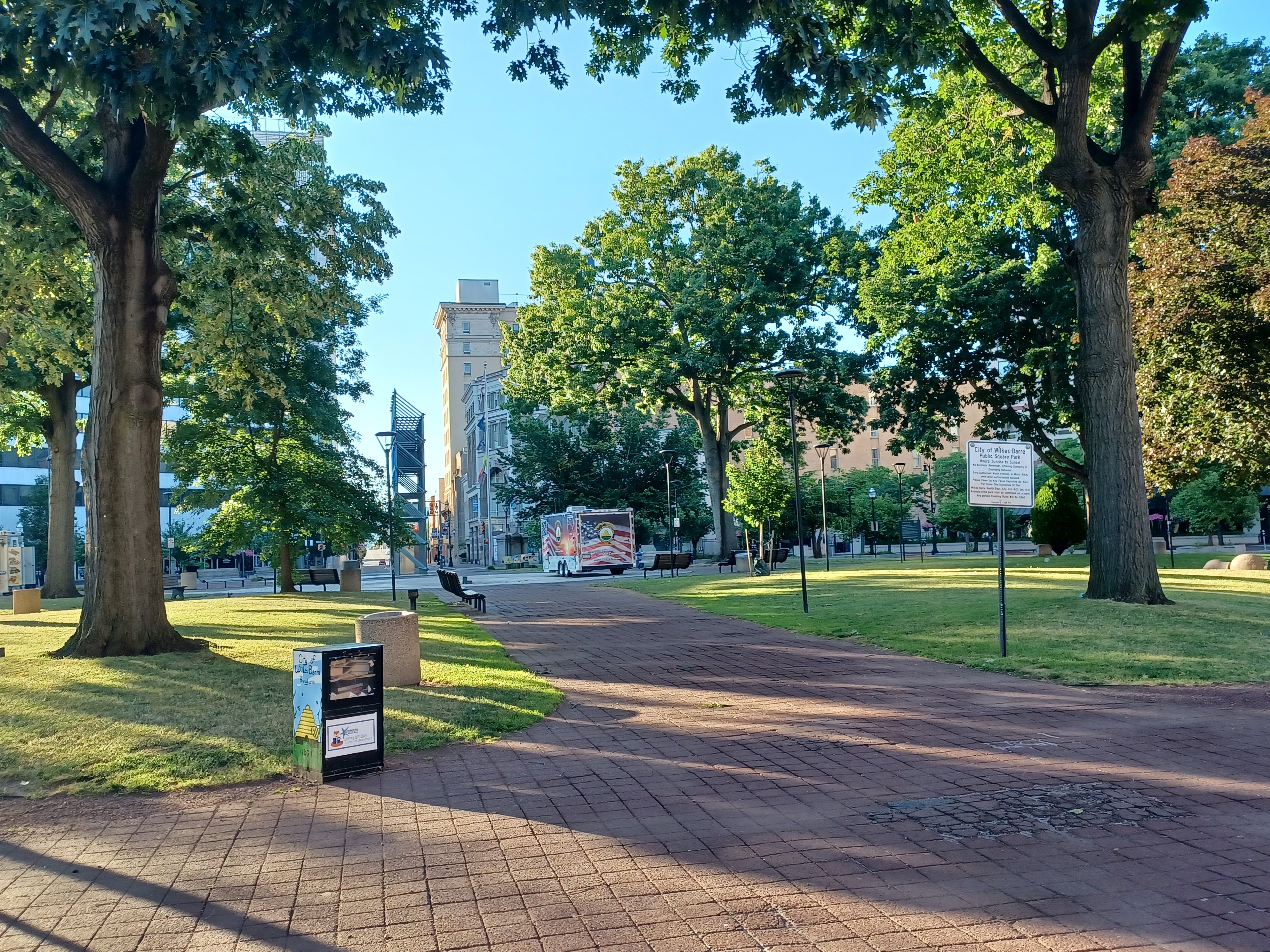
Market Street took us to the Public Square in the middle of town. Inside this
square was the location of the original courthouse, before the current one was
built a few blocks to the east. The Public Square is now just a nice park in
the middle of town.
We passed through the center of this, and there was some art on the side of a building with a woman and “est. 1769” which I assume refers to Wilkes-Barre in general.

We crossed over the Market Street Bridge at the entrance to Kirby Park, and immediately on the other side of the bridge, the rest of the group was all laying on the sidewalk in the shade of some of the concrete walls.

At this point, I had officially completed walking the entire
route of the D&L Trail from Bristol to Wilkes-Barre. It was a little too
hot and we were too tired to do any celebrating. It was just a nice little
milestone.
We all got up and headed to the left into Kirby Park from here. We went around the little pond and past the carnival that was going on to get back to our cars.

It had been another great day, checking things off the list, and keeping with the celebratory theme of our 25 year still doing the exact same type of events, and the close of this hike had us set up to do so much more. We had already started with the Susquehanna series, and we can move ahead more actively from this point up and down the river, as well as on other branches of these lines we had already dedicated so much time to.
No comments:
Post a Comment