

Hike #1484; 5/8/22 Bellvale to Fuller Mountain with Greg Andres, Kirk Rohn, Jenny Tull, Brittany Weider, Rick Alejandro Furnstein, Stephen Argentina, Justin Gurbisz, Professor John DiFiore, Craig Craig Fredon, Heshi, Serious Sean Dougherty, Robin Deitz, Stephen Argentina, and Thomas McNamee
This net trip would be a very oddball thing I came up with in Orange County NY, to tie in to the one we had done earlier in the year that ended up in Warwick.

I had been working on my different series to cover all of the
parks and historic railways through the area, and I had not traced all of the
Lehigh and Hudson River Railway yet. This one is kind of mind boggling
considering the fact that it was one of the first rights of way I ever
incorporated into my hikes. I just never got around to finishing it.
The problem was, I didn’t want to focus on following railroad tracks for an entire day. That would kind of suck, and there is so much other cool stuff to see that could be incorporated. Certainly, I could have finished following this line in basically two hikes, but why do that when we could do it in four excellent hikes?

I looked over maps and mulled over different routes based on what looked interesting, and thought I came up with something that might be a winning route.

I figured we could finish the hike down near Wawayanda State
Park, and start further up near Bellvale. We would be along the Appalachian
Trail only at the start, and then wander back roads, preserves, follow along
the railroad, and then do other oddball trails and preserves to get back to
Wawayanda. I would promote the hike as “Wawayanda the Wrong Way”.
The work is Lenape meaning “winding winding water” or “water on the mountain”.
Wawayanda State Park on the NJ side has tons of trails, which I’ve done just
about all of, but there are other really odd spots that I wanted to use as
well.

I made Wawayanda State Park at the office the meeting point with the idea that we would hike back to there, but the problem was the road was blocked off when we got there. There was nothing on the website saying that there was anything closed, and so we all drove around the barricade to get in. We couldn’t just wait there though, because we’d surely get ticketed as soon as we tried leaving the cars. I had to come up with another way of parking and ending the hike.
On the fly, I kind of changed the hike around, and I had everyone follow me out of the park, then up to the very limited parking for the Fuller Mountain Preserve, located on Bowen Road over the NY line. Even parking there, this would end up being a rather complicated ordeal. Still, it ended up being a really very fun day.

We shuttled up to the Fuller Mountain Preserve and took
basically all but one of the parking spots there. Someone else was showing up
to use the trails and probably wondered what was going on.
We all piled into fewer cars and headed north to Mt Peter on the Bellvale Ridge, just off the Appalachian Trail west of Greenwood Lake NY.
There was a parking area across the street from Bellvale Farms Creamery we used, and a side trail that leads to the Mt Peter Hawk Watch off the AT.

The hike began with the side trail; we headed up the steps and
to the wooden platform overlook with a view to the west. A nice little spot. I
had been there on a hike once before, while doing my NY AT series back in
Summer of 2008.
We headed back down from the hawk watch, and began our “wrong
way” trajectory by heading down Kain Road from the parking area at the
creamery.
This was really a beautiful back road, and very little used, so it was great. I
just found it amusing that the most famous trail in the world was right there,
and we were walking away from it in true Metrotrails style.

As we made the first corner in the road, it got really steep going down and afforded us amazing views into the Warwick Valley ahead. Some of the group got pretty far apart here, and I was having great conversations with Craig and Rick, and lost track of where I was going.

I made the mistake of turning right on Bellvale Lakes Road. This was actually a huge mistake because it put us much farther north than we should be.

My intention had been to go further down Kain Road, and then turn right on
State School Road. That would have taken us right into the former Mid Orange
Correctional Facility. Instead, we ended up following the road way north toward
Sugar Loaf.
After we’d gone so far, I realized it when we got close to view
of Wickham Lake. I let everyone know we went the wrong way and they all paused for
a moment. Once again, on the fly, I had to change up the hike a bit.
We continued on Bellvale Lakes Road, and then turned left on Lake Station Road.
We only had to walk a little bit of busier road from the intersection of Gibson
Hill Road to Lake Station so it wasn’t so bad.


We reached the railroad tracks and regrouped. I’m assuming there used to be a station there based on the name, but there was no evidence of it. I’m honestly not sure.

We followed them to the left for a bit, and soon Airport Park
was on the left. Just after this there was the crossing of Airport Road. Here,
we turned left, and then right on Simpson Road which was closely parallel with
the tracks.
The road was a new development. There were homes at the
intersection, but then the rest of the road only had maybe one house on it.
At the end, the road became abandoned and it was a trail. Another trail went briefly to the left, and we tried following that, but it petered out. We went back to the old road trail, and this brought us down to a boat launch and parking lot in a disjointed piece of the Wickham Woodlands property.

I went and stood in the water which actually felt pretty nice and amazingly not too cold.

From here, we had seen another little gravel road parallel with the trail we had taken in. We backtracked a bit, and then followed that road past some really nice big trees in the direction we’d come. One particular white oak was incredible A short bushwhack past them led to the parallel road.
The parallel road was pretty nice, but then it surprisingly got crappy and overgrown with weeds. We weaved to the left a bit, parallel with the tracks, and eventually came up to a railroad crossing where we turned left again over a fill.

We only had to go a short distance to State School Road. This was our planned brewery stop and maybe lunch stop if they had anything.

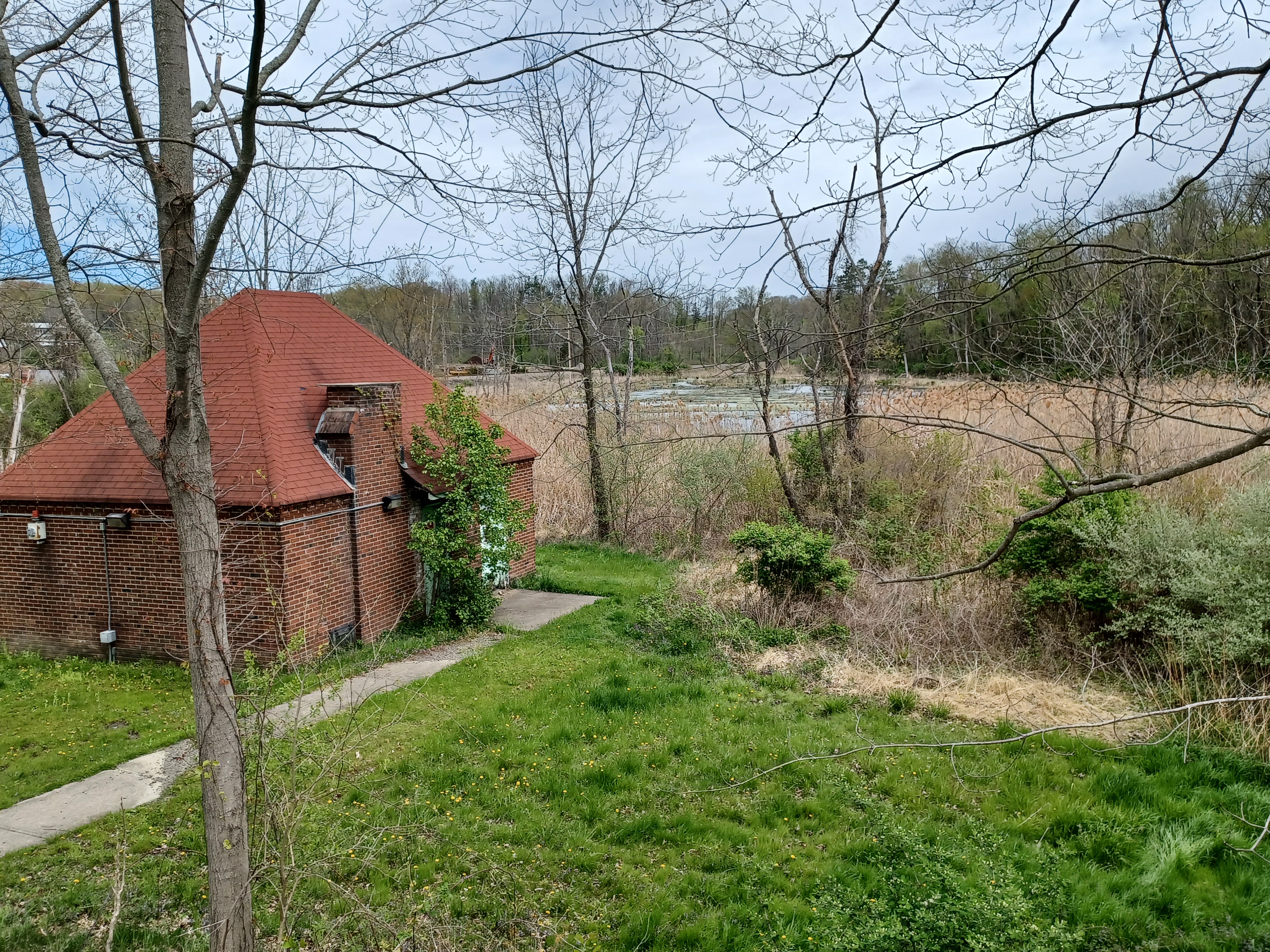
We turned left on the road, and there was a little brick building to the left, probably some sort of compressor building for sewage outflow or something like that.
1840 Henry Wisner homestead as we entered the property now known as Wickham Woodlands. It was built on land purchased by his great grandfather, Captain John Wisner, in 1766.
We continued ahead, and the main facilities started coming into view.


This was formerly the Mid-Orange Correctional Facility just northeast of Warwick NY.

The site was originally the aforementioned Wisner
and later Durland Farm It was purchased in 1912 for use as New York City Farm,
a "colony" for men addicted to alcohol. Mostly comprised of tents, it
was one of the nation's first treatment centers for alcoholism.
It closed in 1919, and was reopened for drug
addicted men in 1920. By 1929, it became the New York State Training School for
Boys. The cornerstone of the administration building was laid in 1932. A
school, hospital, and 16 living quarters were constructed by 1933.

The training school operated until 1976. In 1977,
it became Mid Orange Correctional and once had over 1000 medium security
inmates.
The prison was closed in 2011, and the site has
been redeveloped as a park with trails, the brewery, and more, situated along
Wickham Lake and the Wawayanda Creek.
To the right as we got closer was the Drowned Lands Brewery, which was formerly the facility administration building. It is kind of funny considering the location’s past that a brewery occupy the site today. We went on in and checked out the selection they had.

I didn’t have enough interest in anything they had on tap to get anything to go. I’d of course already brought my good stuff this time, but I did try the strongest IPA they had, which was not as high as 10% ABV but it was still good.


We headed out from the brewery on a route around the facility just to the south. This ended up being a bit more distance than I was intended, because on my original planned route, we would have been coming right by it.

There were nice views and picnic benches set up on the lawn overlooking the wetlands of the Wawayanda Creek to the north.

There were some handsome brick buildings in view and a brick
covered guard tower to the right. We kept to the left around the access for the
facility. It was amazing how many people were walking around at this time. The
access road around makes for a pretty good trail, but it was also surprising
that the entire loop it made was fully open to motor vehicles too. There were
old people driving by us gawking at the structures as well.
I figure this is a good thing and there weren’t too many of them, but I could
see it becoming necessary to either cut that out or use some of the space, of
which there is plenty, to designate a dedicated pedestrian path parallel.
Near a bend in the road, there was a grey metal guard tower that was not blocked off. This, for us, was of course an invitation.

We climbed up the tower, which afforded us a pretty good view of
Wickham Lake. In the opposite direction, we were looking across what must have
been the recreation fields for the inmates. There was definitely a former
basketball court and what looked like it was probably a baseball field.
We couldn’t get in the box on top of the tower, but getting up the steps
was enough.
We continued around the facility to the left, and passed another picnic grounds
with a fireplace and lots more picnic benches.
We could barely see some of the higher up buildings which were still blocked
off by very tall chain link fences. Autumn Olives were growing inside the
fences and obscuring a lot of stuff there.
We walked around the back of the facility and passed by the power plant and stack. These places, with over 1,000 people in them, are basically like little cities and require all of the resources to keep that many people going, so most of the old jails and hospitals had their own power plants early on.

There were two handsome buildings to the right and to the left
as we swung back around the facility to the north, back toward the brewery,
both vacant. Maps showed there was a Whisky Bar out behind the facility in one
of the buildings, but there was nothing opened and didn’t look like anything
was going to be unfortunately.
We continued back toward the brewery, and I walked a section of
grass with a raised berm out through the center of it that didn’t seem to have
any business being there.
I figured this could possibly be some buried utility, but I also wondered if
there might ever have been a railroad spur to the site. It seems like during
the time of construction, it would be practical to use the rail for bringing in
materials, and many of these plants had their coal for their power plants
delivered by rail.

In fact, in many cases, the trains went right into areas beneath the facility. I checked over all of the maps I could for the place but could find no evidence of rail service ever being there.

We continued on back to the brewery and some of the group got
some stuff to go. Sean gave me one of his Drowned Lands Willow double IPA,
which was not bad at 8.1%.
We headed back the way we came, only this time we stayed mostly in the grass of the property to the west side of the brewery, away from the roads, partially because that allowed us to drink our beer without going by all of the cars driving in to the site. We got there at the right time, because it started getting really packed after we left.

A path to the left at the end of the property led us over parallel with the railroad tracks. We were able to walk for a bit on this good trail in the meadows just to the south of them, but eventually had to come back up.
We followed the tracks to the west a bit, crossed the Wawayanda
Creek, continued on a fill through the drowned lands, then crossed the creek
again.
We crossed Chancellor Lane, where there was a really great mirror we used to
get several group shots, and then headed further to the west again.

Pretty soon, we reached Wisner Road, and the former site of Wisner
Station. The site didn’t look like much at this point, but there was apparently
once a station at this point when the railroad was constructed.
The Lehigh and Hudson River Railway went through from Maybrook NY to Belvidere
NJ by 1881 or so, but this section we were walking had been in place since 1862
I believe, and was known as the Warwick Valley Railroad.
After the road crossing, there was definitely enough room for a small yard and
station stop.
There was a blueish building to the left, which looks like it
might once have been rail served, and it had “Stone Bridge Station” written
faintly on it. Could this building have been the Wisner Station? I really have
no idea, but at the very least it probably made use of the railroad.
Collins photo, Bob McCue collection

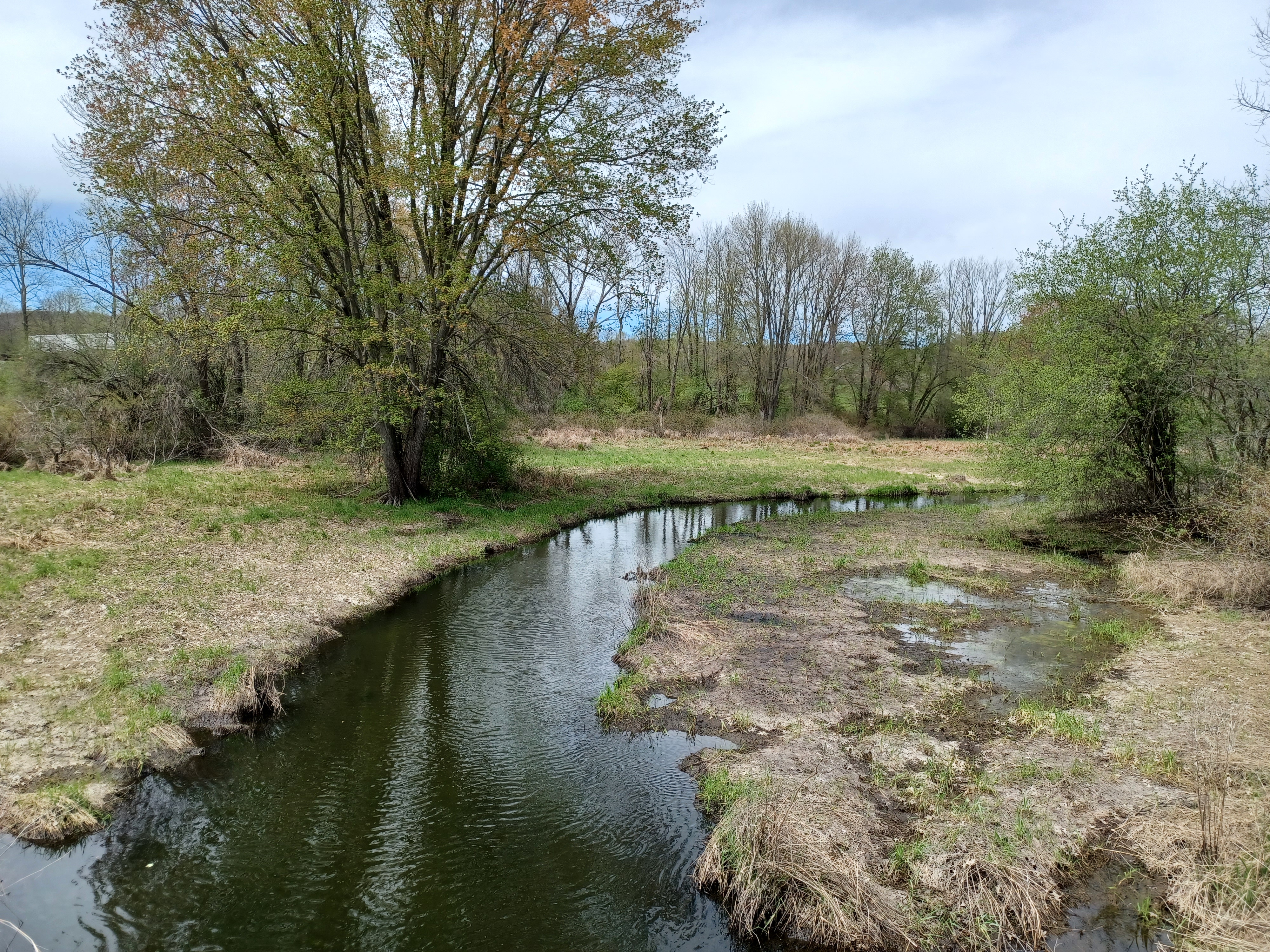
We continued on to the southwest from here through a very pleasant section near the Wawayanda Creek, which we crossed twice more with plenty of nice views of it along the way.

The pleasant section took us directly on in to the town of Warwick where we’d have our late lunch stop.
The Coquito Puerto Rican restaurant was just off the tracks to
the right, and had great outdoor seating, so that’s where we went.
We had a really excellent lunch, and we were stuffed. I of course ate way too much, which is no good since I’ve not been losing weight with my lack of exercise during the week. I was only starting to make a dent in it since I started taking my son out walking on week days.

While there, some of the others took a walk to other nearby establishments, and we had some nice strong drinks.


Thomas went into the place and apparently made friends with other patrons through the place because he certainly had the most appropriate hat.

Before anyone else had the chance, Thomas also picked up the bill for everyone,
which was a lovely but certainly expensive gesture. I tried to keep giving him
beers as at least some sort of payment for the remainder of the trip.
When we were all ready, we headed back to the tracks just a bit more, and crossed the Wawayanda Creek right in town.
We made our way out to South Street, which was where we had
finished the previous hike on the Lehigh and Hudson. Just across was the old
station building, a handsome structure with an attractive turret tower section
to it. The station was built in 1893 to replace the original wooden station
that dated back to the 1860s.
I set up another then and now compilation here, this time with a photograph of the original station provided by Marty Feldner on one of my other then and now compilations featuring the station.


We continued over to Oakland Ave, and then turned left away from the tracks. The remainder of the hike would be the route up to Fuller Mountain, which would be quite the adventure.

Some of the group decided to leave us a bit early here because there was so much more to do, and we didn't know what it was going to entail.
We went up the road to 2nd Street and turned left, then passed the
Christ Episopal Church, built in 1866.
The was a “blessing box” outside with stuff in it, and I think someone left a White Claw in it. I don’t know how anyone can drink those things. They’re weak and they taste like drinking television static while someone is screaming the name of a fruit from another room.

Across from this church was another lovely stone church, the
Warwick Assembly Church.
We turned right on South Street, which took us to the
intersection with Park Way. We crossed, and then entered Stanley Deming Park
directly.
We crossed a little foot bridge over a stream, then walked directly across the
fields to the southeast. We touched the corner of Burt Street, and then
continued through grass past the Park Avenue Elementary School where there was
a sign that read “kiss and go” for drop offs.

There was probably a funny photo opportunity with the group here that I didn’t bother taking, but oh well.

The stately school had its first section built in 1883. It had some nice giant trees
out in the yard, and an impressive outdoor classroom set up.
We continued beneath some Norway Spruces at the end of the property and headed south to cross Rt 17A. There was an old cemetery to the south side of the road, shown on google it seems as St. Stephen Cemetery. It was established in 1795, and someone had posted a piece of wood over the entrance to the property with the phrase “Everything is going to be ok”.

We continued walking 17A to the east a bit more, and to the left
of us was the historic James Burt residence. He was a Revolutionary War Lieutenant,
assemblyman, and senator. The house was confirmed to me through some of the
local history groups to be the original 1760 structure. A well out in front of
the place has 1760 written on it.
Just ahead of this spot, I noted an earlier alignment of the main road from before the 17A development, parallel with it on the south side near the intersection with Ball Road.

At this point, we crossed that intersection and followed a path into the woods up hill a bit. It soon picked up more of the older highway alignment heading east. Some of it was lined with handsome big trees.

We didn’t stay on the old road for long, and turned to the right at an opening
into fields of Warwick County Park.
I wasn’t sure exactly how this section of the hike would play
out, but it turned out really great. There is a commuter parking area below and
adjacent to the park, but the fields are also apparently all park land. Not
only that, there was a worn route going right up the center of it to the
southeast.
We gained elevation in the fields, and everyone was either drunk or really
happy, singing loudly. I had gotten really far ahead of everyone else, and when
I paused farther up the hill, they were all carrying on audibly heading toward
me.

Sugarloaf Mountain really stood out in the distance from these higher level fields, off on the horizon to the northeast I think it was.

To the southwest, I pointed out to everyone that I could see the High Point Monument in New Jersey, at 1,803 above sea level.

Once everyone was caught up, we continued along the field edge to a smaller
field to the left. We cut through and then headed to the corner of the fields
where a clear path entered over a stone row and continued to climb gently
through a small cleft in Warwick Mountain.
We continued on the path, which climbed gradually to the right on the cusp of the mountain for a while.

I had been expecting that we would end up in a lower field first, which has a baseball field in the lower part of it, but this trail continued sort of the direction we needed to go entirely in the woods.

It actually went on much
farther too in that direction, but I wasn’t sure we’d be able to get out of the
property that way. We took the next good path that went down hill to the left when
we were parallel with the second fields. I watched my google aerial images
closely, and this path did indeed take us down, over a small stream, and into
the fields I was expecting to come out at.
Thomas made a wrong turn and ended up on the mountain for a bit longer, but was
able to catch up to us soon enough.
We crossed the field directly to the south, to a corner of woods that has a
line of trees jutting out, and found what appears to be a hardcore mountain
bike trail parallel with the fields inside the woods. We followed this for just
a bit, to the low eastern part of the fields.

We bushwhacked into the woods from there. We could see there were more good trails, but the property doesn’t go all the way out to the next road. I chose to try to follow a route that simply came out where it was mostly woods, where we wouldn’t be intruding on anyone.

We had to go down pretty steeply at times, and Thomas went off
the wrong way slightly again, but we got him back.
The route wasn’t full of thorns, which was great, but there were some technical
spots we had to get over. We made our way down, barely in sight of the homes to
the left and the right, and reached a low spot and cross a tributary of Long
House Creek. We had to then climb up to reach Buttermilk Falls Road.
Buttermilk Falls itself must be on totally private property to the south of this point. We never got to see it, and could barely hear it as we went by.

We got on Buttermilk Falls Road and walked to the south for a while. It was
really a great road to walk, except for the fact that it was so much up hill.
We passed by a house that was a Marine, with lots of Semper Fi stuff, flags, no
trespassing signs, and religious stuff.
We continued up and the road became paved. We passed an old red truck on
display in front of a driveway, and eventually reached Cascade Road where we
turned right.
Just ahead, Cascade Lake Road went left.

My plan for the hike was to follow this road to Cascade Lake Park, and then take the trails out of there to the Appalachian trail, which would bring us to the west. We’d have to do one bit of off trail to reach Fuller Mountain from there. Directly on the road, there was 2.6 miles remaining, and to go on the AT and possible final bushwhack, we could face from problems. It was decided that we would just stay on the roads for the remainder of that distance and try for that other route on a future hike. I’d screwed up enough of the route right from the start that I could easily set up an almost totally different hike out of this area.

We continued down Cascade Road, and we were all super tired. It
got to the point that I actually wanted to Uber out, which rarely happens (this
is mostly because I wanted to get home to my son, and we’d already hit fifteen
miles).
I tried to Uber and there was nothing at all available and very little service.
Along Cascade Road, some guy pulled over to ask what we were up to, and I told
him. He seemed enthusiastic and interested, and I told him about “Wawayanda the
Wrong Way”, which he found amusing. I let him know we were tired, but I stopped
short of asking for a ride. I thought maybe he would offer, but he never did,
so we continued walking.

We turned left when we reached Brady Road, which took us past the lovely Brady
Farm after yet another climb.
After the farm, we turned left on Bowen Road, and only had about a mile left so
I gave up on getting a ride out. The sun went down when we got to the clearest
spot at the Brady farm, which was nice, and it reflected well on their little
farm pond.
We soon reached the cars at Fuller Mountain, and headed back to Mt Peter to get our cars. Several of us waited on line for ice cream including me, which was a great reward after all of this. I got pretty much a double serving because Justin couldn’t finish his.

It really was an exciting and great day. Kirk had so much fun he had to get a ride home and then come back for his truck the next day. He was so tired we had to drive back and pick him up along the road on the way!

This would be the last of the west Hudson railroad connection
hikes for the start of the year, because it was time to start shifting to hikes
that had more swim spots and the remainder of what I have up there might not
have so many of them, but many have told me they really liked this semi-series,
and we’d definitely return to it with cooler weather, and maybe tie up all of
the loose ends.
No comments:
Post a Comment