

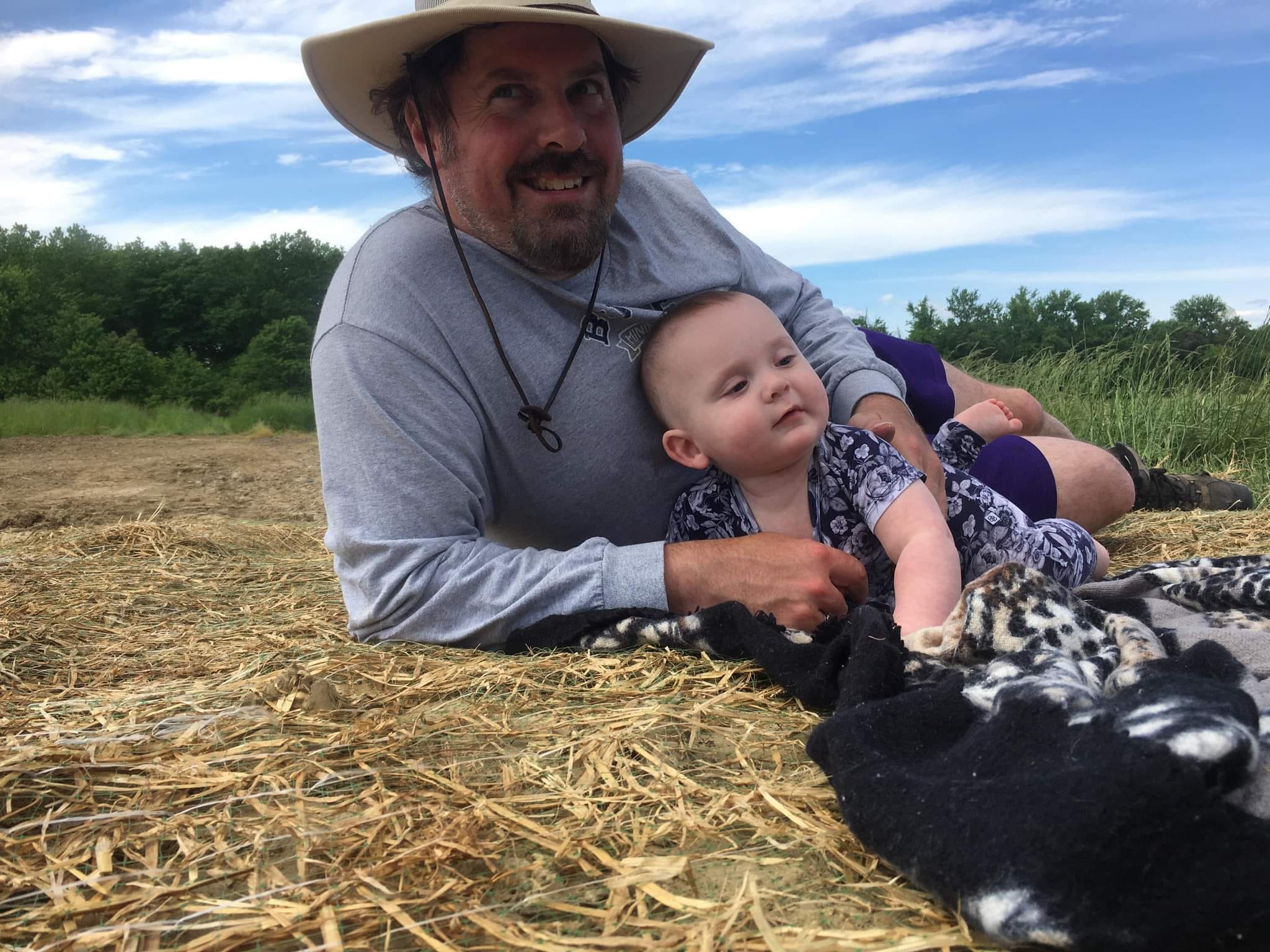
Hike #1485; 5/18/22 Trenton to Roebling with Shane Blische and Everen
This next hike would be a sort of spur of the moment point to point, something special I wanted to do pushing my son in the stroller, and a revisit of one of my biggest life milestones.

A few years ago I completed hiking the entire perimeter of New
Jersey. This was from Roebling to Trenton on the Delaware River. Really not
long ago, but so much of the landscape there has changed since then, and I
found out that there was technically a part of the perimeter I had never done
before. A new trail had been constructed to the Roebling facility right along
the Delaware for a distance, so I just had to do it.
Shane was available to attend, and he was right on the way, so I
scooped him up on my way down, and we headed to the Roebling NJ Transit
station.
Roebling Station is situated next to all of the brick houses where the workers
for the Roebling plant used to live. Most of the facility has been torn down,
but there is a museum there as well as the trail.
The site was where cables were made for bridges and more, built by John
Roebling’s sons. Roebling created the first cable suspension bridges on the
canals such as the Delaware and Hudson and Pennsylvania, and then later went on
to the Brooklyn Bridge.

The three of us would take the train, light rail, which is built
on the old Camden and Amboy right of way to Trenton, then walk back. It would
be Ev’s first time in a train ever, and the light rail is the perfect one to
start with.
I couldn’t make sense of the schedule, and I wanted to be sure to get to the
station so we weren’t bumming around for an hour, but it worked out great. The
first train that went through was not the one we wanted, but the second came
fast, and we were in Trenton in no time.

Ev freaked out a little on the platform when the train went by, but overall he
did really great. He looked around a lot as the train rocked.
We headed to the Cass Street light rail station in Trenton and got off there.
From that point, it was an easy walk to the west to reach, and we passed by the
jail building on the way.
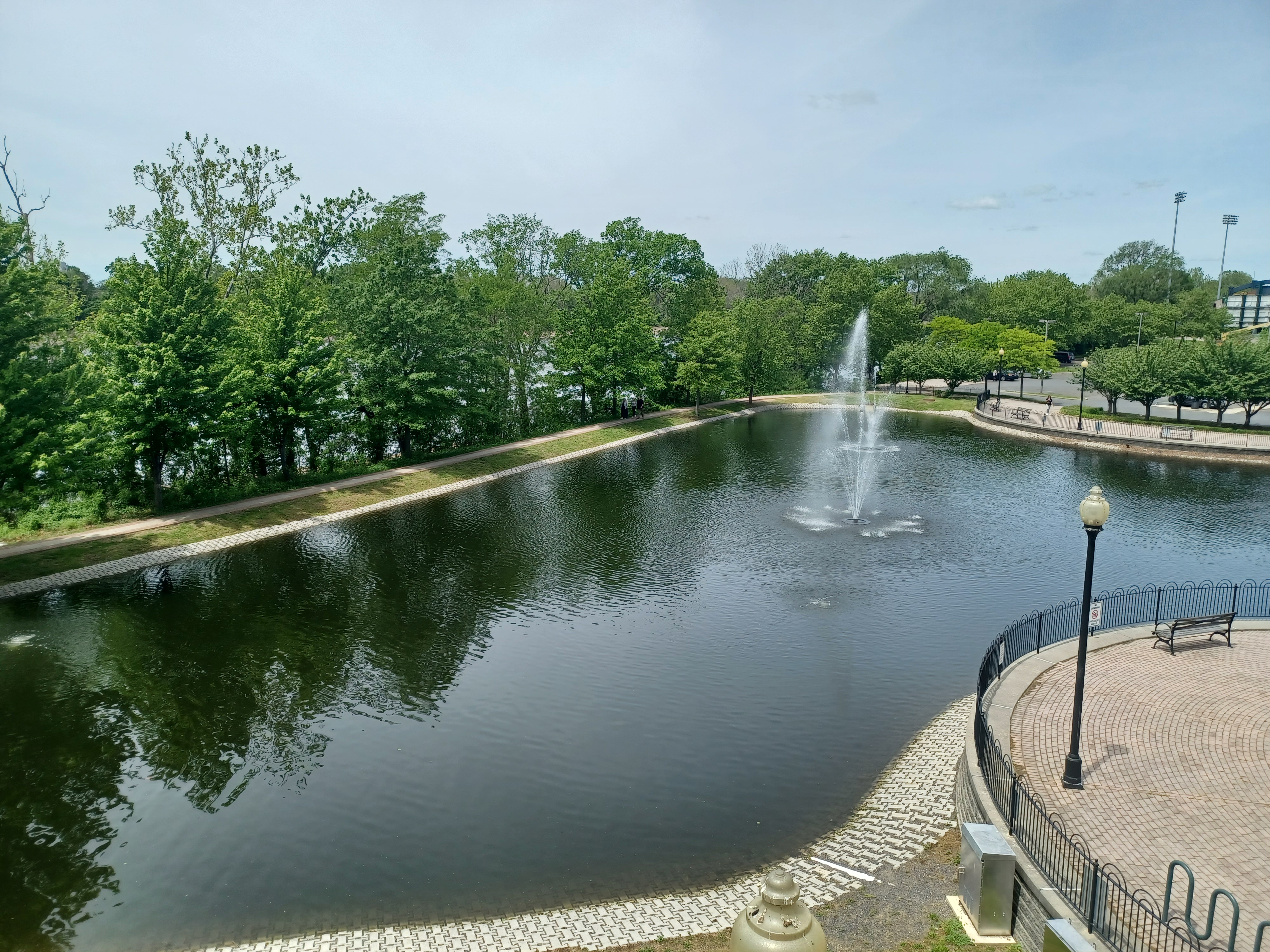
We crossed over Route 29 carefully, and then reached the Trenton Thunder ball park. We continued past that out toward the river where we got on the first bit of trail to the left, around the stadium, and then to a giant fountain pond.

We went around that to the right, and then up a series of ramps in
South Riverwalk Park. I had only ever done this on the perimeter hike and one
night hike, so in the Spring during the day was kind of like a new experience.
There was a nice view back to the north of the pond we had just
passed.
The first bit was Lalor Street Park when we got to the higher elevation. The South Riverwalk Park had some really nice views out to the Delaware River to the right, and it widened out ahead. Route 29 went into a tunnel, and the trail and greenway was on top.

I have mentioned this in meetings on the Route 80 rock fall project, saying they should encase some of the highway in a tunnel like this and have the greenway on top. They aren’t willing to really listen to any reason unfortunately.
We continued along, and one of the things I hadn’t noticed before was series of themed archways. Maybe they were there before, maybe they weren’t, I’m not sure.

The first arch was made of a marble or concrete I think. The second one had a steel arch above it. The third I think may have been brick. The fourth was a wooden one, and the fifth was a sort of stick material made to look I think like the braces for native American long houses.

When we got to the south side of the tunnel area, the trail
turned off to the right and started descending. Rt 29 came out of the tunnel to
the left of us, and at this turning point there was an amazing view up the
Delaware River to the right.
We continued along 29 directly beside the river for a bit, and then turned away
on a rougher trail to the right, down beside trees, and then into Marine Terminal
Park.
This sort of old unloading area is a neat spot with some old equipment around. On
the right, there was immediately a lumber car of some sort that reportedly
worked the Port of Trenton.

There was a giant framework out on the waterfront where I assume there was once freight loaded from boats on the river. We continued past this and then out to along Lamberton Road.

We skirted the Trenton Marine Center and walked through
some of the parking lots rather than walk the road. Another lot after the marine
center had sidewalks along the building we used.
We continued walking to Lamberton Road again south, and then reached Capital
City Yacht Club on the right. Shane pointed out how there was one solitary pier
for a bridge out in the property. He explained that this was intended to be a
bridge for the Pennsylvania Railroad that had never been constructed.

There are two piers on the NJ side of the Delaware that were
intended for the bridge, and a power line seems to have taken on the right of
way. There are at least three piers in place on the Pennsylvania side.
We turned left ahead on Canal Blvd, and in a short distance the trail on the Delaware and Raritan Canal began. The canal was basically filled in at this point, but soon became watered. It was overgrown, but still pretty nice. The towpath itself, if it actually was the towpath at this point, was undulating.

I think it must have been the towpath because the railroad tracks
on the other side were the Camden and Amboy Railroad, and that was chartered on
the same exact day as the D&R Canal, so they’re technically about the same
age. The towpath would had to have avoided interference with the rail.
To the north of where we got on it, Canal Blvd continues on the
former canal route, filled in, and then Rt 129 was built over it until it reaches
near Rt 1.
As we walked, a train soon went by on the River Line light rail
to the left. At a power line crossing ahead, yet another one went by.
This was a really very pleasant section to walk. The rest of the canal is much more authentic looking to the time when the canal was in service, but this long abandoned section wasn’t even open as a trail until the early 2000s after years of being grown over.

The Delaware and Raritan Canal main route was completed in 1832 from Crosswicks Creek at Bordentown to New Brunswick. It was basically in service for a century when it was closed down.

We walked along, and I handed Ev mini cucumbers to munch on because he was just getting his front teeth. Shane pointed out an old rail spur from the former Camden and Amboy that used to serve a power plant which is apparently now gone.

Ahead, we passed beneath Route 295, and took a break beneath
because we were coming to an area with next to no shade.
The canal towpath got much clearer, and the surface was almost like a railroad
bed in the section ahead. It seemed totally straight for a long time and much
more elevated and flat.
We continued on, and eventually got to a more shaded area where the trail
turned off to the right more. It seemed to get further from the canal for a bit
than it should have, and then there was a spur trail to the right that goes to
a pedestrian bridge over 295 to an overlook area on the Delaware River.

Staying on the canal led directly to the first lock on the
canal.
This was a neat spot because there were still snubbing posts in place, and
might be the only ones remaining on the entire canal.

Lock 1 is a weird spot because it is completely made of wood rather than stone
like all of the other locks. I never knew exactly why this was, but I figured
it required repair or something.
I found out more recently that this was not the original site of Lock 1. I previously believed that Lock 1 had been attempted closer to the railroad tracks, but that it had to be moved due to swamp conditions. It turns out that Lock 1 used to be at that location and was for years, with stone work, but it was moved further out to where it is now due to sinking stones and proximity to the railroad.

As we continued over the recognizable lock, we could hear the train whistle. I started running pushing Ev because this one I wanted to try to catch a photo of. The trail goes out to the railroad bridge and crosses on a walkway affixed to the edge of it, and so I knew it would be a really cool spot to catch the train going across.

We made it just in time and I caught the train coming across the bridge. We then got on the walkway and began walking over the bridge to the south. There were some bulkhead type of remains in the water at this point, and it might have been an entrance remnant to the original lock.

There is also a submerged old canal boat in the Crosswicks Creek at this location, partially under the bridge. It was determined to have been, based on size from the Schuylkill Navigation, from between the widening of the locks in 1846 there, and before the 1880 bridge construction on the railroad. Schuylkill Canal boats could travel up the Delaware from Philadelphia as it was navigable at this point, and then enter Delaware and Raritan Canal to head east. The D&R was much bigger than our typical towpath canals, so much so that it could even accommodate steam powered vessels.


Once across the bridge, we turned up Farsworth Ave steeply, in a bit of a cut where I climbed onto a concrete barricade to try to get a then and now compilation, then we headed up and right on Courtland Street.

There is a nice statue of Thomas Paine at the corner there, and we went over to Princes Street for a splendid view over the confluence of Crosswicks Creek and the Delaware, and the 295 bridge.

From here, we headed south a bit, then left on Park Street to
get back to Farnsworth Ave. I wanted to stop by Tindall Road Brewing Company,
but they were still closed by the time we went through.
We continued down the street through Bordentown, which is an absolutely beautiful little town for walking. It reminds me a bit of New Hope, only without the crazy crowds. I’ll certainly have to do another hike there in the near future.

Along the way, we passed the former home of Thomas Paine, which he purchased in 1783, and lived in periodically until 1800.

We also passed the Quaker Friends Meeting House, which stood
back a bit further from the street, with a walkway up the middle of a lawn full
of all sorts of great historic texts on large four or so foot high signs. The
Meeting House was built in 1740, and sits back farther from the main street
than the other buildings because it existed there before the street grid
existed. The building is now home to the local historical society.
The buildings through town are all quite nice; across from us was the United Methodist Church built in 1867, another very handsome structure.

We stopped along our road walk route at a little liquor store, and I stepped in to see if there was anything of interest. I found something called “Outen the Light”, a barrel aged barley wine ale by Bonesaw Brewing Company that looked delectable. I had to have it. It was 15.3% abv, so I figured this would be pretty good.

We turned right on Burlington Street and headed down hill across
the Blacks Creek. We passed under Rt 295 and continued uphill a bit with a
women’s prison on the right, and a Juvenile Justice System campus on both left
and right.
The buildings we saw here were original part of the Bordentown School, built in
1894, after having been established nearby in 1867.
The school was one of the most important Secondary Schools for African
Americans until the desegregation of public schools in the 1950s.

The road walk
section we were on is now part of the Delaware River Heritage Trail officially,
and so it had a map and some nice historic interpretation on the site. I
thought to myself how much this had changed since my perimeter hike.
We continued west from here into the little town of Fieldsboro. There are some
nice little side trips that could be taken through here, which I would like to
do in the future again, but just can’t get around to it right now with
everything I’d taken on.
We continued southwest to the newer townhouses and such, and the new Quick Chek that had been put in. It was still under construction when we had hiked through on the final perimeter hike.

I can’t remember if we stopped in the Quick Chek or not, but we probably did. We then came out to Route 130 and crossed directly. Another new development since our last visit was the completion of a greenway path along the road on the south side.

We skirted pretty Crystal Lake on the left, and then the trail
went into the woods to turn away from Rt 130. I had never been on any of this
before, and I had only once hiked in Crystal Lake Park (and got done late
because a ranger was angrily waiting to lock the gates when we got back).
The trail took us up into the woods, and I tried to open my new barleywine, but I found that it had a wax covering over the outside of the cap and I couldn’t get it off. I neglected to bring a pocket knife, and so for the next half hour I found myself picking at wax all frustrated.

There were a lot of people walking around through the park. There were also a ton of side trails I had never been on before. I really needed to get back out there to hike more of this. We passed through a section of woods, then headed out into an area of open fields near the parking lot off of 130.

I managed to get the bottle open in the fields and handed it to Shane to have a
taste of first.
I was actually out of work from having covid just a bit before all of this, and
I really needed to get out and get some exercise. That is why there was a ten
day period between my previous hike and this one. I’d had only maybe 24 hours
of misery with a headache, but other than that I was fine. The next week I
still had a fever so they doubled my time off from work, but I pretty much felt
fine the remainder of the time I had it. Ev also got it and he was just
coughing a bit for a while.

Overall, he seemed happy through most of it as well. Jillane got it from me, and she had it the worst because she lost her voice for months. It might be because she took the anti-viral medicine though, which other people also had similar negative effects from.
The trail turned hard left away from Route 130 to the south, and we followed it through the wide open fields. It remained paved through this length. I wanted to follow it all the way through because it supposedly connected with the new Roebling trail bit.

Out in the fields, there was a trail intersection where the paved one went to the left a bit, but an unpaved field perimeter one went to the right.

We opted to follow that because it would get us where we were going faster, and it still looked fine to get through with the jogger stroller. It was also an insanely hot day for May, and this edge of the field it led to was in the shade more.
The field edges brought us out to Axe Factory Road where we
turned right, at the intersection of Old York Road. The paved path was along
the road here and became a regular sidewalk along Old York Road, which we
followed to the west.
The road passed new homes, but then brought us to the historic little village of Hedding.

The settlement was known as Bryant's Tavern from 1793 to 1813 after proprietor William Bryant.
In 1817, the community was named Three Tuns, as a
sign in front of the local hostelry depicted three casks or "tuns" of
booze.
The Hedding United Methodist Church was
established here in 1847, and named for Elijah Hedding, a Bishop of the
denomination.
The name of the settlement took on the church name
in 1920, but I understand that some still refer to it as Three Tuns.

We crossed directly and continued east on Old York Road. After we passed all of the houses, the paved trail shifted off to the right again.

In an area ahead with an open field, near a power line crossing, we all laid down in the grass to take a break. I had to give Ev another diaper change and get a bottle ready for him, and it was a good spot back from the road a bit before our next turn.
Just a little ahead on Old York Road, we came upon the former railroad crossing
of the Kinkora Branch of the Pennsylvania Railroad.
This was one of the oldest railroads in New Jersey, built in 1838 as the Columbus, Kinkora, and Springfield Railroad, one of the first connections from the original Camden and Amboy that connected to the inland part of the state. It later became the Kinkora Branch of the Pennsylvania Railroad.
The line served Columbus, Jobstown/Springfield, Juliustown, and more. I had
hiked the entire branch from where the Union Transportation crossed it by Fort
Dix, but had never walked this new bit, which to the north had just been opened
as a trail.
I considered this to be one of the most unlikely trail projects in the state to be opened. It was abandoned mostly in 1971 I understand, with the last of the line closed in November 1972. It had been gone without any reuse of the right of way save for some road construction for fifty years, and it was much farmed over. It wasn’t even an ATV trail like so many others had become. I can only imagine they must have had to litigate some when it came to adjacent home owners.

We continued to the north on the paved trail which took us through a line of trees on the rail bed, and then next to the rail bed on a field edge.

It blows my mind that so much money is invested in paving these trails when Governor Phil Murphy is pushing a “rain tax” to be imposed on anyone with a paved driveway, saying that the runoff is causing water contamination. If it is such a big deal to be creating or having pre-existing impervious surfaces, why are they paving all of the rail trails?
The trail continued along the field edge and passed a spot where
there was an island of grass with a tree in it.
At the end of the field segment, the rail bed and trail went into a bit of a
cut and had a surprising descent below a property to the left with buildings. The
structures soon came into view, and it was an enormous warehouse structure.
These things seem to be going in everywhere.

Not to play crazy conspiracy theorist, but there is something
unnerving by the amount of these going in. It may very well be possible that
these are for storage of bulk items like a grocery store, since everyone seems
to be relying on deliveries instead of regular shopping these days, but I find
that many of the structures are completed but remain empty.
I wonder if they’re intended as a backup fallout shelter or shelter for
homeless or something since they aren’t being actively used to the potential
that they were built for.

I’ve been thinking this since the warehouse sprawl craze all started, and I
just want to get it written down somewhere in case anything ever comes of it.
Pretty soon, we reached the underpass of Route 130. This had
been built for a trail bridge by the time we finished the Jersey Perimeter hike
in 2016, and we went under it to follow the rail bed north, but it looked like
the trail was a long way from ever happening.
The trail took us ahead along the right of way, and then turned left to cross the former Camden and Amboy (River Line) at grade.


We headed west, and crossed a foot bridge on likely an old rail bridge over the Crafts Creek. There was another abandoned bridge just downstream from this, right next to the bridge we were on, and another near the confluence with the Delaware.

We continued along the river heading downstream, and there were
pretty spring blooms along the edge. The trail came right out along the water’s
edge, and there were giant rocks down below holding it all together, probably
to protect the infrastructure that used to be to the left.
We took a little break and Shane stood with Ev while I went down
to lay in the river for a few moments. It would probably be my first time
completely submerged in the water of the entire season, and I needed it badly.
We continued along, and the first abandoned building appeared on the left, all
chain link fenced in.

This was the site of the Roebling steel mill, the Kinkora Works, founded by Charles Roebling, son of famed bridge building John A. Roebling. John A. Roebling & Sons company provided metal for the Brooklyn Bridge, the Golden Gate Bridge, and many others, as well as elevator cables for the Empire State Building, Washington Monument, and many others in different cities.

The Roebling plant was developed on a farm the family purchased at Kinkora in
1904. In 1905, they laid out the model company town to house their ever growing
force of immigrant workers. Charles Roebling laid out 750 strong brick homes on
rectangular grids, with medians in streets lined with fast growing London Plain
trees for shade.
Along with the homes, the Roebling company built an inn, a bank, recreation
hall, auditorium, post office, drug store, hospital, jail, bakery, and boarding
house for single workers. All of these building still exist. The Main Gate
building from the plant now houses the Roebling Museum.

The mill flourished until the 1940s, but production slowed after World War II.
Many of the workers purchased their homes from the company. Roeblings sold to
Colorado Fuel and Iron in 1952.
The mill property is mostly empty now, but we did pass by another building
before the trail emerged at a point where I’d been before. I’ve still never
visited the Roebling Museum, but it is in my plans to definitely do so
hopefully in the near future.
We turned left along the fenced portion of the property and headed north toward
all of the brick homes.

Pretty soon we were back at the station to finish a really great hike.
As I continue with the 911 Trail series it will bring me back through this area. I really look forward to doing a lot more connecting stuff on that when the time comes.
I think I could probably do this hike a dozen times and never get tired of it.
It was just that nice.
No comments:
Post a Comment