

Hike #1493; 6/30/22 Allentown and Coplay Loop with Jennifer Tull, Professor John DiFiore, Violet Chen, Heshi, Greg Andres, and Everen
This next hike would be a loop in the vicinity of Allentown PA. I had a loop I put together to cover some stuff I’d done before, and some stuff I hadn’t which would be good with a stroller.

It was I believe the last day of appointments I had to go in for
with Ev for his physical therapy, so I set it to be early, and then headed out
to the Lehigh Valley to do some hiking.
This was a guard lock where the Lehigh Canal let out into the Lehigh River and used slack water navigation up to the Allentown Dam.
Most of the lock area is now buried under a parking area. I came up with a route that would cover a lot of area that was once very familiar to me, but that I had not done in years, as well as a few other things similar to what I'd have put together for a night hike.
Everyone showed up to the meeting point except for Greg who was running behind a bit with his new dog, Saga.
We started the hike heading north from the parking lot, up along Daupin Street.
I had walked this so many times before as parts of my hikes on the Lehigh Canal, but it had been quite a while since I'd been back. We only had to follow the road a bit and turned to grass on the right side.

In the grassy swath, which is part of the St. Luke’s Center Campus, there were some lovely, giant Sycamore trees. We continued past them, and then turned right along St. Luke’s Way.

Just ahead, there was a paved trail
that went off to the right and around the south side of the campus.
We followed this east around a retention pond and along a tree
line on the south side of the property. I watched closely to the right for
places where we could break away to the south. We had to get out to American
Parkway to continue.
The paved trail started getting pretty close to the main road into the campus,
and I didn’t want to go over near the buildings in case we weren’t supposed to
be there, and so we turned right through grass, passed through a line of trees,
and came out behind buildings off of Business Park Lane.

We cut through the grass and out to the road where we turned left. This brought us downhill to American Parkway.

To the left at American Parkway, the former Lehigh and New
England Railroad had a branch to Allentown that American Parkway is partially
built over to the east. This section of the road I was probably never on
before. We turned right along the edge of American Parkway, which wasn’t
particularly great. I thought there would be much more of a shoulder since it
was a newer section of road, but there wasn’t.
We crossed over the road when it was clear enough, and a sidewalk began at the
North Bradford Street.

We continued on American Parkway to the new bridge that was completed over the Lehigh River within the past couple of years. I had still never walked over it, so this was on my to do list.

We could see the Tilghman Street Bridge to the south from the
walkway along the bridge, and it was a really nice view of the Lehigh.
The bridge is an attractive one similar to others in the lower Lehigh Valley, a
twelve span concrete open spandrel arch opened in 1929, 1,387 feet long. Nearer
than the bridge, the area below us was undergoing a massive construction
project for which I am not sure the planned end result. There is a bit of paved
trail already in place along this section of the river, but it doesn’t go all
the way through.

Once on the other side of the bridge, we turned left on Riverside Drive, and then left again down to the construction site.

At the bottom, we turned a hard left onto the abandoned right of way of the
former Lehigh Valley Railroad.
I had walked this segment several times, and until somewhat recently, there
were still tracks in place here (by somewhat recently, I mean early 2000s).
I used to walk this route to reach the former Central Railroad of New Jersey
connecting bridge from the east side of the river at Kimmet’s Lock. The area is
under development for something to the right of this as well, but I’m not sure
what.

Heshi was telling me about a program he is working on that will be similar to street view with Google maps, where he can track a trail perfectly.

He was running a test with this hike starting in this area. As soon
as we got on the railroad right of way, he started powering ahead pretty fast.
It was brutally hot in this stretch, definitely the hottest day
of the year so far. I wasn’t counting on having really no shade for this long,
but we managed alright.
When we got on the path, I had a beer I’d recently found called Inky Cap from Tox Brewing, brewed with pistachio nuts and vanilla and other stuff. This was a pretty delicious thing. Jenny didn’t care for it though.

We eventually got to some more reasonable shade for a bit, and then back to the open again to pass beneath the Rt 22 bridge.

We had a little more shade beyond the next underpass again. The
right of way was grassy but still clear. It was a little bumpy also, but
nothing I couldn’t handle with the pivoting front wheel of the jogger stroller.
We came to yet another wide open clearing as we came close to the former Tarkett Flooring place. Through this section, it was clearly set up so that no one could get through, with lots of tree branches and other junk dumped over the rail bed. It is shown on Google Maps as a trail through this entire section now, but it was kind of hard to get out and around with the stroller.


We did get past the building, and we could see where there were still some rails leading to the building to the left. After we got by it, things got a lot clearer again.

We again went through another section without a lot of good
shade. I was glad I had sunscreen on Ev and the carriage cover would cover him
well.
We continued on and ate some Day Lilies. I gave Ev one to eat,
and we reached the Race Street Bridge where we took a little break. It provided
the right amount of shade we’d needed for a bit.
We headed north along the Lehigh on the rail bed some more, across from
Catasauqua, and just before getting to the Pine Street Bridge, the was the
former Lehigh and New England Railroad connection to the West Catasauqua Yard
and to serve industries.

This is in some of the most deplorable condition of any abandoned rail bridge I’ve ever crossed. Needless to say, we did not cross it this time, but Heshi and I went out onto it a bit.

We continued beyond this to Pine Street, which is an interesting older one as well, but not quite as old as many others. It is an 8 panel rivet-connected Pratt deck truss structure completed in 1953.
The grated deck on the bridge is something that seems to be falling out of
favor with bridges. It is a good design in that it does not hold water and
inhibits water pooling. So it shouldn’t rust as fast. It does make a crazy
sound going across.
What made this bridge a bit more different than the others was the fact that it
even had a grated walkway.

People often don’t like those because they’d be
looking straight down through the grates to the river or land below. I
personally find them interesting. I would suspect the Pine Street Bridge will
be one of the next in line for replacement.
We continued on the right of way ahead, and soon came out behind
the Eberhart Road Pump Station. We continued straight to where the Lehigh
Valley Railroad used to cross a bridge over Water Street. This was a bit more
technical with the stroller.
I pushed Ev down the hill to Water Street, as there’s no bridge abutment there
in the way, and then the rest of the group had to help me lift the stroller
over the galvanized rail.

Just ahead to the right, I had to go over again, because we were going to take a little break where the Coplay Creek flows into the Lehigh.

At the bottom, I took Ev out of the stroller, and found a little
rock to sit him on with a flat top. He sat peacefully upright while I took a dip,
and was okay as long as I was right by him. The last hike when I took him in
the Delaware in Lambertville was a good introduction, and he seemed good with
this stop.
It was so hot, so going in the water here was more necessary than usual. The bridge the Coplay Creek passed under at Water Street, and beyond both the Lehigh Valley Railroad and then Ironton Railroad, made for an interesting sort of sluice.

The water also looked very surprisingly crystal clear, which was odd considering it comes from such an urbanized and former industrial area.

We made our way back up after our break, and I employed the
others to help me get Ev in the stroller back over the railing. I then had to
push him steeply up a slope on the other side to return to the former Lehigh
Valley Railroad bed. We then continued north.
Immediately parallel with us was the former Ironton Railroad, now the Ironton Rail Trail.
That line was originally built in 1860 for the purpose of carrying raw iron ore from mines along the route out to blast furnaces along the Lehigh River. It made a loop between Coplay, along the Lehigh to Hokendauqua (where we were at this point), and looped around with a connection to the Philadelphia and Reading Railroad to the west, north of Whitehall. The main line went west to Egypt and then Ironton, but just before that point, another branch of the line was established a year later that went to Siegersville and Orefield to the southwest, where more extensive iron mining took place.

The iron industry out there started to die off, but at about that time the Portland Cement industry was born. The first transport of Portland Cement over the line took place in 1884, and Coplay became the center of that industry.

The line between Orefield and Siegersville was
abandoned before 1900, but passenger service began on the rest of that line in
1898.
That
branch saw more traffic with potato farmers, and even Mr. Trexler, who owned
the area known today as the Trexler Preserve, used the branch to deliver
buffalo and bison to the then private game preserve in 1911.
The iron industry pretty much collapsed, and the
Thomas Iron Company along the Lehigh River closed in 1921. The Ironton Railroad
had been operated for a while by the Philadelphia and Reading Railroad, and
after 1923, was jointly operated by the Reading and the Lehigh Valley Railroad.

It still saw industrial use, and the line switched from steam to diesel power in 1948-49. The entire branch to Seigersville was abandoned in 1955. The PA Turnpike would have severed it anyway.

The
Ironton Railroad was paired back by one mile to Ironton in 1961, and then
further to Ormrod and Egypt between the 70s and 80s. It became part of Conrail
with both the Lehigh Valley and Reading in 1976.
The entire remainder of the trackage was abandoned
in 1984.
Whitehall Township purchased 9.2 miles of the line
in 1996 to form the Ironton Rail Trail.
For many years, only the loop of the eastern end,
an oddity among rail trails, was paved, and the rest of it was just surfaced
with a crushed stone aggregate. I was saddened when I found out that the
western section had also recently been paved, but for our purposes it would be
much easier with the stroller.

Still, at this point I was not going to walk the Ironton Rail Trail yet. We were at this point going to continue on the former Lehigh Valley Railroad.

It runs pretty closely to the trail, but is used today as a sort of driveway to
several Hokendauqua homes.
When we
got to the sort of end of the driveway area, the right of way was clear for a
bit, but then got a little weedy and we had to go up a slope where the new
Lehigh Street Bridge had been built.
We passed beneath the bridge, and then reached the loop around created for
River Street. The former railroad was fenced off immediately on the other side,
and I wasn’t sure how we were going to get through.

I had last hiked it only less than a year prior, but at this point I didn’t remember how we went through because we were moving along and it was raining.

We went
to the left, and there was a bit of a way around that would require lifting the
stroller over a narrow spot, but then I saw a guy working in the adjacent
driveway and figured it might be his property, so we would find another way
around.
The guy saw us and said “Go on through, I give up!”
He had apparently had problems with people coming through in the past, and it
seems his concern was probably more about ATVs, but we looked pretty innocuous,
especially with the stroller. I thanked him, we lifted the stroller over, and
we continued through on the railroad grade, which got pretty wide and grassy
here.
We were very closely parallel with the Ironton Trail at this point, but we
continued on along the Lehigh Valley Railroad because I planned to go through
the Thomas Ironworks.

The Thomas Ironworks were named for David Thomas for his contributions to revolutionizing the iron industry through the use of coal.

The process was far more difficult in earlier years, with colliers producing charcoal in the hills, and later with the hot blast bellows.
The plan for the
ironworks was laid out in Easton in early 1854, and things progressed quickly.
The Butz Farm, on the west side of the Lehigh, was chosen as the best site for
the industry. The town was laid out soon after, with streets and homes for
employees, as well as a spring with pumped water, a school, and a church.
The Lehigh Canal was already in place on the opposite side of
the Lehigh River.
The railroads showed up also in the 1850s. Lehigh Valley
Railroad on the west side of the Lehigh, and Central Railroad of NJ (Originally
Lehigh and Susquehanna) on the other. The Ironton Railroad of course was built
in part to serve this site, as well as the Crane Ironworks a little farther
down which was on the other side of the Lehigh River.


The Thomas Ironworks were purchased by Bethlehem Steel in 1938 and demolition began soon after, except for a few structures that still remain in place today.

The first one we come to
walking the railroad bed is the tall one with the roof frame, but no roof.
I pushed Ev into the
frame of the structure, which is always pretty interesting looking and everyone
always enjoys.
At the far end of the building, there is the entrance to a tunnel that goes all
the way out almost to the Lehigh River beneath the works. I used to bring the
hikes on through the tunnel, which stands over six feet high like a doorway,
and then we’d climb up into the big building.

But this site is really the party situation gone bad. People drinking have been throwing their bottles into the pit where one would come out from the tunnel, and in doing so they filled it almost to the top.

It is now no longer possible
to walk all the way through the tunnel because people had dumped so many bottles
into the exit.
This level of idiocy is just beyond comprehension. Here you had one of the
coolest places to hang out, and a way to escape if police or whoever came to
bust you, or even just something cool to explore, and they completely ruined it
through selfish and foolish behavior.
From the building, we turned around and headed down a slope into the ruins of where the main structures used to stand.

The bases to the stacks, I assume, were on either side of the informal trail down into the works. There was elevated stuff to the right, and partially buried kilns and such in the woods. One would never know all of this was back there from just a short distance away.

Closer to the river, there are remnants of structures that are
roofed and can still be entered. I was hoping to push Ev down one of the
corridors, but I had forgotten the protrusions in the floor that would not
allow easy passage of the stroller. I sent the others through the corridor
while I pushed Eva round the outside to the east, closer to the river.
Another large roofless structure was just ahead at the end of the corridor,
which I could have gotten Ev partially into, but I chose to stay around the
outside just in case for safety.

We moved ahead through the ruins, close to the river, and then came to the east end of the aforementioned tunnel that leads to the larger building.

I think
some of the group walked back it a ways, but didn’t bother going all the way
through because they knew they couldn’t get out. I also happen to know the
thing is full of cave crickets typically.
After the tunnel, we turned left through woods, went up a giant
hill and then down into a lower area. The top of the tunnel was exposed
concrete we could see and kind of parallel heading back to the west.
There was no good way to go straight out, but we turned right on
another trail that looked like it might be following another railroad grade
that was used in the facility. It got to be more undulating terrain, and
eventually led us up to the left, and then back out to the former Lehigh Valley
Railroad grade. We turned right when we came back out on that.
Pretty soon, we reached and passed beneath the through truss bridge that carried railroad tracks from the former Central Railroad of New Jersey on the other side of the Lehigh over to the Ironton Railroad. I’d walked that bridge many times, but that was not happening this time.

We continued ahead a little more, and we came to the all new Coplay-Northampton Bridge, which replaced the handsome 1930
concrete arch that was demolished in 2017.
One of the reasons for demolition was inadequate
pedestrian connection with major trail connections, but there is the long
abandoned rail bridge within sight of this that would have been far better to
rehabilitate.
The other claim from PennDOT was that the old
bridge would last 50 years after rehabilitation, but a new one would last 100.
It seems off that trails were a consideration, but
aesthetics and ambiance the old bridge had offered along these trails were not.

The new bridge is honestly ugly; the old one had the fancy small arch on top of big arch design and was really something special to see.

It was also built
before the Lehigh Canal was taken out of service across the river, and so a
towpath walkway was built as part of the bridge.
The bridge crossing has a rich history; there was originally a covered bridge
at the site between Northampton and Coplay. It was built in 1857 and served the
two towns until 1931, when it was no longer needed with the new, higher bridge
in place. The current bridge was opened in December 2019.
The site of the bridge was once the home to the Coplay Ironworks, which was
demolished in 1899.


The main yard of the Ironton Railroad used to be at this location until 1910. The Sheesley Concrete Company was right along the yard in this area.


The railroad yard was previously the limestone quarry associated with Coplay Iron Company. The rail yard was expanded to twelve tracks wide through this area by the early 1900s.

Just beyond the bridge was the site of the Lehigh Valley Railroad station,
which was built in 1871. It served passengers and freight for both the Lehigh
Valley and Ironton Railroads, and was conveniently located between the two.
Passenger service on the Lehigh Valley ended in 1935, and Ironton had ended in
1920. The station continued to be used for freight service until 1966.
Sadly, the station was burned by vandals in 1984.
I set up a few then and now compilation photos with the historic ones by Mike Bednar and James Benetzky at this point, and we continued ahead on the paved former Ironton Railroad.

The rail bed turned inland a bit, and we soon approached the old Schoefer Vertical Kilns of the Coplay Cement Company. They are now part of Saylor Park Industrial Museum where we could see that some repointing work had taken place on some of it.

The nine kilns were constructed in
1892-93, and taken out of service in 1904.
The park is named for David Saylor, the father of the
Portland Cement industry. Saylor's cement was superior to the earlier mined
Rosendale Cement.

These
stacks were originally enclosed in Mill B, through which the stacks protruded
from the top.
The
land was donated to Lehigh County in 1975.
We
used to walk between these things all the time when I first hiked here, but now
a lot of that was closed off. I think we took a little break in this area so I
could give Ev another diaper change. It’s always key to do that when there are
benches and trash cans handy.
From
here, we continued on the trail to the west.
There had been a lot of improvements made on the Ironton Trail since the first
time I hiked it, and as far as rail trails go, I really commend the work that
went in to showcasing accurate history of the line. The displays and signs are
really great, and each time I go back it has become more like a walk through
outdoor museum.
To the right, there was a block phone booth used between 1902 and 1906. We often see railroad phone booths in back woods locations, but this one was painted white and was made to look quite attractive.

We don’t usually see them restored (last I saw one like this was on the Lehigh Valley Railroad south of Slatington). It had a cage over the front for protection.

I’m
not sure if this phone booth was there historically, but I’m quite sure the
utility pole standing right next to it was not originally there.
The telegraph pole had a handsome collection of exactly 100 glass insulators on
it. That doesn’t just happen anymore. People go by and shoot them, or at least
throw rocks at them and break them. This pole and the insulators were
intentionally installed for display, which is also something I’d never seen
before.
Just a little further on, an old caboose was parked to the right of the trail. It was panted red and made of metal. I am not sure if this caboose ever served the Ironton Railroad, but they did paint “Ironton Railroad” on the side of it. Many places get newer model cars and paint them in vintage color schemes and logos, but they were never part of that system. I unfortunately am not familiar enough with what ran where.

We continued west and crossed over Ruch Street. There was an abutment and a piece of rail where the trolley line used to cross in this area as I recall.
 |
| 1932 |
There used to be another cement plant between Ruch Street and 2nd Street we used to climb through years ago, but now only the base of the cement silos are still standing. It was really an awesome structure, but basically nothing now.

As we approached the MacArthur Road underpass, the trail weaves
left and leaves the railroad bed, I assume due to some highway construction
that occurred at some point, and we reached the intersection where the trail
breaks to the left and right. To the right leads to Ironton and the junction to
Seigersville and Orefield, and the left goes back to Hokendauqua.
My original plan for this hike was that we were going to go right, and then
wind our way through the trails around some of the original cement plant areas,
but I confirmed with John that we had already done enough miles at this point
that cutting this corner would still put us just over fifteen miles when we
closed the loop. I was good with that. And so, we turned to the left instead.

We headed south and crossed over Columbia Street. Somewhere in this area I
spotted a couple of I-beams that were a rail spur bridge over the Coplay Creek.
I had assumed that this must have been part of the connection with the Reading
Railroad that broke off earlier, but I was wrong.
I was quite honored that when I posted the photos on the Metrotrails page, Mike
Bednar himself came on and commented on the series with some historic
dissertation. He said that this bridge was actually a spur to yet another
cement plant that used to stand right about where the Weiss Market on MacArthur
Road is today.

We continued south from here, and crossed over Center Street. Soon, to the right of the trail was the Tate Meadows, a pretty natural area along the Coplay Creek.
 |
| Teedyuscung |
To the right, there was a beautiful old farm house along the
creek, but there were no historic markers or anything at all telling what the
significance of it was.
Thankfully, I was again able to rely on the Metrotrails hive mine to bring it
all together.
Apparently this was the home and farm of Peter Mickley, who transported the
Liberty Bell from Philadelphia to Allentown to keep it safe during the
Revolutionary War.
Rachel Rose, who knows the local native American history like none other, said
that Peter Mickley ran to this farm from the Spring Street Farm when his
brother and sister got attacked by native Americans while out collecting
chestnuts in 1763. Peter survived, but apparently the siblings did not.
Supposedly these native Americans came up along Spring Creek from the Lehigh River looking to attack Ballietsville, but mistook the nearby Sheidy settlement. It was the last native American massacre in Lehigh County.

Apparently those attacked all had connection to Paulus Balliet, who had burned a teepee and murdered Teedyuscung, the “King of the Delawares”.
He was the
leader of the remaining Lenape nation in the Delaware and Lehigh Valleys, and
participated in the Treaty of Easton.
Teedyuscung’s son, Chief Bull, is said to have orchestrated the massacre and
other raids including one in the Wyoming Valley up in coal country, which led
to a forced extermination of remaining Lenape in the area. Teedyuscung died in
May of 1763, and the last raid was October of that year. Two young girls who
escaped and survived being scalped were Magdaena and Dorothea Schneider, and
their mother was sister of Paulus Balliet.
The old homestead was supposedly purchased a decade ago, but they haven’t secured the funds to restore it yet. Aerial images seem to show another structure on the same property, maybe another house, with no roof. I have to explore this more.

A little bit further ahead, the trail crosses over Coplay Creek
on an old rail bridge. We took a little break here because it was so hot, and I
took Ev down to the creek. There were some houses nearby, but no one around, so
I sat in the creek with him for a minute. I had to change his diaper again
anyway, so this was a good time to do it. There was also a trash can nearby, so
it was again convenient.
We continued ahead and paralleled Hokendauqua Park. I had gone
swimming after dark with Brittany at this pool while everyone else waited
during a night hike a couple of years back, for one of the last hikes of the
Summer season 2020.
South from there, we crossed Lehigh Street, then headed to where the Reading Railroad used to have its junction on the right. We continued to the left on the Ironton Trail, which had more stuff on display like a museum through this area such as wheel trucks.

We continued to the east, back out toward Water Street and the former Lehigh Valley Railroad where we had been before, where Coplay Creek spills into the Lehigh. At this point, our hike would overlap where we’d been before just a bit.

Since we liked the spot so much before, we descended from the rail bed, lifted
the stroller back over the galvanized rail, and went back down along the Lehigh
for a dip at the same spot we had stopped before.
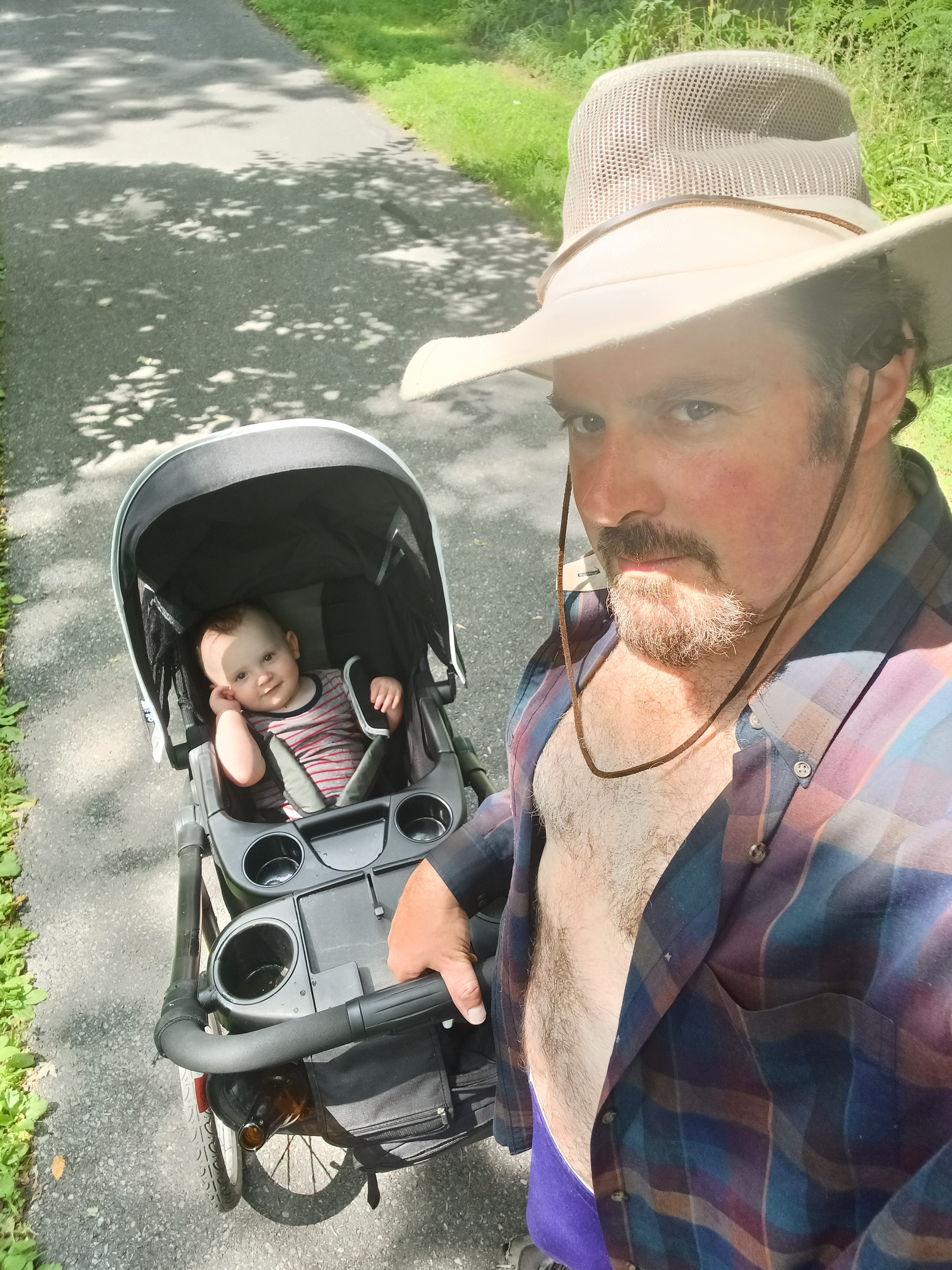
I took Ev out of the stroller and sat him on a rock again, and he was quite content looking around, getting in the water a bit again. I was a little nervous about it because he still couldn’t quite crawl yet. He could get on the floor and push himself backwards, but didn’t really get anywhere. Sitting up on his own was kind of a recent thing as well, and he was wobbly. He was pretty firm in this way by this point, but I was still concerned about him falling back and hitting his head, so I had to stay pretty close.

From here, rather than try to go back up the slope behind the water place, we continued up Water Street, and could then go left to get back on the railroad bed.

We followed the Lehigh Valley line to the south for just a bit, and then went
off into the woods to the right on a side trail to come out near the bottom of
the Pine Street Bridge. We went across the road beneath, then beneath the
bridge, and ascended the south side of it to get to the walkway across.
From the bridge, we could easily see the former Lehigh and New England Railroad
through plate girder bridge over the Lehigh to the right, which we had checked
out a bit earlier in the day. The piers on the upstream side looked to be in
deplorable condition. It is only a matter of time before they are undermined
and this bridge completely collapses.

If any flow of water hits those girders, it will act like a dam until the pressure breaks them free. These bridge parts could cause major damage downstream.

We crossed over the Lehigh Canal on the bridge, and there was a
set of steps down and back up to the right that served a business to the right.
There was only a way onto the steps from the far side, so I just had a brief
look at them.
We turned right on Front Street where there were some nice paintings on the buildings across. In the grass and in sidewalk to the right of the road, I was rather shocked to find two railroad rails. These appeared to be six foot gauge tracks, so it would either have to be trolley tracks or otherwise some sort of industrial ore movement cars. I’ve been told that all of the trolleys in Catasauqua used standard railroad gauge, but also heard that trolleys later on were forced to switch to a wider gauge as not to be used by standard railroads.

I still don’t know what the history of this was.

We couldn’t get down to the Lehigh Canal towpath, which had been
my plan, just yet. We were forced to walk Front Street as far as Willow Street.
Then, we tried to go down to the right.
At the end of the drivable street, there was an old stone building, apparently
at least part abandoned, and then a foot bridge over the somewhat sloppy wet
canal bet to reach the towpath. It was situated immediately adjacent to the
former Central Railroad of New Jersey.
The section is pretty nice, with a natural surface. I’d walked
this bit of the canal lots of times.
We continued on, and eventually came out to Race Street in Catasauqua.

The Lehigh Canal towpath switches sides of the canal at Race Street; this would have been a “change bridge”.

Unfortunately, the Lehigh Canal
on the other side of the road was closed for construction.
I had always liked the towpath on the other side for its rustic nature. It was
clear, but not some abomination of a trail that was unlike anything it was ever
intended to be. It looked like that was coming to an end.
We had to go left on Race Street and right on Lehigh Street a bit. To the left, as we went ahead, the historic George Taylor home and estate was up on the hill to the left. Taylor was one of the signers of the Declaration of Independence, and probably Catasauqua’s first wealthy resident. After the industrial revolution, “Catty” had more wealthy self made successes than any other town in America.

Across from the Taylor homestead, is the Taylor House Brewing Company.

I always try to include these breweries and wineries into the hikes, and so
this would be our late lunch stop. They had a food truck outside, like so many
of these places do.
I got I think one of their IPAs, and a tasty toasted sandwich and chips. We sat
right along the canal towpath in the front of the place and ate.
Construction was going on, and there was some orange mesh fencing between the
brewery and the towpath, but we could easily step over that and continue right
from here.
We lifted Ev in his stroller over the fence and continued on.
The trail was beat up and being widened, but it got worse.
The towpath had gone through a section where it tightly hugged a slope to the
left, but they had gone through with some giant machine and wrecked what
remained of the original towpath to make it super wide.

It looked like they are
preparing to pave it, which will be absolutely horrible. When I saw those rocks
cut into, I was very disappointed.
We continued to the south from here into Catasauqua Lake Park. The canal
was to the right, but the lake is to the left, and near the end of it there is
a splendid dock we could go out onto. I pushed Ev out onto that and took in the
view.
Just ahead of the end of the lake is old Lehigh Canal lock #37. It’s a bit
overgrown, but still there and recognizable. Most people go right by it not
realizing what it is.
Also next to this site is a giant Sycamore tree over 250 years old.
From this point, it was nice to see that the trail continued on the towpath
maybe a bit farther than it used to in recent years. We were able to walk it
parallel with Dauphin Street for a good while, and then eventually had to get
back on the street for the final stretch back to Kimmit’s Lock.
It had been exactly the kind of day I wanted it to be, and we finished early enough that I wouldn't have Ev out for all too long.
Sadly, this would be the last time I would have him out for the rest of the Summer because other inescapable responsibilities kept me from it. I worry that the amount of time inside might have been the amount of time that would have made the difference between loving nature and hating it one day. I'm probably too paranoid, but such is the nature of fatherhood I suppose.
No comments:
Post a Comment