

Hike #1479; 4/21/22 Bethlehem to Phillipsburg with Ken Zaruni and Deidre Supple
This next one would be a point to point trip on a weekday planned in kind of short order. My old friend Kenny Z was available to hike the Lehigh Canal with Ev and I, and so I decided it was a good day to do this hike.

Everen had something called Torticollis where the way he turned his head favored one side, so he had been going to physical therapy to correct it. I was bringing him every week for a while, and I shifted the appointments to the morning hours so that I could spend the day with him hiking and exploring.
In
the colder months, I didn’t want to keep him out for as long, so the two of us
did driving tours and shorter walks on those days, researching and trying to
set up then and now history compilations.
It was now warm enough that we could do longer hikes again, and I really needed it.
In December, my medical records showed that I weighed 203 lbs. From that time until this, I had gained over fifty pounds. Cutting out one fifteen-mile hike per week was enough to really put me out of shape and I could feel the difference badly.

The appointments were in Phillipsburg, so I would head from there to whatever was convenient. I’d be out by 9 am, so I really could go most anywhere and not have it be a problem.
This
time, it was easy to just go down the street and meet Ken at the boat launch by
the Northampton Street free bridge to start.
From there, we shuttled out to Illick’s Mill on the Monocacy Creek in northern
Bethlehem. This would allow us to do a little of the Monocacy Creek Greenway at
the start of the hike, and then the rest of it would be the Lehigh Canal.

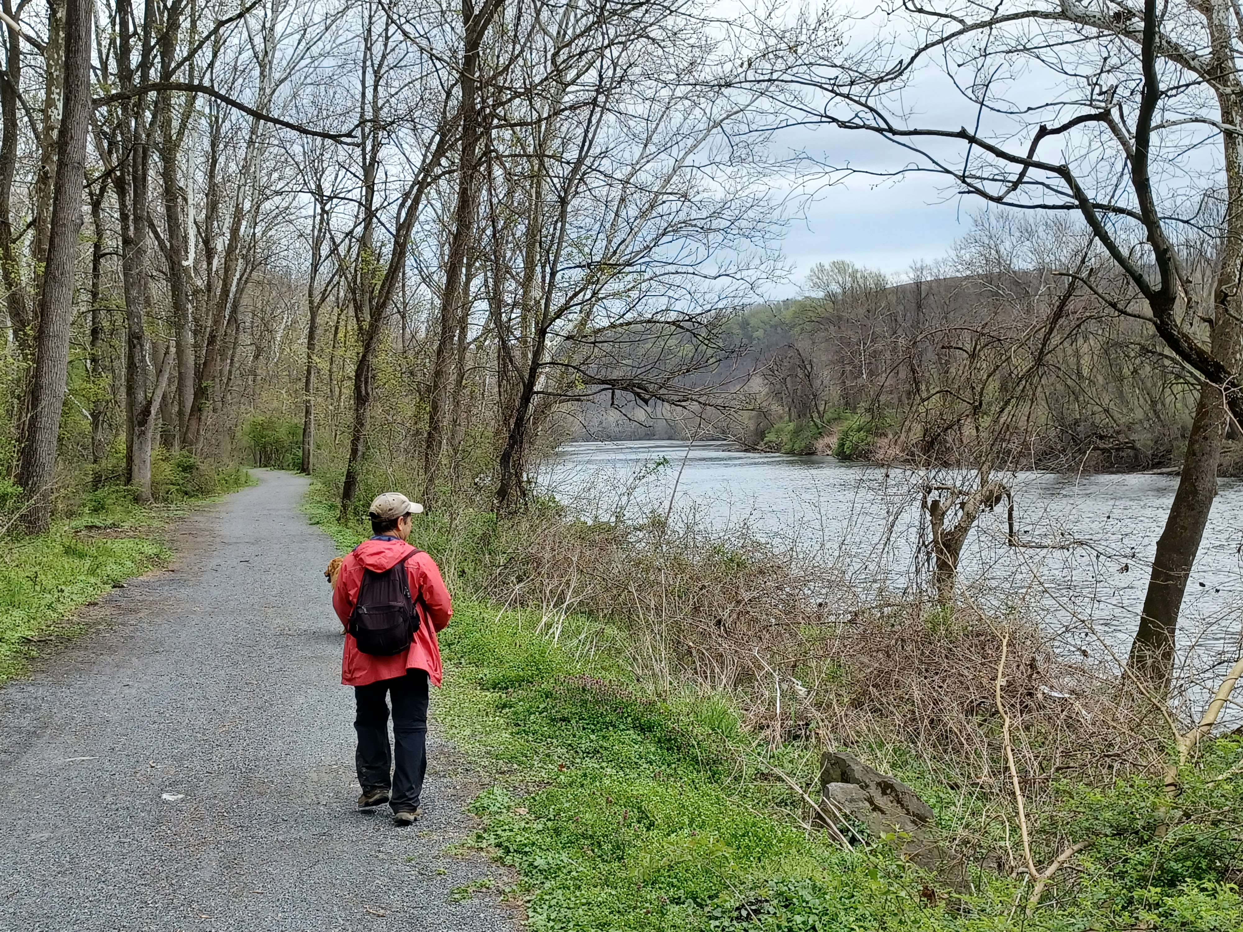
Ken and I started heading south right from there, and took to the trail closer to the Monocacy Creek. There is a crushed stone trail that goes to the west a bit more, and would have been more appropriate for the stroller, but we tried going through this way anyway.
We made our way along until I couldn’t really remain on the creek any longer. It was getting too narrow and taking the jogger stroller under and over branches any more was not working. We made a direct cut on a side path that went over the former Lehigh and New England Railroad’s Bethlehem Branch, still active, and then over to the more appropriate multi use trail.

We paralleled the tracks for a bit and went around an old quarry pond. There was some old concrete infrastructure along the quarry walls to the right of the trail as we walked by.

Pretty soon, we reached Schoenersville Road and crossed. On the other side, the trail follows the access road to the Burnside Plantation.
The Burnside
Plantation, with the 1748-1818 homestead, was an early Moravian settlement of
the area, a bit outside of the original Moravian stronghold of the downtown.
Established in 1747 on
500 acres purchased by James Burnside of Georgia, it was deeded to the Moravian
church by his wife following his death.
The homestead was expanded upon by 1818, and retains much of its historic ambiance.

The trail used to follow to the left from the driveway under a line of droopy Weeping Willows, but now it appears to go on the other side more directly out along the bottom of the farmstead.

We continued along as
the trail entered the woods again parallel with the creek.
Just a little further, we crossed the tracks of a former Lehigh and New England
Railroad branch that went west to Allentown. The tracks are in place well out
beyond Rt 378, but then end over near American Parkway somewhere. I had hiked this
through back in 2006, but it was never easy. This first part is the only clear
one.

We continued further south from here, and passed another former rail bridge site to the right of a pedestrian bridge over a small tributary. This also broke off of the line we just crossed, and must have been a southbound connector to the Bethlehem Branch nearby.
We continued ahead, and the trail goes onto an impressive long boardwalk known as Monocacy Way. It brought us out to Union Blvd, where we turned left and then crossed to the other side of the creek. We turned right to parallel the creek downstream from here through Johnston Park.

Pretty soon, we passed beneath the enormous Broad Street bridge, and then reached the grounds where there are usually lots of vendors during Musikfest.

Some of the buildings along the creek down in this area are historic mills, and it was home to one of the oldest waterworks in America dating back to the 1700s. Public water supplies were not yet common when the one here was constructed, and the older towns would have relied on wells or streams and such, and later cisterns.
We continued south beneath part of the Hill to Hill Bridge, over a foot bridge and south through a parking area to Main Street. This brought us south over the Lehigh Canal and former Central Railroad of New Jersey tracks. The station, quite a beautiful one, is still standing and now a restaurant.


Once across the canal, we immediately turned to the right onto the towpath heading east.

Just ahead from this
spot, the canal crossed the Monocacy Creek aqueduct. There is still a small
trough aqueduct that crosses here to keep the canal watered, but nothing like
it once was. Just on the other side of the aqueduct was lock 42, which still
has good lock walls and a blockage right under the foot bridge. The canal
remains watered downstream.
We had to turn right a bit onto Sand Island in order to continue on the canal because there is no walkway over the aqueduct. After that brief time on the island, we turned left over the Sand Island Park Bridge which led out just below Lock 42.

Sand Island Park Bridge spans the Monocacy
Creek just below the aqueduct site.
The rare pony truss bridge was built in 1867, and
originally carried Township Line Road over the Monocacy Creek. It was built by
the Beckel Iron Foundry and Machine Shop of Bethlehem.
It is a rare example of a cast iron truss bridge.
The style is the rarest type of historic bridge in
America, and the mid Atlantic has more examples than any other region.
The bridge was rehabilitated and relocated to
cross the same Creek at Sand Island Park in 1991.
We turned right on the towpath and continued to the east beneath the Fahy Bridge. There was a predecessor to this bridge near the spot, of through truss style construction.

Just after passing beneath the bridge, there were some nice views through the trees to the right of the Bethlehem Steel stacks and buildings, beyond the Lehigh Valley Railroad tracks.


Bethlehem has roots in the iron industry dating back to the first industrialization of the site in 1857 as the Saucona Iron Company. The name changed in 1861 and Bethlehem Iron Company operated on the site until 1899, when the owners of the company founded the Bethlehem Steel Company.

Five
years later, the Bethlehem Steel Corporation was founded to be the steel
company's corporate parent.
The
American Steel Industry faltered in the 1970s, and Bethlehem Steel ceased all
metal production on this site in 1995. Bankruptcy was filed in 2001, and
dissolution of the corporation took place in 2003.
Today, the Wind Creek Casino manages the property and has the Hoover-Mason
Trestle for public to walk along the stacks, and it’s incredibly impressive.

There weren’t a lot of leaves on the trees yet, so we had near continuous views of Bethlehem Steel as we walked, as well as some new construction going on along the property further to the east.

On the Jersey Central tracks on the other side, we soon started seeing some
tent cities in plain view directly on the other side. They used to try to hide
where they were living, but this was just obviously in view from the trail.
As
we approached the Minsi Trail Bridge over the Lehigh, we had a clear view of
the new construction of a hotel building going up. I realize that this building
completely blocks the view I’d taken of the Hoover Mason Trestle and all of the
Steel infrastructure I had taken in 2003. It’s truly a horrible piece of view
pollution.
We next passed Lock 43. I always forget this lock even exists. I always think of Freemansburg, and then the two after that on the way to Easton, but this one is rather easy to forget about.

We then continued on along the towpath toward Freemansburg. I tried to find the
location of another historic photograph with some steep rock cliffs, but I
couldn’t find it for comparison.
We crossed beneath the Freemansburg bridge, and I pointed out to Ken that this section of the canal was used in a popular movie known as “The Farmer Takes a Wife” starring Henry Fonda, to represent the original Erie Canal, because the entire stretch looked so authentic.
The canal gets a little crappy between Bethlehem and Freemansburg, but after the bridge and mill, it gets to be really nice again, and popular with walkers. We continued along parallel with the town setting, which is always quite nice.
Toward
the far side of town, we came to where there was a beat up dam, probably pretty
old, with some of the water of the canal flowing over. It was not watered as
far as Lock 44 just ahead.


Freemansburg is a great spot because the lock walls are in great shape, as is the bypass flume, and even the lock house. Unfortunately, the old Geissinger’s Mill that stood next to it is no longer standing.


I had already done a then and now featuring the mill in 2018, but I set this one up again because I figured I might be able to do it better.

.jpg)
We continued past Lock 44, and made our way along the towpath and dry canal in a section that I have always adored. Everything from Freemansburg to Rt 33 strikes me as being so secluded.

If I didn’t know any better, I might think I
was deep in Lehigh Gorge, not so close to Easton and Bethlehem. It’s just so
natural and unspoiled. There are nice giant trees, and always views of the
former Jersey Central line on the slope above us to the left.
Somewhere
in this stretch, Deidre caught up with us on her bike. She had gone to Easton
and decided to backtrack to try to catch us.
The stretch through the woods ahead was also quite nice. The entire section only comes closely parallel to a road one time from Freemansburg to the boating club property, which is the next lock.


Lock 46 was known as Hope Lock, and there is a Hope Lock Road that travels far north from this point. There is even a Hope Lock Farm way up there, which almost doesn’t make any sense until someone sees that the road used to go right down to the lock. The construction of Rt 33 through the area changed around how the roads were oriented, and so the road no longer goes straight on through.


The towpath switched sides of the canal at Hope Lock, and now it is the gravel road there that crosses below the lock rather than over the top. The lock house for Hope Lock was originally located where the Central Railroad of New Jersey is now, with a stone arch culvert. It had to be moved for the railroad and there are currently two very old houses on the other side of the culvert. One is stone, and lived in, and the other one I’m not sure about. One of them had to have been the lock house.

We followed the towpath east beneath Route 33, and then came out to the Freemansburg boat launch area.

Ken had his dog Scout with him; he had sort of inherited the dog from someone who offered to dog sit for a while back, and this was probably only his second time taking the dog out hiking with me. He brought him along on part of the anniversary hike as well, but I didn’t get to interact that much on that one.

From this point, the Lehigh Canal towpath is obliterated. It went straight, and then crossed onto an island in the Lehigh River where there was once an amusement park. In the earliest days of the canal, the towpath did remain on the near side, down to Chain Dam where boats were ferried across to the next guard lock, but that segment was abandoned early.
The trail continues along the former Central Railroad of New Jersey at this point, and it is paved. We continued ahead, and I pointed out where the junction was, now also a trail, with the branch that went up to connect with the Easton and Northern line.
We
continued along the grade to the east and reached the ball field parks before
the near Glendon Bridge, and stopped for a break there. I needed to give Ev
another diaper change before too long.
There was a portajohn out there too that had “toilet” spelled wrong as “toliet”, and someone wrote the question “is this French” next to it.

From
here, we continued east beneath the new Glendon Bridge, and then turned right
from the railroad bed along the trail to the Old Glendon Bridge. We took that
across the Lehigh and over into Hugh Moore Park to get back over to the Lehigh
Canal.
Before
heading over there, I spotted something I was quite shocked to see.
There were art sculptures we had been seeing for years, made my my friend Randy
Melick working with a guy by the name of Keifer, and they were all located along
the old Easton and Northern line in a scrap yard of of Bushkill Drive. There
were a lot of really cool pieces there, and among them was a rather abstract
version of Atlas made of blue steel and bicycles.
All of the sculptures disappeared several years ago, and so when I saw the Atlas at Hugh Moore Park, it was like seeing an old friend. It was rusty at this point, but still looking pretty good.
We
could see ruins of some of the old ironworks in the weeds, and we made our way
back onto the Lehigh Canal towpath to head east.

We continued on to Lock 47, which was a double lock, but only one of them is still in place today. We crossed the canal here down the other side, and then headed beneath the former Easton and Northern Bridge to the old toll building vault and the Outlet Lock.

Outlet Lock was constructed to replace locks 48 and 49, which were buried when
the Lehigh Valley Railroad was built through the area. The canal operated as
slack water navigation in the Lehigh River from this point back to the Delaware
Canal.
We
headed from here on along the towpath and approached Rt 611/3rd
Street Bridge, above which was the former Central Railroad of New Jersey Bridge
over the Lehigh.

We only continued a bit more from there, and turned to the right up to Rt 611. We could then follow that across the 3rd Street Bridge and out to Phillipsburg. We walked along the waterfront and checked out the views of the Morris Canal arch and the dam at the forks of the Lehigh and the Delaware.
It had been a really great day to be out, and to get some more exercise.
Hiking with Everen had become so much better in the past couple of months because he so genuinely smiles and enjoys the time being out. This might have been his last time in his infant seat on the jogger stroller as well, because he was getting too big for it.
I hope I can keep pushing him around for a bit longer, because I do love it.
No comments:
Post a Comment