

Hike #1491; 6/18/22 Hopewell to Princeton with Stephen Argentina, Brittany Weider, Jennifer Berndt, Robin Deitz, Diane Reider, ?, Gregory Andres, and Violet Chen
This next hike would be a point to point in the Princeton, much of the way covering some of the Lawrence-Hopewell Trail because it has become such a better route in recent years, but also a few other side things as well.

I had this hike set up so that I could bring my little son on it
in the carriage if necessary, but would do some of the tougher stuff if I didn’t
have him.
I ended up not having him with me this time, and so we did some
of the stuff we could only do on foot.
We met at the Mercer Mall near Joe Canal’s and Lawrenceville, which would be
our end point. I chose this because there were interesting development paths we
could connect to from the canal, and because Joe Canal’s has some really
interesting beer selection usually for cheap.

I ran in at the very start to see if there was anything of interest. I think I got something, but I don’t recall what it was.

Once we were all together, we shuttled with as few cars as
possible to the north a bit to start our hike out in Hopewell.
I had done many variations of these hikes before, but I wanted to try to cover
some new stuff, so I looked at the entire route through those eyes.
We parked on South Greenwood Avenue in Hopewell, which is adjacent to Hopewell Park, an attractive little park with a pretty pavilion in the middle of it. Several trails break away from this area, and some of them I’d never even done in the daylight, or barely any daylight anyway. They were mostly night hikes when I’d come through here.
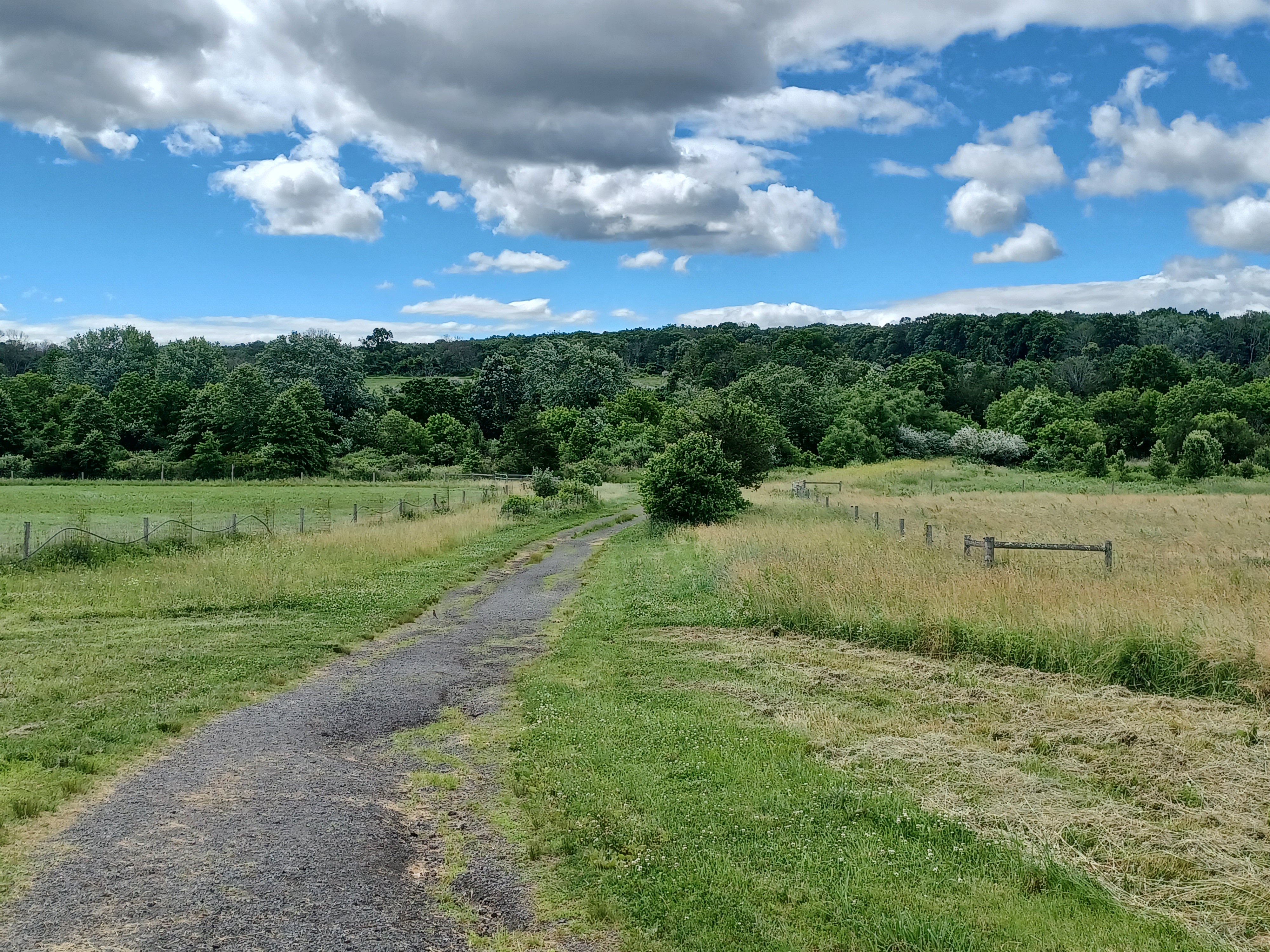
We started by heading to the southwest into the wooded section of the park.

There was a little foot bridge over the Beden Brook, then a little
up hill next to a nice big tree, and we skirted a field edge briefly. It was
already getting hot, so I figured we’d try to stay in the shade as much as
possible. There was going to be a lot of open area walking on this one already.
We weaved around through the woods a bit, and then came back
close to the Beden Brook again. We crossed the brook on another foot bridge
heading to the east, and then came out to a wide open field. We skirted the
south side of the field and headed east.
1964, St Michael's Orphanage
We headed pretty directly east to Princeton Ave, Route 569, to come out just south of a Citgo Station. When no one wanted to go up to get drinks or anything near there, we cut a corner and went right behind the backs of other businesses, and came out almost directly across from the entrance road to the St. Michael’s Farm Preserve.
The preserve was formerly the site of St.
Michael’s Orphanage and Industrial School, which was operated by the Catholic
Diocese of Trenton from 1896 until 1973. After the orphanage was closed, the
large building where students lived and studied was torn down. Most of the land
was leased to a local farmer. Despite plans to develop the land, D&R
Greenways eventually purchased it to turn it into the preserve.
We continued to the east a bit, then to the southeast to head toward the center
of the property. There is a barn structure out there on a height of land.

This was the McComb Barn, originally built in 1840 in Belle Mead NJ.

It was dismantled at that location and saved by barn
collector, Dr. David Reynolds. A trustee for D&R Greenway Land Trust, Dr.
Reynolds donated the barn for use at the St. Michael's Farm Preserve. It’s now
used to store a tractor, materials, and such things for use on the preserve.
There is a wind vane on top of it that has “D&R Greenways” written on it.
When we got there, a guy was outside cutting wood with a table saw. We gave a
wave but opted not to try to bother him too much.
We crossed over the Beden Brook yet again on an old farm road within the pretty topography. Jen was running a bit late, so I directed her to a parking area we would be close to off of Aunt Molly Road on the east side of the preserve.

Once across the brook, we turned left, then right parallel with
Aunt Molly Road, uphill a bit more.
After a little bit, we reached a small overlook area where Jen
was waiting for us.
I had been considering going through the property a different way to the north, but there is a lot of traffic to the east, and I wanted to get to other stuff. The other thing was, Aunt Molly Road was unpaved, and a really nice route to walk. I chose to shift the hike onto that and we’d follow it to the south.

We came out to Cherry Valley Road, and turned to the right into the little settlement of Mt Rose. For a sleepy little unincorporated community, people sure drive fast through there.

The settlement started when the first store opened up there in 1822, and more
businesses followed. It still retains some historic ambiance.
We turned left onto Pennington-Rocky Hill Road, which was far too busy to be
walking the narrow shoulder we were walking. This would not have been a good
carriage route.
Fortunately, we didn’t have very far to go on this before turning left onto the paved Lawrence-Hopewell Trail. This section has been in place for over five years and amazingly still has not found its way onto Google Maps.

We turned left and soon entered some nice woods and crossed a little foot bridge. This section was part of the Mt Rose Preserve.

I had walked through this right after it was first opened, but
only as parts of night hikes. I don’t know that I’ve ever walked it during the
day until this time. On one occasion, police were driving the trail and we had
to dash off into the weeds.
There are more side trails through this preserve that I also have never done before, but they would have to wait for another time, because I kind of knew I had planned for more than enough for this time.

While walking, we saw some Spotted Lanternfly nymphs on the trees. They hadn’t been as bad as in previous years, but they’re still a major problem.

We continued on the trail, which soon paralleled Carter Road,
and then came out to a parking area. The trail turned to the left and crossed
Carter Road with a crosswalk, then turned right. I had been excited to see
this, because I figured the trail went totally through now. But it didn’t.
I was shocked yet again when we got to the end of the trail, at the NJ Biopharmaceuticals place. This and another area of stuff (one of them used to be Bristol-Meyers-Squibb) had the property, and we had gone through only at night before. I had actually lost one of my phones while trying to go through these properties in the dark.


The trail just sort of ended in their loop drop off area, so we continued walking through their parking lot.

There is a pedestrian trail at the
southeast end of the property, so we walked through to that. A sign there
warned that it was the end of “landlord maintained property” and that the trail
was “not maintained for use”, which we found funny.
The paved trail does lead to and around some buildings to the south, but I didn’t want to be seen wandering with a group through where I shouldn’t be.
I decided we would move quickly, and head to the east around the facility, the same way we used to do at night.

Once we got to the east side of the mowed area, there was a path into the woods a bit. We had a look at it, but it turned out to be just a sort of path that goes along a utility right of way. We turned to the south through a field area, which looked different than when I’d walked it even before.
We continued past a ball field, which now had no trespassing
signs on it, and was completely overgrown. One would never have known they were
ball fields if it weren’t for the existing backstop.
Our trajectory was one that would bring us out to Cleveland Road to the south. Rather than go out and around, I decided we would go to the edge of the field, and then just cut through the line of trees on the south side to come out. I figured that would be where the trail will eventually go anyway.

This turned out to be really kind of rough, maybe the toughest of the entire hike. It was a brutal push through only a bit of weeds, but it was thick. Fortunately, we got through out to Cleveland Road and went to the left.

Apparently, former President Grover Cleveland either lived on or
at least had a home on this road. It was pointed out to me on the left side of
the road, and I took a photo to remind myself to look it up later.
I was surprised when I went to research it that I could find no mention of
Cleveland having lived on this road. It was a pretty nice old farm house.
As we continued down the road, it changed names to Pretty Brook Road, and then ended at Province Line Road.

This road marked the Province Line, also known as the Keith Line, which separated the colonies of East and West New Jersey in 1686.

We turned right on the road, which at that point is still part
of the Lawrence-Hopewell Trail. Province Line Road used to go through to the
south, but now it is closed to all but pedestrian traffic.
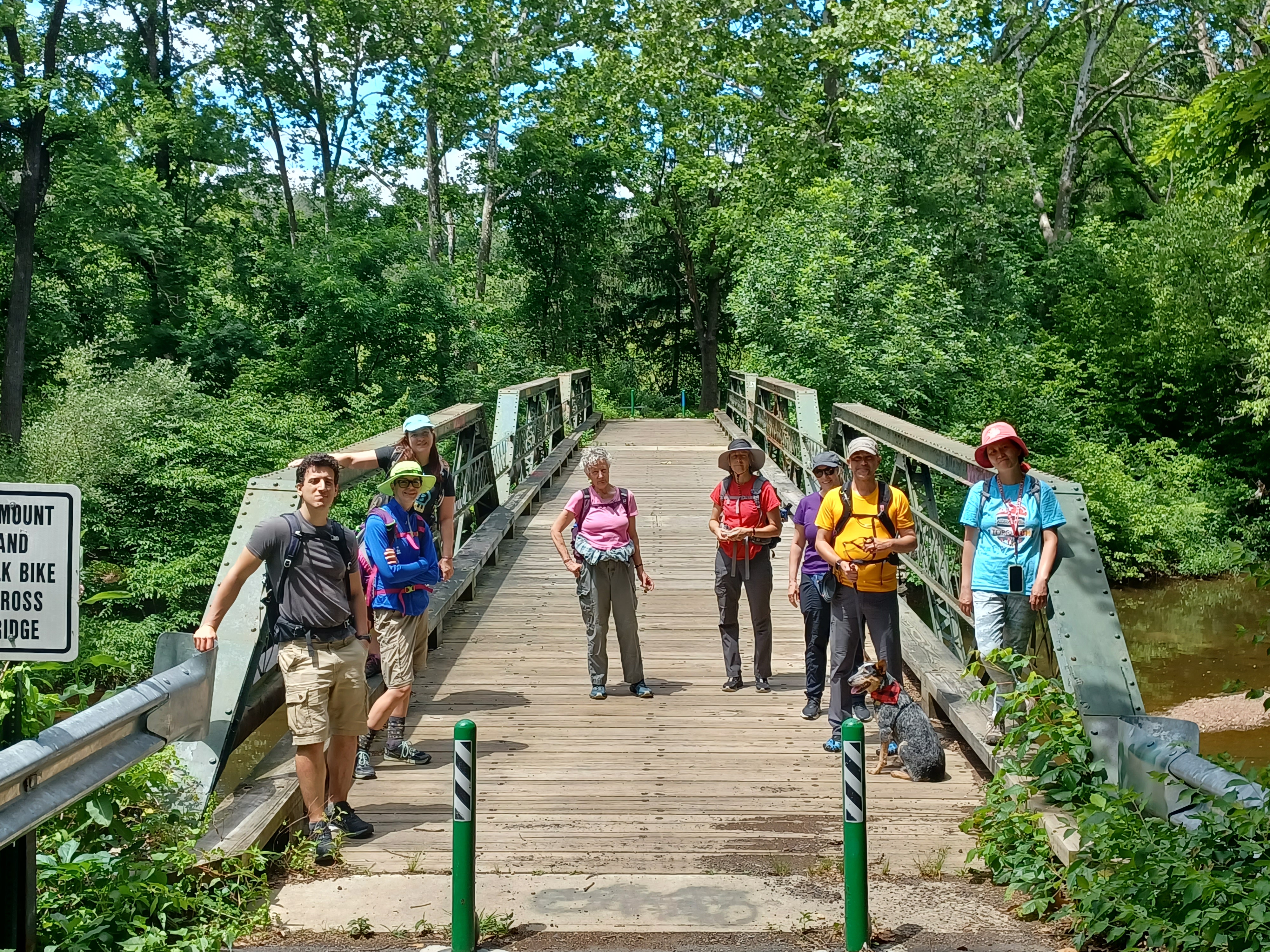
We headed downhill, and soon reached the triple pony truss
bridge over the Stony Brook.
The first time I had walked across this bridge, in 2009, it was in quite poor shape. The decking was all rotted out pretty badly, and plywood was placed on top for at least some degree of safety.

By the next time I visited the bridge, which might have been 2014, it had been
completely refurbished for use as part of the trail.
The bridge was built in 1903 by the Berlin Construction Company of Berlin
Connecticut.
The brook looked very welcoming, and it was hot out, so I went down and had a great dip in the creek. It was surprisingly not too very cold at all.

From this point, it had been my plan to hike the Laura Chauncey Trail to the west, around the ETS facility, which is where all the SAT tests and such for students used to be graded. I’d walked the trail before, and it is quite nice.

However, thanks to Violet, we made a change of plans to something I’d not done
before.
Violet said there was a better trail that went to the east from
the bridge, and we could cut up to the development to the south from there. I
started considering what he was saying and went over the maps to see how we
could work this into our trajectory, and it would be perfect.
We started walking the trail to the east, and it was quite pleasant with several views of the Stony Brook along the way. It followed the stream pretty closely.

The farther we went, the less obvious the trail was, but it was still a really great area.

We reached a bend in the river, and Violet wanted me to see a large rock and interesting tree out there. The rock looked to be obviously cut, and probably part of some old mill or something that is long gone, and a somewhat hollow trees was situated quite close to it.
We took another nice break here and I went for another nice dip.
Near this point, we were at a power line crossing, which was my signal that we needed to head uphill away from the brook.

There was no good trail up, we just had to sort of switchback
and bushwhack a bit, until we reached the multi use trail that connected
between sections of developments at the top.
Once we were on the path, we turned right. This brought us back
onto the utility line, turned left, and then crossed Christopher Drive.
There is an intersection of paved development trails just after that, and I’d followed these before. We headed south through the middle of grassy fields, kept to the left side of a loop of pathways, and then came out to Christopher Drive once more.


We turned right, and then left on a grassy swath of land parallel with Rosedale Road. The line of trees next to the grassy swath was once the Johnson Trolley Line, the fast line trolley between Trenton and Princeton that was mostly off road, making it faster.

A paved trail paralleled the road when we got away from the grass, and we
headed downhill to the Stony Brook again. We crossed, and foot paths went to
the north and south side of the road, and we continued south through the
Greenway Meadows property.
This was a beautiful, long stretch of foot path along the Stony
Brook for a ways heading down stream. It’s one of the best foot path sections
in Princeton.
Eventually, we reached the property of the Hun School, and we crossed a wooden foot bridge over the Stony Brook to the right.


The trail then turned left and became more developed and paved, and brought us up parallel with private homes on the left, and a golf course on the right. Pretty soon, the trail turned right and closely paralleled Rt 206.

The trail ended across Rt 206 from Hutchinson Drive. So, we
crossed over and walked Hutchinson Drive to the south through the development.
This went by pretty quickly, and toward the end of the development we could
turn off to the left beneath trees on some mowed grass.
Near the end of Hutchinson Drive, the road crossed a paved trail that closely
parallels Mercer Road. We turned left
and followed the trail northeast.
Pretty soon, we crossed over the Stony Brook, at a lovely spot with a great view of the triple arch Stony Brook Bridge built in 1792.

It was said that the Continental Army burned the original bridge at the location during the time of the Battle of Princeton, and that this one replaced it.

The trail came up to the intersection of Mercer Road and Quaker
Road, and we crossed the intersection directly to reach the property of the
Princeton Friends School. We walked back through the grounds and past historic
homes and the cemetery to the historic Princeton Friends Meeting House.
Originally the Stony Brook Meeting House, now
known as Princeton, was built in 1761 on the same Foundation footprint as the
original wooden structure from 1724.
Six Quaker families established their homes along Stony
Brook around 1696.

Benjamin Clarke donated 9.6 acres for this Quaker Friends Meeting House and to establish a burial ground in 1709. The cemetery was established almost immediately, while Quakers met in area homes until the first meeting house was constructed.

After the Battle of Princeton in 1777, the Meeting
House served as a field hospital for both American and British soldiers.
The Princeton Friends Meeting House is still
actively used today.
We continued on the path from the meeting house through the woods, which I understand to be the original road to Princeton before modern day Mercer Road was constructed, to head toward Princeton Battlefield State Park. It used to go right by the meeting house, and I assume turned at that intersection at Quaker Road to take a more southerly route than the current road.

We emerged from the woods at the parking lot at Princeton Battlefield, and to the right we could see

The Thomas Clarke House, the same Clarke who
made the aforementioned donation of the meeting house, built the home in 1772. The
Clarkes were third generation Quakers from the Stony Brook settlement on the
west side a Princeton.
During the Battle of Princeton in January 1777,
the house served as a temporary field hospital for both American and British
soldiers.
General Hugh Mercer died of his wounds nine days
later.
Mercer was treated only one room away from British
commander McPherson; Quakers are a peaceful people, and refuse to choose sides
in the war, and thus both sides were treated equally in the home.


Mercer died of multiple stabs from bayonet attack, and the incident was publicized heavily in America as an illustration of the brutality of the enemy.

Once we were inside, there was a young lady working for state
park service giving historic dissertations about the history of the building,
and she was quite impressive with her ability to rattle off all of the information.
We toured all of the rooms that were open, and we were pointed
to the rooms where the two opposing generals had been staying.
From here, we headed down to the original road to Princeton and turned left. There was a giant tree down over the way, so we couldn’t go out to the battlefield section I wanted to hit. We instead went straight along a field edge and into the woods.

Just inside the woods was the original trolley right of way that served Princeton. The Johnson Trolley line was further to the north, but this was the earlier and slower one, because the majority of it was on public streets.

This section as we headed into Institute Woods was the only
significant section that was what is referred to as “cross country”.
We headed south on a trail known as Founders Walk, and then
reached the swinging bridge over the Stony Brook, which people always like.
We crossed the bridge, and the trail ahead is usually under water backed up near the canal, but an unmarked and informal trail leads to the right, around the wet area and out to the Delaware and Raritan Canal. We followed that.


We turned right and followed the canal towpath for a relaxing majority of the rest of the distance.

The canal, which at this point was completed in 1832, is 75 feet wide, which
was quite a bit wider than the Morris Canal, Delaware Canal, or Lehigh Canal.
This one matched up more with the Schuylkill Navigation, which was much wider.
We continued past the two golf course bridges at Princeton
Country Club, and onward to parallel Quaker Road.
When Quaker Road turned left, so did we.
My final plan was to head along some development paths to the south of there
back to Mercer Mall.


It was really a great hike, covering stuff I knew and loved, and stuff I didn't know but knew I would love, and I think the rest of the group did too.

No comments:
Post a Comment