

Hike #1569: 9/10/23 Lempeter Twp to Rock Hill with Diane Reider and Everen
This next hike would be the next in my Conestoga Trail series. Because there is so much cool stuff throughout the area, I made a little more than half of the distance Conestoga Trail, and the other stuff in other area trails.

It really is difficult to promote the kind of hikes I want to do, especially the ones that I'm particularly excited about doing.
Most other clubs do far less mileage than Metrotrails does, and I think they are seriously missing out on a full experience when trying to do less miles. That, of course, is just my opinion, and I run the hikes the way I want to do them. Obviously, this impedes my ability to pull in more people, but I think I am also weeding out potential complainers and problem people in doing so. My experiences trying my hand at shorter hikes I feel have proven this to be so.
If mileage were not enough, I'm posting stuff no one has ever heard of. People who want hiker groupies know to post places that everyone knows the name of, places they've been and enjoyed once, and will just keep going to.

I am always trying to go somewhere completely new to me, and places that might only look remotely interesting from a map standpoint.

I went over the route for this hike probably a dozen times. I knew I wanted to end at the Rock Hill access on the Conestoga River, because then we'd have a swim spot at the end, and I knew I needed to get on the Conestoga Trail where we left off at the old Lincoln Highway route in Lancaster.
I needed to figure out where the hike was going to take us prior to that.
I had looked over different trails and such to the east, the north, and the west, to come back to where we had been on Conestoga Trail.

In doing this, I first found the apartment complexes and school campuses that looked rather interesting, but then I found a way of connecting to the Mill Creek, a tributary of the Conestoga River we would be following later anyway, but in a section that had more trails along it.

I felt like I pieced together something particularly interesting. It reminded me of some of the hikes I'd put together as night hikes in the past throughout NJ and eastern Pennsylvania.
As the day of the hike was approaching, there was about a fifty percent chance of precipitation. The forecast was actually pretty good, mostly cloudy with a bit of rain here and there. A scattered storm here and there would actually just feel good in the heat. September was hotter, in my opinion, than the entire rest of the Summer this year, so being along water was important, and rain was going to help.

My plan almost shifted last minute; Ev's mom told me she was going to take him to Land of Make Believe on Sunday, because she got a free ticket.

I didn't want to argue that too much, and so I made an alternate plan to do the Conestoga Trail section to the south that could not easily be done with a stroller.
The morning of the hike, I was told to take him anyway because it was going to rain. So we went along with the original plan anyway, all because of a rainy forecast that never amounted to much of anything until the end of the day.
Still, apparently people haven't learned that rain days end up being great days, and only Diane showed up to meet Ev and I at the meeting point.

We waited a while to see if anyone would show up at Rock Hill, and there was no one.

We shuttled in my car to our starting point, which was in Lempeter Township, in a community that I guess is called Summer Breeze, because that was the name of the trail system we went on.
There was a parking area on the right side of Cool Creek Way, in the development north of Lempeter.
Getting to the hike, Ev and I headed through one downpour, but it was totally clear before we reached the meeting point on the hike. It was just cloudy when we actually started walking.
The Summer Breeze Community Trail system went across Cool Creek Way at the parking area we started in. It went to the east into a wide open field with a loop and connections, and to the west across the road and out behind neighborhood homes.
There were a few different ways we could have done this, but I chose heading to the west across the road, and then north behind the homes in the shade.
I didn't make Ev get in the stroller at all for the start. He had his boots on, and was doing quite well moving along on his own.

We headed gradually uphill behind apartments, parallel with Cool Creek Way on the opposite side of the homes, and then the trail turned to the right and crossed the road once again.

The trail paralleled Steepbank Road which was to the south of us, but it skirted the edge of a line of trees, which separated it from the next bit of the development to the north.
Pretty soon, another paved trail came in an intersected on the right. If we had gone into the open area from where we parked and made a left, it would have brought us here in similar distance, but I found that the route we took was probably the one to look nicest.
We continued along the trail to another intersection, where we kept to the left. This brought us down a rather steep slope and to a building that is used as a Summer Theatre camp. The trails split a few ways here, and we kept behind the building, turned left at the next intersection, and then reached Conard Road.

The paved pathway turned left along the road, but directly across the street from the intersection of Conard and Cool Creek Way, the next bit of trail entered the woods.

This was the Mill Creek Neighborhood Park. I figured that this might be a rougher section of foot path and tree roots where Ev might have a hard time walking, or I might have a very hard time with the stroller.
I had not had to put Ev in the stroller just yet. He was still happy to walk, but I thought for sure it would get difficult soon, but it didn't.
The Mill Creek Neighborhood Park was about as nice as could be. The entire trail was surfaced with wood chips, it was wide, and it was very easy to push the stroller through.

The creek was good sized, but not too big. It had occasional riffles of rock outcrops that it flowed over, and there were nice benches with interpretive signs along the way.

We were never too far from homes, and some of them had their own accesses to the creek. A few other people were walking through while we were in there, but it was never crowded.
When we had a nice spot, I brought Ev to the water so he could throw some stones in, and I waded in.
I was wearing my beat up old bowling shoes on this one again, which had hurt me pretty bad on previous hikes. About a week prior, I wore horrible socks and they basically cut open from them. I had gaping holes in my foot that made it really tough to walk.

This time, the wounds were healing up pretty well, and I just wore a sort of better sock with more of a heel so it wouldn't be as bad.

This still ended up being a problem, because the thin red socks I thought were good wore a hole in them from the shoes, and I had to regularly adjust the shoes to cover my ankle area where the hole was cut. I ended up wearing the scab off anyway.
We continued along the path, which went to the north, cut around to the east with the upstream creek, then another path came in on the right from the development, and we shifted to the north again.
The homes on the other side of the creek looked like they were extremely rich estates. One house on our side of the creek near the bend had a metal cut out of a Great Blue Heron, and I figured it might have been a community building of some sort, but I think it was a townhouse.

We continued and the trail rose to a higher elevation than the creek, which afforded us some better views, and we headed soon to the south, away from the creek.

The trail merged into a sidewalk off of a road known as White Tail Path. We continued south here, crossed the road, and followed the sidwalk along the west side, because that one deviated from the road a little more than the one on the east, and I figured that would be nicer.
The next road in the development was called Little Hill. Directly across the intersection of Little Hill and White Tail path was a trail that meandered to the south in the development. We followed it ahead into an open grassy area, beneath a power line and between two lines of houses.

We continued out to Little Hill once again, crossed, and then continued parallel on another path with Thistle Lane.

Once again, the sidewalk or path on the west side of the road looked more inviting, so we followed that one to the south, pretty much to the end of the development at Windy Hill Road, where we turned left.
We exited the development, and then continued to the east on Windy Hill Road. There was no sidewalk, but the road wasn't all tha busy. We just kept to the left side as best we could.
We followed the road out to the intersection with the Strasburg Pike and turned to the left.

This was a busier road, with even less of a shoulder on it. I tried to stay in the grass of the adjacent yards as we went through here.

Ev wasn't happy with being in his stroller at this moment, and I got him to be happier by giving him more chocolate milk in his bottle I'd started the day with.
It started out as just regular milk, which he had some of, but then when it was down just a bit, I added some chocolate. He drank some down, and I added some more.
I'd bought two quarts in the morning and already drank one of them myself, and a little of the second one. I wanted to save a good amount for Ev, and I knew Clover Farms was really good and I'd want to have an entire one to myself.

As we walked up this road, which had next to no shoulder, especially where there was a small bridge over a tributary, so we had to move fast through those bits. I kept moving Ev off to the side and adding more chocolate milk to his regular milk, so it kept getting more chocolatey.

Soon, we approached the old Millport Mill and Olde Mill House Shop. The latter was the former miller's house directly across the street from the mill.
This little area was the community known as Fertility. Yet another kind of funny name to add to the list including Blue Ball, Virginville, Bird In Hand, Intercourse, and others.
The mill was known as the Fertility Roller Mill as well as the Millport Mill. The brick mill was built by Isaac Groff in 1882, and the miller's house where he lived across the pike was built of cut stone.

The mill was still used as a feed mill well into the 1900s, but by the 1990s, it was relegated to just being used for storage, although it has been kept in very good repair.

We switched sides of the road because the miller's house now has the shops on the property, and there is a good walkway in front of the house. There is also a walkway over the Mill Creek bridge just ahead.
Just upstream from the bridge, we had a good view of the dam that served the mill, as well as the old mill race. A private home on the far side had a great private access to the inviting looking creek.
Once we were across the creek, a path broke away from the road from the sidewalk to closely parallel. We followed this to a bridge that went across a small tributary into Flory Park.

We turned here, and reached the parking areas. Here, there was a sign reading buggies only were allowed into a spot to the left. I at first thought that this was a trail that only buggies were permitted on, then a parking area, but it turned out it was a turn around for them!

It's always cool when we go to an area unfamiliar to us, and find these regional identities and nuances that are unlike what we typically see.
We continued from this lot past the turnaround, and along a mowed and path along the tributary heading north. Just ahead, the path went onto a ramp with hand rails.
This led uphill to the Walmart complex to the north. I had considered possibly staying lower along the tributary, because the path seemed to remain good down there, but I didn't know what the access might be like at the far end of that swath, and the ramp looked to be pretty cool anyway.
There was a tree partially down over the path, and I told Ev to duck as we went under it, and he respoded "quack quack quack".

This was actually a very long ramp. We followed it up toward the top at the Walmart lot, and just before reaching that point, I used the opportunity down low and still relatively out of sight to change Ev's diaper. We'd covered a good distance and I wanted to deal with that while I had the means to dispose of the diaper.

He had only been in the stroller a bit of time after walking along a lot of trail, and after the change, I let him stay out of it again for a bit. Diane took his hand, and I walked the diaper and some of the other garbage from the stroller over to the nearest trash can.
We continued to the north along the edge of the Walmart parking lot, and I noticed by looking to the left that it was a good thing we didn't try to follow that park land to the north. There was no good way up through the weeds to the left, and although the mowed swath continued almost all the way to Rt 462, the old Lincoln Highway, the path did not go through. There would have been some crummy bushwhacking and/or a stream crossing.
 |
| Ev's mom at the same spot as Ev 12 years earlier |

We turned left on 462 and crossed the culvert for the tributary, and then passed through the front of the Turkey Hill. Just ahead, the Brewers Outlet East was along the road.

I had seen this on the map, and figured it might be a good opportunity to get some good, inexpensive but strong regional beers, but unfortunately it was not yet open. I figured we would be to this point around noon, but we were making better time than I thought we would, at first at least.
I decided we wouldn't wait, and instead just went across the highway at the nearest crosswalk. We let Ev hit the buttons, which he always loves. He was walking this entire time from the Walmart.
On the other side, we walked through some parking lots, and then along a retention pond and lawn of a paint store. When we got to the end of that lot, I noticed that Ev's bottle was missing, which I'd just topped off with chocolate milk.

I didn't want to lose a bottle, nor did I want to lose out on any of his drink, so I ran back to look for it.

When I pushed the stroller up from the retention pond, it was really steep, so I felt almost sure that it would be there.
I didn't see the bottle anywhere, and I was out of breath from running back. I decided to dash back across the busy highway and look along the road in that last section, but saw nothing.
Then, I went back to the liquor store, and the bottle was sitting on the bench out front, right where Ev sat it down.

I grabbed it, and then rather than use the crosswalk, I dashed back across the highway to get back to Ev, Diane, and the stroller.

Ev was ready to get in the stroller at this point. I picked him up and put him in, and handed him his bottle. He drank it for a little while, but then as he tends to do, he chucked it to the right.
Although he does this all the time and it usually ends up being okay, this time it busted open and the chocolate milk went all over the road. I always tell him throwing things is bad, and hopefully one of these days it'll sink in.
We continued ahead just a bit more, to an insurance agent parking lot. There, we headed into the back, from which we were able to walk directly into the mowed Mellinger Mennonite Cemetery.

This was a pleasant walk, with a view to the west where there was an odd looking water tower. We continued through the cemetery, and I chose a line to walk that was about a block's distance from the people who were there mourning.

We walked up a lane generally to the north, and at the last one that went to the west, we turned. This brought us out to Greenfield Road, where we turned left.
We only continued a couple of blocks, and then turned left on Serene Way, which led into a townhouse complex. We remained on the road, and passed by several other people walking through.
This was a rather uncertain part of the hike I planned. I wanted to cut from this apartment complex directly west to the Rosewood Terrace Apartments, but I had nothing showing that there was a path cutting through. I just assumed one must exist.

We made our way through, and the road shifted from west to north, and the cul de sac at the end. I still didn't see any good way through, so we pulled into the driveway of the last building.

At the end, when I didn't see a good path, I just pushed the stroller on into a line of evergreens that were planted as a buffer between the two developments. It wasn't so hard, I just had to flip Ev around backwards and pull him through it, then down the slope to Basswood Drive on the other side.
We got through with very little problem, and then turned to the right. After a short bit, there actually was a path that cut through, and we just didn't go far enough north to get through that way.

We went to a sidewalk at a section of parking area, and at the end of it, we turned right on Honeylocust Square. In a short distance, we passed a building on the left, and then cut uphill into a lawn area and a courtyard between all of the buildings.

We headed straight across, and at the end of this courtyard area, there was an enormous tree. Of course, we had to go up to it and check closer.
To my great surprise, this was a Chestnut tree. The leaves looked consistent with American Chestnut, in which case this would be the largest specimen of that species I'd ever seen.
In the early 1900s, most of the American Chestnuts were killed off by blight, and although they're not extinct, they only grow to about fifteen feet tall before the blight takes them out.

This tree did not stand as straight as American Chestnuts should, but it was growing out in an open area, which means that it would end up growing more oddly.

The leaves did not appear shiny to me, and they were elongated more, which is sort of what the American Chestnut are like.
The Chinese Chestnut, which is the introduced species, looks very similar but has its differences. I assumed that this specimen was far too big and old to have been the Chinese variety, especially on the outskirts of Lancaster, but then I found that the Chinese variety were introduced to North America in the late 1800s, so it could possibly be Chinese.
Whatever the case, it was an impressive tree I was happy to see. I had a closer look at it, took a few photos and a video of it, and we moved on out of the complex to the north.

We exited from a sidewalk to the intersection of Chateau Road and Rt 340, Old Philadelphia Pike. We crossed almost directly over the road, through a lot where an abandoned house had recently been demolished. There was no sign really that it had ever been there.

We headed out the back of the former yard and into a wide open, grassy area adjacent to an apartment development called Cedar Acres East.
Diane commented about how worthless it is to have all of this mowed grass. It wasn't sports fields or anything, and it could easily be in agriculture. We continued through this field, and there was a large steel fabrication place in view. We could see lots of girder bridge segments, and it turns out this was a railroad yard associated with the former Pennsylvania Railroad, which is just to the north.
We kept to the left, went a short distance into a parking lot, and then cut to the right and down a grassy slope to the north. We headed gradually downhill parallel with the railroad's steel yard, and into a wide, mowed trail. In a little bit, another path continued straight, toward the still active former Pennsylvania Railroad.

This section of the Pennsylvania Railroad was the Main Line of Public Works first, completed in 1829 as part of the combined canal and rail route from Philadelphia to Pittsburgh.
I already started a series of hikes to try to trace the historic route out of Philly, but hopefully I'll get to all of it which will bring us back to this point again.
We made a left turn on another mowed path, which skirted a ditch to the right. I can't help but wonder if maybe this could have been the original rail alignment. I know it deviates at a lot of places, because the first segment we walked had a whole lot of that by Philly.

It warrants a lot more research before I assume too much.

We continued along the mowed path, and a school bus came into view. Ev is getting so smart with recognition. For a while now, every time he sees a bus, he starts singing "Wheels on the Bus", only with "da da da da da da da" instead of the words. Whenever we see train tracks or even mention them, he says "choo choo".
We continued on the mowed route to the west, which reached a line of trees and had a good mowed cut to a dead end bit of paved trail, which led in a short distance to a paved trail where we could go straight or left.

Ahead, the trail went beneath another foot bridge and along a drainage area, while to the left it went uphill slightly and around the tree lines skirting developments. I chose to the left to follow from here.

This trail was a perimeter around the property of the Harrisburg Area Community College-Lancaster Campus. Diane said she had worked here once because they were on contract with her building inspections.
We continued on the trail, and a couple of people went by us along the way. The trail remained high enough up that it afforded us a pretty good view of the college buildings.
The trail took us downhill to Campus Drive. We crossed over and behind a bank through its parking lot, then through a grassy area to reach the Weis Supermarket parking lot.

At this point, we had pretty much reached where we left off on the Conestoga Trail on the previous hike. The trail follows Pitney Road south to the old Lincoln Highway, which becomes King Street.

This area was where I finished my second ever Conestoga Trail hike, and started my third and final with Jillane. We had turned away from the trail near this spot on the last one, because we went over the mileage I was planning.
We had several food options prior to this, but I wasn't hungry and I had enough stuff for Ev, and since Diane was good too, we kept moving on.
We turned left from the lot on Pitney Street, and then right on the old Lincoln Highway route as it became King Street to cross over the Conestoga River.

There was a stone tablet in the middle of the bridge that was part of the original bridge across at this spot, erected in 1798. In addition, there was an old mile marker from the early highway denoting 61 miles to Philadelphia and 1 mile to Lancaster.

The Lincoln Highway was the nation's first transcontinental highway, completed in 1913 from Times Square to Lincoln Park in San Fransisco.
The trail continues across the bridge, and then turns left onto busy Conestoga Drive. Diane commented that there were so many street names with the Conestoga name, it must be a nightmare for emergency personnel.
She was right; in this area, we had South Conestoga Drive, North Conestoga Drive, Conestoga Blvd, Conestoga Road, Conestoga Woods Road, and the hike would end at a totally different Conestoga Blvd.

The road was kind of tight, with little room to pull the stroller off. I had to watch closely and use yards as best I could through this stretch, which fortunately didn't last all that long.

After the intersection with Garden City Drive, there was a paved trail that appeared along the right side of the road, which made the walk way nicer.
Just after this, there was also a rather overgrown trail that went into the woods to the right. This apparently goes out to an open field and around the outside of it to terminate at the sign for the Conestoga Greenway Trail.
This section ahead was where the trail gets really nice and easy for a while.

This used to be a foot path until just before my first time hiking it. It was apparently cut along the edge of the Conestoga River, but then the city upgraded it as a wide, paved path.

I remember my first two times on this section, I could occasionally still see the sort of orange blazes down into the woods to the left, because the modern trail deviates just slightly from the old foot path at times.
The trail took us along the edge of the road for a little bit, and then came to the Conestoga Greenway sign, and I got a picture of Ev in the stroller at about the same spot I'd gotten a photo of Jillane about twelve years earlier.
We continued on the trail ahead, which soon was on its own; the roadway continued uphill to the right, and the trail remained along the edge of the river ahead.

At about this spot, there was a little access path to the left, so I went to check it out.

Below, there was an old dam remnant. The abutments to the dam were pretty obvious, with some concrete, but the original masonry components were obvious along the shore.
I went into the creek and laid down in it for a moment to cool off. In doing so, I could see downstream that there was a locatio of a second, even earlier dam. The edges of it were still apparently, and there was a lot of rubble rock from it still in the river.
The dams certainly must have served area mills, which are probably all long gone today. They were not part of the Conestoga Navigation system, because the head of navigation was at about where Strawberry Street is today.

We continued along the trail, past some apartments to the right, and then beneath Circle Avenue which leads to the Lancaster County Youth Intervention Center.

It was a very pleasant walk on the trail from here out to Duke Street. At that point, the trail turns left and crosses the Conestoga River.
The trail passes through a grassy swath above the gateway entrance to "Williamson Park". This must be an old regional park that predated Lancaster Central Park, of which this is part today.
I didn't have a written guide to the trail this time like I did the other time I'd walked it, so we just had to go by the blazes. This proved to be a little difficult at times because there were various overlapping trails.

I didn't see the orange or mauve Conestoga Trail blazes at first on everything, but we found our way alright. We missed the trail turn and went under the Williamson archway, and then found that the blue trail and Conestoga Trail deviate.

Conestoga Trail goes uphill on the park road, and then cuts to the right at the top at a road intersection. The blue trail goes through the woods, uphill, and then turns right to join with the blue trail at the top.
It would have made more sense to have the trail just follow the blue route, but oh well.
We continued into the mature woods under some nice big trees, and I had to take Ev out of the stroller again. This was getting to be too tough to traverse with him inside. Fortunately, he had no qualms about this.

Diane helped Ev to walk through this section, and I got the stroller downhill in a saddle of land below a small tributary. There were the remnants of an old stone bridge for pedestrians in the bottom, and then many water bar steps going up the other side.

We could see where the trail probably used to go, up a washed out steep slope straight ahead.
The trail continued uphill, and then turned hard to the right, steeply over rocks, to the Indian Rock. I recall this not having this name, but Indian Princess Overlook or something. There's some story of a heartbroken Native American girl jumping to her death from here I think.
I took Ev by the hand and brought him up to the overlook to have a better view. We then headed to the west a bit more, and the trail emerged into a large clearing.
 |
| Conestoga Trail on our hike in 2013 |

The trail continued through this big mowed field, and then entered the woods again on the other side and began to descend. There was an oddly bent tree in view straight ahead, toward a trail intersection.

Just as we approached the oddly bent tree, I think the blue trail continued straight toward it, and the Conestoga Trail turned hard to the left.
We went downhill a bit, and came very close to the historic Rock Ford Plantation.
First of all, the site is named for a ford over the Conestoga River, where it was shallow enough to drive through. Rock Ford was also the name given to the beautiful Georgian style brick home of Revolutionary War General Edward Hand, built in 1794.

The trail turned to the left and went gradually uphill a bit, and then came to another clearing. We realized in a few moments that it was actually the same clearing we went through just a bit ago.

The trail takes these circuitous turns through the park, and there were a lot of corners that could be cut short. I didn't have a mileage chart on it, and didn't scale it quite properly, so this put is at more miles than I was anticipating.
We continued out to the Williamson Road, which was the one that came into the park at the stone arch entrance we had seen earlier.
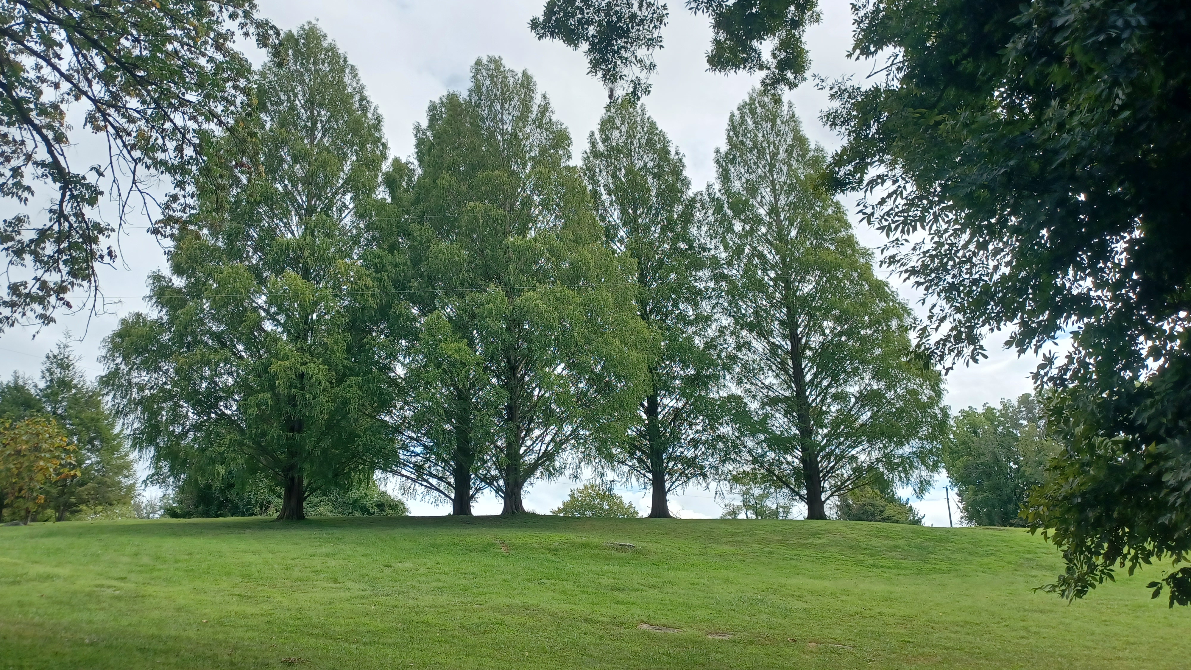
We walked along this for a bit, and there were some large Metasequoia trees, I think five of them, to the right. These are also known as Dawn Redwoods.

The trail turned slightly to the right, through grass, and headed slowly downhill. The blazes were not kept very well through this area to show us the way.

The Conestoga Trail was also still blazed with the slanted slashes rather than regular offset turn blazes that most trails have adopted by now. The northern bit of Conestoga Trail I noticed had been mostly changed to the "international standard" for trail blazing, but not this part.
There was a couple walking through the meadow looking for the same trail ahead, and I talked to them for a moment. They found the right way just before me, and so I waited for Ev and Diane to get to me, and we headed into the woods on this next bit.

It was only a short distance through the woods until we got to Golf Road, where the trail crossed again.

There was a good bench here and a trash can, so I used this opportunity to give Ev another diaper change where I could dispose of it. Then, we continued across the road and headed into thicker woods.
The trail weaved along at about the same elevation on a slope, and then gradually started to drop. There were some slight ups and downs that were easy to hike, but pushing the stroller was not so easy. Ev walked the entire stretch.
After a bit of only slight descending, we had a hard right turn and then a steep section. Ev walked a whole lot of this all by himself, and he keeps getting more sure footed.

I was careful about the stroller, and this section continued on far longer than I'd have liked it to, but we got through it. Pretty soon, we emerged on the abandoned section of Kiwanis Road.

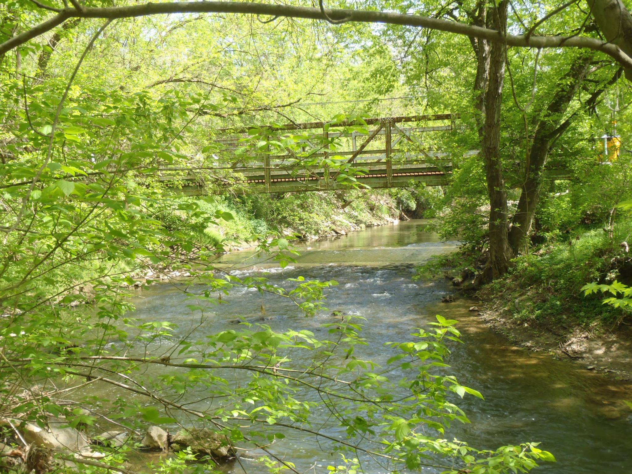
To the left, we could see the Kurtz's Mill Covered Bridge over the Mill Creek. This bridge was originally built in 1876 over the Conestoga River, and was damaged by Hurricane Agnes in 1972.
I don't know exactly where the location of the bridge used to be over the river, but it was moved to its present location in 1975 I believe. It was also known as Baer's Mill Covered Bridge.
We didn't walk over to the bridge from here. Typically, I would do so, but I had been through it before, and I knew we were running a bit behind at this point. I wanted to make up a little time. It would also take us a while if Ev was still walking. He can move fast, but not quite as fast as the rest of us while we're walking.
We headed along the abandoned section of road to the right, parallel with the Mill Creek.
We continued on this for a bit, and then the road started heading uphill, as it connects to Golf Road. Before getting to the end of the abandonment, the trail turned hard left downhill again.
I had put Ev in the stroller just for the last part of the uphill, and felt bad that I had to take him back out again.
Diane held his hand going down the steep slope, and I struggled getting the stroller through the mess. It was really rocky, had a lot of tree roots, and the treadway was of course not meant for strollers because it nearly tipped several times.

This was the kind of trail section I wouldn't have tried to bring Ev through when he was smaller, but I can slowly ease my way into this stuff as time goes by.

I continued until the trail opened up to much easier terrain, and there was a great little pool on the Mill Creek with wonderful views upstream of it. Diane and Ev were not far behind me at all.
Ev handled all of the trail like a champ, and I picked him up to bring him over to the creek while I laid down in it to cool off. He wasn't particularly interested in throwing stones in at this point. I could tell he was getting worn out from all of the excitement, but he, as usually, did not want to go to sleep.

Once I was out of the water, we continued ahead onto better grassy treadway. I offered Ev the stroller, and he did not refuse. I pushed him a bit, and he started closing his eyes, and his head wobbled.

It is adorable to watch him fight going to sleep, like he's afraid he's going ot miss something.
The trail shifted around a sharp bend in the Mill Creek, and we were headed south. I remembered the next section being very open and just sort of mowed with a brush hog through it. It was very different this time.
As soon as we were on the level, the trail was totally mowed down and pleasant. It used to have a feel like the Conestoga Trail in the northern part of the county, sort of flying under the radar and rather unimproved. It was a neat spot coming out of the city to a sort of wild land.

While it was still a very natural location, it was no longer a brush hog path, and the open edge of the Mill Creek was now lined with young trees that had been planted to protect its shore line from furthe erosion. They were already providing a bit of shade we did not have on my previous visit.

This was really quite lovely. The location had changed so much in just a decade. Ev was fast asleep for all of it, and we continued walking along with lots of other people walking by. On my last trip, not a single other person walked by us.
As we moved on, a Kingfisher was in the creek, and it flew down the stream parallel with us so we could get different views of it along the way.
The trail continued along the creek south, and then around a tight corner again, and back to the north again. Heading back to the north was much more wooded.
 |
| 2013 |

Eventually, the trail turned to the right and headed uphill into an open clearing along cultivated fields. This was an area of Lancaster Central Park known as the Exhibit Farm.

There was an old farm house and a parking area here. We continued through the grass to the right of the lot, and then came down from that onto Exhibit Farm Road.
We continued along the road north to the intersection of Golf Road. We walked across the street, then turned to the left through the grass and paralleled Golf Road for a while as we headed to the west.
Pretty soon, we had to come out to Golf Road and walk that for a bit, parallel with the Meadia Heights Golf Club.
 |
| 2013 |

Golf Road took us all the way out to Rt 272, where we turned to the left briefly. It was a busy road, so we had to hurry across onto Roselyn Avenue.

We continued to the west along this road for a bit, which soon came to a ninety degree turn to the left.
The Conestoga Trail follows Conestoga Avenue from this bend, but at the end of the turn there was a mowed path that just went off into the woods.
There was not a single no trespassing sign, and there were no visible blazes on the road. I wondered if perhaps the trail might have been rerouted through this section. Some maps seemed to show that the slope below was park land, so I wasn't sure. I figured we could walk down it just a bit to check it out.

I was definitely curious about this, because I knew the old Quarryville Branch of the Pennsylvania Railroad was just below through here.

We took the chance and started heading down the path, which was very gradual at first, then came to a power line. It turned hard left on the power line, skirted the edge, and then dipped down along it, turned right, and entered woods on the other side.
From here, it descended somewhat steeply, but not too tough. We were able to take the clear path all the way down to the abandoned railroad grade. I figured just maybe we'd be able to pass through on this. I could see that to the south, a cul de sac on a spur of Conestoga Avenue seemed to have a mowed path off of it. We might be able to make this work.

We turned left and began following the old right of way to the north, which still had some railroad ties in place on it.
This line was originally the Lancaster and Quarryville Railroad, built in 1875. It connected the Pennsylvania Railroad in Lancaster, on its original alignment in town, south to Quarryville, about 15 miles. It later became the Quarryville Branch of the Pennsylvania Railroad.
When it was first being built in 1874, it was planned to be a narrow gauge line, but it apparently shifted to standard gauge before construction was finished and the line was open. Because of the plans, it seems that some locals refer to this as a narrow gauge mistakenly.

Passenger service on the line ended in 1909, but freight continued until it was badly damaged by Hurricane Agnes in 1972.

My understanding is that there was connection to the line from the Enola Low Grade Line, aka Atglen and Susquehanna Branch, and that the connection was used for a time on the line until it finally went out of business. This might have lasted into the 1980s, but I'm not sure.
Some areas are very easily recognizable, while others have been farmed out of existence on the southern end, and this section was very obvious because it was along a shelf above the Conestoga River.
The route was really particularly pretty, and had some interesting rock outcrop sections along the left side.

As we walked, I noticed there was a somewhat level grade along the right side of us, which I assume might possibly have been a section of towpath associated with the Conestoga Navigation.
The Conestoga Navigation was where the Conestoga River was "canalized" with a series of dams up the river, 18 miles from the Susquehanna River to Lancaster. It was in operation from 1829 to 1857.
It is possible this might have been a remnant even though both of these transportation corridors were not in operation at the same time. Some of the old towpath might have been utilized for the railroad.

The canal navigation had nine locks to raise boats 64 feet from the level of the Susquehanna, each 100 feet long and 22 feet wide.

The first lock was very near to where we were, I think maybe just a bit upstream, and navigation extended just a little further upstream from there.
We continued along the rail bed, and there were a couple of no trespassing signs on the sides, but it was on an area shown as public land on the maps.
I didn't want to intrude on anyone, but we had just a little bit further to go to get back up to where I wanted to get.
We made our way to where the railroad crossed the Mill Creek, and the bridge was still there, but there was a vehicle parked down below to the right along the creek.

I didn't want to be seen, so we hurried out into the open only for a second, then cut immediately to the left onto the power line clearing that was coming in adjacent to the right of way.

The mowed path took us uphill, rather steeply, into the woods next to the power line, then back onto it again, and out to the cul de sac right where I wanted to be.
Just as we were partway up the hill, it started raining a little bit. I was glad to be out of there before we had any significant storming.
We continued to the intersection with that cul de sac spur, and turned to the right to head downhill gradually along Conestoga Ave, back on the official trail route.
Soon, we came to the intersection with Eckman Road, and the trail turned right to follow that.
It wasn't very long before we reached the crossing of the Mill Creek, on a rather new bridge just downstream from a dam. There was a huge Sycamore tree just upstream.
My phone was not opening very easily because my hands were wet, and my unlock key on the side of it was not working with the wet hands, but I did manage to get a couple of photos of the bridge.

I was trying to compare photos on this hike with ones I got when I hiked here ten years prior. Then, there was a nice old pinned Warren through truss bridge with vertical sections atypical of what we normally seen in Lancaster County. That bridge was built in 1935, and at the time of that hike, it was closed to all but pedestrian traffic. At the time, I didn't know if it was to be repaired or replaced.
Obviously, it was replaced, with a rather bland and uninteresting looking structure with concrete rails and no overhead trusses.

We headed somewhat uphill from here, and the old railroad bed came up beside the road but was obscure at first. I didn't even notice it was there at first.
There was an abandoned earth mover on the right of way where it crossed the road, and I wanted to get a shot of that, but the camera wasn't opening. I realized in a short bit that it was the rail bed because there was a nice concrete arch bridge underpass to the left of the road.
The right of way remained on that side just for a bit, and then came to a point where the level grade crossed the road on the same level. it disappeared into a pasture to the right, but at the next intersection, with Brenneman Road, the abutments of the bridge where it used to cross it were very obvious.

Conestoga Trail turned left on this road next to a lovely farmstead, and then headed out to the Willow Bend Farm development.
I remembered from hiking this before, that at the bend in the road was something quite cool. The old trail guide had it mentioned in it, but there's nothing like that available anymore.
Just behind a line of trees at the ninety degree bend, in the swath in front of the new development, the Kreider-Snavely burying ground is rather hidden. The site dates back to 1743.

I often don't like exposing sites like this to any attention, but the fact that it is right next to a new development means it is well watched over.
We continued on Brenneman Road to the intersection with Millwood Road and continued straight.
Since the last time I walked this route, a new development had been built to the right of this road. This provides for an opportunity for more off road walking. The current aerial images show that there was construction, and it looked like there was a pedestrian path around it, but I could not be sure.

We walked at an opening from the road into field, and then up to the end of the new development. I should have walked to the right of the building there, because there was a new paved path around it that we did not see at first.
We followed Summit Drive throug the new town house complex, and there was an access to a trail to the right we had missed. We got on the end of it just below the road as it appeared ahead on the right.
We cut away from the trail onto the grass, and along the edge of a retention pond out to Schultz Road just ahead. Right about where we came out, and at a power line, the old Quarryville Branch used to cross the road. For those who don't know, it would have been very easy to miss it.

Just after the former rail crossing, we passed the Equestrian Estates Horse Farm and Bed and Breakfast. I remember this being House of the Lord Bed and Breakfast when we went by a decade ago.
We continued along the road, and the rain had pretty much let up at this point, but there was more coming. Schultz Road took us west into the little community of New Danville. We turned left on Newswanger Road out to Rt 741.
New Danville was founded in 1780 and named for early settlers named Daniel.
If we had gone to the right at the intersection with Rt 741, we could have stopped at a Turkey Hill, but I didn't want to bother. We had a ways to go and we were going to be done later than anticipated.

In the distance, we could see more rain was coming down. There were cumulonimbus clouds all in view to the west and to the south. I thought maybe we might avoid some of it.
We followed 741 to the south, and then turned to the right on Long Lane.
I remember this is being the worst road walk of the entire Conestoga Trail. It was far too busy for the trail route, and not enough of a shoulder. There just wasn't really any other good way through.

Also, this road follows the historic route of an aboriginal path that once connected to the Conestoga River to the west, so they wanted to follow some of that.
We crossed over the New Danville Pike. At this point, we were pretty far away from the Conestoga River. The old navigation system had its second lock a bit north of New Danville.
One of the points of interest on the road was the site of the old Postelthwaite's Tavern. It was at this point that the Justices under King George II met for the first time in Lancaster County, in 1729. It is not clear if the old house standing there is original. I would assume it is probably not, or if it is, it was much altered. It is possible the building, which was built at leats in the 1800s I assume, might have some of that original building in it. I just don't know.
We continued across Stehman Road, just south of the settlement of Slackwater, which was of course also named for the navigation system.
I stopped and did a little video at the old tavern site, and took some photos as some of the rain let up. I had Ev's plastic cover for his stroller each time it rained, and he was fine with having it on because the alternative was getting wet.
I tried to keep it off when the very last rain started to come down. Diane went ahead of me while I was photographing Postelthwaites, and I figured we'd probably already seen the worst of it. This was not the case. The stress really began here.
I had gotten my phone a little wet, and it turns out Ev also got it messy because it had fruit punch in the case, which he was drinking earlier and threw on the ground after his bottle.

I ended up having to put the cover back on again, and the rain was coming down hard by the time we got back to Diane's car.
The parking lot at Rock Hill Access was formerly the site of the Conestoga Navigation Lock 5, and some of the masonry was reworked for the dam that remained in place until recent years. I didn't have time to get a closer look at it this time.
We got into Diane's car, and I was able to use my phone barely for navigation back to my car. I left Ev in her car while I tried to get my stuff together, but when everything was good to go and I got in, I could not get my phone to unlock. I sat for a minute trying to do it, because Diane wanted to follow me back out, but I couldn't get it. I figured it'd start soon.
We started driving, and I figured I would try to get back by memory. Memory of the map, not from being there, because I'd never driving to this spot from the north, and we needed to get back to Rt 222 north and east.
I figured if we got to Rt 30, we just follow it west a bit, and we get back to 222.
It rained harder and I couldn't see so well what was on the signs. I ended up driving right through Lancaster. That was sketchy enough.
During the heaviest downpours, I could not get my radio unit to turn off. The dash was flickering from the water getting into it. I was freaking out. Water shouldn't be getting up in there from underneath.
When I got to what I thought was the north side of town, I stopped and asked directions at a Turkey Hill. They had no idea how to get to 222. I went out and went to another Turkey Hill. They told me to go one way, which ended up being wrong.
I asked a clerk to call my phone, to see if I could unlock it. I could get it to ring, but not answer or call out.
I then went into a Burger King because I had to get something for Ev and I to eat. My card wasn't working from the rain, so I had to go inside. Again, I asked for directions, and they told me where to go to get to Rt 222. I followed that, crossed Rt 30 as instructed, but was going forever. I figured it couldn't be right when I saw that I was heading west. I turned around and went back to 30.
Assuming I was on the east side of Lancaster, 30 west should take me to the 222 ramp and then I'm good. I followed 30 west, unable to see so many signs in the rain.
Before I knew it, I was in Columbia. By this point, I was ready to have a panic attack. Ev was falling asleep, but my adrenalin was keeping me wide awake.
I turned back around on 30 east, and finally made it to 222 north. Because it was such a crazy mess, it took until close to midnight to get home, after having finished the hike at 7 pm. I was spent.
I called out of work the next day because of the issues, and then tried to get my phone taken care of at Ubreak I fix outside of Easton, but they were all knocked out because no one had internet, due to the same storm I was out in.
I had waited a couple of hours, couldn't get in, and didn't have any means to look anything up. I didn't even know where the nearest local library was.
I decided I would head to Palmer Park Mall nearby where my friend Stephanie, who I dated just out of high school, owns the Spin Me Round record store. I figured she could tell me where something was.
Steph wasn't around, but there was a T Mobile store there, so I went in to talk to them. I wasn't going to buy a new phone, but I feel like I actually just needed someone to talk to, and no one was around. I was feeling completely defeated.
Thankfully, they referred me to a place just down the hall, where a Russian guy was opening phones and working on them right in the front. Something told me I could trust this guy.
He quoted me $100 to fix the phone, and he managed to do it no problem. It was great and I had it back working within the hour.
I felt a bit better, and started driving home, but Jillane asked me to pick up toy trains for Ev in Bloomsbury on my way.
I stopped in the TA station and my car stalled. It would not turn back over.
I went in to ask for a jump, after all, I was at a service station.
They didn't jump cars, only trucks. I couldn't believe it. I asked another guy, and he said it was a liability issue, but they do it all the time, ask someone actually in the garage.

I went back, and the guys working the garage said they were under time constraints and must finish each job with a certain amount of time or they fail, so I stopped asking them for help.
I called AAA, and they quoted me $249 to come out for a jump. Apparently because internet is down, I had to pay them cash, and they said they'd provide a receipt I could turn in to AAA.
I was not going to do that, so I put it up on Facebook. Immediately I got tons of responses offering to help, but my brother was closest and came and jumped me.
Lots of other stuff went wrong too, but this was just the start of a whole lot of stress that I don't know how I pull myself through.
I'd had a really fantastic hike overall, but one can never be fully prepared for how much craziness might go down. I certainly wasn't.
No comments:
Post a Comment