

Hike #1559; 7/9/23 Ephrata/Brunnerville/Lititz Loop with Diane Reider, David Adams, James Kohan, and Everen
This next hike would be the second in my Conestoga Trail series, connecting where we'd left off in Brunnerville PA with the Warwick-Ephrata Rail Trail. I came up with a loop that I was really excited about, and that I figured would be a great time.

This ended up being another that didn't quite go as planned, but was still great, and also changed my trajectory for future hikes in this and other series as well. All in all, it ended up being a much better day than I'd anticipated it would be.
The Conestoga Trail is a more than sixty mile long trail that connects the Horse-Shoe Trail in the Furnace Hills to the Mason-Dixon Trail along the Susquehanna River. I'd backpacked it with little Ev's mom Jillane years ago, and was one of my favorites I'd ever done.

There have been enough reroutes on that trail to warrant re-visiting it I felt, and so I was happy to do it again. Like I'd done with other area trails, I could use this as an opportunity to do all of the other substantial trails that connected with it as well.
The hike started at Millway Road, where there is parking for the Warwick-Ephrata Rail Trail.
The Warwick-Ephrata Rail Trail was originally the Reading and Columbia Railroad (not to be confused with the Philadelphia and Columbia). It was built southwest from Reading in 1864.
The Philadelphia and Reading Railroad began leasing the line in 1870. It continued in regular use and declined much in the same way most of the railroads we regularly walk did. Customers disappeared through the sixties and seventies, replaced by trucks. Passenger service was discontinued earlier, but the section from just east of Ephrata to Lititz was abandoned about 1985.
 |
| Marvin Sauder Collection |

When I had hiked the Conestoga Trail through here previously, it was all road walk from a point to the north of here, and then down Millway Road, but now it had been rerouted to follow some of the rail bed between this point, and a point just west of the community of Millway.

We would hike the Conestoga Trail northbound, and then cut off of it when we got to Brunnerville, where we had finished the last hike on it.
We only had a bit of drizzle in the morning, and there was promise of rain later in the day. As such, people were naturally scared off from the hike, but I thought it was great.
My original plan was to do the hike in the opposite direction to what we did. I wanted to follow the railroad bed west to Lititz, and then continue to Conestoga Trail back to where we started, but when I saw the forecast, I decided it was prudent to do the hike in opposite direction.


We would be able to get the foot path stuff out of the way before heavy rains came, and then be on the railroad bed if it got bad. This turned out to be an excellent idea beyond what my words can express.

I'f we'd followed the Conestoga Trail the way it went when I backpacked it, we'd be following Millway Road to a left on Rothsville Road, to a right on Cocalico Road, to a right on Meadow Valley Road, a left on Millway Road, a left on Erb's Bridge Road, and a right on Millway Road. From there, the trail is the same route as it was, but those road segments were eliminated when the trail was rerouted onto the railroad bed, so we followed the railroad bed at first and again at the end.
There was apparently once a wooden bridge that carried Millway Road over the rail bed, which is long gone. The fill must have been built up on both sides, but it was not so apparent at the parking area.

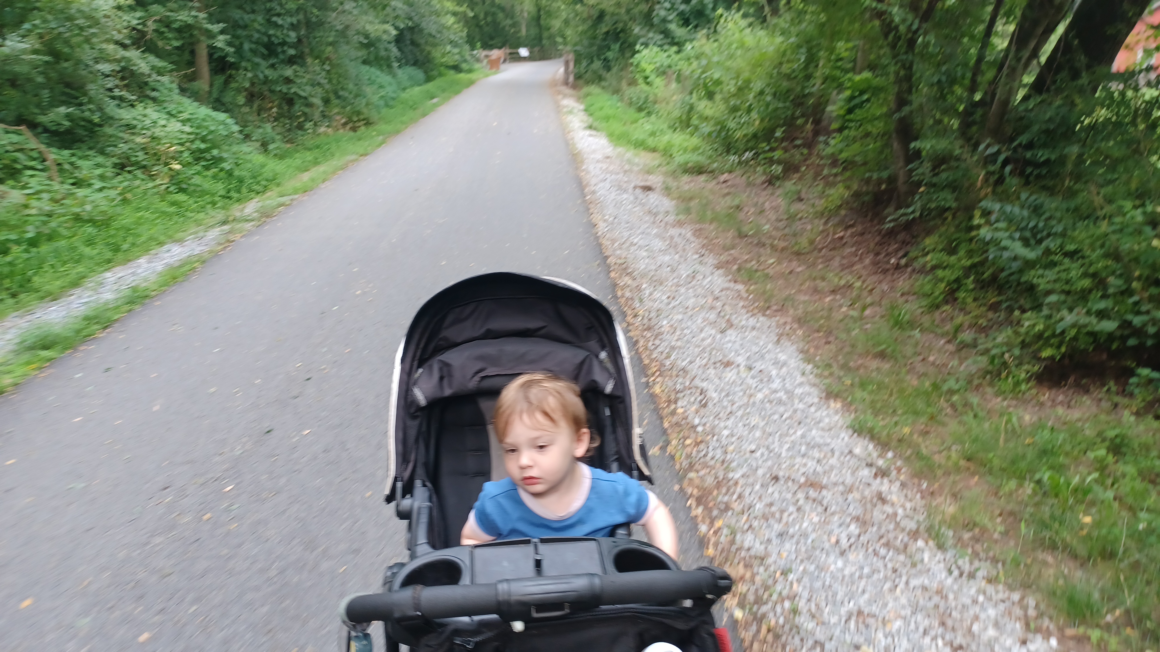
We headed west on the trail for a bit, and I kept Ev in the stroller at first. The trail was at first paved, but very nicely kept. We descended for a bit to the original rail grade level.

Almost immediately, I didn't see it and would never have known about it, but there was a junction and spur just a short distance west of the Millway Road crossing site.
Greg Pawelski told me that a line continued south from here, with the intention of going farther, but it never made it all that far to the south in the vicinity of the town of Akron. I don't think it ever went farter than Cocalico Creek Road to the south, but was intended to. Yet another very obscure little piece of railroad history.

We continued ahead, and it wasn't too long before we got to the Cocalico Creek Bridge. This bridge was built in 1909, a deck girder structure to replace the original deck Burr Arch truss bridge.

There were history markers along the way, and I was able to use some of them for then and now compilations as we went.
There were excellent views of the Cocalico Creek from the middle of the bridge. The Conestoga Trail follows the Hammer Creek just upstream from this area, but the confluence with the Cocalico Creek is just north of here and the trail mostly follows it south until the confluence with the Conestoga River.

We reached the other side of the bridge, where below us on private land was the former site of a petroleum distribution site that was established in 1882.

We could kind of see where there was a junction with a spur and elevated line that served the industry. It remained in service until the 1950s, and little remains of the site today.
We continued west a little bit and crossed Rothsville Road at grade, then made our way into more woods.
Pretty soon, we approached the little community of Millway, a small settlement between Ephrata and Lititz that served as a station stop on the railroad.
 |
| Dan West collection |

As we approached the business center area, which wasn't much, the station building used to stand on the left side, now long gone.

To the right, the J. H. Reitz and Son Warehouse still stands, which operated from 1902 to 1964. The original building from the site burned down and was rebuilt in 1907, and it remains in good repair today.
According to Dan West's West2k website, the warehouse served as a station as well at one point, maybe at some sort of intermediate time for reasons simply lost to history.
Today, the old mill building is operated by something called the Farfield Company. I got a couple of then and now compilations here, and we continued across Meadow Valley Road to the west.

To the right at the crossing, I could see an abandoned old stone mill downhill that used to be on the former Conestoga Trail route, which I remembered walking by years ago. I was glad we could at least still get a look at it.

The area ahead opened up into wide farmlands, and was quite pleasant. I was glad to be in this while it was somewhat cloudy or it might have been miserable.
We continued around a slight bend, and came to Picnic Woods Road, where the northbound Conestoga Trail turned off to the right. This was confirmed by the orange-ish blazes on the poles here.
We turned right off of the railroad bed and headed north for a bit on Picnic Woods Road.
 |
| Marvin Sauder Collection |

We turned left ahead on Millway Road, and the old route of the trail was ahead on Erb's Bridge Road. Erb's Covered Bridge is really nice ahead of here. The trail used to come out right at the bridge, but the land owner in that area closed it because someone had stolen his trail cam on the trail.

We followed Millway Road to a right turn on Pine Hill Road, and continued gradually uphill past some really beautiful old farms.

We headed downhill on the other side, and at a corner to the left, we passed where the Conestoga Trail southbound used to turn off to the right into the closed section. I thought the section was funny, because the trail guide read that the landowner didn't allow cutting or blazing, and it just described where to walk.
We turned to the right soon onto Buch Mill Road, parallel with the Hammer Creek. When we got to just before the creek crossing, the trail turned into the woods to the left.

The trail was not terribly narrow, and looked as though it had just recently been cut back, making it quite easy for me to get Ev's stroller down it.

There were almost immediately some beautiful, enormous trees along the path. It was rather tough to get the stroller through some of this because of the tree roots and such, but Ev walked the first part of this on his own, so it wasn't too bad.
There were some side hill bits, and I was already hot, so I took the first good opportunity I had to get down in the creek and lay down. Ev just watched in sort of confusion.
Pretty soon, the trail turned into a pretty much weed-whacked good path along fields and such. Ev had been okay with the rough stones and hard ground, but he couldn't handle the grass.

It wasn't terribly high or anything, but it was maybe ankle deep for us, which made walking for him kind of tough. I ended up getting him back in the stroller for a bit ahead.

He constantly tries to pick out the ones that are far too big for him. he can lift some surprisingly big ones, and tries to get the ones out of the ground that look like they won't budge. Amazingly, he's pulled a couple of those up.
We passed through trees along the creek heading upstream, and there was a footbridge over it to private farms on the east side along Milman's Lane. I noticed there was a new house under construction on the other side, which hadn't been there when we hiked through here years ago.

The trail came out right along the edge of cultivated crop lands, and then cut into the trees on the right, which turned into sort of a lawn heading out to Carpenter Road.

At the road, the trail turned slightly right to where the road crosses Hammer Creek, but then turns abruptly to the left onto a farm road that continues parallel with the creek upstream.
This was quite a pleasant section, on a nice hard packed farm lane that just ran in a pretty straight line along the creek, with a few houses on the opposite side.
We entered woods at the end of the farm road area, which was short, and then emerged at the edge of another crop field.

The trail continued along the corn edge to the west, with one big rock sat in the middle of the section with an orange-ish blaze on it. Ev reached over and felt the coarse corn with his hands as we went by.

Eventually, the stream course changed direction to north, and we had to go through an opening to the right of the fields, down into a ditch, and then back up into the edge of a nicely mowed lawn.
The trail stayed right along the creek in the mowed area, through a line of trees, and then came out to and crossed Lincoln Road. There was enough space that I could get Ev in his stroller around the galvanized guide rails.
The trail continued through more private land ahead, in another lawn area that was full of nice planted trees and ornamental grasses that seemed out of place with everything else around us. It was an easy and pretty walk, so no complaints on this.

The trail entered woods again, deeper and thicker than the other woods we'd been in, which was quite pleasant, and I cooled off a bit again at a good spot.

At the end of this woods section, we came to a fenced in field with an electric fence. There was a slight opening for the trail in the very corner of the fence, with insulated rubber around the electrified wires where they went around the wooden posts as not to shock anyone trying to go through. Jim touched the fence to confirm that it was actually on, so we had to be careful.
Everyone in this group was able to squeeze through the tight opening, but we have many friends who would have had a tough time with this spot. I had them hand Ev over top of the fence to me, sat him down, and then carefully had to lift the stroller over the fence as well. It really wasn't too bad, and we were on our way again.

These fields have cows in them, but none of them ever got very close to us while in there.

We continued along the creek, which was lovely, but then we sort of lost the blazes. I didn't see where they could be, and we took the path of least resistence as best we could to the north. That put us at a point along the electric fence, where we turned right. Pretty soon, we came to a stile over the fence for the trail. The trail had gone more direct to this point, but the area of it was a bit more overgrown, so we didn't go that way. We were just only a bit south of its actual route.
A nice section of woods along the creek again soon brought us out to Clay Road. The trail turned right on the road, crossed the Hammer Creek, and then went left into a field directly along the creek.
I let Ev back out of the stroller here to walk on his own, because the grass wasn't so bad in this section. He had a little bit of a tantrum because he didn't want to be in the stroller, but he also didn't want to walk. I tried explaining to him that he was getting heavy, and I couldn't push the stroller and carrying through the section. Eventually I have to just put him back in there when he does that, despite his protest, because he just lays down and sobs or gets angry when he doesn't get his way.
When I get him in the stroller, he arches his back to try to keep from getting him in his seat, or then scoots down to try to slide out the bottom of it. I end up having to adjust him a bit, but usually after only a short while, there's so much to see on these hikes that he calms down and he's just looking around.

The trail simply stays along the edge of fields heading west through this bit, close to the creek. There are a few cut ins to reach the creek here.

I remember walking through some of these areas and finding a water tank with a blaze on it. I love those odd things about trails like this.
We mostly just stayed along field edges here, and the creek shifted from west to north again over the next mile or so. There was a small old dam remnant in this section, so I used it as an opportunity to take another dip. Dave pushed the stroller for me for a bit, while I carried Ev through some of the high grass after the break.
At the very end of the fields, the trail turned hard ninety degrees to the right, uphill through a field. Ev was about ready to get back in the stroller then, so I put him in.

There was a crazy hunting stand on the left as we headed uphill on the field edge, with an extension ladder going way up into a dying ash tree, and the stand was out near the end of the branches. It was way up there, and looked absolutely insane. It was one of the craziest hunting stands I've ever seen.

We headed uphill just a bit more, and then turned ninety degrees to the left again, heading north along the field edge. This took us out on Hackman Road, just slightly east of the bridge that carries it over the Hammer Creek.
We turned left on Hackman Road and crossed the creek. On the other side, the trail used to turn to the right and continue upstream along the creek. That was the route we took when I hiked the trail last, but that section has sadly since been closed. I could see on the utility pole where the turn blaze used to be, now with a white electrified fence blocking it off.

The trail now follows Hackman Road. As we headed slightly uphill, there was a crabapple tree on the left, and we ate some of them. I let Ev try one, and often he likes these things, but he spit this one out.

The road turned ninety degrees to the left, from which point there was a nice little view of the farmland around the Hammer Creek.
We continued on Hackman Road uphill to Brunnerville Road gradually. When we reached that intersection, where the northbound Conestoga Trail goes left, we continued straight into Brunnerville. This was where we turned off of the Conestoga Trail on the last hike.
Originally, I had intended for a brewery or something in Lititz to be our lunch stop for this hike, but we were soon approaching the Brunnerville Inn, where we had eaten at the end of the last hike. The burgers there were so good that I think all of us that had them couldn't stop thinking about them.

I think the decision was pretty much made before we even got there that our lunch stop was going to be there again.


From the tavern, we turned right on Lexington Road, and I set up one of my then and now compilations of downtown Brunnerville.

As we headed northwest, there were lots and fields associated with the John Beck elementary school, so we walked along those for a bit until they ended, and then came back out to the road. It was a pleasant walk along the road, past the Midway Mennenite Church, and then we turned left at the fork onto Race Street. We went a short distance and then turned left on Elbow Road. We passed by an interesting tree along one of the corners I keep meaning to look up the species of, with its purpleish flowers, but I still haven't figured out what it was yet.

There was a mowed out path to the left through fields, which I could see on aerial images goes through to about where we would be ahead on Tara Drive, but we didn't chance it. I think someone was riding an ATV through this tract anyway, so I didn't want any trouble.

As we were walking this stretch of road, the clouds moved in and the rain began. Fortunately, I had Ev's rain cover for his stroller all ready to go. I got it over the thing, and at first he seemed a little freaked out, but realized quite quickly that it was keeping him dry. The rain really started coming down, and it was a good thing we had it for him.
Next was the thunder and lightning, but I was very happy Ev wasn't too freaked out by that. He'd been scared of it while we were home, and wore head phones to block it at times. The thunder never got terrible this time, but when it was happening, he didn't panic which made me happy.

Elbow Road led us to Snyder Hill Road where we turned left. We were only on this a short bit and we turned right to head over to parallel Sue Drive where we continued to head south.

We went a few blocks on this, and the rain wasn't too heavy just yet. We then turned right on Tara Drive, which led to a dead end, but the lane continued beyond that into old farmland. On the right, there were old barn foundations and an old silo. The clear old farm lane continued ahead.
My goal from here was to continue ahead and see if there was a connecting trail to the Warwick Linear Park Greenway to the south.
Google maps showed this greenway going up into the woods and ending, but there were clearly no signs saying to stay out up off of Tara Drive, and it looked like it was somewhat maintained.

We continued to the south, and the mowed path continued along the edge of crop fields. This was looking promising.

We made our way down a slope among some trees, and we were getting closer to the actual trail as shown on Google maps. There was one slightly weedy bit downhill to a clearer grassy path. We turned left on that, and pretty soon came to a small barricade where the greenway trail started, with improved surface.
The rain started coming down a bit stronger as we came out onto this trail.
The trail came out of the woods, and skirted a tree line to the right. We headed through a small swath of woods, and then came out to the old former alignment of Newport Road.

From there, the trail dipped down around a tight switchback, and then passed under the current alignment of Newport Road through the tunnel that carries the Santo Domingo Creek. It was raining pretty good at this point, so we stopped for a break under the culvert.

From inside the culvert, we could see the power of the stream increase right before us.
There was a pretty arch of stone, which may or may not be authentic original, on the old road alignment to the north of the culvert.
We waited under the bridge for a bit, and it just wasn't letting up. I think Dave checked the radar and figured that this was what we'd be dealing with for the rest of the day, so we eventually just headed on out along the trail.

The pathway took us right through a development through swaths of houses on the south side of Newport Road.

The character of where we were changed pretty much entirely when we came out of the tunnel, like we were appearing in Oz or something, only it was not as much a nice thing.
We reached Laurie Lane, turned left, and then right again to continue on the trail to the south. Pretty soon, a side trail went off to the right, which went out to a pier overlooking a small pond. This trail was a dead end, so we backtracked the way we came to the through route again.
We skirted some baseball fields heading south as we passed through Dean Saylor Park, and emerged in a parking area on Market Street.

We turned to the left to the sharp turn to follow Cedar Street Southwest.

I didn't know it at the time, but we could have headed to Water Street, and a greenway trail continues downstream on Santo Domingo Creek. We'll have to remember that for next time.
We continued south to the crossing of the Reading and Columbia Railroad, where tracks are still in place but disused. We went down to them, but walking beside them was pretty much out of the question, so we walked slightly back uphill to Kleine Lane and followed it to the east, to Water Street.
The Appalachian Brewing Company has a place in Lititz that I was planning on stopping at, but it was kind of miserable weather, and while we were in the parking lot, I figured I didn't need to buy more booze. We could wait for a nice day with a bigger group to hit this place.

We headed down across the tracks, which didn't really look good for walking despite being clear. However, there was a good linear trail on the other side of the Lititz Run on the south side of the tracks immediately parallel.

We headed across the tracks and to the bridge that carried the road over the Lititz Run, and we could literally watch the water coming up fast. It was going to crest the bridge and come over the road very soon. Part of me wanted to stay put and watch that happen, but if it were that bad, we needed to get to higher elevation on the railroad bed first.
We continued on the trails on the south side of the tracks and the brook, but pretty soon the trail dipped down and was going under water. We continued as close as we could, but had to cut south out to North Lane. This brought us to North Lane.

We continued to the east a bit, and there were some kids playing in a big parking lot below along the creek, which stretched down to a foot bridge over it to the tracks on the other side.

We continued on North Lane to Locust Street and turned left. There was a trail that skirted the parking lot and came out to this location, still on the opposite side of the creek from the tracks, but a few steps away it went under water. We wouldn't be able to do any of that.

We crossed the creek on the road bridge, and then turned to the right on the railroad. The tracks were still in through here, but long unused and overgrown. We were able to walk a rather narrow path on ballast rock, on fill above the Lititz Run and Oak Street Wetlands ahead, out to Oak Street. We cut up into a parking area along these tracks just before, and the official trail started on the other side of Oak Street.
We continued to the east, and it was pleasant as could be save for the rain, which got heavy at times.

We headed away from town a bit, and the Newtown Square Trail broke off to the left. I had originally considered using this as part of this hike, but we did enough extra stuff that we'd have enough miles without it. I could do that as part of another thing in the future.


There were accesses to the right to a development, and soon we crossed over Clay Road. The trail veered away from the actual old railroad bed in this area, where some of the Warwick Municipal Building complex had been built over it. The trail skirted their parking lots, and then went along the edge of a baseball field that was almost on the railroad bed.
Pretty soon, the salt sheds for the township were on the left, and that was built right on the rail bed. We went south and north a bit, and got back on the actual railroad bed just beyond the salt shed to continue east.
We continued through pretty wide open farm fields, and crossed Newport Road ahead after a bit of a cut, and then next crossed Rothsville Station Road.
There used to be a station here, at this point north of the community of Rothsville, on the west side of the road, south side of the tracks. I have not been able to find a single photo of what the station looked like.
.jpg)

We had another long and pleasant section of right of way ahead to the east, and the next crossing was back to where we had been earlier, at Picnic Woods Road.

We continued on to East Meadow Valley Road through Millway, and then on through the woods over Rothsville Road and then over the Cocalico Creek.
I was really unhappy that I couldn't capture any of this in photos because my hands were too wet to unlock my phone (it's messed up and I can only do it with finger print because the side button is broken).
We continued the last stretch to the Millway Road parking lot to conclude the hike. We got done with a good amount of time before dark, and I was very happy it went down as it had.

The way we did this caused me to change a lot of my plans for the future. I had wanted to do little bits of the old railroad line in conjunction with the Conestoga Trail, and my plan for the next month was to follow the railroad bed from the east rather than the west, and then hike south as far as the little settlement of Oregon, then the next one would take me through Lancaster.

I decided that the next one would be almost totally Conestoga Trail instead, all the way to Lancaster, and I would instead post a hike that was entirely on the Reading and Columbia Railroad. I loved this route so much that I decided it MUST be a hike of its own in the late fall or something. It was just too good a trail to pass up, I wanted to photograph segments we had missed doing in the rain, and I wanted to explore it in greater detail possibly with some more side trips. Further, there are other connections of trail that we missed in Lititz that would have been continuations of the greenway we were on, and I could do an entire alternate version of the Conestoga Trail hike by cutting to the south on trail segments that would make for excellent cooler weather days.

I finished this one very excited for the prospect of things coming up. The future is bright, and there is much to look forward to. Each area has great stuff that is perfect for Ev at the age he is right now, and will offer opportunities to improve his walking skills.

No comments:
Post a Comment