

Hike #1562; 7/24/23 Oldtown to Paw Paw with Evan "Joe Millionaire" Van Rossum, Professor John DiFiore, and Everen
The day after hiking the Chesapeake and Ohio Canal from Oldtown to Cumberland, we set out once again to hike it between Oldtown and Paw Paw Tunnel.

We had stayed in the Fairfield Inn and Suites the night before. I was supposed to stay there two nights before, because it was right on the trail, but they screwed up and sold my room to someone else because there was some big event going on in town.
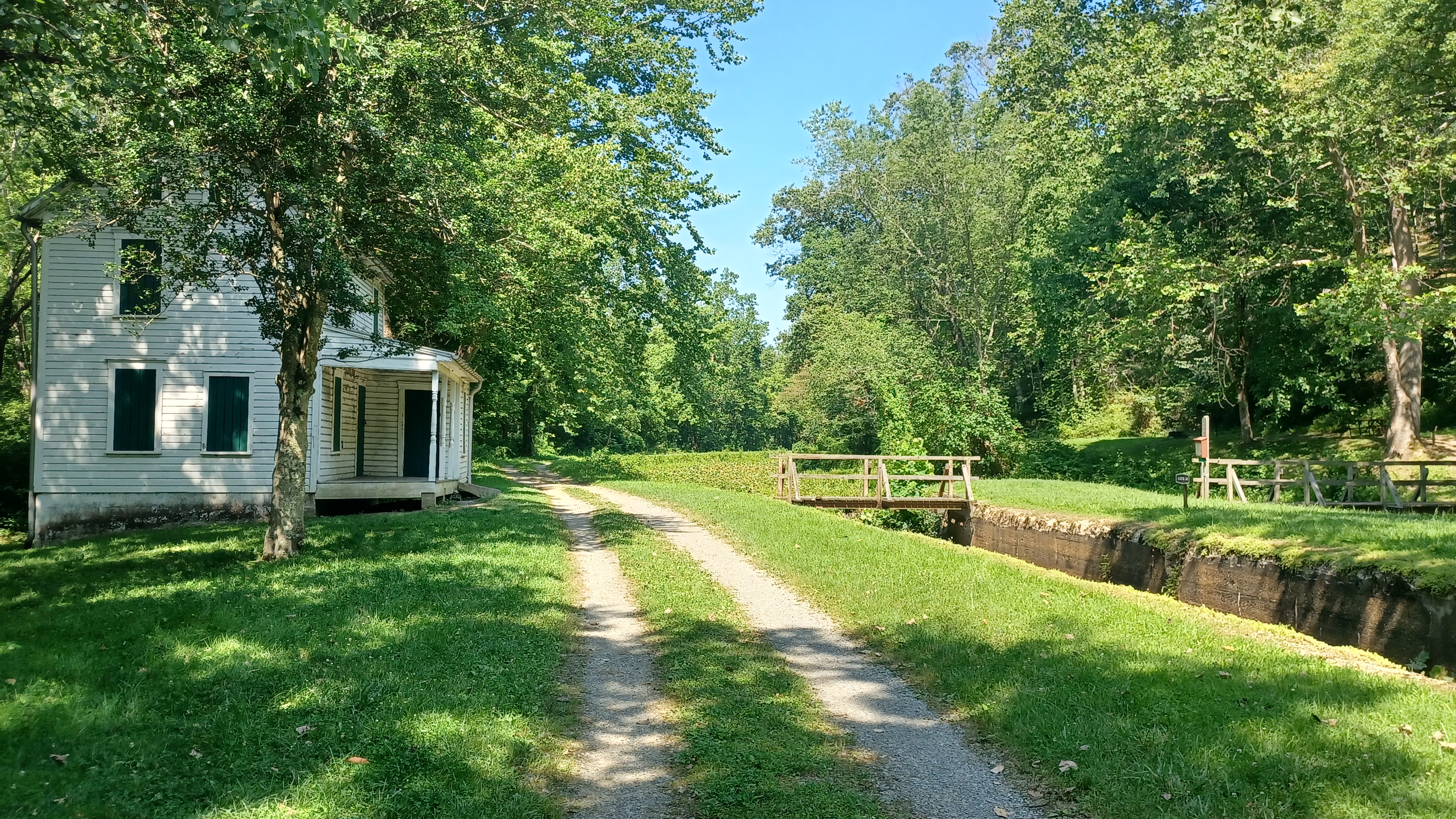
We had stayed in Cumberland the night before, and then headed west to Paw Paw where we met up with John for this Monday trip. With cars spotted there, we shuttled in my Element back to Oldtown. On the way, which took us slighlty on a different route to get into Oldtown than the day before, we passed by the Schoolhouse kitchen, and turned down to the lot at Lock 70, in the Battie Mixon Fishing Area, a section of canal pools between the three Oldtown Locks refurbished in the 1950s.

This time, we'd be on a gradual downhill trajectory back toward Paw Pawk.

As we got out of the car, a lady was parked to the left of us and said we should have gone down to the tunnel. I told her we were in fact going there. She looked shocked and asked "From here???". When I told her we were doing 15 miles, she seemed even more shocked. She said she lived right by the Paw Paw Tunnel on the canal, but hadn't been back in many years.
Like I'd done the day before, I let Ev out to walk the first bit of this. We crossed over the footbridge over Lock 70, and turned left where the road crosses the canal.
To the north, from the bridge, we had a good view of the Michael Cresap House, built in 1764.


Michael's father, pioneer Colonel Thomas Cresap arrived prior to 1746, and the place was named Shawnee Old Town, as the Shawnee tribe once lived here but had since vacated.

Cresap established a fort, where a teenage George Washington got his first experiences in surveying, while decided to make his profession.
By the early 1800s, Oldtown had been established as part of the major east-west road, for which there were several incarnations and improvements including the National Road.
The town became more prominent with completion of the Chesapeake and Ohio Canal in 1850.
A wooden pivoting bridge once stood here, but it burned in 1906, taking the original lock house and Canal store with it.
We descended onto the next level of the canal, and like the day before, it was pretty wide open with no shade at all.

It wasn't far to Lock 69, the lower of the locks at Oldtown, also known as Twigg's Lock.

This lock, like the other two Oldtown Locks, was built in 1849-50, in an "economy lock" style, made of composite stones stacked with kyanized wood sheathing on the outside. This was like most of the locks we'd seen on the Delaware and Hudson Canal series we'd done.
Some time after 1900, all of these wood lined locks were lined again with concrete, making them a bit different than the others.
Adjacent to Lock 69 was Union Fort Lininger, in the wetland between the canal and the Potomac River.
The first really odd thing we came across while walking this section was a single grave off to the right in the weeds, very near to the lock. We couldn't quite read anything on the lock, but there was a flag on it.


We continued ahead, and Ev was getting a bit cranky. There was a basin on the left, and then a narrower section again. The canal continued down along the Mill Run, which was on the berm side, which is sort of a side creek parallel with much of the Potomac River for a time, but we soon came out into the river basin once again.


Ev didn't want to walk any more, but he also didn't want to ride in the stroller. Where he had been completely happy the day before, he gave me a hard time the beginning of this one. He just wanted me to carry him, but he doesn't realize how heavy he is getting. He's well over thirty pounds now for sure.

I got him to sit in the stroller, unhappily, and then he likes to arch his back to make it hard to keep him in, and when he fails at that, he slouches down into the stroller to the point where he is almost falling out of the bottom of it, with his feet sometimes scraping against the wheels, either slowing me down or making it hard to turn.
He hollered for a while in this stretch, but then the cicadas were starting to make their noise for the first time I recall of the season. They were quite loud, and I told Ev to listen to the cicadas. He stopped screaming and immediately listened, and things were all of a sudden better with something of interest.
The canal remained watered through this stretch, and quite pretty. After the basin, we came to major cliffs on the berm side known as Falling Rocks. The stunningly beautiful section took us around a curve known as Yorker Bend.


I got pretty far ahead of Joe Millionaire and John, but they were having good conversation so I didn't mind so much leaving them both behind. I suppose I spared them of Ev's screaming for a little while.

Ev looked up at all of the rocks and seemed interested as well. It was quite great.
Soon, we came to Lock 68, also known as Crabtree's Lock, named for two generations of lock tenders who worked here. The lock was apparently built at about the same time as Locks 69 to 71. This one has a concrete thing across it to keep the canal watered upstream into the Battie Mixon Pool area. Battie Mixon was an Allegany County game warden who organized the volunteers to established fishing areas on the canal starting in the 1940s.
The unoccupied lock house is still standing at the site, and a 1918 modified Warren Through Truss bridge spans the canal directly over the locks.

It was a road that used to go from present day Rt 51 to a ford and ferry site over the Potomac to the site of South Branch Station, later French's Station, on the Baltimore and Ohio Railroad on the other side.
Directly below this lock is where the North and South Branches of the Potomac River split. This river had a major effect on decided the boundary between Virginia (later West Virginia) and Maryland would be.
The original bridge at the site would have been a pivoting bridge, destroyed during the Civil War. It was rebuilt in 1869 before the current one was placed.

Through this section, the former Western Maryland Railroad, built about 1904, comes and goes from view uphill from the berm side of the canal. It pretty closely parallels the canal all the way from Cumberland to east of Hancock MD.

Some of it is now trail, and I hope to do more future hikes on it as loops using both the canal and rail bed.
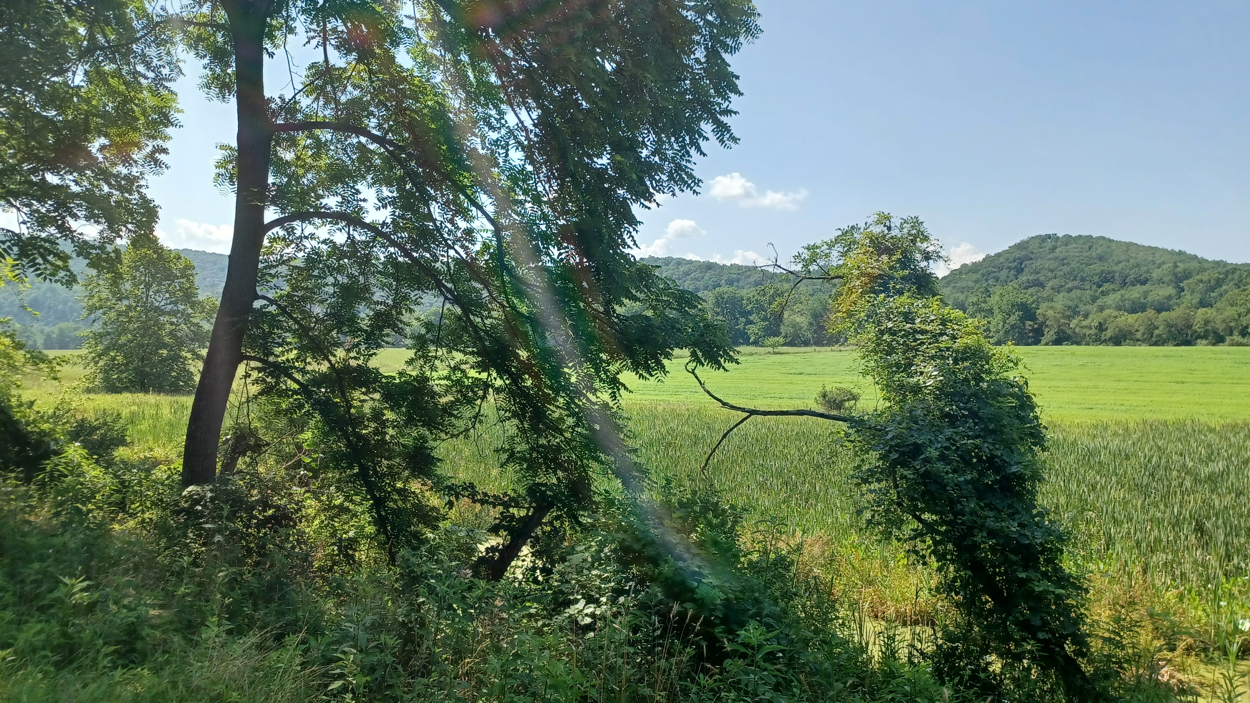
The canal remained watered ahead, with a lot of farmland along the way. It didn't provide nearly the amount of shade I was hoping it would through this section, but we got through it, and it was quite pretty. There were always Great Blue Herons in the canal adding to the ambiance.
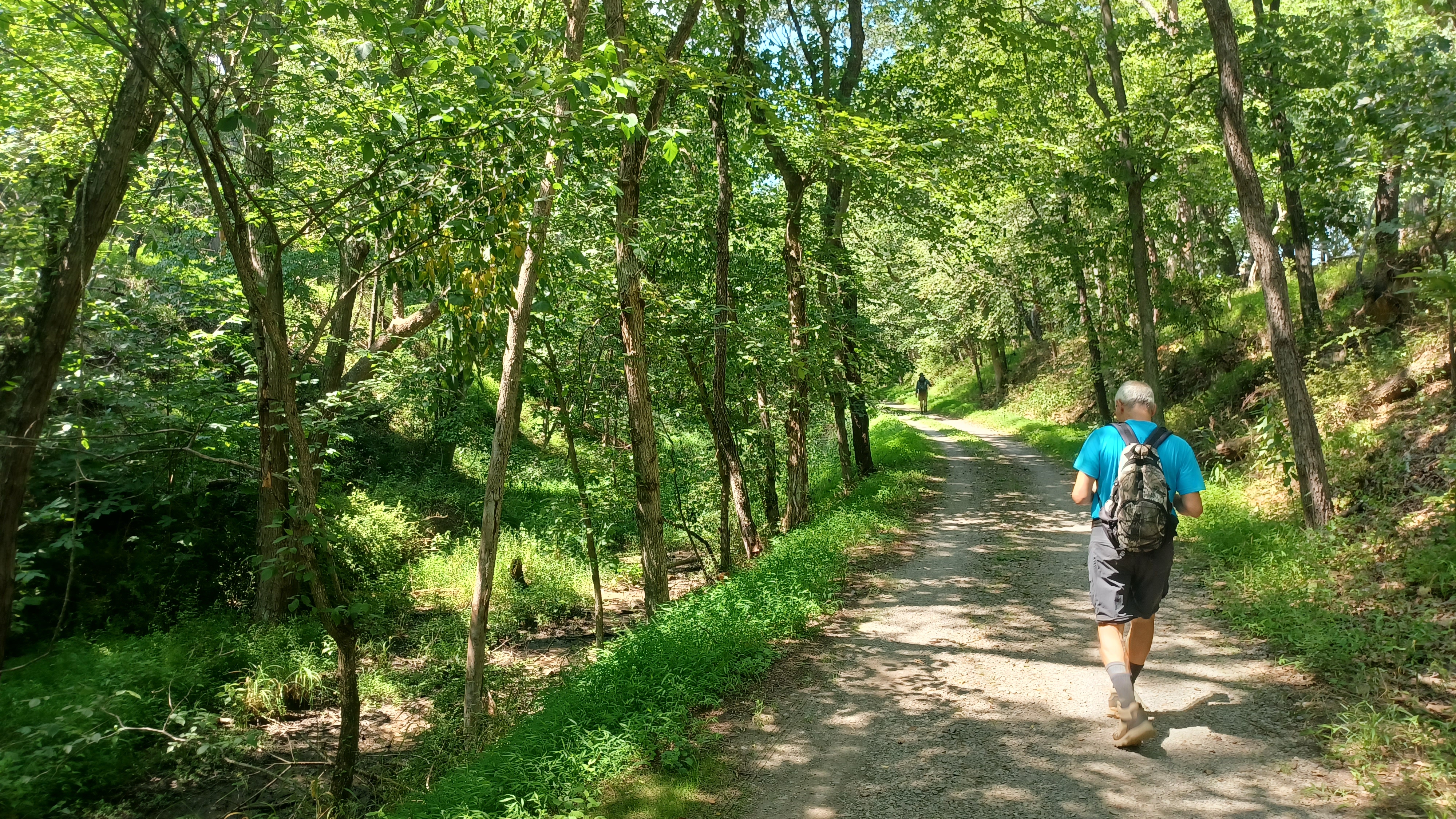
There was eventually a concrete thing across the canal that keeps it watered to the west. Beyond there, we ended up in more shade, and along a dry canal bed.


Soon, we came to the Town Creek Aqueduct. The 100 foot long single arch span was similar to the one we had crossed Evitt's Creek on the day before, with a dry flood in the aqueduct, and a nice towpath on stone. Immediately to the left of us, the former Western Maryland Railroad bed crosses Town Creek on a deck girder bridge. The aqueduct was refurbished by National Park Service in 1977 after extensive damage.


We took a break here, and went down to check out the creek and confluence with the Potomac. It was a beautiful spot to take a dip, and for Ev to throw sticks and stones in.

We headed back up to the towpath and continued east along Green Ridge. Town Creek campsite was just ahead on the trail. It was another pleasant stretch, and soon we came to Lock 67.
This was another of the composite locks, originally wood lined, and later outfitted with concrete. It was also known as (Hughey) Darkey's Lock. A long time occupant of Lock 68 named Isaac Long claims that there was a saloon of one Gene Stumph, who had flirtatios red-headed daughters made this a favorite stop for boatmen.
Lock 67 marked the start of the 6.5 mile long "Tunnel Level", which led out to beyond the Paw Paw Tunnel.


We continued ahead, and the canal became watered a bit again. There was a very narrow spot where the canal, river, and Western Maryland Railroad bed are all within a sixty foot span.

As we walked, we came upon a nice path to the right down to the Potomac River. It looked too inviting and easy to push the stroller down not to have a look. There was one steep spot, but we got down it okay.
We came out to a stunningly beautiful stony beach along the Potomac which was just perfect for a dip. We all went in and enjoyed it, and Ev again threw rocks and sticks into the river happily.
I decided to see how tough it was to cross, and it was really nothing. I swam a little, but it never got too deep. I was able to walk across the entire river to the West Virginia side with no problem at all, and back.


We continued along, and passed into Mitchell's Neck Deep Cut, a rather dramatic cut the canal passes through, and over top of us crossed the former Western Maryland Railroad again.

I climbed up to check out this bridge, which was quite an interesting through truss structure. None of the right of way was clear in either direction, so it was definitely no good for any loop hiking opportunities.
Soon, we passed beneath Rt 51 via a bridge. Prior to this road being built, he settlement of Paw Paw West Virginia was reached by ford or ferry one mile upstream. We had crossed a farm road that was the original road to the ferry site.

Paw Paw was once a major industrial center on the Baltimore and Ohio Railroad, with a tannery and lumber interests.
Ahead, the Paw Paw campground is on the right. We parked at this location, but that would put us under the 15 miles I wanted to do for the day, and I really badly wanted to see the Paw Paw Tunnel. The remainder of the trip would be an out and back from this site.
To the right, the Canal Section Superintendent's House still stands near the campground.


We continued past a side trail that through hikers and cyclists must take to get past the tunnel. While the tunnel was open to pass through, the trail on the other side was not, so it had to be done as an out and back. The cut on the other side of the tunnel was in bad shape and currently under construction.

We made our way past a few signs, then into a cut to the mouth of the tunnel. Ev was fast asleep at this point, having waited and tried to keep himself awake for a long while before we arrived.
The amazing engineering feat has a towpath built into the right side of it, and I'm told some of the hand railings inside are the same ones that were in there during canal days.
The construction of the tunnel eliminated six miles of navigation necessary to get around the Paw Paw Bends. This would have required either a crossing of the river to the West Virginia side and back, hacking out a canal on the Maryland shore along steep cliffs, or damming and utilizing slack water navigation for that six miles. All of these options were debated, but Charles Fisk pushed for the tunnel.
The contract for construction went in 1836 to Lee Montgomery, a Methodist Minister, who had experience working on a tunnel in Pennsylvania. Construction began that year, and the tunnel was holed through in 1840. There was a major work stoppage from 1842 to 1846, and then work started and stopped in fits until the final brick lining work was completed in 1850 or 51. The tunnel opened for navigation on October 10, 1850.
There were all sorts of financial issues with the tunnel, stemming from strife between different nationalities doing the work, and the fact that Montgomery had been making his own poor quality bricks, which were apparently discarded nearby and have been found near the superintendent's office.


The fights got so bad that militia had to be called in to restore order.

Even after completion, there is much local lore surrounding the tunnel.
Only one boat could pass through the 3,118 foot tunnel at a time, and sometimes boats would end up facing one another going through. The rule was that the more heavily loaded boat would have right of way, and the lighter one would have to back out. There are stories of boats coming to the tunnel and neither would back out. Superintendents would have to show up and talk one of them out, or a gun was drawn to decide who would go through first. A humorous one was where the Superintendent burned green corn on the downwind side of the tunnel to smoke out the stubborn boatmen.


In addition to the tunnel, there was a 200 foot long cut we walked through at the south side, and if we'd continued on the north side, an additional 890 feet at the north end.
I was elated to be at this point. I had read about and seen photos of this tunnel for years, and I was finally there.
We entered the tunnel, which was quite dark, but absolutely amazing, and continued through.


Ev woke up while in the middle of the tunnel, which was probably pretty scary! He handled it fine as I talked to him immediately when he was waking up.

We reached the northern end of the tunnel and looked out at the cut, where machines were present, and working until somewhat recently.
I really wished we could have continued, but I was very happy to make it this far. We turned back through the tunnel and headed back out to the west, then turned to the left onto the side trail that makes its way back to the Paw Paw Tunnel Campground.
I remember taking a break and laying in the grass at this point, very happy at what we'd accomplished over the past couple of days. I got a ride back to my car in Oldtown, and we were on our way home. Joe Millionaire stayed another night in Cumberland to drive out the next day.
There is one more day of hiking, 15.6 miles, on the C&O Canal east to Little Orleans, from which point I am willing to do a series of loop hikes along the canal all the way to east of Hancock. I have at least four loop hikes ready to go on the C&O after reaching Little Orleans that I'll drive to do.
I anticipate the day that I finish with these few far away things, and how great it is going to feel having conquered all of it despite difficulties in schedule and personal situations.
I'll get there. And I'll keep pushing.
No comments:
Post a Comment