

Hike #1373: 11/19/20 Flagtown to Flemington with Jason W. Briggs, Daniel Trump, Karen Ezzo, Brittany Audrey, Kirk Rohn, Justin Gurbisz, Joe Tag, Tom Vorrius, Jennifer Tull, Cory Salveson, Linda Salveson, Dani ?, and Janice ?
This next hike would be the next night hike, a point to point piecing together history and greenway stuff I'd done before, some new stuff, and some stuff I hadn't done in a very long time.

I first walked through on the entire line back in Summer 2008, and much of it was really good.


We met at the Taco Bell in Flemington near the Shop Rite, and then shuttled with as few cars as possible to the little town of Flagtown.
The settlement of Flagtown is named for Jacob Flagg who settled there in 1700. His descendent, another J. Flagg, was proprietor of a local hotel, which served as a voting place and headquarters for the Hillsborough Company during the Revolutionary War.
Flaggtown became a station stop on the two railroad lines that came through; it was also for a time known as Frankfurt, and then was changed to "Flagtown", dropping one letter G.

I was so happy that I had such a large crowd despite all of the covid craziness still going on. For a while, I thought no one would want to be coming out on night hikes, or even day hikes for that matter, but I think it helped to really bring people closer overall.

The line was built in 1864 as the South Branch Railroad, which operated from Somerville NJ, at a site that is now the commuter parking area at the current station, out to Flemington.
The Lehigh Valley Railroad also served Flagtown, and is just south of the line we were following, still actively used by Norfolk Southern.

We got to a bend in Clawson Ave, and then had to push through a little bit of thick undergrowth, but it soon widened out to a reasonably clear rail bed to walk.
It wasn't as nice and clear as it had been the last time I walked it in 2008, but it wasn't too bad either.


On this trip particularly, we had a nice discussion about "towing the line".
Because of my outspoken criticism about the management and seriousness about what has been going on, I've come to deal with a great deal of scrutiny that has sometimes been hard for me to handle. People I thought respected me sort of turned, and a whole lot of friends dropped me from social media because for whatever their personal reasons were.
As an environmentalist, historian, and preservationist, I lean very much toward the Democratic way of thinking when it comes to those things. I was outspoken against what was going on in Iraq years ago and found the quite perfect style of Barack Obama to be refreshing.

At that time, I stated that there would be a landmark case that would force government to be responsible for its actions with regard to social media, but this rather small railroad was not big enough to be the landmark case.
I thought covid would be tht landmark case, but people were still "towing the line" despite rather obvious lies that could be proven regarding what was being said by the Democratic governors.
I'm still as much an environmentalist and historian as ever, but I simply would not cast a vote for someone who so blatantly lies and pushes non truths to public.


His sometimes dark sense of humor might provoke the reaction "too soon" from some folks, but we have both always had a similar appreciation for such humor.
As we walked and talked, he told me that some of his fellow Democrats were giving him a hard time for not towing the line 100%. That was kind of disheartening to hear because he's so incredibly intelligent, but in no way pushy. When I'm hearing that people are not giving consideration to things he is saying, it leaves me more worried more about the state of the world.

"Maybe...they're brave" he said of them in this time. His take on it I found both endearing and refreshing.


It was at this point when on that past hike we found a creepy doll head duct taped to a tree.
We pushed on ahed from here, and then came close to Riverside Drive.
We pushed on ahed from here, and then came close to Riverside Drive.

The railroad bed just got far too overgrown to bushwhack through it ahead.
The road changed names to Mill Lane, probably when we passed an old farm house. The road moved out around the house and further from the railroad bed at this point.
I gave the option of following me or just staying on the road here. Most of the group chose to follow me, and it was a bit more grown in down there than what we were previously in.

It was already totally dark by this point, so there wasn't a lot to see, but we went for it anyway.
Dan and Karen continued ahead on the road I believe, or they got on the active railraod track, I'm not sure.

.jpg)
We followed Mill Lane out to where the railroad crossed the South Branch of the Raritan River.

One segment of girder bridge crossing was removed on the section that went across River Road. That would keep us from being able to go across the Raritan on the old railroad trestle.

We headed over to the Neshanic Bridge.

The Neshanic Station Bridge carries Elm Street over the South Branch of the Raritan River in the little community of Neshanic Station.
The 285 foot long, 2 span, 9 panel pin-connected lenticular through truss bridge was built in 1896 by the Berlin Iron Bridge Company of East Berlin, Connecticut.
It is the more significant of only two remaining examples of lenticular through truss bridges in the state of New Jersey.
There are actually only two other examples of this style bridge I can think of that we've gone to. One was over the Housatonic River in Connecticut, and one is the Waterville Bridge on the Appalachian Trail over the Swatara Creek.
We headed across the bridge, and then passed the new South Branch River Trail parking lot.
I really want to walk this section, because it's one of many that I haven't looked at yet, but it might not have been good to get through and it would certainly have taken a bit more time.
.jpg) I didn't want to chance bullying through if it it didn't go all the way through. I'd certainly have to do this segment as a day hike first, or as a night hike that started during the day in that area.
I didn't want to chance bullying through if it it didn't go all the way through. I'd certainly have to do this segment as a day hike first, or as a night hike that started during the day in that area.
.jpg) We turned to the left from Elm Street to Main Street, and then got to the former railroad crossing and the Neshanic Station itself.
The station is in pretty good shape, and is now a private residence. I pointed it out, and we moved on ahead pretty quickly.
We turned to the left from Elm Street to Main Street, and then got to the former railroad crossing and the Neshanic Station itself.
The station is in pretty good shape, and is now a private residence. I pointed it out, and we moved on ahead pretty quickly.
 We reached the bend in the road, and Woodfern Road continued to the west.
We went straight past the abandoned business buildings on the right.
There is an old mansion that used to stand to the left, and I wasn't sure if it was still standing or not in there.
We continued around the back of the building, and there was a door wide open. We decided to have a look in there before moving on.
From that, we continued along the back, and Joe told us that there was hidden in that now closed industrial complex, an old cemetery that some of his ancestors were buried in.
We reached the bend in the road, and Woodfern Road continued to the west.
We went straight past the abandoned business buildings on the right.
There is an old mansion that used to stand to the left, and I wasn't sure if it was still standing or not in there.
We continued around the back of the building, and there was a door wide open. We decided to have a look in there before moving on.
From that, we continued along the back, and Joe told us that there was hidden in that now closed industrial complex, an old cemetery that some of his ancestors were buried in.
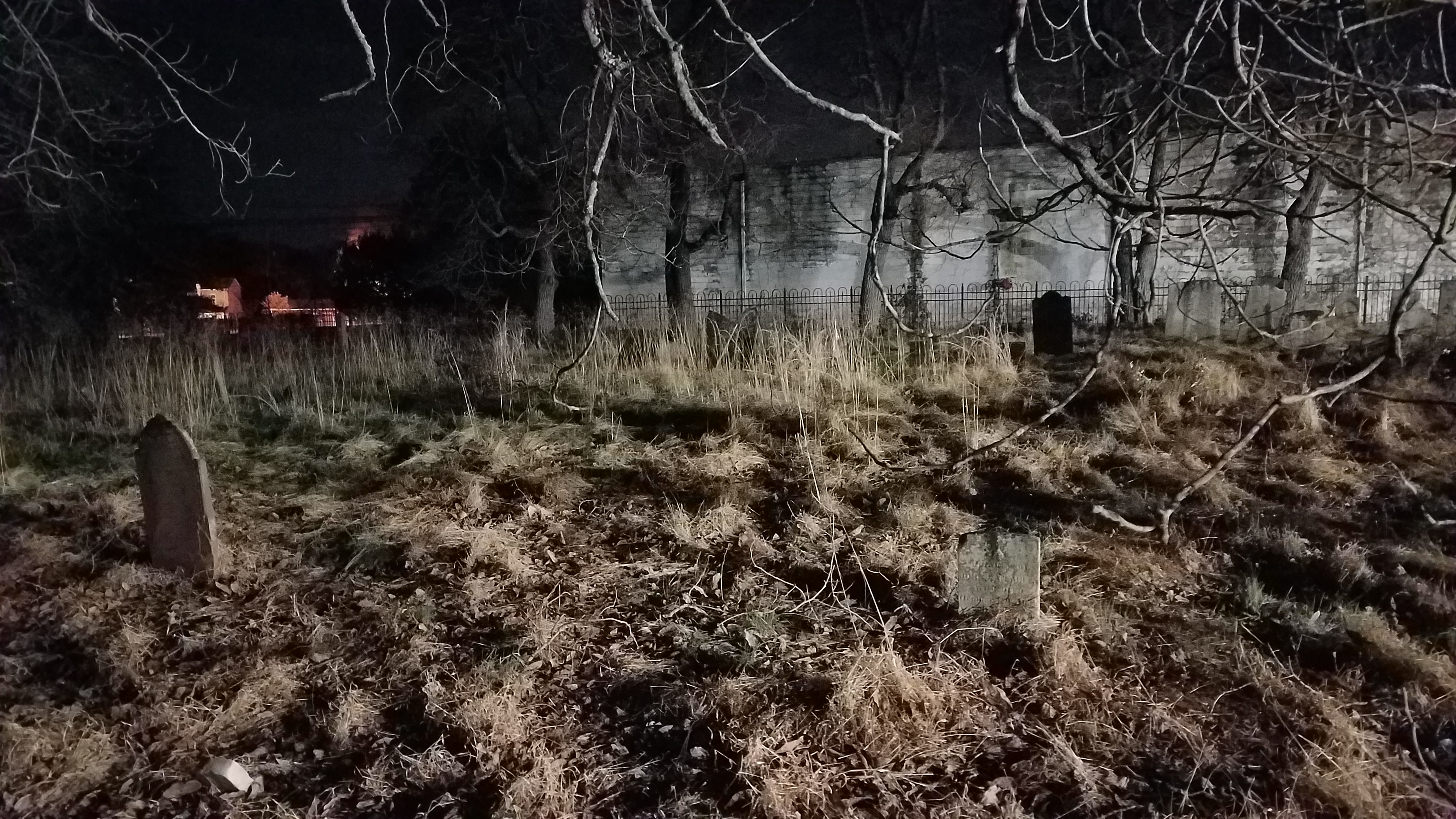
 We went around the buildings, and then cut to the right, and Joe brought us directly to a very old fenced off cemetery oddly located between all of these buildings.
It was known as the Hall Cemetery, and it had a very nice ambiance with the bright moon and slight ambient lights around.
After checking out the cemetery, we continued along Woodfern Road heading to the west.
The railroad at first paralleled the north side of the road through this stretch in a deep cut. I bushwhacked it years ago, but that wasn't happening at night.
We continued along and passed the Joe Stala Park lot. This has mowed trails going out through it, but we didn't have time to be going over those this time.
We went around the buildings, and then cut to the right, and Joe brought us directly to a very old fenced off cemetery oddly located between all of these buildings.
It was known as the Hall Cemetery, and it had a very nice ambiance with the bright moon and slight ambient lights around.
After checking out the cemetery, we continued along Woodfern Road heading to the west.
The railroad at first paralleled the north side of the road through this stretch in a deep cut. I bushwhacked it years ago, but that wasn't happening at night.
We continued along and passed the Joe Stala Park lot. This has mowed trails going out through it, but we didn't have time to be going over those this time.
 We passed the intersection with Blackpoint Road where the trail we first saw at the Neshanic Station Bridge would come out. I'm hoping to try to hike that in the very near future.
We made our way further west again, past several houses. The railroad bed to the right was often indiscernible.
We eventually turned to the right where Woodfern Road headed north across the railroad bed. I'd gone through that section back in 2008, but there is a house close to that spot so we didn't bother to try to go through it. It was somewhere in this area that the Woodfern Station once stood.
We passed the intersection with Blackpoint Road where the trail we first saw at the Neshanic Station Bridge would come out. I'm hoping to try to hike that in the very near future.
We made our way further west again, past several houses. The railroad bed to the right was often indiscernible.
We eventually turned to the right where Woodfern Road headed north across the railroad bed. I'd gone through that section back in 2008, but there is a house close to that spot so we didn't bother to try to go through it. It was somewhere in this area that the Woodfern Station once stood.
 It was a simple shelter station, but I'm not exactly sure where.
We followed the road north and it turns hard left ninety degrees when Lehigh Road goes straight.
We walked out to the next ninety degree bend and waited there on the corner for the rest of the group to catch up.
We continued south from there to where the old CNJ line used to cross again.
It was my understanding that the rail bed from Woodfern Road to the west was all public land, but that they hadn't developed the trail there because of some disagreement with the farmer or something. Whatever the case was, it was clear and easy walking, and it leads right to the Hunterdon County line where it does become official trail.
It was a simple shelter station, but I'm not exactly sure where.
We followed the road north and it turns hard left ninety degrees when Lehigh Road goes straight.
We walked out to the next ninety degree bend and waited there on the corner for the rest of the group to catch up.
We continued south from there to where the old CNJ line used to cross again.
It was my understanding that the rail bed from Woodfern Road to the west was all public land, but that they hadn't developed the trail there because of some disagreement with the farmer or something. Whatever the case was, it was clear and easy walking, and it leads right to the Hunterdon County line where it does become official trail.
 We followed that along the wide open fields, and then into the woods of the county park land.
This is a cool bit for me to see, because I worked on this section as an employee. Adam "Bandit" Johnson and I went back and did chainsaw work to get the right of way clear, and we talked about redecking a short bridge that was just I beams at the time. The county was somewhat opposed to moving along with that at the time, so nothing ever happened while I worked there.
We followed that along the wide open fields, and then into the woods of the county park land.
This is a cool bit for me to see, because I worked on this section as an employee. Adam "Bandit" Johnson and I went back and did chainsaw work to get the right of way clear, and we talked about redecking a short bridge that was just I beams at the time. The county was somewhat opposed to moving along with that at the time, so nothing ever happened while I worked there.
 Somewhat recently, the right of way had been fully developed on the county side, and so we followed that trail right back to Higginsville Road in Three Bridges.
This time, I was rather surprised to see as I recall that it looked like they might develop trail onto what was always private land toward Three Bridges to the west. It wasn't open yet, and that wasn't the trajectory of our hike, but it was still pretty cool to see.
Somewhat recently, the right of way had been fully developed on the county side, and so we followed that trail right back to Higginsville Road in Three Bridges.
This time, I was rather surprised to see as I recall that it looked like they might develop trail onto what was always private land toward Three Bridges to the west. It wasn't open yet, and that wasn't the trajectory of our hike, but it was still pretty cool to see.
 |
| Woodfern Station |
.jpg)
.jpg)


On the other side of Higginsville Road was the Higginsville Station, which was another very small shelter type of station, maybe a flag stop or something.
We turned to the left and crossed the Higginsville Bridges over the South Branch of the Raritan.
 |
| Neshanic Station |
Actually, although quite similar, these are two are separate bridges that share a center pier.
The north span is an 1890 7 panel Pin-Connected Pratt Through Truss bridge built by the Millikin Bros. of New York. It’s said to be a rare surviving example of the company.
The south span is an 1893 through pratt truss, built by the Wrought Iron Bridge Company of Canton Ohio.
It’s unclear why two similar bridges were constructed three years apart by two different builders. Maybe one of another original washed out at a different time, or maybe one at a time was replacement for earlier wooden structures. Whatever the case, they’re quite interesting.
They’re painted a nice cream color which is also atypical of bridges of this area, which are usually a sort of light green in color.
 |
| Higginsville Station We continued out to the little settlement of Higginsville on the other side, where the old mill still stands as a private residence to the right. We turned left on Three Bridges Road a short bit, and then turned right into Clover Hill Park. This area was close to the Province Line, also known as the Keith Line, which separated the colonies of East New Jersey and West New Jersey in 1686. We followed the farm land west, and then north again further into the property. I had worked for Hunterdon County on the tract, which at the time was working on the management deal for which it became Clover Hill Park. It was actually part of South Branch Wildlife Management Area, but put under county management. I think some of it is still state managed, but most of it is now the Clover Hill Park. The land was woodland, then in agriculture adjacent to Higginsville for many years. In 1930, it was purchased by John P. Case for use as a poultry farm. There was a four story barn for this purpose as well as two metal chicken hatchery sheds. The farm was considered to be the last full scale chick hatchery in the state, serving up to sixty customers per day. The farm was eventually sold to Merck, the pharmaceutical research company a research farm. It remained in their hands for many years until Hunterdon County and the state of NJ purchased the two sections of it. Merck actually dates back to Germany in 1668 when the Merck family purchased a drug store in Narmstadt, Germany. The American subsidiary of the company started in 1891. The German parent company still owns the rights to the name around the glove, and is somewhat separate from the giant American company today. Jersey Central Power and Light removed the poles and lines from the property for the most part in 2013, probably the last improvement made to the property since the initial management deal was made with Hunterdon County Parks in 2008. My plan had been to go through the property the way I had in the past, but when we got about mid way through, and before I wanted to make the left turn to the east, there was one of those amazing long plank roads built under the power line so that vehicles could get across for work.I changed the plan right then, because it was about the same distance, but it was something new and different. We walked the plank road directly across Clover Hill. I forget if we took the side trail from the fields on down and around the way we always used to, but we ended up leaving the park onto Clover Hill Road. The group kind of got ahead of me on this segment, and some of them made a bee line back to the cars without doing the trail stuff I had in mind. There was first a ball field park with a perimeter path I wanted to do, then it went over a small tributary to another undeveloped field. It's from that point we cut out the corner of it and onto Old York Road. We followed the road left at Voorhees Corner Road and made our way to Barley Sheaf Road. We turned left there and then right on Ewing Drive through developments. From Ewing Drive, a paved path cuts to the right skirting private yards, and leads to Redwood Terrace near the intersection with Mulberry Lane. We turned onto Mulberry Lane, and then soon came to a municipal park at the Sun Ridge Home association. There are some nice paved paths through this, and usually when I come through here we skirt the east side, which we did this time. The trail ends at Sunridge Drive but there is sort of public common land that goes all the way to Hart Blvd with a foot bridge over a small brook and such. I believe we meandered that to Hart, and then turned right. We followed that to Liverpool and turned right, then left on Aberdeen to a paved trail on the right. That led us out to a cul de sac on Devonshire. I think it was this time we didn't go straight on through to Devonshire, but rather found a path earlier that went to a playground between homes that we didn't know had existed. So we checked that out first and then continued the other way. I seem to recall I might have finished this hike alone with everyone going far ahead. The next street intersections, Londonderry, Wellington, and Manchester are all crossed, sometimes following grass, and sometimes on more paved paths that meander along the development. After Manchester we cut to the left away from the pathway, and then through a line of trees to come out behind the Shop Rite of Flemington. We just walk around that to get back out to the Taco Bell. It was overall a really good trip with some interesting stuff along the way. |
No comments:
Post a Comment