
Hike #318: 4/15/20 Harriman/Reeves Brook Area Loop with Jason W. Briggs


I assume that because of what we were discussing during the hike, and the other few that were deleted in all but title on facebook, that it was removed due to the covid discussions we were having.
Everything was crazy at the time and getting worse.
The State of New Jersey was the only state in America that shut down all state and county parks completely to even passive recreation. This was absolutely ridiculous, and the amount of crime that took place within the parks while there were were no eyes and ears on everything was out of this world.
In one week alone, we had all of the toilet paper stolen on two occasions. I was boarding doors shut to keep people from breaking in. A vacant house was broken into twice, and then had to be cleaned out to keep it from happening again.
Municipal parks were not all closed, and so they were over flooded with people out and about.
The State of New York did not close their parks, and so the trail heads just over the state line, like where Jason and I went at Reeves Brook, ended up overrun with people. We fortunately got there early enough that we found some pull off parking.

I really wanted the workout, and so going up and down the undulating terrain in Harriman was just what the doctor ordered.
Further, that was the best thing for the pandemic. Fresh air, exercise, and sunlight were the best thing for us, but doing what we were doing was often ridiculed by those who just stayed inside.
I had done a whole lot of Harriman before, but I had never hiked out of Reeves Brook yet.
I believe we got on the Pine Meadow Trail for a bit out of the Reeves Brook parking lot, and then started heading uphill along a brook, then away from it, on the Seven Hills Trail.

The trail was brought up to Major Welch of Harriman State Park, that it should be "made official". Another trail builder, Jack Spivack, found Allis's trail, and reworked it a bit, to the "Trail of the Seven Hills". Those he had in mind were Nordkop Mountain, Hillburn Mountain, Ramapo Torne, Torne View, Chipmunk Mountain, Diamond Mountain, and Conklin Mountain.
There is a colorful history in this area of the "Great Ramapo Trail War", in which a Russian man named Kerson Nurian, who also marked his own trail system, started his own trail.

Seven Hills Trail was eventually repainted out to Suffern, but then the entire area was closed down by the Ramapo Land Company, Pierson Estate, in 1940 when permission for the trail to cross the then private property was rescinded.
When President of the Ramapo Land Company James R. Pierson died in 1959, negotiations for the land reopened and were acquired by the park about 1963.
Most of the trails were re-opened, but had to be tweaked at some points. The Seven Hills Trail had been rerouted from Suffern being the western terminus over to Sloatsburg, but there was no on street parking, so it was moved below Ramapo Torne.

When we finally reached Ramapo Torne, it was quite a splendid view. I'd never seen it before, and although it wasn't as broad a view as that of Nordkop Mountain to the south, I quite enjoyed it.
Hillburn-Torne-Sebago is another trail that has a rich and unique history, and it originally went from the town of Hillburn to the Lake Sebago Dam.
This trail was first blazed yellow in 1928 by Kerson Nurian. He utilized some Seven Hills Trail and would paint out blazes of a couple of other trails that passed through the area with black paint, and leave only his blazes up.

The trail was reinstated after the park acquired the land again, but it didn't remain from its original location in Hillburn.
It also didn't connect to Lake Sebago any more, except for by way of other connecting trails. That east end was eliminated for simplicity of less blazing apparently, but the segment from Hillburn still had a private property issue. No official trail apparently goes up Hillburn Mountain anymore. The trail used to go down into the valley between the Ramapo Torne where they put in a land fill, and then climbed to the top. Now it just loops back to the Seven Hills Trail where it terminates.

We continued along the trail which joined Seven Hills Trail briefly, then descended slightly to the right to down below a large rock face.
This is apparently the site known as "Russian Bear".
In 1929, Dr. Myrtle Rothrop Massey saw what she thought looked like a performing bear profile in the rock face. It was said that she would create fanciful names for images she thought she saw in the rocks, and that this is the only one that lasted the test of time. I didn't notice it.

We were only on this for a bit, and then turned right on Reeves Brook Trail briefly. We followed that to the Seven Hills Trail again, and turned right to begin the climb of Chipmunk Mountain.
The name "Chipmunk Mountain" didn't really fit the climb. It actually was quite rocky and hand some hand hold climbing involved, and headed up a pretty rocky cleft.


We continued on Seven Hills Trail across Hillburn-Torne-Sebago Trail, and then reached the Pine Meadow Brook.
We crossed on a foot bridge, then crossed Pine Meadow Trail before beginning the climb of Diamond Mountain.
This was another really steep but rewarding climb. I just love when hand holds are necessary to an ascent.
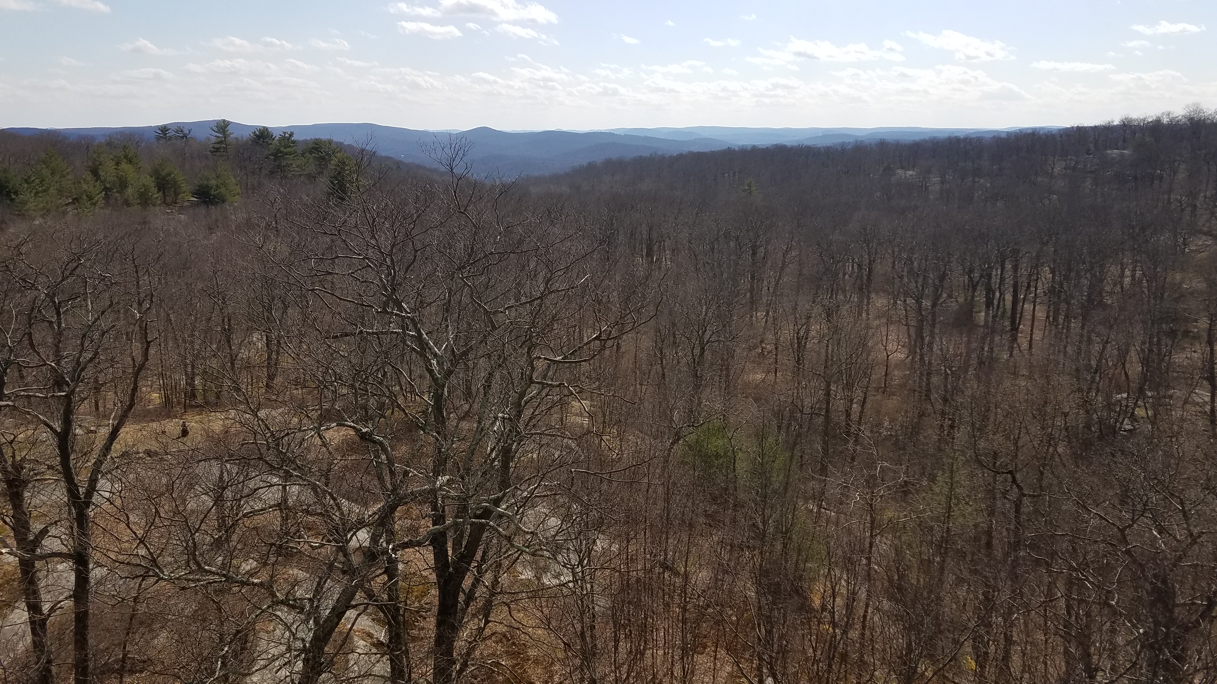
At the top, the first view as just across the valley and down through it to the west.


"Sebago" is the biggest lake in Harriman State Park, and it means "Big Water". Sebago was in fact the largest of the lakes built for recreation in Harriman State Park.
Work began on Lake Sebago in 1923 and was completed in 1926. It covers what used to be Emmetsfield Swamp, and the small settlement of Johnsontown. There was also a sawmill that reportedly still stands beneath the water.
I believe we continued to the Hillburn-Torne-Sebago Trail from the Seven Hills Trail and followed that downhill to the Tuxedo-Mt Ivy Trail.


Like so many of these long distance trails, it traveled between train stations. From Tuxedo, it traversed the mountains much in the way it does today, but it used to continued out toward Ladentown and then down into the suburbs to terminate at the Mt Ivy Erie Railroad station. That station is now long gone, and I'd hiked the line as closely as I could somewhat recently. The location is now passed through by the Long Path.
A lot of the trails have remained in place long after the train stations have been closed, but a lot of them were also abandoned or rerouted. Today, the trail is only just over eight miles long and no longer gets near the former settlement of Mt Ivy.
We soon reached the Sebago Dam, and then ascended to Seven Lakes Drive with a good view of Lake Sebago.


We continued across Sebago Dam and continued along the trail on the west shore of the lake for a bit, and Jason got a phone call he had to take.
I had been to this location before, and it was notoriously bad for phone service, so it was surprising that it went through.
The Tuxedo-Mt Ivy Trail continued up a bit, and then crossed an entrance road to the Adirondack Mountain Club camp along the shore of the lake. It turned away from that and climbed up between a saddle in a mountain. On the other side, we descended into a bit of a valley and reached the intersection with the White Bar Trail which the TMI Trail turned right on. It looked to be an old woods road at this point, which was exactly what was originally used.

We turned right on the coalsigned TMI and White Bar, and passed a cellar pit on the left. This was the homestead of the "Dutch Doctor" for which the nearby Dutch Doctor Shelter was named. His real name was John Frederick Helms, and he lived here from 1874 until 1884.
Soon, the TMI Trail turned from White Bar Trail to the left and began climbing Blauvelt Mountain. Jason was amazingsly still on his conference call, and both of us were shocked that it didn't drop. The entire call was regarding the property he owns in the islands, and how they would be handling quarantine and travel over the next several months or year. It was interesting to be a fly on the wall for these management decisions for sure.

We got to around the top of Blauvelt Mountain and started to descend a bit, and came to a point in rather open woods atop some rocks and such. I was using the official Harriman State Park map, which was good, but it was missing a lot of stuff the NY/NJ Trail Conference map would have had. I didn't realize it from their map, but we had reached a point I had wanted to get to for a long time: Claudius Smith's Den.
I didn't know a whole lot about this site except that it was some sort of cave. That alone is interesting enough, but I found out there were a lot more interesting points that tied this further in to everything I've been doing than I'd have expected.

When we started heading down, we saw just how interesting the formation was. We wandered on through one section of narrow natural cave, came out on the rock on the other side, and then kind of chimneyed along the south side of it to where we could safely come down.
Smith was an Englishman from Brookhaven Long Island, and a descendent of the great Richard Smith, founder of Smithtown Long Island, and the subject of discussions regarding those hikes when we did them in the Long Island series. He was married and had sons William, Richard, and James.
Claudius was captured in jailed in Kingston in 1777, but he escaped. He escaped to Long Island and was recognized by Continental Army Major John Brush. He was captured in his sleep in late 1778 and brought to Goshen where he was hanged in January of 1779.


We walked around and checked out more of the rock overhangs and such, which were pretty impressive, and then tried to find where the Blue Disc Trail continued.


The area where the trail intersects is kind of confusing because there is no underbrush at all, and the only thing to go by is the blazes on the trees. They were not painted in this area, but were rather tags that were either getting pulled down or were growing out of the tree. There were no signs of any kind otherwise.
We eventually found the correct route and began following it to the south, and passed by a rock formation known as "Elbow Brush", probably because of how it brings us walking up against the edge of it. I at first thought this was going to mean we would be pushing through Japanese Barberry or something.


Near the southend end of Pound Mountain we made it to a rock formation called "Almost Perpendicular". It's a really steep spot that I'd been wanting to experience for a long while, so that was another one to check off of my list. Going down it was probably a little more technical than going up, and I'd imagine going up it would be more fun.
We continued along the bottom from here, and then crossed Kakiat Trail. Near the bottom, on Blue Disc, I found a chocolate Easter Bunny sitting on a moss covered rock that was still good, so I ate it. It went quite well with my Weyerbacher.
The tral turned onto Kakiat briefly, and then continued down a gradual descent toward old Johnsontown Road.
I recall when we reached the road we turned left, then reached where the White Bar Trail starts at the end. We turned right on the informal path and then followed it out to the edge of Seven Lakes Drive.


There were so many more cars along the road, parked up and down the side, than there were when we arrived in the morning. Everyone was trying to get out, and most of them were Jersey plates since all parks in NJ were closed.
Jason and I had both had a very good day, and he said to me "This was the best day I've had in quite a while" when we departed.
The world was getting crazier by the day, with people panicking and such. Mask requirements hadn't started yet, but they were coming soon. We were instructed not to leave the state, and people were e mailing me asking how they would go about getting from Pennsylvania to New Jersey without getting caught. Everyone was just that paranoid.
I knew already that there wasn't really any way they could enforce any of the draconian measures.

Jails were let out because it was too dangerous to be in them apparently, and then all sorts of crazy crime took place.
There was the step sister of a girl that worked at one of the concessions where I work shot in the head on the interstate exit closest to my house, and she lived, but the guy got away.
An old friend who grew up across the street from me turned up dead in a swamp, more closed government land during this time under questionable circumstances of which I still don't even know any further details.
Everything just felt absolutely crazy and unreal. Gates and caution tape were put up to close off public parks, and people would come by and tear them down intentionally on a daily basis. I wished I could do that same thing, but I'd get in big trouble for it. I'm sure if I didn't work for such an agency, I probably would be one of the first doing so.
None of us had any idea of just how crazy it was to get.


No comments:
Post a Comment