
Hike #1367

10/24/20 Lewistown to McVeytown with Serious Sean Dougherty, Jennifer Bee, Jennifer Tull, Brittany Audrey, Professor John DiFiore, Steve DiFiore, Kirk Rohn, and Diane Reider

This next hike would be the next in the 911 Memorial Trail series, which at this point, for me anyway, is the next one in the Juniata Division Pennsylvania Canal series.

We had last left off with this series way back in the beginning of the year, and then I put it on hold because of all of the covid craziness. I had planned on getting most of the Juniata Valley done by this time, but since we were so far behind, I decided we’d do lots of the other trails through the area as well.
As far as the Juniata Division canal, I slapped it together with two sections of Standing Stone Trail.
As such, counting this one, there would be only four more remaining in the Juniata series.

In the end, only about half the hike was road walking, and they were beautiful backroads. It turned out to be quite excellent, and we saw quite a lot!
When we last walked into Lewistown, we walked down Charles Street to finish where we had parked at a grocery store. This time, I wanted to add something a bit more trail and nature to the start of it.
When I planned this one out, I was fully prepared for it to be a pretty sucky road walk much of the way, so having this bit on the start of it looked good. There is a trail that follows along the side of the Kishicoquillas Creek that looked promising, and took us right back to where we had been before, along the former route of the canal.


We met at the end point, at a Dollar store in Mcveytown further down the valley. From there, we shuttled in two cars back to Lewistown where we parked on street near the Lewistown Community Center, adjacent to the Lewistown Community Park.
The route would take us right down the street from there and into that park, where there are improved surface paths going all the way around it and along the creek.


We headed along the east side of the park and came out along the creek. We went over by Dorcas Street and had a look at the creek there, then climbed slightly to reach another trail out of the park. It went across Dorcas Street and then crossed over the creek by way of a former railroad bridge that had been re-decked. This was just a Pennsylvania Railroad spur that served an industry there at one time. The trail turned to the right away from the rail bed immediately on the other side.


We walked this to the confluence with the Juniata River where there was a nice view of the former Pennsylvania Railroad bridge upstream. This was a branch line that went up through Lewistown and beyond toward Sellingrove. The middle section of that is abandoned, but stubs from either side are still active.

We turned left and walked downstream along the Juniata briefly, and checked out the ruin of an old wing dam or something.
There was a sort of camp spot out there, and over closer to 22 there was a rough set of wooden steps built into the hillside we could take back up to the level of the road.

We turned left and walked downstream along the Juniata briefly, and checked out the ruin of an old wing dam or something.
There was a sort of camp spot out there, and over closer to 22 there was a rough set of wooden steps built into the hillside we could take back up to the level of the road.
We did so, then waked beneath the underpass toward Charles Street to formally connect with where we had been before on the previous hike. A ditch that might be part of the old Pennsylvania Canal was on the other side.
This section of canal was completed in 1832, and its hard to imagine that this was once the most important transportation corridor in America.
Right about where we got on Bus Rt 22 was once the site of a lock on the canal, but of course there would be nothing left of that.
We walked down the road briefly, and then checked out the oddity of the former Pennsylvania Railroad going right up through the center of town in the middle of Water Street. We headed from here adjacent to the railroad bridge over the river, down into Victory Park.
Here, a long section of the former canal route has been turned into a paved trail heading to the west.
I was expecting this section to be very short but quaint, but it looks like they officially extended the trail further in 2018, so we were in luck.
The path was at first nicely tree lined, and it passed the Mifflin County Veterans Memorial. It also took us beneath the Rt 103 bridge, where the underside had some very impressive art featuring scenes of different time periods of military.
There were some beautiful views of the Juniata River through this section. The former canal was filled in to the level of what would have been the towpath, and the delineated trail was along that, close to the former towpath. We went through the parking lot the park, and the path continued on to the west.
It was so nice, and there were some really clear areas down below closer to the river, and so I had to go down to check them out more closely.
I was so happy with the route so far that I broke out some special Sierra Nevada rum barrel aged quadrupel ale called “Trip in the Woods” which was quite excellent.
Serious Sean climbed a tree down there, which was kind of sketchy, because it would have been a big drop down to the river if he went the wrong way.
We headed back up to the trail, which eventually came to an “end” ahead. There was a sign reading “end of trail”, but the canal route is followed by a utility right of way that remained mowed for a while beyond the delineated pathway.
We eventually came to a work yard of some sort, and then a truck pulled up into it. I didn’t want to go much farther with a vehicle there, and so we headed to the left, over a pile of concrete and debris, and descended closer to the Juniata. There was a reasonable path down below along the river that we could follow parallel with the former canal route.
I was getting warm, and the river looked so inviting that I decided at this point to walk out into it. My ankle was still hurting badly after the damage from the recent night hike, and the cool water was feeling really good on it.
I decide dnot to stop heading out, and managed to walk to the very center of the river. It was a stunningly beautiful place to be, and I felt a lot better getting into the water.
I actually then took my shirt off back at the shore and layed in it. It felt great.
When I came out, we remained on the small informal path along the river, which was great. The banks were lined with impressive, large Silver Maples. There was a really cool one that went way out onto the water, and Brittany, Serious Sean, and Kirk all went out onto it.
It looked particularly funny because Sean wore a really nice striped suit on this hike.
We continued out along the shoreline, and came to a really pretty stony beach, and a wash where an old stone arch culvert from the original construction of the canal was still in place. Half our group walked all the way through the thing. I went in to take a photo through it but came back out the same way.
It was at about this point that we climbed up to resume walking on the towpath.
The path was pretty clear, and the utility lines were still using the former canal route. The route took us out to a road that joined the canal route called Blue Juniata Drive. We continued to walk this.

There were spots out there I thought could have been former lock sites, because of a rather obvious rise in the elevation of the road, but I haven’t found any maps that show any in the area. None of the historic atlas maps from the 1880s show there having been a lock anywhere in this area, from Lewistown all the way to below Mcveytown, but I know there were three of them right together at one point. Because there are not acknowledged, even in nice areas, I figure there are probably others that are missing from the maps as well.
We continued walking Blue Juniata Drive along the river upstream, and there was immediately an abandoned home on the right. We went past that, and another one was on the right, this time probably a former hunters cabin or something.
We of course had to check this one out. The door in the front was wide open, and it looked like basically no one used this road.
As fate would have it, just as we were in, a car went by. I made my way out hurriedly, and then had the others hide as another car was coming. And then yet another car from the same direction, followed by a couple of the cars that had driven down the road, presumably having thought this was a through road I would think. Then after that, and after we were clear of the old house, no more cars.

The bridge sat next to the piers of its own predecessor. The Pennsylvania Railroad built newer, higher bridges and did minor reroutes along its main line back around 1907, and this was just one of them.
It was really very warm out for an autumn day, and so John and I both took a dip in the river beneath the bridge. It was just a beautiful, magical spot.
The section of the canal would have been gone by the time the current bridge was completed, so there wouldn't be any grading left of it.
We went up on the other side and came out to Juniata Division Road. Across from it, the canal continued ahead, beautifully watered. I believe this is all still private land, but we followed the towpath anyway.
This was probably the most pristine and well kept segment of any along the entire former Pennsylvania Canal system I'd ever seen, and I'd certainly walked a lot of it. With the exception of the Delaware Canal, this was just an outstanding and refreshing example of what it was actually like. Even the towpath had a clean route between it and the water, like it could go back into service tomorrow.
There was also a very nice little turn lagoon along the route.
We crossed Canal Road, and passed by a former bridge site over the canal.

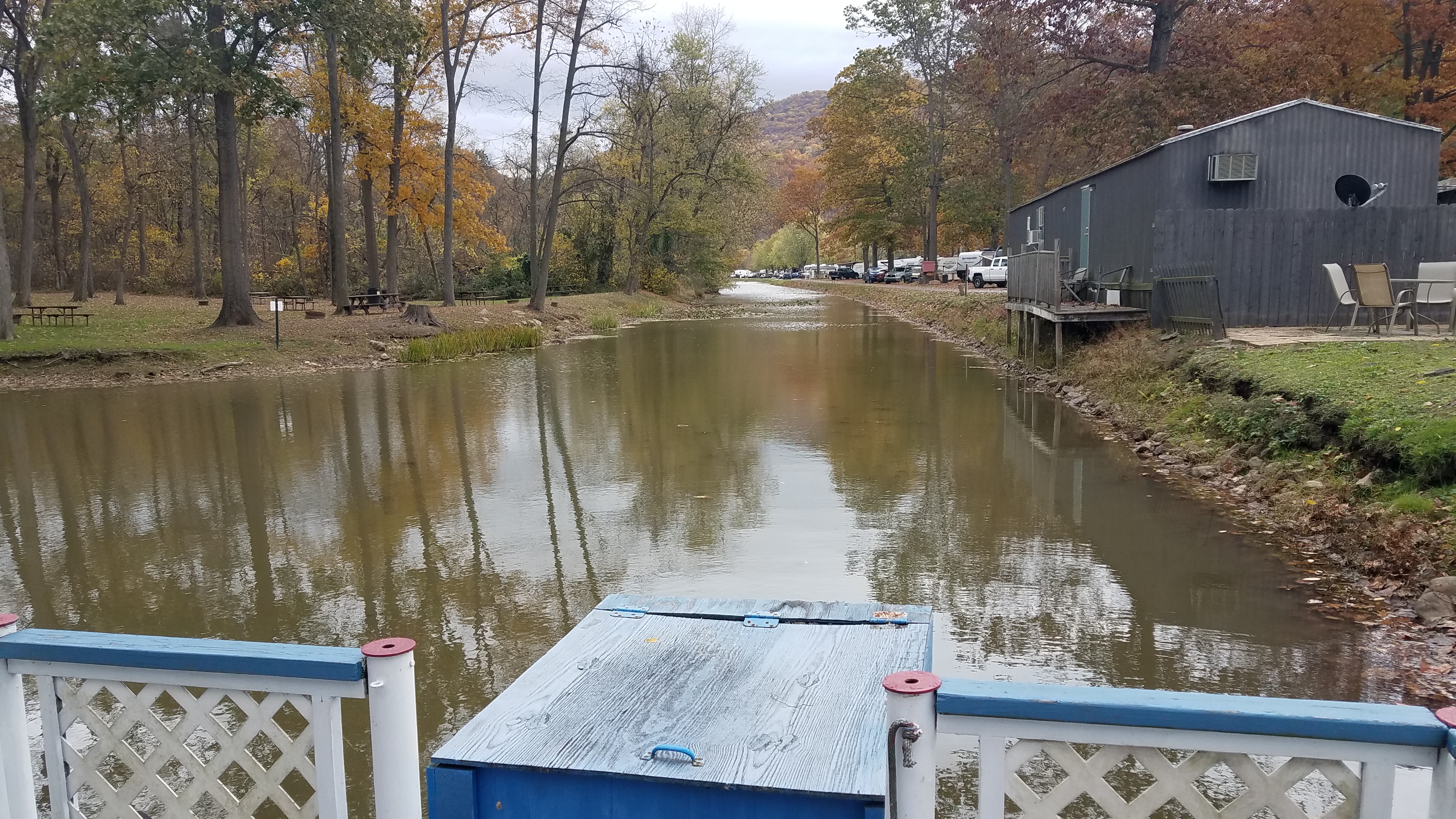
We continued to the end of the grounds where there was a camp store named the Canal House. I doubt it dates back tocanal days, but I can't be sure.
There was also a boat in the canal at the point where it becomes filled in. I wonder if they do any mule drawn canal boat rides. It appeared that they do a motorized one.
I don't know if there was a lock in this area, but there appeared to be a change in elevation a bit.
The canal is filled in under Locust Road, and we moved ahead beneath the former Pennsylvania Railroad bridge, which crosses the Juniata to the left. It was another of those circa 1907 replacements. The original canal would have gone beneath its predecessor.
We followed Locust Road for a bit, and then got to where the canal used to turn off into fields to the left.
There was a clear path onto the old canal from there. No "no trespassing" signs. I had thought we would have to follow roads through this bit, but instead we got right on the canal.
We passed through a lovely section of woods, which then gave way to fields with a mowed path. I was a little leary about going ahead, but we continued on. A little island of trees was at the former canal site in these fields.
The canal came out to a private driveway called Red Barn Lane. There was an old house there that on old 1877 maps was home of S. H. McCoy.
We turned right from the canal at this point, after having a look at the remnants, and went up to Loop Road, which parallels it.
We climbed uphill, passed a nice house, and had a great view over the Juniata Valley near the top.
The road came back down the hill, and then came close to the canal again. It was at this point a driveway called Old Canal way.
We couldn't stay on the canal here. It looked like too much private property and ahead it goes onto a golf course. I considered trying to go through when I planned the hike, but it wasn't looking feasible now.
We continued walking on Loop Road, which took us to the north a bit. We went left on Middle Road, which had some views out across the Juniata Valley, but it kept us a bit away from the canal route.
There was what looked to be an old school house, and a few abandoned houses. There was also an oddball cemetery that looked like someone's front yard. It had very interspersed graves, among them some Civil War veterans. There was an oddball side road called Boogersburg Lane. Could this little settlement with the abandoned houses have been called Boogersburg? The 1877 maps of the area do not denote such a name, but it could be.
Some side roads were named tow path and such, and one was Aqueduct Lane. Surely, this was because below this point the Pennsylvania Canal would have crossed an aqueduct over Strode's Run.
Toward the end of the road, there was an unsigned tract of land with a mowed path along it. Most of us went off of the road and followed that for a bit of time parallel with a creek known as Strode's Run. We then came back up to the road and skirted a pretty little pond before turning left on Lockport Road.
We then continued into the little settlement of Lockport. We didn't get to see the canal here because it was private and inaccessible back Canal Road, a little ways on the outside of the settlement.
Soon, there was another side road called 3 Locks Road. Of course, I would assume there was a flight of three locks on the canal down that way, but it becomes a private road so we could not see.
and continued on Lockport Road heading kind of west. It was a pretty road, as far as those go, with more views over the Juniata Valley. The pastoral settings were among the most beautiful we had seen all day.
We continued around a bend, past some cows, and then reached the point where Lockport Road crosses Wakefield Run. We were milling around while I was looking at the maps of the area, and a guy came out of the house up a private driveway to talk to us.
I wish I could remember his name, but it's just been so long now I can't hold onto all of this.


He walked us from there back along the creek. I turned back and saw that everyone except Diane had left me and moved on toward the end. A shame because they missed out on some pretty cool remnants!
A little of what might have been wood work on the stream base for the canal was still there, and the abutments were still recognizable. Both sides had wall segments on either side of where the trunk of the canal would have been held, but it was badly deteriorated. I was so grateful to have the opportunity to see this place.
It was around this time that I got blocked from the Pennsylvania Canal group on facebook. I don't know what I did wrong, but my to theories are that I had a then and now compilation posted incorrectly, or that I was getting to more interesting places to the point that I possibly had a better grasp on the remnants of the Juniata Division than the expert that ran the group.
If the latter is the case, it's kind of upsetting because I really very much love the guy's work. In fact, his name is Russel Love, but his online name is Frank Clemente. He has done some of the most amazing documentation of the Pennsylvania Canal system I've ever seen, but now he has me blocked. It might also be because I'm friends with his brother James, and the two of them are apparently at odds about some things. Whatever the case, I hope Mr. Love knows I appreciate and respect his work.
I headed back from the aqueduct site walking in the stream itself while Diane kept to the shore. We also checked out a bit of a railroad right of way at the end of the driveway. Some of the driveway is built on the right of way, and it curves parallel with Lockport Road.

There are a couple of roads that follow the old canal between this point and McVeytown, including Sandbeach Road and another called Old Fisherman's Crossing, but both are dead ends and we didn't have the time to be wandering all the way down and back, if it was even allowed.

Diane and I walked out to Rt 522 and turned left. I thought at one moment when we were at the top of a hill that I could see some of the others far off in the distance. We were a long ways away from them and wouldn't catch up with them till the end.
We could see the canal below us from the road as we began to enter McVeytown, and where it came out to cross. It used to go under the road, and then would have crossed the Town Run on an aqueduct.
Beyond, the canal is now a side street from 522 called Canal Street. It sits right in the prism, because it is lower than the other road. There used to be a lock along the street section, but I didn't notice much of a gain in elevation.

We had now only a bit more to go in order to connect where we'd left off a while back in Huntington, which would be the farthest I'll go for a simple day hike.
It felt like it had been an eternity since we'd been out on the Juniata Valley, since the covid crap kept us from traveling as far, so it definitely felt good to get back to the area.

No comments:
Post a Comment