
Hike #1320
4/23/20 Bear Mountain South Loop with Jason W. Briggs and Justin Gurbisz

This next one would be another oddball virus day off where Justin and I went up to hike Bear Mountain with Jason since the NJ parks were all closed to public.

I took the opportunity to have a look at places I’d been wanting to do, and one of them was a loop out of Bear Mountain State Park that would feature some more of these new spots.
Unfortunately, just like some of the other hikes where we discussed Covid heavily, the journal entry for this hike was also removed.
Sure, it comes up on facebook, but only the title. The rest of what I had written is gone.
This was the hike where we looked own on the covid test center and saw it to be nearly empty, meanwhile Governor Cuomo of New York was on television saying it was “overrun”.

I continue to say that I don’t want to BE right. I don’t need to be agreed with on all topics. Rather than to be right, I want what IS right. And what is right is not what our government has been telling us since the start of all of this.

We headed north and got on the Palisades Interstate Parkway toward Harriman State Park.
On the way, we passed by the Anthony Wayne Recreation Area, the largest parking lot in all of Harriman and Bear Mountain State Parks. It was here that a covid test center had been set up. It didn't look to busy and there was no line of cars going in while we were on our way.


We
really could barely see anything of the site from the edge of the road. We
continued around and toward the Bear Mountain Bridge after the circle, and then
parked in the Bear Mountain parking lot near the Inn.
The lot was really crazy; every other parking space had a cone set up in it to
keep people from parking in them. They wanted everyone to park a couple of
spaces apart. The panic was really insane.
I took some photos of the set up so that I could potentially implement some of
that at my own job before we started out.
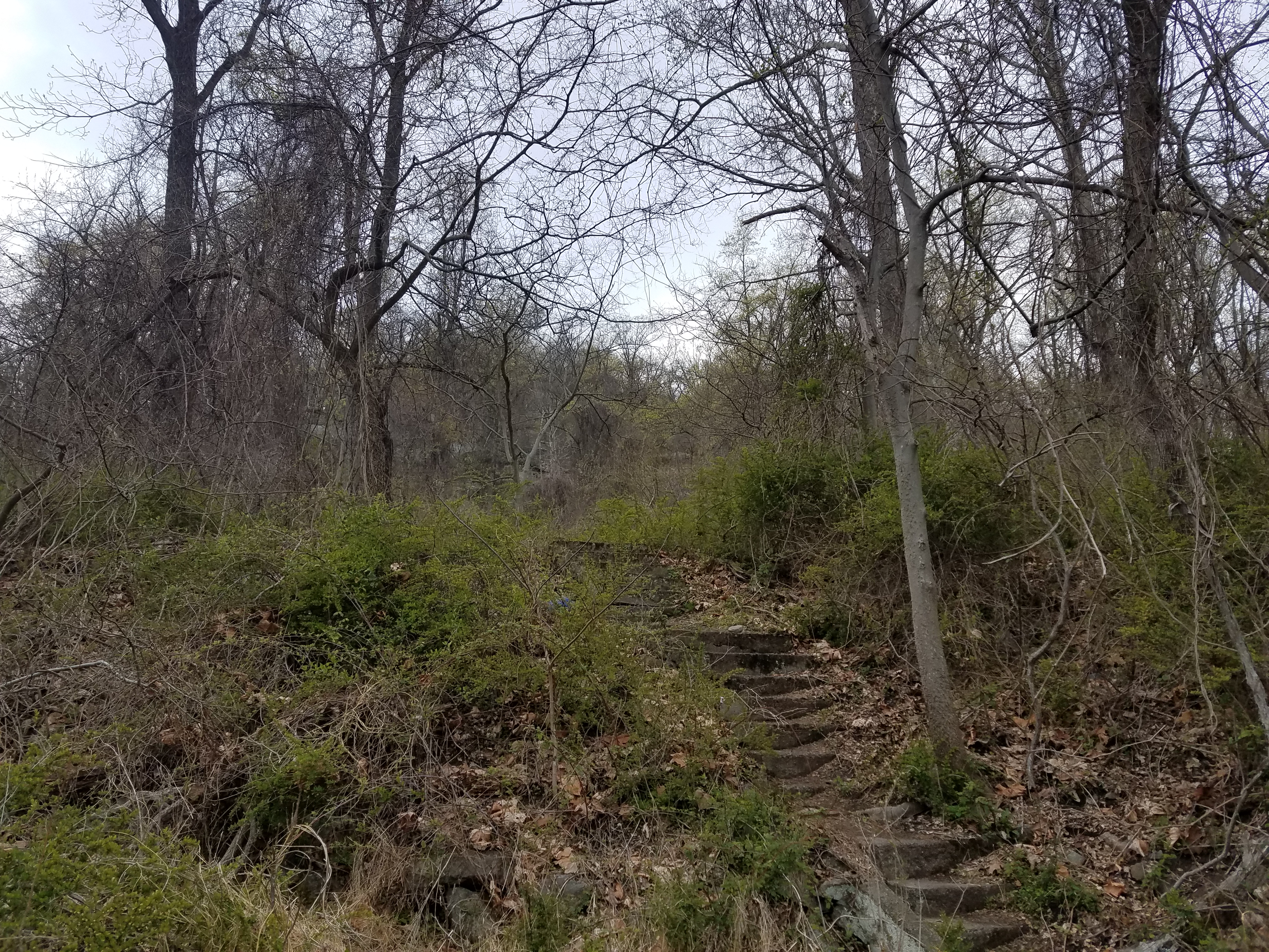
We started walking out to the Major Welch Trail, around the west side of
Hessian Lake.
The trail passes along easy terrain before reaching the northwest side of the
lake, and then begins ascending Bear Mountain about a half mile west of the
Bear Mountain Bridge.


Eventually, the AT was moved further to the south of there, and in 1944 the original trail was renamed in memory of Major William A. Welch, first General Manager of Bear Mountain State Park.
The climb up Bear Mountain is a difficult one; the height of the mountain is 1,289, but one must consider that this is coming from basically sea level. The Hudson River at the Bear Mountain Bridge is still tidal, so it’s not that far up. In fact, the lowest elevation on the entire Appalachian Trail is just before the Bear Mountain Bridge in the Bear Mountain Zoo.
The current AT route up and down Bear Mountain has been completely redone with impressive stone steps and walkways. While many hate this, the erosion from the overuse of the AT up Bear Mountain really made it necessary.
A few years ago, we were hiking the Major Welch Trail, and we met the Jolly Rovers Trail Crew on the way down, who were to take the lead on rehabilitating the trail.


The work we saw was quite beautiful, and they didn’t ruin the wide open rock outcrops either. This was really nice.
On the way up, I was disheartened to see that there were face masks everywhere. It was the first time I’d ever seen face masks on the ground.
People were starting to get a bit crazy, and I went into a mini mart I regularly visit in the morning only to get hollered at by the clerk wearing plastic gloves, a mask, and goggles, telling me I can’t come in without gloves. I told her I don’t have any and I don’t have a way to get them, to which she referred me to some store down the road. I said screw it, I didn’t need iced tea that bad. The owner I saw the next time I went in and he told me to take the mask off, and did so the entire pandemic.
I took photos of every mask I saw laying, and I predicted that this was going to get really bad as soon as it was made mandatory in New Jersey. I could not have been more right about this. I sent picture messages of these issues to my superintendent and warned that this was what we were going to see everywhere soon.
In one way, it was not surprising that they were throwing their masks off at the point we started seeing them. Trying to go up this slope was very hard, but to do so with a mask on seemed impossible. Justin said trying to do so felt like being water boarded.


The bridge was once the longest suspension bridge in the world, when it was completed in 1924. That distinction only lasted for nineteen months until the completion of the Benjamin Franklin Bridge between Philadelphia and Camden.
There were more and more masks on the trail as we reached the top, and then we came to the ADA accessible trail at the top, which meanders through the woods after crossing a rock outcrop.
I noted how idiotic some of the park management was at the time. Parking spaces had to be two apart, restrooms all had to be closed, water fountains had to be bagged so that no one could touch them….but the view things on top of Bear Mountain, which is accessible by auto, were not covered over at all. Something that one would put their face up against.
We hung out on the top only briefly, and then made our way to the Appalachian Trail to head back down the mountain the other way. I recall we took a little side trail that came back to the AT on the way down, which I’d never done before.
It was the southbound AT we followed on the way down, which was also improved with some stone steps and such over the years, though not as wide and outlandish as those coming up from the area of the Bear Mountain Inn.

We crossed a road and the 1777W Trail, and then turned right on the Fawn Trail for a bit. This skirted some of West Mountain until we reached the blue blazed Timp-Torne Trail. This trail was only the second one blazed by the Palisades Interstate Park Commission after it was founded. It was completed in 1921.
We followed this up West Mountain with some views back to Bear Mountain. Through the trees to the right, we could see over the covid test center at Anthony Wayne.
Soon, the trail intersected with the Appalachian Trail to continue along the top of West Mountain.
We had more spectacular views to the west, north, and south, including more of the test center.
This was really interesting, and we all commented on the history we were witnessing. Four large tents and one small one, as well as one trailer were in the largest parking area in all of Harriman and Bear Mountain State Parks. Supposedly everyone was trying to get tested.
The thing was here, hardly anyone was there. We could see the area very clearly from multiple vantage points coming through on the trails. During this time, there was at most only four cars in line to go through and test. Aside from that, there were parked employee cars sitting around.

I actually wanted to get tested at first, and when contact tracing was first starting. I pleaded that I’d ridden public transportation all over New York City and Long Island, had been on Staten Island, rode Staten Island Ferry, New York City Subway, Staten Island Railroad, all recently, and that I’d been in touch with many hikers.
Justin and I both got very sick during and just after our Connecticut trip, and had dry cough that persisted for over a month. I almost went to the hospital one day, but decided against it. I did end up out of work for a full week, which is way out of character for me. Still, I was unable to get a test early on for contact tracing. By the time it was offered, I didn’t care to do it anymore.
It was kind of surprising that the Anthony Wayne area seemed like such a waste for what was going on.
We continued on the coaligned Appalachian Trail and Timp-Torne Trail until the two split, and we continued on Timp-Torne.
The trail descended a bit past a cliff and headed toward a rock formation known as The Cat's Elbow.


We followed Timp-Torne to the last view of the covid center, and then turned to the right when we reached the Suffern-Bear Mountain Trail.

This was another early trail, laid out in 1924 when it was proposed by Major Welch. Work began on the south end of it by Trail Conference volunteers Frank Place and Raymond Torrey, who was responsible for the Long Path.
We were only on this section of trail for a short bit when we turned to the left on the Ramapo-Dunderberg Trail. This was the very first trail proposed by Major Welch in 1920, and first blazing took place December of that year.
There were some really great views on this stretch, to the west up the valleys through Harriman State Park, and then to the south over the Hudson River toward New York City.
We meandered along the ridge down and over some pretty awesome rocks down into Timp Pass.

I guess the trail has been officially rerouted on the old Timp Pass Road and then onto Timp-Torne Trail. We did just that, and it was a good climb up on Timp-Torne.
There
were more great views, and I can’t remember if we continued on the top along
the Timp-Torne Trail further, or if we continued on the Ramapo-Dunderberg
Trail. We did one or the other.
Whatever the case, if we were on Timp-Torne, we didn’t follow it farther than
the 1777 Trail and turned left, or if we were on Ramapo-Dunderberg, we just
followed it straight through across 1777 Trail. I think we stayed on
Timp-Torne.
We then followed Ramapo-Dunderberg Trail to the east, through woods and uphill
a bit more to the very top of Bald Mountain. I had been there on a hike before
several years ago, but I hadn’t followed much more than from 1777 Trail, so we
covered a good amount more.
The view from the top of the mountain is pretty spectacular, out toward Bear
Mountain to the north, and through more valleys to the west.
The very top of Bald Mountain was once property of Thomas Edison. He purchased
it in 1890 as part of his iron mining interests when he was trying to combine
iron and magnets. He lost interest in that field rather quickly and sold the
property off in 1891.

The land was in the late 1800s inherited by Minerva Herbert from a previous husband, and she leased the land for the purpose of iron mining to Alexander Phyfe of New York City in 1880. The property was then leased to Thomas Cornell of Kingston in 1885.
Cornell was very much involved in a lot of things we had covered on our past hikes. He was owner of a popular steam boat service on the Hudson that terminated at Kingston Point. He was also President of the Ulster and Delaware Railroad, which we had followed entirely from Kingston Point to Bloomville NY. He was also Director of the Delaware and Hudson Canal. The central peak in the Burroughs Ranger of the Catskills is named after Cornell.
Certainly, Cornell had interest in the property because he had so much interest in transportation.

The upper mine entrance we saw off of the Ramapo-Dunderberg Trail is believed to have dated to about 1859. We turned from that trail onto the Cornell Mine Trail and descended, and there are other openings including a fifty foot adit along that, which opened between 1885 and 1890. How productive these mines were is somewhat unknown, but they were pretty much discontinued by 1890. Both Thomas Cornell and Minerva Herbert died that year.
Cornell Mine Trail travels from the Bear Mountain area to the top of Bald Mountain, and first appeared on local maps around 1943.

I recall seeing one guy wearing a mask while walking uphill, and watching him throw it to the ground with frustration.
In addition to masks, I started seeing a lot of rubber or latex gloves scattered all over the trail.
Cornell Mine Trail comes close to a Doodletown Brook and a lovely little cascade before reaching Route 9W.
From there, the trail went from the brook side back uphill a bit, after crossing the brook on the highway bridge.


The road was originally the Kings Road, and then the Albany Road before taking the current name. It is the route Cornell Mine Trail follows into the lost settlement of Doodletown.
We made our way up the hill on the old road and around the first switchback where there were steps and a former house site. There was also a hotel in this area around 1920.
We continued uphill a bit more, and passed an impressive large tree before intersecting with the 1777 E Trail.
This was the route that half of Sir Henry Clinton's British troops took to attack Fort Clinton. The 1777 Trail is one trail up until the point where the British troops split and went different ways, which is why today we have 1777 E and 1777 W Trails splitting from simply 1777 Trail.
We continued uphill a bit more, and then came to a small garage structure. This was constructed by the Works Progress Administration for storage in 1934.

The settlement was
founded by a group of French Huguenots who anglicized their name to “June”.
Some of the earliest
settlers were miners and loggers from the aforementioned works.
It is said that the
name Doodletown comes from the Dutch word “Dooddel” which meant “dead valley”,
when Stephanus Van Cortlandt first purchased the land form the native
Americans.
By the 1920s, there
were about seventy dwellings in Doodletown.
Nearby Iona Island
employed some residents at the military installation, and others were employed
at the newly created park. Some of the residents of the time were the same
original founding June family, right up until the end. More and more residents
over time sold off their land holdings to the park, save for just a few
holdouts.
Grays Hill Road into
Doodletown was closed in 1966. The school nearby was the last building to
remain, and was used as a trail hostel for a time before demolition in 1960.

Around this area, we passed a small pond to the left.
Directly across was the route of the original Dunderberg Turnpike, later Pleasant Valley Road. The road was rerouted when the dam was built, but reportedly the old bridge is still underwater.
Next, we passed the former site of the Montville/Doodletown Community Church. It was built in 1889 and torn down in 1965.
The larger school building of Doodletown was built in 1926, and was the last one to be demolished by the park in 1960. Just uphill was the former Deemer residence with its stone wall and steps still standing out front.
We passed the former sites of the Stalter Home, the Wenzel Home, and the McClean House. There was a self guided tour map of the area, and the numbers corresponding to the historic building sites do not match the numbers shown. It was a bit harder than I’d imagined to try to figure out what exactly I was looking at.


We continued to follow
the old roads of Doodletown until we got to the Suffern-Bear Mountain Trail
where we turned to the right. We followed the trail up and down for a bit,
which had more elevation than I was really prepared for so close to the end of
the hike. But once again, it was a good workout.
We continued back to the Bear Mountain lot where we had started.
I was rather shocked when we returned to the lot that all of the cones that had
blocked every other parking space in the enormous lot had been removed. It made
absolutely no sense. The lot was nowhere near full when we arrived, and it was
far less full when we got back to the lot.
I didn’t think much of it from there, and we headed out. I tried to steal a
blockade that I figured I could put to better use elsewhere, but it wouldn’t
fit into my car.
There were cars along the edge of 9W along the way back parked in blocked off
parking spots, which Justin and I just found funny.
The truly frustrating stuff came later.
Governor Andrew Cuomo came on the news and said that the covid test center at
Anthony Wayne was “overrun today”.

I was already doubtful of the management by this time, but the fact that we were there and he was saying something completely different than what we saw was just infuriating. Photos I posted on this topic were removed or flagged as false or misleading information. But it didn’t stop there.
Cuomo also came out saying that the Bear Mountain Bridge and the lot we were parked in were completely overrun and they had to be closed. I was shocked. Neither was true, of course.
When I talked about or posted this, I got arguments claiming that I was lying or that I was exaggerating. It became disgusting that people wanted so badly to believe in exactly what government was saying.


I could clearly see that we had reached the landmark case, only it was not at all playing out the way I would have expected. People were believing every word of it, even when handed undeniable evidence to the contrary.
No comments:
Post a Comment