

Hike #1377: 12/6/20 Rockport to Newburg/Lebanon Township with Kirk Rohn, Jennifer Berndt, Sue Bennett, Diane Reider, Robin Deitz, Serious Sean Dougherty, Professor John DiFiore, Jennifer Tull, Kevin P. Gora, Traci Vicaro, and Tom Edmunds.
It was time once again for one of our holiday traditions: hiking somewhere that we pass by and visit my grandfather along the way, usually northern Hunterdon and sometimes southern Warren County.

By this time, we could pretty much start posting the trips again online. For so long, we had to do invites via text message and it was just a huge pain.
For this one, rather than start or end at my grandfather's house, just because people were still pretty leary about doing so, we decided that we'd play it safe and have the hike pass by my grandfather's house without going in, and then instead we would end at the home of my Aunt Pam and Uncle Ken. They lived at a part of Lebanon Township historically known as Newburg, where the old abandoned municipal road went into what used to be the Boy Scout Camp Watchung. They have plenty of parking, and it ended up being a great idea for this one.
We met in the morning over there, and then shuttled with as few cars as possible to our staring point, which would be along the Morris Canal near Rockport at the Rockport Church. We'd do some back roads and wildlife management area lands, but also cover some stuff I'd never done in the daylight before.

Instead, we headed downhill on the road, crossed over the former Lackawanna Railroad tracks, followed by a little creek.
From there, we cut off of the road to the left through some weeds to get into the fields of Rockport Wildlife Management Area and started to head south.
We continued until we reached a line of trees and turned to the left. I had done this as part of a holiday hike in the area in the past, only this time we were heading through the property in the opposite direction from before.

We crossed a little brook, came to the intersection with Watters Road, and turned left.
We only followed this a short bit and sort of continued straight where Watters Road went left. This is where it becomes Heiser Road.
From that point, we continued to head downhill to the south following parallel with a lovely little brook to the right. I had always wanted to walk this road before but never got around to it on any previous hikes.

However, 57 was not the main road. The Easton-Morristown Turnpike is now Old Turnpike Road, and it is at this point on the south side of the Musconetcong River, which is in view from the intersection.
We turned left on the highway only a short distance, and then turned to the right on Stephensburg Road to the right, which passes through the very old little unincorporated community of Stephensburg.


There was another building to the right that most certainly would have been a general store, because it just had that sort of look about it. We continued straight.

Tom Edmunds decided to turn back somewhere in this area, as he had only planned to join us for a bit of the start of the hike.
We didn't take this way this time, and instead continued uphill on Stephensburg Road rather closely parallel with the Stephensburg Brook, where old dam remnants from past milling operations can still be seen if looking well.


I stopped everyone and noted that neighboring Hunterdon County was home to more of these little stone bridges than anywhere else in North America, with over two hundred of them noted.
Morris and Warren have quite a lot, but not nearly as many as Hunterdon.
We passed Cider Mill Lane, and a property to the left of us had some really tempting looking private trails passing through it.

Fisher Mine Road broke off to the left as we got closer to the top. There were indeed iron mines in the hills here, and I've never seen the Fisher Mine.
Soon, we headed up to the intersection with Pleasant Grove Road, which I have always understood was called Scrappy Corners. There is an enormous Silver Maple at the house on the left as we reached the corner.
Straight across is Califon Road, and we all continued across there.
There's an old church and cemetery on the left just ahead of this point, and new construction was going on at the time, but nothing up yet. Later, it would end up being a Biserica Orthodox church under construction that was quite attractive. I don't know what the fate of the old church there will be, but it's been interesting watching that site.
We continued ahead just a bit, and then cut to the right into Washington Township (Morris) park land with a pretty little pond ahead.
We reached as close as we could get to the pond and then turned to the left to follow the field edges out to the parking area off of Ascot Drive.

Ascot Drive makes a big loop, and I accidentally turned on the first cul de sac, Surrey Lane, and we had to go back. We then made the second left which was the correct way to get onto the loop.
After passing the last house on this segment of road, there are no houses up to the height of land to the left. This was where we bushwhacked into the woods, which leads to the Crystal Springs area of Hunterdon County Parks Teetertown Reservation. The county line is right there.


I pointed it out to everyone, then a short distance away we reached the perimeter trail in the fields of Crystal Springs.
I developed this trail when I worked for Hunterdon Parks back in 2008. The county let me put together my own volunteer crew, and so of course I used the hiking group and we got a lot done.


In anticipation of that, some of us worked on a new trail out of the Crystal Springs fields to the end of the property we owned, to the point where it would continue through the Pelio 2 tract, and then eventually come out to Mt Lebanon Road where two more tracts of land were necessary to continue the trail system through.
Unfortunately, before the end of 2008, the Hunterdon Freeholders under George Melick canceled Pelio 2. This was the greenway plan that would allow us to connect through to make a greenway with Point Mountain. There was a plan in place that if this and the Pitha acquisition happened, that we could have a trail through the YMCA camp as well as the camp of Crossroads Outdoor Ministries. The cancelation killed it all.
I still hiked through it in December of 2008 and brought the group, holding out some hope, but then it was dead.
Somewhat recently, I decided to try to get through it again, and found that the trail was indeed put in place.
My former coworker Tom Sheppard was ousted from running his naturalist programs with the county, and resorted to spending more of his time doing trail work that was falling too far behind.

We followed the field edges to the west, and then south, and I looked for where the trail would break off.
I hadn't found it over this far when I attempted to do a night hike on it before, and looking at it at day light, it didn't seem to be where I recalled the partially built trail going in. It was actually a bit south of that point.
Still, we followed the trail, which meandered through a lot of underbrush rather than the more sparsely grown areas to the north, and it took us out to some field edges.

I eventually figured out where it went back into the woods, and we made our way through the wider swath of woods toward Mt Lebanon Road fields.
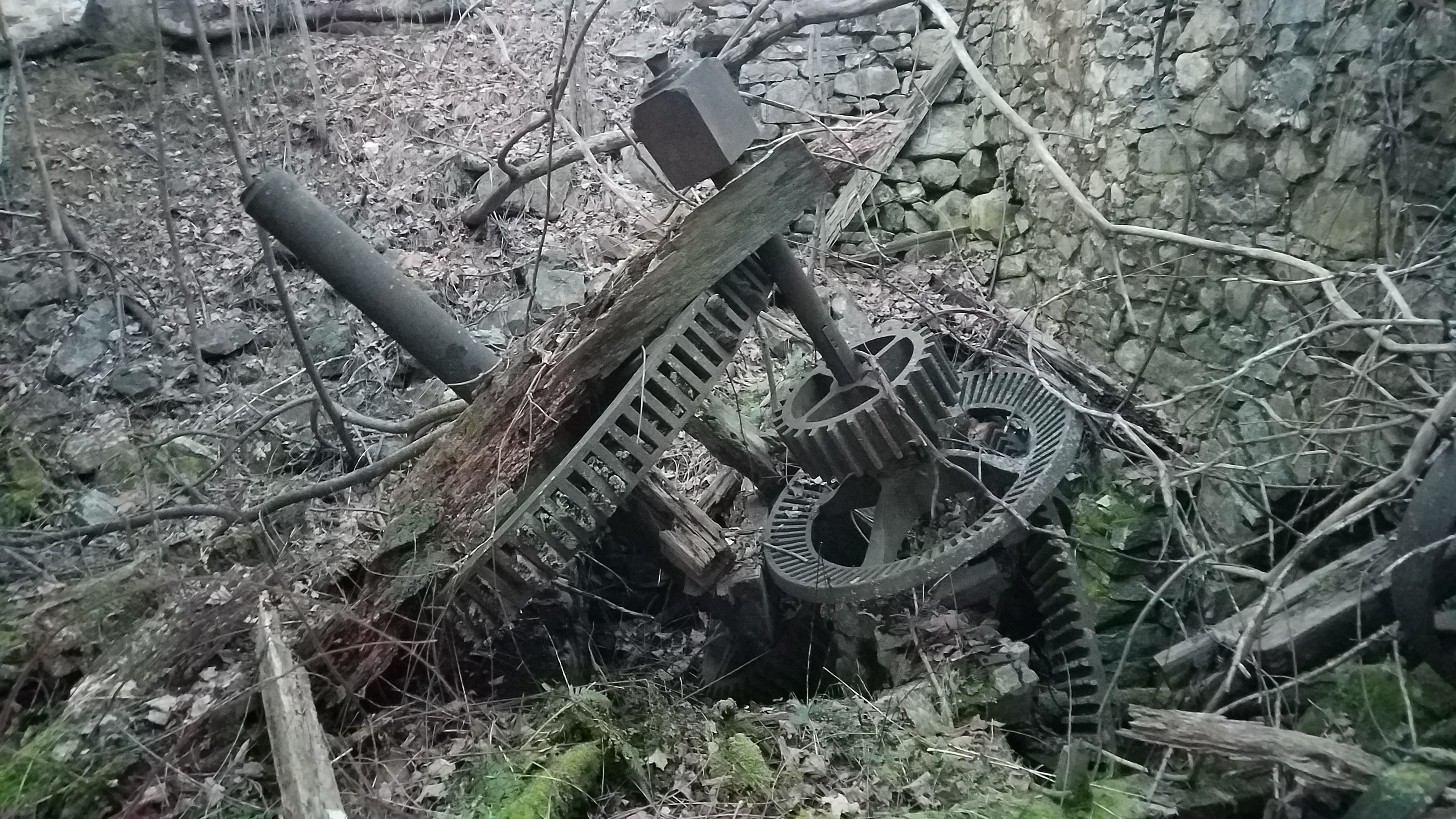
There was an abandoned garage structure to the right of the trail, and we went off to check it out a little more closely in this section. There was nothing in it.
The trail was very well built through this area with elevated turnpiking over some of the wet areas.


We hit Mt Lebanon Road, turned right for just a moment, and then turned left onto Turkey Top Road heading somewhat downhill. There is a missing swath of land to fully put the trail through here, but not far. The county now owns the aforementioned Pitha tract ahead as well.

"I would be strong, for there is much to suffer"
"I would be giving and forget the gift"
The signs did not seem to continue beyond a certain point where we had to cross over the small creek.

- I would be true, for there are those who trust me;
I would be pure, for there are those who care;
I would be strong, for there is much to suffer;
I would be brave, for there is much to dare. - I would be friend of all—the foe, the friendless;

I would be giving, and forget the gift;
I would be humble, for I know my weakness;
I would look up, and laugh, and love, and lift. - I would be faithful through each passing moment;
I would be constantly in touch with God;
I would be strong to follow where He leads me;
I would have faith to keep the path Christ trod. - Who is so low that I am not his brother?

Who is so high that I’ve no path to him?
Who is so poor I may not feel his hunger?
Who is so rich I may not pity him? - Who is so hurt I may not know his heartache?
Who sings for joy my heart may never share?
Who in God’s heav’n has passed beyond my vision?
Who to hell’s depths where I may never fare? - May none, then, call on me for understanding,May none, then, turn to me for help in pain,
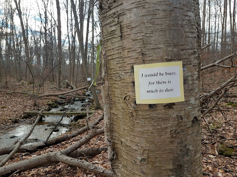
And drain alone his bitter cup of sorrow,
Or find he knocks upon my heart in vain. - We continued to hike on through the woods, and my plan was to cut across the Camp Bernie YMCA property on the route that the trail was intended to go, although this section was never developed.
I had never tried to go through this end of the property, but I had hiked into Camp Mason before from some of the trails already in Point Mountain.
We followed a lesser trail for just a bit, and then it became an impressively wide woods road.I had a few special beers for this occasion: a barrel aged malt thing, and a Victory Belgian style called V12.
We wandered the woods road to the west a bit and I watched my GPS very closely. The woods roads were only barely visible at times on the aerial images. We came to a fork where I was rather certain that the woods road straight would take us out to Point Mountain Road, but we turned to the right. This turned out to be the correct move.
We came within sight of a building near a line of evergreens when it looked like we started going the wrong way, so we went off trail a bit to the west, and came out along another camp road. We passed by one building that didn't appear to be occupied and came within sight of a pond.From here, we turned left and skirted the edge of their active recreation area, and then came upon the sign that read "Point Mountain Trail".
This was the trail that came out to the white trail on Point Mountain in the county park.
I hadn't followed this one all the way through on a group hike yet, and the only one I knew really well was an old woods road that comes in to the camp from the orange trail from the north.
The trail came to and skirted some fields and followed a bit of a small ridge line to the west. Before reaching Point Mountain Road, it dipped down and reached the familiar old farm site I'd visited so many times in the past on hikes, on teh white trail.From here, we turned right and went to the foundation of the old bank barn on the white trail. We then continued on along the trail until it hit the orange blazed Ridge Trail. We turned left there.
The trail climbed to the ridge and along the top for a while, and then came to the highest point where a jutting forward rock sits at 934 feet above sea level.
Since there were no leaves on the trees, there was a splendid view out over Mansfield Township in the direction we had come from to the northeast.
We continued on along the ridge, and there is a big dip between the two main rock outcroppings and popular overlooks. I showed everyone on the first rock outcrop what people refer to as the "dinosaur footprint", which is of course not one despite resembling one. - Rather, this is likely a smoke signal rock similar to what we have on Ragged Ridge on the Warren Highlands Trail. The promontory is perfect for it because of the ability to see for miles.

- We descended from that point down to where the orange trail turns right and yellow goes left. The blazes I painted on the trees back in 2009 are still holding strong while most of the plastic one put up by Hunterdon Park employees since that time have been replaced a few times.

We turned right briefly on the orange trail to reach the main overlook which provides 180 degree views over mostly Mansfield and Washington Townships. - We took in the view for a bit in all directions, and had a good view all the way out to Mt No More and the Kittatinny Ridge beyond.


We headed slightly uphill and then to the left where the yellow trail ends at an intersection with the same white trail we were on before, only further to the west.


We managed to get through alright, headed out to Mountain Top, and then turned left. We went around the ninety degree bend and past the Born To Run Farm, then up past Henry Addickes Orchard. There was an old house in front of it that was slowly collpasing over the years, still maybe one third standing at this time.

We then moved on along Mountain Top across on Symonds Lane.
That road used to be dirt when I was little, and I remember being in the stroller on it with my mother and grandmother. It's now totally paved, has an intersection with more development, and many more houses built.
We made our way from this to Hollow Road at near the point it becomes Anthony Road, then turned right onto Newport Road. This skirts the Miquin Woods Preserve, which was formerly Boy Scout Camp Watchung.


We turned right to follow that road. Where it comes out on Newport Road it is now called Hoy Lane, for my my Aunt and Uncle Ken and Pam Hoy.

Back in 2008, I had walked this route for this same hike, and I later posted the photos of the old Newport Mill on the Metrotrails facebook page. I got a phone call while I was out from the guy that owns the property threatening to sue Metrotrails for posting photos of his mill on the page, and was just really kind of ridiculous considering how professional and courteous I was to him regarding the request.
He also demanded that I remove them right away, which was not possible for me while I was nowhere near my computer and the smart phone system I had at the time made it impossible to manage the pages from them.
Fortunately my buddy and Metrotrails VP Matt Davis was available and he was able to remove ust the mill photos from the page to appease this guy, and that was the last of it for a while.
For this hike, I was originally going to go out to the road again another way and not bother with that tract possibly, but then Aunt Pam told me that the guy that lived in the house had recently died of covid.
While I feel bad for the guy's family and I certainly don't celebrate the death of anyone, it kind of worked out for us because he probably would have made a fuss about us parking on my aunt and uncle's lane at all if he were still around. Now I understood how we were able to get away with parking there without any concern like we would have had in the past.


I would suspect that one day Hunterdon Parks or Lebanon Township will acquire that property as well to add to the Miquin Woods tract.
We then reached my aunt and uncle's house, and they ushered us over to the garage in the back where they had put out all sorts of goodies and drinks for us! We hung out and chatted for a couple of hours to finish off the day, which was really great.
I was very happy that even though we didn't get to have some sort of thing with my grandfather like we normally would, there was still a family element that I got to share with the rest of my group.

No comments:
Post a Comment