

Hike #1509; 10/15/22 Spruce Run Reservoir Perimeter with Jack Lowry, Sarah Jones, Elizabeth Manner, Robin Deitz, Jennifer Berndt, Celeste Fondaco Martin, Kirk Rohn, Violet Chen, Erika Daniels (Barone), Judy Philips, Meg Powers, Tom Lawrence, Samantha Farrante, Darren Melchiorre, Chaiyut Saelao, Jim Cirona, Alyssa Valenti, Caroline Cullen, Scott Clarke, Rob Kiely, Melanie Kiely, Paul Soltis, Carol Harris?, Helen Hahn, Carol Rath?, Brian Tortora, and William Honachefsky Jr.
This next hike would be a pretty great one for me, a loop around the reservoir where I report to work on a daily basis.

Spruce Run Reservoir has a perimeter of about 15.3 miles, and I’d walked it
several times before. I’d done them all as night hikes until finally in 2016 I
got paid to do it through work.
The hike was so popular then that it brought out staff from
Trenton and all sorts of people from all over whom I’d never met before. I had
at the time given up on cross posting my events on other groups, but I decided
to revisit that for it, and we got a great sized group.
I wasn’t expecting really more than ten people to show up for it, since we are still fresh off of the pandemic times and so few people show up for my hikes in general.

I was blown away when I’d heard that we had so many rsvps for
this hike, on top of what I had through my regular Metrotrails resources. Good
attendance followed on all of them immediately following this, so it was a
great resurgence.
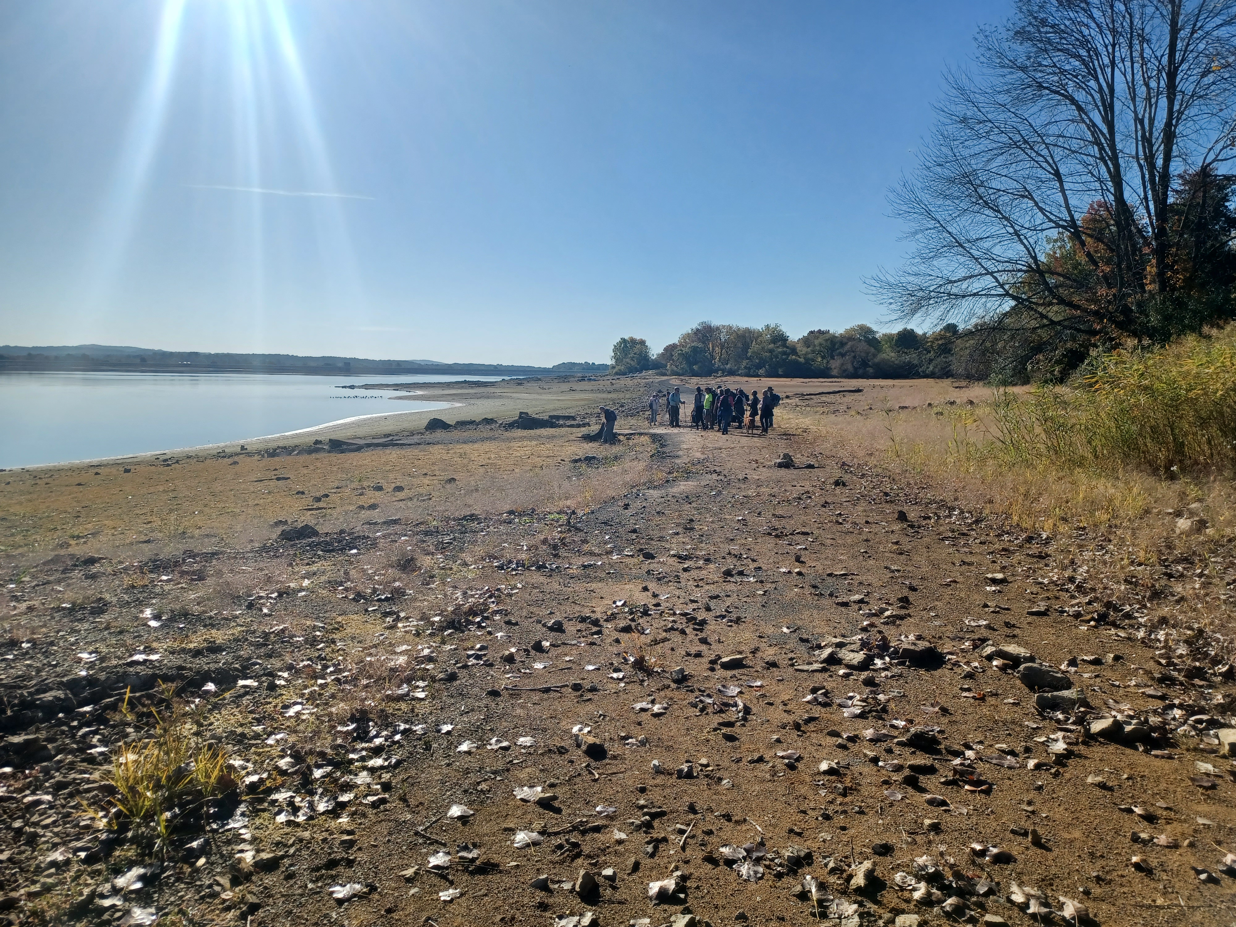
I made the meeting point the large lot on Van Syckles Road,
where the Spruce Run flows into the reservoir. The reservoir had been dropping
quite a lot over the Summer, and so it was at this point below 40 percent
capacity.
I felt this was a really good opportunity to showcase my knowledge of the the properties my team manages, and to demonstrate the kind of groups I can and do pull together on a regular basis.

I actually pull groups more consistently than most interpreters; there are some that have well attended weekly events, but more often its monthly, and I pull a group ever week.

I was actually getting a bit concerned because it seemed like
the groups were tapering off a bit. Maybe it was because of the pandemic, or
maybe it was because some found other groups that were doing more specifically
the kinds of hikes they wanted to do, but I continue to do the new things that
excite me.
Whatever the case, the numbers that showed up for this were good, and we had a
good time.
When we met at the lot, our new Superintendent Lauren was there to greet everyone, and I started off introductions and gave some of the history of the area and what we would be seeing.

From the vantage point where we started, along the Spruce Run, we could see the original route of the Spruce Run Turnpike, which was chartered in 1813 and traveled between Clinton and Oxford.

I went over the history of how Robert Taylor of the Taylor Iron and Steel Company took over as ironmaster after years of serving as bookkeeper and manager of the company under its founders, William Allen and Joseph Turner.
The township was Union Township, not because of anything to do
with the Civil War, but rather because it was the union of acreage acquired by
Allen and Turner in 1742 for the Union Ironworks, the previous name of the
Taylor Iron and Steel Company. The land was needed for both mining of the iron
ore as well as production of charcoal that powered the furnace.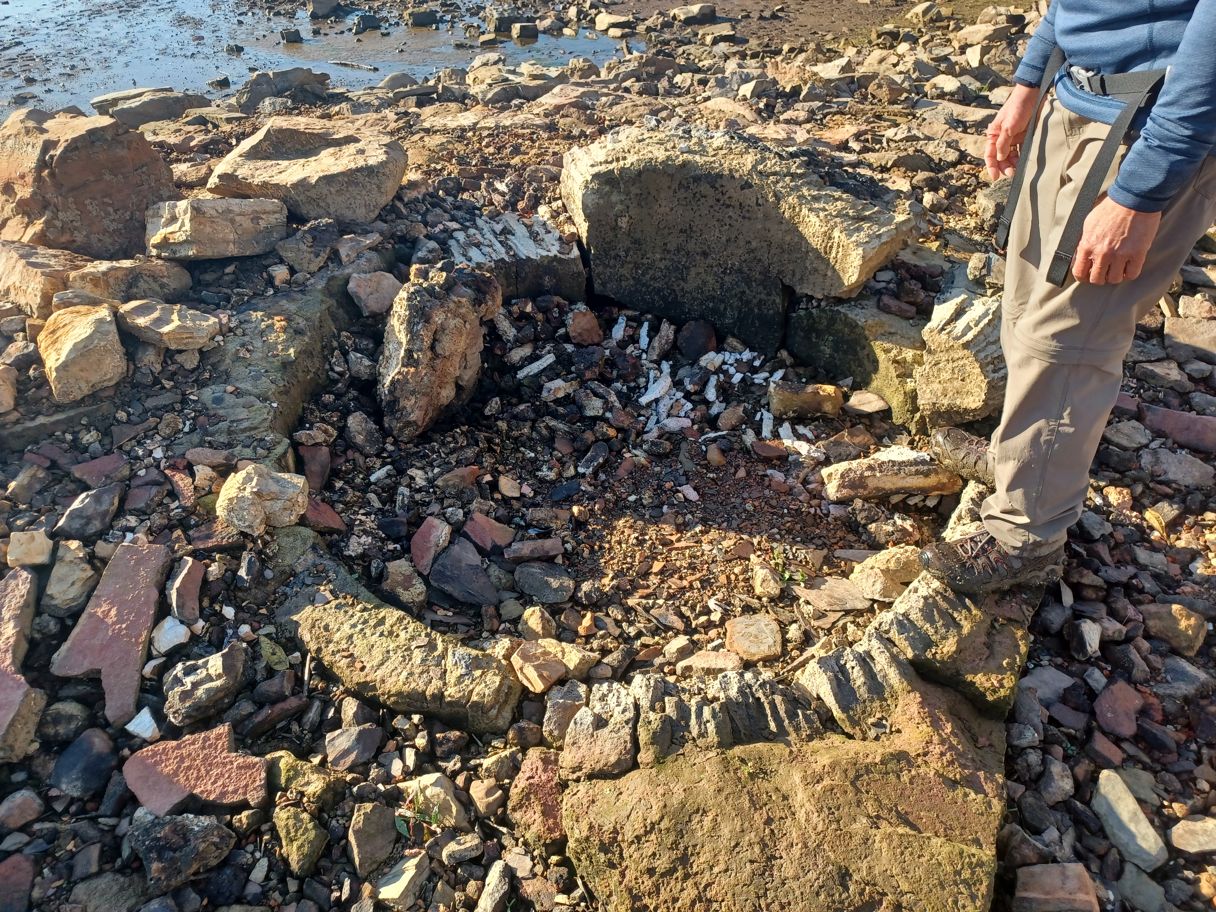
Union Furnace ruins
I pointed out where the Spruce Run Turnpike used to go, from the
Toyota dealership on the corner of Van Syckles Road and Rt 31, out past the now
abandoned former central region state park office, and then into where the reservoir
usually is. We could see the old concrete bridge over the Willoughby Brook that
is under water when the reservoir is at full capacity.
William Allen homestead ruins
We would start the hike by walking out the little peninsula of land along the Spruce Run, and then down to where Van Syckles Corner Road used to go, predecessor to modern day Van Syckles Road.

The Spruce Run Turnpike was upgraded through the early 1900s and it became
State Route 30. It held that designation until the sixties when it was realized
that the number was already given to a highway in the southern part of the
state. As such, it had to be given a new designation, and 69 was chosen. Of
course, the highway signs were too often stolen, and it had to be changed to Rt
31.
The current alignment of Rt 31 was built before the reservoir, and the old road
remained a side road from it.
The road used to have a four way intersection where Van Syckles Corner Road and Cregar Road intersected right across from one another. That location is now right in back of the Rita’s Italian Ice stand on present 31.

We walked over to where Van Syckles Corner used to go across the Spruce Run and we paused to go over the history.

I told everyone how the highways used to be aligned and then how
they were rerouted about 1963 for the reservoir.
I’ve read that they wanted to have a reservoir at this site going back as early
as the 1930s, but it was never justified enough with support of people as well
as funding.
The thing that changed the level of support was the disastrous Flood of ’55 where
two hurricanes pummeled the area with an unprecedented amount of rain resulting
in disastrous flooding.

Following the flood, no one was going to oppose something that was in the name of flood control, and the Water Bond Act was passed in 1958.

Several reservoirs were constructed as a result of the Water Bond Act,
including Spruce Run and nearby Round Valley. I also went on to describe other
authorized reservoirs that were never constructed including Six Mile Run,
Confluence Reservoir, and Waterloo Valley as well as the most famous
de-authorized one, Tocks Island at Delaware Water Gap.
From that point, we began following the old Van Syckles Corner Road to the west a bit.

The road is still paved, although the macadam surface deteriorates somewhat after years being under water. It had actually deteriorated more than it was when I walked it last about six years prior.

We continued out across a point where some water was flowing out
over the old pavement that required some careful stepping. Some of the recent
rains had made it a bit more difficult to navigate than it would have been a
few weeks earlier.
At Spruce Run, the grass had all turned brown because we’d had so little rain for a while of the Summer. We could tell where the leaks were in our water systems because it was the only area with green grass.

Although it was considered a drought, at the time of this hike, we were actually 0.3 inches more than the average rainfall.

I had to explain to everyone the reasons for a reservoir aside
from flood protection. One of them that people don’t realize is that it
supplements public water supply downstream. Although it is not tied in to Round
Valley Reservoir directly, it feeds into the South Branch of the Raritan, from
which there is a pumping station below Clinton.
The other big thing is sewage treatment. There are facilities for that in Clinton, Flemington, and then the Raritan and Somerville areas where all of the development is.

In order for these plants to release their treated waste into the river, there needs to be volume for it to be innocuous.

Further, there are more stringent policies when it comes to how much chlorine
and such can be put in the water supply. If it can only be so many parts per
million, then the volume has to be higher. I know those policies have changed a
lot since the seventies, but I don’t personally know exactly how it is dealt
with on the water supply end. I just know there is an effect.
The old Van Syckles Corner Road joins the modern Van Syckles Road at the second parking lot in from Rt 31.
That parking lot occupies some of
the old road route. Just before that, there is a small concrete bridge which I
understand used to cross the outlet of the raceway that served the Union
Furnace.
From this vantage point, we could clearly see the ruins of where the old
furnace stack used to be. It’s just a pile of rubble from a distance now, but
the road route provided the good view where I could talk some more on this
topic.
Old Van Syckles Corner Road continued on the current route to the intersection with Polktown Road, still the same today.

Almost across from that intersection, the old boat launch road access to Spruce Run is obvious. This was the old route of the Union Road, which we’d hit later.

Van Syckles
Road didn’t go straight through as it does now. One had to turne left on Union
Road, then right on Van Syckles Road which is close to the current route of
boat launch road today. It then passed through about where the control/toll
building is today in Spruce Run Recreation Area.
We turned left along the shore and headed over to the remains of
the furnace where many of us stepped out onto it.
I hadn’t been there with my buddy Bill Honachefsky in a long time, and so it
afforded us the ability to discuss the ruins in greater detail. Bill remembers
nuances of the history that I don’t, as author of books and papers on the
topic.
We both share concerns about the preservation of the furnace remains. Since the last time it was exposed, and also since it first became exposed this year, someone has been dismantling the furnace remains.

Rounded blocks from the structure have been pulled off and placed aside, or taken away as souvenirs.

There is no protection for
the remains of the structure, and really no good way of protecting it. The
remaining furnace stack was bulldozed almost level when the reservoir was
constructed, despite dating back to 1742 and possibly earlier. It is possible
that Allen and Turner purchased an existing smaller scale ironworks.
With some of the surface block missing that had not been missing at previous incidents of low water, I noticed there were some curved sections of stone that might have been part of the “pig” or form where the bars of iron were removed to be brought to a forge.

There was one section of curves stone I found this year on the north side of the furnace remain, and another on the west side.

It would be
interesting to see if the site could be properly excavated by professionals and
somehow protected. I sometimes wonder if a hydraulic cement cap on it would be
worthy of investigating after a thorough examination. It would probably take a
lot of grant money, but I’d be very interested in it.
There are historic furnaces in south Jersey that were placed beneath mounds of dirt to keep the site secure until money was available for possible excavation or restoration.

I pointed out at this site that the horse hair mortar that held together the old stone structures does not hold up under water, but concrete does, so the old stone walls that used to be part of the furnace basically look like little stone rows now.

I showed a historic photo of the furnace from the 1930s before the remnants of it were demolished at this point.

From here, we began following the shore of the reservoir to the
south a bit, onto the peninsula on which the boat launch for Spruce Run
Recreation Area is located.
I had seen other ruins in this short stretch before, but never
knew the history of it except that it might have at one time been associated
with the Union Ironworks, because of the proximity.
When I posted a photograph of the ruin on Metrotrails, Mike Gronsky from the
Union Forge Heritage Association (who was away for the weekend and unfortunately
couldn’t take part) responded that this was the homestead of none other than
William Allen.

I had known that Joseph Turner’s house was now the museum, but never knew where William Allen’s place was.

As I understand, the original portion of the home existed before
William Allen purchased it, in 1720. The building was added to over the years,
and by the time the state purchased and demolished the property for the
reservoir, it was being used as a nursing home.
We continued on along the edge of the reservoir from this point, out toward the boat launch. The docks have long been out of the water, and have issues being broken anyway, and the water was well below the concrete pads there as well.

We split the group only briefly at that point. Some who wished
to use the restroom headed directly across the peninsula there, while those of
who didn’t need it headed further to the south along the end of the now longer
peninsula onto the reservoir.
We weaved around and headed back to the car top boat launch area that is now
closed, and the rest of the group joined back in after their short cut and
break.

The first part of the reservoir as I understand was farm land used by the Plushanski family.

Alex Plushanski recently passed away in
Washington Township, and his brother I believe used to farm this land under
Spruce Run.
On the other side of the boat launch we had just reached, was historically the
Exton Farm.
This goes back a long way, because Exton is shown on the 1870s
atlas maps of Hunterdon County at this site.
Near the end of the boat launch peninsula, there is one of the largest
collections of foundations anywhere on the reservoir.

The Exton farm at this location once had multiple silos and several large barns. I think at least one of these was once a cow barn.

Directly across from us at this point, we could see the aforementioned old
Union Road. It makes its way out of the woods on the shore in low water times
and heads along the shore line parallel with Picnic Area 4, 3, boat rental, and
the campgrounds at Spruce Run. We could clearly see where the side road would
have come off of it to reach the farm buildings.
We continued along this edge of the reservoir toward the land; there is a small tributary that flows from a wetland north of Van Syckles Road down to the water, which is easy to step over.

We continued to walk to the old Union Road where we would turn to the left and around the next peninsula in the recreation area.

At this point, we reached the
historic site of the old Exton farm house. The foundation for that one is quite
easily recognizable, and has some old walkways still in place along it that
were made with more modern mortar, and thus are more recognizable. There was a
giant old tree stump still next to the foundation.
Just below the house foundation, there was a serious sink hole opening up. I had to go out at work and mark off the area so no one fell in.

Celeste pointed it out and said it needed to be done, because she had seen it collapse badly to a deep hole in previous years.

The Union Road is mostly walkable from this point until it
disappears under the reservoir again heading to the south, but the very first
bit gets really muddy and I didn’t walk it. I tried when I did this hike
through the state the last time, and I got really stuck. It was super muddy.
There used to be a few other homes in the area of the Exton farm as I understand. Just before the reservoir, probably in the early fifties, some of the Exton tract was subdivided and there was apparently a small bungalow community along this bit of the reservoir. Of course, all of that had to be demolished to make way for the big lake.

We went around toward the inland just a bit more, and we could see my coworker Rich Gonachelis mowing along Picnic Area 4.

I was walking up front with Erika and her dog, and waved frantically at him, but I don’t think he saw me. He did end up seeing some of the rest of the group.

I was quite happy with the group on this one not only because it
was a large group that brought so many newcomers, it also brought out a lot of
old friends I hadn’t seen in a long time, or hiked with in quite a while.
I hadn’t seen Erika since my anniversary hike at the height of the pandemic in
2020, so she and I were catching up a lot at the start.
Celeste I see regularly, but she hadn’t done any full length hike in a long
time, and she ended up hiking the entire reservoir perimeter.

Judy Philips works with me and has known me for years now, plus her son Larry has hiked hundreds of miles with me, but she impressed me by being able to hike the entire perimeter as well.

There was Brian who has been working Spruce Run
as a retirement job, and he had been following my Metrotrails stuff and
enjoying it, as well as taking some scenic bike rides around the area with his
wife, so it was great for him to experience some of what I typically do as
well.
There were plenty of others as well whom I hadn’t seen in a while or had
connections to others I knew, and it was great to have them out.

Once we got on the old Union Road segment, the walking was extra
nice for a while. Some sections of the pavement are in horrible shape, but some
sections are actually pretty good.
The old road route gets closer and closer to the shore line of the picnic areas
as we continued, and we reached the foundation on the left side with the 1930s
date etched in it.
According to former Spruce Run maintenance supervisor Will Bullivant, the house
that sat here is now sitting at 1 Van Syckles Road. It was moved off of its
foundation and put over there when the reservoir was built to be used as office
space. I don’t know how true that is, but I’ll go by what he told me. The 1 Van
Syckes house does look to be pretty modern, but it would of course be on a
modern foundation, so who knows.
After the foundation, the road got super close to the land and appears to disappear into where the building is for the boat rental.

All of the
docks there are out of the water, as well as the pontoon boat that was supposed
to come out, but it’s stuck now.
We headed down closer to the water here, and then stepped over
some substantial rock formations as we began to parallel the campgrounds.
Beyond the campground, there was a long peninsula that connected
what until somewhat recently had been an island that appeared with the low
water.
I got out to the area first, so I walked most of the way out the peninsula.
Some of the group had this as an opportunity for a shortcut.

We continued out and along the other side of the peninsula that boat rental and
the camp grounds sit on, which was very nice with the foliage. The Black Maples
growing in the edge of the campgrounds and recreation area, as well as the
Sweetgums had particularly vibrant foliage in this area.
As we walked this section of shore, there was a boat way up on the shore line beyond where it looked easy to carry it. I figured it must have been left by some camper or by a boater that got run aground at some point and never went back to retrieve it (I went looking for the bat the next week at work, and didn’t find it, so it must have been someone staying there who was crazy enough to pull the behemoth so far inland).

We continued along from here and soon came parallel with lower picnic area 2. This is another area I’m going to have to eventually address, because people have taken picnic benches and dragged them out onto the dry reservoir bed.

Around the end of the area 4 picnic ground we reached the beach
complex. In the past I’ve chosen to walk along the Highlands Trail route on the
walkway around the complex, but this time we stayed out on the waterfront.
I was able to relate a story at this point that I couldn’t before, because it
came through my friend Wil Bullivant.
There is a jetty on the far side of the beach complex that was not originally there.
As Wil explained it, there was an issue with a leaking drainage pipe that goes from the complex near where there used to be a kiddie pool, out to just beyond where the jetty is today.

He said that it was decided upon to deal with the
leak by pumping hot tar into the pipe to clog the leaks.
The problem with this was people swimming in the beach area were getting bits
of tar stuck in their swim suits. The problem got so bad that they had to
construct the jetty to keep whatever crap was flowing through the pipe from
coming back into the swim area!
When we passed around the outside of the jetty, the exposed land between the normal shore and our low water line got narrower. Just beyond the beach area we reached the tower and club house area.

The club house and tower date back to the 1930s when they were built as a Works Progress Administration project.

They were associated with a traditional hound
hunting activity, and the tower had been the judges tower. They are the two
oldest standing structures remaining within Spruce Run Recreation Area.
We continued past this point, and climbed over some of the steepest rocks we
would have to deal with for the entire hike. One of the deepest spots in the
reservoir is this bit past the tower.
Hand holds were definitely necessary through there.
A little beyond this was the ranger dock area behind the maintenance compound.
In this area, we observed some of the Harmful Algae Blooms (HAB) and I was able
to point it out to everyone.

It sort of blooms and then turns a blueish color, then dies and gets sparkly. We’d seen quite a lot of it in this area while at work.

It is these blooms that have kept the swimming area closed for so many years,
and it seems it may keep them closed forever because the source of the problem
is not being addressed.
The main problem with this is the town of Glen Gardner which has antiquated
cesspools leeching into the Spruce Run, which is the main tributary. They were
fine year ago, but now none of the residents can afford the Highlands Legislation
compliant septic systems, plus the entire town is on a hill so they’re not
really possible in most places. The town really needs a sewer system, and it
seems logical that it should be built at the outflow of the quarry area on the
east side of town, which will certainly be closing in the next several years.

In addition to the sewage, the area also has chemicals from farm runoff, runoff
from Route 31 and other roads, which includes salting all Winter, acid mine
runoff from iron mines, and fine quarry runoff. All of these together are the
cocktail that makes the blooms so bad at Spruce Run.
One of the annoying things here was that there was a study done first on the
Mulhockaway Creek on the west side for evidence of contaminants, but we knew
all along it was coming from the Spruce Run itself. One need look no further
than Google Maps to see that all of the big new McMansions are located along
the widespread Mulhockaway creek and its tributaries.

These homes with their paved driveways are those who would be effected by the “rain tax” that’s been proposed.

This tax would allow municipalities to tax residents based on the
amount of impervious surfaces they have on their properties. It seemed to me
that the studies done were seeking confirmation bias to support the tax plan
because they studied the Mulhockaway first.
We continued from here to the west a bit more, and then came to a bit of a cove where the rocks came to an end and the walking got a bit easier. I got a call from Jen and had her park out at the parking area where the Black Brook flows into the reservoir, and she could head out to us from there.

In this area, we came to where old Van Syckles Road from before the reservoir comes back into view and crosses a finger of the water, then comes back out on the other side.

I spotted a flower in this area that I thought at first was a Crimson Eyed Rose
Mallow, but was actually a common invasive species known as Flower of an Hour,
or Hibiscus trionum.
Pretty soon, we got back on the old route of Van Syckles Road
again, and followed it to where it used to cross the Black Brook. The abutments
to the old bridge are still in place there, and I had never noticed there was
etching on the concrete. It said “I Love Liz” something, but I couldn’t quite
make out the rest of it.
Jen came out and met us at this point, and we all continued to walk the former road alignment to the tree line where it comes out of the water.

I tried standing in the middle of the road and looked back at
where we had come from to see if I could see where the road goes up onto the
dry land. I tried walking into the weeds at two locations but found no good way
of getting out! It was awful and thick, and it looked like we would have to head
out to Van Syckles Road in order to get back out.
I gave it one last try by going around a downed tree and climbing out on the
other side. This too was a bit thick, but I managed to push through, and the
entire group followed suit. This ended up being probably the toughest spot of
the entire hike.

I stayed back in the weeds and made sure everyone made a turn that I had made to get through. Once I had everyone through, I gave a little more history of the area.

We would be reaching the Highlands Trail again, and
would follow it westbound for a time instead of the actual reservoir edge in
order to reach the Joseph Turner House Museum.
The northeast bound Highlands Trail follows old Van Syckles Road
uphill to where it joins the current road, and then follows the new road for a
bit.
We turned left away from the old road route onto brush hogged old roads and
farm lanes going very gradually uphill.

I was in the front of the group, and soon I started hearing some yelping from further back in the group.

Apparently we had stirred up a yellow
jacket’s nest directly in the trail and many of those further back in the group
got stung. For once, I got away without getting hit at all.
Fortunately, no one had any allergic reactions this time, and we
were able to continue on along the field edges.
After a few fields, the trail cut into woods, dipped down across a small
tributary, and then out to parallel another field. It crossed a private
driveway and reached another parallel old farm lane and turned right.

We paused there and let everyone catch up, then the trail turned us left off of the road and down through woods to the northern end of a pond wetland.

Here, there was a side trail to the right that leads up to the
museum. The trail that had previously been rough cut was on the other edge of
the pond, but this one turned out to be much nicer. I’d never followed this one
before.
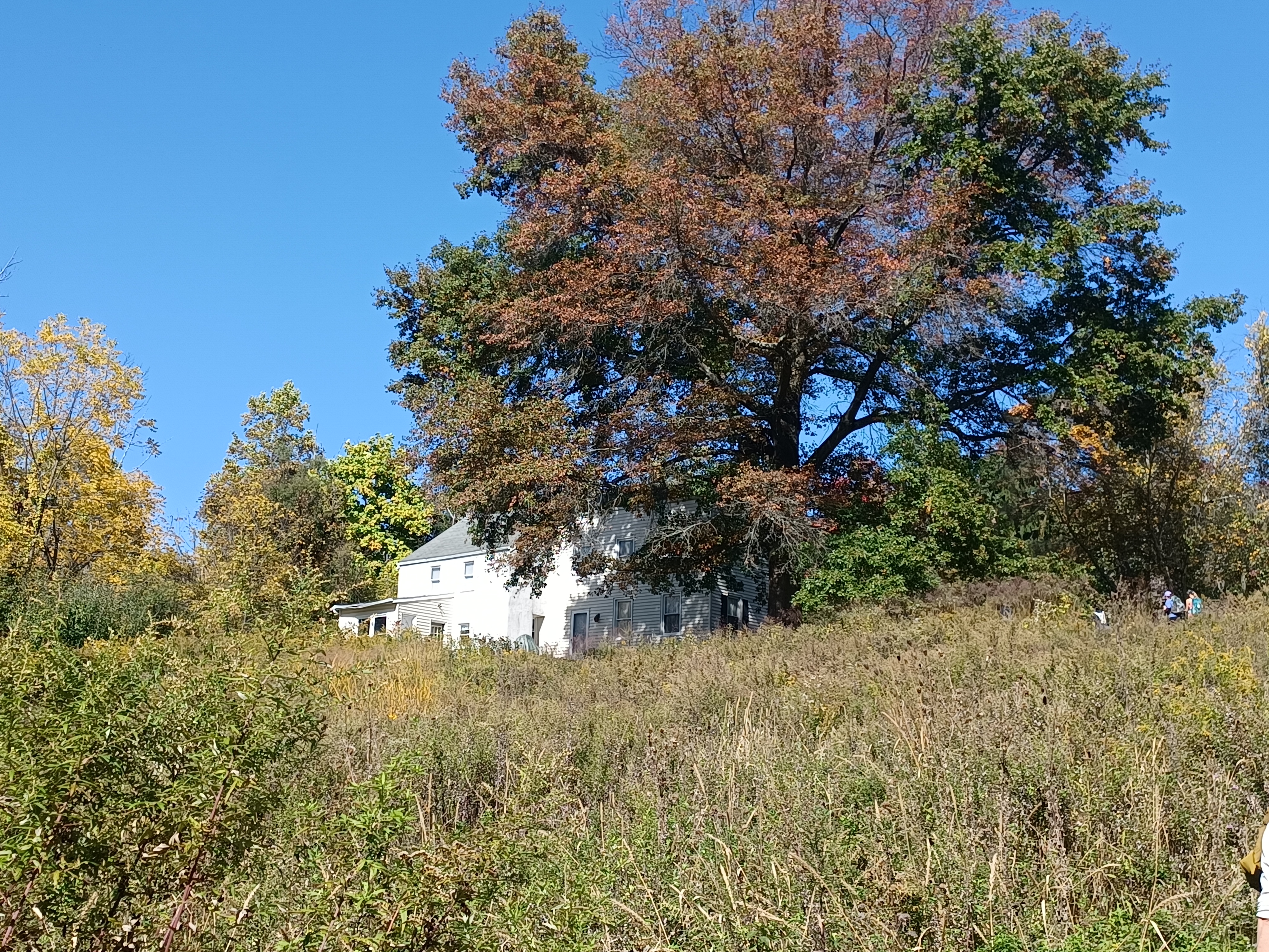
The trail came out into the meadow below the Joseph Turner House, and we climbed to the edge of it where Donna Hermann met us in historic attire. My Superintendent Lauren was also there to greet everyone again, and to check out the museum herself since she’d never been to it before. This was a great day for connection as well because she’d never met Bill before.

The original portion of the house was built in 1760 for Mr. Turner, and the larger addition came in the later 1800s.

The house had been
sold to the state, and was then used for employee housing for some time until
it was vacated and put on the demolition list. No one would have known the
significance of this house if it weren’t for Union Forge Heritage Association.
The organization had been located for years at the Solitude House in High
Bridge, but were kind of ejected. The town will say that they willfully left,
and the organization doesn’t talk about it as to be professional about it, but
I’ll spat out the truth to anyone who will listen.

The truth is, in order for any non profit to be able to apply for state or federal grants, the have to have what is defines as a long term lease.

A long
term lease is defined as fifteen years. The town of High Bridge offered a five
year lease, with the caveat that the lease could be terminated at any time.
The reason the long term lease is a requirement is so that the government
agency awarding the money does not lose on the investment, which is fair. The
town effectively tied the hands of UFHA by offering only the short term by
limiting their ability to fund raise. As such, the organization really had no
choice but to part ways with the property.

The town got screwed in the end because they thought they owned the collection in the Solitude House, but it was property of UFHA.

The collection moved with
the organization to the Turner House when the state lease was offered. They did
a fantastic job restoring the building and creating a great museum.
Today, the town of High Bridge is under different leadership that are
friendlier with UFHA, but I feel it is important that the truth about how the
town screwed the group be known. I understand them not wanting to bring it up
again, but I certainly can since the group can’t be held accountable for my
words.

We did a group shot with everyone in front of the house, and some of the group either got picked up to leave early, or turned back to walk the Highlands Trail back for a slightly different return route.

I hadn’t been in the museum in quite a while either, and several improvements had been made, with more displays and a nice job done on the kitchen as well as a little merchandise store area. Donna showed me the collection of artifacts she had personally found while exploring the property including some really spectacular rare coins.

I wanted to make sure that before leaving, everyone went to see the authentic piece of pig iron that was cast in the Union Furnace we had past, complete with “Union” inscribed in the top of it.

I went through the museum last out of everyone because there
were so many of us, and hung out with Lauren outside while she watched Erika’s
dog.
Eventually, we were on our way out and headed back down the hill. The last thing we saw before heading back to the Highlands Trail was the old spring house that the volunteers had recently cleared off. We were told that it might soon be a Union Forge Heritage Association project to restore the old spring house with a new roof, which will be great.

I went the wrong way and had to bushwhack a bit to the left, but we got back on the trail we had come in on to the Highlands Trail, and started following it westbound again.

The trail brought us along the west side of a large pond, which
was also rather dry, but is not connected with the reservoir. Some of it is
private property, and some of it is part of Clinton Wildlife Management Area.
We continued on the trail through this property to a point up on a hill, where
mowed off paths through fields lead south to the edge of the reservoir once
again.

We turned left from the Highlands Trail and started following the most obvious farm lane to the south, which weaves around back to the east slightly into one of the peninsulas on the reservoir. I had gone down this way when I’d hiked this bit on the last state affiliated hike.

I walked ahead, and found a spot where there was a bit of a clear spot, rather steep, down to the dry bed of the reservoir in the level area of the Mulhockaway Creek flood plain.

The old 1870s atlas maps of the county show that the name of this tributary was
Monselaughaway Creek. I suppose this was probably closer to an original native
American name, but I’m not sure where it came from or what it means exactly. I
would assume the dialect is the same as where we get the names “Rockaway” or “Piscataway”.
This section of the reservoir I believe dries up much earlier than a lot of the other sections, kind of like the wide flood plain for the Spruce Run.

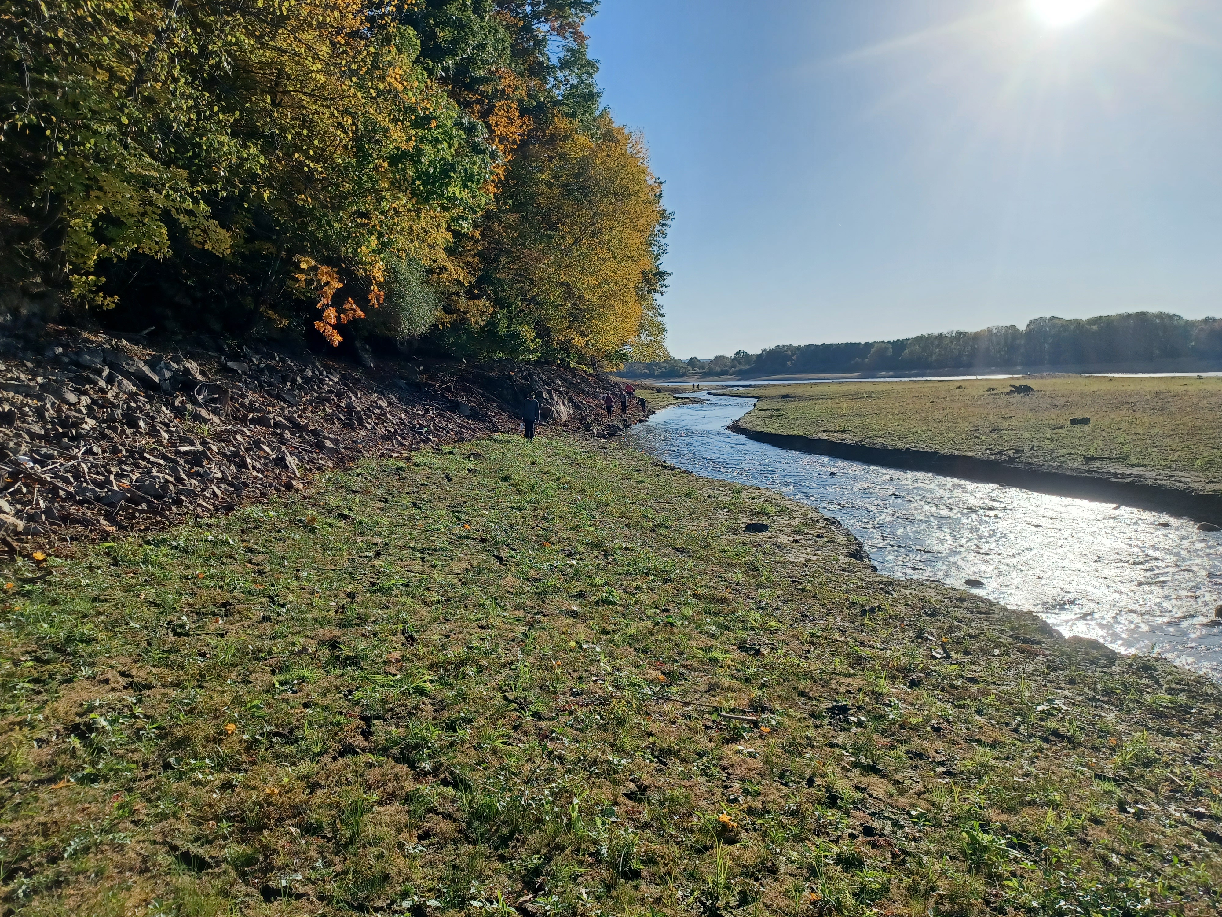
We wandered through the fields and high grasses out to the
Mulhockaway Creek, which was finding its original course in the dry reservoir
bed.
The stream was quite big, and crossing it would be the next toughest thing we’d
have to do for the entire hike. I managed to keep my feet dry because Brian and
his wife had gifted me a box of Keen hiking shoes. I would normally just wear
my latest junk shoes on it, because these shoes were great and I didn’t want to
mess them up before Winter.

However, I also didn’t want Brian to get crap from his wife when she saw me if I wasn’t wearing them, so I put them on this time. I kind of wanted to walk in the water for the crossings, but the things are pretty well waterproof. If I had gotten them wet, my feet would likely end up being like buckets of water.

I hopped across pretty easily using some rock hop spots, and most of the group went way upstream to find an easier spot to cross. Judy went downstream further thinking there would be something better over there, but found nothing. Jen went across the water and then went back to follow the rest of the group, so she kind of got her feet wet for no reason!

Overall it was a pretty fun crossing, and Judy ended up having to walk in the water anyway, but didn’t complain. We ended up talking about when Larry walked through Musconetcong Tunnel through the ice and tried to do it bare foot.

We headed to the east again, and turned a corner from the
Mulhockaway inlet where there were great views of both the stream flowing into
the still water, as well as the foliage on the land.
After going around the corner, we could start to see out to the recreation area
again, and the tower and club house came into view on the other side.
We continued to the right a bit around another inlet, and there was evidence of another road that used to cross here. It wouldn’t have been a regular public road, probably just a farm road or a driveway, because I couldn’t find anything of it on the historic maps.

We went around another corner and out a peninsula, then back to the south once again. In this area we came to an old building foundation, in view with the main dam across to the southeast.

We’ve always referred to this
as the Mulhockaway Farm, but I’m not sure the original farming family that
would have had it. I think it was newer than the 1870s atlas maps, so the
owners there wouldn’t have been on it. The closest names I could find to the
reservoir were the Carhardts and the Bonnells, but I’m not sure if those
properties were at the current reservoir site.
We continued past the ruins, and came to a point where there is a height of land with more trees on it to the left, usually an island, and some standing water in between, mostly dry.

Historically, this was a tributary that flowed north into the Mulhockaway, but with the reservoir, its source has shifted and flows I think more to the south.

There were springs somewhere in this area
that are screwed up from the reservoir.
We continued on the slope of the island, and then came down at
the only spot we could cross back over to closer to regular land without
getting wet.
There was a steep slope ahead that dropped down to the reservoir
edge, and we had to take care walking along this bit. It was a beautiful
section, and there were people right across from where we were with a boat
moored on the shore line. I was surprised to see anyone else out in this area
at all. They were probably quite surprised to see anyone walking along the
shore!
We weaved around the corner, and we kept finding balls in this
area to throw for Erika’s dog, but he also kept losing them.
We were getting close to the end of this bit of the reservoir bed we would walk. It was getting closer to the main dam, which we did not have permission to cross, so we would have to head inland. I wanted to try to do it following the old Union Road directly, but I shifted over just a bit like I had done the previous time.

We headed into the next inlet area, which is quite wide, and has a levee at the end of it for when the water is high. We paused for a break before reaching that point, and then I told everyone to move along quickly as not to alarm any of the adjacent land owners. I try to stay away from the homes, and didn’t want to get anyone upset.

We headed to the rocks and climbed steeply up to the top of this dam area, then turned left to wider grassy fields to the east. Once we were a bit further away from this dam, we turned to the left on another grassy old farm lane back to the north, still following the edge of the reservoir.

Once we got out to the end of this peninsula area, we had reached the old Union Road again, which was just another grassy mowed path again. It did have some railings along it that might be left over from when it was still open to traffic.

We turned that right, and had one last good view of the main dam
before heading further inland.
I had a nice conversation at this point with Paul, who is the
interpreter at the state’s Wallace House and Old Dutch Parsonage in Raritan. I’d
first met him when he was hired for the position, and told him a variation of
the same thing my former supervisor at Hunterdon Parks told me: the job is what
you make it.
It’s true that at the state, you can get away without doing work, but if you really care about these resources, you’ll find yourself working harder than you have at any job before.

I was very impressed by what he had to say, and he indicated some of the frustrations with group that weren’t interested in the level of outreach and planning that he wanted to bring to the site, which is exactly the experience I’ve had since getting involved in government and environmental or history groups.
The conversation left me with a level of hope for the future,
that one day some of the people who hold us back from being the best we can be,
and the organization being the best it can be, will be gone, and people like us
will be dominating and improving these places we love so much.
We also talked about having some history hikes in the future, tracing historic
routes like the Spruce Run Turnpike and the Old York Road, which we could tie
in not only to the properties associated with Spruce Run, but also Paul’s site
at the Wallace House. I hadn’t done a hike right by that site in several years,
and it would be really nice to bring the group through and hear his
presentations.

We continued to walk the old abandoned Union Road to the south, which was just a grassy route. It took us past a gate where we could walk around, and then out to another access road.

A slight jog right and continuing
mostly straight took us directly into the neighborhoods on the west side of
Clinton, and the road there is still named Union Road. The road rather inexplicably
changes names to Rupell Road for those driving around the corner, and most
probably have no clue that the road used to go through.
We followed Union Road straight out to Rt 173, and cut through the bank parking lot and past the Shell station. There was a Dunkin Donuts we were going to go in to, but it was closed for construction. So, we continued walking along Rt 173 east into Clinton.

To the right, I paused to point out the former Clinton Branch of
the Lehigh Valley Railroad where it terminated, and that Fox Lumber is still
using the old train station for Clinton as one of their office buildings.
We continued a bit more, passed the Clinton House restaurant
which is an historic coach stop, and then headed out to the Old Red Mill and
onto the historic Pratt through pony truss bridge over the South Branch of the
Raritan River.
Old Red Mill is
possibly the most photographed historic structure in the state of NJ.
The mill was originally known as Hunt's Mill. The
settlement was a small community until about 1813 when the Spruce Run Turnpike
was chartered to connect the site to the successful mines and furnace in
Oxford, Warren County. Archibald Taylor, of the Taylor Iron and Steel Company
Taylors (son of Robert Taylor), purchased the mill and ignited an
entrepreneurial flame in the town.
Hunt's Mill was redubbed "Clinton" after
famed governor of New York, DeWitt Clinton, who was known nationally for
helping to create the Erie Canal.
The mill is a museum today along the river.

Directly
opposite the Old Red Mill, on the other side of the river, was another mill. This
old stone mill was constructed to replace an earlier one in 1836. It operated
for a century before closing, and saw its rebirth as an art museum in the 1950s.
Both mills are stunning to see with the dam that powered both of them. The
location is really a step back in time with a lot of character.
Once we got
to the east side of the bridge, I told the group we would be taking a break. If
anyone wanted some food, they could head to one of the area businesses to get
some. I was going to make my way back out to Rt 173 to get something at the
Krauszers. Jack and Sarah went with me over to that.
We cut
between a couple of buildings on the main drag, and got directly out almost to
across from the place. Traffic was kind of bad, but we were able to get across.
We probably took longer at the store than we should have because everyone
wanted to keep moving.
We headed past the art museum mill, and headed to the north a bit until we got
to Rt 513. We turned left and crossed the South Branch of the Raritan again,
and headed slowly uphill toward Rt 31. Along the way, we passed the library
where we stopped for one more break so that everyone could use the restrooms.
Alyssa cut out in Clinton because she lived within walking distance, and I think she got stung pretty bad earlier, so it was understandable wanting to get out. She could walk that last bit any time.
From here, we
soon reached the Water Authority property where we headed slightly left away
from the intersection between Routes 513 and 31. This route would have been as
I understand the original Spruce Run Turnpike.
We got on a paved trail that went close to the bottom of the main dam and then
paralleled 31 heading north.
It was odd
that we saw someone walking in the no admittance area below the main dam.
Celeste commented that she’s never seen anyone walking down there before, and
wondered how they got beyond the gate to get there. They must have gone in by
way of the Quarry Road or maybe behind the red mill.
The paved
trail we were following passed through a gate, shifted left, and then took us
to the reservoir again. We turned right and started following the dry shore
once more, which at this point was some of the steepest shore we’d seen. It
wasn’t a wide flood plain like the rest of what we were doing.
I was talking to one of the new guys on this one about all sorts
of hiking stuff, because he had been doing the Connecticut Blue Blazed Trail
system. I had done a whole lot of that myself, and hiked all the way across
Connecticut east to west, so we had a whole lot to talk about. We also both
loved interesting beers, and so we chatted about the different kinds we’d
liked. He had been a lot farther out than I had been, doing more peaks and such
into New England, and I really look forward to doing those myself. I hope as my
son gets older I can connect with more of that if he’s willing to do it.
He also was telling me about how he’d just finished the Appalachian Trail, and
about how he was slack packing some of the other ones with a buddy who helps
him spot cars in certain places to get through. His adventures sounded really
awesome.
It was a great conversation to have on the home stretch heading
back.
We continued past the Water Authority building, and then a
private home that as I understand dates back to the 1700s, and I think to 1720
or so I was told. It was apparently affiliated with the Union Ironworks as
well.
We continued along the slope as it brought us to the edge of the
Spruce Run, which is also finding its original course through the area. I found
an old bottle of Dad’s Root Bear in this area, in reasonable shape. I took a
photo of it, which was really all I wanted, and gave it to Chaiyut.
Probably the most technical spot of the entire hike was this
little bit where it was super steep to the right, with the creek to the left of
us. We really had to watch our footing there. Some of the group just waded across
the creek and walked the other side of it out to the parking area again to cut
a corner.
I continued walking straight, and it was just fine after the
slope ended. I had wanted to get on the hill above to the right, but didn’t
bother this time. I had heard rumors that there was an old cemetery up in
there, but I had never seen it before. I really want to go and look for it.
This time, we were almost done, so I wasn’t going to push it.

As the flood plain widened, there was a beautiful little cascade
from a spring flowing down to the Spruce Run from the right. I assume this is
the spring that flowed out of the spring house along the Spruce Run Turnpike
just around the slope to the right. The old road route was coming into view as
we approached the rear of the Rita’s Italian Ice place.
We headed up onto the old highway route, and then crossed the
Willoughby Brook on the old concrete road bridge that would normally be
submerged. Most of the group continued ahead from there, but I waited on the
bridge for everyone behind me to at least get within sight again.
Celeste texted me that she and Judy were hanging back and taking their time,
not to wait for them, but I waited for them to get within view anyway. Jack and
Sarah hung out on the bridge with me while I waited.
Pretty soon, we continued to follow the old road over barriers
and beside the former Central Region Office at 1 Van Syckles Road. The building
was scheduled to be demolished, and the word was it was going to happen
somewhat soon. Its amazing how much the place had declined in the past few
years.
There used to be a garage across from it, which I had been tasked with cleaning
out. One would never have known a building even stood there with the amount it
had grown over at this point.
We headed out to Van Syckles Road from there, and crossed the
Spruce Run on the road bridge to reach the parking lot where we had started.
Most of the group actually hung out and waited for me to get back, which was
nice so I could say goodbye to them.
Someone, I assume Bill, had placed a bag on my car with “Ham”
written all over it.
I was so happy that this hike had gone as well as it did, and
there were even requests for it to be hosted again before the water comes back
up, so we actually scheduled to do it again.
It was particularly nice for me, because through work, I was able to show the
kind of crowds I can draw with an odd kind of hike, as well as the information
I can impart off the top of my head. If things go really well, maybe I’ll be
able to offer more programs like this through the state and my own organization
more regularly. I certainly hope it can work out.
No comments:
Post a Comment