

Hike #1500; 8/14/22 Neshanic Station to Branchburg with Jenny Tull, Serious Sean Dougherty, Sue Bennett, Greg Andres, Stephen Argentina, Joe Pinto, Carolyn Gockel Gordon, Diane Reider, Brittany Weider, Justin Gurbisz, Robin Deitz, and Professor John DiFiore
I have often said that any reason to party is a good excuse, and my 1500th long day hike was just another one. I had been thinking about it a bit for a while. How would I choose to celebrate it?

There was a time that any of these milestone hikes would have to be something traditional, like doing the Portland to Washington anniversary hike another time, or coinciding with some other event that was going on.

I
think I intended to have hike 1500 fall on the day of Musikfest, but I
unfortunately had a mess to deal with at home that kept me from doing any more
week day hikes.
The hike ended up being the week after the Musikfest one, and I thought about doing some classic location that was very meaningful or something, but then changed my mind and told myself I would do something that I genuinely wanted to do.

This would be a hike that I’d have considered posting as a night hike, but since I am no longer doing those, it would be a day hike.

We’d be a
bit closer to home, and I planned it to be along water much of the way. It wasn’t
as relaxing as my Pennypack trip with its simplicity, it had some classic spots
that we’d really loved in recent years, but also hit some other spots that I’d
badly wanted to see.
It ended up being exactly the hike of hike I wanted it to be,
and super fun.
I planned for the meeting spot to be Ten Eyck Park near Branchburg NJ, but that lot was closed, so we all had to meet at the Milltown School just to the east across the North Branch of the Raritan River.

It wasn’t a huge group for my 1500th hike, but it was a pretty good showing anyway.
We shuttled from this point to just west of Neshanic Station on
Blackpoint River Road, the trailhead for South Branch Riverwalk Trail.
I had found out about this trail a while back, before one of the night hikes I was doing through the area, but I wasn’t sure if it went all the way through yet. More recently, closely looking at the aerial images revealed that it did in fact go through. It was something I definitely wanted to do, and led to planning of this hike with other similar lands.

We had a miscommunication in directions going to the starting point where the GPS took John and his crew a turn closer to the settlement when we were going west of it. We did catch up with one another after a phone call though.

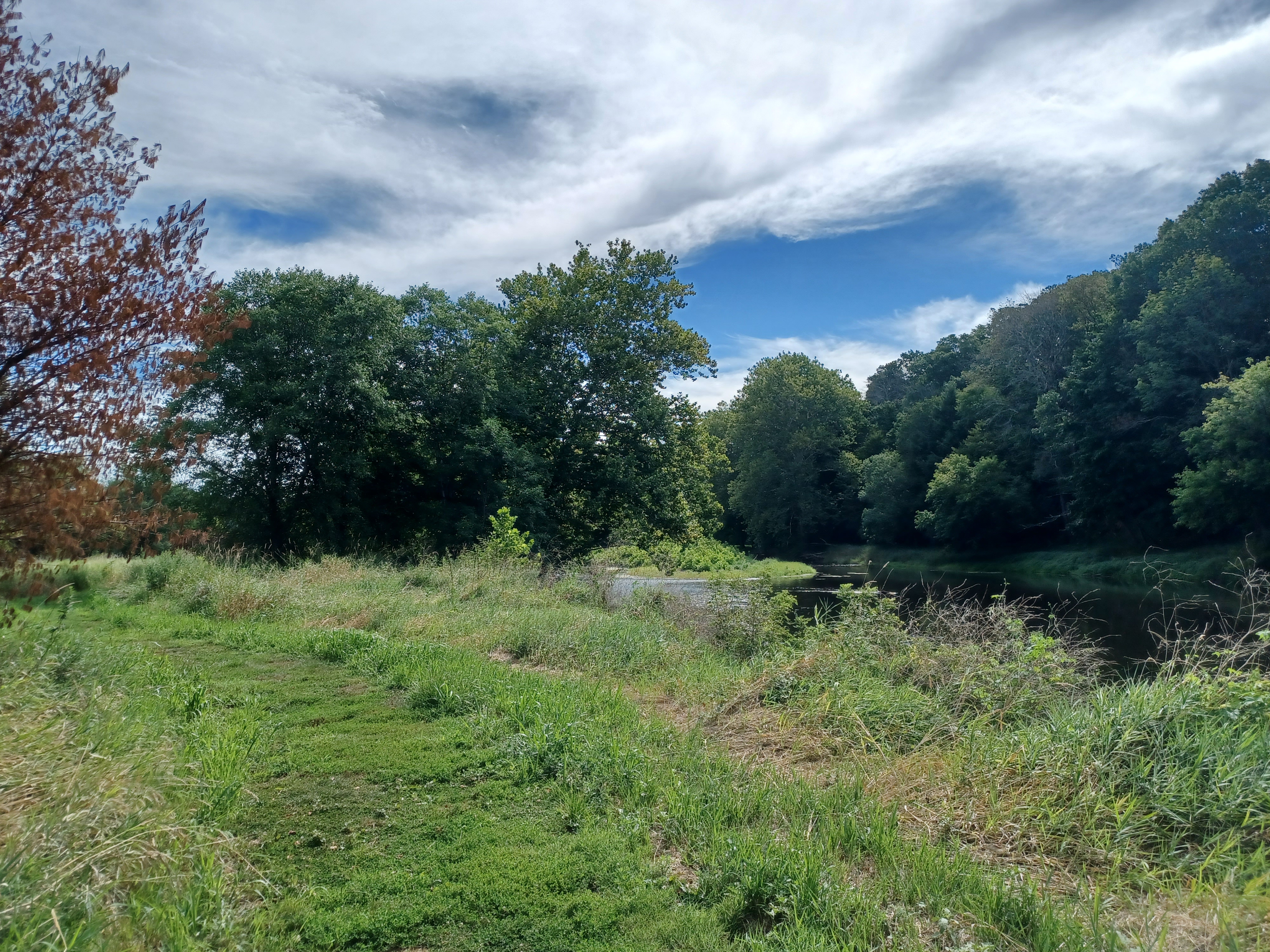
The South Branch at this location was rather shallow but wide,
and really beautiful. Brittany was already in it before we even started
walking.
I walked out into it right away and checked out the modern truss
bridge that carried Blackpoint Road over.
We started hiking the trail to the east from here, on a very nicely mowed trail beside the river. I celebrated at the very start with one of my few remaining bottles of Weyerbacher Blasphemy that I’d bought several years ago. I think I’ve been aging it over five years at this point, and this was a good occasion to partake of it.

I think it has gained strength over the years, because I was feeling it pretty soon.

The trail didn’t have a lot of shade; it mostly moved along
flood plain meadows, and it had outstanding views of the river. At one point
there was a really nice rope swing on the other side, but I didn’t indulge this
time. I did walk out into the center one more time before moving on.
We continued along the trail a bit more, and started to turn inland a bit more from the river. The mowed path came to an end because the area was still too wet to get a mower through, even with the drought conditions, and then seemed mowed again just a bit ahead.

As we got closer to a bend, where the South Branch of the Raritan turns from moving in a generally east direction more to a north one, we came into view of the 18th century Schenck Farmhouse.

I had read about this place before, on a past hike, and even recorded in a journal entry on it that I believed the house to have been torn down when I did not see it from the road.

I didn’t realize at first that this was the building,
and just admired its attractive construction.
The Colonial Revival embellishment style home may have already been on site before John Schenck acquired the property in 1857. Schenck's wife Sarah inherited the land from her father, Teunis Huff, who had purchased it from Dumont Van Doren three years prior. The land had been in the Van Doren family for three generations, since the late 1700s.

The home has had several additions up through the 1960s. It was enlarged and converted into office space for the industrial complex built on a piece of the farm land just to the west.

The old family cemetery is still in
place, fenced in the middle of that complex, and we visited it on the previous
night hike we did in the area. Our friend Joe Tag apparently has ancestors
buried there.
The house, as we walked around it to the east, looked like a really modern home
from certain angles, but we could tell its antiquity from others.
We continued across a meadow and back closer to the South Branch of the Raritan. Pretty soon, we reached the former South Branch of the Central Railroad of New Jersey, up on a fill before its bridge over the South Branch.

This line was built in 1864 as the South Branch Railroad, from a point on the Central Railroad of New Jersey main line in Somerville NJ (where the parking lot is today) all the way to Flemington.

I had walked the entire line through in 2008, and then other parts of it I’ve revisited a few times since. This point at the bridge I had never gone out to before.

The line became part of the Jersey Central system, and it served
well through the years. I think passenger service on the line was discontinued in
1953, but freight continued through the 1970s.
The line was apparently embargoed by the ICC because the tracks were in
horrendous shape in 1974. They were torn up some time soon after that, although
the bit to Three Bridges remains in place.

The ties going out onto this bridge were deplorable, but I still walked a ways out onto the bridge to check it out.

I would actually have gone all the way across, except there is a girder span section on the east side that has been removed completely due to clearance issues on River Road.

From this point, we descended down to the other side of the
tracks, and there was a bit of a deep spot in the river with a bit of an eddy,
where the water shifts directions. I went for a swim here, which was great and
well needed by this point.
Directly across the river and next to the bridge, the old Ammerman Mill was in view.
The mill was built in 1876 to replace the original
1810 structure. It was powered by
a turbine until World War II, then a Buick gasoline motor for a short time
until milling operations ceased in the late 1940s. I believe it is now a
private residence, and is kept in beautiful shape.


Just ahead in view, Neshanic Station Bridge carried Elm Street over the South Branch.
The 285 foot long, 2 span, 9 panel pin-connected lenticular through truss bridge was built in 1896 by the Berlin Iron Bridge Company of East Berlin, Connecticut.

It is the more significant of only two remaining examples of lenticular through truss bridges in the state of New Jersey.

We made our way along the trail a short
distance further to the parking lot at the end of the trail, and then turned
right to cross the bridge. The wooden deck walkway on the upstream side was
pretty badly mangled from flooding earlier in the year. It’s hard to imagine
the water so high that it came over the deck of this bridge, but it definitely
got there.
We crossed over the bridge, with some good views of the river, the railroad bridge, and the old mill. Just barely downstream from this bridge was the deck girder bridge carrying the former Lehigh Valley Railroad.


We turned right on River Road briefly, and then left on Mill lane just before the former railroad underpass.

We passed a few houses on the road, and
when there was a clear way of walking over to the old CNJ grade, we cut over
and began walking it to the east.
It wasn’t very far on this before we reached the underpass beneath the former Lehigh Valley Railroad. It is a very strange bridge that sat at an odd angle, double track wide although I understand this line was only ever single tracked. I suppose they had to make it double wide in case the need ever arose to double track it.

I had one historic photo of the site I’d seen through the Gillette on Hillsborough page, which is quite excellent and I highly recommend it for those who love history, so I wanted to set that up at the right spot.

Once we got through the underpass, we continued on the rail grade for a little while more, as long as it was even reasonable for walking.

It gets somewhat overgrown, but not too terrible until
a certain point. This section back in 2008 was basically all ATV trail.
Eventually, it got so bad that it was basically impassable, and we had to climb uphill to the left to get back out to Mill Lane. We reached the roadside, turned right, and it changed names ahead to Riverside Drive after a farm and a bend in the road. I think where it changes names, Mill Lane used to go across the tracks. I think this was where the former Hibernia Mine Railroad bridge had been.

It was originally on the namesake railroad up in the Farney Highlands, but when the railroad was abandoned up there, it was moved down to the Neshanic Station vicinity and re-purposed as a road bridge to cross the railroad.

We continued along Riverside Drive, which paralleled the railroad bed for a bit, but then turned north, away from it a bit.
It was still a very nice road to be
walking, narrow and very little traffic.
The road soon lived up to its name as
it started to parallel the South Branch very closely.
The road remained very pleasant with the occasional good river view for a while, and then Clawson Avenue came in from Flagtown on the right.


At that point, there was a line in the middle of Riverside Drive. I always judge the roads by whether there is a line or not.

If
there’s not one, it’s a small road and is pretty much guaranteed to be a good
one for walking.
Still, we continued ahead on Riverside
Drive, and it was pretty much as pleasant with little more traffic than before.
We continued on the road along the river to the next intersection, where it was Opie Road to the left across the South Branch, but to the right it was River Road.

I had considered trying to do an off trail thing here, and go along the river and through fields, but at this point I was feeling tipsy and pretty happy, and the road was relaxing. No one was complaining, although it was hot, and so we just kept to the right.

We crossed a little concrete bridge
over a tributary almost right away that had a plaque in it reading “Morz Bridge
1931”. I was surprised to see such an insignificant little bridge with a formal
name. I figure there must be something more to that story.
The road was really pretty through farm
land and past only a few homes. There was a scenic windmill off along the
fields to the right.
Soon, we were back along the South Branch again heading north.

We were all feeling pretty good, and Sean was playing some great songs on his guitar along the way.

He and I were
talking about how he had just seen Steve Miller the night before out in
Carteret or something, and that he was really great. We started singing and
playing “Serenade” by him, which is always a great one. Sean said Miller really
handled the guitar work amazingly despite the fact that he usually has a band
and doesn’t always have to perform these parts. Quite talented.
I can’t quite remember what other songs we sang on this stretch, but I’m sure
there were more.

To the right, a collection of homes in a settlement known simply as South Branch appeared to the right, part of Hillsborough Township.

We could see
the Italianate Munroe House built in 1870, then another last quarter 19th
century home, and the Greek Revival Temple farmhouse.
The area near the confluence of the two branches
of the Raritan River was first settled in 1750, and became home to many
affluent members of society including one former New Jersey governor, Peter
Dumont Vroom.
We continued on ahead a bit more, and there was an informal path to the left where Orchard Drive came in on the right. We decided to head down it and have a look.

The little woods road continued back in the same direction that Riverside Drive had taken but only for a bit.

This was a great payoff because it led us to an epic swimming hole complete
with a rope swing!
There was a large island in the South Branch
right next to this point, and the water was very deep, well over my head.
Several of us went in and enjoyed the spot for a while, and others in the group
just enjoyed the good shade.
We headed back the way we had come down into the little settlement of South Branch, and continued north on Riverside Drive.

From Orchard, we had walked this before as part of a night hike. I reminded Jenny that she had ubered out of a night hike from this point once a couple of years ago.

This brought us past the South Branch
Reformed Church, a Greek Revival style temple built about 1850, and still in
great shape today.
We turned left here across the Studdiford Bridge on Studdiford Drive to cross over the South Branch. Serious Sean, Justin, and I walked along the tops of the arched trusses over this one for extra fun. Sean did so playing his guitar!

We walked Studdiford to the west for a bit, and came out to South Branch Road. Just to the left of this intersection was what was known as the Little Red School House. The historic structure was built in 1873 and is now a local museum piece.

We reached the Little Red School House and walked around the outside of it to the back.

To the right out the back was
a piece of preserved farm land that has a public trail system through it known
as the River Lea Farm Preserve. I had seen this on maps before, and had figured
it would be a good thing to incorporate maybe into part of a night hike, but
again I was not getting around to doing those possibly for a while.
It was the second significant preserve I decided to try to incorporate into
this hike.

We walked along the field edges to the east, and the map showed that a trail should go to the west at a certain point.

When we got to where the trail should be, we saw nothing. There were faint tire
tracks that a track had traveled along this route where the trail should be,
but nothing else. I decided we would just walk up those tire tracks as not to
disturb crops through these open and cultivated fields.
Eventually, we reached a spot to the west where there were metal arrow signs denoting the trail. We were able to easily continue to the west from there without a problem.

The trail skirted the south sides of fields rather closet to
private homes in a development as we continued to the west.
Some of the group realized we were just doing a kind of tight
loop through the fields, and that we could see exactly where we were going to
be in a short while, but I reminded them that we weren’t out there to just get
from point A to point B. It was the joy of walking and seeing whatever there
is, sharing the time with friends.
I was incredibly happy at this time. It was turning out to be a wonderful,
relaxing day seeing some new places and some loved old ones.

We turned the right at the end of the fields, and continued back to the east toward the other side of the preserve. Carolyn was ready to meet up with us, and she was going to park at River Lea on the east side at the parking area, which is an active farm.

We were right by some houses along this first section, which had
access out to the public streets that I’d like to use on a future hike, and
then we were closely parallel with the Holland Brook. I had considered trying
to get in the brook when I planned this section out, but there was no good way
in at this point.
We passed through a small tree line, and then straight on through to the active farm. The marked trail route was a farm lane that led right into the barn and silo complex. Sean ran up onto a pile of feed or something that was sitting out there.

I would imagine whoever owns or leases this farm, whatever the situation is, must have been rather surprised to see such a large group meander out from the trail, without a car parked there, with a guitar!

Carolyn was parked in the lot, adjacent to the Branchburg
Community Garden, and she had brought me a four pack of Weyerbacher Blithering
Idiot, for which I will love her forever.
We turned left on South Branch Road from the farm entrance, and only had to walk north on the road for a little bit. On the right, there was unmarked entrance to state park property, which was part of what used to be referred to Confluence Reservoir State Park.

I had hiked some of these lands before, but never the section this far south along the South Branch.

After the Water Bond Act of 1958 was passed, justified following
the Flood of ’55, a lot of reservoirs were proposed, including Spruce Run where
I work. Many of the reservoirs like that one, Round Valley, Merrill Creek,
Yards Creek, and more were constructed, while others were authorized and never
constructed. Many of them are still authorized to this day.
Confluence Reservoir was one of these, and I think it may still be authorized but will likely never be built. This reservoir would impound land back on both the North and South Branches of the Raritan from just below the confluence point, around the current location of the Head Gates Dam in Duke Island Park.

The state purchased a lot of land up and down both sides where the flooding
would happen, and buildings were demolished. The area floods so badly it really
didn’t make sense to have any buildings down on it anyway.
The property is under management of Round Valley Recreation Area, but I don’t think any of the employees there have ever even been to most of the properties. They certainly haven’t done the ones we were about to walk through. Even I hadn’t done them!

I found using one of the trail apps that there was an informal trail along the South Branch from this point, at the intersection of South Branch Road and Chubb Way, that went all the way to the Old York Road. At this point, we were doing well enough on time that I figured we had the time to do some exploring here.

At first, it was just great. It was a farm lane that went way back in to the property parallel with the field edges.

After passing through a line of trees, the path started to get a
bit overgrown. I knew we needed to get out to follow the South Branch of the
Raritan more closely, so rather than try to follow the field edges, we made a
bee line straight across the field through hip-deep soy. It was actually pretty
cool!
We got to the river edge, and bushwhacked along the fields to the next little stream inlet. At that point, it was a bit of a bushwhack through to the next field, I could easily have done it, and then the field edges wouldn’t have been so bad, but I wanted to get in the river.

I hopped down and decided to walk in the river as best I could the rest of the way back to Old York Road. Carolyn, John, and Sean all went with me on this one as I recall.

This was the part of the hike where things started to get
sloppy.
I thought I was being really careful with my phone. I was
carrying it for a bit, but the water started to get deeper. I didn’t expect it to
go higher than the back of my pack, and I put the phone in a spot where I
thought no water would get to it.
We continued walking, and the water kept getting deeper. I held the pack
further up on my pack, but it continued to get deeper. Carolyn I think did a
little better keeping hers higher up. I should have kept mine in my upper most
pouch, but I think I was worried about it coming accidentally unzipped.

The others moved along surprisingly more quickly than we did
outside of the water, on out to Old York Road. We moved along through the water
just about to the confluence of the North and South Branches. I had never
actually seen the spot straight on before, and always wanted to. It was a
really cool sight.
We got out of the water at that point, where we had a better view to look on
back on. In this area I got my phone back out and realized it was terribly wet.
It was still working fine, except the screen didn’t unlock as nicely as I would
have hoped, and the camera was bad.

I couldn’t see anything at all out of the regular camera, but the selfie camera worked. I tried using it to get a few views of the confluence area, but it just wasn’t good.

In addition to my phone, Serious Sean's guitar was completely loaded with water. He actually had to turn it and dump it out! Amazingly, it ended up being just fine and wasn't even out of tune in the weeks to follow!
The Head Gates Dam just downstream in Duke Island Park is reportedly to be removed in the near future I found out from some of the posters in the Metrotrails forum, from the last times I hiked the Duke Island area. The dams downstream from that location on the Raritan have mostly come out as far as Somerville, and that is the next one up.

On the South Branch, I
don’t think there are any dams in place any more until Rockafellow’s Mills near
Three Bridges, and beyond that Clinton. On the North Branch, the next little
dam upstream is in North Branch Park.
The path was more prominent when we
were within view of the confluence. We walked it to the north, and there was a
little foot bridge built over another inlet tributary, just before we came out
to the road.
The area here floods so badly that there are gates on both sides of the Old
York Road bridge that can close off the road when it floods over the top.

The Old York Road was the historic colonial route between New York City and Philadelphia developed between 1711 and 1771 along the earlier route of the Tuckaraming native American path.

The concrete bridge over the North Branch today stands on the site of the original wooden bridge that occupied the site when the road was developed, through the Ten Eyck Farm (I had wanted to find the Colonel Ten Eyck grave stone, which is nearby, but there just wasn’t enough time to go back to it).

We turned right on Old York Road here and headed uphill for just a little ways.
We passed Campbell Court on the right, and a short distance past that, on the
left side, there is a trail that goes into the Chipman Tract, a county park
property.
I had done this trail a couple times at this point get get down along the North
Branch of the Raritan in a lovely secluded area.
We descended and followed the most obvious route, which is like an ATV path until it reaches the edge of the river. Then, we remain on a very nice shelf above the river along a well worn path.

We followed this almost out to the homes at the end of North Avenue, to a point
where there is an island in the middle of the North Branch. There is a side
path that leads steeply downhill from here, and there is an awesome zip line at
the end of it.
When we got down there, I think I ran and got the zip line, but I don’t remember who tried it first this time. I did it a couple of times.

I tried to get photos and videos of just about everyone going off the thing
that did so. It was great to get back to this spot, because the group split the
last time we did this, and many of them missed this that time.
Most of the group actually went off the zip line which was awesome.
For my final time off of it, I was about to go, and Serious Sean jumped on my
back! I went down the zip line and the thing held us both with no problem!

I think some of the group went back uphill to the trail to head out to Milltown Road, while the rest of us were going to walk along the North Branch, or rather in it, heading north. The route is pretty shallow and makes for nice walking.

I think most of us continued along the river, and eventually I headed up to the
left side of it because there is an informal foot path on the west side that
continues almost out to the Route 202 bridge. I’d followed it on one of the
night hikes before.
Everything was going alright walking the shore when someone in
front of me, I think it was Brittany, yelped and started running. Then I felt
the first sting.
We had hit some kind of next of wasps or something in the ground. I first got
stung on my leg, and then one right in the area of my hand between my thumb and
my pointer finger. Another one got me behind my right knee. These ones hurt
pretty badly. I at first thought they were yellow jackets, but these were much
more painful. Someone in the group told me they looked like yellow jackets,
only they had more black than yellow on their rear sides.

We ran until there was a good spot, and then jumped into the North Branch to
get them away. My hand hurt pretty bad right away.
This put a damper on things, and I think I held behind the rest
of the group who must have continued further ahead. I heard more yelps from
people who were behind us that must also have gotten into the same nest. Sean
ended up getting stung on his butt.
Somehow, we got all separated a bit between this and the previous split around the zip line. When I finally made my way to the Rt 202 bridge, I wanted to walk beneath it.

I tried walking out to it, and it went to
way over my head almost right away, which was kind of a surprise. I’ll have to
remember that spot for future swimming.
I climbed up the west side of the bridge and crossed to join the
others. The plan was to stop at the Char Burger and Creamery near the
intersection with Milltown Road for our late lunch stop.
I was feeling really out of it after the stings, and I’m sure the Blithering
Idiot probably helped things along. I started drinking them a little more
heavily after this to help deal with the pain.

They were also still good and
cold compared to my usual stuff from when Carolyn brought them, so it was more
enticing.
I sat inside, and a lot of the group sat outside, and I got the
mushroom and swiss burger with the cheese fries after seeing someone else with
them.
This burger was outstanding. Sure, I was hungry, but it just stated amazing. I
was so glad to have gotten the cheese fries as well, because I was still so
hungry after having the burger, and I really needed something in my system to
deal with everything I’d just put myself through.

I think Joe and I’m not sure who else cut out early at this
point. The rest of us, when finished, headed to the west again after crossing
202, and then took a right turn down an informal trail that leads into the
fields of North Branch Park. I’d done this route before, and it’s really a nice
and easy way to cut through without doing any road walking.
There were a lot of tents set up to the right as we reached the open fields.
The 4H fair I think it was had just wrapped up, and they hadn’t taken down the
event tents yet. I had just missed it, because this would have been a cool
thing to walk through.

We headed directly to the north through the first few fields,
not along the river yet, and there is an old probably Dutch homestead in the
middle of North Branch Park, which has been rehabilitated and added onto as
part of the park headquarters. I don’t know when the building was built, but in
1873 it was the home of J. Dunn.
We continued through a pedestrian covered bridge structure just before the house, and turned left to cross another tiny foot bridge, then a little wet area before we descended to the North Branch again.

I was in kind of a daze at this point, but I was still cognizant
enough to lead everyone through the way we needed to go.
We continued upstream along the river, and when we got to the tree line, turned
slightly right to an access road through the woods, still parallel with the
river.
We soon reached a power line clearing and turned right for a bit. In this area,
there was some construction on the lines going on, and so there was a plank
road temporarily built on the right of way and near it. We turned left from the
power line onto this road route, and somehow the group got way ahead of me. I
must have been going really slow.

The plank road was directly parallel with the old Central Railroad of New Jersey main line. It led right out to the stone bridge over the North Branch built in the 1850s.

The bridge is still used by the NJ Transit
Raritan Valley Line. Everyone was sitting up on the bridge wall when I showed
up, and I jumped back in the river at a spot I didn’t remember being as deep as
it was, on the east side.
After a bit, I got back out and we crossed the bridge to the
east side.
There used to be a bridge made of wood that spanned the tracks just beyond the
other side and before the North Branch station stop, but the road has been
closed a lot. We climbed up along the tracks onto this road, and I have a very
blurred memory of this. John was right with me at this point, and we walked
through a sort of lawn of an abandoned and boarded house right next to the
tracks.

I’m not sure the history of this, but it might be a rail related structure. Maybe
a station agent’s home or something. Whatever the case, it might end up getting
torn down based on the look around the property. John and I walked right by it,
and then descended down to the intersection with Station Road.
It was starting to rain a little bit, and my plan was to turn to the right on
more preserved land, in what Google maps calls Ralph T. Reeve Cultural Center
property, but it was getting late and no one was into bushwhacking more after
what we’d been through.

We went north and under Rt 22, and I think John got a ways ahead
of me again. I was dragging pretty bad.
At the end of Station Road, I turned right on the Easton Turnpike. Near this
intersection, Justin and I think others too pulled over to make sure I was okay
and see if I wanted a ride the rest of the way, but I was alright.
I continued across the Raritan on highway bridge, and the Milltown School was
just ahead on the right.
This bridge was an historic site dating back to colonial days, and was reported
by Robert Erskine in 1779 to be a “good bridge” while he was Surveyor General
under George Washington. The bridge was maintained by the original New Jersey
Turnpike Corporation from 1809 to 1869, and a toll gate was erected nearby. In
the late 1800s, an iron truss bridge replaced the wooden one, and that was
replaced by a concrete bridge in 1924. That bridge lasted until the current bridge
was built in 2005.

When I got back to my car, I was exhausted and felt off. I fell
in the grass next to my car and just took a power nap. It was raining at that
point, and eventually had to get back into my car to head home. It was kind of
an odd way to end my 1500th hike, laying alone in the grass, but it
was still a really great day.
There are still so many other things to be done through the entire area we
hiked this time, and it drives me crazy to thing I haven’t done it all yet. I
probably never will, but I’ll try.
Over the course of the week, the aftermath of the hike haunted me quite a lot.
My phone ended up being shot. It worked, but the screen didn't. It worked for a bit into Monday, but then I fried it probably because I didn't try to dry it out enough before use. I ended up having to pay $120 and got a new screen, and fortunately it worked and was ready for the next hike.
As far as the stings, I'd never experienced anything like them. My left hand, from the stick between my thumb and pointer finger, was sore for days with a deep pain that stretched all the way to my elbow. Most of the stings got better fast except for that one, and the one behind my right knee. That one got infected and had to be popped twice, and then got better.
Soon after that, I came down with lyme disease symptoms again.
No comments:
Post a Comment