

Hike #1496; 7/17/22 Ashley to Mondaqua with Professor John DiFiore, Justin Gurbisz, Jenny Tull, Gregory Andres, Serious Sean Dougherty, and Teresa I.
This next hike was a return to coal country after the excitement of having done the rest of the CNJ and other stuff recently on the final D&L hike.

I ended up looking over the maps quite a lot, and in doing so learned what some of the branches were that broke off of the lines we had been following all along. We had done much of the former Lehigh Valley between Solomon Gap, through Ashley and to Wilkes Barre, and each of those two lines had branches that went out west from Solomon Gap around the Ashley Planes to reach the valley floor in a roundabout route, basically an enormous switchback.

Down at the bottom there were more junctions, and I wanted to
explore all of it. Wilkes Barre itself could take a lifetime, and I already started
long ago. Now, filling in the gaps of all of the things I missed was sensible
by picking off branch by branch from the bottom of the Ashley Planes.
So, we had already been as far west on the Lehigh Valley Line as Sugar Notch to the west of Ashley, but there were Jersey Central branches that looked interesting heading west from there.

I chose the southernmost of those
routes as my subject for this one. We could follow rail grades all the way to
the Susquehanna River out in Mondaqua, a place I had never been before, and it
looked exciting.
Going to these new places always means learning a whole lot of
new stuff, and for that I was excited.
As we headed to the meeting point in Mocanaqua, a park at the Conyngham Township Municipal Building, it was a totally new drive for me.

I had never passed over any of these roads before, and the views were tremendous.

The hike didn’t attract many people, nor have any of them been
lately. It’s kind of sad because I feel I’m putting out some really very
interesting trips for which I’d done a lot of research, but people are
gravitating toward the same old spots with the name brand clubs as usual.
From the meeting point, we shuttled to the start point. This would end up being on street parking on Main Street between Ashley and Sugar Notch, not far from where the Huber Breaker used to stand. We’d not have to walk very far on the road from there to the Earth Conservancy Drive, which would take us to the Sugar Notch Trail.

We walked along Main Street to the west to the Earth Conservancy Road on the left, and I popped my first can of an IPA I had procured the day before.

This was an odd one from I think it was Eviltwin Brewery which had
consistently been good with other stuff. This one was tasty enough, but the
problem was that it was so incredibly carbonated that one could not drink it
without it fizzing out of the can every sit. It had to be allowed to mellow out
before it could be sipped. This was something that said New York City, and ”Tiny
Neighborhood, Big Views”. It had a good photo of the Brooklyn Bridge between
buildings on it. I must have lost a lot of the can waiting for the fizz to stop
unfortunately.
It became a thing on this hike that I had to save the can for when I opened the
second one so that I would have a container to catch the overflow from the
previous can, and then I’d end up double fisting two part full cans. I just
passed the second one on to Serious Sean.

The Earth Conservancy Drive took us up and beneath Route 29, and we paused in the shade beneath the bridge for a few moments.

This was probably
the hottest day of the year so far, and I had planned this so that we would be
near creeks much of the way and cool off. Unfortunately, that too would not
work out that well.
Earth Conservancy is an organization dedicateed to the reclamation and re-utilization of former coal mining lands in Luzerne County, and this particular area was quite disturbed. There is a lot of new forest through the area, with a lot of white birch and scrubby stuff, but this organization apparently helps it along and develops areas amenable to such.

Just after we headed up the road beyond the underpass, the road is on or right next to an old railroad right of way that served what was known as the “Old Jersey Tunnel”, which was apparently a mine just off of the road area. We had explored this some in the past, but not to any really great extent.

I was surprised when the Sugar Notch Trail turned off so soon
from the road to the left. It was very poorly blazed with spray paint, but it
was something there we could follow.
We turned onto it and headed out through woods, gradually uphill in a swath of
land between Interstate 81 and the Earth Conservancy road.
The trail took us uphill on a combination of woods roads, atv trails, and foot path. We weaved around and followed a bit of a stream, which would in normal conditions have had a waterfall or two on it, but it was quite dry this time. A disappointment considering the heat.

It seemed like we were in this woods for far too long, going up and down, left and right, and the trail had no turn blazes to show us the way at all. We had to just watch and hope we chose the right way. Some of what we followed was just luck.

We emerged onto a sort of ridge and lost blazes, but then ended
up on the gravel road near Sugar Notch Run where we had ended up early on in
the pandemic, just below the old interurban line, the Wilkes-Barre and Hazleton
Railroad.
I knew that the Sugar Notch Trail briefly followed that railroad right of way, so even though we lost it, we could get back to it easily by heading south, uphill a bit to the right of way at a point just below a former reservoir.

We headed back into the woods and I stood in the Sugar Notch Run. It wasn’t super deep, but it was about the most refreshing thing we’d come across until finishing the hike.

Just ahead of this point was where the Wilkes-Barre and Hazleton Railroad
crossed the Sugar Notch Run. It had an old stone culvert to the left, and a
concrete one to the right. This concrete one was apparently added when the
reservoir dam was constructed just on the uphill side of the railroad bed.
This line was built in 1903, and was the first interurban line
to employ a third rail. But this was not like other trolley lines either. It
also carried freight, which set it apart quite a lot. It interchanged with standard
railroads, and was built mostly “cross country” meaning on its own right of way
rather than in existing streets like many trolley lines.
The line lasted until 1933 when it was abandoned. We had done several hikes
that incorporated sections of this right of way, which was quite interesting.

Also at this bridge site was apparently once the site of Sugar Notch Station. It is hard to imagine passengers getting off at this site, and for what reason when there appeared to be no regular roads nearby at the time. Perhaps it was just for workers serving some of the coal interests in the area.

We checked out this site, and then I walked the right of way to the east a bit,
which I’d not done the previous time. A side path to the right led to a splendid
view over Interstate 81, with an American flag erected on the rocks. Quite a
nice site. There were views both to the east and west, but the east facing view
was a more commanding one.
I descended to the left and returned to the old interurban rail bed, which just to the east is obliterated by the highway for a bit of time. The others were milling about around the dam site, but then came out to join me and check out the view.

When together, we all headed back onto the rail bed across the culverts and over to where the right of way continued. We’d already followed that before, but the Sugar Notch Trail went up to the right on another old woods road.
The route reached to the top of an incline and for a while looked like another railroad bed. I’m not sure if it was or not. It could have been a company breaker or sorts. We lost the blazes for the Sugar Notch Trail along the way, an then after a time made our way back to them.

The trail descended a bit, and reached different levels of mining. It followed levels of woods roads, then descended a bit, then switched back from going west to east again gradually down on another level.

Near the top level of these woods roads, we passed one other guy walking the trail in the other direction. It seemed odd to see anyone else out there at all.

As we continued, a strong smell of spray paint was in the air.
It didn’t take us long to realize that this guy we passed was out re-marking
the trail with spray paint. Clearly no one in this area realizes never to mark
a trail with spray paint (I only use brushes, and prefer foam ones. Spray paint
is clumsy, sloppy, and goes on thin. It looks unprofessional and doesn’t last
long.).
The trail continued to switch back and forth and eventually started to head down toward Warrior Run, the next settlement to the west.

In this area to the east was the former Central Railroad Maffett Colliery Branch. The colliery belonged to the Hanover Coal Company, so I assume many of the lands the Sugar Notch Trail passes through were formerly of this company.

Just to the west, another branch, this one from the Lehigh Valley Railroad, used to serve the same area.

We headed downhill and soon reached the access road to the cemetery we had
passed through and met at for previous hikes in the area. Google maps now
refers to it as St. Charles Borromeo Cemetery.
We had found a hat with a feather or something on one of the hikes that went
through here, and Justin went at the end of it and put it on the head of a
statue of Jesus. When we came back a month or so later, the hat was gone, and
we found it again in the refuse pile along the edge of the cemetery, so he went
back and put it on it again.

This time, there was no hat to be found, so we couldn’t mess with people so
badly.
We headed down to Main Street after spending far more time up on Sugar Notch Trail than was planned, and bushwhacked straight down the hill to the railroad grades. The Lehigh Valley Railroad passenger main was the first right of way, and the second was the Central Railroad of New Jersey’s Nanticoke Branch, which was built in 1862 between Sugar Notch and Warrior Run.

It was
built by the Lehigh and Susquehanna Railroad, a subsidiary of the Lehigh Coal
and Navigation Company, and leased to the CNJ in the 1870s.
The parallel Lehigh Valley line was built in 1867 from Fraser to Wilkes Barre.
We had already followed the Lehigh Valley line on a couple of hikes to complete the sections, but I had not followed the Nanticoke Branch beyond Warrior Run, so that would be the next leg.

I waited at the bottom of the hill beyond the LV grade for the others to catch up. The CNJ grade had an ATV trail on it for a bit of time, which was nice, but that didn’t last all that long.

We followed this along and had to cut out to parallel Hanover
Street in order to continue. I had bushwhacked this section of right of way
before, and it gets thick, so I saw no need to try to push on through it again.
The Lehigh Valley line and the CNJ part ways in this bushwhack, and the CNJ
remains lower level heading west.
We walked Hanover to Front Street in Warrior Run, and a small park on the left is built over the old railroad grade. It used to cross over Front Street/Academy Street (it changes names here) just ahead.

There was some obvious remnant of rail bed parallel with Hanover Street just ahead. We continued walking and got onto another bit of rail bed to the left beside Jones Street. I was surprised as much of it was clear in this town area.

At the end of Jones Street, there was an abandoned house on the left side of the rail bed. We continued through these woods to Beaumont Street, and turned to the right back to Hanover Street where we continued west.
The railroad bed became overgrown straight ahead, and the ATV trail that had been following it descended to the right, down to the “Old Back Road”. We descended with it and turned left, to follow the old paved road parallel with the railroad bed.

This was a pretty nice route as well, and we soon reached a bridge over a tributary to Nanticoke Creek. We took a little break and sat on the north bridge wall.

From this site, the old CNJ stone arch culvert that
carried the railroad over the same tributary was in plain view.
We continued ahead, and there were ATV paths that went to the left. Briefly, we
were able to get back onto the railroad bed, but it made more sense to continue
following the Old Back Road because it was clearer, and it was right next to
where we needed to be.
Soon, there was a dam on the Nanticoke Creek to the right which created a large
pond parallel with us.

Despite it being so hot, this pond did not look at all tempting to swim in. It was quite brown, and probably full of all sorts of acid mine runoff.

We continued on the paved road to the west a bit more to a gravel mine road
access back out to Hanover Street, which becomes Front Street as it moves ahead
toward the little settlement of Hanover.
We turned right back out to the road, and then headed to our
next side trip, the famous Concrete City.
I had visited this site once before, but it was after a hike was over because it was right down the street, and because I’d intended it to be part of a hike, but we went over the mileage I wanted to do before that time.

The Concrete City was built by the Delaware, Lackawanna, and Western Railroad in 1911 for select employees of its coal division near Hanover and Nanticoke PA.

The homes were problematic, lacking in indoor
plumbing, and froze too easily in the Winter. The site was eventually taken
over by the Glen Alden Coal Company, which abandoned it in 1924. The
buildings came along at a bad time, basically right before the advent of indoor
plumbing and newer amenities that had not been considered during construction.
The buildings were too difficult to demolish, and
so they stand to this day, although there are talks of demolition. The
site is heavily visited by urban explorers, and our arrival was not
surprisingly after there were already hordes of people wandering around the
site.

We emerged from the woods to the main road to find lots of cars all parked along the edge from people who were wandering up through the abandoned town.

We headed across the street and up the gravel road to the north toward the town
area.
I missed the turn for the main concrete city by a lot, because there is a
clearing just to the east of it, so we had to descend a bit to get to the
buildings.
We came down to the first building, which was slightly different than some of the others because we could walk in the south side and exit the north side. Most of them were buildings we could go in, but then had to head back the way we came to head out.

There were a lot of people around, and as we went through this first building, there was a hot young girl walking around with a guy who’s nose was probably the smallest I’d ever seen on a person.

Some of the people around the site came
across like the kind that were annoyed we were having a good time at the site.
It’s only a matter of time before this place gets destroyed due to heavy
visitation. There are always people there, day and night, and people do foolish
things. In this case, there were collapsing sections of buildings where someone
is bound to get hurt, and people climbing around that probably shouldn’t be
doing so.
We checked out a few of the buildings on the east side of
Concrete City, and then moved on across the open area in the middle to the line
of them on the other side and checked some of those out.

Near I think it was that side was one of the buildings that had collapsed pretty badly. I had never noticed that one on the previous visit, and we had walked around all of the buildings then.

I doubt it happened within the past two years, but it was pretty substantially damaged. An entire corner wall was missing, and the upper floor was collapsed into that corner. I suspect that this was actually not collapse, but perhaps the original attempt to demolish the structures that didn’t go so well. Another building right next to that one had an entire lower corner missing from it, which makes it look like the upper level will just collapse, but it appears to be standing strong.
The concrete buildings are reinforced, but a lot of it is deteriorating and chipping away. Still, it doesn’t look like any will outright collapse any time soon.

We headed out from these buildings and toward the west a bit, which was where the DL&W Auchenclaus Branch used to be. We might have touched that right of way, but I’m not sure.

We then weaved along the corner of
a mowed yard, and then back to the woods parallel with the Concrete City, and
then turned to the right on another ATV path that took us steeply down a hill
parallel with the old road we had used to walk up there from Hanover/Front
Street.
We descended to and crossed the road, then headed directly across onto an old
coal road and turned to the right. At first, this was the former route of the
CNJ Nanticoke Branch. It was indiscernible, and turned into the woods a short
distance ahead while the coal road that turned both right and left was the way
to walk.

We continued to the west, and when a side ATV path turned to the right, it went closer to where the rail bed used to be so we followed that.

It
actually continued quite a bit further away than what I wanted, and was likely
part of a right of way associated with the Lackawanna Railroad.
The area was very clearly, formerly part of the Lehigh and
Wilkes Barre Coal Company Number 17 Slope and Tunnel site. There was no trace
of any buildings or infrastructure here from what I could see.
The ATV path cut into a line of trees and then turned abruptly east after
having headed west. We followed this for a bit, and then it turned north and
came out to a mowed area of what looked to be a park.

It was apparently the Hanover Recreation Club Park. We turned left through this, not realizing that any of it might have been some sort of private club.

There was soon a basketball court and tennis court, very badly overgrown in a
fenced area to the left. It seemed to be an abandoned park. There were also
some kids toy things, and a burning barrel that was actively being used with a
fire in it. This place was starting to creep my out a bit.
We continued ahead, and there was a concession building and I guess a restroom
building that both looked abandoned. I walked through a breezeway to the rear
of the building to check it out. It was overgrown and had not been used for
quite a long time. I would say probably since before the pandemic times.

The others hung back and were playing around on the playground stuff while I walked the edge of the building.

I went out to the nearest large shade tree
closer to Front Street in the settlement of Hanover, at the entrance to this
place, to wait for the others to catch up. They weren’t even noticing I was
there I suppose, because I had to wait for a while.
Soon, I started moving off onto the street, and was quite surprised to see
railroad rails still in place. This was the Nanticoke Branch we had been following.
It moved over closer to the road at this point, and right about where I was
standing was the former site of the Hanover Station.

Most people don’t even know this community is so named, because it’s one of
those colloquial names, which there they refer to as coal patch towns. Even
though it is quite separate from Nanticoke, it is still referred to as a
Nanticoke address it seems.
The others noticed I was leaving. I think I gave a wave. I started walking
along Front Street and the rails continued in the grass parallel with the road
for a bit.
After a few blocks along the south side of Hanover, the railroad bed continued straight ahead into an area of Whiting-Turner Construction. Google maps showed the entire area clear, as a former coal facility, but other signs warned of open pit construction.

The clearing was once the site of the Bliss Breaker, yet another coal mining and processing facility that tied in to the Lackawanna Railroad and probably the CNJ as well.

Now, it was home to a new warehouse. A giant monstrosity that appeared to be
maybe a mile long. We would have had a clear shot on through from here if this
construction wasn’t going on, but we couldn’t go through with big vehicles
moving around. Even though it was a Sunday, it was a pretty heavily used site.
A sign on the intersection of the construction site was riveted sheet metal
that read Meadow Crest Drive, a continuation of Front Street. It led downhill,
and then into a new home development. We had no choice but to continue this way
through that neighborhood.

We continued to Espy Street, and turned to the left, north. Fortunately, the edge of the road to the left offered us some shade. This route took us a bit out of the way of my planned trajectory.

I had to make a change in plans last second when I saw what had
been going on with the land from the Bliss Breaker, and I noted a power line
clearing with a path on it to the north. We would use that to pass through, and
take advantage of a store to the north of there to replenish water.
It was so hot out that I was actually going through mine quite fast, so this
ended up being a good detour. We went over a small creek at the bottom, and it
didn’t look quite welcoming enough for me to get in.

We headed to a traffic circle ahead at the intersection with Middle Road, and there was a convenience store on the southwest corner called the Cocoa Hut.

I was expecting this to be some mom and pop expensive ice cream
stand or something, but it ended up being more like a 7-Eleven or something.
When we went inside, the air conditioning was heavenly. It was
just too perfect and we had to sit down. We checked to see if they’d allow Greg
to come in with his dog, Saga, and they did, so we ended up doing an extended
break here. I also got a bunch of food as I recall.
This place was shocking because it actually had beer. Pennsylvania is always known to be the super prude state, where they can’t even sell liquor on Sundays, but this place was just like any convenience store in New York or wherever.
They also had Four Loco, which led to silly conversations
about early Four Loco experiences.
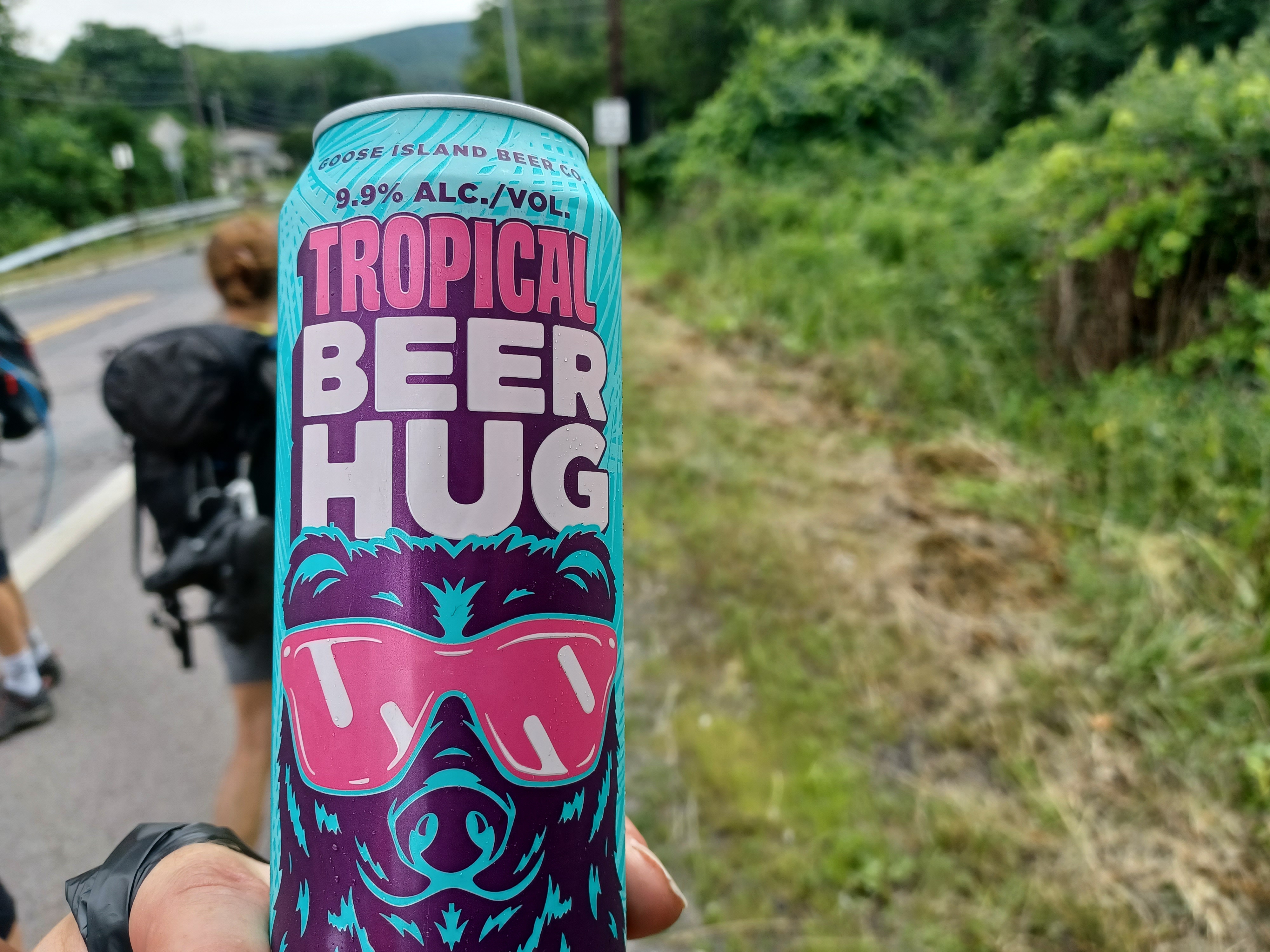
I picked up a can of Tropical Beer Hug, which was an IPA, and I
grabbed a Four Loco for Teresa. She had never had one before, and I always love
giving people their first Four Loco experience, because it is typically so
funny. At 14% ABV, that gets to the brain pretty fast.
I think I also got some ice cream at this place.
After our break, we walked back down Espy Street to the south to the power line
crossing.

We turned onto the ATV trail on that and started walking west. I
passed off the Four Loco to Teresa and she didn’t hate it too much, so I left
her with it.
The power line path took us uphill somewhat, and crossed over
Dziak Drive, which was the access road to the new warehouse. We could see the
sprawling structure from the height of the land near this location and along
the power line just a little ahead.
The power line path brought us right back to the Nanticoke Branch again, which was hardly recognizable from the left where we joined it, except for the fact that the grade was level.

To the right, it left the open area and headed toward the little settlement of Alden. It went into woods at that point which made it more obviously the railroad bed.

We walked the right of way west, and came out to Middle Road at about the point where it changes names to Kirmar Avenue in Alden. The track bed is now part of the parking area for the R Bar and Grill and Alden Room Catering. Unfortunately, this establishment was closed, so it was not going to be a lunch stop for us. There was an old enclosed bed Chevy truck of some sort parked under the sign for the establishment. I think it was a 1958 or 59.

We crossed the road directly into the woods, and here was the
site of a junction that is now quite obscure. This was also the site of a depot known as Lee Mine Depot. A branch to the right went
further into Nanticoke, but to the left went westbound. There was an Alden coal
breaker for which the settlement owed its existence as apparently most of the
residents worked there. Another coal patch town.
This branch of the railroad was built in 1871 by the Lehigh and Susquehanna and then leased to the CNJ. It was extended further west to a place called Lee in 1885, and this part of the branch would make up most of the remainder of the hike.

We descended just below the junction point, then went back up a bit to the left to get on the right of way we needed. It followed a shelf to the west along the north side of the settlement.

It wasn’t a path on the right of way, but it was clear enough under the canopy
to walk, among ferns and a few railroad ties still there and rotting away.
After a while, it got to the point we couldn’t continue walking the rail bed
due to undergrowth and lots of sticks and such, but just above us was the Alden
Cemetery. We were able to backtrack slightly and then get up into the back of
the burying ground. It had a wooden sign on it that read “Alden Station
Cemetery”. Apparently the station was at the crossing just ahead of where we
were.

We walked down through the cemetery and around the rear of the church as not to miss anything of interest, just in case.

The railroad had to have come out along Robert Street just below. We walked out
to the intersection with Kirmar Ave and turned left. The railroad used to go almost
directly across this intersection and onto West Railroad Street. The right of
way was either on or right next to the road as I saw it. I noted some remnants
of right of way just to the right, but some of the road is built right on the
rail bed.
Railroad Street was a pleasant walk, and soon there was an abandoned brick building in the left. It was some sort of industrial property, but I’m not sure what it was.

Another grown over abandoned building was just past that also on the left side of the road.

There were several homes along the road as we got toward the end of the street,
and at the very end there was a path cutting through a line of trees and then
into more reclaimed coal lands.
These lands were also part of the Lehigh and Wilkes Barre Coal Company. The
railroad bed had been completely obliterated through here, and all of the
ground leveled off like it never existed. About where we emerged from the line
of trees was the former site of The #18 breaker and #18 slope just to the south
of where we stood.

The land had been replanted with lots of young trees that were in white tubes along the landscape. We had to continue between them straight ahead. I believe this was another Earth Conservancy property.
The South Branch of the Newport Creek flowed through the area, and we descended over a trench where water usually flows, then headed out the other side to reach a woods road, part of the Penobscot Ridge Mountain Bike Trail.

The trail apparently has a lot of interesting features, parts of
old coal industry infrastructure, and maybe two cemeteries, but I wanted to
save that for a future hike and keep the theme of this one to the CNJ branch.
There was a map of the trail, which comes out on the other side of the town of Wanamie just ahead, but we turned right out to Kirmar Ave again, and then out behind a building to the left to get back to the railroad bed. It was blocked off by fence from the trail parking so we had to go around.

There was a wide paved road beyond the buildings, and the railroad grade probably would have been to the right a bit. The wide, cleared area ahead was the former site of the Wanamie Breaker. We continued along on this route, and it sounded like the town of Wanamie had some sort of festival going on because there was loud music. We continued ahead, but then saw that the area we ended up in had some tall chain link fences blocking us from getting directly through.

I wasn’t sure what to do at this point, but I didn’t want to go all the way back. We had already had issues with doing extra distance.

We cut to the right, and down a bit of a slope, and ended up on
the railroad bed again anyway. It had turned off to the right.
Not only did we end up on the railroad bed, this brought us in good shady woods
to a former junction site.
There were three junctions in this area, and the first one was I think to the
original terminus of the branch in Wanamie. I think this spot was called
Gardener’s Switch. That southern of the three routes went ahead to the #19
Breaker and other mining interests on the west side of town.

We moved ahead, and I could see two grades, as land started to rise and separate the two of them ahead. I was quite glad to find this formerly important site.

We took to the right on the grade, which soon brought us out to
Kirmar Ave. The right of way went slightly across and onto a power line right
of way immediately parallel with the road. There was an ATV path on part of
this, so we went direct across and out to Center Street.
In this area was yet another junction. To the right, I did not see where it
broke away really, but there was a bit of a level grade near a stone wall and
steps to what looked to be a former house site. I think the branch to Glen Lyon
broke off here, while the one we were following kept to the left, and went parallel
with Kirmar Ave.
Former junction, possibly Gardner's Switch
Both of these two branches come back together to the west, and were the extension constructed in 1885 to Lee PA.

We continued straight across Center Street and through a
clearing on the railroad bed. There were cut down trees in a stack there with a
sign on it reading “Do not steal fire wood, you are on camera and I know the
police”. We continued past all of that and into the woods on the right of way,
which was clear enough to walk, but somewhat weedy on a shelf above the highway
to the left.
We managed to follow this bit of the right of way for a while, and it was pretty nice, but we all of a sudden hit a wall of thorns that just was unacceptable.

Serious Sean and I were up front, and decided to cut down the slope to the road again. That was not particularly pleasant, but we made the best of it. This was very near the local municipal building.

We turned right down the road a bit, and Teresa ended up falling
down while trying to do this bushwhack bit, but she managed not to spill her
Four Loco. She was already feeling quite terrific from it at this point!
Just ahead, we came upon a Dollar General that I was not at all
expecting to find. It was a good thing too, because I was again running low on
water. It was brutally hot, and going into the store would be quite a
comfortable thing.
Junction site in Wanamie PA looking east
I went in and picked up a couple more bottles of water, and I think I got some kind of snack as well. Most of the others waited along the shady side of the building and sat down for a bit to pick thorns out of themselves and such.

I went back and forth into the store, and talked to the clerk that gave us the
restroom key. I chatted with him about what the key should be called instead of
restroom key such as mud room key, and Mud Blower key. I think I also said
hiney avalanche key but I can’t remember what else. The guy said something
about how he was going to write one of my suggestions on the key!
From the Dollar General, we just continued along Kirmar Ave to the west. This would make for a little bit of easy walking for a bit.

The railroad bed was immediately parallel with us to the right, and I believe it turns away briefly and then comes back. There was one more spot where we were able to go over onto it or at least close to it on an ATV path, but then again had to come back out to the road.

We eventually reached the Earth Conservancy Waste Compost Facility road, which runs somewhat parallel with the railroad bed, just to the south. I think a lot of the rail bed is obliterated through here. No one seemed to be around, so I figured we could just sneak back through this to get back on it again. The historic file I have on this shows that on the south side of the road there was a historic school site for Wanamie.

We continued out past all of the compost and such, and then at the end of the clearing, had to bushwhack down to the right a bit from a built up land area.

Down below, there was an ATV path on the old railroad bed, which
was in good shape beyond. We probably could have gotten on it earlier from a
point beyond the Earth Conservancy Yard, but I didn’t know what to look for for
this one.
Greg and I got down to the bottom first, and waited for the others to catch up, then continued to move ahead pretty quickly. It was some really nice walking, and the railroad bed, to me, was very obvious where it went. I recognized the cinder dirt and level grades, even when at times the ATV trail would deviate from the actual right of way.

We had to go around one big pile of debris near where the Shoemaker Drifts once were, and then the ATV path shifted to the right to a spot beside the railroad bed, then ascended back to it again.

That right of way was still pretty obvious to me.
The others fell a bit behind, and I figured they would now
exactly where we were going, but that was a bogus assumption.
Greg and I waited a bit ahead, and when they didn’t show up, we got a bit
concerned. John eventually called me and it turned out they had made a wrong
turn, or so they thought. They said they got off of the railroad bed somewhere
and were farther from the quarry area ahead to the west.

I let them know that we were heading out to St. John the Baptist Cemetery off of West Main Street so they could just try to get to that area and we continued on.

The branch of the CNJ was only 3.98 miles to its terminus at the
coal lands to the west, and we had only a little further to go beyond that, but
we had to circumnavigate a spot where Newport Aggregate had quarried away much
of the right of way.
Greg and I had a really beautiful section of right of way that we both quite enjoyed for its simplicity, and it emerged into an open quarry area. There were not many trees where we came out, but for a while, the right of way was still intact. This was also former coal lands, and it was close to the former Outlet Slope.

We eventually did get to where the right of way was obliterated, and we had to skirt a quarry edge that afforded us a good view to the south.

We could see across at about where the railroad would have continued with the equipment and buildings for the quarry in place.

We then cut to the right and
picked up some old roads and ATV paths. Eventually, some of what we were
following was part of the CNJ branch that was making its way back to
reconnecting with the line we were following west of Glen Lyon.
We turned to the left from these paths to emerge at the cemetery, and then
headed out across Main Street, which becomes Lee Road here, to wait for the
others in the shade.
John called me back, and they were heading through the same area we had been
on. If they did get off of the railroad bed, it could not have been for too
long.

While Greg and I were waiting, a family showed up to take a hike on the west side of the road.

They were going in a direction that I wasn’t planning,
but they were looking for a mine opening the father told me he remembered from
when he was a boy. This sounded interesting to me, so I walked with them for a
bit to see if we could find it. In doing so, I discovered that an earlier
alignment of Lee Road. We walked it briefly, and I decided that would be the
route we would walk when the others arrived.
I walked to the west with the family a bit more to see if we could find the
mine, but nothing came up.

The father told me he thought we were almost to it, but I got a call from John that they had shown up at the parking area, so I turned back. We would have to come back to explore this spot more in the future, and add it to the huge list I already had.

Back together, we all entered the woods and started following the abandoned but paved former Lee Road. All of this land, most of the remainder of the hike, is a part of Pinchot State Forest that I’d never explored before.

We continued downhill on the old road which remained pretty
close to the current road, and then emerged on the current road near the
entrance to Newport Aggregate.
At this point, we could see the slight shift in the road where the railroad
used to cross.
When we reached the crossing site, at the location that was once known as Lee.
The settlement is named for Colonel Washington Lee, who opened up the first
coal mine in this area in 1825. He also erected the first coal breaker in the
Nanticoke area in 1852. It remained in operation until 1891.

The railroad right of way went through a dramatic cut to the right, to enter Pinchot State Forest.

We passed through, and the public access
road to the forest came in from the right, as it circumnavigated the rock cut.
From there, the railroad bed was a pleasant unpaved road heading deeper and
deeper into the forest. I assumed the remainder of the hike would be easy and
pleasant.
The road switched from an improved surface back to simple cinder
dirt again as we continued west, but the right of way remained wider than
anything we’d been following previously.
It wasn’t much farther before we got to the Lee Wye. This was a spot where
there were tracks connecting with the east and westbound line for turning
around and such.

The first part of the wye was I think a bit of a side path to the right that at first didn’t look to be one. The second end of the wye was much more obvious with a cinder dirt base, at a slightly lower elevation than the grade we were following.

We continued west on the road for just a bit, and then reached
where the road and the railroad bed rather obviously diverged. To the right,
the railroad bed remained at the same level, but was narrower with ties still
in place, but overgrown. We could have bushwhacked through this, but it would
have been very time consuming, and at this point in the hike I didn’t want to
try to bully through any of that mess.
Rather, we continued slightly to the left on the road, which led into a wide clearing. This was the former site of the West End Breaker #2.

We continued on the gravel path road, which wasn’t quite as nice as the cinder was, but it was alright.

One of the final let downs on this one was that there was a nice mine pond in
this area that looked quite clear, and I wanted it to be one of the swimming
spots. It would have been perfect, except there were a ton of ATV riders
already there and taking up all of the spots along the waterfront. We couldn’t
really go and intrude on what looked to be a big private party, even though it
was in state forest land, so we just kept pushing ahead.
After the end of the clearings, the road turned slightly to the right and went uphill a bit.

It was up in this area around the head waters of the Black Creek that the railroad bed returned from the right.

It was
indistinct at first where it rejoined the road, but I knew just about when we
were on it. We continued ahead to where there was a pond on the right side.
There, the railroad bed turned away from the road again, slightly to the right
and closely parallel with the couple of ponds. The second pond was prettier
than the first, and looked clearer with lily pads and rocks along it.
Greg, Justin, and I chose to continue following the railroad bed, but Serious
Sean was using another app that showed other trails that seemed like they would
get everyone out of the woods sooner.

The rest of the group was ready to be done a bit more quickly, so they all opted to take that route.

I was not going
to back down from my planned route because I didn’t believe there was any more
direct way to get back down to Mocanaqua from where we were.
At the end of the ponds, the rail bed went into much deeper types of woods. To
the right, there were abutments that carried a West End Coal Company railroad
over the Black Creek. There was apparently an inclined plane on this line and
other infrastructure through the area. There is so much more to explore out
there, and I have another entire parallel hike to this one ready to go on a
slightly different route that would cover more of it.

We continued ahead on the right of way in darker woods, but then the road that we had left a little bit earlier re-joined the railroad bed from the left.

The right of way and road ahead passed through pretty deep cuts
that were kind of surprising. I seem to recall also seeing secondary rail
grades to the left of the road in a deeper ditch which might have had something
to do with loading and unloading. I also noticed what appeared to be a mine
opening to the right side as we continued on.
We had a very pleasant walk on a gradual down grade down, and eventually came
to a big clearing to the right. It was just before this area as I understand
that the CNJ line ended. There was a foundation of a concrete building to the
right at about this point as well.

Not very far beyond the end of the CNJ grade was a West End Coal Company rail grade that continued in the same line that the CNJ was going.

This
was also a very pleasant walk, past wide open coal refuse areas to the right,
and along some pretty sheer rocks. There were also some more concrete ruins of
footings or something.
As we gradually made our way down, there was a very cold breeze that hit us. Off to the left, there was a coal mine hole very obvious. We walked over closer to it and didn’t dare to go inside, but the air was so incredibly cold that it was quite refreshing. There were beer cans and such inside, so obvious people go in there.

I felt that I was getting a headache standing in front of the mine even for a short time, so it had me concerned about what was in the air coming out of it.

We continued downhill from here, and there were soon dramatic rock outcrops to the right of the rail grade.

They abruptly transitioned from
cliff face to coal refuse piles that more closely resembled dunes. It was
breathtaking, and if it weren’t so hot and getting later, I would certainly
have wanted to head out that way to explore more. The exposed earth lacking
vegetation would most certainly afford us incredible views.
The topography only got more interesting when just ahead, there were more interesting vertical rock formations just above the railroad grade to the left. I climbed up to look at what it was like, and it was just like the grottos in the Shawangunks of New York, like a maze between vertically oriented rock faces. I suspect some of these are natural formations, not the result of mining. It was some of the coolest stuff we’d seen on the entire hike, and right near the end.

The rail bed turned slightly to the left and went through another dramatic cut, but then seemed to just suddenly end.

I suspect that this must
have been the site of either an inclined plane or a major ore dump operation. I
don’t have anything to show what exactly the infrastructure was in this area,
but it was quite interesting.
We had to descend at this point, and there was still a sort of trail being used by ATVs. We headed down for a bit, and I watched my phone GPS pretty closely. I wasn’t totally sure where we would emerge from the forest, but I wanted to try to avoid back yards and such. We were tired and we needed to get out, and we all assumed that the others would already be back at the cars waiting for us…possibly. The trajectory we were taking wasn’t looking particularly great because it was heading toward what I figured would be private land there would be no way out of.

I couldn’t get further to the west because the drop down to Black Creek and back up the other side would make that a very difficult route.

We could already see the homes in Mocanaqua, but we just had to get out
to the road.
We descended a bit off trail, and then reached the edge of Turtle Creek, which was almost completely dry with the drought. It looked like we could follow the creek bed out to the nearest road and hardly encroach on anyone’s privacy save or maybe one house. At this point we just had to get out and I hoped that if we had any meeting with someone, they would understand our predicament.

We continued walking in the creek, upstream a bit, which brought us beside one private home, and then to Paradise Avenue, which was a dead end street.

We were able to climb right up to the bridge over the creek and
continue walking the road to the south. We never saw or talked to anyone there.
Paradise took us right out to Main Street, where we turned
right, and then went left on Pond Hill Road to reach the Conyngham Township
Municipal Building in Mocanaqua where we had parked.
The town of Mocanaqua was founded by the West End Coal Company for mine workers about 1882.

No one from our group had returned yet, and they weren’t answering calls, which was a bit worrisome at first.


I eventually got in touch with the others, and it turned out that the shortcut ended up being a long cut because Sean’s app, which is usually good and reliable in most places, was not accurate and brought them through a trail that was basically not there this time.

They made their way
back out to the road, and Greg graciously went back and picked them all up to
bring them back rather than walk the road all that distance more, whatever it
was.
While waiting, I wandered around the park and the municipal
building looking for some way to refresh myself. I was overjoyed when I found a
hose bib on the back of the building. I took my shirt off and gave myself a
shower under the thing for a good long while. It was super refreshing. Justin
went over to use it after me.
Pretty soon, Greg arrived with the others, all happy to be back and done.
I had titled this hike the “Nanticoke Okey Doke Hike and Soak” on the
Metrotrails meetup page, but didn’t count on the only soaking we’d be doing was
in our own sweat. I would have to make amends for this one on the next hike for
certain, because this one ended up being far more brutal than we were counting
on.

On the other hand, it was a really interesting route, nothing like anyone in any other hiking group was posting, and it opened the door to a whole lot more exploring we will be going back to the area to do.


No comments:
Post a Comment