
Hike #1573; 10/8/23 Conestoga Loop with Diane Reider, Jason Itell, Megan Itell, Drew Itell, Zach Itell, Professor John DiFiore, Andrew ?, David Adams, Jack Powers, Christian Perry, and Everen

This next trip would be a big loop in Lancaster County, and fit in as the next hike in our Conestoga Trail series, as well as another bit of the Enola Low Grade Trail and more.

I had a pretty ambitious loop planned that I was quite looking forward to, but it didn't come together exactly as planned, and we had to change it a bit into the hike. Fortunately, as a loop, it was a bit easier to do, but we still ended up well over the mileage I was intending.
The meeting point would be where we left off the previous trip on the Conestoga Trail. On that day, only Diane, Ev, and I made our way down to the Rock Hill Access on the Conestoga Trail.
This time, we had a pretty good group show up to the starting point, and it was really good to see my old friends Jason and Megan Itell out with their two kids. It ended up being really great for Ev.

It was also cool not only to have Jack and Andrew back out, but also my coworker Christian Perry out for the first time with the group.
This wasn't the biggest sort of party hike compared to many others we do, but this was certainly a relaxing and nice day trip out.
Although the Conestoga Trail relies heavily on road walking, there is still quite a lot to see along the way, and we started our walk off with some interesting history right away.
The Rock Hill access was once an important stop on the Conestoga Navigation. Back in canal days, this was the site of Lock #5, which lifted boats up six feet.

I walked around a little and had a look at the bit of a ditch and small stream that flowed into the river at this point, which was probably some of the canal remnant.
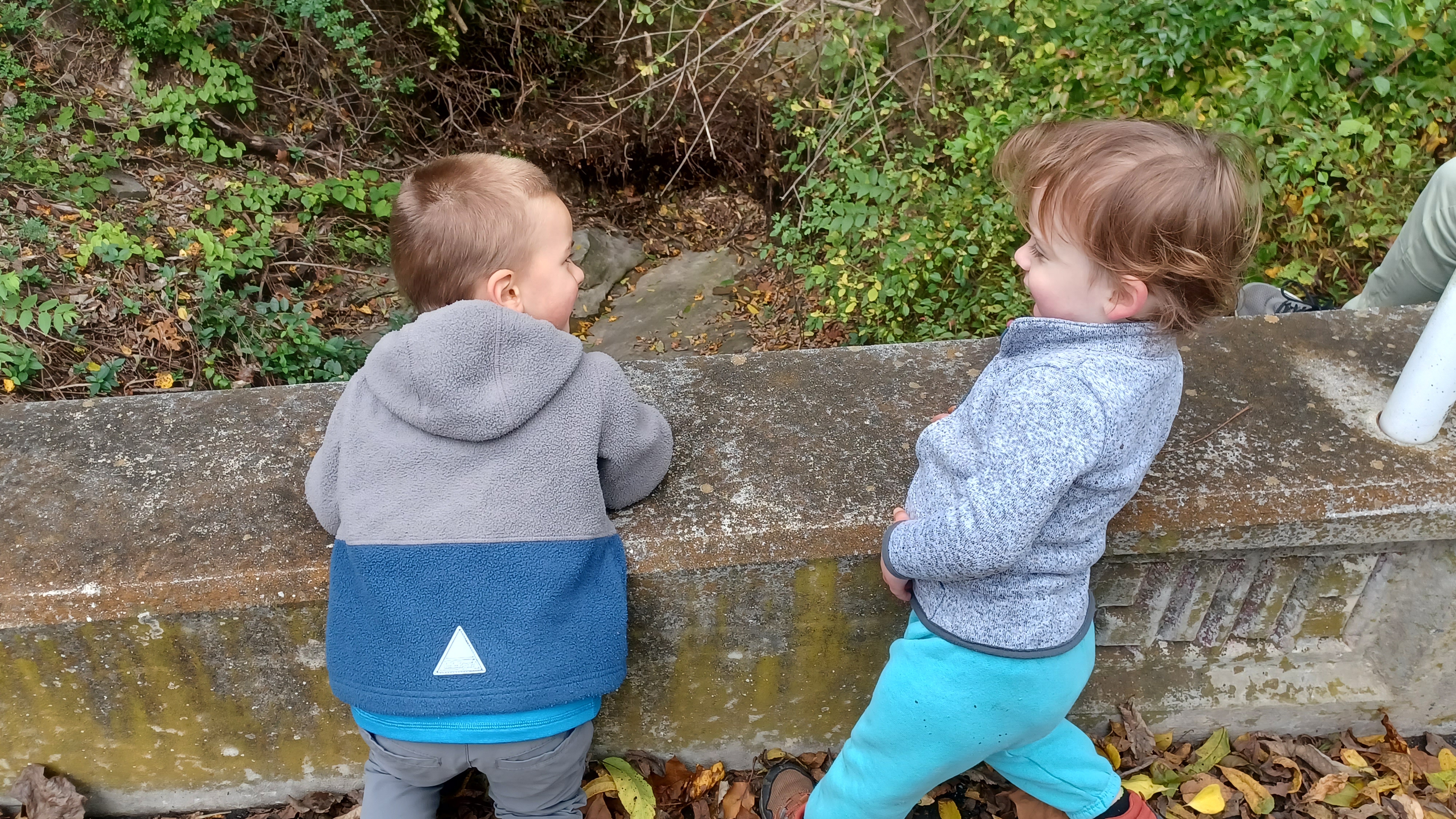
Megan took Ev by the hand and led him around with her son Drew, and the two of them hit it off right away.
When everyone was together and ready to go, we started out with a little side trip just to the north, to the former site of the lock. I understand that the later mill dam, associated with Rohrer's Mill, was originally built to provide slack water for the canal, and some of the stone work that is still in place today was part of it.

The altered lock gate area now has some vertical concrete bits in the middle, and but much masonry remains.

The Conestoga Navigation was in operation from 1829 to 1857, 18 miles from the Susquehanna River, where boats were ferried across to and from the Susquehanna and Tidewater Canal where there was another lock. The towpath navigation continued all the way to Lancaster, and overcame 64 feet using 9 locks.
We walked on up through the lock site, and then just beyond to have a closer look beyond what I'd done the other two times I'd been to this site.

I was quite surprised to find some old wooden crib work with the cuts where wood was fit together still in place along the river. The dam here was only removed somewhat recently.
A path continued along the shore line upstream, and one could tell it was the canal towpath because it was level and just slightly higher than it needed to be for the current level of the river. This accounts for the level the dam would have been at.
We continued uphill to the right, into the towpath area, and then turned back along the height of land above what would have been the lock, which afforded us some more good views of the lock area.

We made our way back out to the parking area, and at that point we had to make sure the kids were not out in traffic. The Itells had back carriers for their kids, and Ev of course the stroller.

The Conestoga Trail from this point followed along Conestoga Blvd to the south for a bit. We passed by the Rock Hill Bridge, which just turned one hundred years old.
Built in 1923, this fixed 2 span, Metal 7 Panel Rivet-Connected Pratt Through Truss spans the Conestoga River just below the Rock Hill Access and the former site of Rohrer's Mill and the Conestoga Navigation lock.
The road in front was the aboriginal Conestoga Trail before the road and hiking trail. An historic hotel is across on the corner, now a private residence.

The navigation canal would have broke off toward the lock at around the side of this bridge, but because it closed in 1857, it is difficult to spot definite remnants, since the current bridge would not have coexisted with it. It is possible that the piers and abutments are from a previous structure.

There appear to be efforts to downplay all historic significance at this site, probably to better justify replacement in the near future. The historic bridge sites give little to no value regarding historic relevance of the bridge.
As we walked sections of the road to the south, there were definite spots where it looked like some towpath remnants of the Conestoga Navigation still existed, but to positively identify them today would be tough.
After a bit of road walking to the south, we reached the small side stream and picturesque little waterfall where the Conestoga Trail begins to ascend to the left. I took Ev out of the stroller to let him walk a bit, and Dave took him by the hand uphill.

It wasn't too terrible getting the stroller through at first. The trail went up as an old wood road initially, then crossed the stream by way of a little rock hop.

I was able to get the stroller across, and the group helped to lift the front end of it when necessary to get over fallen trees or tougher rocks.
The foot path became narrow as it took us along a bit of an eroded ledge along the tributary. It eventually began to turn to the right a bit, on an old woods road, and ascended through woods somewhat steeply. I managed to push the stroller all the way up, and Dave helped to walk or carry Ev on the worst of that. Without him in the stroller, it is certainly much easier to navigate.

We came to an intersection in woods roads, and there were some corn fields in view to the left. I remembered walking this while backpacking with Jillane years ago, where there was a guy weed whacking a steep slope. It was a bit more grown in back then.

This was overall pretty easy to get through. The trail turned off to the right at another intersection, and then to the left as a bit tougher foot path. I needed a little more stroller help in here, but we got through it pretty easily overall.
After a bit more ascending through rougher terrain, we emerged at a clearing on the back of the Mt Zion Cemetery.
Officially, the trail skirts the back of the cemetery and comes out to Main Street on the west side of the little village of Conestoga, but it was nicer to just walk up the center lane of the cemetery.

After looking at a few of the stones, we came out to the Main Street and continued walking into the community heading to the east.

We continued along the north side of the road, and switched to the south when it had a better sidewalk. The historic old homes made for a pleasant walk through the community.
When we reached River Corner Road, which was a bit of a bigger road with more traffic, we turned right. We got a good mirror group shot along the way in Conestoga.
The trail leads down this road for a bit, though a light residential area with new homes, and then turns left on River Corner Road.

Things got to be a lot more pleasant here. River Corner Road has no lines in it. I always like to judge a road by whether or not there are yellow lines painted in it. If it is not busy enough to warrant having yellow lines painted, it is probably not busy enough to be a pleasant walk as well.
In fact, several of the trails we follow are wider than the roads we were walking. That would certainly be the case on this trip, where the Enola Low Grade Trail is the width of a double tracked railroad.
We headed down River Corner Road past a house with some great big trees, and then reached a sharp right bend in the road. Here, there was a house with railroad memorabilia in the yard. I remembered seeing this before, but never looked further into it.

This time, we admired the stuff sitting out there, and noted the narrow gauge tracks heading all through the property. As we walked a bit, a guy stopped to talk to us.

The guy told us his father in law was very big into trains, and had a big layout that we should come back to see. He also said they did rides and such on the narrow gauge, which goes all over the property.
A quick look at google maps revealed that it indeed was quite an interesting layout he had.
The 7 and 1/4 gauge railroad is officially called the Conestoga Northern Railroad, and is run by the Grassel family. I wasn't aware of the great interest in this area on the line. It really wasn't too close to any other railroad. The nearest was the Millersville and Pequea Electric Railroad, a trolley line.

The lightly used road descended from this point, with a bit of a view to the right, and then down into a bit of a gully. The road walking got to be quite pleasant.
I let Ev out of the stroller, and he and Drew ran around like crazy for quite some time. We had to just stay close for the few times we could hear cars coming by.
I recall the old Conestoga Trail guide book reading "Now, you are really way down in the country".

It didn't say exactly why this was so, but there was a lovely barn on the right side that read "Way down in the country" on the side of it. It was still there this time.


The walk downhill remained as beautiful as the start, and soon we reached Meadow Lane. The trail turned left here, and then continued to the intersection with Sickman's Mill Road.

The trail turned right on this road, which was a bit bigger and had a double yellow line. We were only on it a short distance before turning left onto Pequea Creek Road.
At this intersection, there was a little bridge over a small stream where Ev and Drew stopped and threw stones and sticks off into the water below.
We passed through some beautiful farmland, and then descended for a bit past some old stone farmhouses that probably date to the early 1800s and maybe even earlier.


The first views of the Pequea Creek came in this area. We passed a former quarried area with a totem pole, which I seem to recall reading might have at one time been a mica mine.


The road was on a narrower shelf along the creek for a bit, which was quite scenic, and we came to the spot where the Loop Road Bridge used to be.


When I had backpacked this trail with Jillane, the pony truss, although closed, was still standing. I read that this was planned to be replaced, and then it was decided not to do so.


I had saved some photos I got of the bridge from my previous trip out there to my phone, to do some then and nows. I tried to get those, and Megan stuck close to Ev and Drew.


The bridge was a double span, with one being a pony truss and the other being a deck beam section. I was thankful I'd gotten photos of it before it was destroyed.


Just ahead, there was apparently once another bridge, also a part of Loop Road, that crossed the creek. I don't recall seeing really any evidence of it however.

On the right side, there was some stone work with an odd growing large tree, which might have been a lime kiln or other barn at one time.
Just ahead, we reached a large farm, where the road (and trail) turned ninety degrees to the right heading uphill. We ascended and descended a bit through farm lands, and came to another large farm on the left.
The farm in this area is known as "Bacon Acres", a pig farm.
Ahead, we intersected with River Road, and the Conestoga Trail turned left to follow that.

At this intersection, I regrouped everyone and made the judgement call that I was changing the hike significantly.

My original plan to head all the way out to the Susquehanna River on the Conestoga Trail was going to take us too far out of the way. I had messed up with scaling, and it would have put us at well over twenty miles. I would have to reroute us onto the Enola Low Grade Trail earlier, make up some time, and then head down to the Conestoga River to close the loop earlier.
I had really wanted to continue down the trail to Pequea on the Susquehanna, but it also wasn't great weather for it. I was hoping to have that on a weekend that would be good for swimming, and it was actually getting quite cold.


No one seemed to have a problem with my cutting it short, and so we continued.

We stayed on the Conestoga Trail route along River Road to the south, and then turned to the right on Colemanville Church Road. This took us away from the Conestoga Trail.
The road used to go through and cross the Enola Low Grade line, but now dead ends, meaning there would be less traffic.
As we walked up the road, an Amazon driver was delivering to a couple of the houses. I commented about how I'd heard from friends that they are pretty much forbidden from backing up their vehicles, and that if they do so, they get shit for it.


I ended up seeing this particular driver backing up when he got near the end of the road and parking lot. He must have wondered what was going on, because every time he drive ahead of us, he was stopping again for a delivery only to see us catch up with him.

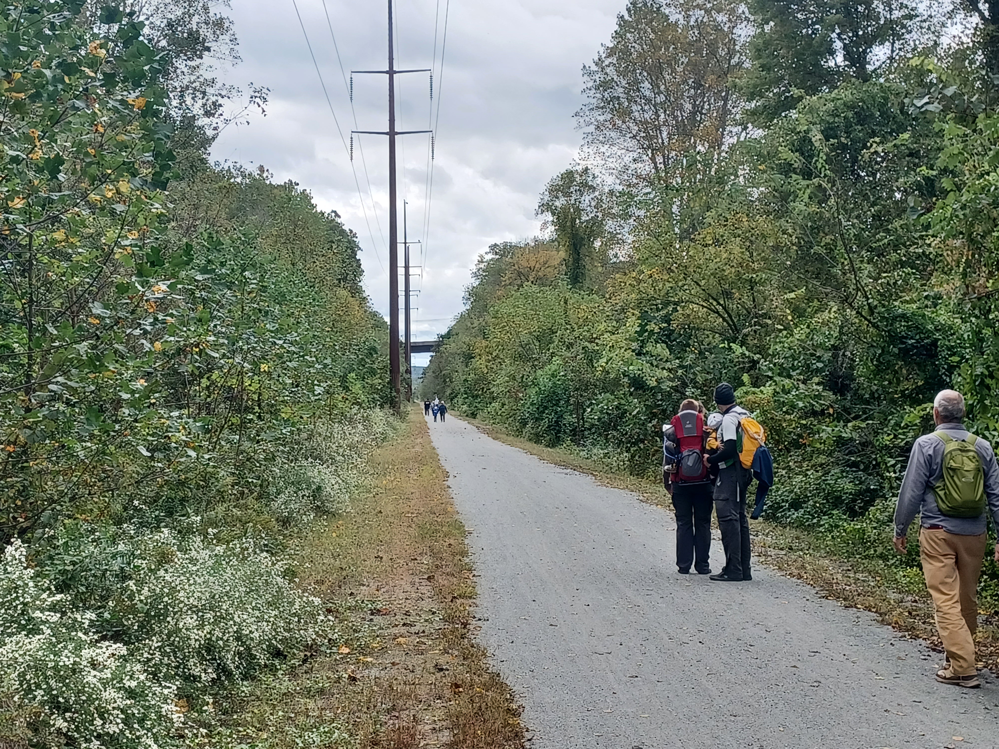
We reached the trail and had some easy walking for most of the remainder of the hike.

This line was the former Atglen and Susquehanna Branch of the Pennsylvania Railroad. It was completed in 1906 as a mostly freight bypass to the original Pennsylvania Railroad to the north. It was put in place to avoid the downtown Lancaster area.
The new line had very few grade crossings and limited grade for climbing, making it perfect for freight.
Amazingly, this well built line was abandoned in 1988 and ripped up in 1990. The catenary lines over the right of way are still used to transfer power from Safe Harbor to the Northeast Corridor.
 |
| 1955 John Barriger III photo |

I had several then and now compilations I wanted to get on this stretch, starting with River Hill Road underpass coming up. Gregory Pawelski has done a fantastic job collecting together all historic photos of the lines, especially in this area, and through him I got a lot of stuff to use for the historic compilations.
 |
| Kerry Glenn collection |

I got some more shots as we continued on, near Green Hill Road, which is above the historic site of Shenk's Ferry. The rail bed went into a dramatic cut before emerging at the edge of the Susquehanna River.

Ev and Drew were out and running around like maniacs, which was funny.
Below us, the original Columbia and Port Deposit Railroad built in 1877, which later also became part of the Pennsylvania Railroad, was sometimes in view.
I got a likely then and now compilation again before the turn, and then we enjoyed the relaxing walk on the wide rail bed shifting from westbound to northbound.
After a short bit of walking on the trail along the Susquehanna, there was a gully to the right where we went over a fill. It was here that in 1981, there was a major derailment from a train hitting a major rock fall.
When we got to the site where we understood it was supposed to have happened, we took a little side trip downhill to the right to check it out.
There was a trail, which became a woods road, that went along the edge of this area.
Ev stayed with the group above for a bit, while several of us went down to have a look.
Sure enough, there was still wreckage of the boxcars that had derailed, down in the gully, and now totally surrounded by trees to the point they were almost invisible.

While we were down there, we decided to also have a look around for some Paw Paw trees. It was abou that season and they should have been getting ready to bloom we felt.
I went down a little further to the property line, mostly on the road, and then bushwhacked uphill a bit into weeds. Jack ended up getting into a patch of them as I recall.
I was having no luck, and I think Diane found the first one, but Jack found the motherload.
We carried a whole bunch of them out of the woods and back up onto the trail where we proceeded to cut them open and eat them.

Some of them were some of the best I've had yet, and others were a little more grainy and not as good. I am finding each time I taste Paw Paws, they are inconsistent with their flavors.

The myth had always been that it is just about impossible to transport them. They can't be carried, or they'll spoil on their way home. I tried during the last crop of them, and they actually held up pretty well. I managed to bring several home, and they even lasted for a few weeks there. They browned a bit, but remained good.
I recall Ev's mom Jillane had never had one before, and so I wanted to give her the opportunity as well. She ended up trying the very last one from that batch, but didn't remember it. This time, I brought more home so that there would be a better opportunity.
I took some stuff to wrap up the paw paws, including a bag and maybe some paper towels, and placed them in safe spots in the bottom of Ev's stroller.

Ev and Drew continued to walk through much of this section, and even pushed the stroller together.

Ev, even though he was only barely two years old, was getting pretty close to Drew's size, and he turned 3 in early 2023. It blows my mind that Ev was nearly two months premature with his size now.
 |
| John W Barriger III |

Jason also gave his other son Zach his first taste of Paw Paw as well, which seemed to be enjoyable.


I was rather surprised that Jack, Andrew, and Chris all decided to just hang out at the end of the bridge rather than take in the views. It turns out Chris was having some major chaffing issues because he had worn the wrong pants for this one or something.

I made my way all the way across the bridge, and I had several historic photos I wanted to get now versions of, which took a little bit of time.
After crossing, those of us who went turned back and met up with the other group, and we headed down the path that goes behind the Safe Harbor Trestle. The old Port Deposit Branch has a bridge immediately parallel with it. The original had been washed out, so that bridge dates to about the same time as the Enola Low Grade structure.
I had to get some assistance again, heading down from the bridge on the steps. We turned right on the road at the bottom, which still has some rails in it from the time of the construction of the dam, and turned right.


Somewhere in this area is the buried former Lock 9 on the Conestoga Navigation. It was either completely buried or destroyed during the construction process for the Safe Harbor dam.
 |
| Pennsylvania RR Negative Collection |

The Powerhouse Road led to the left a bit away from the main road, and I let Ev walk. He and Drew walked a long while here.
 |
| Manor Twp Collection |

We continued along the dirt road to the left, and I could see a small shelf closer to the Conestoga River, which could have been remnants of the towpath.
 |
| PRR Negative Collection |

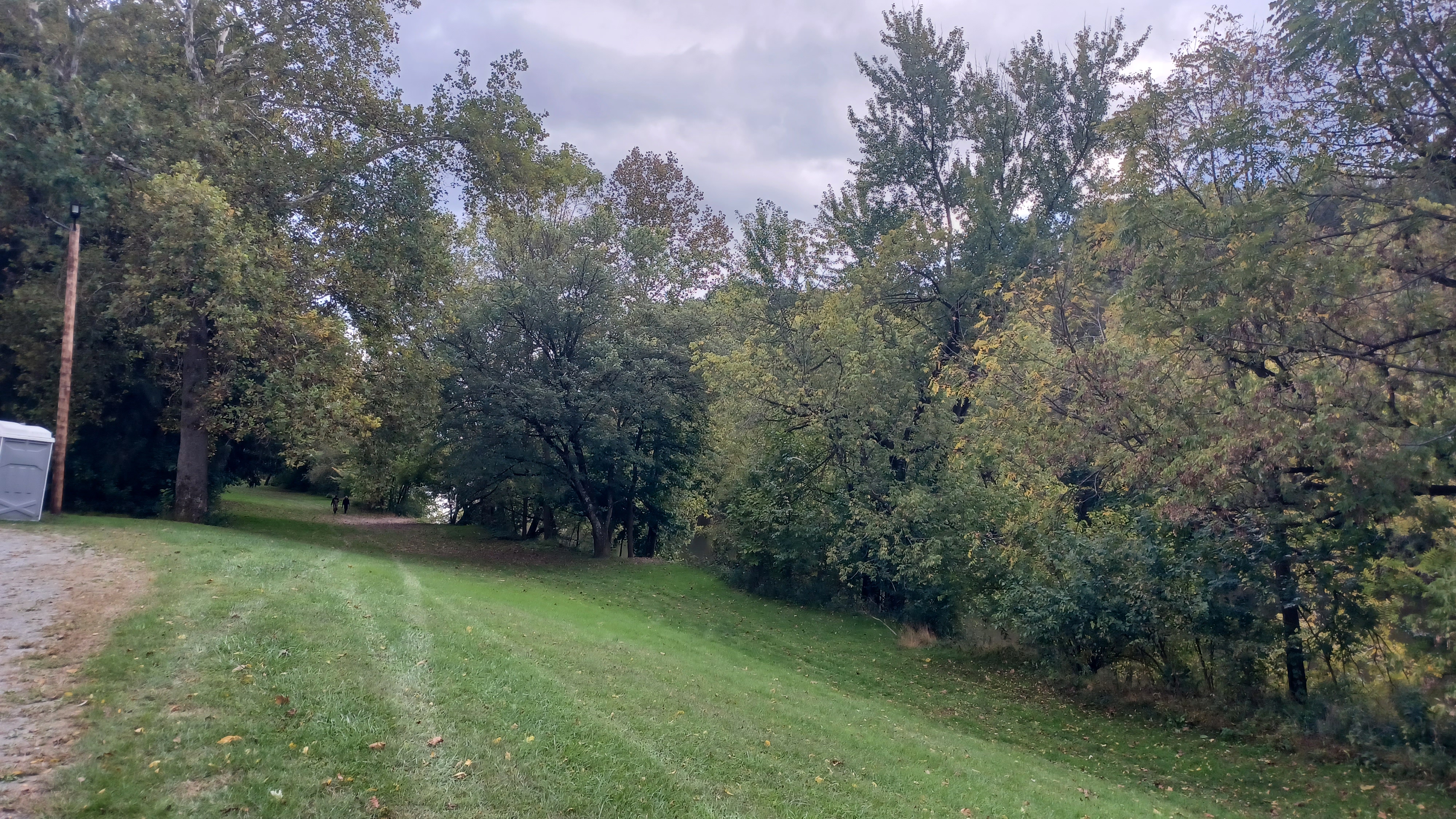
We came to a small parking area and then a narrow, paved park road into Conestoga River Park. We walked along that baside the river, often with possible towpath remnants in view. Ev got on top of all of the utility man holes along the way.
 |
| Library of Congress Archives |

The road switched to gravel, and there were pleasant spots for pulling off and enjoying the river through this section. We came eventually to the River Road bridge, and then passed beneath to reach the quite well preserved remnants of Lock 8.
 |
| Columbia Preservation Society |

The entire area is enclosed with a chain link fence to keep people from climbing on it, but it is very nice to see even from afar. I don't think any other Conestoga Navigation locks are preserved in such a way.


I walked all the way around the thing to get as many good views of it as I could. Ev was content to walk around more here because Drew was also running around like crazy.


We could see some contours of land that were certainly part of the former canal heading upstream from the lock site, and pretty soon after that we reached the end of the park.
We came out to Conestoga Blvd, and I had to put Ev in the stroller because this road is bigger and would be a bit more dangerous to have him running around on.
As we walked the road to the north, we could see below to the right that a foot path continued on the old towpath, directly beside the river. Had I been hiking without the stroller, I'd have stayed on that for a while longer.
Eventually, the towpath was not clear anymore, and the road was the only choice. Soon, the road turns away from the river, and there is an abandoned house on the left side.


Lock 7 might have been down below in this area, but I can't be sure. There are riffles in the river at about three points during this stretch where it stays away from the road, and any of these could have been the location of lock 7 or 6.

I'm not sure how close they were together, but I think there was only one there, and lock 6 would be a little further up, and closer to where we initially turned away from the road on Conestoga Trail.
We came back to the edge of the river again, and I began looking for any remnants of a former dam, which would be where a lock was. There were a couple of potential spots, but I was not sure.
I recall reading that one was near the intersection with Boy Scout Road, and there is a large stony protrusion into the river at that point, so that is likely it.

We continued walking, and I kept my eyes peeled for any canal remnants I could see. There was often a possible towpath remnant as we walked, but I didn't see much of a potential dam or lock.

Ev was completely exhausted. Up until this day, he had always napped at some point mid day, but this time, because he was playing with Drew so much of the time, he did not nap at all during the day. As a result, he fell asleep soon after getting into the stroller.
He was quite angry about getting in at first, and flipped himself around kind of funny. At least at this point, he was starting to give up on the slouching down and trying to fall out of the bottom of the stroller.

He didn't holler for long, because he was mostly just having a tantrum due to being tired. Pretty soon, he was passed out in a rather uncomfortable looking position, but I wasn't going to try to correct it at this point. We didn't have very much farther to go.
We hit the fifteen mile mark before we had even gotten back to our turn off on Conestoga Trail. Just after this point, Chris sat out on the side of the road for Jack and Andrew to come back and scoop him up. I reassured him later that he did pass the fifteen mile mark. He'd done really great for his first time ever doing such high mileage.

As we went further up the road, and were closing in on the end, some sort of patrol car went by us. I wasn't too terribly concerned, but I looked at my stuff to make certain I didn't have anything that could be taken as incriminating in sight.
The vehicle went by us slowly, turned around a short distance away (I forget if he talked to Chris), and then spun back to talk to us. Jack and Andrew were ahead of us and he had stopped to talk to them first, so they referred him to me.
The vehicle pulled up beside me, and I went over to chat with the officer. This was Officer Schmidt from the Pennsylvania Fish and Boat Commission I think it was. He was concerned that there is conflict of interest at the area where we were parked. In the Summer, the lot is loaded with boaters, and it is also used by hikers. It's not so often one sees that lot as full as we left it.
We chatted for a bit, and he guided other vehicles by as we talked. He was a former Marine, and was stern but also friendly. He gave me is email address, and even offered to help promote the future hikes we had going on if I reached out to him first before we came back to the area.
This was kind of a funny almost end to the hike. Ev slept through all of it, and only started waking back up again when we got back to the Rock Hill access and our cars.
I put him in his seat, and Drew was upset to be leaving already. I was actually pretty surprised that Ev was not more angry as well, since we'd had such a great day for him in particular.
This would be the last Conestoga Trail hike for a little while, because I wanted to wait for warmer weather before we head back to the section along Pequea Creek, which is great for swimming. I had plenty more things I wanted to get out of the way to the north on Horse-Shoe Trail, around Lancaster, and so much more, on top of all of the other stuff all over the tri state area.
No comments:
Post a Comment