

Hike #1520; 12/11/22 County House Mountain to Newport with Justin Gurbisz, Kirk Rohn, Diane Reider, Violet Chen, Professor John DiFiore, Evan "Joe Millionaire" Van Rossum, Jack Powers, and Andrew ?.
This next hike would be a point to point, one of my great holiday traditions of doing a "home" hike. As part of the hike, I incorporate visits to my family members which has in the past almost always included my grandfather, as well as my Aunt Pam and Uncle Ken.

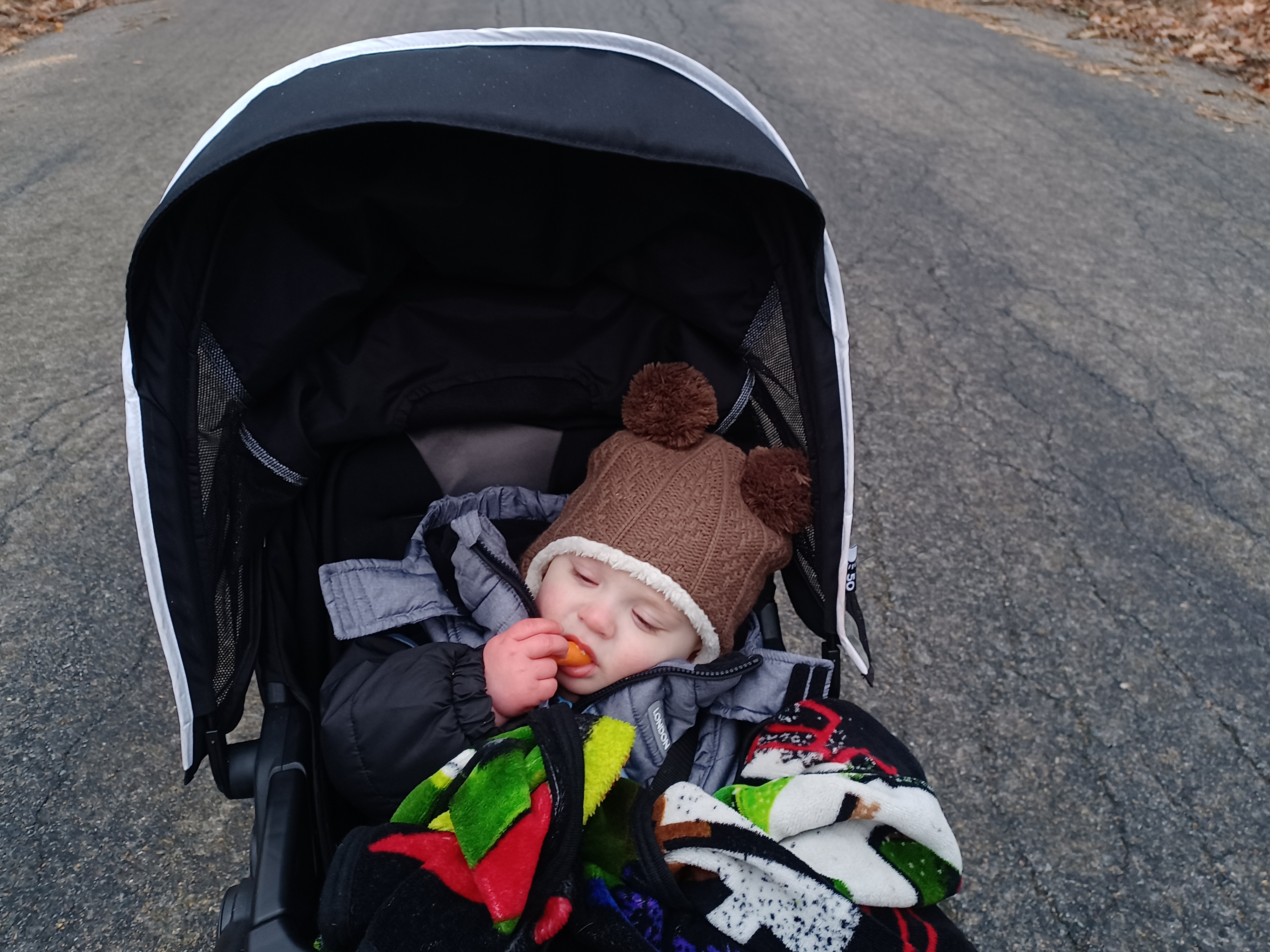
As usual, I have to look at things a bit differently since I have my son Everen with me. The hikes have to be a bit easier than they would have been before so that I can get the stroller through.
Still, I also want to do some harder stuff, and so I planned for the tough stuff to be at the start of the hike, and the rest would be pretty easy.
We met at my Aunt Pam and Uncle Ken's house, and parked along their side road, which used to be the Boy Scout Road into Camp Watchung, now the county park known as Miquin Woods. They own to the middle of the bridge over the Spruce Run down the lane, so it's great for parking, and an even greater place to end a hike.

From there, we shuttled to the starting point over in Mansfield Township, on Janes Chapel Road atop County House Mountain.
This was a lot of Pequest Wildlife Management Area, in a section of that property I had never explored before. I figured we might try to bushwhack through the property to the south and hope to find an old road or something, then head east to Rockport Wildlife Management Area.
While we were driving to the start point, I was already changing the hike. The distance from what I put together using Google Earth, versus what I was feeling from the drive seemed a bit off. I didn't want us to be out super late, and so I adjusted the route to make the start a road walk.
The only hard part we'd do would be the off trail bit through Pequest Wildlife Management Area, and that would be more than enough. I just wish in retrospect I had used another lot that would have eliminated the initial road walk section. There were definitely places I didn't know about that we could have used we found while walking.
We pulled into the lot, which was on the crest of the hill along cultivated farm fields owned by the State Department of Fish, Game, and Wildlife.
Since the hike, I researched this a bit more, and found out that there is in fact a woods road that goes over this eastern cusp of County House Mountain. It goes into the woods a bit west of where we started, climbs over, and then becomes a dead end road known as Smith Road, which lines up with Parke Road across Valley Road to the south.

I suppose we probably could have gotten through on that, or we could have gone to it from the south end of the farm fields, but I'm glad we didn't take the chance on more stuff early on in the hike.

We simply left the parking area, and it was drizzling slightly with freezing rain at the start. I had Ev bundled up pretty well in his heavy coat, and he was good at first. Pretty soon though, he got to be fussy, and I didn't know what was wrong with him.
Ev is usually fine on these things, especially at the start. It was a bit colder, and I had him wearing his hat, but I had him in enough warm stuff that he should be fine. He started hollering, then stopped, then would start again. I changed his diaper before we started, but I started to figure that he must have pooped. There was no good spot to change him at first, so we had to continue on, and I had to try to just keep him happy.

Along the back road route, there was an old barn foundation on the right side. Joe Millionair told me he thought he remembered an old farm house standing there, as well as a silo. I don't remember them so well through that area because most of my driving through there was at night.
There were only parts of barn foundation left to see in this area.
We continued along Janes Chapel Road downhill a bit, passed the intersection with Valley Road, and then reached Mt Bethel Road. Here, we turned left and headed slightly uphill a bit more. I wished we hadn't done this road walk, but it also wasn't terrible. With the stroller, there just ends up being a lot of that type of thing we have to do with these kinds of situations. At least it was a road I'd never walked before.

Along the way, there was a nice old abandoned house on the left side. It was not part of Pequest Wildlife Management Area, so it's just sort of sitting there. I'm not sure who owns it or the status of it.

We continued along the road, passed a couple of farms, and eventually came to a power line crossing that was part of Rockport Wildlife Management Area. Had there been a good path into this section, we would have taken the power line instead, but surprisingly there was nothing good to follow. In a lot of ways, I'm surprised there are not more atv trails on some of these properties. Pequest used to be loaded with them, but there are far less now than there used to be.
While most people are totally against ATVs, it does provide access to the land that we really wouldn't have otherwise, and honestly no one at the state is doing a great job of maintaining trails. We are losing more of them than we are adding in some areas.


We continued on to the ninety degree bend in the road where O'Brien Road goes to the right, adjacent to the Camp Merry Heart property.

We didn't go into the camp property. My plan was to turn right on O'Brien, which is a dead end, and use it to ascend Upper Pohatcong Mountain.
When I got to the corner, I put a blanket down and gave Ev a diaper change thinking that would solve his problem. He barely even peed, which had me concerned because he was hollering so much. I thought maybe he was too hot because I had him in layers and with the jacket it was quite warm. The only problem there is that his hands are uncovered, and he won't wear gloves willingly. I found that I can cover his hands by closing the velcro on the end of his jacket. I tried unzipping the jacket a bit in case he was overheating, but that didn't appease him either.

My final thought on this problem was that he was probably teething, and the new teeth are probably cold sensitive. While he's screaming, it probably makes it worse because he's doing mouth breathing.

\He went from being miserable to somewhat content again as we turned to start going up the hill, and then got fussy once again.
The road crosses the Pohatcong Creek, which is very small at this point. It is kind of amazing that the creek travels this far to the east. It is its own tributary, not one of the Musconetcong, and flows through the north side of Washington, and then out to reach the Delaware River at Carpentersville. It is one of Warren County's most underrepresented tributaries, and most substantial, but never really considered as much as it should be.
The hill really killed me. I am so out of shape from not doing elevation, and I'm really feeling it. Pushing the stroller uphill is just that much tougher. I'm also carrying a lot more stuff than I used to before because Ev needs to have more food, water, and layers.
 |
| Historic scene Rockport Church |
We pushed on ahead and reached the crest of the Pohatcong Mountain, and then it leveled off a bit as we went by a power substation. There were fences and more different no trespassing signs than we usually see on such a place.
We crossed the power line we crossed earlier, and continued on the road ahead. There was a substantion to the left which I considered going over to, but I wanted to try to stay a straight trajectory.
The road came to an abrupt end where a private driveway, well signed, went to the right with fences around it. The low chain link fences extended into the woods ahead, but there was a hole in it, and it was illegally placed as well because it was over the state land boundary.
We assessed the situation, and I decided to just start pushing Ev into the woods. He seems to do better when we are going over bumpy terrain, and he was okay for a bit.
This turned out to be the craziest terrain I ever took him through, because it was for so long, through so much woods without any sign of a path.
 |
| Rockport historic scene, Emily Mayberry Bundy Collection |
I went to the right a bit, and we headed toward a rock outcrop we could see, weaving around fallen trees and avoiding rocks. I can't believe I was able to push him through as easily as I did. Everyone was great, helping me to grab the front of the stroller to navigate the mess.

We continued to head in a sort of southwesterly direction, but it turned out that this was a mistake.
O'Brien Road used to continue on through, pretty much straight from where we cut into the woods, and adjacent to an evergreen grove. We might have seen that if only we had stayed to that side, but I thought we'd find more brush over there. That road would have taken us directly to the Morris Canal just east of Rockport, or we could have used it to at least get to the clear power line just above that point. I guess I'll have to try it again in the future, because that would have been a good stroller-friendly route.
I continued to try to push the stroller, but the rocks got more difficult to navigate. The was a sort of round area of land that jutted out from the steeper slopes we headed over to, and came upon a section that had more undergrowth.

We found what looked like it was probably once an old logging road, but barely recognizable. We managed to follow that west for a bit, but I had to steer the stroller on and off of it in order to avoid some of the fallen trees over the way.

Ev started getting more upset in this area, and I didn't want to leave him in the stroller to descend over some very steep rocky areas coming up. We had to head down to the south over a steep bit of Pohatcong Mountain, and it was really rocky. John offered to hold him and carry him down around to the right a bit, while I managed to push the stroller, or more often pull it over some of the larger rocks, down to the bottom. The group fanned out a bit looking for what would be the best route with least resistance. Joe Millionaire found a pretty good one below the rocky stuff, and he and I stayed in pretty close proximity heading to the southeast again. The land we reached certainly had been cleared pastures probably a century or more ago, and didn't have so many rocks that I couldn't navigate the stroller through. I chose to wear my bowling shoes again, which made traction a bit tougher, but we managed to get through.
Pretty soon, the power line that runs east/west and parallel with the upper end of the Rockport Game Farm came into view. I wasn't worried once we reached that point because I'd walked up through there on my own before. I knew that there would be a good old woods road that would lead us down to the mowed perimeter path I'd already done a couple of times with Ev since he was born.
We re-grouped, and turned right along the power line heading west. I knew there would be a good old woods road to the left that would lead downhill soon.
We weren't on the power line for all that long before the woods road came into view.


It wasn't the clearest thing ever, and it had a few fallen branches over it. It was also a bit steep, but far better than the mess we'd just been through, so everyone seemed pretty happy to be there.

We made our way down the steepest washed out part, and then came to the intersection with another woods road. Here, we turned left for just a little bit, and emerged at the mowed path on the highest point of the Rockport Game Farm.
This was the area of the pheasant runs and cages on the slope. The most recently used ones were on the south side of Rockport Road, but these ones north of Rockport Road have been abandoned for many years. They have slowly been deteriorating and turning into just a hunting ground. We turned right on that perimeter trail, which is still kept mowed to this day.
In a short bit, there was a nice view out to the lands below and the rest of the game farm. There was also an old building still standing on the corner. We continued to descend along that section, and Ev started to fall asleep.

At the bottom of the hill, the trail turns to the left just above the former basin of the Morris Canal. It has grown in badly since maintenance stopped on it around 2003, and is barely recognizable as a basin anymore. I pointed that out to everyone, and I was about to start giving a history of the Morris Canal, but stopping made Ev wake up and start screaming again. I had to move everyone on instead of going over history.

We descended and crossed the former canal, then tuned to the right along the section that opened up into the basin. At least the towpath was still kept mowed through this section.
We continued on this out to where the canal used to cross beneath Rockport Road, and I took a photo for a then and now compilation of the crossing site. This was a photo that was from the Emily Mayberry Bundy collection that had just started appearing on the internet.
Once we got out onto Rockport Road, there was a now information board sign on the right that I hadn't stopped to check out yet, so we paused there.
There was a guy there looking at the sign, and I chatted with him a bit. He had grown up along the canal and was happy to see the history preserved there. I told him where I grew up, and he seemed surprised that we were all out hiking for the day, especially with a stroller. It was starting to do more freezing rain at this time.

Ev started hollering again when we stopped, and so Jack put some classic rock mix on his phone, and stuck it in the jogger stroller area. Ev seemed to enjoy that at least somewhat, and started napping again. We had a pretty peaceful walk along this section, along Rockport Road to the west.

This next bit of the hike was to try to trace the Morris Canal as close as possible, which isn't the greatest hike ever, and I've done it plenty of times, but I figured it was something to put this together other than just any old road walk.
We took a sidewalk for part of the time out of the Rockport area, and continued west past the Borealis facility where we got down off of the road for a bit and walked along the evergreen trees instead of on the road.
We eventually reached the Rockport Church, and near there I pointed out the old mill stones in the front wall of a house. These stones, according to Don Mayberry Jr, are the original once associated with the Penwell Mill just to the south. Of the two prominent mill stones, apparently the one on the left was imported from France when the milling began, and the one to the right was a locally hewn piece.

Pretty soon, we turned left on Cherry Tree Bend Road. Rockport Road had been closely along the canal most of the way, and much of it is recognizable in fronts of private properties. It is in good view from a good amount of Cherry Tree Bend Road as well, which is really a great road for walking.

I pointed out to everyone a steep driving that I'd backed up a Mitsubishi Fuso box truck on for Taylor Rental years ago. There are so many memories from so many facets of life passing through these areas.
We made our way almost to the end of the road, and then cut to the left down into the Dennis Bertland Heritage Area, a side trail that leads to the canal towpath trail again. I had to get some help to lift the stroller down the stairs at the start of this, but the rest of it was doable. There was another puncheon section, and then a longer board bridge over the canal prism itself to reach the towpath. Once there, the walking was all easy to the west.


We followed the old road into the preserve, around a gate which Kirk helped me to lift the stroller over, and then we crossed the Spruce Run on the old road bridge.
The left turn from here led us onto the old Boy Scout Road, now abandoned, which goes right to my Aunt and Uncle's house.
The old road was harder to get through than I'd remembered only because I had the stroller. It's really easy walking, but there are a lot of branches down for the first bit of it. Eventually, we got to where there was a parallel ATV path that was alongside of it from private land to the right, and then a good crushed stone path on more of it. From there, it was much easier walking.
Pretty soon, we passed the old Newport Mill ruin. The stone structure remains pretty good, but there is no roof on it. The old water wheel is amazingly still inside. It is privately owned now, but I would love to see this preserved and maybe even restored somehow, but it would cost a fortune.
We crossed the bridge over the Spruce Run, and then reached the back of my aunt and uncle's house just after 4, which was way earlier than I'd anticipated, and still just over fifteen miles as planned.
When we were doing some introductions, and Aunt Pam asked who had been hiking with me for the longest, Justin figured it was him, since 2013, and I think everyone was rather surprised when Joe Millionaire was able to chime in that it was about twenty years, but that he'd taken an eleven year hiatus and only recently started back up with us.

I got out the very last bottle of the Governor's wine I had procured at the beginning of the year to celebrate the close of the hike with. Aunt Pam particularly liked it, and since she and Uncle Ken were hosting, I made sure they each had some of it, and Aunt Pam had the biggest glasses of it.
Some of the group went back to get the cars, and Justin was good enough to drive mine back for me. I would have been able to actually leave Ev with Aunt Pam and Uncle Ken because he was having a great time with them, laughing and being sociable, but I certainly didn't mind having the break.
We were blown away when Justin returned with snow completely covering my car, of about three inches! We had nothing accumulated on the ground where we were, but our starting point was quite different!
It was really a nice time hanging out there, and Ev played with some toys they had around for their grandchildren. My cousin Ken showed up as well. I hung out until everyone had left, and then packed up to head home.
It was a pretty good day despite the cold and wet weather, and the fact that Ev was probably the most cranky he's ever been on one of the hikes before. It still wasn't unbearable, and if that's the worst it gets, I can certainly handle everything, because this wasn't bad!
No comments:
Post a Comment