

Hike #1519; 12/4/22 Garfield to Ho Ho Kus with Tina Chen, Violet Chen, Jim "Mr. Buckett" Mathews, Eric Pace, Diane Reider, Robin Deitz, Kirk Rohn, Professor John DiFiore, Barry ?, and Everen
This next hike would be a point to point trip that would sort of cover a bit of what I'd done on a previous Saddle River hike, but also cover a whole lot of different ground.

I keep looking for hikes that would be nice to do with my son in the stroller, but are also exciting for me as something new and different.
Even though I had done much of the Saddle River Greenway before, I had not covered the entire greenway; we had cut away from the Saddle River to follow the branch of the trail along the Hohokus Brook, and then followed the North Jersey Rapid Transit rail bed for the remainder of that one.
This time, I would plan on trying to follow the Saddle River more closely, and continue to the northern end of the main greenway instead of cutting it short. At the start, we would also get closer, as planned, to the river instead of following the parallel streets as much.

Overall, it would end up being a good route, and probably better than the previous one we'd done on it.

We met in the morning at the Ho-Ho-Kus NJ Transit station. I'd hiked through the east side of Ho-Ho-Kus before, but never really experienced the town. Part of my plan was to have a closer look at that.
It is the only town in America with two hyphens in the name. This name very likely derives from an old native American name, and there is a lot of speculation as to exactly what it means. There is also the possibility that it was a derivation of an old Dutch word as well, because the Dutch were among the earliest colonists to settle there.
My plan was to take the 8:38 train south to Garfield and have no car shuttle. It was only a dollar and change to get that distance, so it would be perfect. I didn't want to chance running behind, and so I left super early and arrived almost a half an hour early.


I went too low to the wrong parking area initially, and I noted a little sign off of the corner of it when I got out to find a place to pee. Ev was fast asleep in his car seat.

There was an old forgotten cemetery out in the corner of the lot below the tracks were maybe a half a dozen graves in it. This was the historic Hopping-Zabriskie Cemetery. The Hopping family used it first, and then the Zabriskie family purchased the land and they too used it.
There is said to be burials in this spot dating back to the late 1700s, but those grave stones are missing today. The Zabriskie family goes way back in Bergen County history, including Jans Zabriskie who owned the house at historic New Bridge Landing where the Continental Army crossed during the American Revolution.
I had a look around a bit because there was plenty of time, and then got back in my car and moved uphill to the correct meeting point at the Ho-Ho-Kus Station.

The railroad was one of the oldest in America. This was completed in 1849 as the Paterson and Ramapo Railroad.

It extended service from Paterson to Suffern NY, having connected with the Paterson and Hudson River Railroad which was established in 1833. The connected two were a quicker route between Suffern and New York City than the popular New York and Erie Railroad, and so the Erie began leasing them as part of their own system in 1852.
Ho-Ho-Kus was an important stop along the line due to the cotton mills there, but it wasn't until 1860 that the station stop we were at was established. That original station burned and was replaced in 1886. That station also burned, and was replaced by the current structure, adorned with river stones, in 1908. A second shelter building on the eastbound side of the tracks was built in 1909.
I had a couple of old photos of the station I wanted to set up then and now compilations with, but I only managed to get one of them from the start.
Ev was starting to wake up, and a few were already in the lot waiting. I had a lot of stuff to get together, and misjudged how long it was going to take me to get ready.

I left Ev in the car seat for a bit while I made sure I got everything together. I need to start making a regular checklist because I always think I'm going to forget something important.

I eventually got him out, and the hikers kept him entertained while I got the last of the stuff organized. The train was to arrive at 8:38, and we needed to be on the other side of the tracks to board. There were ticket machines on both sides, and Mr. Buckett spotted me for my ticket, and got a half ticket for Ev. We hurried up to the tracks, and had to cross then on Glenwood Road. I could see that there used to be grade crossings for pedestrians directly over the tracks, but they were eliminated and fenced off.
Everyone made it over to the other side and I think Kirk was the last one running as the train was showing up. I needed help lifting the stroller up the steps to the train, and then it wouldn't fit between the seats in this somewhat older car.


I was able to stay almost between the cars in the area where the door wouldn't open up. The conductor told me almost right away that I'd need to fold the stroller up while in motion, but I pointed out that I had far too much stuff beneath to ever do that, and so he let me just stay standing for the duration of the ride. He recommended that in the future we use a station that has a handicap accessible entry, but I told him we were hiking between the two stations and that was the only option for what we had planned.


We continued south with many stops on the way until we reached Garfield.
Garfield was close proximity to some of the other stations on the line, and so it was apparently not established as a station stop itself until 1881. The station sadly burned down in 1973.


The town of Garfield was established in 1873, and originally named East Passaic. The town is now named of course for President James A. Garfield, who was assassinated 1881.

One story holds that the town as renamed for the President before his death because they felt he would lead them to prosperity, and the other is that the new station stop was named for the fallen President in 1881, and that the surrounding community assumed that name due to the stop.
The group helped me to get Ev's stroller off of the train and we paused on the station platform. Here, newcomer Barry met up with us. He was late meeting up at the station and so he decided to just go to Garfield, and he'd get the train back in the end. He lives up in Westchester County NY, and he and I discussed some of the places up there we had both hiked, and it was nice to have a common frame of reference for those areas.
I think he had RSVP'd no to the hike at some point there, and so the only newcomer on the list was "Bert Camen" with a picture of a cup or something. I was referring to him as Bert, and even writing that as his name in this thinking he was the new guy, when actually, it was Kirk using a pseudonym and the name is a kind of cheese! So it seems that the Barry that had put "no" down actually showed and I had a mix up!

I had a couple of historic photos of the station area I wanted to emulate, and so I intentionally set them up with the group in them.

I'm feeling that by including my friends or Ev in his stroller into my now versions of the photos, it is almost like me posting a watermark on the photo. It makes it undeniably from my hike, in a sort of candid way, and it also gives whoever is in it a sense of historic relevance and inclusion.
I had views of the station site set at two different angles. There is now just a shelter structure for passengers waiting, and a mural of a train on the wall of the adjacent building.
There were steps down from the station platform to Midland Avenue, but I didn't want to bother having someone help me get Ev down that flight of steps, so we walked along the platform to the north, turned right on Somerset Street to Midland Avenue.
We turned right and passed beneath the railroad girder bridge, and continued on Midland Avenue south. We stopped at a little mini mart first just so we could grab some snacks and such. I knew we might not be passing anything for a while and recommended we grab something before we get moving.

Usually I have a lot of stuff for Ev to eat before a hike begins, but this time I didn't have as much, so I wanted to make sure I had something to hold him over. I gave him a couple of pepperoni and cheese roll things that he really liked a lot.

We continued down Midland from there, and reached where the Saddle River spills into the Passaic River.
This would be the first for the Saddle River section of my Passaic/Hackensack Watershed series that we had just started earlier in the year with the first one on the Hackensack River and to a degree, the old railroad beds on causeways out to them.
Watersheds have always been fascinating to me when it comes to tracing them from confluence to headwaters, and having walked the entire perimeter of New Jersey, I am setting my sights on all of the major watersheds in the area. Rivers are fascinating in general, not just for their natural aspects, but because industries and communities all formed around them.

They were literally everything when it came to how an area was developed. Transportation, power, sustenance, and a path of least resistance to name just a few.

I haven't formally announced my plans to become New Jersey's "Creeking Boy", but this might as well be it. I'm of course working on the Hudson as part of this, and I've done all of the New Jersey side of it up to above the New York line. I figure I'll focus my "creeking" plan starting with the Hudson area and then work my way along the Hackensack, Passaic, Rockaway, Pequannock, Ramapo, Wanaque, Pompton, and Whippany, then do more of the missing pieces along the Raritan, and continue south around the state. I've already knocked out a lot of that as well. Even though I have years of this to go, literally no one will ever catch up with me unless they devote all of their hiking for years specifically to catch up with and surpass me. I don't want to compete anyway, and I'd rather challenge myself than others and have no animosity.

The last time I was in the area, I made the hike because my friend Jason Briggs grew up in the area (and his great grandfather was the first mayor of Garfield), and he recommended that the more than six miles of greenway without road crossing would make for a good hike.

This time, I wanted to focus a little more closely on the Saddle River. That time, it was more like a good through hike that would utilize what made sense just to walk through. This time I would try to get closer, which was why we crossed the Saddle River into the Wallington side and headed to the east up the river more closely behind the apartment complexes.
The apartments were called Jasontown, and if I'd seen a sign saying it, I would have sent a message to Jason Briggs on it.
There is a second development that is almost contiguous with the first one called Jasontown II.

We walked along he back of the developments as close as we could get to the river, through parking lots and along sidewalk sections that took us out to Ventura Road, which we followed to Main Avenue. There were a few river views in this stretch.

We turned left on Main Avenue to the north, and passed an area under construction with an entrance sign and another spray painted one that said "hole" which I found funny. We passed beneath the bridge of the former Erie Railroad, at a point just west of the Wesmont station.
We continued on the road to the north, and then turned left briefly on Saddle River Road. We then turned right to enter the St. Michael's Cemetery. This looked to be a Polish cemetery. There were some people visiting graves, so we tried to stay out of their way, and kept on the road to the left.
As we reached the north side of the cemetery, there was a large fence blocking the way to the Felician University. There wasn't a good way to get through the fence.

I should have known we'd face some sort of a problem, because cemeteries further west are not fenced off, but the closer we get to New York City, the more fences around them we find.

There was a spot a little further back where there was a path down to the edge of the Saddle River, which I thought to follow initially and didn't. We backtracked to that, and I was able to get Ev down the slope in the stroller pretty well. Kirk went ahead to the right and found a reasonable enough trail along the river to continue. I pushed Ev ahead on that, and was able to get him through on it well enough. At points where there were large branches and such, Kirk helped to lift the stroller over them.
We continued rather close to the river and on a bit of a slope, and then came out behind the Felician University. There was still a very large fence, but the good news was it had a ton of room beneath it, probably two and a half foot clearance, so we could just crawl under it easily.

Ev was going to be a little tougher. I unsnapped his seat, and had the others hand him over top to me, and then the same with the stroller itself after that. I snapped him back on top, and we were on our way. Eric didn't want to go that way, but it wasn't a problem really.

We continued through the parking lot behind the school, and there was an old two story brick building back there with construction equipment around it. It looked old and gutted. I'm not sure if it was part of the college from early on, or if it was some other sort of building. It seemed odd where it sat, like it should be on a busy street in a town.
The school was founded in 1923 as the Immaculate Conception Normal School of the Felician Sisters. It has two campuses, and has gone through a couple of name changes over the years, but I'm not sure if Lodi is the original or was one of the original campuses. Maybe the school was original to the site. I'm not sure if it is getting demolished or rehabilitated.

After skirting the lot, there was a pedestrian bridge over the Saddle River on the left. I had seen that on aerial images and chosen that as the route. I hoped that my previous issue with the fence was going to be the only mishap like that on this hike.

When we got over the bridge, there was a small cemetery with all similar tomb stones. I had originally thought that this would be part of the St Nicholas Cemetery, which sits on the municipal boundary where we enter Lodi. I had walked through that cemetery on the previous Saddle River trip.
Unfortunately, there was a large white fence separating this cemetery with the St Nicholas one. Kirk noticed at the back left side of the cemetery was a gate that was almost unrecognizable in the fence, and he went over to see if it would open. We were in luck!
The fence opened up and we made our way right into the St Nicholas Cemetery with no problems.

We were able to walk along the right side of it, close to the river, as we continued upstream. I had to double check later if we had for certain walked this way, and I found a photo of Eric standing next to a giant Sycamore tree that was still there very obviously. We had walked right through that spot before. This time, I got a shot of Ev in his stroller next to it.

This section of the cemetery also had some interesting tomb stones that seemed to be made of concrete, with metal inside holding them together. These stones were not working out so well, because they were badly deteriorating. I suppose they lasted for a while, but many were in sad shape. Curiously, they seemed to have a twisted cable used as the "skeleton" on at least one of these stones rather than the more common re-bar that we see holding concrete items together.
When the cemetery road turned to the left, we continued straight to the edge of the cemetery where we were met with another fence. I was not going to try to lift Ev across another one, so I turned to the left and skirted the extreme end of the cemetery.

Eric wasn't about to make that mistake again, and he and others went out the main road and then were on the other side of the fence before I even got there.

We headed out the main gate and then turned right on Passaic Avenue.
I was tempted after the next intersection to turn right into the next cemetery, Lodi Cemetery, but we had already had to take extra time for the first cemetery issue, and we'd probably have to come right back the way we came, so I didn't bother with it.
Lodi sits right up against the B'Nai Jacob Cemetery, and I think it is fenced between them. In this area, it seems that each denomination has its own cemetery. We continued past this one as well to the north.
I found it odd that as we continued along the street, most of the buildings were built at an angle from the street, not with direct frontage to the street.

I imagine that this would only happen for aesthetic purposes, or because of some predetermined lot lines, subdivisions, or municipal ordinances. It was just odd not to see buildings lined up normally with the street.

When we reached the bottom of the hill, and just before the bridge over the Saddle River, First Street Park was on the left. We turned left into here.
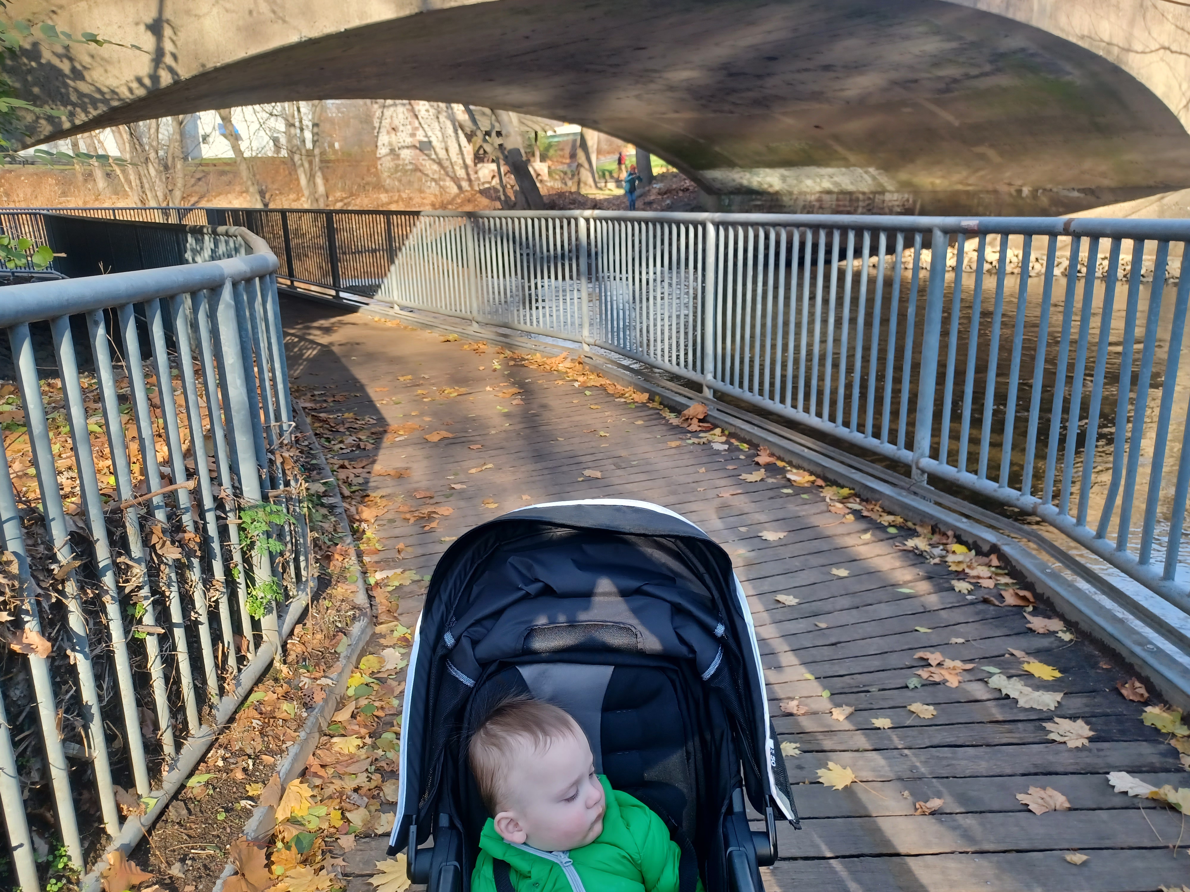
We continued north along the river, and then crossed it on a pedestrian bridge.
I opened my first can of beer at this point; the new taste I brought out for this hike was a Brooklyn Brewery barrel aged imperial stout called Black Ops. It was quite tasty. After letting the others taste it, I had to pour it into an Arizona Iced tea can as not to get in trouble for having it out in the open.
On the other side, there were trees planted between pavers, which is always a poor idea with the way these things grow, and then beyond that we entered another park area behind the community library.

The paved trail merged with a large running track, and there was an activity going on on it. During these times, it seems they are able to close that section of the trail that runs concurrently with the tracks, so we had to go around it to the right.

Soon, we came out to Arnot Street next to where it crosses the Saddle River. We remained on the east side of the river and crossed directly in the the parking lots behind retail establishments, along Graham Lane, and then through a much larger parking lot behind and adjacent to the Shop Rite of Lodi.
We continued through the parking lots, over a curb, and behind the CVS and other stores.
Just beyond that Route 46 was on a high bridge over the Saddle River. We had to turn to the right along the edge of the parking lot to come out on Main Street and pass beneath Rt 46.

Once we got to the other side, I was considering just remaining on the east side and walking to the north, which is probably what we did the last time I was out there, but this time I saw that we could continue by heading up onto the Rt 46 bridge and cross the Saddle River.

We did just that. There was a long wait at the crosswalk and no one coming, so we hurried over. A cop car was a bit ahead of us and put on its horn, which I pretended not to notice as we hit the crosswalk button to cross the exit lane from 46. We crossed properly there, and then followed the looping sidewalk up to the westbound side of the Rt 46 bridge. The good sidewalk took us over the bridge, and below us on the right was a park called Jet Age Park.
I figured we could get around to that by heading to the right, and despite some fences, we could get over to it by skirting an apartment building of sorts.
Some of the group decided they were going to try to go around. I continued over very uneven terrain around the building, and just as we reached Kimmig Avenue, Eric and John were on the other side of a locked fence heckling us. We couldn't get through it, not easily anyway.

We went back, but then there was a cut through of the fence to the left without going all the way back, and we got down to Jet Age Park with pretty much no problem.

We headed down along the river, and then upstream around a fenced in dog park area. The pathway soon came close to Kimmig Avenue, and Eric was sitting waiting for us at a bench. John was coming up from around the corner to our left.
Together, we continued to the north to Borig Place. Directly across this road was George Warchol Community Park, which had delineated trail through it heading along the river upstream. We continued to follow that.
Near the end of the park, we were able to cut out to a road at the Lodi Portuguese Club. We reached Hamilton Ave, turned right, and then left on Vreeland Street, still parallel with the river.

The road brought us out to Outwater Lane. We turned to the right briefly, and then to the left into the enormous Riverside Cemetery. We just stayed to the lower right side away form everything to remain close to the river.

There seemed to be a funeral service going on, so we stayed out of the way and hurried on through the cemetery, which brought us out to Market Street in Saddle Brook. We turned left briefly, and then right onto Saddle River Road.
This section of road closely paralleled Interstate 80, and then passed beneath it at the crossing of the former New York, Susquehanna, and Western Railroad. I believe this section is still called the New York, Susquehanna, and Western Railway, which is a sort of modern reincarnation of the original line, but otherwise unaffiliated.
The line started as smaller railroads consolidated into the New York and Oswego Midland Railroad, the line that became the New York, Ontario, and Western.
 |
| 1972 Rochelle Park Station |

The name changed on this one to New Jersey Midland, and then joined with other lines to form the NYS&W.
The line is still active through this area, and there was even a train parked under part of Rt 80 on a siding track. To our right, the old Roshelle Park station is still standing in good shape about two blocks away, within sight.
Railroad avenue was parallel with this, and directly across the street was the start of the easy stuff; the Saddle River County Park continues over six miles without having to do an at-grade street crossing.
We crossed the road here, and where the last time we stayed on the west side of the river in Saddle Brook, this time we crossed to the east on the Rochelle Park side.

The town was named for a location in France, having originally been Midland Township, but it was getting confused with another location.
The east side is probably the worst one for walking because the paved path is immediately parallel with the access road into the park. The only thing we had going for us this time was that the road was closed off to vehicular traffic after a short ways in. It must get opened up farther seasonally, but we picked the right time to do it and avoid extra traffic.
There were definitely a lot of people out on the trail on this occasion, but the trails here are wide enough that it was never an issue.

This bit seemed to go on forever, but eventually we got to the foot bridge over the river, and it was only paved path on the other side without adjacent roadway.

We skirted the Vander Sande Field, and then passed beneath the Garden State Parkway bridge.
The trails split in three just after the bridge. One way went far off to the left, around the west side of a pond. Another went along the near east side of the pond, and the one we remained on was the one closest to the Saddle River on our right.
We moved off from the pond and other trails and continued along the river, skirted a couple of ball fields on the left, and entered more wooded area heading north.
I held everyone up when we got to another open area to let them know the options for our lunch stop.


There wasn't a lot of options along the trail directly, but in the Arcola section of Paramus, there was a Wendy's and a Popeye's pretty close.
I decided I was going to go for the Wendy's because it was the closest thing, and I figured it would be easy enough for Ev to have something and maybe turn him loose for a bit.
We continued along the trail for a bit, until we came to a split just before where the trail goes under Red Mill Road.
There, we turned to the left on a side trail that goes up to Red Mill Road. We crossed over the bridge over the river, and I could see Easton Tower, also known as the Arcola Mill, off to the left.


Arcola Landscape Park was developed by Edward Easton, a notable technological figure known for his patent on incising sound through engraving of wax cylinders.

 |
| Roberta Taylor Collection |

 |
| Roberta Taylor collection |


I'm not sure where, but somewhere in Ho-Ho-Kus I understand was the site of the main power building for the trolley, so it must not have been too far away.


The inn once served as a parsonage, and first became a tavern in 1890. It has been known as the Zabriskie House, the Villa Inn, the Mansion House, the Wayside Inn, Washington Inn, Estephe's Hotel, and Paddy Burke's.


We crossed Brookside Avenue immediately on the other side of the bridge, and there was a walkway up across the street to the Ho-Ho-Kus Station where we'd started. I told the group about the old Hopping-Zabriskie Cemetery and recommended they take a walk over to have a better look at it. I told them I would take the walkway up to the station, but that on foot, they could walk to the cemetery and from there directly up the slope to the parking lot, so they all went that way.


The final historic photo I needed to emulate was one taken in 1908 by noted photographer J. E. Bailey, who had done images of a great many Erie Railroad stations around the time. I'd used images by him for a lot of my compilations in the past.
No comments:
Post a Comment