Hike #1455; 11/20/21 Tuscarora Trail; Yellow Trail/Cove Valley to Cowans Gap with Professor John DiFiore, Jennifer Tull, Diane Reider, David Adams, Mike Krejsa, and Neil Washington
This next hike would be the next point to point in our Tuscarora Trail series, the sixth.
We had finished the last hike in the series in Cowan's Gap State Park, right at the parking lot for Cowan's Lake. This time, we would do the next section to the south of there.
I really didn't know what to expect other than the fact that this just might be extremely difficult. It also might be easier.
This section was the first that was also part of the Great Eastern Trail, so I figured it might have a greater degree of maintenance than previous sections of the Tuscarora. The Standing Stone Trail is part of the Great Eastern Trail and it ends on the Tuscarora Trail in Cowans Gap, so I figured the surprisingly pleasant level of management we encountered on that trail might pass on with this one.
There was also the very real possibility that this could be extremely difficult, with rough terrain and heavy brush everywhere.
These and other questions meant I had to consider the details of this hike differently.
The southern end of this section was to be a yellow blazed trail that ascends from the Cove Valley through State Game Lands #124 to the Tuscarora Trail. I was uncertain about the condition of the road to the parking area, or if I could even find it. I didn't want to post that as the meeting point because there might be very limited parking. Instead, this hike would be the first in the Tuscarora Trail series to go from south to north instead of north to south.
Cowan's Gap Beach would be a far better place to meet, that most of the group interested in this hike knew how to get to.
Also, once up the ridge, it seemed that we would remain on ridge top for a long while, and the majority of downhill walking would be at the very end. I wanted to try to make it as easy as we could because the days were getting shorter.
I also wanted to try to have some time set aside to stop for lunch at the Tuscarora Summit.
It seemed like this would be the best plan, and we would be able to deal with things appropriately from the start if we went about it this way.
We shuttled with as few cars as possible to the starting point, just two of them.This brought us south on Route 456, Little Cove Road, in Cove Valley north of the little settlement of Sylvan.
There was supposed to be a dirt road that went part way up the Tuscarora Mountain, but it was not very obvious. I had to look ahead of time for it on the maps to know where I was going.
When we arrived at the road, I pulled in and began trying to drive my Honda Element up it. At first it was okay, but then it started getting really very bad. I wasn't going to be able to make it, or if I did, I might wreck the oil pan under my car. I ended up trying to back back down.
There was some room to pull off park along the west side of the road at the very sharp turn, barely enough for our two vehicles, but that's what we had to do. We couldn't chance trying to get up there.
There were some blue blazes down at the road to show that there is a trail that comes down here, so we took the chance that we would be okay to leave the cars there.
I was a bit concerned because this added a full mile to our hike. We would have to walk a mile on the woods road just to get to the parking area before even beginning the ascent to the main trail. I was just glad to get moving though as we started.
Neil and I got up in the front to move on. It had been a while since he and I had seen each other, and he was living down closer to Washington DC for a job he had just taken.
I had been getting more out of shape from lack of exercise, and I really needed this major climb at the start of the hike, but Neil smoked me on it.
I had been home from work for over three months for child bonding time, a sort of paid paternity leave I got through the state. It was great, but the lack of exercise was weighing on me pretty badly. At least I was still able to get my son out on hikes with the jogger stroller during the week for exercise.
The woods road got worse and worse as we took on the slight ascent from Cove Valley. I couldn't believe anyone would bother going up there. Still, as we made our way up, there was in fact a couple of trucks in the parking area (if you want to call it that) when we got there.
From the parking spot, the blue blaed trail followed a more beat woods road into the woods to the west.
We moved uphill very gradually just a bit more into the state game lands, and then came to the intersection where the yellow trail contineud ahead as a foot path, and the blue trail continued to the left following the old woods road.
It started to get a bit more gradual as we got closer to the top. The ascent was still kind of rough until we were right there.
Immediately, it was not the rough mess we had been through before. Previous sections had been badly overgrown and full of briars, or full of loose rocks, or both, with vegetation so thick that we could not tell if we were planting our feet on solid rock or into a crack.
It was kind of rocky at first, but the treadway looked immediately almost as if it had been recently weed whacked. On it we were able to make some really good time.
We continued along and passed by the terminus of the Hells Hill Trail, a very steep one also up from the Cove Valley. I had initially planned on using this as the start of the hike, but noted that the further down yellow and blue connections would put us at the right spot to do our final hike in the Tuscarora north half.
A little past this trail, we passed over some rock outcroppings that jutted to the west a bit. There were some views to the west, but the best ones were from the upper level of the rocks looking back to the Cove Valley to the east.
The trail ahead got a bit more rugged, but it was never at all overgrown. I was able to move along pretty quickly still, and we went up and over several very nice rock outcroppings, but none of it was that bad.
After a series of outcroppings, I noted while I was walking ahead of everyone else that there was a hunter below us in the woods to the left, below a rock. I was really surprised to see anyone else out there. I just kept moving ahead and pretended like I didn't see him at all.
Just ahead, we reached the intersection with the Reece Hollow Trail, where there was a trail register in a mail box. I stopped and signed in on the register, and then waited for the rest of the group to catch up to me.
As we were reconvening, the hunter and his son came walking up the trail from the direction we had just come from. I was thinking he was going to be the angry type, because we walked by the spot where he was hunting and might have scared away the deer he was looking for.
He was surprisingly friendly and told us about how the deer come right up and over the right where he was sitting, and that he often has to tell hikers coming through that they should be wearing something bright. Most of the group had some orange on, and I was wearing an off white blazer with green pants and a bright orange seventies butterfly collar shirt, so I think we were probably okay in his book.
We continued along the ridge with more views, plenty more seasonal views, rock outcroppings, and even a few balanced rocks.
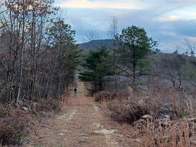
Through the later segment of ridge top, the trail got super wide, but not because it was an old road. It looked like there had been some fireline training or professional trail clearing going on. The foot path was widened to super wide, well more than it ever needed to be, and the treadway was very easy.
After a great series of rock outcroppings and splendid views, we began descending from the ridge rather steeply to the east side. After a bit, we came to a woods road. We followed this briefly and then turned sharply downhill on some sood bracing steps to reach Route 16, known as the Buchanan Trail because the former President James Buchanan was born just at the base of it nearby.
I had thought the trail would follow an easy woods road from this road to Tuscarora Summit, but it actually was mostly downhill from it to the east. We had to descend a bit, and some of the trail was old woods road, while other bits were foot path.
We crossed a power line and meandered through the woods for a bit, reached a woods road, and followed it uphill to the a wider woods road in private property. The trail passed through some of this private land on their woods roads, some of which were logged around. The woods looked of a different quality since it was privately owned and timbered as the owners saw fit.
There was also a very nice little bench and seating area.
My guide book said the trail followed a woods road past a private home, but I think it must have been slightly rerouted and maybe lengthened through this area.
After the woods road bit, when the road started to turn to the right a bit, there was a large sign reading "trail" that put us over closer to the western side of the ridge on a foot path. I think this must have been cleared in order to keep hikers a bit further away from the private home.
The trail meandered a bit, and we did come within sight of the house, but didn't go very close to it like my out of date guide book described.
We continued ot the north, and soon came to a small overlook and a plaque on a rock that must have been to the former land owner who allowed the trail to pass through his land.
It read:
"This plaque is placed in memory of John Castellar Simonson (1915 - 1998)
He loved these woods and this land, which his family has shared with the Potomac Appalachian Trail Club to carry out his dream that this viewpoint and environment will be preserved for future generations to enjoy."
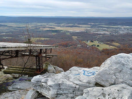
We continued just barely beyond this point to the Hang Glider View.
This was probably the best view of the entire hike, which is kind of off putting that it is within sight of and easily accessible from the Lincoln Highway just to the north. Still, there was no one there besides us taking in this awesome scenery.
I think the blazes came in further back behind this, but we got closer to take in all of the scenery.
McConnellsburg was well within view as well as all of the beautiful farm lands to the west.
Before we reached this point, I called ahead to The Mountain House, just ahead, so that we could stop for a lunch break and have some burgers. I ordered two for myself I was so hungry.
Once were were done at the overlook, we headed out an informal side path into the back of the establishment, which was originally the famous Tuscarora Summit Inn.
Either way, the food was great. My two burgers were awesome, and I also had a bottle of Troeg's Field Study IPA, which was quite tasty.
The spot kind of reminded me of the Indian Wells Vista on the Mid State Trail, and it was just about as good. We enjoyed the view for a bit, then continued on our way into the woods, on a foot path past some abandoned concrete ruins of some sort, which might have been some sort of comfort station.
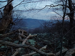
The trail took us gradually down hill, and the sun was sinking in the sky fast. It was not much uphill left for the entire hike, but at this point I was already aware that we were probably going to be out just until after dark.
We took on a few switchbacks left and right when we hit woods roads, and then came to an intersection with a prominent woods road at the bottom. We turned right there, and then for a brief time we had another footpath section in woods parallel with one of these roads. We passed a couple of hunters walking on their way in at this time, and they were friendly with us.
The trail passed through a somewhat recently logged area through scrubby young trees, and then we came out to another prominent woods road. We continued straight to follow that woods road to the north.


.jpg)

.jpg)


No comments:
Post a Comment