

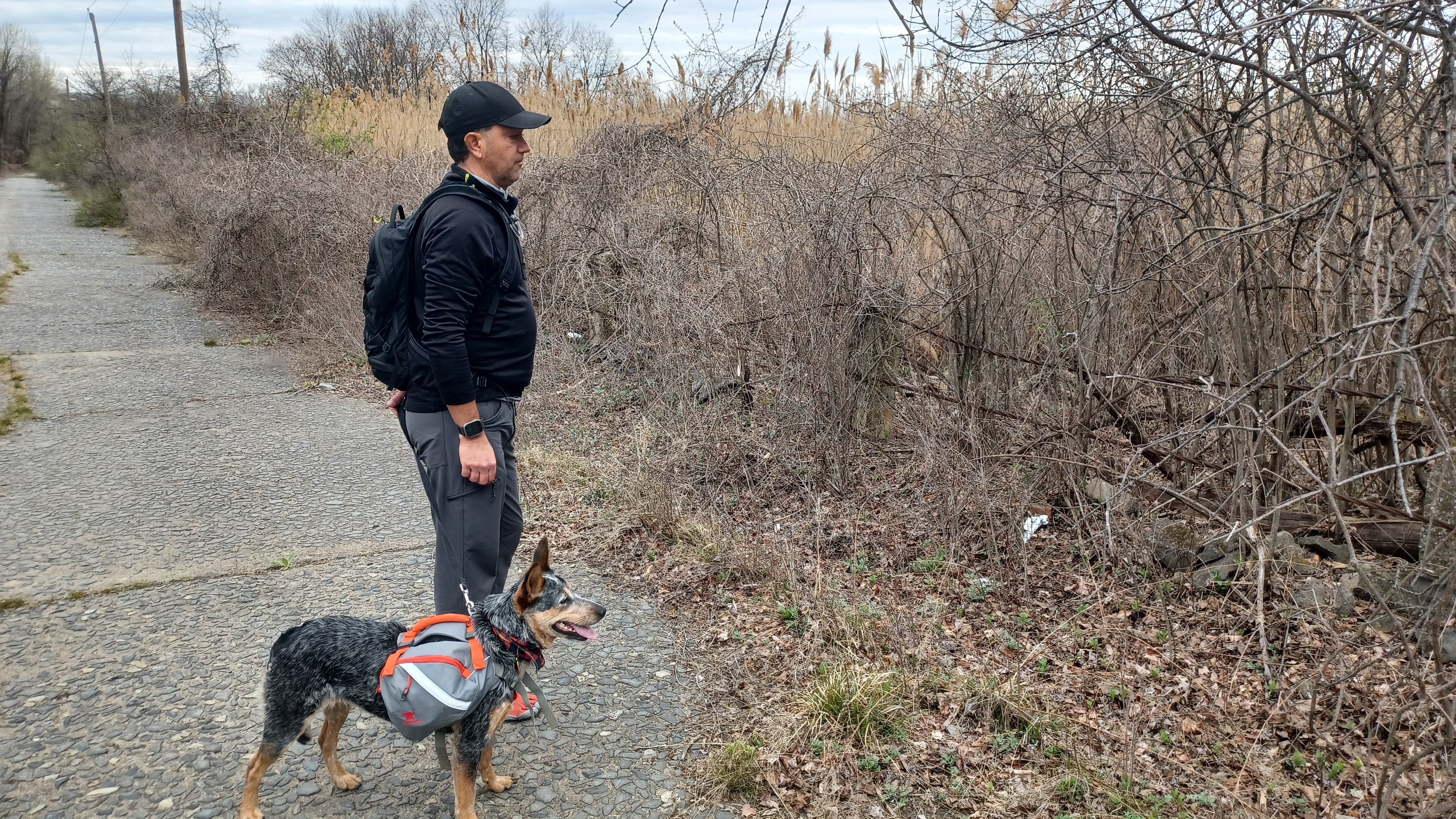
Hike #1540; 4/9/23 Teaneck and Hackensack Loop with Justin Gurbisz, Kirk Rohn, Brittany Weider, Violet Chen, Dan Lurie, Caleb Olivar, Serious Sean Dougherty, Diane Reider, Gregory Andres, Daisey FG, and Everen
This next hike would be the next in our Hackensack River series. I not only wanted to hike the entire Hackensack River, but also cover all of the substantial tributaries to it.

On the last one, we did a trip up the Overpeck Creek from the confluence with the Hackensack, but this time we would cover some of the tributaries to that, some of the other greenways along the Overpeck, and then head back up the Hackensack. It would end up being a really cool hike that I liked a lot, but had a few frustrations here and there.
I found a way of making this hike a loop rather than a point to point, by simply doing a few blocks of road walk between the Hackensack River and the Teaneck Public Library. There's a lot of stuff I'd like to see through the area, so it was exciting.

We met at the library in the morning, which was handy because it was actually open, and they had good restrooms. Once everyone was good to go, we began our walking.

The first leg of this was far more interesting than I'd thought it would be.
We started walking from the parking lot south, past the Teaneck City Building Department, and then continued down across Cedar Lane toward the Holy Name Hospital. It turned out this was where CJ was born, and so I got a nice photo of he and Dan next to it.
We continued past the front of the hospital and then down through the parking lot to the southeast. We crossed over Teaneck Road and then followed a concrete walkway along the edge of Teaneck Creek.

Of course, this creek is also a Hackensack tributary, so I wanted to cover some of that on the way to Overpeck Creek as well.

The path followed the creek to an intersection of paths and then cut through Thomas Jefferson Middle School. We continued across the creek, then turned right to follow it south through the school property and around the outside of one of the buildings to Fycke Lane.
Directly across the street, a trail entered woods of the Teaneck Creek Conservancy.
I looked forward to heading into this small but interesting looking property.

It ended up being far nicer than I'd imagined it would be. The trail took us through a fence and stone pillars into the preserve, which was really nice right along the creek.

There was a nice map sign (with an older version of the map beneath the outer one that someone had torn). There were also art displays through the area, with the first one being a swan or something surrounded by little ceramic pieces affixed to a rock.
A side trail led to the left onto a very nice section of boardwalk, so we checked that out, and then came to where the trail was closed off at apartments known as Arbor Terrace.
We had to follow their access lane for a bit, but their island of shrubs and such looked cool because they had big turtle statues in it.

Eventually, we got to a place where we could cut to the right into the conservancy area. It looked like there was a major wetland restoration project going on out in the meadows there. We kept to the middle of the property to head toward the west side. Dan told us there was a really cool art display there that was worth seeing.
It was great to have Dan back with us for the first time in so long, after he'd just returned from his sabbatical or exile.
Dan couldn't really resist this area because he'd known it so well, and we didn't get around to it while he was living out there. So, it was great catching up and having a splendid walk.

As we headed toward the middle of what should be the wetland, there were some giant concrete pipes strewn about. Each had paintings done inside that I suppose were representations of different periods of time.

One was what looked like ruffled sleeves of colonist clothing and hands holding and implement, with a backdrop of fire. Another was of hands situated similarly but holding onto a gas station nozzle with highways.

pushed Ev right through one of the pipes in his stroller. We then continued through the center of the preserve with some splendid wetland views, and then came to a trail intersection. There was an opening to our left that led into a very well manicured labyrinth area I wasn't expecting to find.
We wandered on in to have a look around and saw some nice door work that looked like Adirondack benches, and the labyrinth was a stone walkway with a stone circle area in the middle.
We followed Dan to the point where he was saying the art installations were, which I think were supposed to be along some apartments, but they moved them further into the preserve.

The highlight was this giant metal Norse-looking statue that Dan says used to have a big axe, but someone stole it.

The statue looked a little bit like Dan.
After looking around a bit more, we followed a trail to the south, along the west side of the preserve.
It was questionable how much of this place was open and what was closed, because from the south side, it was kind of blocked off to public. The stuff we didn't get to see where we were initially supposed to turn was also blocked off at one point, but we could have gotten onto it from the inside of the place.
We cut uphill at the end of the preserve to DeGraw Avenue, but we had to go to the right and up a slope through the grass to get around a chain link fence on that side.

It was quite odd, because it said no trespassing on the other side, but we had walked in where there were absolutely no signs blocking anything off.

We headed out to the intersection of Degraw Ave and Teaneck Road and used the crosswalk there to get across. Once on the other side, we made an immediate left turn onto Willow Street.
The street took us to Parkview Commons, and we continued right behind the building to the left through grass. Out around back of the place, we were able to follow a nice little greenway trail with benches around the outside of a retention pond.
We made our way from here south out to the corner of Willow Street and old Fort Lee Road.

Fort Lee Road was historically a colonial road that went from Washington's Headquarters in Hackensack to Fort Lee.

Before the New Jersey Turnpike was built just to the east of this spot, the Fort Lee Road was a main through road, but it is now severed at this point and gated. The bridge over the Teaneck Creek is gone, but on the other side of the Turnpike it picks up as a drivable route again. The abandoned bit from this point out to the creek is really beat up with some exposed old paver surface showing. Google maps shows this as Old Croaker County Park, but everything I look up says that officially part of a northwest corner of Overpeck Park.
Whatever the case, it is a cool piece of public land, and my plan was to walk it as far as we could down to the creek to view where it used to cross.

We walked down the road, which was made of old concrete, which had the larger stones that were used in the mix very visible. We don't typically see concrete like that anymore, and this one was holding up quite well.

We headed all the way down to where the bridge used to be, and I could see no remnant of it at all. It might have been a wood footed bridge that would leave no trace of abutments, or otherwise everything was removed.
The old single slab style concrete highway section probably dates back to the 1920s if consistent with other roads I've explored of the time.
On the other side, the NJ Turnpike with its seventeen lanes at the exits and on ramps with crossing of Degraw Ave have probably erased most everything of it for a ways.

Some of the others checked out a side path to the south, but I knew I didn't want to try to go out that way. I planned this as an out and back venture.

We headed back to the west on the old road, out to Teaneck Road where we turned left, to the south.
We followed Teaneck Road for a bit, and then turned left again onto Walnut Street, which went downhill a bit toward the Teaneck Creek. We turned right on Parkview Drive, and followed that to the south for a bit until it ended. There, my plan was to cut to the left into an apartment complex and use some of the pathways through it, but there were a ton of signs reading that it was for residents only, so I decided against going through any of that and potentially having a problem since there were so many of us.

We backtracked to Maple Street and followed that back uphill to Teaneck Road, then turned left again to follow it to the south.

It wasn't very long on Teaneck Road before we got to the bridge crossing over the eastern terminus of Interstate 80. This is actually a pretty significant spot for those who have driven the highway so often, through different parts of the country. It is one of the most significant highways in America.
The view east was where it breaks away from the New Jersey Turnpike. 80 is the second longest interstate highway in America, behind Interstate 90. It was actually one of the first US Interstate highways to be planned, back in 1956. It doesn't go fully across the country, but from Teaneck to San Fransisco. So, it comes within ten miles of New York City anyway.

Work continued across the country starting in the fifties, over eleven states, and it took until 1986 when the last segment was connected through Salt Lake City.

We crossed over 80 and continued on Teaneck Road to the south until we came to Grand Avenue. We turned left and followed this downhill, and at the bottom reached Ridgefield Park Nature Preserve.
Aerial images did not show the amazing park that stood before us. I was planning on just turning left into parks to the south, but this park had one of those floating boardwalks up onto higher land closer to the NJ Turnpike. We of course had to check it out.

There was a little looping trail at the entrance, which I just pushed Ev around briefly, and then a large dead tree that had been carved out into images of turtles, fish, coyote, birds, and at the top a Great Blue Heron. It was really impressive work made from an old tree that probably died recently.

We walked out across the boardwalk, and some of the group took a little break on the benches at the entrance. We didn't realize it at the time, but when Jen sat down, she must have had her phone in her back pocket and it fell out at the bench.

The boardwalk crossed Albin Obal Marsh, then ascended some steps onto a knoll. I got help getting Ev's stroller up it, and we continued on a gravel delineated path at the top to the left, which was sort of back in the direction we had come from, but I figured it wouldn't go through.
We came to a fork, and the trail did go back down into the marsh, but another one went straight. Just to be sure, we followed the trail out to the end. It went to a sort of little loop at the end, which I pushed Ev all the way around, and we came back out to the previous steps we had seen.

We went down the steps, across the swamp, and ascended slightly to the end of Overpeck Ave. We followed this to Grand Ave, to close a loop with where we had just been.
We descended on Grand to the left, to the entrance of the Ridgefield Park Nature Preserve, but we turned to the right onto the pathway that led into Dexheimer Park.
The park is named for Adolph Dexheimer who was a local Commissioner from 1912 to 1929, and Mayor of Ridgefield Park from 1916 to 1920.
The section of trail traveled up on the edge of a slope above the Ridgefield Park High School. There was a bell on display to the right of the trail and then another tree that had been carved out into something unrecognizable after it died.

We came to a restroom building where there was a switchback to the paved path that would lead us downhill near a ball field, and there was a large playground as well. We took a break here for folks to eat some stuff and take a breather. The girls brought Ev down to the playground just below us while we took the break.

Eventually we moved on, and took the trail that headed to the east a bit, around more fields, and then switched to the south through Veterans Park, through the fields.

We paused at the McKeown Field, I think to use restrooms or something, when Jen realized she was missing her phone. We thought about it for a moment, and I'd hoped it was right back where we last took a break. We couldn't really go back with the group because we'd be set really behind, and I figured it wouldn't be too tough to find. I'd just start calling the phone and she'd end up picking it up.
Since this was a loop, it was always possible to just walk a few blocks west and take the next Hackensack River crossing to catch back up with us.

Jen didn't find the phone, and ended up walking back to her car and going home. She messaged me when she got there about finding it, and she found the location. By that time I guessed that it was at the Ridgefield Park Nature Preserve at the bench, and I was right.

Jen came back and found the phone again later, but opted not to join back up with us once she found it.

The rest of us continued on after a while of calling to see if she'd found it. The trail continued parallel with the NJ Turnpike for a while, then made its way out to Emerson Street near one of the exits.
We continued south and west to Teaneck Road once again, and then continued to follow that to the south.
We reached the intersection with the old Bergen Turnpike and turned right, heading northwest.
We traveled a few blocks, and then on the left was McGowan Park along the Overpeck Creek, which was super wide at this point. We walked the path along the waterfront, and then back to Bergen Turnpike.

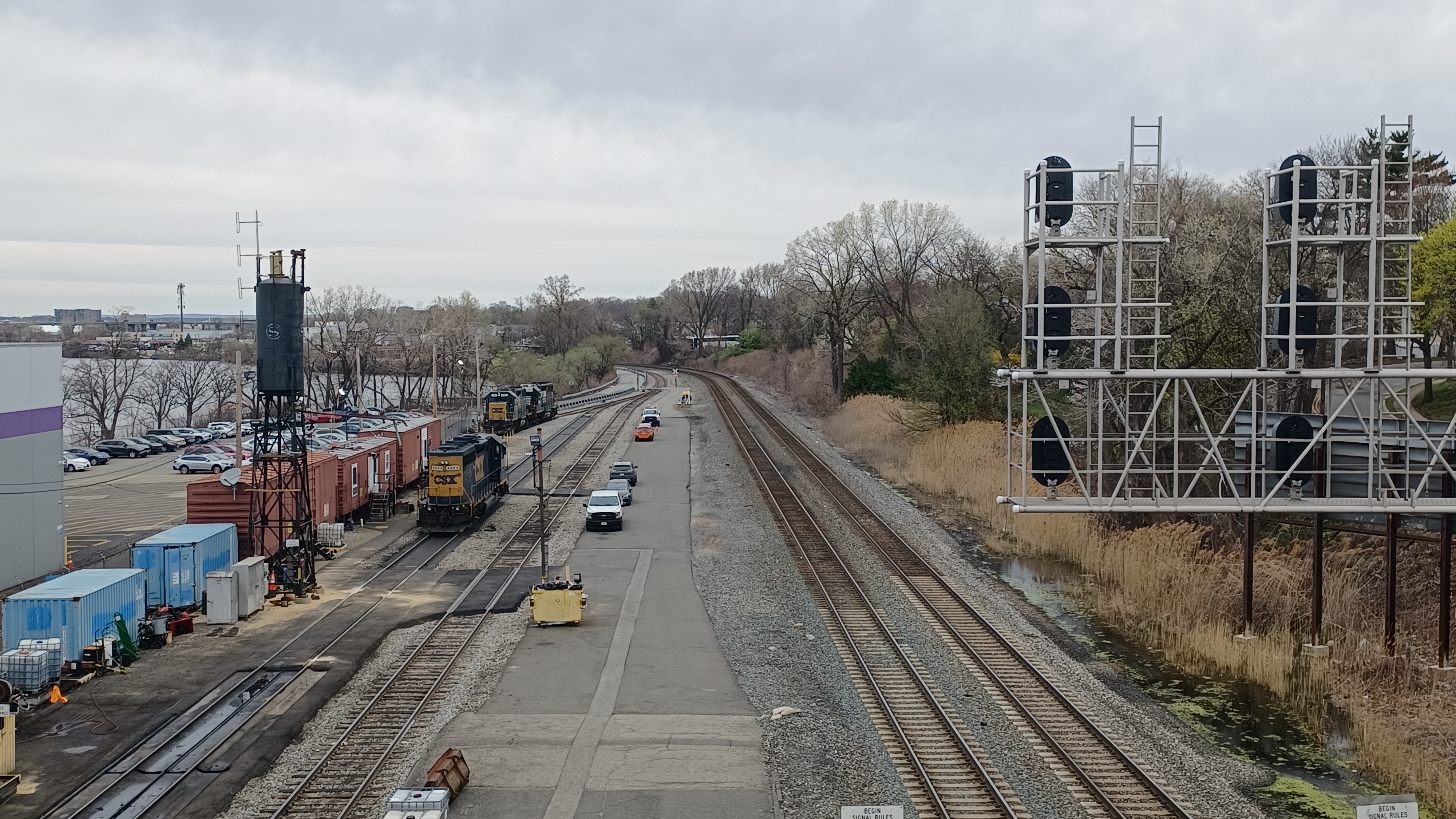
We continued on the Bergen Turnpike to the west a bit and cut through a bit of a vacant lot, which afforded us good views of the railroad bridges over the Overpeck Creek.

There were two lines side by side. The first one was the New York Central, and the second was the New York, Susquehanna, and Western.
The New York Central had a swing span bridge, which I understand is fixed in place now, but the NYS&W had an old lift bridge with a giant counterweight slab on it.
We headed over to the crossing; both rail bridges were still active, and the shanty that worked the lift on the NYS&W looked like it was badly falling apart. I suppose neither bridge has opened for quite some time.

The Bergen Turnpike would have continued straight from this point, but the bridge or whatever it was that used to be there in the past is now gone. We would have to go up Main Street to the north, back on the east side of the tracks.

Industrial Ave went up the west side of the tracks, but that had no access to the next bridge over the Hackensack River we could use.
We headed back over the tracks, turned left on Main Street, and continued north to where the Main Street Bypass continued to the left.
We soon reached and passed beneath the Winant Avenue Bridge, or Veterans Memorial Bridge.
The double leaf bascule bridge was built in 1934 to carry Rt 6 between Ridgefield Park and Little Ferry.

The central span of the bridge has four towers that were intended for bridge tenders, bridge mechanisms, and for storage.

The bridge is apparently still operable as a lift bridge, but it may not have been opened for thirty years or something. I don't know if it having been opened anyway. The section of the Hackensack River is still supposed to be considered navigable anyway.
I believe the Little Ferry for which the town on the other side takes its name was that associated with the Bergen Turnpike in colonial days. Before, that, it was also a major crossing for native Americans.

The bridge had walkways on both the up and downstream sides, but I opted to head for the upstream side. We went up to the right after passing beneath the bridge, and then turned to cross on the walkway.

The view upstream was outstanding. We got a good look at the windowed towers along the way, and when we reached the other side, there was construction going on along both sides of the road. To the left, the building was almost up, and to the right it looked like something had just been demolished and was being cleared. I don't know the area well to say what that was.
Wynant Ave became Sylvan Ave, and we turned to the right on Bergen Turnpike again briefly, and then right again into a little area with a building and several businesses.

We walked through the lots toward the back, because I was planning on getting into the Waterside Village development.

This was a frustrating bit to get through. I wanted to get to the back and walk along the Hackensack River, but there were these oddball fences around this place to keep people from doing just that. Eventually, we made our way to the waterfront and continued walking to the north. Some of the buildings just had grass around the waterfront side, and I walked those mostly by myself while the others took the nearest streets to it, but eventually we found some sections of sidewalk that went around the buildings.

We barely made it anywhere around the outside of these apartments and townhouses, and there was no way to get through to the next development. There was some sort of tributary flowing into the Hackensack that was not bridge, and so there was no way through.

We made our way back out of the north side of the development, then to the right, and then to the right again into the next development back out to the waterfront.
Some of the next apartment sections had some really nice walkways that afforded us amazing views of the river. They were sometimes lined with flat stone walls. A couple of the buildings had some really tight spots to get through around their corners to continue upstream, but we got through.
We emerged into River Drive Extension briefly, and then continued through more apartments. We had one final section to go around before we had no choice but to meander through the complex back out to River Street.

We followed River Street north a bit, and there were a couple of businesses to the right, but not much we could get close to the river through.

It wasn't until we reached the southern end of the Shop Rite of Hackensack. We turned right through the parking lot and made our way to the back of the store where there was a surprisingly nice wooden walkway directly along the waterfront.
Ev had fallen asleep around this time, and was knocked out for a while, of course just when things started getting a bit nicer.
We continued on the wooden walkway out behind the Riverfront Plaza shopping mall. On the other side, the trail turned hard to the left and back out to River Street, by the intersection with Pulaski Place.

We turned right on River Street again briefly, and then there was a segment of the Hackensack River Greenway on the right.


We turned to the right and followed the greenway section to the waterfront. There was a police car parked right where we went into the trail, probably not used to seeing people use this section.

We went left at the waterfront and continued walking toward the Rt 80 bridge over the river and surrounding area.
Unfortunately, as we got toward the bridge, the path did not continue through. We had to go back. I felt like that would be weird, because we'd be going back right past the cop that was parked there. It probably looked like we had some sort of drug deal going on or something.
We made our way back to the street, and then turned right on River Street again, out to Rt 80. I think Justin, Kirk, and Brittany ended up trying to bushwhack through a different way rather than backtrack, and it was a bad choice. They ended up going back again anyway.

There was another side trail that went to the right soon between a couple of self storage facility buildings. This one was rather narrow, with high black metal fences on either sides of the path.

We followed it out to the Hudson River, but it did not go upstream. It only went briefly downstream and ended before the Rt 80 bridge. Hopefully some time soon we'll be able to revisit and do these trails successfully.
We continued back out to River Street again, which gave the rest of the group the opportunity to catch back up with us, and then turned right to follow the road north again.
The next spot had a parking area and a solar farm to the north, and it looked as though the trail actually might go through this time. I was quite happy with this next area where we might finally stay on the waterfront.
We reached the waterfront again, and although closed off, we got to see a new segment of the Hackensack River Greenway under construction heading to the south. It seems we might in the near future be able to get on the waterfront here after all.
We turned left to begin following the trail upstream along the river yet again, and it led us to a pedestrian bridge over a little inlet.
Unfortunately, the trail was again closed at the inlet crossing. There is another bridge over the next inlet as well, but this entire area is closed to public access. That's because this goes onto the property of the Bergen County Jail.
By this time, we had been forced to go back and forth from the waterfront on the same route we went in, it didn't seem like we could fail many more times.

We turned on back around and headed back out to River Street once again, then headed north past the jail. I don't know how everyone else was, but I was kind of annoyed by it.

Justin had a silly sign that read "Wings" on it, and I came up with lots of captions for it, such as:
- Metrotrails Gives You Wings?
- Metrotrails: Just Wing It
- Boneless Wing Special
- Justin just earned his red wings (the sign was red)
We made the next right onto Broadway, and it looked as though we'd be able to walk out to the Hackensack Public Works Garage, where there is a segment of concrete trail along the waterfront that dead ends at an inlet.


When we got to the end of Broadway, where we should have been able to cross a road bridge over a little inlet, there was a closed chain link gate. AGAIN we were forced to backtrack back down Broadway to River Street. I couldn't believe it. We were having no luck with this route.

We headed up River Street a bit more, cut through a Citgo and Dunkin Donuts lot, and then into the large lot of the Costco Business Center. We walked along the south side of the lot around the Costco to the rear, turned to the north, and then reached the edge of the Hackensack River where we finally got on another section of concrete walkway. We could have followed it to the dead end to the right, but I just wanted to get to get on with the hike. We still had a lot left to go.
There was a sign reading that Hackensack was a "stigma free town". I'm not so sure about that considering all of our circumstances.
We continued along the walkway, which took us to the west on the north side of the Costco parking lot. It was in this area that Dan and CJ decided to cut out, and then newcomer Daisey also decided to head out early as well. We did have a bit more to go, but was very glad to see Dan and CJ again, and to meet a newcomer that may come back and join us again.
At the end of the lot area, the trail cut to the right along the upstream Hackensack River. There was a good view of the historic Court Street Bridge coming into view as we turned.
The Court Street Bridge is also known as the Harold J Dillard Memorial Bridge.


This is a center-bearing swing span Warren through truss with steel girder approaches and concrete substructure, which opened in 1908 to replace an earlier swing structure. It is the uppermost bridge on the river required by law to have the ability to open upon request.


I'm not sure if the thing actually opens right now or not, but I've heard tell that it's been seen open for a test every now and again.

We made our way along the path toward the bridge, and several of us were pushing shopping carts from various stores we'd found sitting along the pathway.
Around this time, we needed to figure out what we wanted to do for lunch. We hadn't been passing many different options. I think one of the reasons Daisey left was because she didn't want to stop for food for a long time.
We reached the edge of the bridge where there was a plaque on the 1909 construction, and turned to the left along Court Street heading west just a bit.


This area of old downtown Hackensack was an area I had never visited before, but had wanted to see for quite a long time.

To the right side of the road was the First Dutch Reformed Church of Hackensack NJ, also known as the Old Church on the Green, built in 1791. It is the oldest church in Bergen County, on one of the oldest community greens in New Jersey.
The east wall incorporates some of the stones of the original church on this site built in 1696, which contain the monogram of several founding families.
General Enoch Poor served the Continental Army under General George Washington. Washington attended his funeral at this site in 1780. Poor is buried a few feet away at the green. A statue honoring General Poor stands out in the middle of the intersection of Moore Street and Court Street.


The Green is just barely to the west of that, and to the south of it is the Bergen County Courthouse.

The court house building was designed by civil engineer James Riely Gordon who won a competition for the project. The American Renaissance style building was completed in 1912. It was the sixth building to serve as courthouse for the county, and second on this same site.
At the very center of The Green is the Hackensack War Memorial, erected in 1924.
Beneath the statue of the soldier, the monument depicts famous War scenes including the American Revolution with Washington at the Battle of Monmouth, the Civil War with General Robert E Lee surrendering to Ulysses S Grant, the Spanish American War with Colonel Theodore Roosevelt leading Rough Riders at the Battle of San Juan Hill, and the World War I panel, then called the Great War, the War to end all wars.
Mi Rancho Mexican Restaurant was not very far away from the main intersection, and so we headed up Main Street a bit toward it.
This turned out to be a really great place for us to sit down for lunch. There was a good area toward the back where we could sit and let Ev run around like a lunatic without really disturbing other patrons too badly. The food was also really good as well.


When we were full and happy, we loaded back up and headed south on the Main Street back into the downtown and courthouse area, and turned left on Court Street.

We continued on the street all the way back to the bridge discussed previously, and began walking to the east on the north side of the bridge, which afforded us a view of the rather famous, abandoned submarine that is parked along the west side of the river.
The USS Ling, a naval submarine, is permanently docked in the Hackensack River.
The Ling is Baleo-class submarine named for a Ling fish. It was launched in 1943 during World War II, but saw no action. It was placed in reserve in 1946, and converted to a training vessel in 1960 and was stationed in Brooklyn.
The vessel was donated to the Submarine Memorial Association In 1972, and brought to Hackensack in 1973 as centerpiece of the New Jersey Naval Museum.

North Jersey Media Group, who owned the museum site, decided to redevelop, and the museum and submarine would have to find a new home.
A series of unfortunate events including Hurricane Sandy, theft, break ins, lawsuit, silt, fixed bridges, and lower managed waters apparently have doomed the sub to remain stuck where it sits.
Apparently, it may be stuck because of some of the bridge lift functions, as well as the lack of money to repair much of it. After all, this is metal sitting in the water, and it was looking like a great deal of it was pretty badly rusted in place. I couldn't see all that close enough to make a good judgement on its condition.
We crossed to the other side of the bridge, into the town of Bogota. There was an industrial site to the left side of the road which looked like it was only lightly used today.
This I am told was the George M. Brewster and Son business, but I'm not sure exactly what it was that they did.
We continued down Court Street to the east a bit more, around a curve to the right, and soon approached the grade crossing of the former New York, Susquehanna, and Western Railroad again. The tracks were still active in this area, and this was the site of its Bogota Station.
Historic George M Brewster & Son business image in Bogota
The railroad here was originally chartered as the Hoboken, Ridgefield, and Paterson Railroad in 1866, but became the New Jersey Midland Railroad in 1870. The line was extended west, and by 1881, crossed the entire state of New Jersey. By 1893, through a subsidiary, the line had the most direct connection between coal mines and eastern ports.
Historic Bogota Station image. Possibly by J E Bailey

The curving single track line could not compete with the larger companies, and even though this became a subsidiary of the mighty Erie Railroad in 1898, it could not compete.


 |
| Pic from Hudconja on Wikipedia |

The trail approached the bridge site and went up onto a very nice boardwalk with good views both of the current bridge, as well as back to the NYS&W Railroad bridge.


No comments:
Post a Comment