

Hike #1539; 4/1/23 Upper Hopewell Forge to Speedwell Forge Lake with Kirk Rohn, Diane Reider, and Everen
Our next hike would be the next in my PA Highlands region series, actually the 11th in the series, which wasn't only on the PA Highlands route, but all sorts of stuff around it.

The area around Cornwall had a whole lot of stuff to cover, and so we spent some extra time on the area between there, Governor Dick Hill, and more. This would be the last of those before we'd break out to the east a bit, but we'd also connect with the Conestoga Trail, which I was ready to re-start as a series.
I had hiked the entire Conestoga Trail as overnight trips with Jillane years ago, and it is among my favorite trails ever to have backpacked just because it was so different and weird.
It was kind of sad that not many showed up for this hike because they were afraid of getting stuck in the rain. The forecast was indeed saying that we were in for some nasty stuff potentially, but the percentage was never all that high.

We ended up not getting any rain during the hike at all. It was quite perfect.
My meeting point was the former site of the Upper Hopewell Forge along the Hammer Creek, just east of where we'd turned around on the Horse-Shoe Trail on the last hike out here.
The Horse-Shoe Trail was one that I'd already completed, but there were already some reroutes that I'd not done before, so it warranted doing it all again I figured, but the last section ended up being really tough with Ev and the stroller. I seemed to recall there would be one section tough on this one as well, plus a couple of spots that I was unsure of.

It would turn out that the very start was the only tough part of the entire hike, and even though only Kirk and Diane came out on this one, they both helped through the start to get us through it.

The Highlands Trail designated route follows much of the Horse-Shoe Trail route, so I had been trying to do that, as well as all of these connections, and on the last one we finally really got into State Game Lands 156. This time, I planned to cover a whole lot more of that for the start.
The next bit of the Horse-Shoe Trail on the agenda would be from where we left off on top of the Furnace Hills to Upper Hopwell Forge, but we would do that segment backwards this time.
We started walking from the lot, and it had drizzled right up until we were ready to start moving, then stopped.
Westbound on the Horse-Shoe Trail took us south on Pumping Station Road just a little bit; there was a sign near the historic marker about Peter Grub's Hopewell Forge, as well as one that denoted the northern terminus of the Conestoga Trail.

The Conestoga Trail continues on Pumping Station Road and heads south over sixty miles to Lock 12 on the Susquehanna and Tidewater Canal and the Mason-Dixon Trail.

The westbound Horse-Shoe Trail turned hard to the right and began climbing up the Furnace Hills.
It was much of the way a really old woods road, possibly logging or charcoal road, but it was pretty badly washed out.
I was able to push the stroller up just a little bit, and then it just got too tough to do. Fortunately, I was ready for it this time, and had it so I could carrying all of my stuff in my backpack, while others could help with the stroller and seat. Kirk grabbed the stroller and Diane grabbed the seat, and we continued heading uphill.
I got pretty far ahead of the two of them. I did try to have Ev walk a little bit of the way. While he was getting more sure-footed, he was not yet ready to be going up a slope like this one.

I had to pick him up and carry him most of the entire way up the ascent, which was pretty tough. I think he weighed 28 pounds at this time, and so I had to keep switching from left to right arm to handle it. I waited a couple of times to see if Diane and Kirk were close before continuing.

Before getting to the very top, there were a couple of more level areas where the trail became stroller-able, so I waited with Ev there. I was able to put him down and let him wander around for a bit and give my arms a break.

Some of these little level areas looked to be charcoal hearths, where colliers would have made charcoal during Winter months to power the iron furnaces throughout the rest of the year.
We put Ev back in the stroller for a bit in the next level area, but then it got rough again and we had to go back to carrying him and the stroller. This was a bit of a workout for me even carrying Ev because I've not been doing so much elevation since he started coming out with us regularly.
There were some nice seasonal views to the south as we made our way uphill, and it went on far longer than I remembered it would.
Some of this was the Rannals Kettle Run Nature Preserve, and there is a side trail to the left that goes down to connect with some State Game Lands stuff.

I had wanted to hike this trail as part of this series, but I opted against it this time because it would be just too difficult with the stroller to get through. I figure I could use other area trails in the future, after Ev is big and strong enough to handle it, and for now just continue with the series in a more logical way.
We continued uphill, and eventually reached the hairpin turn in Fire Tower Road/State Game Lands 156 access road. From that point, the trail was just on the paved but lightly used road up to the west.
This road section also had some nice seasonal views through the trees to the left, but it also continued to ascend more than I'd remembered from before. Of course, when I had done this section of trail before, I was coming from west to east.

We continued uphill gradually, and this was just a very relaxing section. I was very happy that it looked like most of the remainder of the hike would be relaxing from this point. The only part I had any uncertainty about would be the Speedwell Forge Nature Preserve, which I'd never done any of.

We continued on along the road until the final crest of the Furnace Hills. At about this point, the elevation is 1,200 feet above sea level, which is actually pretty high for a Highlands region peak. It certainly felt like it with the climb we had to do up the hill.

There are several towers near this peak area, with the first one being a microwave tower on the left side. Just after we passed that, I spotted what I believe were the footings for the Cornwall Fire Tower, which no longer stands today. They had some young trees growing all around them, so it was kind of easy to miss. The tower was built in 1929.
Just past this, we came to the old WC3RS Cornwall Radio Station, which I have read was also built in 1929 by the Civilian Conservation Corps, which doesn't make any sense because the CCC didn't become active until 1933.

Either way, the building was constructed as a ranger's quarters for the now gone fire tower, and it now serves as a radio club headquarters.
I had a photo I took of the building a decade ago I used for my own then and now compilation.
We continued past the building, and I was surprised to see a sign forbidden loud music to be played up there. That was kind of shocking because this middle of nowhere location surrounded by towers does not strike me as any kind of party spot. There's no water feature or view, or anything of interest really to bring the demographic of people who might do that.
 |
| Ranger Station, 2011 |

There were at least five more towers along the road, which shifted from paved to gravel. Pretty soon, we reached the gate where the Horse-Shoe Trail continued beyond. Just after that, the trail turned right to descend the Furnace Hills. This was where we had cut down the previous visit.

We would leave the Horse-Shoe Trail here, and continue through State Game Lands #156, at first covering again the same thing we had done on our last visit.
The road was gravel and wide for a while from here. It was nice to just stroll along casually without much worry. I sipped some drinks and just meandered ahead a bit talking to Ev as I went.
I had assumed on the previous hike that some of what we were walking along could have been on or close to some of the old Strause logging company railroads, and so it was a good opportunity to get back out there and take a closer look at it after having done a bit more research.

Sure enough, when we came to the first woods road intersection, that was certainly the railroad grade branching off to the left.

I watched closely, and the woods road we were following straight ahead was not the rail grade, but rather it was just parallel with it to the right. Some of it was pretty obvious when looking, and recently logging activity that started to appear in this area made some of it a bit more obvious.
The Strause Company constructed a 36 inch narrow gauge track in 1923 from the Cornwall Railroad near Penryn Park to extract lumber from this part of the Furnace Hills. It was at one time the only lumber railroad in Lancaster County. The line was ripped up in 1941.
We had walked this part of the game lands before, from a spot at the far west side, after bushwhacking up from the old Cornwall Railroad. I was thankful we'd only be doing the more relaxing stuff this time.

We continued to the west, and the Strause rail bed descended to the right, apparently on down to the Cornwall Railroad after quite a ways. I'd like to walk that bit one day, but it's too overgrown for the stroller to do in reasonable time now.

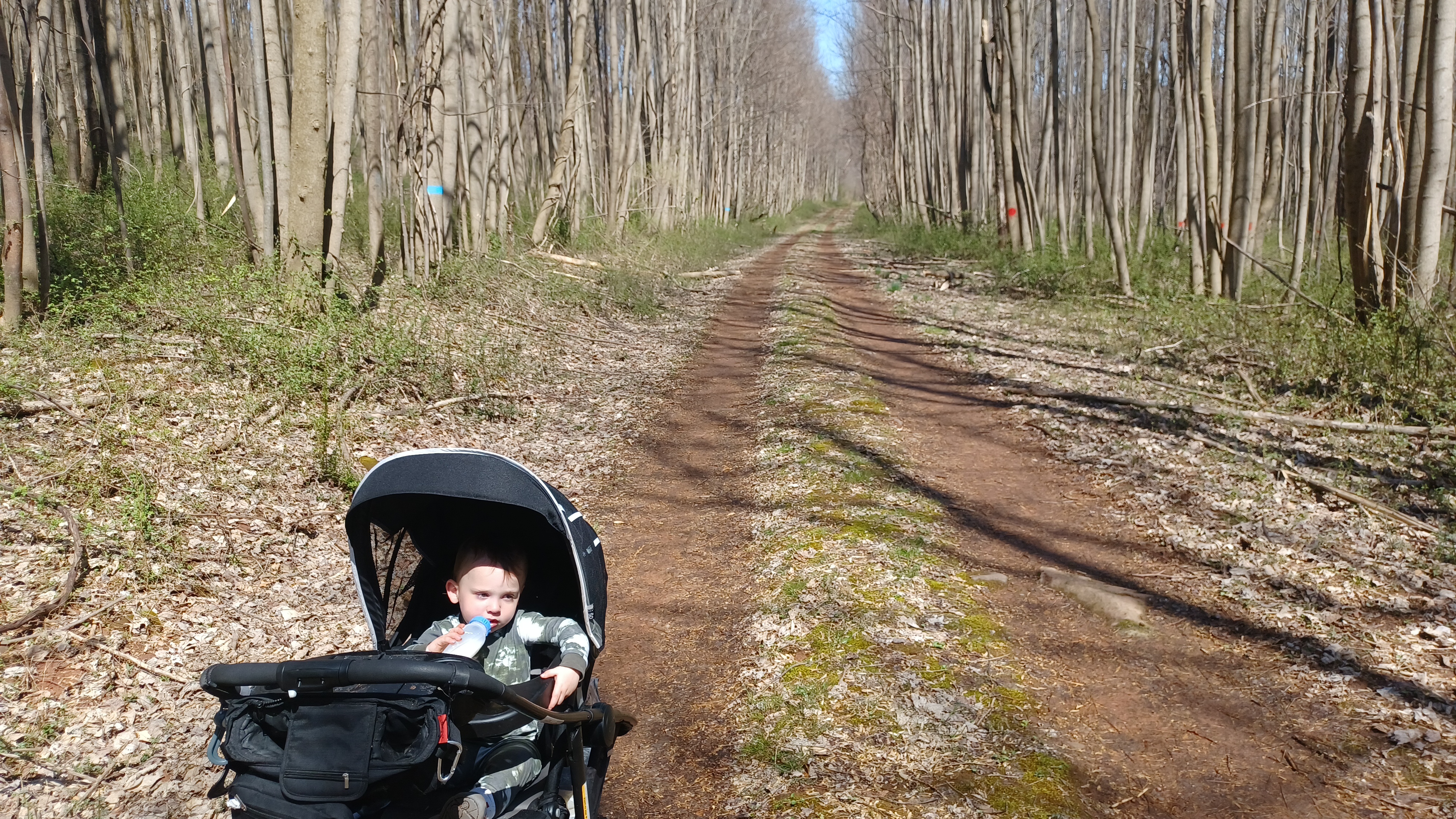
We continued to a point where it is quite wide open from the logging activity, and so I let Ev out of the stroller there to walk. I'd let him out many times before to see how far he'd want to go, and this was quite secluded with almost no one around, so I figured we'd be fine.
He was quite happy to walk, but of course he had to pick up basically every stick that was in the woods road. The gravel part ended at the logging area because the machines aren't using it as much, and we were on simple grassy woods road, heading slowly downhill off of the west side of the hills.
It was a pretty bright day, which was shocking to us because they were calling for all of this rain and cloudy conditions that barely ever happened.
The generally downward slope was good for Ev to walk, and he kept up picking up sticks and handing them to Kirk. Apparently he would get upset if Kirk didn't accept them, so Kirk just kept holding them for him.

I let them fall behind just a bit, and watched in amusement as Ev excitedly handed more to him, and the bundle he was carrying under his arm continued to grow.

I think Ev picks these things up with the idea that he is saving them to throw off of a bridge or something, and eventually forgets that he was handing them over.
We headed downhill through the meadow areas where we had emerged from the bushwhack on our last hike here,
We continued downhill from this point, which brought us to a sort of hairpin turn in the woods road. Just beyond that was a field on the right with a mowed opening. I had planned to emerge from that field when we did that last hike, but it didn't work.

It was tempting to go and have a look this time, but it was out of the way to get to so we weren't going to bother. The Cornwall Railroad used to cross the PA Turnpike just to the south of us, and at this point that highway was audible.

The entire area here had to have been logged again in the past twenty years, because it was all very young trees growing around us.
The woods road shifted around to the east again, and we continued down below the main ridge of the Furnace Hills on a mostly pretty level shelf. I suppose some of this might at one time have been part of the logging railroad system, but I'm not sure.
The old road was very grassy and pleasant with very little change in elevation. We moved on along, and eventually came to a little spot where there was a small pond on the right, possibly affiliated with an old farm.

Just a bit beyond, a culvert and a stream called Behm Run passed beneath the road, and we paused there for a few moments. I figured Ev would want to throw some rocks into the water.

He had gotten tired of walking on his own after covering well over a mile unassisted, and so I put him back in the stroller so he could relax a bit more.
The road shifted from northeast direction to east, and came to a major intersection. This was the right of way of the old Strause Company logging railroad we had seen on the road further up before. We turned right on the old railroad bed, which was well widened out as a game lands road, and annoyingly placed with gravel rock that made it harder to push the stroller through, but we managed anyway.

It was soon pretty obviously a railroad bed the way it hugged the hillside on a shelf. We weaved around a corner and eventually came out to a clearing with a view of the 1200 door peak of the Furnace Hills.

We could see the towers we walked by earlier from this clearing. I think I counted that there were nine of them from this point in total.
We continued through the clearing, and the woods road continued easier to follow along the old railroad bed ahead. It weaved back and forth with the contours of the land so it wasn't really any significant change in elevation, and the grael became more hard packed where the wheels travel, so walking this was much easier.
The rest of the section went by pretty fast. There were actually a few cyclists we saw passing through the area, apparently doing the shorter loop version of what we had done passing through here.
Eventually, the route we were taken ceased looking like a railroad bed and instead just an old woods road. Another side road went to the right that leads down to "Dead End Road", which I'd like to do one day too, because I have another version of a loop to do in this area maybe one day.

We crossed over the Kettle Run, and I didn't notice where a rail line would have turned away. There were wide cut outs for what looked like crops along the sides of the road.
There were more people around this area. Pretty soon,we came to where the trail emerged out of the lower part of Rannal's Kettle Run Nature Preserve. I hope to incorporate that into a future hike, but that'll have to wait until Ev is a little more capable of doing harder terrain on his own. I'll try to keep it on my mind until then.

We emerged in the parking lot off of Dead End Road, came out to the road, and turned left. The paved road was not all that busy, being a dead end, so it was pretty nice.

The spring flowers were all starting to come out, and so I was picking some and handing them to Ev to checkout. This would be the first Spring that maybe he'll remember such things.
We continued out Dead End Road to the intersection with Speedwell Forge Road, which is the route of the Conestoga Trail.
I had forgotten to bring the beer I wanted to drink at the start of this hike with me, and it was only a short distance back to my car from this point, so I pushed Ev on back to Pumping Station Road and the short distance back up to the lot so I could get that for the remainder of the trip. It only took a couple of minutes.

I headed back and Diane and Kirk were just waiting patiently at the intersection. We were actually doing really great on time, and I was feeling excellent because nothing except for the first bit had been difficult.

We continued back to Dead End Road, and then down Speedwell Forge Road to the south, on the route of the Conestoga Trail, which is blazed with a sort of orange or mauve like color.
Another interesting thing we saw along this stretch of road was that one of the drain ditches was made using some light rail. It looked kind of like trolley rail again, but I don't know of any trolley rail in the area. Maybe they used some old narrow gauge logging rail? I'm not sure, but interesting to find.

We continued only south to beneath the Pennsylvania Turnpike. The Conestoga Trail turned to the left into the woods, while we turned to the right, parallel with the highway on Mountain Road.

We only followed Mountain Road for a bit, to the intersection with North Penryn Road, which used to go to the right before the PA Turnpike was built, and connected with Dead End Road. Penry Park on the Cornwall Railroad was so named only because of the proximity to the town of Penryn to the south in Lancaster County.
This road was a little larger than I'd anticipated and went by a bunch of newer homes I wouldn't have expected to see in northern Lancaster County, but it was alright. We had to go uphill for a bit, and then back down again, which took us near a body of water full of Spring Peepers.

Once at the bottom, we turned left onto Oak Lane, which was a beautiful narrow back road. I always judge how nice a road is by whether it has lines painted on it or not. If it doesn't have lines, it may be just as good as a trail.

The next section was the last bit of uncertainty in the hike, the Speedwell Forge Nature Preserve.
I didn't know what to expect going into this place, but I figured it was only a short distance to pass through, if I couldn't get the stroller through, we'd do what we did before and have Ev walk for a bit.
I wasn't even sure if we'd be able to get into it from Oak Lane. I used some google street view to determine that I probably could get in, but it was kind of obscure.

I was elated to find that when we got to where it showed an access, there was a little obscure wire gate I could barely get the stroller around, but just inside the woods we hit a very wide trail that was overall easy to use the stroller on!

The preserve was really everything I'd hoped it would be. It was a shady, gently rolling property with mixed hardwood trees and well packed treadway.
We could have either gone left or right, and I chose to take the loops to the north side of the preserve this time.
We meandered along, and made our way down and up one stream wash deep in the woods, but I really didn't have any trouble getting the stroller up and down it. The only part that was kind of difficult was when we got to a slope above a small stream, a tributary to the Hammer Creek, and the trail was full of roots of medium size Beech trees.
The southern alternate trail route joined in from the right, and as we continued, we came to where another trail broke off to the right. This segment went out to follow the edges of some fields to the south.
This was called the Oak Loop Trail, and I plan eventually to go back and incorporate the southern loops from the property.
We continued on the north one, which soon took us down a bit of a steeper slope, then reached a mowed trail in the flood plain of the Hammer Creek. The option here was to follow the trail to the left or right, with the left one being farther.

I chose to do the left one of course, because to me it looked more interesting and like it would go closer to the creek. We were doing so well on time that I wasn't so worried about getting done too early.


The only thing that had me at all concerned was that we might end up in the rain for the very end of this, but if that happened, it looked like we would most certainly be out of the trail anyway.

We continued west briefly, across a little wooden foot bridge over the tributary, and then somewhat steeply uphill to the right. This brought us out into the edge of a field where the trail turned ninety degrees to the right.
We continued downhill slightly through the fields and approached the Hammer Creek winding through beautiful farmlands. This section reminded me much of the Conestoga Trail from when I'd backpacked it, which made me like it even more.


We continued down into a swath of woods, then over some puncheons and corduroy work in wet areas, and along the edge of an electric fence, also reminding me much of the Conestoga Trail.

Soon, we reached the edge of the Hammer Creek, and we turned right to follow it downstream.
After a short while, we came to a broken bridge over the tributary we had crossed a bit earlier. This was a tricky spot because Diane and Kirk had to help me to get the stroller over this while I lifted Ev over the missing spot. It was only brief and we were on our way on the other side.
Soon, we emerged at the parking area on Speedwell Forge Road. We simply exited the lot and turned right onto the pleasant backroad which followed the Hammer Creek downstream.

At the road bridge here, slack water begins at the upper end of Speedwell Forge Lake. We turned right and passed a pleasant old stone house on the corner and continued south.

The storm was just starting to approach by this time. It wasn't at all cold out, so it was fine really, and I was prepared with a rain jacket if I needed it.
I didn't want Ev to get cold, so I put the rain cover on the stroller, and he was fine with it fortunately.
We continued down the road and made the left fork onto Lakeview Drive south. There were some views out to the water along the way that were quite nice. It was only just starting to rain a little bit as we walked, at less than a mile left.


We eventually passed the first parking area for the lake on the right, but we didn't go down to it because it was starting to rain more. I didn't want to deal with trudging through the grass.

We continued down the road just a little bit, passed the fish and boat commission building, and then crossed the intersection with Brubaker Road.
Immediately on the other side of the intersection was the parking lot Diane's car was in.
Diane got Kirk and I back to my car at Upper Hopewell Forge to conclude another really great day in the PA Highlands.
Kirk, Ev, and I had a nice drive back, and we stopped to have a look at the old Union Canal in Myerstown on our way back through to the north.
From where we left off, we'd have the series on the Horse-Shoe Trail and Highlands Trail continue to the east, but also the Conestoga Trail heading to the south.

I planned it so that we'd be doing hikes on the Conestoga as we headed into the warmer months, and the Horse-Shoe as the cooler weather approaches again. That would give Ev time to get better at the ascents and terrain, and afford us swimming opportunities as well.

It looked like things were going pretty well as planned. The series is going well, and looks like it will continue to get better as we make our way east and the trail sections get easier.

No comments:
Post a Comment