Hike #1536; 3/16/23 New Hope/Raven Rock Loop with Shane Blische and Everen
This next hike would be a big loop between New Hope, Lambertville, and Raven Rock and Lumberville along the Delaware River.
 |
| National Railway Historical Society-New Jersey Chapter Collection |
I think I had to go to the doctor in Flemington in the morning for a follow up or something, and when I do that, I plan on taking the day and doing some hiking with Ev.
 |
| Lambertville Beacon collection |
 |
Shane was free, so I planned to meet up with him and do a relaxing walk.
After the previous Sunday and all of the rough stuff, I needed to have a nice, easy walk. It was also a stressful time because I'd had these cancer things removed from my face, and I'd been wearing a band aid or bandage most everywhere and feeling extra awkward.
 |
| 1960 Lambertville Historical Society |
I think we started out right behind Shane's house in New Hope. Since it was just me driving down, I could just park in his driveway behind his home on Ferry Street. We then walked from there down to the main street, and across the Lambertville-New Hope Bridge.
 |
| 2001 on our hike |
I set up my first then and now history compilation using a photo of the New Jersey and Pennsylvania Traction Company trolley reaching the NJ side of the truss bridge, which was completed in 1904 to replace the earlier covered bridge that was washed out in the Pumpkin Flood of 1903.
Although the trolley crossed the bridge, it never reached farther than two hundred feet into the New Jersey side.
The handsome stone station, now a restaurant, was immediately on the right of us, which I got another shot of before continuing to the north.
I set up a then and now shot of the last regular service passenger train passing by the Lambertville Station in 1960, and then we headed onto the D&R Canal towpath on the inland side.
I had another one to set up on this first bit of the towpath, with my own photo I took of my friend Jeremiah Apgar when we hiked the section in 2001.
From here, we continued on the towpath to the south for just a bit to the north, to Coryell Street where we crossed over and got along the old Bel Del Railroad right of way.
We continued to the north from here, on the double track right of way leading north out of town along the tracks. A side track to the right is the old Flemington Branch, which is pretty badly washed out to the north.
We soon crossed over the Alexauken Creek bridge and aqueduct. It had been busted up pretty bad so the towpath was inaccessible the last time we went through, but it has been replaced now.
The wood looked nice and clean, all sort of yellow. We pushed ahead into a nice, pleasant area where i watched closely for the location of a photo I had also taken on my hike in 2001.
It was kind of hard to figure out exactly where it was, because the utility poles didn't quite seem to match, nor did the terrain. When I thought I might have found it a couple of times, I actually hadn't. We kept moving ahead, and I kept taking other versions of what I thought was the photo until I think I got it right on the last one.
We continued ahead from there, and soon reached the old baggage car that had been left on a piece of siding for many years. It was there the first time I walked through there back in 2001, although then there were no trees growing along it at all.
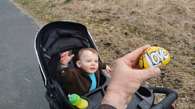
The area was full of all sorts of painted friendship stones or whatever they call them. I find painted rocks all over parks regularly now. There was one that said "love" and another with a dissertation about music that I decided to hang on to and give to one of my musical friends (it's still in my car).
We passed beneath Rt 202, then headed north further after the main trail shifted to the rail bed near the Holcomb Jimison Farmstead.
The next point of interest would be the former Brookville Quarry spur.
The tracks were still in for this entire distance, and there was a junction with the spur to the quarry at a point south of Stockton.
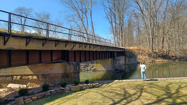
The tracks on the right of way are elevated above where the trail and former track bed for the main Bel Del line was, and the rails continued to a beat up old bridge over the canal.
I set up a then and now compilation, as did Shane, with a 1976 image by Harry Abendroth.
 |
| 1980s by Harry Abendroth |
The then and now we set up was of a loaded stone train being hauled from the quarry with Gerry Cruver on the front, on the spur coming from the Brookdale Quarry bridge over the canal.
The next one we set up featured Frank Capalbo Pete Reimer in the 1980s on a train at the junction with the Brookville Quarry spur.
We continued on our relaxing walk to the north on the old Bel Del line, and the canal weaved away to the right for a bit. Shane and I did some of our history videos for posting on the Metrotrails facebook page through this entire trip.
We set up something at the Brookdale Quarry spur, and then on the settlement of Brookdale, and more ahead. At Brookdale, the canal turns to the left beneath the tracks, and just beyond we think was the historic location of the station flag stop.
Brookdale is today considered part of Stockton, but it was its own separate community in years past, and important enough to warrant the flag stop along the railroad, although short lived compared to many of the other ones.
We continued ahead on the railroad bed, as the canal turned away from the railroad bed to our left. In years past, the canal on the left used to be open to public to walk, but it is now signed and blocked off in this area, which I am not at all a fan of. It seems the canal should be more a state thing than the railroad bed, where the trail is, but it's blocked off from people walking on it to Stockton and all the way through Prallsville.
As we walked, there was an old railroad box on the left side that had been re-purposed as one of those little libraries. I'd never seen anything done like that with any railroad structures before, so this was quite an interesting little oddity.
We continued on up to the north through to Stockton where we took a little break at the old train station, which is now a great little deli. I had Shane stand with Ev for a few moments while I went in to get a sandwich. Then, Shane went off to get one of his own and something to drink I think.
Before we left the station, Shane and I shared in an historic dissertation video to put up on the Metrotrails page about the station stop. He remembers a great deal of information about it, and there are some really great tidbits in there. One of the facts was that the original station at the site was accidentally destroyed when some dynamite was used to try to blast a safe open. They used too much and wrecked the station, which is when the one standing today was constructed.
I set up some more then and now history compilations in this area. First, I got one of the station and the old Rubber Plant to the right of it.
 |
| 1910 Stockton |
When the station stop was established in 1852, it was called Centre Bridge. It was renamed Stockton in 1867.
There was actually a second station built in the 1870s when Pennsylvania Railroad took over of mixed stone and wood construction, but that was the one that got destroyed by the would be robbers in 1894.
The current station was completed in 1895. The rubber mill also served as a bicycle factory for a time, and it burned down in 1927.
I also ran over to get a photo of the front of the Stockton Inn, which had been closed for a few years now. It was built in about 1833 along with the arrival of the canal.
The place has been famously visited by big names over the years, and was known for its historic ambiance. When it closed its doors for good, I was the very last customer. I actually purchased several of their bottles of wine that were in their bar when we had left.
It's uncertain what will become of the building now, but there are some sort of plans to reopen it with some updated grounds around it as I understand.
We continued north from the station on the rail bed, which passes through a bit of town, and then out to the historic Prallsville Mills site.
 |
This spot was a prominent stop on the railroad for quite some time, starting when it first arrived in 1852. The mills were already there since 1794.
Grain and feed processing continued on that sit until 1942, and the sawmill was in operation until 1955, when it was still served by rail. The grist mill continued operating as a hardware store until 1968.
The siding to the mills were used for privately owned passenger cars for a decade after that, and it was removed when the rest of the trackage in this area was removed in 1980.
For many years, the Pennsylvania Railroad car known as Herald Square was parked at the mill.
It was a Pullman car built in 1929 as a sleeper car, but then sold to Pennsylvania Railroad and converted to an office car in 1948.
It was retired from service with that railroad in 1968 and purchased by Ed Joselyn who restored it. It was moved when the tracks were taken up, and eventually brought to its final home in Ringoes where it is redubbed New York, Ontario, and Western "Chenango", although I'm not sure why. I'll have to check with Shane. Maybe it had a life with the O&W prior to PRR. I'm not sure.
The mills are situated at the confluence of the Wickecheoke Creek and the Delaware River. The canal simply had the creek flow over it with a spillway, but the railroad had a wooden covered bridge.
 |
| 1960s Michael Slack, Delaware River Mills Society Collection |
That burned in 1874 from spark of a locomotive, which took the original wooden mill with it. The mill was replaced by the stone one that stands on the same spot today.
The current bridge was built in 1913 by the American Bridge Company of New York. The deck girder four span structure was apparently damaged last year and is undergoing some kind of repairs, and so it has been closed for some time.
Shane and I did another couple of historic dissertation videos again here, and one of them was at the newly re-done sign at a little segment of track in Prallsville, left for historic ambiance.
There has been a sign there for a long time, and it has always been an annoyance to both of us how incorrect it is. In fact, most all historic markers on the entire Bel Del are incorrect or contradict one another.
 |
| Delaware River Mills Society Collection |
The sign post looked pretty great, but inside were a list of dates associated with the railroad. Several of them were totally wrong, and Shane pointed out which were correct.
It has been quite a frustration with historic markers being placed statewide with absolutely incorrect or misleading information. I'm not helping to write interpretive panels, and through my job I am involved in that in no way at all, meanwhile absolutely incorrect information is being put out not only on the social media, but also in these sign boards that will exist probably for another twenty years. Then, someone will repeat the wrong information when they write a book, and it will eventually be treated as fact. This all because someone was too lazy to get the correct information, or to full of pride to correct it when it was proven to be wrong.
We walked down by the bridge, but we couldn't really see anything much wrong with it at all. We then went to the right along the Wickecheoke Creek in back of the mills, and continued along the old road route out to current Rt 29.
The original bridge abutments can be seen at the crossing location.
Previously, Shane and I when walking from the rail bed came in along the creek, which was a bit of a rough walk, but we decided against that this time and just continued on Rt 29 north. Shane decided to climb up the hill to the right in search of old quarry remnants, and Ev and I remained on the road until we found a bit of a path back down to the railroad bed.
It was a rough spot, and I think I recall taking him out of the stroller and holding him under my arm, while carefully trying to lower the stroller down the path myself.
Once we were down on pretty calm rail bed, where I knew there wouldn't be a lot of people since the section ahead was closed, I let Ev out of the stroller to walk on his own for a bit. He did really well and walked quite a ways.
We caught back up with Shane, and continued on the section that was really close to Rt 29. He pointed out a spot where there was once a siding called the Johnson Siding I think it was, as well as where thre would have been something to go over to the edge of the Delaware to access some sort of a float operation that served the quarry operations in Lumberville area, at Cuttalossa Mills.
We continued to the north further, and reached the bridge over the Lockatong Creek. There's a great little spot to take a dip down below there, but it was nowhere near warm enough yet for that.
We continued north from that point, and it really didn't take long before we got to the former site of the Raven Rock Station, at Bulls Island Recreation Area.
The old metal rails along the platform area, pretty signature of Pennsylvania Railroad, are still there at the approach. I set up another then and now comparison, and Shane and I did another historic dissertation on the area for video posting on Metrotrails.
The site has quite a lot of obscured history including the bridge, the original name being Bulls Island, changed to Raven Rock, and then the location of a failed uranium mine across the road.
 |
| 1971 Raven Rock, photographer unknown |
From here, we headed on over to the park office to see if anyone was around. While we were doing our video, a couple of maintenance employees were going by, and then they were within sight when we went to use the restroom. I used the opportunity to change Ev's diaper. None of them came over to talk to us.
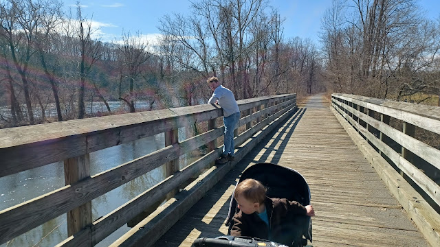
We continued across the Raven Rock-New Hope Bridge, a pedestrian bridge built on the abutments of the original covered bridge from the site.
We turned right at the other side of the bridge at the Black Bass Inn, which was originally the Lumberville Inn or Hotel, and is one of the spots that General George Washington tried to sleep, but was turned away because the owners were loyalists.
We headed down the road to Delaware Canal lock 12. The lock house there is long gone, but the lock and bypass flume are in good shape. We continued south and passed under the foot bridge to continue south.
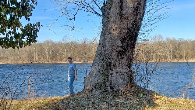
The section has beautiful views of the Delaware River as well as the homes on the inland side of the canal in this section. I kept Ev in the stroller for a little while longer just because it has some dangerous steep sections I don't want him running off of to the river.
We continued out of Lumberville and into the vicinity of the Cuttalossa Mills, some of which the buildings have been restored very nicely.
The quarry company there is still actively used, and has its own bridge across the canal. I actually had to get stuff there for some of the projects with Hunterdon County Parks when I worked there.
When we got to the south side of the business, we could see some of the stone work remaining from the moorings Shane had talked about earlier, that were associated with the float operation to get product to the Bel Del across the river.
I let Ev out to walk some more again just past the business area, as the canal went inland a bit more, and we passed an old weir gate. He ended up walking more than a mile this time, which was the most he had done yet.
Ev gets all excited and always has to pick up rocks and sticks. He's almost always carrying one or the other. This kind of gets him falling behind at times, but he was doing pretty well.
I'd just walk ahead enough to know he was okay, not too far off, and when he'd see I was moving he'd start back up to catch up again. He'd been getting so much more balanced that he could walk at a good clip.
We were making good time, so I just let him walk and slow us down a bit. Shane went ahead and was sitting on a bench just beyond where a road to some private homes crosses over the canal.
We soon passed beneath the Centre Bridge, and I let Ev walk just a bit more before putting him back into the stroller for the final bit.
Just after the bridge, we were along the Delaware River only briefly and the canal turns inland just a bit. Ev was completely tuckered out from all of the walking and ended up falling asleep in the stroller.
Shane pointed out a nice spot on the canal where there were stone walls lining the inland side, formerly for moorings, as this was a community known as Limeport. There were lime kilns inland from this site and they used the canal to haul the product.
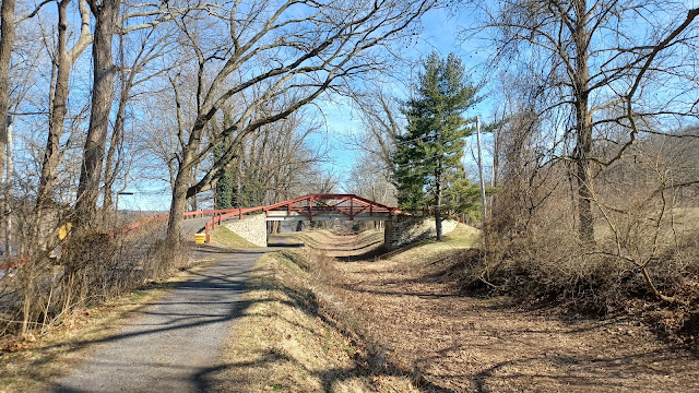
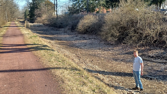
The canal was completely dry through this entire section, which is always sad to see. It wasn't so many years ago that almost the entire length of it was watered, but after the flood in 2004, it never came back in the same way. Shane went down and walked in the canal for much of the time.
We came closer to the river again as we got closer to Lambertville and passed beneath the Rt 202 bridge. Ev started waking up again I think in this area. The towpath shares use as a driveway in this segment, and there is a foot bridge that goes over into another park area to the right.
We continued on the towpath to the north, passed beneath Rt 32, and then headed back in to New Hope.
It went by pretty quickly, and we were soon to the bridge street, where we made our way back out to the road, and then a few blocks along the streets back to Shane's house to close the hike.
It was a really great day to be out. I'd already done this loop a couple of times since Ev was born, but I never tire of it. Both sides of the river are really beautiful and there's always little nuances to see.
I got Ev all packed up in the car, and since we finished in really good time with more daylight remaining, we took the long way home and drove up along the Delaware, in the direction we had walked, and then further up. I ended up stopping at towns all along the way as far as Riegelsville to get more then and now history photo compilations throughout all of the little towns.
By the time I reached Riegelsville, I was ready to cut it short of Phillipsburg and start heading home. The sun was setting behind the bridge there just as I was taking my last shot, and I felt like I had a really great, full day.











No comments:
Post a Comment