

Hike #1532; 2/26/23 North Bergen to Tenafly with Jennifer Berndt, Serious Sean Dougherty, Tina Chen, Brittany Weider, Justin Gurbisz, Elizabeth Manner, Luke Freselone, Professor John DiFiore, Cindy Browning, and Everen
This next hike would be the next in our Hackensack River series, between North Bergen and Tenafly.

I intended, since the start, for this series to not only be the Hackensack River itself, but all of its substantial tributaries. As such, this hike would focus not only on the Hackensack River itself, but most prominently on the Overpeck Creek.
The major tributary flows from the north along the western end of the Palisades formation, only about a mile from the Hudson River, but makes its way south from head waters at Tenafly area to the Hackensack near North Bergen and Ridgefield Park.
The prospect of hiking along the Overpeck just looked too good to pass up, and the weather was looking like it would also work out quite well. The other hikes in the Hackensack series had been fantastic so far, so I wanted to keep that good energy going. Each one of them has been very different than the previous one, and this one would certainly fit that progression.
Our last time out, we had finished he hike with an epic exploration of the now abandoned Edgewater Tunnel of the former New York, Susquehanna, and Western Railroad. It's one of the only major NJ rail tunnels I had not gone through yet.

I chose the ending point to be the old Tenafly Station site on the former Erie Railroad, and we would park at the Stop and Shop up there. We'd then shuttle with as few vehicles as possible down to the Wendy's below North Bergen where we had parked for the last hike in the series.
After we did that hike and I posted photos of our adventure through and back, I posted them on Metrotrails. A local guy named Ken Accomando happened to have some wonderful photos he had taken of the tunnel over the years and shared them onto my post, and so I saved some to my phone to get now versions of them.
We opted not to go back down to the tunnel this time, but rather over the top of it through the Fairview Cemetery. The odd tunnel goes directly beneath the cemetery, which is strange to think there are that many dead people over top of us while walking through.
After parking, we made our way north on the Broad Avenue to the entrance to the cemetery. We went directly to the left in order to get closer to the railroad right of way which was heading into a very deep cut.

The railroad was built by a subsidiary of the NYS&W in 1894. Prior to that time, the line had to make its way south and utilize some trackage rights to reach the Hudson River, which was a pain.

The subsidiary on the western end, the Wilkes Barre and Eastern, had just been completed in 1893, which gave the line the most direct route from the anthracite mines of the Scranton/Wilkes Barre area to the Hudson River. With the completion of the tunnel, there was an even more direct route.

We continued up, and I found a spot where we could access the tunnel in the cemetery if we ever needed to, but otherwise just continued up over the top, which afforded us a nice view.

I could see the Watchung range to the west pretty easily, despite the clouds overhead.

Once we got almost directly above the tunnel, I was able to line up Mr. Accomando's original photo pretty well by getting a little closer to the edge while the others watched Ev.
Once finished, we headed down along the opposite side of the right of way to the west, through the other side of the cemetery.
By the Spring, some kids decided to try to go through the tunnel after heavy rains and had to be rescued, so it looks like the tunnel will probably be closed off or watched more closely in the future. It's a good thing we did what we wanted to do when we did it.

I honestly don't believe all of the newspaper stories. It said the kids were up to their shoulders in water, but the tunnel level should remain about the same because it would drain out either side.

There was no blocking debris on the west side, and sure there is always water on the east side, but it shouldn't get that deep, nor should it get to where they'd not be able to get out at all. I have a feeling they got through the tunnel and got trapped in the chain link fenced construction site on the other side and had to be rescued, and they decided to try to play it up that they were in water. They would have had to go through water, but they'd be trapped on the other side, and then have to go back through, which would explain why the rescue.
Anyway, we continued on down through the cemetery and exited onto Rt 9/Broad Ave. We turned right and crossed, and followed the road to the north until we got to Pleasant View Terrace.

The right turn brought us gradually downhill to the tracks of the former Erie Railroad. I had seen a pedestrian overpass on the aerial images I intended to use at the crossing, but when we got there, we found that the crossing had been long abandoned. The bridge was fenced off.

This did not stop some of the group, who decided to climb up and cross over it anyway. I was easily able to just go straight across the tracks with Ev in the stroller, because someone had placed planks downhill and back up the other side, including over the tracks themselves for easy travel.

We got to the other side and turned right on Railroad Avenue north. There were a couple abandoned industrial spurs form the active tracks in this area going off through the pavement to industries on the opposite side of the street.

We continued to the north until we reached Hendrick's Causeway, a highway that goes over the level we were at. We continued under this, and then turned to the left on Edgewater Ave in Ridgefield, to Church Street.
On that street, came came upon the beautiful Old English Neighborhood Reformed Church, built in 1793. This hidden gem is not unlike some other locations that avoided the wrecking ball as progress passed it by. The location was a prominent one soon after the American Revolution, and it grew in 1805 with the arrival of the Bergen Turnpike.

The first railroad came about fifty years later and the area continued to grow. When the new causeway route we had just passed beneath was built, the church found itself on a dead-end street with no need for further access. Industry grew around it, highways were widened around it, and it simply remained a time capsule.

We walked up on the church, and saw one car in the lot. We figured maybe someone was around to check it out. There was just the chapel building itself and one other out building. We walked up to the chapel, and the front door was wide open so we went inside. No one responded to our calls out, so we figured someone was simply in the restroom or something.
We looked closely at the beautiful decor and and ambiance of the place. It reminded me of the Musconetcong Valley Church I attended when I was younger. There were balcony areas above, and an organ and guitar in the front. Sean, guitarist that he is, said that he wanted to play it, but didn't think he should. I asked "Why not? Play it!".

He was not going to play something offensive. He picked up the guitar and strummed what I guess was some classical chords, and he said it was the most beautiful sounding guitar he had ever played.

I wish we could have met someone there, but we were thankful to have the opportunity to see the place anyway.
We moved on out to the cemetery behind the church, which had some glorious giant trees in it. We let Ev out of the stroller for a bit to walk around, and Tina and Jen took him by each hand to walk on through for a bit.
When we got to the far end of the cemetery, it was time to put him back into the stroller, much to his dismay. We couldn't have him walking along busy streets in case he broke free and ran though. He's pretty good about it, but I needed to also pay attention to mapping, and no one but me can really handle carrying him more than a mile.

We followed Edgewater Avenue to the west to the intersection with Bell Drive, and there we saw a sign that read there was some sort of sale down that road. We decided we were here and now, we should go and check it out.

A little ways down the road and to the right was a warehouse where people were being let into a long corridor in which stuff was being sold. Some of the group stayed outside with Ev, and I walked the length of the building to see what there was. Nothing of particular interest really, and I was back out in no time. I waited for the others to have a look around, and then were were on our way back on our original trajectory.
Edgewater Avenue intersected with the Hendricks Causeway, where we turned to the right. Almost immediately, we crossed over the Overpeck Creek a short distance from its tidal confluence with the Hackensack River. There was a narrow, fenced walkway on the westbound side of the road.

Once we got to the other side of the bridge, there was an abandoned paved road to the right. I wasn't sure if we could use this to get through, and I had previously planned that we wouldn't attempt it, but it looked so inviting when we got there that I figured we would try it.

We followed the roadway to the north directly, and there were enormous piles refuse. To the left, there were giant rolled up piles of astroturf apparently from a golf course in the area. We were able to meander through this area almost to Rt 46. I didn't know if it would take us through or not, but fortunately we found a break in the fencing just beyond some piles of ripped up asphalt we had to skirt over.
We got out into the grass on the other side, and right to the edge of Rt 46, but then I realized there was no good way across. The highway not only had a median, but an elevated one.

Aerial images made it look as though it would be a straight across dash, but it wasn't that simple. It would require dashing, jumping up, jumping back down, and dashing again. In the past, we'd have all handled this with pretty much no problem, but with the stroller we just were not going to try it.

We tried walking to the right, toward the 46 bridge over the Overpeck Creek. I figured just maybe there might be a path down underneath and back out the other side. In such an urban area, there should be something.
Shockingly, there was no path down and no access. A faint fisherman's path led down at one point, but with no paths beside the waterfront.
An abandoned gas station and mini mart was right near this, with chain link fences erected around it. Someone commented on my Metrotrails post about this that the station had still been open only a couple of months prior. It is amazing that it fell into such horrible disrepair after such a short time.

We started heading to the west, thinking maybe we could get through that way to get to the other side of the NJ Turnpike, which crosses pretty close. If we could get to the other side, that wouldn't be too much of a detour.

There was no good shoulder, though we could probably have gotten through. Unfortunately, there were a lot of police all the bridge pulled over, and they certainly would have told us to turn around and go another way. In fact, if they saw, they would probably have opposed of us going back the way we came! Rather than have any further issues, we backtracked quickly to the opening in the chain link fence and made our way through the disturbed area, on the abandoned road, all the way back to Bergen Turnpike.
We turned right on Bergen Turnpike up a ramp, and Brittany said there was no walkway to get up and over there. I had checked street view ahead of time, so I knew we were good to get through and we made it no problem. There were some interesting views of the wetlands and the NJ Turnpike as we passed over it.

We continued west on Bergen Turnpike to Teaneck Road and then turned to the right. The only way we were going to get to Overpeck Creek again was to head north, cross Rt 46, then turn right on Emerson Street.

We did just that, which wasn't too bad. After passing beneath 46, we turned right onto Winant Ave. This brought us to Emerson, where we turned right. Another paved trail went right across from that intersection, but I would do that on a future hike in this series.
This time, we crossed the Turnpike on Emerson, and then reached Challenger Road. Directly across the parking lot from this location was some sort of a property management company or something, which had a road around the back of it, and just to the north in the next building was the AMC Ridgefield Theater I think it was.

We continued straight out toward the Overpeck Creek, which was right behind both of these buildings, and began walking close to the waterfront on the access roads. The next building beyond the theater place was the Samsung Electronics company. We continued around that, and then there was an inlet, so we had to go back out to Challenger Road briefly.
Just after the inlet and across from the Hilton Garden Inn, there was another small park area. We cut across the grass there, and then started following the crushed stone trail that went around the outside of this property.

We meandered along the Overpeck Creek again, and then made our way off of the trail and into the next parking lot to the north, which had another business building with another Samsung thing in it and a few other things.

We walked just a short bit, and then a paved trail turned to the right away from the road, at the start of Overpeck Park. The park is over 800 acres covering both sides of the Overpeck Creek, with trails and other facilities. I was quite looking forward to the greenways we would be following especially starting at this point.
There were road cones along the route that read "JFC" for which people made vulgar religious comments. I think I said something about fried chicken.

We kept to the right, and the paved trail brought us along the wide, tidal Overpeck Creek again heading to the north.

We followed this for a bit, and I planned that we would take a side trip to the restroom facilities near the center of the park where there is an awesome amphitheater. We turned to the left uphill through grass, past the amphitheater, and then over to the restroom. I gave Ev a diaper change, and then let him run amok with the group all looking out for him. Tina took him around the building and pretty much wherever he wanted to walk while we took a break.
Here, we also finished off some of our special Phil Murphy donation wine I had been making use of on hikes for the past several months.

After everyone was done with the restrooms and well rested, we made our way back over past the Ampitheater, and then to the north along the Overpeck. There was soon a dock on the right side, and the trail remained much closer to the waterfront. I let Ev walk for a while through this, but he soon got tired and I put him back in his stroller.

Just ahead, we reached the Overpeck Deck, a really nice platform out onto the creek with great 180 degree views.
Upstream, I could see two interesting bridges, variations of bowstring arches like the prominent ones around the Pittsburgh Pa area.
The two timber arch suspension style bridges were completed in 2012 to provide vehicle and pedestrian access to the north side of the park.
We continued along the edge of the creek and then closely parallel with Challenger Road again, and to these bridges, which are close to present day DeGraw Ave.

That road route is part of the original old Fort Lee Road, which was a through route now abandoned in this middle, but still called Fort Lee Road to the east and west of this point.

We crossed the bridges and had great views to the south over the wide water of the Overpeck, and just ahead Luke came running up to us to meet late.
We dashed across DeGraw Ave in this area to continue on trail to the north, now on the east side of the Overpeck Creek.
Luke was messing with something with his knife, I forget what, but I told him he should probably be careful about it. At some point just ahead, he went off running back to his car and said he would cut the corner and meet up with us again just to the north. I'd find out later that he ended up cutting his hand when he didn't listen to me! Silly boy.

We passed a World Trade Center Memorial on the right, and then crossed over a tributary known as Moore Creek heading north.

We followed the edge of the fields on the paved trail all the way as far north as we could in the Henry Hoebel section of Overpeck Park, then cut to the east and reached a parking area. We skirted the east side of the parking area, went south only slightly, and then there was a pedestrian walkway that went over the former Erie Railroad tracks to the east. We waited a few moments for Luke, but I wasn't getting a response, so I just let him know where we were and our trajectory as planned.
We were at this point behind the Leonia High School, and we turned to the left parallel with some ball fields heading north. We just continued through the grass to the north side, and then exited the fields onto Ray Avenue.

Once we were only the road, we didn't have to walk a full block and there was a path that went up to Lakeview Avenue adjacent to some apartment buildings.

We went up there, and there was a concrete platform that extended perpendicular to the railroad tracks to the left. I wondered if this was either a bridge footing, or was it perhaps once a station site for Leonia on the old line. There was another slab of concrete on the other side of the tracks, so I suppose either could be a thing.
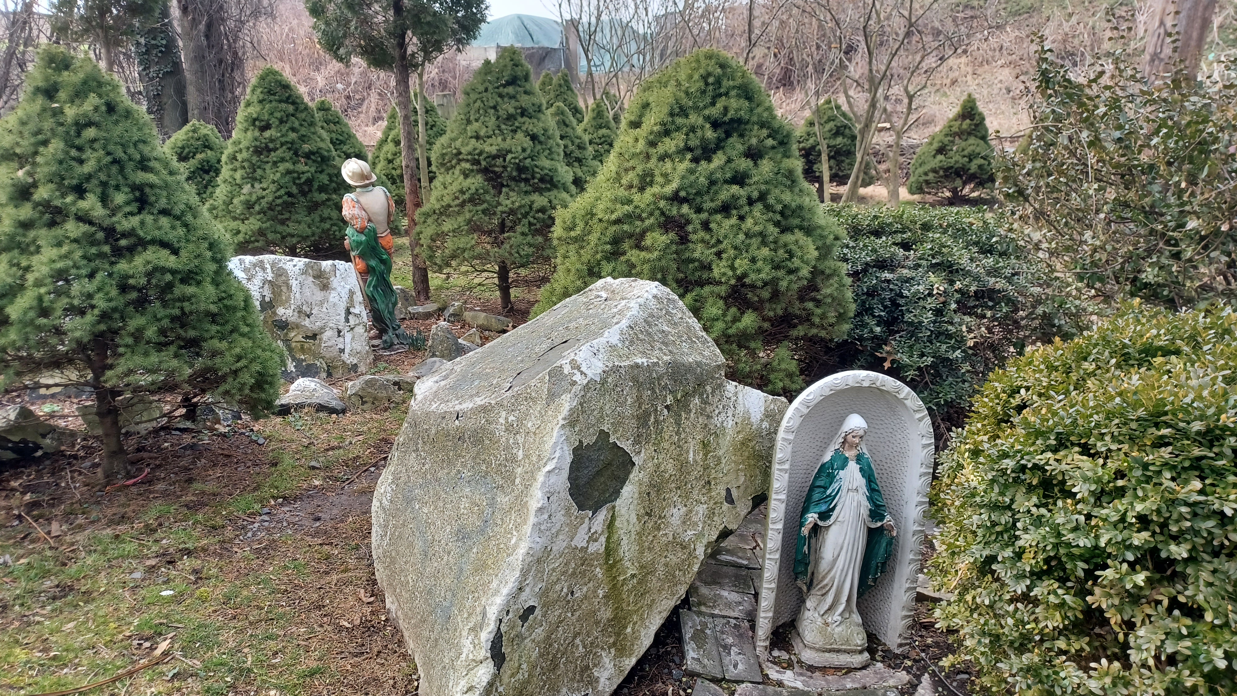
Just past this, there was an area between the apartments and the railroad tracks where pavers were laid out nicely along the earth, with ornamental shrubs planted within them, and then several statues.

There was one of the Virgin Mary, and one that looked like it must have been a Roman judging by the helmet, and I don't remember what else. It was just a sort of odd thing to see, especially with the pavers so lifted up and warped out of place.

We headed from here onto Lakeview Ave for a bit, and I was planning to follow it east out to Grand Ave, Rt 93, but then I noticed from the parking lot that there looked to be a good safe corridor next to the railroad tracks to the left of us. We headed north into one of the apartment parking lots for just a bit, ad then cut to the left from them out to the old Erie tracks. From there, we were able to just headed to the right a short distance and across a bridge over Flat Rock Brook to reach Cedar Lane on the other side.
This ended up being a really nice little detour.
Flat Rock Brook is another tributary that breaks off to the east, and passes through Flat Rock Brook Nature Center, which I've hiked through on different trails a couple of times.

When we reached Cedar Lane, we turned to the left, and there were old industrial buildings. These were built about 1900, and seemed to be for sale now for other uses. I'm not even sure what they used to be.
I couldn't initially find anything to said what they were, but I've not gone so far as to checking Sanborn Fire Insurance Maps yet.
I had wanted to go left on Cedar Lane, but when I was planning this, I noticed that the trail that crosses over the Overpeck Creek, which Google Maps has labeled as "Public Park Road", actually has a sign on it that reads "private road" in real life. I figure someone must have edited google maps just to mess with them. Fortunately, I found out about this debacle before I walked the entire group out that way.

Cedar Lane used to go straight on through to the west, from where we were in Englewood to Teaneck, but the road bridge on the original road alignment is no longer there. Apparently, the public labeled bridge is just a golf course bridge now.
We looked over maps for places we could stop to eat, and we were all pretty dead set on Mexican. We saw a place called "My Ranch Taqueria" and decided to try to head toward that. It was conveniently located right along the Overpeck Creek, so it seemed like it would be perfect.

We walked Nordhoff Place parallel with the tracks to the north, and then turned left on Sheffield Ave. We followed this to the end, and then turned right on Riverview Ave.
There was a good sidewalk there, which brought us north for a bit. Then, a footbridge crossed over the Overpeck Creek, which we used to the north.
The creek is a fraction of the size of the tidal thing we saw just a little earlier, but still interesting. It passes through these urban areas, and is encased in a concrete lined sluice.
The road on the other side, Windsor Park Court, came out directly behind the My Ranch Taqueria, which to our surprise, was just a gas station.

It really looked like they might have good food, but it didn't look like a sit down establishment with a Mobil Mart right next store to it, and gas pumps out front. We decided not to go there, and to try to find something else more appropriate to sit down in.
We walked along Rt 4 to the east a bit, which is a big, busy highway, and then took a ramp and steps down to Nordhoff Ave again, parallel with the railroad tracks. We had heard train whistles while we were away from them, so this section must be somewhat active, but it isn't much farther to the north.

Once we got to the bottom, we turned left beneath Rt 4. Luke was somewhere close by, and kept trying to catch up with us, but at some point he was running south when he needed to be running north I recall.

Once out from under Rt 4, we cut left across some parking lots and to some newish buildings that had several business in them including eateries.

We checked out a pizza place that looked really far too upscale for us, and prices looked out of this world, so we decided not to stop there. It was enticing because it was also a wine bar, but we weren't into spending a fortune on anything either.
We continued across the lot to Van Brunt Street, and cut across the lot for the Crown Plaza Englewood for a bit. Somewhere in this section, Sean was in touch with Cindy, and she met up with us after parking her car at one of the nearby lots. Together, we all continued to walk to the north.

When we reached Forest Avenue, we turned left a short distance, and soon returned to the edge of the Overpeck Creek. It was just above this intersection where the Metzler Brook joined it. The Overpeck was smaller than before above this point.

The creek was still hostage to the concrete sluice through the area, but they made for some interesting views. We followed along the right side of the creek for a bit into MacKay Park, and crossed 1st Avenue. After 1st, we passed a parking area, and then there was a footbridge over the creek. We crossed, and then turned left to continue along the side of it heading north. A good paved path paralleled it past ball fields, a tennis court, and then to a parking lot adjacent to an ice skating rink. We stayed along the creek through here, and then reached Englewood Ave beyond which the creek was not accessible again. We turned right, then left on William Street to the north. The Overpeck Creek goes underground through some of this area.

We turned right when we got to Palisade Ave, and then reached Taqueria Los Guerros on the right.

his would be our lunch stop, and it would be quite tasty. Ev was able to run around like a crazy boy while we were in there, which made it pretty good. We were able to sort of keep him limited to the rear of the venue as not to bother other patrons, but there weren't many. Most people seemed to be coming or going for take out.
Luke finally caught back up to us in this area, which was great because after hours of trying to reconnect, at least he got to join up with us for lunch.

Ev gets far too super excited and I couldn't get him to eat a whole lot, but he did have some.

We had a great meal, and then continued on our way, about one block to the east to Nathaniel Place.
This road intersected with Palisades Court with a parking lot straight ahead. We turned to the right and walked along the fronts of stores heading generally to the north after a slight bit of east.
Just a little beyond te end of the parking area, the Overpeck Creek emerged from its underground route into Depot Square Park. At this point, it was still encased in a concrete sluice.

Adjacent to the park was the handsome old Englewood Depot. This was on the same Erie branch we had been walking parallel or at times directly on for most of the hike.

This line was actually part of the Erie Northern Branch, which had been subject of hikes as early as the beginning of the year, when we walked the sections that are now Old Erie Path and the Joseph B. Clarke Rail Trail just over the NY line.
The line was active to the south of Englewood Station, but to the north of this site, it has been out of service for years.
The line was fully established by the 1880s, as a sort of cutoff to the original Erie Railroad which was established to Piermont by 1838. In the 1870s, it started as the Northern Railroad of New Jersey and extended north to the Erie old main line near Sparkill.

A subsidiary branch continued into Piermont in the early 1880s. The line was absorbed into the Erie system, and passenger service continued above Englewood until 1966.

I have been hearing some conflicting stories at to the future of this line. Some say it is to be reactivated for light rail service from its original terminus in Jersey City, or as an extension of the Hudson-Bergen Light Rail. Others say the Joseph B. Clarke Rail Trail is to be extended south to beyond the state line. I am inclined to believe it will be a bit of a combination of the two.
It is sensible to take the light rail as far north as possibly Northvale, and then have the trail extend just over the state line from the shopping center adjacent to it there. Actually, it makes sense to continue it all the way to Piermont, but I doubt we'll see that happen anytime soon.

The Overpeck Creek was only out from underground for a short bit in Depot Square Park, and then went back underground before the other side of it.

We exited the park onto Demarest Avenue, and then went into a Housing Authority property parking lot to the right of an apartment building. The Overpeck Creek emerged from underground once again there, and there was a grassy little greenway on the right side of it. We continued walking to the north for a bit.
Pretty soon, we came to a chain link fence over this greenway. It was going to be tough for me with the stroller to get over it unless someone were to help hoist Ev and the thing over, and I just didn't want to bother with it. I walked all the way back down to Demarest, turned right, and then turned right again onto West Street past a couple of buildings, and then there was a sidewalk that led down toward the Overpeck Creek again.

My plan was to use a pedestrian bridge over the creek on these paved walkways to reach the east side again. Some of the group scaled the fence, and we'd have to meet back up with them.
When we got down along the creek, I was shocked to see that the foot bridge was no more. The abutments were obvious, and it was recent enough that it was still shown on Google maps, but the bridge was entirely gone, the openings fenced off. We had to go out to West Street to continue to the north.
The creek actually came back closer to West Street anyway, so I suppose it was better off for the theme of my hike. When we got to Slocum Ave, we turned right, and then left on Pindle Ave to parallel the creek. It passed between and behind private homes to the north, so we couldn't see much of it here.

I had intended to continue walking north to the Winton White Stadium, the property of which Overpeck Creek skirts on the right side, but I opted instead to go up Hamilton and out to Dean Streat, because the Northern Branch of the Erie very closely parallels it. It is such a nice walk, because although it is technically out of service rather than abandoned, it is basically a rail trail right now. There is a wide, well worn path on the right side of the tracks heading north, and we were easily able to just walk along that for a good distance. I had seen this when we started off, during the car shuttle, and figured this would be a great segment of the hike.

We started following the tracks, and then crossed over the Overpeck Creek on the old rail bridge. On the other side of that and Dean Street, the creek enters the Brookside Cemetery, which it had been my intention to walk through.

However, when we got here, there were fences around the cemetery, and I decided we didn't need to try to force our way into there if there was only one way in and out and we might get stuck.
The Overpeck Creek splits in two up the hill from the cemetery, and the shorter east branch ends up in a very small preserve known as Churchill Nature Center, which I've never been to. The longer north fork goes further up into Tenafly and ends in a small community apparently as a simple spring.
We stopped following Overpeck Creek here, and continued on the Erie Northern Branch from this point. My original plan had been to go up through Brookside Cemetery, and then take to streets briefly, and continue to descend through Mt Carmel Cemetery, but we never got around to it. We didn't need to because we'd earned enough bonus miles right from the start that it put us at higher mileage than I'd anticipated being by this point.

The tracks remained parallel with Curry Ave for a bit, and then we crossed Hudson Ave at grade ahead. Ivy Lane came next, and there was a near perfect parallel path to the tracks, natural surface, worn down, all the way to Westervelt Lane.
From that point, it started getting a bit more grown in. The tracks went into a bit of a cut, and it was no longer possible to walk anything worn down along the sides of the tracks. I had to put Ev's stroller right into the gauge of the rails and push him over top of the ties through slight woods to the north.

Amazingly, this wasn't all that hard. So many years of silt and vegetation had come through, and people had been regularly walking between the tracks, so it was worn down enough, but also not grown into. It was only somewhat bumpy going over the ties because they were now pretty much flush with the ground.
The next road crossing was getting close to the end, as we approached the old Tenafly Station.
This beautiful sort of Gothic Revival station was built in 1874, and is just amazing. It now houses the Cafe Angelique. I understand that if the light rail does take over the line, the train would still come through, but the borough of Tenafly voted against having a station stop in their town.

It's probably a foolish move considering the train might come through anyway. Missing the town is really potentially missing out on opportunities.

The station is now Cafe Angelique. I looked for some historic photos of the station so that I could set up some then and nows, but amazingly didn't find any at the time.
We only had to walk a little further, across Hillside Avenue to Jay Street, and the Stop and Shop was right there on the left. From this point, it was only about six more miles to the Rockleigh area where I'd already walked it the remainder of the distance to the north. I'd really love to get in there and finish hiking the entire branch. I need to more closely parallel a bit more of it to the south as well, which will be a good Winter hike, but that will be for another time. It might be the next little branch thing I set out to complete in the near future.

We reached the parking area, and Jen took Ev and I back to my car at the starting point to finish off another really great day.

We had pretty much done all of the Overpeck Creek, and the next hike in the series would put us on the Hackensack River itself, as well as some of the other Overpeck area stuff. There's so much more to see throughout this entire area, and the Hackensack River basin is rewarding to learn about. In a lot of ways, I'm very surprised that this series hasn't taken off more like some of the other past ones I've done. I suppose we're still coming off some of the pandemic craze and people aren't ready to be out in groups, or they're more inclined to go on trips that are place names they recognize. Still, the momentum of the Metrotrails online presence has been growing greatly, so hopefully attendance too will pick up with it.
No comments:
Post a Comment