
Hike #1119; Shoemakersville to Reading
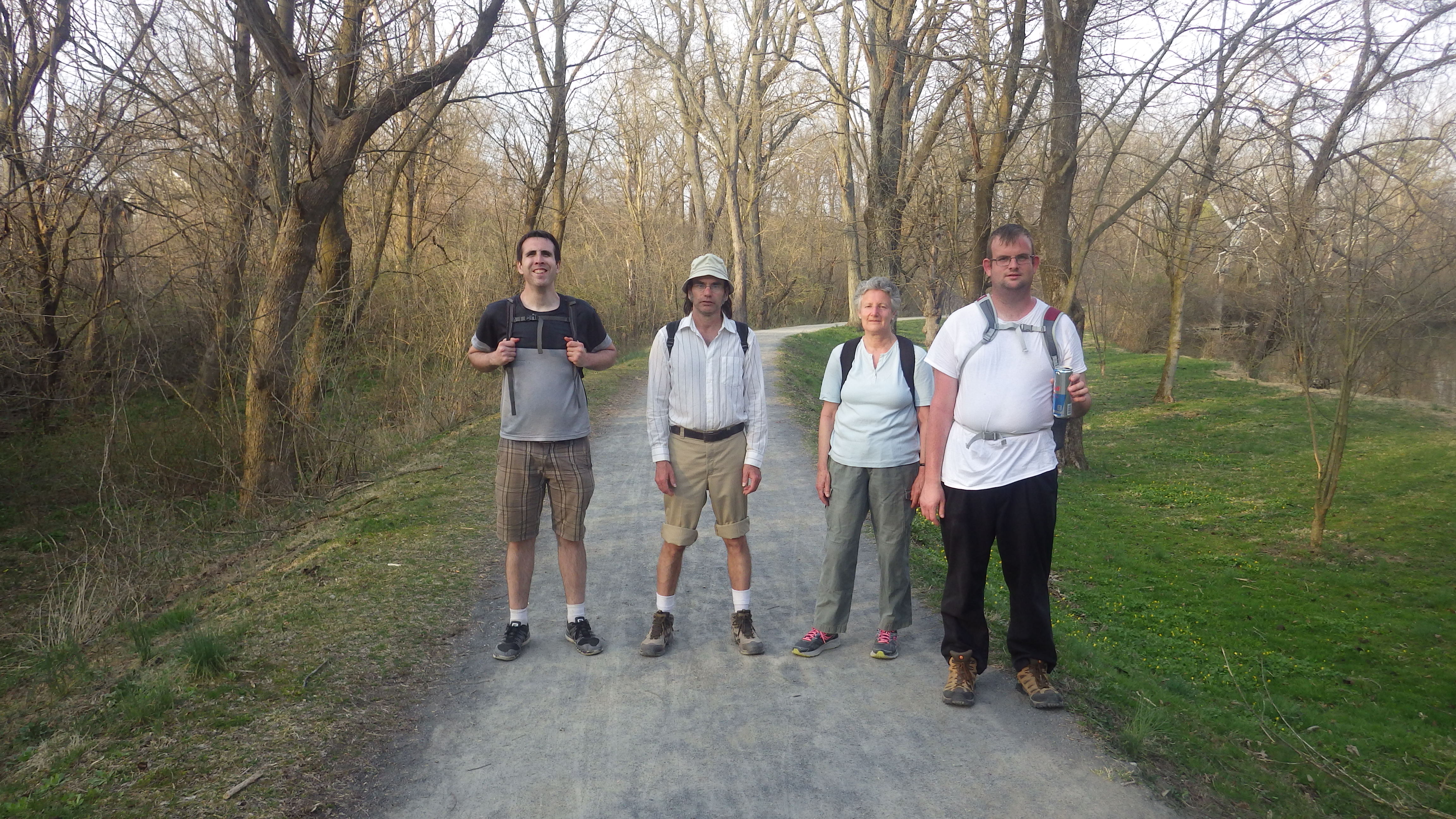
4/14/18 Shoemakersville to Reading with Jim "Mr. Buckett" Mathews, Eric Pace, James Quinn, and Robin Deitz.
This next hike would be the 26th in the 911 Memorial Trail series. I was feeling like this would be the last easy one for me to scale off before moving west, because once the trail got to Reading, the designated route was all road walking.

The 911 Trail route completed thus far
Very straightforward, the route was simply the Schuykill River Trail route. It was the section I was looking forward to the least, because it was the section most heavily reliant on road walking rather than on trail stuff. Previously, it followed a lot of the Schuykill Branch of the Pennsylvania Railroad, but that became active below Hamburg.

Shoemakersville Station on Pennsylvania Railroad
The last hike found us walking the road, or parallel tracks, which gave us some good views of canal remnants, for the latter portion of the trip. I was thinking that would be the entire hike this time. In some ways I was dreading it because the forecast was showing that it would be terribly hot.
I didn’t know it, but it turned out that the route would be so much more interesting than anticipated, and people dropped out up to the last minute.

Historic image of Shoemakersville Station
We met at our end point, in Reading PA. It’s amazing to me that I’d never done a hike through Reading, which is quite a famous and historic city on the Schuykill.

Shoemakersville Station today
I tried to make the mileage work out just right, and so I found a parking spot on street we could use as out end point. I chose a generic location, a 7-Eleven mini mart, to be out meeting point. Meetup.com had messed up their platform where I can no longer drop a pin for a meet point, and so I need to use things that have regular addresses to meet.

Schuykill Canal and Pennsylvania RR station
I made great time getting to the point, but it was already hot when I arrived. I decided to take a drive and see if I could find some kind of wide brim hat so I didn’t get too burnt.

Sheomakersville Station and canal site today
I ended up finding a Dollar General or something a couple of miles away on the opposite side of the Schuykill, and managed to find a cheap floppy boonie hat that would suffice.

Shoemakersville Station
I then headed back to the meeting point. Mr. Buckett, Eric, and Robin all showed up shortly. James ran a little bit late, but got to the same point as well. We used my van to get to start.

Former Schuykill Canal route
We needed some more refreshments before starting, and so we stopped by the Sheetz where I’d met the group for the previous hike to get water and snacks. We then shuttled into downtown Shoemakersville where we parked on Main Street, at about where we had parked for the previous hike to the town.
The Schuykill Navigation System’s canal section was just below us at this point, but rather developed over so we couldn’t at first recognize it. We continued a short distance to 4th Street where we could see the Pennsylvania Railroad Station on the old Schuykill Branch. We’d seen it in the dark last time.

Schuykill Canal in Shoemakersville
The canal once crossed just to the west of the station, and was sort of recognizable.
On the west side, the canal bed was seen in a yard. This area was just barely south of Lock #33. The Schuykill River Trail continued down Main Street at this point.

The old canal
Shoemakersville is a neat little former industrial town, ironically named for a family that was involved in shoe making of sorts, and had it for a last name, Henry and Charles Shoemaker. Some of the old buildings on the street still bore some of the old paint advertisements on their brick edges.
To the west, the canal crossed over the Pigeon Creek on an aqueduct parallel with the railroad tracks.

Old adverts on buildings
It was already deathly hot by this point. It was to be over eighty degrees, and there was not yet any leaf cover from the trees. Walking through town was rather brutal, but we soon moved on to where Main Street changed names to Mohrsville Road. I was concerned that we might be missing some new trail section, because there was no Schuykill River Trail signage, but then Eric spotted one a bit further down the road, and we continued.

PRR L-1 No. 1299 at Glen Gery (looking south) near Shoemakersville, Pa. after she broke an eccentric rod and made an emergency stop at the switch on August 15, 1952. (Robert Wanner Photo)
There were trees lining the left side of the road, but the area had no trespassing signs everywhere. That was too bad, because soon I saw good canal remnants.

The trail continued to follow the road past the wooded section and we could kind of make out some canal remnants in the next couple of yards to the left. I think it moved on away from the road a bit more over to the left of us as we headed to the south.
Somewhere in this stretch were the former sites of Locks #34 and 35. This was original a combination of four locks, which were eliminated with one of the upgrades for only two.

Locks 34 and 35 on Schuykill Navigation
The combination of the two locks was 21.9 foot lift. We continued to walk south on Mohrsville Road toward the settlement of the same name.

Pennsylvania Railroad Schuylkill Division Mohrsville Station Platform behind station. (69.5 mile mark) (Ben Bernhardt Collection)
The site was also a station stop on the Pennsylvania Railroad, but the main settlement was apparently on the west side of the Schuykill River.

Mohrsville
There were definitely some historic buildings on the east side where we were walking, and one of them was probably a hotel associated with the canal.
We could see in backs of the buildings as the old canal started making it’s way out closer to the road again.
I have no idea about the history of the town or how it got it’s name. My Schuykill Canal book doesn’t seem to mention it, and nothing even comes up on Google.

Former canal route seen in Mohrsville
We continued along the road, and then saw a sign for Schuykill River Trail pointing us to the right, across the river on Main Street to the west side of the Schuykill.

Schuykill at Mohrsville
I was kind of disappointed because on the other side we would miss more of the remnants of the Schuykill Navigation, but it ended up being a pretty good walking route anyway, save for the awful sun beating down on us.
We had some good views of the river as we went across on a very new bridge. I’m not sure exactly when, but very recently this bridge replaced the older beat up one, which had a wooden deck walkway beside the road.

Reading Railroad coal treste
I kind of wish we could have seen the original bridge, but oh well.
We continued across to the other side, and soon came to an abandoned old coal trestle on the left. This was part of the Philadelphia and Reading Railroad, which is still active adjacent to the trestle.
The Reading line was originally constructed as a horse drawn railroad, and evolved into the largest company in the world by 1871. This main line was double tracked by 1843, the first railroad main line to ever do such a thing.

Coal trestle
The Reading ended up in control of the Anthracite mines, as well as Port Richmond on the Delaware. With ownership of both the product source and railroad, as well as the port, the Reading Company was the very first conglomerate.
Mohrsville on the west side of the river also had a station on the Reading line, but it no longer exists. It probably stood in the vacant lot to the right across from the coal trestle.

Mohrsville Station; Edward H. Weber Collection
At this point it had gotten brutally hot out. We paused by the coal trestle, and could see the next Schuykill River Trail sign pointing us to the left, slightly up hill away from, but parallel with the railroad. The road was called Railroad Road.
We continued over the active tracks and made the left, and there was absolutely no shade. I got out the floppy hat I had purchased before the start of the hike in this section.

No shade
We had a little bit of a view to the east from the height of the land. It was kind of a miserable section.
As we walked, I had a good conversation about food with Robin, discussing some of the things she’s heard about bad foods, and stuff I’d been looking into recently involving Doctor Steven Gundry and a book he’s got called “The Plant Paradox”. Apparently, a lot of things considered to be healthy in the past, according to Gundry, are terrible. Things like whole wheat bread and such.

Still no shade
Of course, corn, which doesn’t digest is on the bad list, as well as many other surprising things like tomatoes. Apparently they’re alright if the seeded sections are removed. These bad things are called Lectins.
A lot of other foods that were considered to be healthy apparently are chock full of them including red kidney beans, soybeans, peanuts, and potatoes, as well as anything with wheat. Surprisingly, I think cashews or something were supposed to be great while peanuts were not.

Nice farm view
If on this diet, only a little amount of cheese would be allowed, which is just a tease, and Robin and I both agreed we could not live without cheese, and we’d likely eat quadruple the servings permitted.
Still, Gundry claims he can cure things like Diabetes with diet if they can adhere to the regiment.
We continued to follow the road over the hill and had some really fantastic farm views to the southwest. The one farm had an interesting mail box.

Nice farm view
It was made up to look like a barn silo, but it was actually an old hot water heater.

Hot water heater mail box
We headed down hill from this farm on Railroad Road to the intersection with Grove Road. Railroad Road continued to the left, taking us gradually down hill into lightly residential area.
At the bottom of a hill, we made a hard right in the neighborhood, and soon crossed over the Irish Creek on an open grate bridge.
To the right of the bridge, there was the ruin of an old dam on the creek, and former pond site, but now the dam was purged.

Farm views
We were now coming into the village of Dauberville. This is another historic town that was settled in colonial days. Improved roadway system was developed starting in 1745.

Bridge over Irish Creek
By 1805 a road company was formed to connect Reading and Sunbury via Maiden Creek and Hamburg. This roadway would be a toll road, and evolve into today’s Route 61, or Pottstown Pike. The road was known as Centre Turnpike and remained a toll road from 1812 through 1885.
The Schuykill Navigation began development in Leesport in 1822.
Leesport itself started with the Philadelphia and Reading Railroad layout in 1835.

Former Irish Creek dam
A man named Samuel Lee purchased about seventy five acres of land on the east side of the Schuykill with the purpose of setting up building lots that’d benefit from the railroad.

Schuykill at Leesport
However, when the railroad was finally built through the area in 1842, it was on the west bank, and so West Leesport grew around that, but both sides prospered.
We continued to the intersection with Belleman’s Church Road and turned to the left.
I figure the Belleman’s Church they may have been referring to was the former church turned beauty salon on the corner at the intersection. We turned to the left here, and crossed over the former Reading Railroad tracks about where the station used to stand.

Love in Daubersville
I felt certain that the trail was going to take us just briefly on this road, and then turn us to the right on Schuykill Hill Road, a very small road on the west side of the river that led all the way down to the main center of West Leesport. I think the trail used to do just that prior to new developments coming up ahead.
I was kind of sad at first that we wouldn’t be walking Schuykill Hill Road. There was a sign saying no through traffic because a bridge was out or something, so it promised to be a pretty route.

Pennsylvania RR Leesport Station
We could see the Pennsylvania Railroad tracks ahead as we walked across the bridge over the Schuykill River yet again, with more lovely river views.

Schuykill Canal
To my surprise, a new section of trail had recently been developed that was not shown on the regular Schuykill River Trail maps, and didn’t show up on Google maps either.

Schuykill Canal
The trail was beautifully right on the Schuykill Canal towpath. The prism of the old canal was cleared of most brush, and new fences were installed, as well as vehicle barrier bollards. There still wasn’t a ton of shade, but this was already making our route a lot nicer.
We walked the nice towpath section to the south, which led us out to Walnut Street. From there, the canal itself was mostly filled in, and has been since the 1950s, but we could easily parallel it on Canal Street.

The canal in Leesport
The section ahead was pretty interesting. We were able to closely follow where the canal went, through the grass in what was the prism. There were stone walls lining the east side of the former canal, in interestingly deteriorating condition. The rocks almost appeared to be melting, all angled up and down in ways certainly not intended during navigation. It seemed like they must have been laid without any sort of mortar.

Along the canal in Leesport
We also came upon what I thought must have been a lock site, but reading into it I find that really only Locks 36 and 37 were in Leesport, for a combined lift of 21.87 feet.
The ruin must be either an old bridge abutment, or otherwise the ruin of earlier locks. Originally, the Schuykill Navigation has a series of four locks in steps in Leesport, but during the 1846 upgrading of the canal, they were switched to two. I suppose maybe they could have had the locks farther apart and this could be a remnant.

Not sure what this was...
We continued through the grassy former prism along Canal Street to the intersection with Shackamaxon Street. From there, we turned left briefly, and then right on more of Canal Street, this time up hill and parallel with the opposite side of the former canal.

Leesport Lock House
The canal bed was now in people’s back yards below us.
We came to the intersection with Wall Street, where there was a little park and a tree stump carved out to look like mushrooms. We turned to the right here.
As we headed down hill, a beautiful old stone building came into view. This was the Leesport Lock House, in beautiful state of repair. Unfortunately, it was not open for tours on this date, so we couldn't’ go in.

Locks 36 and 37
When I looked to my right, I was absolutely delighted to see a remnant of Locks 36 and 37 still there and accessible, complete with one of the sweeping stair cases.

Locks 36 and 37 today
When I was reading into the Schuykill Navigation just the night before in “The Schuykill Navigation: A Photographic History” by Harry L. Rinker the night before, I was thinking how sad it was that these amazing stair cases would all be gone when we’d walk by.

Historic remnants
So, to see some of this still intact was quite a thrill for me to see. Of course, we walked over to it and had to walk up the stairs to the top.
When I got to the top, I could see the lock walls were still intact, but they were filled in to the top like so many of them are.
The plaque reading the contractors’ names as well as the 1846 date was still in quite good repair. The lock house too, built in 1834, is in great shape.

Filled in locks
I walked up the steps to check out the top of the lock area. It was cool to see that the lock walls were all still in place, but had just been filled in.
We headed down from there and passed the lock house. We’ll have to come back on another trip when it’s open.
We headed out to Wall Street and left the historic canal route for a bit, and reached the Schuykill River. The bridge was out, but they had put in a temporary pedestrian bridge in it’s place, just to the left. We crossed and continued.+

Leesport Lock House
On the other side, the signs for Schuykill River Trail pointed us on Schuykill Ave heading parallel with the river down stream for a bit through West Leesport.

Temp bridge
We continued to turn onto Washington Street to the south side of town, across from some ball fields and such. My maps all showed that the trail simply followed roads through this stretch, but I was very happy to see that the trail had now been built off road, as a sort of gravel path going out across and open area and then entering the woods to the east, more closely parallel with the Schuykill River itself. We started following it down stream, and came to a former bridge site where only piers and abutments remained.

Old bridge site
It looked like this must have been the continuation of Orchard Road from the other side, but I later found out this was probably a spur branch of the Reading Railroad to the other side, but it didn’t really go much further. There was a Pennsylvania Railroad connection though.

Mosalem Branch
Apparently the Mosalem Branch crossed the river at about this spot. It was originally a covered railroad bridge built in 1872, and was replaced by a more modern one in 1931.
It was abandoned in the 1930s, although the original intention was to take the line across to iron mining interests in the Mosalem PA area, but the later Schuykill and Lehigh Branch reached that point, and this branch never needed to be finished.

Lock 38
I was really happy to see this section in place. I wasn't expecting it to be a good bit, just another long section of road walk. It made it so much better.
We continued walking along the waterfront until we came to the next surprise: the remnants of the Schuykill Navigation's Lock #38.
I was delighted again to see such a great remnant in place and open to public. The trail came out to the top of the lock, which was all filled in, but still retained a good amount of historic integrity. This was a perfect spot for a break.

Lock #38 was also known as Duncan's, Buck's, Herbine's, and Meyers Lock. This was the end of a slack water section of the canal in the Schuykill River, in a pool that was witheld by Herbine's Dam just up stream. The lock was blocked by a stone wall about 1931 when it was abandoned, and then the entire lock was filled in in the 1950s when herbine's Dam was removed.
The Hamburg Canal section ended in Leesport, and was followed by the slack water section. Apparently there was a wire ferry or something to get mules across the river, and then there was a change bridge at the bottom of the lock to carry the towpath.

Lock 38
Lock 38 was different than other locks in that it was a combination lift lock and guard lock rather than two separate locks to do each job. The lift was only 1.5 feet, but the lock had high sixteen foot walls in order to protect the canal down stream from Schuykill flooding.
The Schuykill Navigation was roughly half and half canal and slack water, and each canal section, which were often called "reaches", were given separate names. Above Leesport was the Hamburg Canal, and the section down stream from here was known as the Duncan Canal.

Historic undated photo of Lock #38
While taking our break, James played with is app and speaker with the fart machine sounds on it whilst Mr. Buckett ranted about poop type of stuff, which was quite funny.

Lock #38 today
Unfortunately, our trail section ended here, but it still wasn't bad. The Schuykill River Trail, in this rerouted section followed along Washington Road, which was closely parallel with the former canal. It was a particularly great road because it was dirt surface rather than pavement.

The Duncan canal section
We walked it for a bit, but then I realized that it was pretty clear in the former canal prism adjacent to us, and we decided to go over and walk in that instead. We followed it for as far as we could, but then it went into a private yard. We turned back slightly to where we could get back up to Washington Road and made our way out.
The road took us around a corner and past some lovely old farm houses, over a pretty little brook, and past some sort of old root cellar or something. The road turned from dirt back to pavement, and turned hard right twice. First away from the canal, then second after the brook crossing. It then came to a huge old railroad bridge for the Reading line.

Reading RR underpass
We would not see much of the Schuykill Navigation again until the end of the hike, as it goes into too much private land, but the long term plan is that the Schuykill River Trail will eventually follow it more closely. There are some more locks and cool remnants down there.

Schuykill Navigation passing beneath Reading RR
The bridge we walked beneath for the Reading Railroad had a weird design with sort of circles and half circles built into it. South of where we would be, a similar bridge known as the Peacock Lock Viaduct carries the Reading over the Schuykill River, as well as the former canal. Maybe we’ll get to see that another time hopefully.

Schuykill Navigation near Reading
After passing under the bridge, the trail route took us along the road out to Cross Keys Road, in a pleasant little area with historic farm homes. We turned right on Cross Keys Road, then turned left on Rickenbach Road. It took us a bit up hill with some more nice farm views, then out into more open sun, which was by this time even more brutal than before.

Historic postcard image
We went down a nice little hill near the area where the historic Stoudt's Ferry used to be over the Schuykill, and later a burr arch truss covered bridge built in 1857, and collapsed 1948.

View along the way
We headed down hill a bit, then up to West Leesport Road, which was the earlier route of the Schuykill River Trail I had been prepared to walk as per my maps. This was a busier road, and by far the worst part of the hike, but we made the best of it.

Jesus stuff
We turned left and began following it up hill. It seemed steep, and it was really hot. Robin and I moved quickly up the hill, but we had to wait for the others to catch up. We powered our way to the top and waited where we had a little bit of shade.
Once they were up, we continued a bit more, and there were some views of the town of Temple to the east of us through private lands.

View to Temple
We soon came to the big Epler's Church Cemetery. It was really pretty, and it wasn't the road, so I decided to take a walk out into it. There was a sort of meditation maze in the back, but no one wanted to fool around here. I headed back across the cemetery toward the church.

Epler's Cemetery
There were some very old tomb stones as I got closer to the building. Some of them were just old field stones with barely discernible numbers on them. I couldn't really tell what the date was on some of them.
We moved on past the church sign, which had "YOLO LOL JK BRB JESUS" on it, which almost looked like a joke. When Jillane saw that I posted the picture, she thought that someone in my group had done it.

Yolo
The Schuykill River Trail continues along roads through the village of Leinbacks on Leesport Road, and then takes Rebers Bridge Road to the Union Canal Trail, but Leinbachs was going to be where we'd have our lunch stop.
We continued down West Leesport Road until we got to an open park type field behind Bern Township Police Department and headed in a southeasterly direction. We passed by a little pavilion and then crossed Old Bernville Road. There was a Harley Davidson dealership across the street, which we crossed through the lot of where they were doing some sort of demonstration runs. We probably looked like a lot of oddballs. I at least wasn't wearing my suit and tie because it was too hot for it this time.

Mr. Buckett eating ice cubes
We crossed another grassy swath and then made our way to a bar and grill called The Hitching Post.
I don't know really anything about the history of Leinbachs other than that it was a rather insignificant farming community that has grown a lot in recent years due to it's proximity to Blue Marsh Lake and the Reading Regional Airport.
We sat down at The Hitching Post, in a rather dark ambiance with almost no other patrons around. I seem to recall it being pretty enjoyable. I don't quite remember what I had to eat though. I think it was an entree rather than just a burger or something. I also tried some weird beer I recall.

At the restauant
It was quite a bit cooler inside, so I don't think any of us were in a big hurry to get out of there.
Still, we had a long way to go, so we started moving. To avoid walking the main roads, we went through a Volkswagon dealership, crossed Rt 183, then walked through a church property to get out to County Road. We then walked steeply up a grassy hill to reach a Bern Township Park. We walked across the open fields of this rather than ehad out to Rebers Bridge Road directly because it was nicer on the feet.
We eventually headed up to Rebers Bridge Road and followed it to the west, then turned left on Hilltop Road. Rebers Bridge Road then continued after a short distance to the right, down hill to the Tulpehocken Creek and the former Union Canal. The last section of the road was pretty busy, but we managed to not get flattened, and the canal towpath route would be extremely nice.

Rebers Mill Covered Bridge
There was once a covered bridge spanning the Tulpehocken Creek where we were heading, but it’s been long gone now. It was built in 1850 but not sure how it was destroyed.

Map of Union Canal
I'd hiked the Union Canal in places in the past several times. I'd done part of it up out of Pine Grove where it's feeder ended, and in the Swatara Gap with it's giant lock. I'd done a short section of it where the Horse-Shoe Trail was co-aligned with it.

Union Canal
I'd been to the western terminus of this canal in Middletown, where it joined up with the Pennsylvania Canal along the Susquehanna, and I'd been to a couple of other little places that had something to do with it that I can't even remember.

Union Canal
Still, I never felt like I had a real introduction to the canal because it was always these sort of isolated things. This would be part of a better series to hike the entire canal's length.
Not a lot is really said about the Union Canal, but it was no small thing. In fact, I had read that it was the first canal in the US to begin construction, and that President George Washington turned the first shovel of dirt for it.

Patriotism on Union Canal
The route between the Schuykill and the Susquehanna was 81 miles long with 93 locks. Additionally, the 22 mile long feeder canal was also used for navigation and had 14 locks of it's own.
For a time, towns and businesses prospered along the canal. Civil War veterans found jobs on the canal.
Like all of the other American Canals, the Union Canal was too late on the scene to really be profitable. Like the Lehigh Canal, it was severelyd damaged during a flood in 1862. Repairs and maintnenance were costly, and the arrival of more railroads took away canal business.
Despite the fact that it was the first canal started, it was among the first abandoned. It closed by the 1880s (sings read that it closed diferent times).
It's amazing anything still exists of this old canal at all heading into busy Reading PA, however the section is probably the best preserved of the entire length, save for maybe the tunnel mid way in Lebanon. The Union Canal Tunnel was the second one I believe, after Auburn Tunnel on the Schuykill Navigation, and remains the oldest transportation tunnel in the US.

One of many mills on the Union Canal
The Schuykill River Trail follows the Union Canal for now, from the road crossing down into Reading. Eventually the plan is still to have the Schuykill River Trail remain on the Schuykill River, but for now they don't have that route.

Union Canal Lock #47 East
Robert Thomas, a planner for Pennsylvania trails, had a long phone conversation with me and told me of some great plans coming up for the trails.

Lock #47 East
Some of the local politicians were worried that if they moved Schuykill River Trail, something bad might come of the Union Canal, but that shouldn't be the case since it connects with popular Blue Marsh Lake.

On the towpath
We started walking the canal towpath down stream. It was really a great little section. It was too hot to just go on, so as soon as I saw a good spot to take a little break, we went down to the Tulpehocken Creek and I took a dip. This was really the first time of the year that I'd layed down in the water to cool off. It was totally freezing, because we'd still just had snow not too long ago, but the air was hot and I needed it. The others washed their feet off a bit, but I was the only one to submerge myself.
We continued back to the towpath and made our way to the surprisingly nice remnants of Lock #47 East.
Like the Morris Canal in NJ, the Union Canal had it's locks numbered up in either direction from it's center point near Lebanon. 47 was really nice because at some point they decided to rebuild the old miter gate lock doors. It was pretty beat and they weren't looking great, but it was nice that effort went into trying to make the site look authentic again.

Van Reed's Bridge, built in 1837
I soon checked out an abandoned bridge site to the right of the path, complete with pavement right up to it, but I can't figure out what road it used to be, but I thought it might have been Paper Mill Road. It turns out it was the site of Van Reed’s Covered Bridge I think.

Van Reed's Covered Bridge site
This bridge was built in 1837 and was said to have spanned the creek near a present day paper mill site, which I think is where we were when we passed the site.

Lock #48 East
We continued on the trail on the towpath and passed beneath Rt 222. At some of these points, the trail either wasn't directly on the towpath, or it was sort of close to it. We passed by one spot where there was the ruins of a more recent building in the weeds. There were also some older foundations along the way, but these might not have been lock houses because the next lock we passed was #48 east. There was a nice house on the hill behind it, and the lock house foundation ruins were marked by an historic sign.

Wertz's Red Bridge
Below the lock site, the canal prism remained clearer than it previously had, and even began holding a bit of water. We made a corner, and soon reached the view of a lovely red covered bridge, known as Wertz's Red Bridge.

Wertz's Red Bridge
We see covered bridges all the time, especially in Pennsylvania. Berks County alone was once home to 37 covered bridges, but only five, including this one, remain today.

Union Canal near Red Bridge
This bridge was something special. Built in 1867, it is still the longest single span covered bridge remaining in Pennsylvania, with a burr arch design.
Robin and I went up to the top to check it out. There was an old historic farm house of sorts, and we had a look inside the bridge, which was in good repair.
We continued walking from the covered bridge along the old canal towpath. The road there originally crossed the canal on a wooden farm bridge, but it's all filled in now. The canal was not so recognizable on the other side, but the towpath remained at a greater height than the surrounding land and was therefore recognizeable as such.

Lock #49 East
We passed back into more woodlands and remained close to the Tulpehocken Creek in a narrow gorge area. After a bit, we came to the next old lock site, Lock #49 East.
The stone work of this lock was in far poorer condition than the previous ones we had seen. They must have been flooded over a lot.
We emerged from the wooded section to a wide grassy area with homes on a hillside, and a larger recreation area to the right. This was Gring's Mill Recreation Area. The towpath sort of ended and it became part of a wide open lawn area where it apparently had been filled in.

Gring's Mill
We walked through here, and the historic mill building could be seen across the Tulpehocken. There was a concrete bridge over the creek and some sort of gate house next to the dam there, with an underpass for the trail to continue. There really wasn't a trace of the canal at this point.
On the north side of the canal route, there were some old homes that looked kind of German or Pennsylvania Dutch in style.
After we passed beneath the bridge, the towpath and canal began to look like a canal again, although not watered and somewhat silted in.

Union Canal
We continued along the creek, which went through a narrow valley area heading to the east and south alternating.
After a bit, a trail turned off to the right. It crossed over the Tulpehocken by way of a prefabricated metal bridge on a berm. To the left of this was the trail we remained on. In this area, the Union Canal used to cross to the other side of the Tulpehocken by way of slack water I believe. We took the trail to the left, which took us right through an old lock site. Like Lock #49, the stone work on this one was badly deteriorating, but it was still obviously a lock. I believe this must have been Lock #50, but I'm not totally sure.

Lock #50?
We continued to walk along the path below the lock, which must have served as some sort of guard lock as well, and came to an old stone bridge abutment.
The abutment was that of the mule bridge which carried the canal towpath across the Tulpehocken to the other side, where boats would have crossed the slack water above a dam. This was also the site of Lock #51 East.
We continued on the path that continued along the north side of the Tulpehocken, because there is no trail that continues on the south side where the historic towpath would have been.

Mule bridge site at Lock 51
There was an historic home on the opposite bank which is now run by the park police for the county. We also saw footings for a bridge that once spanned the creek coming from where present day Resh Avenue is on the opposite side.
The trail continued on and was quite pleasant. We passed beneath Route 12, and then entered the Stonecliffe Recreation Area. The trail continued along the creek through this open picnic area, and a wide grassy swath remained to the left of us. Anotehr path was just off to the left, and we could see an underpass beneath the former Reading Railroad.

Along the trail, some ruins
We continued closer to the river, and soon we too were passing beneath the former Reading line. There were abutments of a predecessor bridge next to the current one, which were re-purposed for the telegraph poles after it's abandonment.
After passing beneath, we continued on the trail a bit further to the Bushong Dam. This wide, twelve foot high dam was created about 1892 for power for the Bushong Paper Company, and in recent years has been the topic of debate for removal.

Ruins along the trail
While the DEP of Pennsylvania claims the dam is in no danger of collapsing, the city of Reading is afraid someone might fall off of it, so they voted to have it removed I believe in 2015. I was glad to be able to see it before any of that work is done.
There are a lot of industrial ruins along the raceway there, and I had thought this was possibly something to do with the canal at first, but then realized it was not. This was just a later development that came along shortly after abandonment of Union Canal.

At the paper mill site
To my surprise, some of the buildings are still standing there, right along the trail. They are all closed up and can't be entered, but brings an interesting ambiance.
The mill race had quite a great deal of metal infrastructure in place that made it quite interesting, and the old paper mill smoke stack was still intact there.
Down stream from the Bushong Dam was a pier in the river, which I found was actually the site of Bushong's Bridge, which was built in 1866. It connected the Glenside section of Reading to the Berkshire Heights section. I'm not sure how the bridge was finally destroyed.

Historic image of Bushong's Bridge
This was my first time ever really hiking into the city of Reading. I'd always wanted to do it, but in the past my only experience with the town was simply driving through or stopping at a store or two. This time I finally experienced some of it by foot, and this was a great little introduction.

Schuykill River with Union Canal on one side, Schuykill Navigation on the other
After the Bushong Mill ruins, we continued along, and the trail route took us to the left, parallel with the Schuykill heading up stream a bit. We weaved around high up the slope above the Schuykill, just beyond it's confluence with the Tulpehocken, and watched to the other side. We could see a trail over there, part of the subject of our next hike. There were people walking it on very nice sections along the river.

Schuykill Navigation and Union Canal on either side of the Schuykill
We continued as the trail soon paralleled closely to Blair Avenue, and then spilled out onto it. There was a little bit of a turn off built on the trail, like they planned for it to go on through an industrial area ahead, but it was never built. The official Schuykill River Trail roue from here continues north on Blair Ave. We didn't have very far to go from here, as we were parked on Blair Ave.

Bushong Mill Stack
We could easily pick up here where we left off for the next hike in the series, or cover one of countless other interesting routes in the area to make it more interesting.
This was sort of a point of indecisiveness when I finished this one. I didn't know really where to go with it. The "official" 911 Memorial Trail, as per the official website, leads west through the farmlands and picks up Lebanon Valley Rail Trail and such, heads to the Susquehanna, and then goes north through Harrisburg. There would be at least two, probably three hikes that would be nothing but road walking if we followed this route, and it would happen in the middle of the Summer. I knew that would ruin any and all interest in the series, because there were no swim spots and no shade.
The Lebanon Valley Rail Trail is nice, and there's only a short bit of it I haven't done. That would be fine. However, when we got to Harrisburg, we'd have more problems. Heading north, pedestrians are not allowed to walk what the map shows as the official route through the Dauphin Narrows. Even more long road walking would be necessary to get around that, and it would be a not very good route. Also, I had already walked most of the Capital Greenbelt and Lebanon Valley Rail Trail anyway.

Old mill site
After the hike was over, I was fortunate to connect with Robert Thomas, one of the planners involved on the Pennsylvania side, and he gave me some very wonderful information on what to do for the upcoming hikes.
We have a lot of options on alternate routes to take for the trail. One of them was the Horse-Shoe Trail to Lebanon Valley Rail Trail, but I've already done just about that entire route as well. Others include the new Highlands Trail connections to Birdsboro Waters and French Creek State Park.

At Bushong's Mill area
These options seemed exciting. Because that looked like the best option, I scheduled the next hike in the series to be the next one on Schuykill River Trail, from where we left off south to Birdsboro. That way I'd have something on the schedule while I was working out a plan.
Mr. Thomas then told me that his long term plan was to use the Union Canal. The entire historic route from where we got on it all the way to the historic tunnel in the town of Lebanon would be the route.
This was fantastic news, because it's an historic route that has long been on my "to do" list anyway, and this gave me the excuse to go after it.

Bushong Dam
Further, his route beyond would be Swatara Rail Trail, which I'd been wanting to do completely having only finished the northern leg. After that, Stony Valley Rail Trail was the next bit. This would get us around the Dauphin Narrows.
All of a sudden, my excitement for the series grew moreso, and Mr. Thomas gave even more descriptions to me to follow all the way out along the Juniata River to the Raystown Branch. My plans were pretty much set and I would be able to plan every hike in the series as far as Hollidaysburg south of Altoona. This was a huge step. We now have some extremely exciting trips that will be on the schedule very soon.
No comments:
Post a Comment