
Hike #1112; Landingville to Shoemakersville
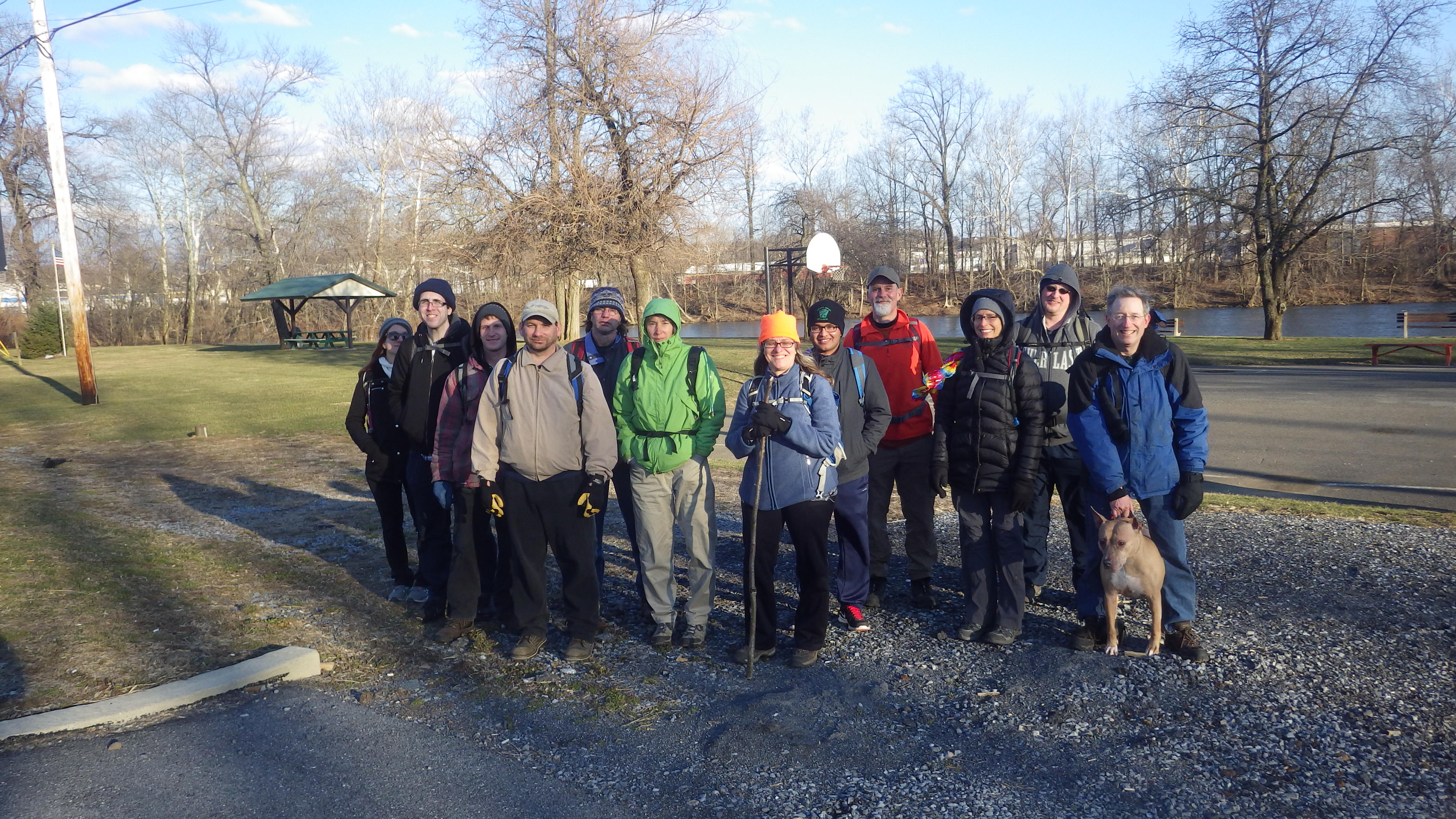
3/10/18 Landingville to Shoemakersville with Jim Mathews (Mr. Buckett), Jennifer Berndt, James Quinn, Justin Gurbisz, Ken ?, Diane Reider, Michele Valerio, Jake ?, Jennifer Tull, Captain Soup (David Campbell), Bob Leahey, and Mike Dicello
Our next hike would be the next in the 911 Memorial Trail series again, with a section that was thankfully almost all trail with only a little bit of other stuff.
There’s really so much to say, so much to share with this, it’s impossible to do it all. I tried writing this journal and lost over an hour’s worth of research and writing, so I’m going to present a bit truncated with photos.

How much of the route we've completed so far
We had already been working on this series for over two years, which encompassed 26 hikes and various other “alternate” routes along the way, like the Morris Canal. This particular section would be really cool because it focused mostly on the old Schuykill Branch of the Pennsylvania Railroad, and featured a lot of the old Schuykill Navigation.

Schuykill Navigation map
As early as 1822, downstream only navigation was taken place on the Schuykill River to get the hard anthracite coal to market. This was a clumsy process, and so the Schuykill Navigation, also known as the Schuykill Canal, was developed.

Historic image on Schuykill Canal
The canal was chartered in 1815, and much opened in 1825. In 1827 the Schuykill Canal was extended to Port Carbon.
The navigation system, a series of canals and slack water pools in the Schuykill River, was a total of 108 miles, with 62 miles of separate canals, often called “reaches”, and 46 miles of slack water. 92 lift locks overcame the elevation of 588 feet. By 1841, this canal was carrying 717,517 tons of cargo annually.
The days of the canal were short lived. Even by 1850, the basin at Port Carbon was nearly abandoned because maintenance was too much a burden. Debris from up stream would constantly plague it, and so loading areas were used from the Palo Alto side. Even this development was rather short lived.

"Captain Duffert" on Schuykill Canal
The Philadelphia and Reading Railroad was built to the coal region also in 1841, and could from it’s start carry more freight than the Schuykill Navigation System.

Schuykill Navigation map from Auburn Area Historical Society
The entire Schuykill Canal system was abandoned from Schuykill Haven north in 1870 because the damage could not be kept up with. The railroads were quickly established, and the Mill Creek Railroad, later part of the Reading, opened to St. Clair in 1846 further opening up the arteries of coal. The canal was filled in from Port Carbon to Pottsville slowly over time, with a lot of it being done in the 1950s.

Historic image of Schuykill Navigation at Schuykill Haven with existing rail bridge of Reading Railroad and former foot bridge to Irish Flats.
In 1872, Pennsylvania Railroad acquired the Delaware and Raritan Canal in New Jersey, and would not allow passage of boats from Schuykill Navigation, killing it’s important connection.

Robert N. Dennis Collection image of Schuykill lock
All of the Schuykill Navigation north of Port Clinton was abandoned by 1891 due to maintenance issues. By 1904 just about all coal traffic on the canal had ceased. By 1913, only the occasional boat would pass through. The canal remained in operation until 1931, and by that time it was mostly a recreational waterway for pleasure vessels.

Adamsdale PA and station, (west2K)
The Schuykill Branch of the Pennsylvania Railroad was one of the blows that killed the canal. Completed in 1884 to compete with the Philadelphia and Reading’s line to coal country, it was constructed after they had built their line to compete for travel from Philly to NY City.

Adamsdale Station (west2K)
Closure and abandonment of the Schuykill Branch happened after the Conrail takeover in 1976, in phases like with most lines. SEPTA operated the southern portion of it into the 80s, but it’s since been scaled back beyond the Manayunk Viaduct.
Today, much of this route makes up the Schuykill River Trail, and would be the main focus of this particular hike, although some sections we would have to go out and around, and we would of course be checking out sections of the Schuykill Navigation System as well.

Schuykill Canal Lock #18
We met in the morning at the Sheetz store near our end point in Shoemakersville PA. We moved cars to on street parking at our southern end, near the former Pennsylvania Railroad tracks that are still active at that point, and shuttled north to where we’d left off the previous time, at Landingville.
I had noticed on the previous trip that there was the remnants of an old canal lock in a park in Landingville, but when we arrived previously it was getting too dark to get over and see it.

Lock #18
We parked adjacent to the ball fields in Landingville and headed over to where I thought I saw the lock site.
Sure enough, it was there, filled in to where only the tops of the lock walls were visibile, but what it was could not be any more obvious.

Ball field along the canal route
We traced the former canal route out across the ball field, and there was a little playground area. I could easily do another version of this entire series just tracing the historic canal route, but this time we’d just do a few pieces out of convenience.
We stopped at the playground which had one of those little merry go round things, and I spun a couple of our group members on it until they got too dizzy to handle it, then we moved on to Rt 2011, Main Street, heading to the north for a bit toward Adamsdale.

Adamsdale/Landingville area
There is no parking for the rail trail section on the old Pennsylvania Railroad just ahead, so to pick up where we left off, we had to walk the road back in the direction of Adamsdale, a former station stop on the railroad. It must have looked nutty to those driving by as I lead the way in my suit.
We passed by a former school house building and soon reached where a bridge once carried the Pennsylvania Railroad over the road, and turned right to climb to the right of way on the Bartram Trail Section.

Landingville/Adamsdale
The section of the Schuykill River Trail immediately crossed over teh Mahannon Creek, with a farm bridge on the adjacent property below. I’d have liked to get a good look at the railroad culvert, which is probably a nice masonry one, but didn’t dare trespass in such an obvious spot.
The rail bed took us soon to right beside the Schuykill River on a very nice shelf. I pointed out to everyone where the Schuykill Canal Lock #18 was that we had just been at before, across the river to our left.

We continued down the trail parallel with the river, which would have in canal days been the canalized, slack water pool above Dam #11.
We continued along the shelf until we reached a crossing and the Canal Street Bridge over the Schuykill. This was a through girder bridge carrying the road, but directly next to it were old masonry abutments. The abutments were much narrower than a regular road bridge. I assumed because the canal apparently switched sides of the river around the next dam, that this was originally a narrow towpath bridge that had later become a road.

Canal Street Bridge crossing just south of Landingville, Pa. on June 12, 1955. (John Dziobko Jr. Photo)
Dam #11 was just down stream from this point, and we could see the former Reading Railroad bridge over the Schuykill just beyond that site. We continued on the rail bed heading to the south from here.
We passed by a trail parking lot and then crossed Tunnel Road, which was just Canal Road continuation, and followed along a large body of water to the right of us. I watched it closely, and could see what appeared to be a causeway out on it. I assumed correctly that this was the old canal towpath. It was purged in a couple of places, but still very recognizable.

Historic image of Auburn Tunnel
The next point of interest was one I’ve been meaning to get to see for a long time: The Auburn Tunnel site.
Auburn Tunnel was the first transportation tunnel constructed in the United States. Work started in 1818, and it was opened in 1821.

The tunnel was not really necessary, but created more as a little tourist attraction, to add to the ambiance of the canal. It was shortened several times over the next several years, and traffic demand eventually made it into an open cut in 1856.

Historic image of Schuykill Canal at the tunnel site
Lock #19 had been just about at the point of the previous dam, so we didn't see remnants, nor did we see remnants of Lock #20, which was just north of the route we were taking along the Pennsylvania Railroad. There was a cut over to the left where the trail ended, and a sort of construction entrance to the right. The "Auburn Desilting Basin" is a giant lake on the river from just north of the tunnel site, which probably inundated a lot of where the canal was. These things, as I understand, were built to keep the coal refuse from contaminating the river down stream. I'm guessing that's what the access road was for.
We continued where the trail ended on the Pennsylvania Railroad bed, which soon was cut off, and a new connection had been made with the still active former Reading Railroad to the right for some sort of industrial spur. We climbed down the slope to the Reading, and followed it to this cut off to the left, to return to the former Pennsy.
We soon crossed over the Schuykill River on a deck girder bridge, right next to the former Reading's bridge, which was a lovely masonry multi-arch structure.
Directly on the other side, there was an area with large concrete vertical footings of some sort. Lock #21 on the canal was just north of here, where it rejoined the river. I’m not sure if this was a loading/unloading station or what, but it looked pretty cool.
We continued along the tracks a bit further, and I wanted to have a closer look at the parallel former canal route. I headed down through woods, and made my way to the edge. There was no evidence on the other side of a towpath because there were some rock outcroppings right on the river, but on the near side, it was rather obvious. I found later this was in fact the towpath.
I found what I felt certain was a former dam site for the slack water navigation, but then found that, according to historic maps, Dam #12 was still further down stream. Maybe it was a remnant of the down stream only earlier navigation system, but can’t be sure.
I remained on the obvious old towpath heading down stream and rejoined the Pennsylvania Railroad at the concrete arch bridge where it again crossed the Schuykill. The predecessor to this bridge was a bit lower, and it’s piers and abutments were immediately adjacent to the current structure down stream. I climbed this side and crossed the bridge with the others, who were mostly all across.
We continued on the tracks ahead toward Auburn. I had half a mind to go off into the woods to the right to look for canal remnants, but we had a long way to go. We stayed on the tracks when there was a connection over to Ash Lane, which would be the “official” trail route. It wasn’t long before the tracks came to an end at S&S Leasing to the left. There was a trail parking lot there, where the old Auburn Station used to be.
Part of the lot for parking was the older alignment of Market Street, where the bridge used to cross next to the current newer one. A little bit of one abutment on the near side was still in place.
We continued under the bridge on the trail from here, and soon ascended back up to the former Pennsylvania Railroad grade. The canal was still on the other side; Dam #12 was just up from the parking lot, and a reach of canal continued on the other side. Lock #22 was in that reach.
We continued and crossed over a small stream called Pine Creek, and then took a side trip down to a little observation area for a break. Captain Soup went too far ahead and had to call me and walk back (he made an Assouption).
From here, we continued along the trail to where it abruptly ended at River Road. Rather than follow the road, we opted to continue on the railroad bed ahead, which closely paralleled it, although it wasn’t formalized as a trail.
We had to climb over a few fallen trees and such, but it really wasn’t bad. The cool thing this offered us was a great view down at the old Schuykill Canal lock which must have been an un-numbered guard lock, because the next one is Lock #23, and it was a bit further down stream.
We made our way until we got to where there was a sign in a cut blocking the right of way that read “no trespassing”. We opted to climb down to River Road at that point.
Above us was a house that had a sort of kennel in it. This place and the people living there are reportedly responsible for the Schuykill River Trail not being completed through the area. They have the right of way blocked by fences for grazing animals and such and won't allow for the trail to come through.
We walked along the road where we could see some of teh remnants of the canal, including where it passed under the road, and we turned left on the active Reading Railroad tracks.
Just ahead, we came to where Pennsylvania Railroad went over the Reading. From here, I gave everyone the option to either climb up to the bridge and hurriedly make it across before we had trouble with adjacent land owners, or continue across the Reading Railroad's bridge over the Schuykill, then cut right to get to the Pennsy where it was now a trail.
Most of the group went for the latter, but a few of us climbed up to the bridge to cross.

Auburn Historical Society image
Originally, there was another truss in place which carried the railroad over the canal, but after the canal was abandoned, that section of the bridge was removed.

The bridge today
PRR iron trust bridge over the Reading Railroad and the old Schuylkill Canal (the section of canal between Schuylkill Haven and Port Clinton was shut down in 1888) just south of Auburn, Pa. after they replaced it with a heavier bridge to accommodate heavier coal cars. Between 1900-1920, trains got a lot heavier. 40-ton hoppers gave way to 75-ton hoppers. This was before they replaced the lighter bridge on the left with fill over the closed canal beneath it. Note the concrete phone box at the base of the pillar. (Auburn Area Historical Society)

Pennsylvania Railroad Schuylkill Branch bridge over the Schuylkill River just below The Chutes in Auburn, Pa. on June 12, 1955. (John Dziobko Jr. Photo)

The bridge today
I had wanted to continue on the near side of the river before crossing to check out another old Schuykill Canal lock, but this would have to wait for another time. I didn't want to have any problems.
We got to the bridge deck, and the ties were pretty badly rotted. Some of the group changed their minds last minute and went back down. Justin and I of course headed across, and I was in front. By the time we got to the open section where we weren't within the trees, the ties were in deplorable shape.
The ties in the middle were about half rotted through, where we could put our feet into them, but they'd potentially fall right through. On most of these bridges, we can walk on the ties directly above the metal superstructure, but in this case it was too far to the side and under the cross braces, so in order to be over those we were basically sitting on the side of the bridge. I started crawling when I got further out. When I looked back Justin was crawling too! We know that when Justin, the guy who fearlessly climbs everything, is crawling, it's got to be pretty bad.
We managed to get across, although a beer bottle fell out of my bag to the river while I leaned forward. The shock of something falling, apart from it being a bad feeling to litter, even inadvertently, leaves a brief shock. It might have been my camera or phone or something.
Once on the other side, we continued on the trail in the most pleasant section of the entire hike.
The section started with lovely pastoral settings, but then gave way to deep cut gorge atmosphere of the Ridge and Valley geological province.
I had done a piece of this in the Summer of 2009, as well as another piece just about a month before that on loop hikes with the Appalachian Trail. I kind of recognized where I'd turned off on those in State Game Lands.

Looking at the RDG mainline from the PRR just north of Port Clinton, Pa. on June 12, 1955. (John Dziobko Jr. Photo)

The curves today
It wasn't long before we got into Port Clinton. Four more locks on the Schuykill Canal were missed by being on the railroad bed, as well as two more former dam sites. Port Clinton started out as a canal town from it's beginning, and was named for former New York Governor Dewitt Clinton, the main behind the Erie Canal, which was sometimes known as "Clinton's Ditch".
The Schuykill River Trail intersected the Appalachian Trail just above town, and ran concurrently south with it for a bit, before the southbond AT turned right to ascend the Blue Mountain. Down below us, the lovely railroad station built in the 1990s for the Reading, Blue Mountain, and Northern Railrod came into view. It was constructed to emulate the look of stations of the bygone era, and is very well done.

1889 map of Port Clinton area
The Schuykill River bent to the north a bit, and the rail bed moved away. This was another interesting historic point.

Currently available USGS map
In the past, we had come across a spot where the Little Schuykill River had been moved by the Reading Railroad to eliminate two bridges. It was amazing to see how much work went into this. This area was another spot, only this time it eliminated the sharp bend in the Schuykill as well as the Pulpit Rock Tunnel.
Pulpit Rock Tunnel was built in 1838 and abandoned in 1924. The Reading Railroad route now is on the other side of the mountain from it. A sharp bend in the Schuykill was eliminated near where we passed beneath Rt 61. The tunnel is reportedly blocked at both ends, but still exists.
We continued on the trail to the south, which passed over a "Warren Through Truss" that I'd been to before. On my 2009 hike, we climbed to the trail at this point. I had been on a section just to the south of here on a scouting hike with Jillane, but apart from that, much of this was new.
The truss bridge crossed the still active former Reading tracks. We followed the graded just a little further beyond, until Schuykill River Trail left it and entered a parking area to the left for Kernsville Dam.
The Kernsville Lake was one of 7 dams, 3 desilting areas, and 26 impounding basins created to clean the Schuykill River after a 1945 act was put in place to stop pollution. Much of the problem was coming from the washing of coal to the north, as well as other industries.
We took a brief break, then started following the trail to the north, which sort of doubled back on the direction we had been going through the former desilting basin. We passed some sort of old bridge of sorts on the left after entering the woods, and the trail turned to the east.

Passing beneath 22
The trail then reached the edge of the Schuykill River to the east, and started following it down stream. The trail continued on a very nice section along the river, and soon passed beneath Rt 22. A similar bridge to this one had just been torn out in Northampton PA, which was sad because it had character. Diane said something about this one being preserved. Apparently they have more sense in this area.
We continued beneath the bridge, then off to the right where the trail emerged over a foot bridge to Industrial Drive where the Pennsylvania Railroad apparently used to cross it on a bridge. The trail ascended a fill on the east side, and we resumed following the railroad bed again for a bit. Soon, we came to an old girder bridge that carried the Pennsylvania Railroad over the Schuykill and into Hamburg. We crossed, and on the far end there was now a pedestrian bridge to replace a missing span of bridge that was once another rail span over the canal.

Pennsylvania Railroad Class D 4-4-0 Locomotive #914 crossing canal railroad bridge just north of State Street in Hamburg, Pa. (Harry L. Rinker Collection)
We climbed down from the bridge, and the trail followed the former Schuykill Canal route south toward Old Rt 22. I had done the towpath to the north of here with Jillane, and a bit of the railroad, but nothing south of here until below Reading.

Historic image of Schuykill Canal and Geiger's Mill
We followed the path to Rt 22 where all semblage of a trail ended completely. From here, we decided it was time to go for a late lunch break, because everyone was hungry.

Schuykill Canal image today
We turned to the right and walked up State Street further into town, where we planned to stop for lunch at Westy Bar and Grill. I hung back to meet up with Bob Leahey, who was to meet up for the remainder of the hike here. I'd wished we could have met him earlier, because now he'd have to wait for everyone to eat, since his dog couldn't come inside the restaurant.

Canal in Hamburg
I checked out the overpass for the former Reading Railroad, and took pictures of the steps and former station stop while I was behind everyone else.
I didn't order any food at the restaurant. I think I ate someone's leftover fries and such, but I didn't really need anything else. Stopping was kind of painful, because I'd worn these loafers that I'd never worn before on a hike. I had a nice suit that I'd not worn yet either, and so I wanted to be somewhat stylish, but they were hurting kind of bad.
After we ate, we headed back down hill and across the Schuykill again. From this point, I decided to take some liberties with the route.
The Schuykill River Trail map simply does not show anything between here and Berne Road bridge area over the Schuykill apart from Reading Railroad Museum. Of course, I want to do this museum, but we didn't have enough daylight left. Instead, I decided we'd follow more Pennsylvania Railroad and Schuykill Canal.
We walked south a bit on Front Street to Grand Street and a Rutters gas sation. We turned there out to Rt 61 and walked some of that south, or just parallel with it into the brush. We continued until Google Maps read "Station Road" coming off of it across from another business. There was a small creek there. We bushwhacked into what the map said was the road, but there wasn't much, if any, of one.

Abandoned
Eventually, we could see an abandoned house through the weeds to the left. Justin and I bushwhacked a bit to get over to it. Some of what we were bushwhacking through was apparently the canal, and maybe some of the waterway we had been following on "Station Road" as well.
We got to the house, at a bend in the road, and went in to check it out. It was pretty sturdy, but overall in pretty bad shape. It might be demolished by the next time I get to the area.
We continued on Station Road and soon crossed the former Pennsylvania Railroad, still active in this area. There was a very nice, authentic looking station that read "South Hamburg" on it, but I couldn't find any historical information on it. It turns out that this, liket the station building in Port Clinton, is an historic reproduction that dates to 1987. A fine job too.

South Hamburg Station
We continued along the tracks for a bit, and the Schuykill Canal was obviously right along side. We had crossed where it crossed the road right before the station. I decided I wanted to try to walk it. Only Diane wanted to see it as badly as me, and so we paralleled everyone else on that.
The canal prism still had some water in it in places, and the towpath was in fine shape. We had to go over some trees and around some undergrowth here and there, but we were able to walk a good long stretch of it.

Schuykill Canal
Nothing could have prepared me for the amazing piece of engineering we came across next.
A creek flowed below the canal, through a beautiful hand hewn stone aqueduct that reminded me of the Pohatcong structure back home. This thing is hidden in the middle of nowhere, along the Schuykill River, and it's quite obvious that hardly anyone even knows it's even there. I simply had to climb down to get a better view of the structure, which was in surprisingly great repair. I climbed back up, and we continued to follow the towpath for a little longer until it started moving a bit too far away from the tracks. We didn't want to lose the rest of the group, so we made our way back to the tracks.

Schuykill Canal Aqueduct
The canal was never too far away on the right of us, and we could always barely see a bit of it. We remained on the tracks until we got to 5 Locks Road and turned right. Then, the tracks were just up hill from us, and the canal was in yards to the right. One stone house might have once been a lock tender's house, if there were in fact five locks in a row.

Canal at 5 Locks
We came soon to a spot where the road used to go over the canal. I could see the remains of lock walls along the water that still filled the prism as we moved to the right side. It was starting to get dark, but there was a good amount to see.
The road continued along the right side of the canal to where Fisher Dam Road crosses the Schuykill. We then continued ahead on Water Street, which took us up and over the former canal after turning slightly away from the river.
Rather than go up hill further on the road, we continued on the tracks at some point. Water Street crosses over like three more times, and it was dark so no one would bother us. I didn't want to keep walking up and down hills at this point. Even worse, the sole had fallen off one of my shoes that I had just worn for the first time. It was like walking in a sock on my one foot.
We continued on the rail bed into town. The former canal was never too far a distance from it to the right.
When we got to one of the road overpasses, someone in one of the nearby houses started hollering out something about the railroad being private property.

Shoemakersville Station
No comments:
Post a Comment