The new year had come and it was time once again for my big First Day Hike, usually a pretty well-attended jaunt, but surprisingly more possibly than ever this time with a total of 46 participants.
Sometimes I get frustrated and allow for the negative things regarding this trail to get to me, but since I opened the first section of it more than a decade ago, it has come quite a long way, and much farther than a lot of other state and county initiatives. Of course, it SHOULD have gone far faster, but no one but me has the invested interest in this so strongly, so it still won't happen fast.
I have a lot of goals in my life, and some of these goals are the same, some are not the goals of the DEP. I feel that we are at a loss when we do not recognize within the DEP that the focus should be made on our common goals, and through them strengths, of our associates.
There have been great people involved in the planning of the trail, but I have to constantly push to get everyone to see through their "action items" long after I had completed mine, or if it had to do with work, to get them to actually let me do the work.
Leading in to this hike, we had tons of known trees down blocking the trail. We had lots of posts in the ground to delineate the trail which had not yet been marked. We had several posts ripped out of the ground and stolen. It made no difference how important I stressed this to be, in order to keep people from getting lost, I still was not cleared to go up and fix the problem completely.
I spent one full day out and didn't finish until about two hours after my time I was supposed to be out, and another putting in some more missing posts, but the more time goes by, the more work piles up and falls off the table.
This hike ended up being a good assessment day to identify what work needs to be done on the trail, as well as of course a promotion of the amazing properties we have up there.
In the past, we had met for my Warren Highlands Trail hike at the large lot in Phillipsburg adjacent to the boat launch and Northampton Street Free Bridge, but that lot is now paid parking, and so I wasn't going to have everyone go there to park.
I actually believe that if I had posted that as the meeting point, and everyone had to pay to park, and if that were posted on the write-up, we would not have had half the participants.
We had to cram all of the cars at the River Road lot for the Warren Highlands Trail and Marble Hill Natural Resource Area, then shuttle to the start from there.
For me, the most difficult part of the entire hike was getting the hike started. I wanted to run this like I normally do, with a shuttle to the start, but I was pushed to have a six mile early out option. Actually, I was asked to do a shorter hike, to which I responded "absolutely not". I was volunteering to do this, so on one hand, I'm going to do what I want to do, but on the other hand, I am also filling a niche that is so needed.
Of all of the hikes posted by the state, counties, or other organizations, the longest one I could find offered statewide other than mine was a six mile hike at High Point, and the organizers were saying it was the most difficult one on the schedule, which of course was not in the least bit true.
If pushed, I would have just said I won't host it through the state. I did agree to offer the six mile early out, but I really had no support in this venture other than my awesome co-worker Tom Rozmirski, who is the only coworker I have that has walked the entire trail (Deidre was out last year, and she hiked the whole thing, but has since transferred to Round Valley and was assisting with the hike there).
I thought this would be the first year ever that the state did not somehow screw up the trip posting in their official posting, but of course, they failed on that miserably again.
The official state posting had it that the hike would be meeting a half an hour earlier than it actually was. I checked over all of the information as sent, and they just posted it incorrectly anyway. I was able to catch it only thanks to someone else pointing it out to me.
I tried to explain all of the vital information in the write-up, as well as to the group at the start of the hike. Still, people just didn't get it, or chose not to read the write-up. Everyone was to meet at the end point, and we shuttle with as few cars as possible from there. Those who wanted the six mile early out would do the same, but independently of those doing the entire route. Tom would go with that group to make sure they got to the right places.
To be certain, I went with Justin and we passed by the early out point anyway.
There were people who met at the meeting point and thought we were hiking from there, then people thought we were hiking from the early out point, and then when we got to the actual start point, others thought we were driving somewhere else from there.
The other problem we had with the early out was that people figured they could just go to the early out point, and then decide whether or not they wanted to leave early at that spot. That would cause a big problem because there would not be enough cars for people to do that. Assuming that this was an option ended up putting others in a position of responsibility they did not want.
I gave a bit of a dissertation at the meeting point, and then again when we got to the start point briefly. I let everyone know that we'd be following the light blue blazes, but that we'd re-group at some points.
Once I was done with the history, as well as explaining the problems we'd had at that lot, we were on our way.
The property at Ragged Ridge had long been a haven for ATV riders, and we could live peacefully since it really is only a few locals, but the problem is those locals want these properties, fully owned state park properties, all for themselves.
They had already rammed the first kiosk we placed into the ground, smeared human waste onto the signs and even into the lock mechanisms on the gates, then ripped the gates out of the ground, and tore down all of the tyvek signs that stated that this was state park land.
Most recently, all of the posts through the area to the north of Ridge Road had been ripped out of the ground and stolen. This work was done in concert with the New Jersey Youth Corps, and prominently posted online, but these selfish locals didn't care about that either.
During the Youth Corps project, we got a whole lot of work done. The young people in the program were into the project, but we actually got a great deal of sweat equity out of Mike Muckle and his coworkers who really pushed hard to get a lot of work done.
One of the big reasons to be excited about this hike was to witness all of the work done with the Youth Corps including a couple of short but substantial reroutes that were not in place the last time I brought a group through.
We started walking up the area we often refer to as the Harmony Ridge, through the farm gates and past an old stone springhouse on the right. Beyond and on the right was the former farm house on this property, which according to the 1874 Beers Atlas of Warren County, was once the Lantz Farm.
We continued uphill a bit more, turned left along the base of the first major crop field, just below a tree line, and reached the next north/south tree line. Posts had been stolen here, but I was able to delineate the trail well enough by painting nearby trees. The trail turns ninety degrees along a tree line and to a height of the Harmony Ridge with a great view of Ragged Ridge, which was where native Americans had their smoke signal rocks, to the south.
I usually make Ragged Ridge one of the highlights of the hike out there, but I chose to omit it this time because it would take so much longer to do. The route would be seventeen miles instead of fifteen at least if we went through with it that way.
I did my group photo at the top of the hill there, and we descended a bit to the north edge. There, the trail cuts through a tree line to the left where more posts had been stolen, cuts through the northeast corner of another field, and then into the woods to reach a woods road and turn left.
We climbed a little higher to the highest peak of the Harmony Ridge, and had to climb over one tree that had fallen across the trail. It was completely covered in poison ivy, which means it needed to be cleared pretty badly. I wanted to check over the entire trail before the hike, but that wasn't in the cards with work.
Tom and I went back and cleared the mess a couple of weeks later, but this time everyone had to climb over it carefully.
We turned off to the right in a short bit where I marked the trail to a seasonal overlook, but not everyone followed that, so it gave some of the others a chance to catch up.
There were three ladies in the front walking with me, at a pretty good pace, so we continued to move along when it was obvious everyone was almost there.
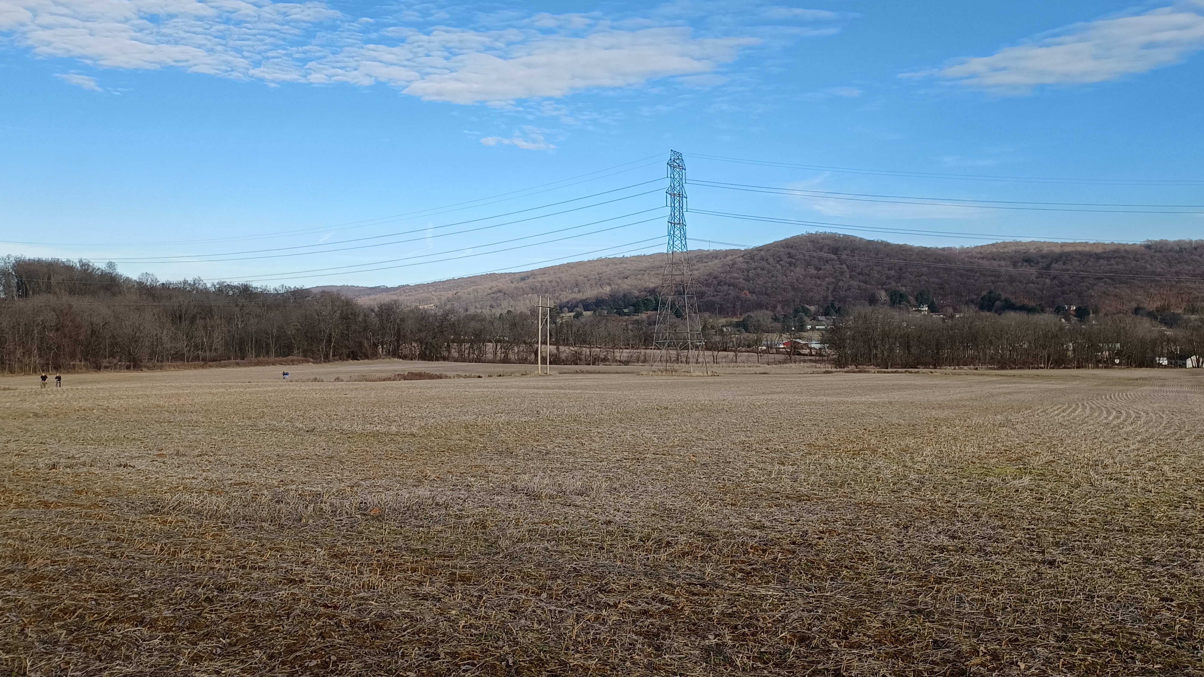
We descended a bit from the ridge on the woods road, and then turned to the right on another woods road that descended more steeply and closer to the power line. The Youth Corp kids installed a post at this corner, but it had been knocked to the ground as well, but this one a least wasn't stolen.
I made a note that we had to deal with that, and Tom and I would end up fixing it when we came back to do the chainsaw work.
We continued to descend gradually with good seasonal views to the north into Harmony Township and Northampton County PA. We came to the intersection with another woods road on the right, which comes down from the Harmony Ridge a different way. The ATVs have been using that instead of the official trail route because of the tree that had fallen. I want to blaze that route as another side trail to make a loop in the property, but haven't gotten around to it yet.
We continued downhill a bit more, and then came to the metal post with trail marker where the trail goes along a stone row and then above the next section of fields to the north. Tom and I had built that section with Verdon Pensyl a couple of years back.
We continued on through and turned hard right near the end of the property, and then descended to the fields. We followed the field edges for a bit, then cut left into the woods on a new section of trail built by myself and the Youth Corps.
The trail goes on top of a stone row that separates private fields and the state owned fields, and passes by some really nice Cottonwood trees. It was a bit wetter when it came off of the wall than the previous time I had been up there.
The trail continued in the tree line to the edge of the field adjacent to Rt 519, then turned to the right parallel with it. Fortunately, the posts were all still in along the fields. We cut through a segment of weeds, then out to a farmer's field access, then climbed up into the north tree line.
Shortly after we entered the woods, one of the larger Ailanthus trees had recently fallen over the trail and blocked it. This one also required climbing over and through, which was a pain. The group started to back up because of the amount of time it took to go through it, so most of the entire group walked parallel along Rt 519 and didn't even see this section.
Some of the group did manage to get through, including Pete Fleszar, who was impressed at the amount of cutting on that part of the trail.
I was quite honored that Pete came out on this hike, because he is one of the managers of the Mid State Trail, as well as being involved in the Standing Stone Trail, both in Pennsylvania, and he lives in the Hershey area. Still, he came to my hike in New Jersey rather than the one on his own trail.
I came out to the spot where the trail descends to cross Rt 519, and much of the group was already caught up with me because they took the road. We crossed, followed the farm access lane, and then came to the spot to park. I got the group back together there again, and was happy to see the posts were still in place.
I pointed out where the farm buildings and house used to be, which according to the Beers Atlas was the Boyer farm in the late 1800s.
We continued along the field edges to the north, then to the west high above the Buckhorn Creek. When we got to where the trail turned hard to the right to reach the creek, and the post at that corner had also been knocked down. Tom and I took some time to put the post temporarily back in the ground, and the rest of the group all went ahead of us.
While we were working, Kat Alexander stayed and talked to us, and reminded me that she was out on the hike with me when we got stuck in a bad place in Musconetcong Gorge several years before. She actually said it was kind of fun! That was the trip where Dan Asnis had to go to the hospital after several stings.
Eventually, we headed downhill and along the shore of the Buckhorn Creek, then switched back to the west. Everyone else was really far ahead at this point, but I didn't worry too much because I told everyone to wait when they got to the next road.
We moved along, and at a really steep spot along the creek, someone had installed a nice water bar. I found out later in the day that this was Mike Merunka who was out doing some trail work.
When Tom and I reached the road, only Kat and one older lady were still back there with us. The trail turns left at this point, where there was once a sawmill, and follows Hutchingson Station Road.
The little settlement of Hutchinson is just to the right, to the other side of the old Bel Del Railroad tracks. I am descended from some of the original settlers for which the settlement is named.
When we got to the intersection with Rt 519 again, I could barely see the tail end of the group turning right. We turned and then climbed up to the edge of the state owned fields approaching the Van Nest-Hoff-Vanatta Farmstead. I could see three of the women who were in the front of the group moving ahead up the hill, and I knew they would end up getting lost doing that.
Someone had said that they were just going into the woods to take a pee, because the porta john had been removed from the property, but they didn't come back out.
I caught up with the group and gave them some of the history of the site, and pointed out the original section of the farm house built in 1755, and the addition built in 1810, at about the same time as the spring kitchen.
There are also several barn structures there including the bank barn, two smaller barns, and a double corn crib. Three of the buildings were originally closer to 519, but one of them was within the right of way of the highway, so the footprint of all of them was moved back a bit to preserve the entire farmstead.
The newest buildings on the site date back to the 1920s, so they're all pretty old.
Once I went over the history, I pointed out how I recently painted the blazes all the way around the outside of the farmstead, which is state owned and managed by Harmony Township Historical Society.
We cut into the woods on the route we recently re-opened, and then north through to another field edge. The posts were all good through these field edges, and then turned right along them to the west. At the end of that section, the trail went into the woods and crossed a small spring.
The trail climbs from there along former pastures, and then climbs via switchbacks for a bit, and then crosses another stream near a weird triangular rock.
From there, we continued to climb via more switchbacks I put in many years ago.
We eventually reached what we refer to as Halleluja Hill, because people keep posting photos of Jesus on the back of the kiosk.
The parking area has some big rocks and cars kind of sink in it, but not too terribly.
Brittany met up with us at that point, and said she had seen the three women that went ahead, who asked her where the trail went. She directed them ahead.
While walking earlier, Kat had told me that when I mentioned trail work was done in the area by Mike Merunka, she was shocked to hear the last name. She indicated that it was also her maiden name, and that she had never heard of ANYONE else with that name before, let alone someone who pronounced it properly. Clearly, she and Mike might be related.
I texted Mike right away, and he confirmed that absolutely all Merunkas are related. I asked if he wasn't busy, he could come out and talk to Kat about their family history, and he agreed he would try to meet up along the way.
I waited for everyone to catch up at this point, and when we had just about everyone, we walked across Ridge Road and onto the Merrill Creek pipeline access road. Tom would hold back and wait for the others that were running behind, and I took everyone over to the big hill with the access bay door to the buried pipeline, from which there is a good view of over one hundred eighty degrees to the west, north, and south. I pointed out how we could see to the Blue Mountain in Pennsylvania as far out as beyond Lehigh Gap to the Schuylkill Gap.
When everyone was back together, we began walking the trail down the pipeline and over a small spring, then up into the fields beyond. As we were walking, I saw a figure walking toward us. It was Mike Merunka!
For a moment, I was afraid that one of the three women that went ahead of us at the farmstead was Kat, but fortunately she was still behind us. I introduced the two after a bit, and they walked and talked for the remainder of the time before the early out area.
Mike had seen the three ladies that went ahead with Brittany's instructions, and he told them to basically follow the pipeline up to Merrill Creek, but after that, I never heard from them again.
When we reached the next tree line, we had installed posts to mark the trail to the right. It leads away from the buried Merrill Creek pipeline, and then follows an old farm lane into what used to be the center of the Miller Farm. The 1874 atlas names Jason Miller as owner then.
The homestead is long gone, but there is still a corn crib in rough shape, a silo, and a beautiful stone frame of an old bank barn.
There is a photo of an old Miller farm barn in the Historic Architecture of Warren County book, which could be this one, but the stone work doesn't quite match up with the stones seen in the historic photograph as far as I can tell.
We continued just beyond the barn, and I pointed out that those from the group who wanted to leave early could cut along the edge of the field ahead rather than follow the rest of us, straight and then along the pipeline clearing toward Merrill Creek Reservoir.
This area got complicated because some of the group who were planning to do the entire hike decided that they wanted to cut out early. Because we had the early out option, less experienced hikers signed up and got us going slower, and so many thought there would be no way we'd finish before dark (of course we did).
Because so many extra people decided to cut out, there were not enough cars to shuttle everyone where they needed to go, so cars had to shuttle back and forth. Tom was having knee trouble and wanted to cut out, but he ended up having to drive back and forth three times to get people to all of their cars.
Kellie and Pete had an issue of having left keys in the wrong cars, so they had to go back at this point as well.
With probably half of the group gone, we moved along at a faster pace. Much of the group already went ahead at this point, and headed downhill to the Lopatcong Creek.
When I marked this section of trail, I went up with a busted up old life guard stand in pieces, and built a bridge over the creek with the leftover wood with Matt Trimmer, using tools borrowed from the late RJ Strunk of Washington.
Unfortunately, that bridge has since washed out, and despite having chained it to a tree, it all broke apart and all that remains is the chain and a single piece of wood.
It can be a little difficult to cross, and it took everyone a while to do it.
I just walked in the creek and helped some of the others across.
Once on the other side, we ascended to the pipeline clearing again, which is kept mowed by Merrill Creek. We followed the route uphill, and then around a small building and onto the paved access road. We ascended a bit more on this, around a corner, and then the road picked up the historic route of Allen's Mills Road.
Today, Allen's Mill Road terminates at Richline and Fox Farm Road to the east of Merrill Creek Reservoir, but Fox Farm Road didn't used to go through as it does now. Allens Mill Road used to continue on along the present north side of the water body, and then descended from Scotts Mountain upon which the reservoir sits, and reached present day Harmony-Brass Castle Road. The little settlement of Allens Mills is at that point. A berm for the old mill dam and the old stone miller's homestead are still standing down there, and these days hardly anyone knows why Allens Mills Road doesn't go anywhere near Allen's Mills.
The founders of that mill might be relatives of mine, but I'm not sure.
We continued uphill to Fox Farm Road, and crossed over onto the Merrill Creek property. We blazed the trail up the access road to the hawk watch area, but I always just walk straight onto grass, across a little foot bridge, and then up to the top of the west end levee. It cuts a bit of a corner and eliminates a slight up and down.
I think Celeste and Sue cut out at this point, and I'm not sure if anyone else did there.
The rest of us continued on ahead, to the right around the Perimeter Trail of Merrill Creek Reservoir. Some of this trail follows the earlier alignment of Fox Farm Road from before the reservoir.
We eventually reached the spot where a side trail leads to the right to the parking area on Fox Farm Road, and the trail leaves the property. I'm glad that I finally got that section of the Warren Highlands on Merrill Creek land co-blazed with the Perimeter Trail.
We headed out toward the parking lot and onto Fox Farm Road, then followed the road to the west a bit more.
The trail heads back off of the road when it gets to the intersection of Fox Farm and Decker Road, which at the other end is called Wester Road. It enters open fields that were once the property of Oswald Stecker, and were locally known as "Ozzie's Fields".
The trail goes straight past the home of friend Bill Cortese, who is a great trail neighbor, and then follows a farm lane to the west for a bit past a hawk banding station, which is a small wooden shed.
That building had been pretty badly damaged from a tree falling on it more recently, but on this visit it looked like it had been pretty well prepared.
I had not yet blazed the trail marker posts we had put in these field sections. They were to replace the original older ones I'd put in years ago. It was another spot where I was worried that the three ladies that went ahead would be lost.
By the time we got to this property, Brittany had her bluetooth speaker on and she and Jenny were dancing like crazy up the trail.
There is an outstanding view of the Delaware Water Gap near the hawk banding station, one of the best of the entire day.
We reached the edge of the far field, turned right around corners, and then entered woods near the posts with no marks.
From there, the trail follows woods road through pleasant woods and up to the top of Shandor Summit.
I recently named the site that in honor of its previous owner Bob Shandor, who was one of my predecessors as Chairman of the Board of Recreation. Mr. Shandor climbed this point with his friends when he was a young lad and declared to them that he would one day own it, and he did. This spot was apparently his favorite hunting spot, and his chair used to sit at the site. I found it and stashed it in a field edge when someone had removed it. The plan is to have a Shandor memorial at the top there.
I stopped the entire group and told that story, and about the story of putting the trail in, having it in place on private land prior to the state's acquisition so that we could bypass the Land Management Review process. We worked the deal out with Bob Shandor Jr who is still a friend to this day.
From here, we descended from the summit, which until recently was just a sort of vague second lower peak of Scotts Mountain.
The trail heads very steeply down the woods road, and then turns right sharply on another road that cuts downhill gradually. We hit another woods road and cut to the left, and it leads down a bit less steeply.
There is a point in this section where there is a seasonal view ahead through the trees into the area once known as Uniontown, where Harkers Hollow golf course is today.
This area was pretty slippery with all of the fallen leaves. Brittany ran super speed ahead down the hill, and Justin and I sort of cringed because we figured she might fall and seriously hurt herself at that speed, but she was light on her feet and calculated every step, and came to a quick and controlled stop at the bottom without a problem. It was quite impressive.
Before the woods road comes out to the upper end of Harkers Hollow Golf Course, the trail cuts to the left and down to the corner of the course where the previous owners had been dumping lawn refuse creating an encroachment issue.
I'd spoken with one of the owners, Steve Taggart, recently at Shawnee and he managed to get the area cleared for us to walk through, which was really nice. I need to get back up there to put trail marker posts in this area, but just haven't had the time yet to do it.
We exited the corner of the golf course, and the trail follows the road that parallels the west end of the course down to Rt 519. That guy Kenny that lives across the street from the exit often comes out hollering at us when we walk through, but this time no sign of him. His dog did bark a lot though.
We headed downhill on the road, turned right and crossed the Lopatcong Creek on the road bridge, then turned left on Strykers Road. The trail is marked along the road out to the Farmers Fairgrounds site, and then cuts to the right in fairground owned fields by way of an easement held by Warren County.
We continued along these fields, and I paused everyone to look back at Shandor Summit, which comes into view prominently several times through these fields. It really likes more imposing from these angles.
We continued through the first tree line, then through a second one, over a bridge I built with Matt Davis and company, then out to the county owned Geiger Tract, which is mostly more fields.
We continued along more field edges, parallel with Belvidere Road, and then came out at the corner of the field. Lori Jo met back up with us at this point to continue along the hike.
We turned left along the road for less than a half mile, and then the trail turns to the right between two houses on the state owned land ascending Marble Hill.
I had just been up there with Tom and my boss, Bruce, putting a couple more posts in the ground to delineate the trail better. The entire route until it enters the woods is kept well mowed by L Scott Smith who lives to the right of the trail.
We headed up though a line of trees, where there used to be a building at one time. The 1874 atlas shows that this was the schoolhouse site, but the late Ray Raub told me that it was further up on a road known as Kelly Lane. I'm not sure what the truth is, but I really want to know.
We continued into the woods, turned to the left, and then ascended to open fields. I have a couple of posts I painted bright light blue there, and recently moved the trail to a more gradual descent to Kelly Lane ahead.
Kelly Lane is the official access to the property for whoever has the farm lease, but it is blocked off at the bottom on private land.
We continued uphill into field edges, and on the left there is a small foundation that I was told used to be the school. We continued straight around a spring site, some fields, the site where a farm house once stood, and then the collapsed double corn crib and barn foundations. The trail then gradually ascends to a peak in the field that affords us beautiful views of Lopatcong Township and back toward Shandor Summit.
We turned left along the fields, and then cut to the right to enter the woods.
The trail follows a woods road only briefly because it goes into private land. I built trail several years ago that goes through woods to the left, and then descends to another woods road just above the point it comes into state park land.
It seemed as though one of my favorite giant Red Oaks was dying while walking through this section.
We continued on the woods road once we hit it out to the power line clearing where we re-grouped again. From there, the trail meanders on a foot path to the west along the hill slope.
This section of trail is one that I took a while to lay out because I wanted it to go past all of the most amazing trees on the property. It eventually emerges near a giant washout closer to the new high school site. The trail goes up and down through two washouts that had happened when the lands above were farm fields. They've grown over quite a lot in the past ten years.
When the high school was built, or rather when the land was cleared, it started washouts down the hill, over the trail and down to the roads below, so it went to some litigation.
It seems like it is stabilizing in the washout in this area, but still definitely happening.
There were also a lot of trees down where the yellow with red dot trail joins the Warren Highlands Trail on the right.
We continued along to the intersection with the orange blazed Mine Trail, and we continued to the seasonal overlook of Weygadt Gap. Once everyone was caught up, we headed back to the orange trail and followed it along the iron ore vein with its mine pits.
When we got to the Fulmer Mine, we descended and checked it out. There was still plenty of light left in the day, and I decided that I would offer to bring everyone through the giant pipe down along the Delaware since we did so well.
We exited the mine, and continued on the trail to where the old office building for the mine works used to be, then descended further to return to Warren Highlands Trail.
When we got there, none other than Serious Sean was walking up the trail toward us, guitar in hand!
We descended along the trail from there, with good views of the Delaware River, and when we reached the bottom area, I announced that there was a slightly longer way to go, but those who didn't want to could just continue ahead to parking. Meg and Frank Powers I thought might join us for that bit, but they opted to get done a bit faster.
We continued down the road breifly and across the former Bel Del Railroad tracks to the edge of the Delaware River.
We walked downstream a bit, and passed the metal doors toward the pump house above, which had been badly forcd open.
We then continued on the shore a bit more, singing along to the songs Sean was playing. We then reached the giant pipe and had to climb over the lip of it.
When everyone was with us or close, we started heading through. Sean was playing a very good rendition of "The Immigrant Song" by Led Zeppelin while going through.
We continued on through the thing and emerged on River Road as the sun was setting beautifully under pinkish skies.
Since it wasn't all that late yet, I went to have dinner with everyone at the place that used to be Rock Creek Tavern over in Harmony Township, which was quite nice although a bit slower on the service.
It was a really nice time and I was very happy to start the year off this way with everyone.
I'm very much looking forward to the coming year.


No comments:
Post a Comment