

Hike #1589: 1/28/24 Akron to Denver with Jenny Tull, Evan "Joe Millionaire" Van Rossum, Alyssa Lidman, Diane Reider, David Adams, and Dan Asnis

This next hike would bring us back to Lancaster County PA, this time in a sort of unexpected backup way due to weather.
I had posted a hike on the Horse-Shoe Trail in the Furnace Hills, combined with Middle Creek Wildlife Management Area, to begin at Middle Creek and hike to Denver.
In case of bad weather, I came up with a backup route that would also end in Denver, but tracing close to the historic route of the Reading and Columbia Railroad, which we'd done a section of recently.
With rain in the forecast, and a lot of rain that had just recently come, I figured the Horse-Shoe Trail would be a mud pit and some tough footing, so I decided again that we would do the backup hike, which I also wanted to do. I think it worked out to be the right choice.

The route I came up with would feature a lot of stuff I'd been wanting to see around these little settlements. They each have several places worth visiting, and for this one I also planned on hitting the Ephrata Cloister.

The trip ended up being far more interesting than even I'd expected it would be, and the area might even warrant further visits in the future.
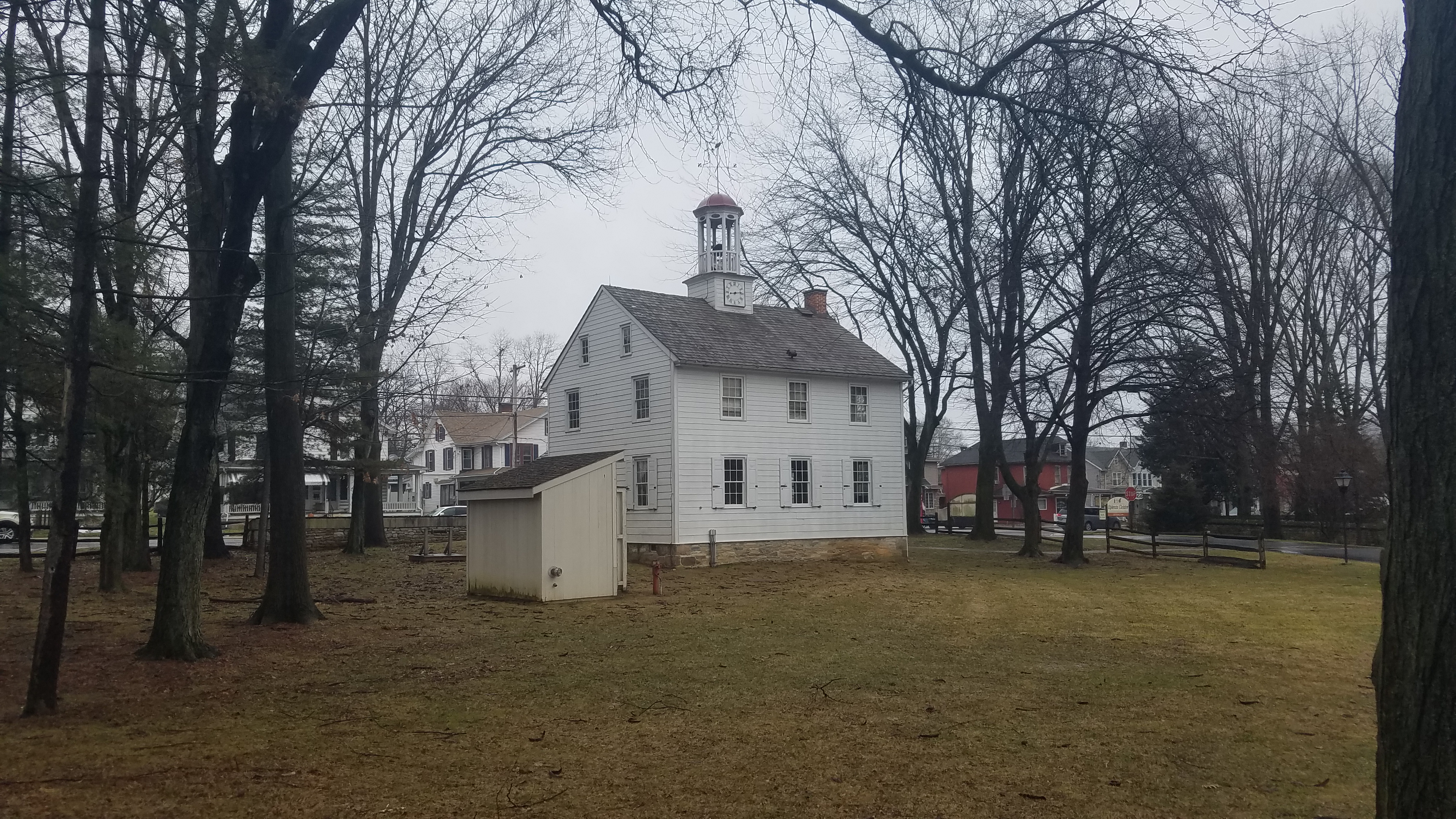
I made the meeting point Denver Memorial Park in Denver Pa. I figured this would be a nice spot for us to visit, and it just worked out for mileages for both hikes.
I also had a bunch of things I wanted to see in Denver that I hadn't gotten around to yet, so that could potentially be incorporated at the end.
We shuttled in as few cars as we could to the start point in Akron, adjacent to Broad Street Park on the south side.

After aboriginal people, Akron was first settled in the 1700s, and the community near the center of present day Akron was known as New Berlin. The municipality of Akron Borough was created in 1895.

Trappers first erected a fur trade in the area on the east side of town also in 1724, and that's about where we were headed next.
We continued down the road to the east, and reached Loyd Roland Memorial Park on the left. The Roland Park Walking Trail was a paved route heading off to the left.
It was on these lands in 1724 that the first colonial structure in Akron, a log cabin, was erected by Philadelphia for traders.

The site was chosen for the medicinal springs found here.

A farm house and barn were later erected, and a spring water bottling business was established by Clayton Wenger Sr. It was then known as Bond Spring Farm.
Clayton Wenger Jr sold the property to the municipality in 1951. The original 1724 cabin burned down in the 1940s, but the farm house is still standing and lived in.
The paved pathway skirted the left side of the park for a time, which afforded us very good views along the countryside to the north and east.

We continued moving along and entered a swath of woods on the trail, through which we got occasionally more good views.

It was raining lightly right from the start of this one, so it was an early affirmation that this was the right move to make changing the hike venue.
We continued along the trail very pleasantly through the woods until we got to 11th Street.
We turned to the right through the lawn from there, downhill to the north, and then turned right on Lion Lane.
The route took us past a pretty little pond, and an old farm house that I think is the one mentioned here earlier.

We continued along the road just a little further to the east, past a little gazebo, and and then to a loop parking area and the Aaron Pines Playground.

This playground was a really nice one, made of wood with turreted sections and farm animal themes on the sides of them. It almost seemed like a very small version of the Kids Castle in Doylestown.
I went with Ev all through the ground and had some fun while everyone took a break, and I went over the maps to make sure we made the correct turns. Hikes like this one require looking at my phone a bit more than some of the straightforward trail routes.

When we were done at the playground, called the Tot Lot on the signs, we made our way onto a paved trail to the northeast. A turn at a fork to the left skirted the private farm lands to the north.

Ev was walking at first in his bright yellow rain suit, but then Joe Millionaire helped carry him on his shoulders for a bit of a relief.
We continued to the north, with very pretty farm scenery, and made our way to the wooded line to the north side of the fields. There, we followed a path that started as as grassy, I think maybe part of a disc golf course, and then went rather steeply as a foot path uphill through the woods.
We put Ev back in the stroller for this, and I had help getting him up the hill. The trail emerged on a sort of park road or multi use trail near the top where we turned right, north through more woods.

The trail was pleasant and easy to the north, but Google maps showed that it abruptly ended. I refused to believe that was the case, and had plans to go on through, which pretty much paid off.

When the trail came to the dead end, we turned left off of the improved surface into woods to the west.
This brought us out to the lawn below a building that is some sort of retreat. I'm not sure exactly what it was, but the informal path got us out to a pleasant grassy area where we could continue on the tree line to the west.
Soon, we reached the access road to the place where we turned right.

As we headed downhill, there were signs on both sides of of the roadway; to the left read "Go in peace", and to the right said "retreat". For some reason I thought this was pretty funny, like it meant that it implies "have a nice day", or "we'll be back for revenge".

We came down to the intersection of Rt 272/Reading Road, and turned right on Steinmetz Road briefly. Then, we turned left, and descended to the Warwick-Ephrata Rail Trail, which we had hiked previously.

Chartered in the 1850s, the line was completed between Reading and Columbia in 1864. It was leased to the Philadelphia and Reading in 1870.
While the section between Lititz and Ephrata is abandoned and now the Warwick-Ephrata Rail Trail, some sections are still active such as part by the East Penn Railroad.
We had hiked the line previously, with the intention to end up in Denver, but we ended up doing too much other stuff and fell behind. Instead, we ended that hike in Ephrata, and I told myself I would plan another trip to complete hiking along the line where we'd missed.

We turned to the left and passed through the tunnel beneath Rt 272 and paused for a moment.

From here, we all continued together to the west on the railroad bed, over what we'd done the previous trip, only for a short distance.
Pretty soon, we were skirting a meadow property owned by the Hope United Methodist Church. There was an interpretive sign on pollinators and butterflies, and a mowed path through the meadow heading north.
We turned through the meadow and headed out toward the church yard. We crossed the parking lot and then reached Rothsville Road. Here, we turned right for a bit, and then soon turned left on James Avenue.

We followed the street through a somewhat newer development, to the corner with Niss Avenue. We continued straight from here, through some grass. The Cocalico Creek was to our left.

The section of land we were passing through is known as Nissley Acres Park. There was a part of a ball field there. We continued to the cul de sac at the end of Henn Avenue, and then followed that back to Niss Avenue, and that to Rt 272.

We turned left along the road, and down into the parking lot of JS Woodhouse to stay away from the bigger road for a bit. We then skirted the wastewater treatment plant on the same side.
We crossed Cocalico Creek, and made our way north through parking areas.
Originally, my intent was to go a little further east and cut through the properties of the historic Heller Homestead, Ephrata Community Garden, and Ephrata Dog Park, but it was a little out of the way.

I wanted to try to get done with more stuff because we had a long way to go.

Soon, we reached the intersection with Creek Corner Drive, into a development to the left. At this point, there is a paved trail that went down and around some retention ponds associated with the development.
It was really steep in the grass, so I had to be really careful pushing Ev down this thing with the stroller. I think one of the others helped me on this one.
Once at the bottom, we got on the paved trail and turned left, around a little loop around the retention pond.

We continued to the north on the path, on the west side of the retention pond. There was a loop all the way around it, with a connecting trail in the middle section.

Just ahead, there was a foot bridge and side trail to the left, over a creek, and out to nearby Hammon Avenue. We continued straight and came out on Creek Corner Drive, near the intersection with Meadow Road.

We cut almost directly across through grass, and past an impressive, giant Weeping Willow tree. We then continued to the left a bit and emerged in a parking area. We crossed this, reached Hammon Avenue, and began following that to the north.
Hammon Avenue made its way north to the Ephrata Intermediate/Middle School grounds.
I had intended to take a slightly different route through these grounds, a bit to the west more, rather than direct through near the school, but there was some construction going on in the fields that blocked much of it off.

We instead headed north, along field edges, and then on a paved path a bit to the north, which eventually goes to the Ephrata Church of the Brethren.

We turned right from this paved path, and soon reached a running track.
Rather than head to the north of the property and then follow more streets, I decided we would turn to the right and then cut through the running tracks. We walked the length of the south side of that.
At the end of the tracks, we reached the lot of the Ephrata Recreation Center.
We turned to the left, and followed the grass on the north side of this parking lot heading east.

We soon had to get down into the lot, but then cut over an island of grass out to Route 272/Reading Road on the far side of it. We turned left here briefly, and then right on Academy Heights Avenue.

We went a short distance here, and then turned left onto an unnamed street that led to the rear of the Cloister Heights Apartments.
We went left into the first parking area, and then around the west side of the building that faced toward Rt 322. We followed a walkway around the outside of the building and down steps to the side of 322 where we turned right to follow it east.
We had to follow this bit of the bigger highway because we had to get across to the other side of Rt 272, which is limited access at this point.
We went beneath the highway on 322, and then continued to the grounds of the Ephrata Cloister to the right.

I had been to the site before, but I had never organized a hike to the site. I'd been thinking about doing it for years, but I still hadn't had a hike connected to it yet.
I did a hike with Jillane in the area, and we visited the place as part of our second day out, and I was very impressed by the entire tour. We ended up being pretty much the only ones in on a pretty rainy day, and we had a tour guide named Michael who gave us a lot of extra time and info, and even let us into areas of the buildings usually closed to the general public.

The first prominent building that came into view to us this time was the historic Ephrata Academy.

The educational institution was founded in 1837 by the Society of Seventh Day Baptists.
We cut around the academy building and headed toward the first building on the right. This turned out to be a gift shop area, not the visitor center, although the lady running it inside was very friendly.
We had to go south from there to the main museum building.
We arrived, and waited for the next tour to get ready to start. We were fortunate to catch it about the time we did, or we'd have had to wait another hour or so, and that wouldn't have worked for our hike.

After getting our tickets for the tours, we walked around the museum for the beginning of the tour to start out. When it was ready, we were ushered into a room to the left of the entrance.

Here, there was a movie made that went over the history of Ephrata.
The Ephrata Cloister was once the center of the settlement of Ephrata as a community.
It was founded in 1732 by Conrad Beissel, German pilgrim who came to Pennsylvania seeking religious freedom and seclusion in 1720.
There were once some forty buildings on site, located in the edge of the PA wilderness.

The term "cloister" is actually a misnomer for the site. To be accurate, the site is simply "Ephrata", because this was the original center of the community.

Conrad Beissel first was in the Philadelphia area, and he didn't care for that, so he moved around a bit, and finally sought seclusion with a friend who had already settled on the frontier in Ephrata.
It almost seems as if he said "so much for seclusion", because he started his own church community that became Ephrata.
Beissel and his followers believe in living a completely pure life where basically anything is a sin, so they ate very little, and they spent days working and praying.

Beissel and his followers believed that God was returning within their own lifetimes, and that living this life was the only way to win their pass to Heaven.

The entire community was sworn to celibacy, so the congregation did not grow without Beissel traveling and recruiting more to join his group. He even traveled as far as Ringoes NJ, very near to where I live, to preach and recruit.
There were other members of the community area that were families, who attended services, but did not live in the buildings within the celibate community.
Beissel died in 1768, and the congregation dwindled until the last celibate member died in 1813.

Church services continued until the 1930s, and it was taken over by the Pennsylvania Historical and Museum Commission in 1941.

The building in the center was the chapel, and the women's quarters was the large German style building connected to it's right, built in 1741. A similar structure served the men of the congregation but has not survived the years.
Once the video was finished, we convened outside. There was a new girl that was just hired I understand as an interpreter at the site, and she was to walk around with us and listen in on the historic dissertations done by another girl. I looked over their social media over the next couple of days, and she had started doing the tours herself.

We had a pretty good tour, but I don't think the girl giving this one was as good as the guy named Michael that had given me the tour on a previous visit.

The oldest surviving building at the site was built between 1738 and 1741, and was a women's quarters. A higher section to the left of the building, which currently has a white facade, was where they slept.
A grey painted section that is lower is to the right, which was their chapel area. A very similar building would have stood nearby for then, but it has not survived the years either.
Nearer to us than that farther oldest building was one of the houses that served as Conrad Beissel's home. We were told that he moved around a bit, and that it was not always his home.

We were able to go into Beissel's home, and then we went ahead into the chapel building, built about 1741.

The chapel was sort of connected to the women's building as I recall, but it is really a separate building.
There was a book in the front behind glass, and we were told that the entire facades of these buildings needed replacement when it was taken over, and that the colors chosen were not really historically accurate.
There was a way of going on through from this area to the women's dorm building, which required ducking, but the problem was I could not get the stroller through that one.

Ev had been starting to get a little moody just before we reached the place, and then he passed out just as the tour started. He slept peacefully through the entire tour, which was probably for the best.
Thankfully, the girl running the tour allowed me into the 1743 women's building by way of another door around the side. Ev started waking up at some point through here, and so he got to see this and some of Beissel's house.
We passed through all of the open buildings, which featured displays including on the fabric making that went on at Ephrata.
Once we got through them all, we continued back to the north a bit, to the cemetery, which was surrounded by stone lined sluices for drainage.
In the middle of the cemetery, laying flat under a big stone, is the grave of Conrad Beissel.


This grave stone is covered in a plexiglass cover for protection from the elements.

We turned from here and made our way to the east side of the community. It is pretty well separated from the rest of the town, either between highway, lines of brush, or the Cocalico Creek on the south side.
The word Cocalico comes from "cocalicunk" which supposedly means "den of serpents".
We got through a line of trees, and then to a parking area for "Ephrata Business Center".
We continued to the east, out toward Rt 322, and turned to the right. Soon, we reached the bridge over the Cocalico Creek. We crossed, and then turned right immediately onto Cocalico Street.

In a short bit, we continued ahead onto grass where the road turned hard left and became Cloister Avenue.

This was the beginning of Thomas B Grater Community Park. There was an old buildng pretty soon on the left, used by the park. It had a somewhat obvious old stone section with additions around it. I'm not sure if it was a homestead or an out building, but it was certainly old.
In 1875, this area was part of the Fasnacht and Bilzer lumber yards, and residence of Sl Hess, according to the county atlas of that year. The main part of the building I understand is Eicher Arts Center. A trail heads over to the Cocalico Creek beyond it.
We headed onto the trail beyond the building, and it was a very nice section of creek side trail.

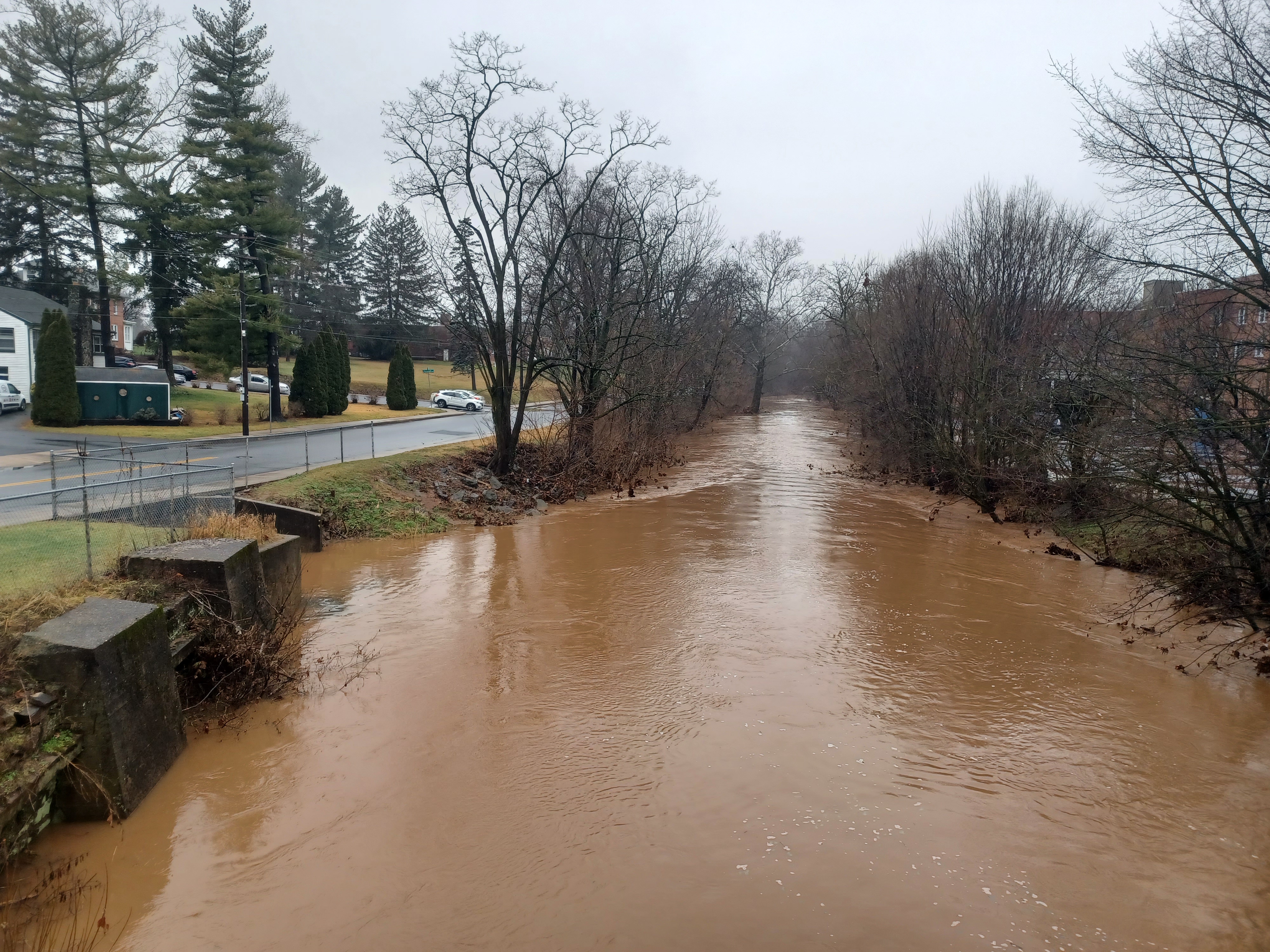
The trail continued along the creek, beneath the Oak Boulevard Bridge. The water was running diarrhea brown because of all of the rain and area field runoff.
There was a really nice little wooden viewing platform out onto the creek, and little foot bridges along the way. There was a lot of evidence that this entire area goes under water somewhat frequently during times of flood, but we weren't that bad off yet. It was however quite slippery at times because of the layer of mud on all of the structures and some of the pathway.

The trail passed through Legion Park, and then headed up alongside Queen Street to the south, and ended just a little further ahead.

The end of the trail had a missing section of sign, and therefore a missing context. It read simply "Soon", and reminded me of a funny photo of Stephen Argentina that had been photoshopped countless times, with his wide eyed face and "soon" scribed beneath.
We continued along the road to the intersection with State Street and beyond a bit more back to the rail trail. I had considered using some of the Heatherwood Bike Park and some other pedestrian pathways through Ephrata, but that would have put us out much later and over distance, so I decided against it at this point.
 |
| 1962 John J. Bowman Jr |

We turned left on the rail trail, paved at this point, and followed it past the buildings with the murals painted all over them to the east.

We talked about a lunch stop, and everyone sort of agreed upon the Tacos El Gordo, where we had eaten after the last hike where we were on the former Reading and Columbia Railroad.
We continued ahead onto a fill, and then across Fulton Street. The trail came to a sort of end at a parking area before where the railroad used to cross Main Street, Rt 322.
Directly across from us was the old Ephrata Station, still used as a sort of local commerce office.
 |
| 1920s Historical Society of the Cocalico Valley |

The group turned to the right up the road to go and get lunch. I told them I would hold back a bit to just get a few of the then and now history compilations I'd wanted to get.

I didn't get all of them I meant to get on my last trip to Ephrata, so I had them saved where I could access them quickly.
I pushed Ev in the stroller to the north on Main Street, and then turned left on State Street. I'd had saved a photo of a steam locomotive going by the concrete silos just off of Main Street that I wanted to try to emulate.
This area had changed a whole lot, and there were now buildings that were blocking the way of the view for the most part.

Still, I was able to emulate the shot with enough of the stuff still accessible. We made our way back and I got more shots of the old station on Main Street.

The station here is in handsome shape, but not the original to the railroad in this area.
When the Columbia and Reading Railroad was built, it seems that in many places, pre-existing buildings served the purpose of railroad station as well, and this was just another example.
There was a hotel building to the right of the current station site, which I understand was outfitted with a platform to serve as the station with ticket agent. It was destroyed in the 1950s.

We found on previous hikes that several locations had this same type of thing. To the west, the station at Akron was originally an awning added to a warehouse building that is still standing today. West of there, the station at Millway was the Reitz Warehouse building with dual use until the dedicated structure was built.
 |
| 1961 George L Slonaker |

The line was chartered in the 1850s, and completed through in 1864. It was in the 1870s that the Philadelphia and Reading took over the line, and this particular section was closed in 1985.

Ev and I continued up the street as it started raining a bit harder, and made our way to the restaurant
It was a pretty good stop; I don't recall exactly what I ate, but it was alright. We then headed from this point directly back down to where the railroad used to cross to continue our journey on it to the east.
We continued past the station, and there was a building with a platform still intact, and a mural of a railroad themed scene from when it was still active.

A little bit past the station building, there was an old caboose parked on a little piece of track just after the Rose Street crossing.

We walked around the caboose, and then out to State Street where the railroad used to cross.
Now, it is totally built over by a new apartment building. This building is partially a new structure, and partially historic. The site was originally the Eby Shoe Factory, which was a rail served business. In later years, the building was the Fleet-Air Corporation.
The bones of the original brick building are still there, but were built upon more, and then some of the new construction was mirrored to the north and built out across the railroad bed. The trail was officially developed along State Street and then around the building to the east side where it resumes following the rail bed again.

We followed around the north side, NOT the trail, because I wanted to be closer to where the railroad actually went. I figured maybe we would see something more of it, but we didn't.

We got back on the other side to where the tracks used to be, and hedges and such were built over it. The paved trail here was actually slightly to the right of the right of way. I suppose both were probably the right of way, because there would have been sidings for the industries here.
We got on the paved trail and started heading to the east a bit more, and we could see much more plainly where the Fleet-Air Corporation building was different from the later construction behind us.

We continued ahead along the right of way, beyond where the trail ended at Chestnut Street.

A small road known as Peach Alley paralleled the rail bed to the left. The right of way was in parking lots at first, but then went into a cut while Peach Alley ascended a bit to the left of it.
As we walked the road a little bit, I decided I was going to try to head down to the right of way to bushwhack it. Dave offered to push Ev in his stroller a bit while I engaged in this silliness.
My reasoning for this was the fact that I had some historic photos of the former site of the Pine Street Bridge just ahead, and wanted to get modern views of it. The bridge is now removed and replaced with fill. It looks like an extension of the rail trail may happen in the future, but it would have to be a climb and grade crossing over Pine Street I suspect.
 |
| Lancaster History image |

The right of way below was rather wet, but I managed to get through it okay. Ev watched from the stroller at the top of the slope as his dad trudged through the mess.

I managed to get two pretty good comparison shots of the old bridge. I was then able to very easily walk up the slope to the others on Pine Street to continue on.
The right of way on the other side of Pine Street was not looking so promising.
The right of way is at first intact through the property of the Ephrata Borough Garage, but that is fenced off and we couldn't walk it. We would have to turn right on Pine Street and circumnavigate the section. Ahead, a new development is built over it anyway.
 |
| Robert Wanner Collection |

I had figured we might be able to take a somewhat new trail out and around to the next section, but that would complicate things when it came to crossing Cocalico Creek, so we went around.

We turned right on Pine Street for just a bit, and there was a vacant lot on the left side.
Two big oak trees and a sidewalk to nowhere are all that remain of the site of the Ephrata Manufacturing Company, which stood on this spot. Now there were just trucks and such parked at the location.
The office was an oblong, one and a half story brick structure, with a complex of industrial buildings beyond. All of these are demolished today.
We continued from here to North State Street and turned to the left. We then passed a cemetery and headed to a new development.

We turned to the right on Autumn Blaze Way. This new development too us uphill for a bit, then turned right on another road called October Glory Trail.

We made another left on Red Sunset Run back to October Glory Trail, and turned left back to Autumn Blaze Way. At this intersection, we were close to where the railroad used to go again.
In fact, a tiny bit of what appeared to be the right of way was still visible in the land on the opposite side of the road, Amber Lane joins and October Glory continues ahead.
The road went almost on or next to October Glory Trail ahead, but we couldn't get through that way.

We had to turn right on Autumn Blaze Way to the east for a bit, and then reach Mohler Church Road.

We turned left on the road, and passed the Martin Energy Group services building, which the railroad bed crosses. Just ahead from here, Mohler Church Road dips down and crosses over the Cocalico Creek.
Just to the left of the road bridge, the abutment to the south side of the railroad bridge was obviously visible.
I had a couple more then and now compilations to set up at this site, using photos from what Gregory Pawelski had in his collection along this line, so I worked on setting those up.
 |
| 1970s Dale Woodland |

The lower part of the central concrete pier for the crossing, which went over both the Cocalico Creek and Mohler Church Road, is still in place. The entire east abutment has been removed.

I got several shots of the former bridge site and the two then and nows, and then figured I would just follow parallel road walking around the next section of the right of way, which appeared to go through private farms.
However, there were no signs saying no trespassing in the bit, and there was a good path along the right of way up the top of the slope from the former east abutment site.
Still, I didn't want to chance it, so I started leading the group along Mohler Church Road to the north.
 |
| 1986 Gregory Pawelski |

As we were heading up the road, Joe Millionaire and Alyssa climbed up to have a look at the right of way.

It turned out that this section was much nicer than I'd anticipated it would be. There were a couple of fallen trees over the first bit of it, but other than that it was totally clear.
In fact, a bit further on, the right of way appeared to be mowed. I suppose that the right of way might be public land acquired with the rest of it that became a trail, but nothing had been done with this bit.
I really don't know the ownership status of the bit, but I'd wished we had gone through it.

We walked further up Mohler Church Road, parallel with the Cocalico Creek. Where we had cut away further back at Pine Street, there is some sort of clear path that goes along a power line parallel with the railroad bed I had considered using for this hike. I could see from this vantage point that there were people over on it, but they had no way of getting across the Cocalico Creek.

In normal conditions, we might have been able to get across it if we tried, but with the rain and its depth on this day, it was a good thing we didn't go that way.
 |
| Photo by Joe Millionaire |
We continued out along Mohler Church Road to the intersection with East Trout Run Road where we turned right.

In a short distance, we came to the point where the railroad would have crossed Trout Run Road on a bridge, and Joe Millionaire and Alyssa already made it to that point. I climbed up to the right of way just to have a look at what we'd missed a bit.
The right of way had a small farm underspass in the section that was still in place as well.
From Trout Run Road, the right of way stays pretty much intact for a bit to the north, but in a really weird location.
 |
| Photo by Joe Millionaire |
It is sandwiched between the Ephrata Borough Wastewater Treatment Plant on the right side, east, and a large solar farm to the left, west.

We continued up the slope to the right of way and simply followed it through here. Chain link fences block off both of these properties on the right and left, but the railroad bed is still fully accessible through it.
It was a pleasant walk all the way out to Springhouse Road. There, there was no way of continuing on to the north. There was a chain link fence, and the tracks begin in brush. They become clear just ahead, active as an industrial spur line of the East Penn Railroad.
 |
| Photo by Joe Millionaire |
We had to turn left and follow Springhouse Road out to Rt 272 unfortunately. I was thinking we might be able to get down to the tracks on the other side and take a shortcut cutting some corners.

When we got up onto the bridge that goes across the tracks, there was absolutely no good way down to them. We were stuck walking the roads for a bit from here.
After the descent from the railroad overpass, which was a rather narrow section of road I wasn't happy about, we crossed over and reached a rather interesting little strip mall that had a record store, antique store, and auction. If we'd had more time, I would certainly have been interested in stopping to look around, but I wanted to get to the next town.

I had a few more historic shots I wanted to emulate in the settlement of Stevens, and it was starting to get dark, so I pushed to get there.

We made the next left on Garden Spot Road. We followed it north to S Line Road and turned right.
In retrospect, and looking at the maps better, this was a mistake. I should not have taken that route. If we had continued straight just a bit more, we could hae cut across a Ford Dealership to the east and gotten off of the main road, then cut over to a paved trail that goes around the Wabash 400 store and produce place.
A paved trail makes its way all the way out to Wabash Road from that point, and from there, we could have gotten all the way through in a newish development to Stevens.

The route would have taken us into ball fields, and then to the historic Stevens School.

Oddly enough, there might be enough more stuff to warrant another trip out to the area to cover this and some of the other oddball little parks along the way.
S Line Road didn't have a really good shoulder on it, but it also wasn't terribly busy either. When there were homes around, we could walk in the edge of the lawns. Other times, I had Dave walking close by to help as a buffer and to keep Ev and his stroller off to the side from speeding traffic.
As we approached the little settlement of Stevens, there was more of a wider walkway along the homes than there had been before.
 |
| 1963 Tom Horst Collection |
In fact, I think there was a walkway in front of some of the very new townhouses constructed on the left side.

Aside from this bit of new construction, Stevens retains historic charm. It is supposedly named for Thaddeus Stevens, Civil War era politician known for being a staunch abolitionist.

Pretty soon, we reached Stevens Road and turned to the right. I let everyone know ahead of time that this part was an out and back little trip, and that we would have to come back out to the main road again, but fortunately no one complained about it.
We made our way down to the railroad crossing, which was the former station site.
The station site is on the left, and is now a vacant lot. Until recently, there was a barn that dated back for many years standing on adjacent private land, but even that is part gone now. Anchor points to the past here have mostly disappeared except the tracks.
 |
| 1900 Dan West Collection |

I immediately began taking my then and now compilation shots, of which there were a lot to do.
 |
1908 |
Everybody was really patient about all of it, and they stood with Ev in his stroller while I just ran around like a lunatic trying to get all of the photos at different angles.
 |
| 1910 Joanne Martin Bender Collection |

 |
| 2014 Gregory Pawelski |


 |
| Dan West Collection |


 |
| John D. Denney Jr Collection |

We continued on Water Street, at this point completely in the dark save for the ambient light of homes and occasional street lights.

We turned left on Madison Avenue, cutting a corner through a parking lot, and then turned right on 5th Avenue.
In less than a block, we turned left onto Railroad Street and went to the north a bit.
I loved this walking in the dark on the barely used back streets. It was like I was back to hosting night hikes again, which I miss doing so much. I had not led one of these at all since Ev was born, but prior to that, I was hosting them every week.

We turned ninety degrees again, and it became 6th Street. We emerged on Main Street and turned left.

In a few short blocks, we reached Denver Memorial Park. Thankfully, none of the gates were closed, and none of us had tickets. We just headed into the park and arrived at the cars with no problems.
It was gently drizzling so much of the day, but it never really mattered, because it was such a nice time.
It had really been the perfect trip to do on such a day, and it knocked out a long stretch of a railroad and several other great historic spots I'd been wanting to hit on a hike. It's hard to believe all of this was in the same day.

It wouldn't be too long and we'd be back to cover more crazy stuff in Lancaster County, which by this time I had gotten to know pretty intimately.
No comments:
Post a Comment