
.jpg)
Hike #1590: 2/4/24 Princeton to East Windsor with Evan "Joe Millionaire" Van Rossum, Diane Reider, Jenny Tull, Lynette Rorer, Justin Gurbisz, Violet Chen, David Adams, Sev, ?, Alyssa Lidman, Dan Asnis, John DiFiore, Pete Fleszar, Maricella ?, Koshek Swaminathan, ?, Ryan ?, Joe Tag,

I've invented a term I call "Pedestrian Salad" for some of these crazy hikes I come up with, where so many of these little parks are not really a destination in and of themselves, but when pieced together, they become part of a rather amazing experience.
I made the meeting point the Walmart down in East Windsor again, like I had done for the last one, only this time we would be starting the hike to the north, in Princeton.

Planning this one out was quite a bit more complicated than most of the hikes I put together. It required a lot of attention to aerial images after an initial sweep.

I planned this one very much in the way I used to plan my night hikes. Years of experience with that has made it much easier for me to plan hikes that would be more stroller friendly for my son Ev. Of course, I do have to watch some of the terrain that I would have done even in the dark, but overall, the planning is very similar.
We shuttled with as few vehicles as possible to the north, and we spotted John's car along the way at a spot I found that would be somewhat convenient to our route. We then all convened using on street parking adjacent to Community Park in Princeton.
 |
| Stevens House |
We convened in the parking area at the northern end of Race Street in Community Park. When we got everyone together, I gave a little history of the location.

The parking lot was near the eastern terminus of the historic route of the Johnson Trolley Line.


Today, much of it is obscure, but a segment from Ewing to this station on Phillips Street in Lawrenceville is mostly a trail. Another short trail section is found near Johnson Park School in Princeton. Other than that, it is only little bits that are recognizable in certain spots.


From here, we headed east over to John Street and began walking the road to the south.

Princeton, even on the streets, is typically quite pleasant for walking.
After about four blocks of walking to the south, almost across from the intersection with Lytle Street, we turned right onto a paved pedestrian path into a development.
We almost immediately crossed Stanworth Drive, and continued to the west a bit. We reached Stanworth Lane, turned left, and then crossed Stanworth Drive. A slight left took us up into grass to the Merwick Park area.

This was all part of the Merwick Stanworth development. After passing the Merwick Playground, we came upon a house that appeared different than the other newer ones. It had the same siding and general look, but the shape of the building looks much older.

It appears this home in the middle of the development was the original farmhouse associated with this property.
1875 maps of Princeton show this as the home of Miss S. C. V. C. Stevens.
We made our way out of the Merwick developement area to the east, and then out to John Street.
In this area, we began seeing our first historic markers on different buildings, and the first one we came to was the site of Jimmy Mack's Barber Shop.

The area we were passing through was previously a black neighborhood of town, and it seems that some of the historic markers were somewhat recently placed to help tell the stories of these neighborhoods that had historically been left somewhat undocumented.
We headed east on Quarry Street, and the next point of interest was the former Witherspoon School on Quarry Street, Princeton NJ, now The Waxwood condominiums.
The school was constructed in February 1908 to serve African American children grades kindergarten through eighth. It accommodated 300 children from both Princeton Borough and Township.
The school districts began to grow, and an addition had to be built, including gymnasium and auditorium in 1939.

In 1947, segregation in public schools was declared unconstitutional, and the building began its use as the integrated borough Junior High.

It continued in use as a school until 1966, when it went into use as Princeton Nursing Home.
In 2004, the building was subject of creative reuse when it was turned into condominiums.
It was renamed "The Waxwood" for Howard B Waxwood Jr, who was principal at the time of de-segregation of the school.
We continued ahead to the intersection with Witherspoon Street, and passed by the whitest Sycamore tree I have ever seen, which I thought was somewhat ironic.

We turned right on Witherspoon Street and skirted the cemetery. I should have gone in, because I had intended to visit the grave of Grover Cleveland, but I forgot. I think some of the group went in and saw it.

We continued on about six blocks to Nassau Street, and then walked straight on toward Nassau Hall.
Nassau Hall, built in 1756, is the oldest building on the Princeton University Campus. At the time of it's construction, it was the largest building in the American Colonies. The building served as the nation's capital for a brief time in 1783.
The reason for convening in Princeton was that it was in the middle of nowhere. The new American government had not been able to pay the Continental Army, and so the decision makers wanted to sort of hide out away from all of the action, and that was what Princeton was at the time.

We continued around this beautiful building, and paused in the lawns just beyond, where there is a lovely green.

In the green south of Nassau Hall, a British canon, abandoned by their army on their Retreat from the Battle of Princeton, is buried facing down.
The Canon remained in Princeton from the time of the battle until the war of 1812, when it was moved to New Brunswick.
The cannon was returned to the east side of town in 1836, and then moved, under cover of the night, to the Princeton campus by students in 1838. It was buried at its current location in 1840.

A second "little cannon" is also buried in the lawn adjacent to the Whig Hall. In 1875, students from Rutgers stole the little cannon, which I understand was known as the "Cannon War" between the two schools.

Students sometimes sneak in and paint the top of the little cannon scarlet after a Rutgers sports victory.
Sev knew the history of the place really pretty well, better than I did.
He corrected me politely on a couple of things, and I was thankful for his including more information.
I ended up reading into the stuff more during the course of the following week and found it quite interesting.

Just behind Nassau Hall was once the northern terminus of the Princeton Branch, better known as the Princeton Dinky Line.

We headed south through the campus, and came upon Mile Marker 0 for the Princeton Line. It's been a really long time since the line came up this far north, so that was kind of a nice surprise to find.

 |
| Original Princeton Station |


We paused for a few moments, and I showed everyone a past then and now I had done of the Princeton Station building. We then moved on to the south.
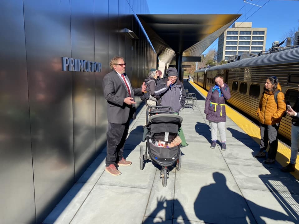
The tracks used to come up right along this station building, but are now gone. A trail more or less follows where the tracks used to be to the south, and pretty soon, we could see the active tracks and a train parked at the new station ahead.

We stepped onto the station platform, and Ev was excited to see the train. We watched him closely to make sure he didn't get too close, and took a break here because there is a Wawa built into the other side of the station.
I held off going into the Wawa for a bit, and then when most of the others had gone, I went in and Dave watched Ev. He ended up walking along some paver blocks, and insisted that Dave show me that he could do it when I got back out.

We hung out here for a while, and watched the train that was parked head out. We then followed the platform to the south, and then skirted the edge of the tracks by following them through the parking lot to the south.

We were able to stay pretty close to the tracks through the lot with no problem. When we reached the end, there was a good swath of grass on the right side of the tracks that would keep us far enough off of them, so I decided we would just skirt them to the south. It looked like people walked this regularly anyway.

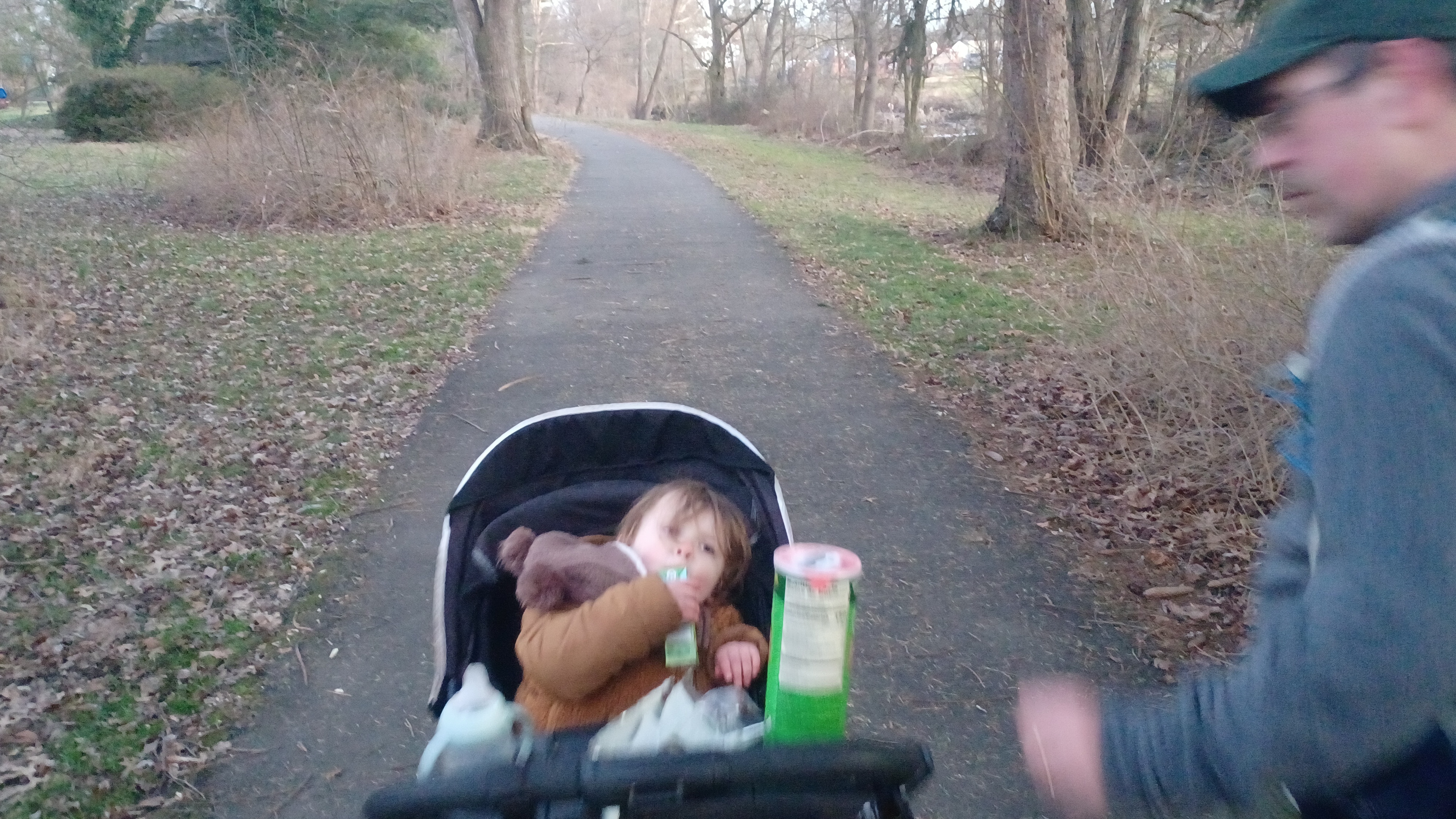
We continued on down to Faculty Road, crossed, and then regrouped. I was pushing the stroller, but Ev was in the mood to walk, so he was holding Dave's hand behind me.

I'm always goofing with Dave, and as I was waiting for the group to come over and cross, Dave was near the end with Ev. I exclaimed "There's my happy boy....and my son!"
We turned right on Faculty, and then left across a swath of grass to Alexander Street and headed south.
In a very short bit, we headed into parking lots behind buildings to the left of us, closer to the tracks. The Dinky went by multiple times as we walked this route, and we pointed it out to Ev every time.

At one point, there was a slope that was harder for the stroller, so I went around the front of the building, but we mostly remained out behind them and closer to the line.

We came out in a large parking lot behind a restaurant known as Metro North, and tried to skirt the lot to see if there was any kind of path into the woods beyond. There was nothing, so we weaved back and used little foot bridges on the Metro North property to get back out to Alexander Street. This part was much more pedestrian friendly.
The Princeton Dinky crosses the Stony Brook and the Delaware and Raritan Canal just ahead, and the canal bridge is still the historic swing bridge from canal days, but we couldn't see it this time.

We soon crossed Stony Brook immediately followed by the D&R Canal on the road, at Turning Basin Park. This was literally what it said, a turning basin for boats, or a parking lot for them basically. The D&R Canal was completed in its main section here in 1832 and is now a state park. It was preserved in its near intact state because it is used as a source for NJ Water Authority.

We continued along Alexander, around a corner, on the south side of the road. This was the worst part of the entire hike I told everyone, because there was just no way to get through without this road walk. We had to cross Rt 1, and all of the exits associated with it, so we were out in the open a long while.

After all of that highway mess, we came to the intersection with University Square Drive on the left and Carnegie Center Drive on the right. We turned left across the crosswalk onto University Square, and continued briefly down Alexander to a small pond adjacent to some pharmaceutical campus properties.
I got help to lift Ev and the stroller over a guard rail, and we got immediately onto a paved path that goes around the pond.
We reached an intersecting path, and continued to the north over an access road, and then to the back of the property close to the Dinky line again. We then continued through grass and on a paved trail that closely paralleled the line.

This was part of one of the segments of the never completed "Dinky Line Trail". We were able to follow it to an end at a line of trees, and I started walking to the right to head back out to Alexander Road again.

Before I got too far, the guys behind me found a good way through the tree line with almost no brush, which led into the parking lot of a long building full of a lot of businesses, including some sort of axe throwing thing.

We walked down through that to the other side of that lot, but beyond, there was MTC Production Shops, which we could not pass through, so we had to walk up through this next lot out to Alexander.
If I didn't have the stroller, a path through trees to skirt the tracks probably could have been used, but I wasn't going to try anything too crazy this time.
After we got past this next business, we turned left into Alexander Park Drive and walked all the way to the back of the lot. There, the Dinky Line Trail started back up again.

The trail continued along the rear of the property of a lot of businesses. It was a relaxing walk pretty close to the dinky line itself.

We came to an interesting spot ahead where there was what appeared to be some sort of concrete shelter, laying on its side down below the tracks.
I didn't think anything of it at the time, but it turns out that this was not just any shelter, it was a defunct station shelter! Lance Erickson informed me that this was the Penn's Neck Intermediate Station, a secondary station stop on the line that has been out of service for some time.
We checked this out for a bit, and a train went by again while we were there.

From here, we continued on the trail, which soon turned to the right, away from the tracks a bit. It soon turned left into a swath of woods, and then crossed a bridge over the Little Bear Brook.

It was a really beautiful scene at the crossing, and we couldn't see a single building when we were in this very small swath of woods and wetland. One wouldn't know we were in the suburbs of Princeton.
The trail emerged from the woods to something Google maps calls the Princeton Metro Park, along a large pond behind some sort of large business building. The trail went both ways around it, but we took the longer way to the left to give us more views of the pond. This wasn't a hike I was worried about being direct on.

There was a fake wolf along the edge of this pond, which is apparently to try to scare off the geese.
 |
| Photo by Pete |
We continued around with some nice scenery, and then continued along the front of the building heading east, toward the first of the large parking lots associated with the Princeton Junction Station.
We cut through a line of trees, and then into a huge, almost vacant lot. We then continued out through another lot, most certainly where the original westbound wye would have been for Princeton Junction. Now, only the eastbound connection of the wye still exists and is in service.
This station area would have been established probably in 1863 when the line was first moved away from the canal as mentioned previously.
The station was very busy with people coming and going, but we were still able to navigate it pretty well without getting lost.
There was a new handicap accessible ramp to the tunnel beneath the station, which was perfect for me with the stroller. It wasn't too narrow, and I was able to get under it all just fine. We then ascended back to the parking area on the other side and continued walking away from the station.

Wallace Road was just ahead, which we crossed, and then followed a sidewalk well away from the road across a business lot on the other side heading to the north.

Ev was having a good time, using an empty Pringles can as a glove, and playing with Osage Oranges we found along the way.
We continued up along Wallace Road to a corner where there was a small park in West Windsor Township with a big clock. By this time, Ev knew what a clock was and pointed it out to me.
The next leg of the trip was parking lots, starting with PNC Bank. We could stay off of the main road for just a bit by following the sidewalks associated with the businesses through these lots, and it would be in this area we'd have choices for lunch.
Most of us, including Ev and I, settled on Aljon's Pizza for lunch just ahead, and I got a couple of slices to share with him.
Ev had been fussy around this time and refused to eat much, but I can usually get him to eat at least a little.
We had a nice lunch stop, and soon moved on through more parking lots heading to the south.

We reached Alexander Road yet again, and crossed directly to enter Nash Park. There was a large sign reading the distances to places all over, which we stopped and looked at.

Among the cities on it, Vineland, New York City, and Atlantic City were ones I had actually walked a line connecting.
Nash Park was a small but charming park with a large pagoda style, Asian influences shelter building.
The park was named for the Nobel Prize winning Mathematician John Nash, who's struggle with Schizophrenia was chronicled in the 2001 film "A Beautiful Mind" starring Russell Crowe.
I thought it was an odd and interesting coincidence that this hike came just after we passed the Cinderella Man statue to James J. Braddock, another local celebrity to Bergen County NJ also portrayed in a movie by Russell Crowe.
Sadly, John and Alicia Nash were tragically killed in a taxi accident in 2014. I understand Mr. and Mrs. Nash would walk through this park before they passed.
We continued around the inside of the park and past the pagoda building, and then made our way into the parking area for the Medical Center of Princeton.

Around this time, I was contacted by both Koshek and Joe, who both intended to join us for the remainder of the hike. I planned that they could meet up with us at West Windsor Community Park area.

We exited the parking area onto Princeton - Hightstown Road, and turned to the right to head south for a bit. The road had a good sidewalk so it was alright.
Soon, we reached Clarksville Road, crossed, and entered Ronald R. Rogers Arboretum. Someone commented that for an arboretum, this place was "awful light on the arbor part of it". Indeed, the park didn't have a whole lot of trees. It was mostly open area with intersperesed trees.
The more forested portion of it to the northeast had more trails in it, which I didn't know about ahead of time, so they weren't included this time. I have plans to do a variation of this hike again where we'll cover more of that stuff.
We went left on the paved trail that went around the outside of this park, and passed trails that went off into the woods on the left.
We weaved around to the southeast side, passed a 911 memorial, and crossed a couple of foot bridges through a sort of Zen garden area, then left the trail to pass through the edges of the tennis courts.

From here, we came out to Hendrickson Drive, and turned left, east. I had to pee so badly at this point that I ran into some nearby bamboo to relieve myself, and the group pushed Ev in the stroller a bit.

We were really moving along at a good pace, and I realized it when I only took a few seconds and they were already down the road far ahead.
We came to the intersection with North Mill Road, at an historic community location known as Vanhiseville, and turned left. It was only a short distance ahead that we turned to the right into West Windsor Community Park.
Like the park just before this, there were more trails to the north side of this park we could have taken, but we took the ones closer to the parking lots for those who were to join us.

Joe met up with us at the very next one we came to, and it was his first time meeting little Ev, which I was happy to finally have happen.

We all continued on the west side of a baseball field, and then along Bernt Midland Blvd.
Koshek and a friend of his, I can't recall her name, met up with us at this point and continued the hike with us.
We crossed over the power line that had been the Newark-Trenton Fast Line Trolley, but I didn't speak on it much at this point. We just continued on along the trail, turned left across Bernt Midland, and then turned right along the road, then past the skate park and more parking.


We followed this trail, which was red blazed, and it soon emerged on the edge of the old Newark-Trenton Fast Line trolley again. We turned right and followed this right of way as a trail to the crossing of the Bear Brook.
There's a lot of interesting history behind this trolley right of way, and I've already followed at this point a substantial part of it.


We convened on the foot bridge over the Bear Brook for a group shot, and someone else happened to be going by to get the photo for us, so I could actually be in this one.

The view of the stream and slack water of Grovers Mill Pond was quite pretty.

It was along this pond in October 1938 that a radio broadcast presentation of Orson Welles' "War of the Worlds" led to widespread panic of a real Martian invasion.
We started walking the trolley line to the northeast for a bit, and soon came out to Rabbit Hill Road.
Here, Pete had to head back in order to get the train back home to the west, so he turned left on Rabbit Hill Road. He also wanted to visit the "Martian Invasion" site.

We turned right, and there was a good sidewalk path that weaved around back from the road a bit. We followed it south as far as Bennington Drive and turned left. The walkways on this road were also well separated from the road.

We continued only a short distance, and then turned right on Kincaid Drive.
After just a little while, a paved trail turned to the right between some houses, and continued behind them through the edge of the trees.
It was a pleasant walk out behind houses for a while, and then it curved back out to the roads to emerge on Glengarry Way.
We turned right on the road only a short distance, to Princeton-Hightstown Road again. Here, John could just follow the north side of that road to the Southfields Common shopping center where we'd left his car in the morning.

The rest of us continued directly across the road, and then to the right onto a paved trail cutting to the south a bit. It was somewhat overgrown and disused, but it got us through to Westbrooke Blvd.

The road was a parkway style road with a median, and the path along the right side. We continued on from here to the east and soon came to Southfield Road.
A right turn on a path following the road led in a very short distance to the entrance and parking to Zaitz Woods Nature Preserve. We headed to the parking area and regrouped.
Ev was out of his stroller walking, and he took off with the stroller pushing it through the grass. Soon, he capsized it and it fell over onto the ground.

I didn't think much of it at the time, but my car and house keys were on my key chain in the top compartment, and they fell out here! Fortunately, I remembered this incident at the end when I couldn't find the keys.
From here we headed across the meadow area and into the Zaitz Woods.
This was a very pleasant and more natural surface place than anything we'd been on through the course of the day, so it was a very welcome change.

Violet was telling me something about how it didn't seem like the trail system went through.

She was right, this park, when planning the hike, showed no trail going through from west to east, but I studied the aerial images closely and found what looked like it was some sort of bridge over the tributary to the Bear Brook further on.
This was definitely a gamble, but I thought it was a good one. It would probably go through, and maps just weren't showing it.
We crossed a foot bridge over a small tributary just inside the woods, and we continued through on good foot path. Ev decided to walk this entire section through the trees.

Near the far end of the property, sure enough, there was a trail at the far side of the property where the loops go around. We followed it, and in a short distance, we came to a piped crossing structure that I was hoping and expecting to find.

The trail went from this crossing of the tributary through a very tight successional forest and continued east as a mowed trail through a meadow, to a paved trail at the West Windsor HOA development.
There were more pathways all around this area, which we could easily have milked more miles out of, but that would have to wait till next time. At this point, the rest of the hike was going to be a bit more direct.
We made our way to the left on the paved trail, which curved and came out on Morano Drive. I think we went through some grass and such, and continued to a paved path that turns right on the other side of the road.

The paved path went south across Tuscany Drive, and then out to San Marco Street. We went straight along Dantone Blvd and crossed over Old Trenton Road.

We crossed and began following Dorchester Drive to the south. There was a good sidewalk and a nice line of trees on the right side of the road, but what had formerly been a big field to the right was now under construction. It's probably residential that's going in there, but I don't really know.
In a little ways down the road, we turned right on a walkway that went out and around Princeton Arms 1. This little community has sidewalks all around townhouses for some distance, and once we turned onto this, we had almost an unbroken pedestrian friendly greenway to the end, using a little creativity.

We continued west, then south around these buildings, and had to only get in the grass to connect between sections of buildings where the sidewalks didn't totally connect.

Near the end of this first community, we came to a parking area and then crossed over Dorchester Drive again. On the other side, more sidewalks went around more townhouses heading southeast.

After a few buildings, we came to a footbridge that crossed over the Bear Brook.
Joe Tag used to live in this area, and he explained that it was a battle to get that foot bridge in place. It was sort of a nightmare with getting kids where they needed to be rather than through bussing. A school is just two blocks away to the north, and it is indeed a convenient connection for those who need to get there quickly.
I think this particular area was known as Whitshire Park.
We continued walking from here along the edge of the creek. Paved trails continued through the park, but I stayed in the grass, which was only slightly muddy, beside the brook ahead.

We soon rejoined the paved trail and continued southeast. We then crossed Dutch Neck Road and entered a wooded area. The area ahead is known as Anker Park.

The next section ahead in the Anker Park area actually had a footbridge over the brook. We continued ahead and crossed Oak Creek Road.
I ended up talking to Sev through this area, and we hadn't talked a whole lot on his past trip so much as this one, just because I'm usually pretty busy with all of the planning stuff.
I had not know previously, but Sev is the son in law of none other than my old friend Peter Beck, who was a well known and loved trail maintainer.

Pete had been involved in many trails through the New York/New Jersey Trail Conference, and he was well known recently as being he maintainer of the twenty mile long Four Birds Trail in the Farney Highlands.

Pete didn't do so much mileage later in life, but he attended some of my hikes over the years, proudly sported a Metrotrails shirt, and was a great supporter of what I was doing.
Pete and his girlfriend used to show up at my work at Spruce Run and chat with me somewhat regularly, and I always looked forward to seeing him.
The last time Pete visited me, it had been a little while since I'd seen him. He told me he had terminal cancer and didn't have much time left. I was called to the office when he requested to see me.

In his car, Pete brought with him his big collection of maps, including many out of print, hard to find ones from the NYNJ Trail Conference, including the celebrated Hoeferlin Maps made by William Hoeferlin in the early 1900s.

Although Pete was a member of so many organizations, he told me he watched what I was doing, and felt confident that the information in his collection would go to the greatest use through me.
I was honored to accept the collection, and then arranged a Pete Beck Memorial Hike in the Farney Highlands, with a shorter version for his family and friends to take part in.
I was blown away that Sev had a connection to this great guy I'd know for years before. I pulled up photos I took at his memorial hike, and he recognized family faces in the photos.

We walked and talked for a while, and it was a really nice time reminiscing and connecting.
Also on this entire stretch, Dave had brought alog a delicious bottle of some sort of honey whisky, so we partook of that quite a lot as well.
We continued following the trail through woods as it was getting darker. The trail turned to the right, and then emerged behind the Mercer County Library Hickory Corner Branch.
I made the mistake of going up through grass toward someone's back yard thinking I'd be able to get through, but we had to turn back around.
We continued out the drive to the library, and Joe waited there to get picked up while we did the last couple of miles on road.
It was dark by this point, and we had run over the mileage I was expecting to do by just a bit, but it didn't feel terribly like it to me.
We reached Hickory Corner Road, which didn't have good sidewalks like everything else we had been on, but it wasn't too bad. We turned left on that and headed out to Rt 130, crossed on the crosswalk, and then continued on the other side on the road.

We then came to Rt 33, and headed southwest a bit along the roads. Rt 33 to 130 in this area was formerly the route of the Camden and Amboy Railroad, later the Pennsylvania Railroad, and very little of those rights of way are visible today.
Soon, we were back in the parking area, and loading up ready to go. We came back to the Walmart from the street in back of it.
Dave was not ready to be driving just yet, and so he sat on the tail gate of his vehicle chugging water. He ended up falling asleep there I think until 10 pm or something.

Jenny took me back to my car, but then I realized my keys were missing. Fortunately, I remembered exactly where they must have fallen out, so we went right back to the Zaitz Woods Preserve entrance and walked the grassy area in the area where Ev had capsized the stroller.
We found the keys pretty quickly, and were on our way with one less thing to worry about.
I can see that one of the participants in the meetup page reads "former member", which is unfortunate because it means they probably didn't enjoy it, but for me, and probably for most of us, this was really another great and very interesting bit of "pedestrian salad".
No comments:
Post a Comment