

Hike #1588: 1/21/24 Edgewater to East Rutherford/American Dream with Jenny Tull, Robin Deitz, Diane Reider, Justin Gurbisz, Serious Sean Dougherty, Carolyn Gockel Gorder, and Brittany Weider

This next hike would be a point to point trip, which would sort of fit into my Hackensack River Watershed series, but also connect to some other stuff we've done.
It was planned for one of the coldest times of the year, specifically because part of the trip was intended to visit the American Dream Mall. It's a place I had never been to, and this was the perfect time for it.
We really got lucky, because it honestly was the best day to do this particular trip. It sometimes amazes my how plans all fall into place the way they do and when they do.
For this one, we met at the Mill Creek Plaza by the Best Buy, a bit east of the American Dream Mall, off of Rt 3.
The reason for this meeting point, away from the actual end point of the hike, was the fact that the mall costs so much for parking. Rates are low for the first few hours, but then it jumps to like $25 after about six or so hours. I wasn't going to pay that, so we figured we'd just park nearby and Uber back over at the end if we needed to, unless we had someone else show up and shuttle us out.


After meeting at Mill Creek, we shuttled with as few cars as possible east to the Hudson River, at the Edgewater Commons.
 |
| 1980s Neil Becker |
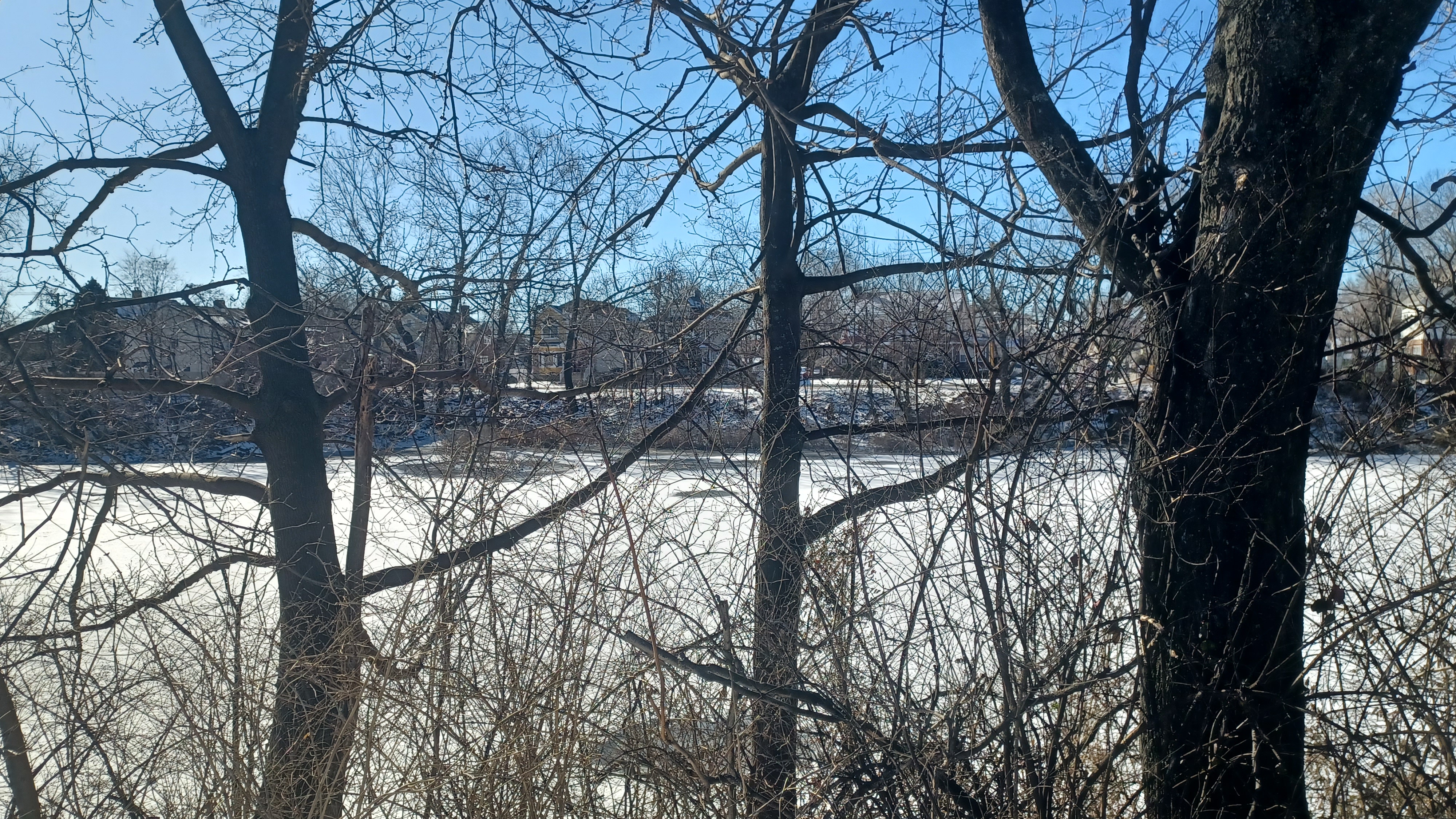
Our starting point was the best place I could find to meet out that way. There were a couple of reasons for choosing it. For one, it started us at an interesting spot on the Hudson River.
Further, I would be able to have a good look at the Edgewater Tunnel before it got developed over and would no longer be visible again.
This was a big deal, because we had somewhat recently walked through this tunnel, one of the longest old rail tunnels in NJ.
The final reason was to showcase a few other parks we had not included in some of the previous hikes in the area.
By this time, I had been doing the Hackensack River series for quite a while, and we had gotten pretty far north on it. However, we skipped doing this section specifically because I wanted to wait for a very cold or inclement weather day to throw this one on the schedule.
I intentionally decided i would be late January or early February for this one and scheduled it.

We shuttled to our start, and I parked over close to where the railroad tracks used to make their way out to the Hudson River ports.


Before even taking Ev out of his car seat, I ran across the street to get several then and now history compilations of the east portal of the Edgewater Tunnel.


This tunnel was built in 1894 as a subsidiary of the New York, Susquehanna, and Western Railroad, and had been of great interest to me for many years.

It wasn't until a hike just last year that I finally got to walking through it, and we did it at the right time.
The tunnel is about a mile long under the Palisades formation, but the east portal of it is blocked off at a site under heavy construction right now.


I got everything together, and made sure Ev was bundled up good. I had his big orange jumpsuit to put on him, which would keep him pretty warm, but the problem was he didn't want to wear gloves. I could get him in his hat, but he'd had this bad habit of wanting to leave his hands out, and it was really cold.
I would lately try to grab his hand and pull it up into the sleeve to help keep him warm, and he'd often offer his hand to me to help him do that, but he wasn't liking the cold at the start of this one.

At first he was okay, as I pointed out interesting stuff along the way, but then he got loud.

We needed to get over to Old River Road, which ascends the palisade slopes a bit, and goes right over the mouth of the Edgewater Tunnel. I had several shots I wanted to try to emulate of the rail yard site before it got completely developed over.
We made our way to the top, and the road is literally over the top of the tunnel arch, which was cool to see.
This vantage point really showed us that they are building directly into every bit of space they can get in the former rail yards. Where there was once a roundhouse and shops, was all going to be a large building. the piers for some of these buildings were all in place already, and it looked like this view we were getting was destined to be completely obscured.
I tried to get a lot of extra shots of this and basically anything looking out toward the waterfront, because the nature of this area is that it is always changing.
Ev calmed down from crying and yelling for a bit when I pointed out the tunnel and where the railroad tracks used to be. He was also at this time getting interested in towers, and there were lots of skyscrapers in view. I would point out to him all of the different kinds, like silos and steeples, and he was into it.
We came down to where Old River Road was again at a lower level, and then followed a walkway out toward the Hudson River Waterfront.

We went around some apartments, and then around the Promenade Condos with great views through the area across to New York City, and some of the footings of where old docks once were.

After only a little bit, there was construction area, and the walkway came to an end. It's necessary to head out to River Road to continue south.
We walked south for a little while, and my intention was to turn right and climb the Palisades slopes when we got to Bulls Ferry Road, obviously a former Hudson crossing site.
I missed the turn and we all walked a little farther south than I'd intended, so we had to backtrack to get back to the road. We then turned and headed very steeply uphill on the road, which afforded us views toward the George Washington Bridge near the peak.

Before a hairpin turn, the sidewalk on the right side of the road ended, and I had to hurry across to the other side. In doing so, I was awarded a better view of some stone ruins in the side of the cliffs.

There was a stone wall and a small park area with steps down to it. There's not much a view over there any more because of all of the trees that have grown in, and the stairway had a sort of arched gallery in it, but each arch was concreted shut in more recent years because it became loaded with homeless people.


Across from us on our left was the Statue of James J Braddock in the center of a sort of triangle area.
Braddock was World Heavyweight Champion boxer from 1935 to 1937. He went by the titles "Bulldog of Bergen", "Pride of the Irish", K"Pride of New Jersey", and most famously, "Cinderella Man" for his unlikely champion win against Max Baer in 1935.
Russell Crowe portrayed Braddock in the 2005 Ron Howard biographical film "Cinderella Man", which earned Crowe a Golden Globe nomination.

This park was originally known as North Hudson Park, established in 1910.

The park was renamed for Braddock, who instilled community Pride in residents.
We continued along Riverview to the west just a bit, along the paved pathways, and then turned to the right into the main section of James J Braddock North Hudson Park, toward the big pond.
We reached the edge of the pond, and amazingly, wind was worse here than it was further down. I changed Ev's diaper quickly out in the cold, because I didn't realize they actually had a restroom open.

It felt more tricky this time than on other trips, because it was so cold out.

In addition to his snow suit and layers, I also had a big green snow blanket I have been carrying during cooler weather to put over him. Because it got so windy, I chose also to put his wind cover on the stroller, so that would insulate him a bit more, and he was a bit happier. He actually fell asleep in there for a while in this area.
We continued along the east side of the lake, and took a break on the north side while we waited for the group that went to find a restroom to catch up with us. Once all together, we continued west along JFK Boulevard East.

As we skirted a section of woods, I was surprised to see a sign warning about poison ivy, as if it isn't already everywhere.

As we made our way west, we curved to the north along the far side of the park. There, there was a very nicely done memorial for all of the American wars since World War I.
Each marble tablet contains an image including one of the US President to serve during the time.
Regardless of feelings about the presidents involved, remember these memorials are a tribute to the people who served.
"The true soldier fights not because he hatred what is in front of him, but because he loves what is behind him." - G. K. Chesterton

We continued north a bit through the park and emerged on Bergenline Avenue.

We made a left turn ahead on Fairview Avenue, and turned left on Harding when Fairview went beneath Bergen Blvd. I should have stayed on Fairview and then cut to the left into Fairview Cemetery, but I figured we had walked through that before. It is the cemetery the Edgewater Tunnel has its west portal beneath.
My feeling was that we could head to the north and then descend the Palisade formation by way of Mt Moriah Cemetery, so we instead turned right on Bergen Blvd to head that way.

It was a rather good climb going up from there, and we had a view out across Fairview Cemetery all the way to the Watchungs. When we reached the top of the hill, we were able to pass through the parking area of the Fair Ridge shopping center.

I figured we could walk around these buildings and then just seamlessly walk into the Mt Moriah Cemetery. That proved to be wrong.
I tried to reach the place from behind, and it was a steep wall down to the cemetery. There was no connection.
From the end of Walker Street, we had to go back to Bergen Blvd, head north, and then go into the next little plaza which was a bit of elevation up. We went to the back of that hoping to get to the cemetery, but there was a chain link fence blocking us. We could have handed the stroller over, but it would have looked suspect, and it was far too cold to mess with something like that.

We chose to exit again and head further to the north.

Both Cliff Street and Morningside Avenue gave us no good option to get down. There was one of the we could have climbed down on, but again it would have been tougher with the stroller, and with the cold, I didn't want to put Ev through anything more than I had to.
He was still asleep at this point as I recall, so having as little trouble with bumps and all was key.
We got a few nice views from behind the buildings, out across the Hackensack and Passaic Valleys to the Watchungs, but we didn't find any good way down.

I decided that instead we'd have to road walk it all he way back down to where I had intended to go. This meant heading to Edgewater Avenue and just following that.
 |
| Early 1900s Library of Congress |
There were other side streets we could have followed through this area, but something told me that I should just stay on Edgewater because there might be something more interesting on it.
The first part didn't have all that much; it was incredibly steep, and stressful for me to walk with the stroller on the ice.
Eventually the grade lessened, but it was a little bit of white knuckling down it. The Palisade formation is bisected interestingly in this area to two sections, by the Wolf Creek, a tributary of the Hackensack River.
We headed down and crossed the small stream after a slight curve north, and on the other side, the road curved somewhat south again to climb the other side.
As we continued down toward the "Old English Neighborhood" area of Ridgefield, the architecture got to be a bit more interesting.
There was St Matthew's Roman Catholic Church on the right, which was a handsome building of light colored brick construction. I couldn't find any information on the building, but I know the parish was created in 1899.

The building looks like it might date from around that time, but I can't be sure. One of the problems with researching history of churches is that their websites are almost free of building history and make it only about the congregation and worship. It happens often that I can't find anything else.
Ahead, we came to Ridgefield Court, a tall brick building that I assumed was an actual courthouse.
It turns out, this was never a court house or civic institution of any kind. "Ridgefield Court" was simply the name of the apartment building.
The oddities continued as we reached Broad Avenue. A former bank on the northwest corner of the intersection is now an Asian church building.
We continued down Edgewater Ave, which is cut off at the railroad tracks, the former Northern Branch of the Erie Railroad.
This was the line that continued all the way up into NY and continues as the Nyack Branch. It was a fun line to walk on and along.

We walked across the tracks to continue on Edgewater Avenue on the other side, and on the left ahead was the Old English Neighborhood Chruch, which we visited on a previous hike.


We continued along the old Ridgefield Cemetery on out to the Bergen Turnpike where we turned right.

We continued north to the bridge with the good pedestrian section over the Overpeck Creek heading to the north, the way we had on the previous Hackensack River series hike.
Once we got to the other side, on that last hike, we walked north through an area of abandoned road and came out to Rt 46. This time, that connection we had walked was closed off and signed with no trespassing signs. Another thing it was good we did when we did it.
We weaved to the west and crossed over I-95, the NJ Turnpike, and descended into the Ridgefield Park area, again in the same way we had done in the past.

We stayed on the Bergen Turnpike west until we got to McGowan Park, at which point we turned left and walked along the waterfront again the way we had done the previous time.

There were good views up the Overpeck Creek from here, and we made our way back out to the Bergen Turnpike again westbound.
We came to a large parking area, where we cut to the left, and were treated to some good views out to the confluence of the Hackensack River and the Overpeck Creek. There, two parallel railroad bridges, the former New York, Susquehanna, and Western, and the former West Shore Railroad, both crossed side by side. I think the NYS&W was an old lift span and the West Shore a swing span.

Both lines are still active at this point, and we were lucky to see trains traveling side by side on both lines, one moving faster than the other.

We continued on the Bergen Turnpike to the railroad crossing, and beyond that highway used to cross the Hackensack River. We turned right, to the north, on Main Street, and then to the right on Ridgefield Ave passing through Ferris Park.
Pretty soon, we reached Rt 46 and the Winant Avenue Bridge.
The Winant Avenue Bridge or Vietnam Veterans Memorial Bridge, carries Rt 46 over the Hackensack River between Ridgefield Park and Little Ferry.

The double leaf vascule Bridge was constructed in 1934 to carry Rt 6, with scenic walkways on both up and downstream sides. Although it's probably been 30 years since last it opened, it is reportedly still and operable lift bridge, as this is a navigable reach of the river.

As the western end name suggests, this was the site of a ferry dating back to colonial days and later on the Bergen Turnpike, just to the south. It was a Native American Crossing site prior to that.
The central span of the bridge has four octagonal towers used by bridge tenders, mechanisms, and for storage.
The last time I had walked across this bridge, we followed the walkway on the north side. This time, I knew I wanted to do the walkway on the south side. That was a good idea, because views were great.
Also, on the west side of the bridge, there was a lot of new construction going on, and the south side provided the best views of what's happening.

We went slightly south on Bergen Turnpike, and then to the west I think on Poplar. The next destination was a Little Ferry park off of Pickens Street.
We cut into this park land, and most of the delineated pathways weren't really visible in the snow. I could see where we needed to go via aerial images.
We continued to the east, and then south through the park along Willow Lake. The body of water itself was behind a chain link fence, but we could see it a bit as we walked.

We came out to Washington Avenue and turned to the right. We then followed this to Merhof Avenue where we went left.

There was a pizza place on the corner, and we were trying to decide whether or not we wanted to stop and eat or not.
I gave everyone the run down on what we had remaining before we got to the mall, and it was unanimous that we should just continue hiking to the mall and get food when we got there.
We continued down Mehrhof, and we didn't realize it, but we had been stalked all day long. Serious Sean had been passing by us on the street several times in his car, and we never realized it was him! He even got out of his car one time and walked by us all heading the opposite direction, and we'd never noticed!

Somewhere on the streets ahead, Sean parked his car and continued walking with us for the remainder of the hike.

I busted out my Buttzville Brewing Company Cookies and Cream stout somewhere in this area just before he joined, and it was the perfect time, because he and Diane were the only ones in the group who would truly appreciate this very yummy brew.
We all walked together down Mehrhof, and my plan initially was to to follow this down to Mehrhof Pond, and then do Lozen Slote Creek Park.
This park has a trail that weaves around through wetlands, which would fit into this watershed series, but at this point I was okay with not doing it and covering it again in the future.

We did walk down Mehrhof for a bit, and then turned to the right into the ball fields area by the Department of Public Works.

Aerial images showed that there was a walkway out of the west end of that to Monroe Street, but it had been recently opened up as a through street.
We followed Monroe out to Eckel Road and turned right to the north. We couldn't go west to any of the roads out that way because the Losen Slote Creek was in the way.
At the end of Eckel, we reached Moonachie Road. We turned to the left, and continued south. This road has the designation Rt 503, and changes names to Washington Avenue after crossing Empire Blvd.

The settlement of Moonachie (pronounced Moo - NAH- kee) is said to have been named for an Iroquois cheif named Monaghie, who lives in the Cedar forests of the area in the 1600s.

We had to shift from the right side of the road to the left at some point because it was safer walking, but as we moved, I caught through my peripheral vision something rather interesting. It was an old cemetery on a slight knoll on the north side of the road.
This was the obscure Outwater Cemetery of the New Jersey Meadowlands, used from 1752 until 1892. In addition to being the Outwater family cemetery, 18 Hessian soldiers who died during the American Revolution are interred beyond in unmarked graves.

The cemetery was abandoned for many years and subject to vandalism. The grave of Revolutionary War veteran Captain John Outwater was dug up, and his skull was stolen.

Outwater was more than just a war hero; he went on to become a County Freeholder and Assemblyman, and he voted for New Jersey women to retain the right to vote. He carried a bullet from the American Revolution in his knee for the remainder of his life. Sadly, his skull was never recovered.

A boy scout group worked to refurbish the site in 2005. Sadly, a bronze cross installed at the site was stolen, as was the groundhog deterrents.

Today, the site is better watched over, but still quite unknown.
We continued on from here, ahead toward Rt 120 as we approached the mall area. It became very clear that pedestrian access was never considered, and is likely not at all encouraged, to this mall.
Sidewalks disappeared, crosswalks were few and far between, or not there at all. It was just walking edges of roads to reach the mall and that was it.
There was some new construction we saw along the way, which is typical of the Meadowlands. I think we had to walk along the edge of Paterson Plank Road for a bit before turning to the right into the mall area. We skirted some chain link fences, and nothing was at all good for walking until we got to the parking lots. Then, all of a sudden, everything was easy. We walked into a parking garage, and then made our way to the nearest doors into the northwest side of the mall.
The American Dream Mall opened in late 2019, after years of stalling and countless news articles documenting the drama of this mall that everyone was saying was too late to the game.
Proposals for this mall, which was initially named Xanadu, have been going on since the 1990s, when so many more Mall related stores were prevalent. Ground was broken around 2004, and ownership shifted several times.

Soon after it finally opened its first sections, it was forced to be shut down completely due to the 2020 pandemic. It seemed like this new venture, and maybe mall culture in general, was doomed.

Although it looked as though the mall would never have a chance to succeed, it was pleasantly surprising. It is always very busy and has quite a lot to see. For us, this was exactly the kind of pedestrian craziness to fit our brand.
We got into the mall and met up with Carolyn and Brittany, who chose not to do the rest of the hike, but they'd walk around in the mall with us.
That makes for a substantial portion of hike actually, because the place is so big. I came up with at least 12.3 miles we hiked prior to the mall, which was over what I was planning anyway.

We'd end up walking well over three miles in the mall, and Ev did all of it without getting into the stroller. Brittany brought a leash for him, or rather a harness, which she'd gotten from a friend, and it had cute fairy wings on it. Surprisingly he did not seem to mind at all.

The first order of business, aside from whatever incidental things we found, was to get something to eat.
For someone who has never done acid or taken any hard drugs, this place is exactly what I might imagine an acid trip was like. Everything was sort of interactive sensory craziness. I don't understand what the theme is other than lights and tactile weirdness.
The walls were full of art, and a lot of big eyed, crazy looking goldfish. Emblems of hearts and windows, and all sorts of crazy stuff. I actually loved the presentation.

Right from the start, there were these sort of neon Christmas trees, and then there was an odd fountain with arches of water to interact with. If we touched the streams of water, they would glow either a pink or a blue I think it was, depending where your finger tips touched.

We made our way up to the food court. Someone there knew the way. I had no clue, and I didn't really even want to know. This was just a relaxing walk. Because it was so cold, I didn't get to drinking hardly any of the beers I brought except for my crowler of cookies and cream stout, which I finished in the mall. I was ready to continue with more.
I was so hungry, I suppose in part because of the cold. I think it must have been Carolyn that led us to the food court.

We made our way in, and the place was pretty expansive. I scanned through the place, and I can't even remember what I decided on for food.

I know I went to two different locations for stuff. I probably got a burger or hot dog or something or maybe a cheese steak. I just don't remember.
We found a great place to sit down in the middle of everything, and we let Ev run a bit loose around the place. He didn't really bother anyone and he stayed close by.
I got Ev to eat some of it, whatever it was, and I remember it being really good. We then continued walking around, with the idea that we should basically follow the perimeter of every level of the mall.

I recall we walked on the same level as the food court was on, out to a point where we could look down on the ice skating rink. I had no idea something like that even existed inside, and I was to be blown away more.

We went outside at one point toward a parking garage to take in some of the views, which was also interesting.
In one of the round areas where we could look down to lower floors, there was a beautiful oval and a sort of winter themed garden area. It had an enormous skylight directly over the top of it.
As we continued walking, some of the art on the walls had flamingos on it, and I turned around behind me to see that Ev was emulating them with one foot up in the air. Brittany and Diane started doing the same thing with him.

Another corner of the place had a sort of bar in it, and a fountain we could put our hands in, which Ev also loved.

The next spot we came to where we could look down through the different levels of the malls had a miniature golf course in it.
Pretty soon, we approached the Nickelodeon Universe, a sort of theme park inside the mall. I wasn't keen on going in there at first, but then I realized it was free to walk around in, so then I was all about it.
I was glad to have gone in, because this was something really interesting as well. There were rides and such, and even a giant roller coaster. It was a double coaster tracks, Teenage Mutant Ninja Turtle themed, with one track called The Shredder, and the other called the Shellraiser.

I wanted to go on one, because apparently these are somewhat top rated rollercoasters, and I hadn't been on one in years. Brittany was going to go with me, but we didn't stay long enough to do it. We did however make the time to take Ev on the more tame upper train ride, which sort of just follows a circuit up in the air.

Everything is so easy these days, as we were able to just get our tickets for this on our phones. On one hand, I'm really old fashion and not up to date on anything like this, but I'm also using a newish smart phone and can figure it out enough.

The convenience of the kinds of things we have today really blows me away, and even though a lot of things are more expensive, they are so much easier to do.
We got our ticket and waited for the train to come around, and got on it pretty much right away. Ev is little, but he was just barely allowed to get on without a problem.
He was amazed the entire ride as it went around high above everything. He was too small to look over the side, but he could still see enough to enjoy it.

Once the ride was over, we headed down and left the Nickelodeon area to continue exploring the mall.

As we left this area, there was another sort of train ride driving around the mall on the regular floor. I recall it was really expensive, but they had this thing just driving around giving rides. Ev was able to look down on it from an upper level which was cool enough this time.
We came to a spot ahead where there was fake grass in a circle in the middle of an open area, and there were plastic sheep that were sat in it that kids could move around or sit on. It was just so weird I couldn't believe it was a thing.
We continued from here to one of the strangest things I wasn't expecting to see: a full ski slope!
We were looking on at a full ski slope inside a building. Every turn we made through this place made it feel even stranger.
The entire area at the entrance to the ski slope had bean bag chairs laying on the floor around. We all took a break and laid down in bean bag chairs, which was really relaxing, but at the same time, just really strange and out of place for what I had in mind.

From here, we continued our looping through the mall, and we saw an escalator to nowhere, to an upper level of the mall that was not yet complete.

Sadly, because we chose to do this hike on a Sunday, not everything was open due to Bergen County Blue Laws, as I've read it. There might have been places to get wine or beer, Not that I needed any more, I'd had a good amount during our time walking around and was feeling great.
There were so many different stores we could have walked into and extended this substantially. Everything is a different experience, and I realized we could probably spend an entire day only inside the mall with nothing else involved and still hit 15 miles.

By this time, there were nearly done hitting all of the main corners of the mall. We might have had a few more little things here or there to do, but we certainly covered more than my planned mileage.

We decided from here that we would start figuring out our exit strategy to get back to our cars over at the plaza by Mill Creek and Edgewater. Jenny had her car with the car seat for her grandkids in it, so I could get a ride back to Edgewater with her, but she still needed to get back to her car.
Fortunately, Carolyn and Brittany were parked at the mall, and they'd be able to get us back to the other lots. Sean had to just get to a point a little north of the mall in Moonachie.
We headed from whatever point it was we were at, and headed to the area of parking garages. I would wait at the mall with Ev for the others to handle the shuttles, and Jenny would come back to get me.

I finished with my last beer about this time, and wandered around waiting to get the call to come out. Ev and I waited by the door, but also checked out the breezeway area where the exit was.

We went up and down the escalator a few times, and our stroller was in view much of the way, so we just left it and kept on doing the thing over and over while we waited.

I found a hole in one of the walls in a sort of vacant corridor in the area, and decided I would put my empty beer bottles in it, just because it would be a sort of funny time capsule whenever someone does show up to work on it and opens the wall again.

When Jenny finally called me, she ended up at a pickup point that was somewhere else, and she couldn't figure out how to get to the one we were at. I had to put Ev into the stroller and hurry somehow to the other spot. We managed to do that pretty well, and were soon safely in her car heading back.
It had been a long but incredibly fun day, and I ended up taking a wrong turn getting back home on some sort of weird back road route to get to Interstate 80 in Fort Lee.
This trip got me more excited about how much more stuff we could do through the area. We could repeat some of the stuff from the north again and visit the Losen Slote Creek Trail, cover a few other little area parks, and there are other opportunities to connect by foot off of the Paterson Plank Road from the west.
At the mall itself, there are tons of stores and such worth visiting, I still want to do the rollercoaster, and there is an entire outdoor flea market on the site that is probably worth visiting.
I'm going to have to plan another entire mall hike day for next Winter for sure.
No comments:
Post a Comment