

Hike #1597: 3/19/24 Easton Area Loop with Kirk Rohn, Chris "Cupcake" and Everen

On the past Hudson hike, I pushed the thing almost all day on a flat tire when it had gone bad, so I wanted to be sure that for the next hike it would be in tip top shape again.
I think this time I might have parked at the Delaware River Joint Toll Bridge Commission lot near the Rt 22/Bushkill Street Bridge. I usually go on over to North Main Street as the closest free parking, but I recall going up and across the other side of 22 this time.

Kirk was going to head out to meet up with me when I got the stroller done, so I walked with Ev up and over the bridge, then descended on the other side to Trek Bicycle in Easton.

They always seemed to have extra tubes for the tires on my stroller, and they were able to get them done in maybe fifteen minutes, so I've been patronizing them. I could do the tube myself, but it's so quick to have it done, and for only a few dollars more, it's worth it.
Ev and I chatted with a guy who was also having his bike worked on there. He'd done a whole lot of the same trails we'd done, and he was amazed at how many miles (at this point close to 2,000) I'd already pushed Ev's stroller. Everyone is always amazed when they find out I started him on the long day hikes at only 44 days old.

The next time I went in to get a tube replacement in a couple of weeks, the same guy was there again too.

Once we were on our way, we headed down to Columbus Park along the Delaware River.
Cupcake was working nearby, and he was going to come out and walk with us for a bit as well.
Ev and I walked along the waterfront to the north, under the Northampton Street Free Bridge, and then looked at the railroad bridges down the Delaware. In order, they were the Lehigh and Hudson River Railway, the Central Railroad of New Jersey, and the Lehigh Valley Railroad. To the left, we could see the Morris Canal Arch, which was the western terminus of the canal.

We had good views around the corner of the forks dam, where the Lehigh joins the Delaware. There was once a slack water ferry type of crossing to bring boats from the Lehigh Canal to the Morris Canal here. Upstream from here, the Lehigh Canal used slack water of the river upstream for a bit.

When we got to the access down to the river, Ev and I went down there, and there was a Canada Goose coming up to us begging for food. It was kind of funny, and Ev leaned over the stroller talking to it. I was telling him the goose wanted to be his friend, and was looking for food.
We continued from here along the path along the waterfront, and then ascended to Scott Park, up by the Larry Holmes statue off of Larry Holmes Drive.
We continued along the road to the west for a bit, and came to Rt 611. We turned left and crossed the Lehigh on 611, and then headed southbound until we had an access to the Lehigh Canal towpath along the river below.
There is a hilarious pedestrian sign on the south side of Easton, where the original canal museum used to be (that building is vacant today), which seems to show a very short pedestrian. I'd been meaning to get a photo of Ev with that for some time, so this time I finally did.
I think Cupcake parked in the lot at the north end of the Delaware Canal, and soon met us on the towpath. Kirk parked somewhere in town, I forget where, and headed down to meet up at about the same area.

We headed from here west on the Lehigh, and the towpath walkway took us beneath both the Rt 611 bridge and the former Central Railroad of New Jersey bridge to the north side.

The CNJ line was built by the Lehigh and Susquehanna Railroad, and then leased to the Jersey Central starting in the 1870s.
It's a beautiful walk on the towpath for a bit, and then goes into the trees for a bit. In this area ahead was the lowermost outlet lock on the Lehigh Canal, covered over for expansion of the Lehigh Valley Railroad above.
The uppermost two locks on the Lehigh Canal were buried by the railroad, and the unnumbered "Outlet Lock" was built up ahead, at a greater height than the original two.

We walked the trail up to that lock site, and I pointed out how the wickets from the original lock were removed and re-installed in the new Outlet Lock in the floor of the upper drop gate.

The buried locks were locks 48 and 49. Just up ahead, in view beyond the Outlet Lock, Lock 47 was in view. I pointed this out, and how it used to be a double lock, and the vault building for toll still partially standing in ruin at the Outlet Lock. I assume that the original Lock 48 was just on the other side of the vault.
Above us was the Easton and Northern Bridge, a crazy half mile long bridge of the Lehigh Valley Railroad system. The line was established in the late 1800s to serve the slate quarry industry in northern Northampton County, and it reached the north side of Easton.

The railroad originally wanted to build through Easton, but the people of the city didn't want it, and so it was decided that the line would take a sort of "beltway" approach, and was completed soon after 1900 when the bridge was finished. I understand that it was ready to go except for the bridge rather early on.

It's an incredibly unique bridge because it incorporates deck truss, through truss, as well as girders through multiple spans with two curves.

Years ago a friend and former city councilman Mike Fleck told me that funds had been sat aside to deck this for pedestrian use, but he ended up in jail I was told, and I don't know what happened to the plan after that.
I had a beer and started sharing with Kirk pretty quickly. Cupcake would eventually leave and head back to work, but I was hoping Kirk would stay and hang out with me for the long loop,
Thankfully, that's how it played out. We walked along the towpath for a while, and could see across the Lehigh River the recently burned out former industrial site on the north side.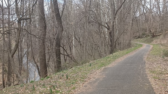

I also pointed out where the enormous footbridge used to be over the Lehigh River that served the industrial workers that lived on the south side.

We looked down at the former industrial ruins below the towpath through this section as well, which were sadly destroyed, supposedly because they were housing homeless people.
Some components of the old building foundations and archways were still in place for many years until the city destroyed it all. Now it's all just a bunch of rubble.
We watched as a couple of trains went by on the former Lehigh Valley Railroad on the inland slope from the river, which of course Ev loved. I promised him we would see trains before even leaving in the morning, so he was already excited for it.

We continued on the towpath ahead until the beginning of the active use area of Hugh Moore Park.
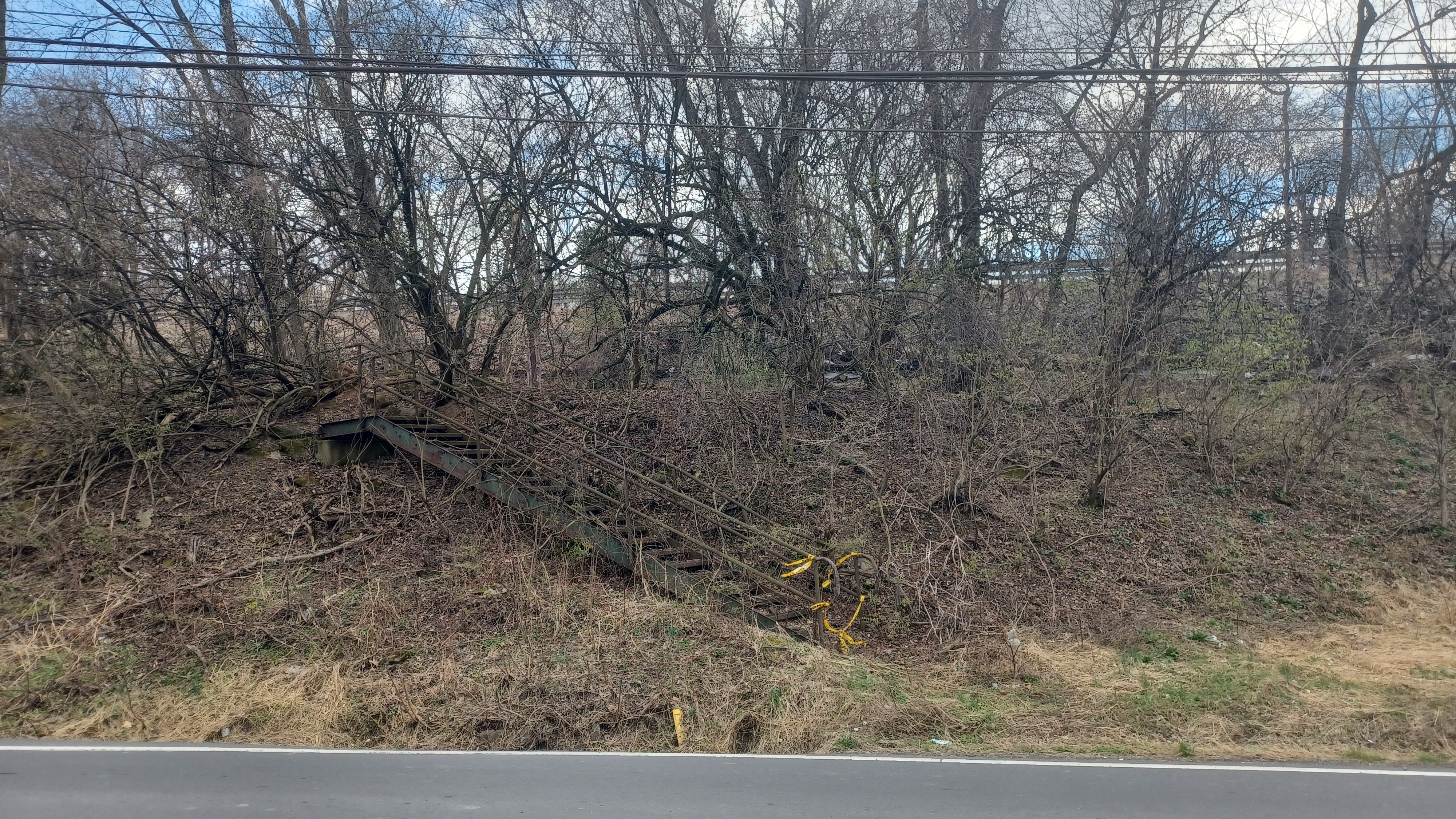
I watched the woods for old stone ruins, and there was a culvert that once carried water I believe underneath the canal. When they destroyed stuff in the area, there certainly was a few back woods things left.
I saw some more significant ruins out in the woods in this area, and since I had friends there, I had them stand with Ev while I bushwhacked on out to check them out. I never seem to get the chance to do this stuff, so I took the opportunity.
 |
| Photo by Cupcake |
These were far enough out in the woods that it would take some effort to build a road to it for demolition. These also don't seem to have any cover to attract anyone sleeping there.

We descended on the paved pathway, and then reached a sort of skill course for mountain biking that had been installed in the past couple of years.
Like the last time I was at this point, I pushed Ev over the thing, up and down the ramps, which he thought was fun. The entire area has been added to quite a lot, with art installations and things like this.
We continued uphill a bit, and then reached the Old Glendon Bridge, which the D&L Trail uses to cross to the north side of the river. 


I'm not sure on the build date of this bridge. The old part over the canal to the south is older, but this one over the Lehigh is a through truss, and doesn't look like anything from the late 1800s. I'm not sure.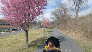

The Glendon Ironworks used to stand through this area near the bridge. It was the second Anthracite powered furnace location in the Lehigh Valley. It began operation in 1842 and saw various improvements over the the years. By mid 1800s, the furnace stack was eighty feet tall.
Like most industries, business began to decline. No one needed pig iron anymore. More and more ironworks were forging items on site, and so Glendon fell behind in the times. The ironworks ceased operations in 1896, and demolition of the buildings began just after the turn of the century. Most of the ironworks was demolished by 1914.


Once we were on the north side of the bridge, Cupcake had to head back to the east. He headed out Riverside Drive near where the fire was and checked out stuff on the way, taking photos and sending them to me.

Kirk and I continued up the switchback and onto the former Central Railroad of New Jersey right of way that the trail now uses.
We passed soon beneath the new Glendon Bridge, and then into Riverview Park. We stopped at the restroom there to see if we could use them, but they were still locked. Kirk went off to use the woods somewhere, while Ev and I ran laps around the building.
From here, we continued on the rail bed ahead, and passed by the Chain Dam, which was originally where the Lehigh Canal crossed from the south side of the river to the north. It was later rerouted along the Island Park area just to the west. The current Chain Dam s actually just downstream of the original dam site. It is so named because it was a chain ferry.

We continued on, and eventually came to the former junction site where a branch of the Jersey Central went uphill to later connect with the former Easton and Northern. We turned to begin climbing this gradually. We passed beneath Rt 33, and came up through the gully along Hope Lock Road.
Pretty soon, we passed beneath Rt 33 again, passed a hospital property, and then crossed over Freemansburg Ave.
I'd given Kirk a couple more beers, and he was laughing and saying that I'd gotten him drunk before five o clock on a Tuesday, which was quite hilarious.

We continued on across Sheridan Drive, and Stones Crossing Road, then along the edge of Fairview Park. Almost no one else was on the trail even though it was passing through suburbia.
We went on to cross Mine Lane Road, Greewood Ave, and Milford Street, and the trail ascended a bit to climb above the rail bed, probably part of a former industrial siding, and then we descended to reach the righ of way of the Easton and Northern.
We turned left and soon reached William Penn Highway. Here, there is no good crosswalk, and a Walgreens is built over the old rail bed.
A trail has been built along the west side of the Walgreens, and then crosses 25th Street, and ascends back to the railroad bed where the bridge over 25th Street used to stand.

I had some then and now compilations I wanted to try to set up, so instead of going on the trail, we went through the Walgreens lot so I could try to set these up. I had one particularly good one that showed the double track trolley coming through next to the old Dixie Cup factory. The cut for that can still be seen, where it came out to 25th Street, but hardly anyone knows it was even there.
The Dixie Cup facility was established at this location in 1921. It remained in operation at this site also until the 1980s, when it moved to the Forks Twp location. It remained there until 2021, and it too closed.
It is being said recently that the old Dixie Cup is to become new apartments, and very recent articles seem to confirm that this is back in the works again after several stalls.
We descended on the grassy hill, down to 25th Street, and then up the other side back to the railroad bed.
Just ahead, we passed by the Taco Bell and the Wendy's. I asked Kirk if he wanted to stop for food there, or if he'd prefer to go to a non chain place over at the Simon Silk Mills beyond.

Kirk picked the Simon Silk Mills, and so we continued on the trail ahead, across Northampton Street, and then past where the Wonder Bread place used to stand on the left. It looks so different today, with a rather new medical facility in its place.

We descended on the rail bed for a bit, and then it turned off to the right. A new trail now exists and goes uphill to a residential area, but leaves the rail bed. We continued down across Wood Avenue, and the trail continues parallel with it for a bit out to Lower Hackett Park.
Because the right of way goes through the former Huntsman Pigments property ahead, the trail was routed up through Upper Hackett Park, and then back to the Easton and Northern line beyond the industry. Now, since Huntsman is closed, I've been going right on through.
We continued off of the trail and through the grass in the park, past Fisk Field, bleachers, and concession buildings, then through the parking lot. We climbed back to Wood Avenue and followed the edge where the former Easton and Northern used to cross, right below the Rt 22 bridge underpass.

On the other side, we checked out but didn't walk on the railroad bed because it has gotten so overgrown. Going into Huntsman, you can't even tell where it used to run anymore.

We skirted the south side of it along Wood Avenue, past some stairs that used to serve one of the parking areas. We passed the former entrance, and then soon after the chain link fence ended.
We turned left and cut downhill directly into where the factories used to stand.
More recently the Harcros Pigment Plant property, previously Huntsman Pigments, is now completely demolished. The last time I had been there, a couple of bits of structure were still standing.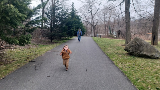

The business was still going until about 2017, a behemoth of a site visible from Rt 22, with giant rusty metal stacks and framework commanding the view.

The site dated way back to the 1870s, when iron oxide production started there. Supposedly the first structures were built by C. K. Williams. Several different entities owned the pigment plan over the years, including Pfizer in the 1960s.
There were workers that lived on site in company homes, on a street that was known as Lucy Street just above, now all demolished as well.
We went north through the site, on an old road that used to go between buildings, then turned right and weaved back to the south just a little bit again.

The Easton and Northern used to continue north along the Bushkill Creek as a main line, but a terminus depot was south along the Bushkill Creek, I think the original line. We followed this out of the site just to the south.
There are a few trees and such down on the former rail bed heading to the east, but we were able to get over or under all of it, passed the old coaling chutes, and out to 13th Street. We then turned to the left and headed into the big doorway to the Simon Silk Mill property.

There are a few trees and such down on the former rail bed heading to the east, but we were able to get over or under all of it, passed the old coaling chutes, and out to 13th Street. We then turned to the left and headed into the big doorway to the Simon Silk Mill property.
The mill was first opened in 1883 by Herman Simon with 250 employees. By 1900, the business had grown to 1,200 employees operating 1,500 pieces of machinery. By the 1920s, the silk industry ballooned in Pennsylvania to the point that one in three American silk workers were from Pennsylvania.


After years of neglect and deterioration, it was proposed that the entire complex would be leveled in favor of ball fields and a new arts building, but the plan never materialized.
By 2010, new ideas for creative repurpose of the strong brick structures began to gain momentum, and the old mills have been redeveloped into upscale apartments with businesses on lower floors including restaurants, brewery, winery, galleries, and more.
The Simon Silk Mill is a bright example of how to reuse historic and sustainable infrastructure, rather than acquiesce to the typical developer looking for a clean slate.
We headed into the wide open corridor, and then out to the access road to the north where we were able to head into the Easton Wine Project.
There, we had a really delicious late lunch as well as some really great wine.
Once we were finished here, we headed through the site and to the somewhat new pedestrian bridge over the adjacent Bushkill Creek, back to the old former Lehigh Valley Railroad.

Now the Karl Stirner Arts Trail, there are always new art installations on this route, which make it always very interesting.
Kirk had actually met Karl Stirner years ago and had been in his house before he died.
We took a side trail to the left, made of wood chips. The old railroad bed crosses to the other side of the creek for a bit, and the trail follows an old access road, but we took the lower one, which goes under the deck girder rail bridge.
I have been told that this bridge, initially left unused, is to become an extension or side of the trail in the future.
We paused beneath the bridge and let Ev throw some rocks and sticks a bit. He was out of the stroller at this point and quite happy walking the trail through a long stretch.
The trail heads back uphill beyond the bridge, and to the paved trail again. There's a lot to see in this area for Ev, including a side trail with bell chimes and such.
 |
| Photo by Rich Pace |

There's also a very nice labyrinth along the left side of it in here.


We followed the trail all the way back to the main entrance to the Easton Cemetery, crossed the girder bridge over the Bushkill Creek, and resumed for a bit walking the old Lehigh Valley Railroad bed.


The trail led us beneath Rt 22, and then came to where the tracks terminated. The trail then follows the edge of Bushkill Drive for a bit. I looked ahead at some of the ruins on top of one of the peaks. Kirk and other friends had recently done a night hike to these ruins, and I have never been up there. The fact that this is just looming over me and I'd not been to it yet kind of drives me a bit crazy.
 |

Kirk helped Ev walk along the tops of the walls along the roads, and soon we cut to the left to continue on Bushkill Drive, where the entrance lane goes uphill to Lafayette College.
 |
| Photo by Rich Pace |

I was surprised to see more of the road scaled back from traffic again. The first time I led a hike on this stretch, it was fully open to two lane traffic. Then over the years, it was switched to one way traffic, and now it is almost entirely closed.
 |
| Photo by Rich Pace |

There is one house along the route that traffic is allowed to access, beyond which it is closed and now part of the Arts Trail.

Even the Bushkill Creek looks way different because dams had been removed on it, and it was now flowing free. Of course, this makes it look much shallower.
I had several photos I'd taken on that hike I did back on February 24th, 2002, and I realized that now, after more than twenty years, it is a good time to be setting up more of my then and now compilations using my own photos, or photos taken by friends on that same hike.
I set up as many of these as I could along the stretch, and then we emerged at the stone entrance gate to the Lafayette College.
 |
| Photo by Rich Pace |
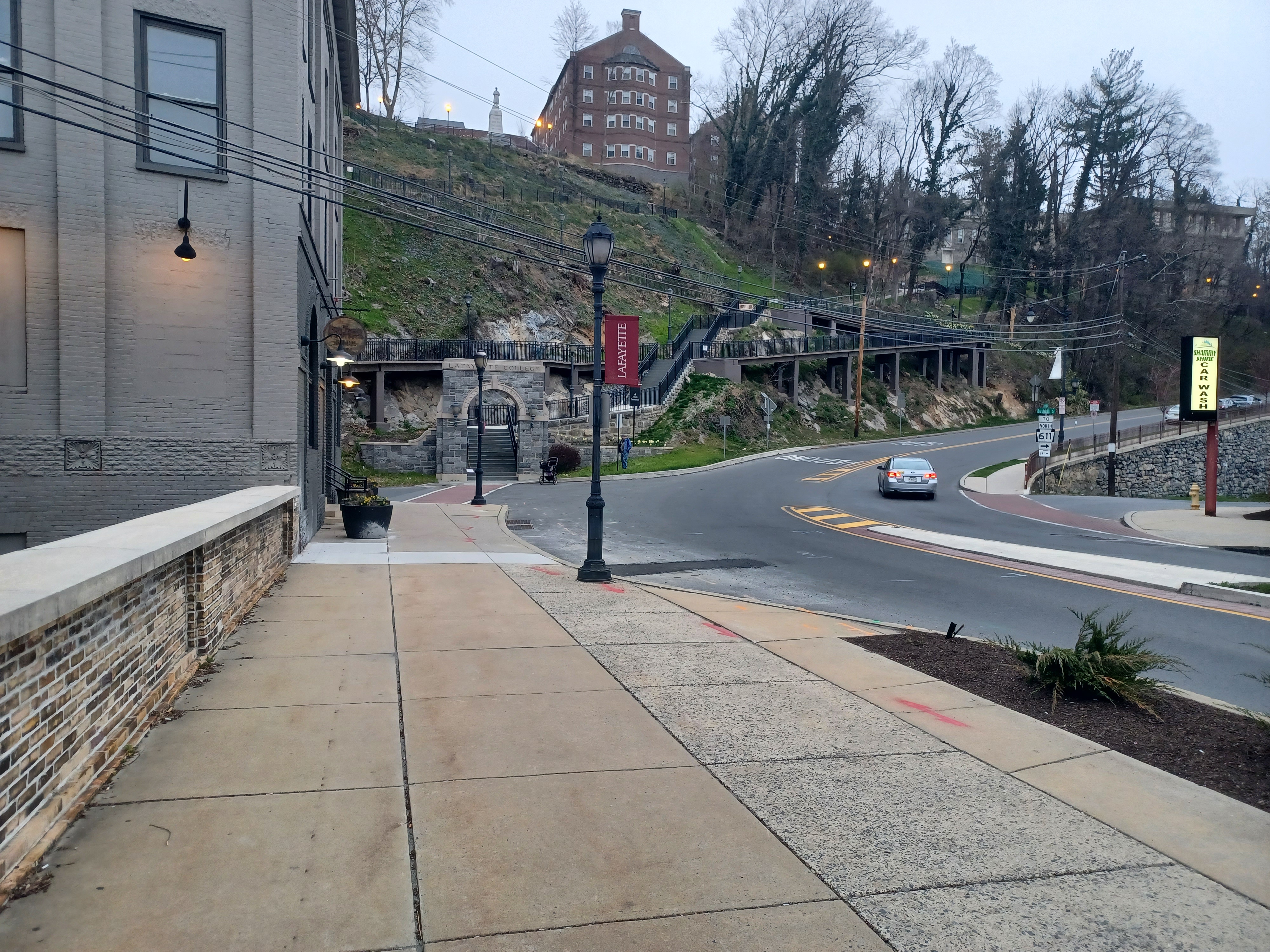
The iconic steps that lead up to the college, which we'd used on countless day and night hikes, had been completely demolished and rebuilt.

This plan fell under much criticism, people saying they had money to burn. There is a ramp going up it from further down along the arts trail now. I'd wanted to go up, because I still haven't done it, but we didn't bother this time. We were closing in on our 15 plus miles.
Kirk went over to the walkway and laid down on the stairs, leaning back. It was hilarious that Ev walked over to him and sat down, then laid back in the exact same way emulating him.
We walked from here out toward the Rt 22 bridge, and Kirk headed back to his car. Ev was almost ready to get back into his stroller, but he stuck it out and actually walked it on his own. I think he ended up walking close to three miles unassisted.

We walked all the way across the 1938 bridge on Rt 22, and then made our way back to my car.
We stopped on the way back and got some pizza at the new place that opened in where Pizza Express used to be, and I did another then and now of when that building was built in 2003.
I talked to the owner, and it turns out he served our group when we were hiking through Bath PA on a previous hike.


This had just been a really great and fun day, totally well spent. Any long day spent walking always ends up being great.
No comments:
Post a Comment