

Hike #1596: 3/17/24 Fort Montgomery to Haverstraw with Diane Reider, Dan Asnis, Jenny Tull, Kirk Rohn, Sasha B, Robin Deitz, Mike Selender, Violet Chen, Sam Chen, Serious Sean Dougherty, and Everen


This next hike would be the next in our Hudson River series, this time stretching from Fort Montgomery down to Haverstraw.

We had done a section from Bear Mountain area to the north, to Cornwall on Hudson somewhat recently, and I wanted to continue with connections from where we had left off from there.
There was some stuff I'd done before, but much that I hadn't, and some of it was worth doing anyway.
I made the meeting point Haverstraw Bay Park on the north side of Haverstraw New York. We could shuttle with as few cars as possible north from there.


On the last hike through the area, I made the mistake of starting right at Bear Mountain, where they impose a parking fee. At first, this time I had decided we would meet at Fort Montgomery itself, but then changed my mind and figured Mine Dock Park was an interesting spot that we hadn't considered before.

I was not aware of much of the history of the spot at all previously. I know the line that came through was the West Shore Railroad. It was first opened through this area as I understand in 1873.

This was a beautiful spot on the Hudson River overlooking the Hudson Highlands, but it was also incredible from a railroad standpoint. I had no idea that the Fort Montgomery Station, or maybe it was officially a Highland Falls station at one time, was down at present day Mine Dock Park.
The station was just to the right of the tracks while facing the tunnel, where we were parked.
Interestingly, there apparently wasn't always a tunnel. There was a bridge out and around a wetland to get the railroad around the rock outcropping, which I've seen photos of, and it is quite interesting.

Today, the former West Shore is freight only. There is no sign that the station ever stood there.

There was a crossing for boat launching, a giant wooden chair, and a great view of the Bear Mountain Bridge from this location. We walked over the tracks to get better views before moving along, and I got the stroller together and ready to go.
Unfortunately, I was having some serious trouble. I could not find my pump for the stroller tires. I was going to have to go through pretty much the entire day on a somewhat flat tire. It would change my plans a bit.
The Bear Mountain Bridge was originally supposed to be a railroad bridge, where work started in the 1880s.

Work had “progressed rapidly” on the footings to this bridge, but it stalled out and was never completed for its original intended use. Instead, the highway bridge was planned, and eventually completed in 1924.

At the time of it’s completion, it was the longest suspension bridge in the world, a distinction it held for only 19 months, when that title was taken by the Ben Franklin Bridge between Philadelphia PA and Camden NJ.

After we'd taken in a lot of the sights at Mine Dock Park, we began walking Mine Dock Road gradually uphill. We passed beneath the handsome bridge that carries Rt 9W over the gully, a nice red metal arch.

It looked like Mine Dock Brook probably had some major flooding in 2023 like so much of the other area had, because it looked as though it had been flooded out.
There were some buildings along the road, and one of them on the left appears to be an old mill building, but the front of it is rather inaccessible due to the issues with the creek.
A large white building was across from the mill building on the right. This might be a former store building, and the 1875 Andreas, Baskin, & Burr Atlas of Orange County seems to show it as such.

It was a steep climb, but we made it uphill on the road to Firefighter's Memorial Drive. I got up there before anyone else, but it took some doing.

We turned left on the road and followed it out to Rt 9W. We then stayed on the west side of the bridge, which I don't think I've ever walked across.
I'd done the east side before, and on this occasion, the walkway over there was closed to public.
The west side afforded us good views of the peak known as Popolopen Torne, as well as the Popolopen Creek below. I've been wanting to hike these again, but some of them have been ravaged by storms and remain closed today. I also need to plan for stroller stuff for Ev for the time being.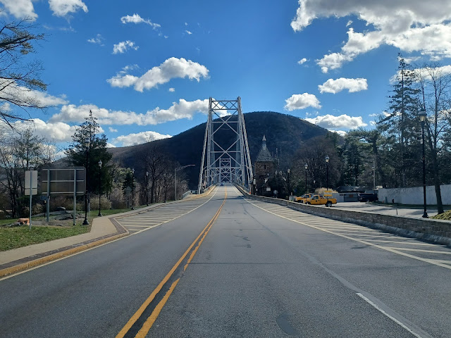

We reached the south side of the bridge, and then there was far less of a shoulder to walk upon as we approached the Bear Mountain Circle. When there were no cars coming, we hurried across to the south side to continue.

We made our way from here around the bend, toward the Bear Mountain Bridge. I had intended originally to head down from Fort Montgomery and use the Popolopen Footbridge. but with the stroller problems, I was not going to chance it.
Soon, we reached where the Appalachian Trail crosses the road at the approach to the Bear Mountain Bridge. We crossed at the AT crosswalk, and I tried to get some shots to use as part of then and now compilations, but I don't think any of them looked quite right.

We continued over and near to the toll booth, and then entered the Bear Mountain Zoo area on the AT route.

The area of the Popolopen Creek just below the bridge was the place where Henry Hudson moored his ship, the Half Moon, in the cove, while searching for a passage to the west.
I hadn't walked through this section in quite a long time, so it was good to be able to get back to it.
We continued past the handsome toll house and then reached a little fountain. There was a sign reading "no coins necessary to operate the pond", to curb the amount of coins tossed into it like a wishing well.

The Appalachian Trail route goes a little more direct through this area, but my goal this time was to do a more circuitous route through the Bear Mountain Zoo area to see all of the displays.

We weaved to the right and went into the first building that was open, which had a mastadon tusk on display in it, as well as the skull and other bones.
We also found a really interesting display about iron furnaces and iron mining.
We found a lot of taxidermy on birds, and Ev really had taken a liking to owls. I don't think he had ever seen one in person before, but as we left the buildings and continued around to a sort of Raptor Trust area, we came to a pen where there were owls inside.
What really impressed me about the place was that there was signage around about each of the animals and how they came to be at the Bear Mountain Zoo. It seems that the current zoo model at Bear Mountain is not only about education, but a sort of rescue.

What really impressed me about the place was that there was signage around about each of the animals and how they came to be at the Bear Mountain Zoo. It seems that the current zoo model at Bear Mountain is not only about education, but a sort of rescue.

We continued around the pens with owls, eagles, and hawks, and then followed along the edge of a pretty little pond where there was a swan, geese, and ducks.
The Appalachian Trail and surrounding trails pass through the ruins of Fort Clinton in Bear Mountain State Park. Here, we passed through the ruins of the West Redoubt of Fort Clinton, just beyond the pond. The fort was destroyed by British forces in October 1777, along with Fort Montgomery, on the other side of the Popolopen Creek.

We continued through some of the area ruins, and then weaved around to rejoin the Appalachian Trail again, near the newly expanded upon coyote pen.

We weaved over closer to the waterfront, and there was a side trail, paved, to the left, which led to an overlook and a small plaque.
The plaque was a memorial to Stephen Tyng Mather, who developed policies for the development of national and service. There was a great view to the Bear Mountain Bridge from this spot.
Somewhere in this section of the Appalachian Trail is the lowest elevation point on its entire route.

Within the zoo section, the trail dips down to a point that is the closest to sea level anywhere on the trail from Maine to Georgia.

I remember there was once a sign denoting this as the lowest point on the entire trail, but it looks as though they have removed it.
If it is gone, I suspect that such was done because of dog owners who were upset that they could not reach the lowest elevation on the AT during their through hike, because the Bear Mountain Zoo does not allow any pets. I've seen more than a couple times where dog owners were angry about this.

We pushed ahead, and the next point of interest was a pair of Cinnamon Bears.

These were actually black bears born with pigmentation problems so that their fur was lighter brown.
I know that black bears can occasionally have different colors on the muzzle and sometimes a white patch on the chest, but I did not know that they could be fully a lighter brown on blonde.
We continued on and came to another enclosure, where there was a porcupine running around like crazy. Ev and I stopped and watched for a bit.

Across, there was an adorable bobcat taking a nap in a box, in another enclosure. 

We weaved out closer to the water and to another rock outcropping where there is a great statue of Walt Whiteman overlooking everything. I do love his "Song of the Open Road" poem.
"Afoot and light-hearted I take to the open road,
Healthy, free, the world before me,
The long brown path before me leading wherever I choose.
Henceforth I ask not good-fortune, I myself am good-fortune,
Henceforth I whimper no more, postpone no more, need nothing,
Done with indoor complaints, libraries, querulous criticisms,
Strong and content I travel the open road." - Walt Whitman, Song of the Open Road

We continued from Whitman's statue, passed a vernal pool, exited the zoo area through a gate, and then headed toward Rt 9W. We passed a building, turned to the right, and soon passed beneath the highway via a tunnel.

The path went up a bit, and then there were steps up to the main lot at Bear Mountain State Park. I used the handicap ramp that weaves around it with the stroller.
We headed across a picnic ground, and then reached the shore of Hessian Lake, where we made a left turn and continued on the Appalachian Trail route for just a little bit further toward the lodge building.
It was here that 2100 Tories, English, and Hessian soldiers under command of Lieutenant General Sir Henry Clinton made their moves to take Forts Clinton and Montgomery, Continental Army strongholds, in October 1777.

900 troops went West around Paramount to take Fort Montgomery, while the remainder marched on Highland Lake (now Hessian Lake).

Hessians were stationed in the front, and so they suffered the heaviest casualties. About 250 men met their end, and their bodies were cast to the lake. It said that the lake waters were stained red from the blood of the Hessians for days to come, and so for a time it was known as Bloody Lake.

In the end, British forces captured the American forts.

We continued up from the lake, and got on the 1777 East Trail, which goes up along the back of the lodge building, where the AT begins to ascend Bear Mountain.
There was a great view of the Bear Mountain Inn and Anthony's Nose from 1777E Trailin the wide open fields behind the building. The inn was completed in 1915.
The building is an early example of rustic style lodges in parks. The site served as a headquarters for training of professional sports teams in the 1930s and 40s, and as a military depot during World War II.

Today, Bear Mountain Inn and Conference Center remains an upscale establishment popular with travelers from the city.

1777 E Trail is the route that half of the forces of Sir Henry Clinton took during the attacks, and travels to the far side of the Inn grounds, then passes a playground.
I wasn't totally sure on what route I wanted to take from the inn, but I figured taking part of 1777E Trail to Doodletown and then continuing along the greenway south would be good.
To be sure, and to give Ev some fun time, we took a break at the playground.

Sasha played with him a lot while I was going over the maps. She got along with him really well right away. This was only her second hike with us, but she handles it well.

After the break, we began moving down the trail, which is actually an old woods road, so I figured it would be fine.

What a mistake this was. I didn't realize that all of the trails in that area were legitimately closed. I think I might have seen some kind of closed warning somewhere, but it was barely anything. I just figured this was some nanny-state warning for a ridiculous hazard tree thing or something.
It was super easy at first, everything one would expect a woods road would be. There were occasional rocks, but overall no problems.

Then, we came to the washout area. 

This was literally insane. For people hiking, it was tough, but doable. For the stroller, it quickly became impossible to do safely.
A small stream had flowed from the woods onto the old woods road that was the 1777 E Trail. That stream, due to localized heavy rains, became an insane river, and washed and rutted the former road down to a very deep trench.
It is so bad that I'm afraid this trail as it was will never be opened again. The historic road route used by he British in this area is completely lost.
I scooped Ev up in my arms and told him to hold on tight. I would have to climb right through the mess directly.
While others were going around the outside of the washout, I could not trust that the steep sides, which were all undercut by the flooding, would be enough to hold us, and I could not risk falling while holding Ev. I would have to walk right down the middle of it and watch my footing for the safest passage.
Thankfully, the group was able to help pass Ev's stroller through the entire mess. It is lighter without him in it, but it is still awkward. Some of my stuff was taken out and carried.

I recall particularly that Kirk and Sam helped to get the stroller through the worst of the mess.

Some of the rut was just basically walking over boulders. I wasn't worried much about stepping in a little bit of water.
At a couple of the spots, I couldn't chance it and I had to sit Ev down while I carefully stepped down, then picked him back up from the steps below. It was just too easy to trip up and risk him hitting his head.
There was one particular washout where it went from just rutted to ridiculously deep. I stepped down from the steep dropoff into water way above my knees, where it doesn't look possible to be.
The worst of the old road was a spot where it turned and descended for a bit. After this descent, the road turned rather hard to the right. The flood waters had obviously dispersed some after this point, but it remained really rocky and uneven to walk through.
After a bit, the bulk of the water spilled off to the left of the trail, and we were able to resume a somewhat reasonable path again, where the stroller could be pushed. I resumed doing that, but Ev chose to walk for a bit.
He did fall behind a bit, and had to be coerced by the group to push ahead a little more, but he did overall pretty well on the trail as we approached the former site of Doodletown.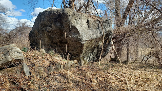

We switched onto the Cornell Mine Trail somewhere in this mess, and passed a giant rock that appeared to have some sort of infrastructure built up along it, now all abandoned.

The area was first settled in the 1700s, and roads through what is now Doodletown area were used by the British army in 1777 heading to the forts to the north.
French Huguenots including the June family settled the area early on, and the town grew in the 1800s. Descenents from the original settlers lived in Doodletown for it's entire existence.
The name is said to derive from the Dutch "Dooddel" which meant "dead wood", possibly to do with local lumberjack work. There were also some iron mines in the area.

Most of the land was purchased as part of Bear Mountain State Park in the 1960s.

Because this trail hadn't been used for the closure in some time, it was starting to grow in rather badly. Ev was still walking, but it got a little tougher for him with all of the weeds. He stuck with Sam through some of this part, and we descended down to the old Dunderberg Turnpike, where the trail turns left to descend.
Some of the group continued on the road ahead, to descend a bit to the north, and some went to the right on another road, which was the official Cornell Mine Trail route. I started going the first way, and then switched to the second because it was a bit shorter. 

Soon enough, we reached Rt 9W at the bottom, and I was totally relieved.

There was a great little view of the Doodletown Brook and the cascade coming down from it. This must have washed out the road pretty bad in 2023, because there was still a lot of strewn rocks and crap beside the highway.
We crossed the highway when there was a break in the traffic and followed the southbound shoulder for a little bit.
Pretty soon, views of Iona Island just to the east of us were seen.

Iona Island was the former Navy munitions base on the Hudson River. It has an interesting history, from its earliest days as a native American fishing settlement, to an encampment for British troops during the Revolution, an orchard farm, and an amusement park.

The government bought the island in 1899 for use as the munitions depot. Today only five original buildings from that use remain. Iona was a very strategic location, protected by the Hudson, but only 41 miles from NY City by rail on the West Shore Railroad.

Iona Island saw America through World Wars I and II, and it closed in 1947. For a time after that, a “mothball fleet” of ships was stored adjacent to it in Tomkins Cove.
The island was purchased by Palisades Interstate Park Commission and became part of Bear Mountain State Park in 1965. Today, the remaining former military buildings are used as storage for park maintenance. The area is popular among birders and rail fans today.

We passed the Iona Island access road to the left as we walked along the highway. It is surrounded by wetlands and seriously effected by tides of the Hudson.

The last time I was at this spot, the road was totally under water, and I walked out it onto the island and back.
I had considered doing some of the island as part of this trip, but after all of the craziness between Bear Mountain and Doodletown, I was tired and ready to be heading further on.
After a short distance, we turned to the left onto the Jones Point Path. 

This trail, part of the Hudson River Greenway, was the original highway that connected to Bear Mountain, constructed in 1906. It was replaced by the current highway alignment, Rt 202 and 9W, further uphill in 1930.

There was an old side road that went up from this road along the way, and I wondered what the story behind that was. There were so many other older alignments.
We had some great views through the trees along this, of Iona Island and beyond to the Bear Mountain Bridge.
I was so glad to be on such an easy route. I had only hiked this old highway route once, acually on the last Sunday before I started bringing Ev out on all of the hike instead of a few.

On that one, it was a really pleasant walk, but only a few of us showed up for that hike, so I figured it was worth making it part of something again.
 |
| 1875 Walker & Jewett Map Jones Pt |
The old highway route has remnants of the older guide rails on the river side of it, which is pretty neat.
Not far into this, a train went by on the former West Shore Railroad, and I got to point it out to Ev as it went by. In addition to this freight line, the passenger trails on the Metro North line across the river went by frequently and he could see those too.
Eventually, the trail emerged back to River Road at the little community of Jones Point. We kept to the left on the River Road to have the better views across the tracks of the Hudson River and the lands beyond.
We continued along the active road, which did not have a lot of traffic at all, and passed the Turning Point Church, which I think was the site of an earlier church before that, but I'm not totally sure.


Pretty soon, we took the road out to Rts 202 and 9W, directly across from the Timp-Torne Trailhead and others, where I'd parked previously.

From this point, we had to walk the highway for a bit. There was no better way through just yet.
Along the highway, we passed a memorial to the Hudson River Fleet Reserve mentioned previously, and another parking area.
Through this entire area, from Jones Point and for a while south, across from us we could see the Indian Point Energy Center near Peekskill.

Until rather recently, this facility provided about 25% of New York City's electric needs, until its closure in 2021. 

The electricity is now provided by new natural gas plants which will keep the city shy of its climate goals.
The power plant was constructed on the former site of the Indian Point Amusement Park. Land was purchased in 1954 and the plant began operations in 1962.
In many ways, nuclear is the cleanest form of energy available. The main problem of it is how volatile it can be. America has been far behind on research with it, and concepts such as "Salt Nuclear" are fascinating but were defunded within the past couple of years.

Former Governor Andrew Cuomo is blamed for the closure of this facility. Beyond that, the area was stripped of its "Indian Point" name on all online maps it seems, as it was cited as being racist.

We continued down the road and passed the 1777 Trailhead. I'd hiked in this way a little over a year prior. It wasn't actually the way that the British army took to attack the Twin Forts. The trail was routed to here years later, and the original road passes through an area near Tomkins Lake to the west.
After a bit, West Shore Drive descended from the main highway to the left, and we were able to take that closer to the waterfront, and with far less traffic. It was a beautiful road to walk, with great views over the tracks and across the Hudson River once again.

Eventually, the road ascended steeply and returned to the edge of Rts 202/9W. Across on the other side, another side road continued up past a church and came back down again, but it was pretty far uphill. My plan for this hike was originally to take that to deal with less traffic, but after all of the burden of getting up to the highway as it was, I decided against it.

We continued to the left on the bigger highway for a bit. Serious Sean joined the group at this point after a bit of time trying to find a spot to park. I'd recommended him using the church just up the road, which apparently worked out.

We reached the height of the land, and I'd had some great talks with Sasha. I hadn't talked to her a whole lot on the previous hike because I was so stuck with trying to guide the group.
That time, there always seemed to be someone that really wanted to talk to me, so there wasn't a lot of the opportunity. This time, I found out that her birth name was Svetlana, and that she was from an uncommon religious enclave from India that had more of an eastern European religious connection. She was surprised that I knew others with that name.
Just after the top of the hill, there was a road called Boulderberg Ave that went to the left. Beyond, another called Boulderberg Road went in from 9W also. I couldn't help but wonder if these two roads connected, so we turned to check it out.
At the start of the road, there was a trace of a road in the weeds, which I think might have been the original alignment before highway development.

We could see before reaching the end of the road, that it was not going to go through, but that it ended at a beautiful mansion house. This was Boulderberg Manor.

The Gothic Revival style mansion house was constructed about 1858 by industrialist and concrete magnate Calvin Tomkins. At the time of its construction, it was considered to be the largest poured concrete structure in the state of New York, and an early example of such construction.
For many years, it was used as an upscale restaurant and catering service.
Calvin and brother Daniel Tomkins came to the hamlet in 1838, and established the Tomkins Lime Company in 1859.

We had to backtrack from the house a bit, and turned back onto 9W to the south again. We followed this into the little settlement of Tomkins Cove.

On the right side of the road was the Tomkins Cove Public Library, a handsome old building.
Originally, this was the Tomkins Cove Union School, built in 1874 by Calvin Tomkins.
In the 1950s, when schools were being consolidated and this one closed, concerned citizens gathered to save the building by turning it into a library. This happened in the 1960s, and it has been the public library ever since.

In a short distance, we turned left onto South Hill Road. This was a really steep road heading downhill toward the Hudson. I had to hold on tightly to Ev's stroller, because letting him go would have meant rolling fast and steep to a bad crash. In these areas, a little bit of gravel makes me nervous. I have to make sure to maintain my hand grip over all else.

Boulderberg Road joined from the left, and the road we were on changed names to Church Road. We continued on this down to Elm Avenue.

There was another good view up the Hudson on Elm, which was another lesser used road. We then ascended yet again to join up with 9W again, and passed a garden center on the left.
We carefully continued along the shoulder of the road ahead, and came to the intersection with the old Buckberg Mountain Road, which was the strategic colonial route over Dunderberg Mountain to Doodletown, the same one that becomes the 1777 Trail to the north. There was an historic marker denoting this spot.

At this intersection was the Cove Deli, and I decided we would stop here to get some kinds of snacks or something.

I recall getting some good chocolate milk, and I think I got Ev some peanutbutter cups. I think I also might have gotten a small round roll sandwich.
Everyone hung out outside while everyone got their food.
When we were done, we headed to the south a bit more along Route 9W.
As we walked, there was an historic marker on the east side of the highway.

The sign denoted that this was the original ferry crossing point until the Revolution, when it was moved to Fort Lafayette.

Kings Ferry was a strategic point because it was the southernmost crossing American forces could use while the. British held New York City. The strategic location was the reason for the Battle of Stony Point, the last major northern battle of the war.
This would be some of the theme of the next leg of the hike.
We turned to the left soon on Park Road. This road descended a bit, and then went into a very interesting cut for a road to pass through.

To the left, Battlefield Road broke off. We turned here.

I was expecting to go out to Stony Point Battlefield State Park next, but at the next left on a driveway, where the road went right, it was gated and said the park was closed.
I figured that it might be alright for pedestrians to go in, so we walked for just a little bit.
On this first stretch, there was a large family walking down the road in the opposite direction, which meant to me that it was alright to continue onward.


The road continued out along a wetland, then to the entrance to the state park.

At midnight July 15-16 1779, Brigadier General Anthony Wayne led American light infantry in a daring assault on the British who had taken the adjacent ferry and blockhouse in May and June of that year.
The British returned after this loss, the last northern skirmish of the Revolution, rebuilt the Fort, but then vacated the site in December 1779.
The site was purchased for Park use in the 1890s, and officially open to public in 1902.
The grand stone entrance arch we had just reached was built in 1908, and the museum was built in 1936.
 |
| 1910 postcard |

We crossed through the arch, and then immediately across a through girder bridge over the former West Shore Railroad. I'd hoped a train would go by at this time, but no luck there.

We continued uphill a bit and passed a side road to the right, to a larger lower parking lot, and a house on the right. There didn't appear to be anyone around there.
From there, we continued at a fork in the access road to the place to the left. This took us slightly uphill, and past the museum building on the left.
At first, and before reading further into the property, I thought this building was an historic one that had already been there, but it was not.


We continued on a bit further, and there were historic markers about the battle and the site, and a nice pavilion overlooking the river lands to the north.

We continued on the paved trail through the site, and then out to the spur trail that leads to the Stony Point Lighthouse.
The handsome white lighthouse was not all that tall compared to others, but it is the oldest one on the entire Hudson River, constructed in 1826.
The lighthouse was built by Thomas Phillips to warn ships of the rocks on the Stony Point Peninsula. 

The opening of the Erie Canal one year prior had brought considerably more traffic to the Hudson. 

There were three keeper's homes here. The original 6 room house was torn down in 1879, and replaced by a second dwelling, which was right below the lighthouse on a flat just to the south. This home was torn down and replaced by one closer to the river in 1938.
After the hike was over, I found that there is an abandoned house down below everything in the park. I assume this might be the 1938 light keeper's house, but it looks like it is in ruins and collapsing. There are keep out signs on the road that goes out to that point, reached from below.

The light was deactivated in 1925, and acquired by the park commission in 1941. Preservation of the structure began in 1986, and the light was lit again in 1995.

We walked all around the building, and there was no one else on the grounds. Still, I didn't want to hang around out there for too long, so I got the few then and now history photo compilations I wanted to get, and we moved on ahead.
The trail weaved to the south a bit, and there was a nice little overlook spot with a small gazebo. We continued on the path then to the west a bit, and there were several more historic markers.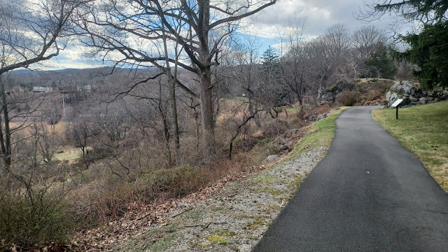

There was a second overlook spot, and the path we were following came back into where we were before, by the museum. We continued from here, past the house building on the left, and then back downhill toward the bridge over the tracks.

I got one more then and now compilation using an historic photo of the archway built in 1908.
We continued from here, and I pushed ahead pretty fast, around the corner and down along the road to the exit gate again.
Once we were through, we all took a break sitting on the fence, where I got our group shot for this hike.

We followed Battlefield Road again over the swamplands, and then back down to Park Road to the south. "I whole-heartedly agree that half-hearted responses to warm-hearted offerings is cold and hard." - Helbing

The view areas showed that we were not very far from the USA Marina buildings, and I would have loved to just head down and skirt the tracks for a short time to get to that point and then more back roads, but we had to go around.
We made our way uphill on Park Road for a bit, and at the top, we turned left on Georgian Drive into a small residental development. Almost immediately, we turned right onto Jackson Drive. I was originally going to go left, but that way was more uphill only to come back down to Jackson anyway.
Along this road, there was one house that had a yard completely inundated with gnome statues.
We continued through the development for a bit, and then made a right turn when we got to Farley Drive, a little closer to the waterfront and the West Shore tracks.
A little ways down this, we turned left onto Hunter Place.
My plan here was to follow along the road to a bridge access under the railroad tracks and to a marina, from which we might be able to continue more on the waterfront.


When we got to the bridge access, it was mostly blocked by someone's driveway, and there were roadblocks under it leading out to the marina, so we didn't bother.

We got back to Farley Place and turned left to continue to the south.
We reached Tomkins Avenue and turned left toward the waterfront.
We passed beneath the railroad underpass, and then turned to the right. The name of the road changed to Beach Road.
We passed marina properties on the left side, and soon views opened up over the Hudson River to the left.

The next bit of road had splendid views for a while, unobscured over the Hudson River.

We skirted Vincent A. Clark Park along the road ahead, and there was limited access to a boat launch on the opposite side of the street from us.
At the intersection, we reached Grassy Point Road, and turned to the left. The road crossed the outlet of the Cedar Pond Brook, with a sort of bay area separated from the Hudson a bit.
We followed Grassy Point Road to the east across the water and onto the next island area, and then passed more marina and yacht club lands.

There is a large gypsum plant on the right side in this area, and just beyond the end of the parking area is the former site of St. Joseph's Church at Grassy Point.

The church served local parishioners from from 1890 to 1969. The church was demolished in 1976.
Just ahead of here was the "downtown" of the old settlement of Grassy Point.
This community was founded around the first steamboat landing on the Hudson River in 1830. Later, the area became the brick making capital of America for a time.
We made our way past the buildings, and passed by the Playa Cancun Mexican Restaurant.


We all agreed this looked like a good place to stop and eat, but we were also getting close to the end. So we also agreed that if we still felt so inclined, we'd come back to here.

Pretty soon, Grassy Point Road reached the direct waterfront again, and turned ninety degrees to the south.
It was beautiful on the waterfront again. We could see way down the Hudson Valley at the Palisades Formation, which cuts inland at Haverstraw. We could see Long Clove, High Tor, South Mountain, and beyond toward Hook Mountain along the river.
We continued on the road to the south, passed yet another marina, and cut slightly inland a bit to pass beneath some sort of bridge out to the river associated with the Gypsum Plant.
We went west just a bit, passed a canoe and kayak launch, and there was an old abandoned railroad spur bridge over the Cedar Pond Brook.


We were able to see part of this bridge from the previous time we crossed the brook as well. At the time, I didn't know where this line had come from, but it actually took a circuitous route.

This branch followed an interesting, circuitous route, having broken off of the West Shore line to the west of here, and then weaving along the wetlands to reach this spot.
Beach Road took us across yet another causeway from here over pretty open water.
Next, we passed by even more marinas. Soon, we came to another little bridge over a flow of the Cedar Pond Brook. This bridge had rather recently been replaced with a new one, which we were walking on.


The earlier bridge abutments were still in place just to the left of us, and the railing section still bore the 1928 date of construction. It looked like maybe a trail bridge might be planned to cross over this.

Just past the bridge, there was what looked to be a new trail, with crushed stone aggregate surfacing, off to the right. It was actually heading in the direction we needed to go to get to Haverstraw Beach Park, so we turned on it.
I was surprised soon to find that this was an abandoned railroad grade, with tracks still in place! The crushed stone buried just up to the top of the rails, which were sometimes well exposed.


We stayed on the "trail" to the south, and the railroad right of way continued on.

This surprised me, because I had no idea where it came from or what it might have been.
Eventually, I found out that this was a branch off of the same line that served the Gypsum Plant to the north. It broke off and headed south, and crossed over a Beach Road, and then Gagen Road to the south before coming to a plant to the south.


I thought this was kind of an interesting one because it came so very close to the former route of the New York and New Jersey Railroad, which I'd followed to the area on a previous hike years ago, but the two spur lines never coexisted.

We turned left on Gagen Road and headed out to Haverstraw Beach Park where we were parked. There was a large playground here, and so we hurried over there immediately with Ev.
Jenny stayed at this spot and played with him, and I did one little final lap around the park, from the north to the south to take in all of the views.
Most the entire group left at this point except for a few of us that hung around. Serious Sean was still somewhere close by, and Kirk hung out to get dinner with us as well.


Sasha walked the entire remainder of the perimeter of the park with me, along the waterfront from the north side, and then south past the boat launching area, and to a great little wetland study area.


There was a really nice foot bridge, and then we weaved around to the veterans memorial along the inland waterfront. 

I noticed that among the large standing epitaphs in the memorial, there was a completely blank marble one.

On one hand, it's wonderful to have this space set aside to memorialize those who serve. But it's also sad, because there's going to be more war and more death.

We walked the final bit out onto the docks out onto the waterfront, with more great views of High Tor and the Palisade formation beyond to the south.

We headed back to the parking lot and said our goodbyes, and Jenny, Sean, Kirk, and I headed over to the Cancun place to have some dinner.
While I don't think it was quite as good as Juanito's back home in Washington, it was of the same type of quality and I loved it a lot. Ev had a good amount and liked it as well.
We got a lift back to the starting point at Mine Dock Park just after dark, and got one last great look at the Hudson River, with the Bear Mountain Bridge lit up beautifully.

This had been another really great trip in our Hudson series, and I already couldn't wait to do the next section down to Nyack.
With the completion of that next hike, I would have personally walked along the west side of the Hudson River all the way from Bayonne NJ up to Cornwall On Hudson, so I was quite keen to do it.
No comments:
Post a Comment