

Hike #1599: 3/31/24 Shiprock Woods to Lancaster with Diane Reider, Justin Gurbisz, Kirk Rohn, Violet Chen, Stephen Blank, and Mark David Moore

I had created a hike that day that in no way connected with any hikes I'd done previously, so it was my goal, as soon as possible, to post a hike that would connect it.
This turned out to be pretty easy to do, and it also brought us to several more places that I'd been eyeing for use on hikes.

Most notable among these other things was the former Quarryville Branch of the Pennsylvania Railroad. We'd done a bit of it last year as part of one of my Conestoga Trail hikes, and it was impressive just how much was left.

Only Diane and I did that hike, so this time I figured we'd focus just on that right of way, and get some more people out for it.
This would be another of the hikes I would market as "pedestrian salad", because I pieced together so many different oddball parks and greenways to create this hike, which probably no one has or will ever again try to do.
I'm figuring that a lot of the pedestrian salad will become the identity of Metrotrails. Government is making it harder and harder to establish actual trails, and so piecing them together in this way is a conceptual way of showing someone them a trail route.

I don't really see anyone following in my footsteps for this kind of mess, but maybe one day.

I took a component of the hike I had planned originally for the Strasburg hike, and then put together a whole bunch of stuff heading to the north from there.
I had originally thought we might follow the old Quarryville Branch of the Pennsylvania Railroad via parallel backroads the entire way, but they looked like they would be boring.
There were lots of road crossings, and very little being right along the railroad bed. A couple of stations are still in place, but there's not a whole lot of infrastructure to see.

The roads were back roads, but not the smaller ones that I really like to follow.

While studying the route, I started noticing other interesting things in close proximity. And then more, and more. I started tracing some of these side routes and came up with something that was far more exciting to me than anything I'd initially had planned.
I came up with a route that would end just north of Lancaster, and begin south of the city.
This would tie together so many different things we've been working on, and things I want to do more of. There would be history and nature mixed together in great spots.

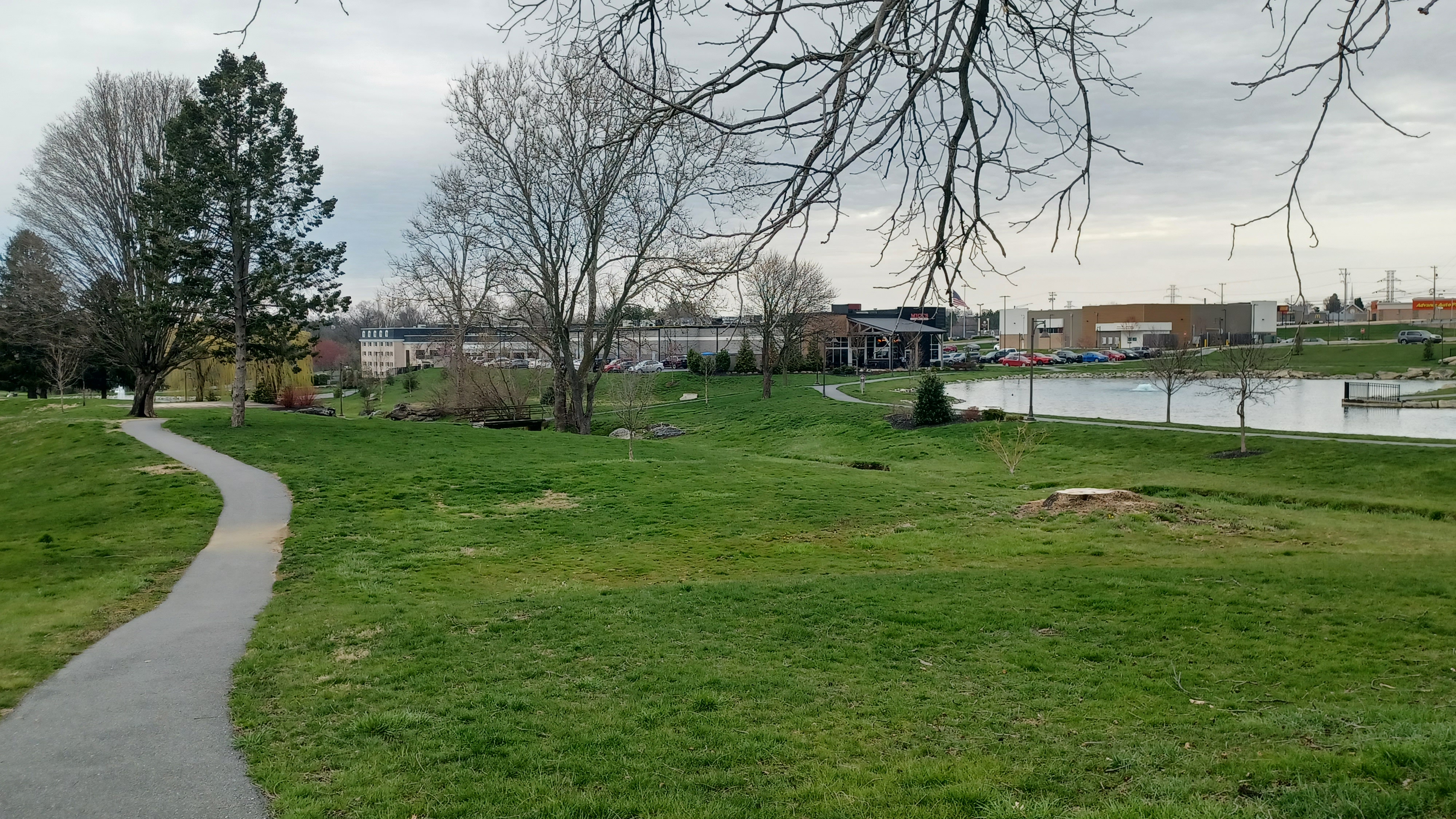
The meeting location would be Noel Dorwart Park, at Rohrerstown, just to the northwest of Lancaster.

We met here in the morning, and then shuttled with as few cars as possible to the start point, which would be Shiprock Woods Nature Preserve, of the Lancaster Conservancy, a little bit south of where we had been on our last hike in Lancaster County.
Parking was on a part of Shiprock Road that is east/west, where it briefly jogs that way, as most of it is north/south.
Newcomer Mark had been in the parking area when we showed up at the meeting point, but he wasn't paying attention when we pulled out, so he ended up driving down to the start point as well.

Shiprock Woods is a 37 acre riparian buffer property preserved by the Lancaster Conservancy in 2005. The stream that runs through it spills into the Pequea Creek.

I started getting Ev's stuff together, his stroller, drinks, snacks, while we waited for Mark to show up.
The little parking area would have been rather easy to miss, although this is a rare swath of woods out in an area that is mostly all farm lands.
Ev wanted to walk right from the start, and so he held Violet's hand for a bit as we began following the trails, which went steeply uphill at the very start, and then leveled out a little bit.

There was a lower trail and an upper trail as I recall, and I seem to recall a ruin of a fireplace or something below on the lower trail near the start.

We continued along through the height of the land, dipped down and crossed and area of steps on a tributary, and ascended a bit more again.

It was a warm day, and the undergrowth was just beginning to pop for the spring. Through the trees, we still had winter-like pastoral views. The only concern this time of year is the good possibility of sunburn.
The trail began to descend toward the north side of the preserve, with blue blazes, and we passed a few other people out for hikes on it.
Eventually, it began to level out and the trail turned to the east, toward the north exit of the park.

We came to a wooden arched deck bridge over the tributary, with a rather steep approach. This was a really pretty site, and all along the stream was some sort of wetland restoration project. Lots of trees had been planted through the entire area.

The entire character of the hike changed from this point, at the northern entrance to the preserved land.
From here, we would be on some back roads and trails through rural and suburban countryside rather than woods for a bit.
We turned left on Shiprock Road, and headed north with good field views.
Just ahead, we could see the farm buildings around the Sassafrass Farm, and to the left, more of them in open areas. Like on the previous trips into Lancaster County, I referred to the 1875 Everts & Stewart Atlas, which told me at that time that this used to be one of the Herr farms.

The intersection of Shiprock and Fieldcrest Drive was the farthest west we reached on the Strasburg hike we'd recently done. When we reached this point, we had connected with where we'd been before. Now, I just had to connect this new hike with other previous ones. That wouldn't be too hard.

We continued on Fieldcrest to the west, through expansive farmlands. Evntually, we came to an intersection where we veered left onto Woodhall Drive, through a pretty big development.

We continued across Wyndmere Way, and passed Bittersweet Path. When we came to the intersection with Heatherfield Drive, Heatherfield Park was on the left.
We turned to the left, and began following a paved pathway that weaved to the north. Pretty soon, there was a playground on the left, so we stopped to let Ev climb around a bit, and I would go over some maps.
To the north, there were the Garrett Fields, large ball fields, and my plan was to cut out through that.

Ev played for a while, and then we put him back in his stroller to continue on the paved pathways to the north.

At the north side of the pathway, where it looped back, there was a large fence that blocked entry to the baseball fields at Garrett Field. I found it crazy that there was absolutely no way between two public parks.
If we'd all been on foot, we probably could have scaled this, but it was pretty high, and taking the stroller over would be a pain.
There was no way around to the east, just back yards. Instead, we went west, and skirted the fence heading uphill. Inside a line of trees, I found a narrow opening in a fence where we could bring Ev through and lift the stroller over.

Everyone was working on getting through, and I started pushing Ev gradually donwill to the left, on a hill parallel with the baseball field. This grass turned into someone's back yard, and so I had to get down to the edge of the field. I had to go at an angle because it was so steep, as not to tip Ev over. He screamed and panicked just a little bit because it was a little rough, but we managed.

We skirted the edge of the fields to the north, and then came to a gravel parking area where something was set up, right off of Penn Grant Road.

As we got around the front, we saw that it was a girl scout troop selling boxes of cookies! My favorite are always the Samoas, which change name every now and then because of different manufacturers. I think it was back to being called Coconut Caramel Delight again.
I got a box of those, and Diane, I think it was got a box of an all new one that they'd just come out with. These were called Adventurfuls, and they were a combination of brownie and caramel in a crunchy cookie. They were quite delicious and might now be my second favorite variety.

We turned left on Penn Grant and soon crossed over the Willow Street Pike. This entire area we were passing through is known as "Willow Street", even on the old atlas maps.

This intersection here was once the site of the Willow Street Hotel, which apparently stood at the northwest corner of the intersection, where the gas station now stands. It was demolished sometime after 1970.
This little settlement dates back to the 1700s, but by the mid 1800s, it was lined with Willow trees on the sides of the road. Most of these were removed with road widening over the years, but the settlement still carries the name.
We followed Penn Grant west for about four more blocks, and then crossed over the west end of Willow Street Pike (they are separated northbound and southbound).

We headed along the road just a little bit more, and then turned to the right through grass to a parking area with some townhouses, in the area apparently known as West Willow.

At the northeast corner of these townhouses off of Southside Drive, there was a paved trail that exited and headed to the north.
We started following this through meadows to the north, and crossed a small foot bridge over a tributary to Goods Run.
The trail paralleled Rt 272/Willow Street Pike west, and then another townhouse complex to the west.
The trail ended at a parking area off of an access road known as Stonehouse Bend. We headed north to Willow Road, and turned right. We then headed east into the community further.

We walked about four blocks to the east, and there was a thrift store called Main Street Closet. It would have been tempting to go in, but they were closed on Sundays.

We crossed the other end of Willow Street Pike, and Two Cousins Pizza was just a little bit to the south. This looked like a good time and place to eat, plus they had good outdoor seating with a wall around it that would keep Ev from running amok too close to moving traffic. It was perfect.
I went inside to get a couple of slices of pizza, which Ev would barely eat, but he had fun running around.
He was doing a really strange and funny thing, trying to choreograph the entire group to stand on the metal railing of the fence enclosure to the outside dining area.

He had each hiker stand in a spot, grabbed another by the hand, and ushered them to the next spot over. When someone was disobedient and moved from the spot he assigned, he would say no, go back and grab their hand, and guide them back to where he told them to stand.

Once we were done eating, we headed to the west on Violet Avenue. I pointed it out to Violet, and of course we had to get her photo with the signs!
We followed this to Peach Bottom Road, and continued straight across. This was a new development, and the name of the road was Willow Valley Lakes Drive. I understand the collective development through the area is know as Willow Valley.
We came to a large, new building, with an oddly distorting mirror out in front of it. We tried to get a group shot into the thing, but it was actually a little too screwed up to work.

We tried to walk a little further to the east on this road, but there was no way through. There were chain link fences up because of the construction going on with new buildings.

We backtracked just a bit, and then turned to the north on Southpointe Dirve. We followed this directly across Cultural Center Drive, and then came to the next point of interest, a collection of historic buildings in the middle of the new development.
This was the historic Mylin Farmstead, preserved within the Willow Valley Retirement Community.
As the community expanded onto the former farmlands surrounding it, they decided to preserve the historic farm houses and some outbuildings as part of their community.

The Mylin House, with its original section having been built in 1787 by Martin Mylin III and his wife Barbara ("Meilin" on the date stone), is now part of the Community Center.

Martin Mylin III was the third generation of German Mennonites to settle in Lancaster County starting in the early 1700s. His grandfather established a gun shop on the farm, and is known as the father of the Pennsylvania Long Rifle.
Wife Barbara Baer was also third generation German Mennonite; her grandparents Christian and Anna Herr emigrated here in 1710 and built the oldest home in Lancaster County.
The Victorian addition to the house was built in the 1800s just before the Civil War.

The house is passed down through the family for Generations until 1926, when it was sold to another Christian Herr (likely another descendant). The Herr family went on to found Herr Foods, known for their excellent potato chips.

The bank barn was on the right, and appears to be refurbished and used for maintenance equipment within the development.

The "Pathways Barn Quilt" pattern chosen for this building was symbolic of the paths taken in life that led here, as per the signage.

We approached the front of the Mylin House, turned right along the edge of a community garden, and then crossed an access road to the east. Ahead, there was a large parking area, a small loop trail in a grassy swath with trees in front of it, and a small shady pavilion.
I got our group photo at this spot, before we moved on ahead.
The next leg of the trip was meandering through the retirement community, because they had such nice pathways.

We continued around the right side of the building in front of us, on good sidewalks, and then came to and crossed Willow Valley Lakes Drive again.

Once on the other side, we turned left and followed the road for a short distance. We passed the first walkway to the right, then beyond a building, we turned right on a paved path to the north.
The path was sandwiched between the Spring Run buildings and a couple of beautiful little ponds. We continued north and crossed a little foot bridge over the stream that feeds the ponds, then came to an intersection where we turned right.
The paved pathway took us to a large parking lot near some of the largest building in the development. We turned right from this onto a concrete pathway that continued around the building to the right.

The concrete pathway came to another asphalt pathway, which we took to the right.

There was a really nice nature trail down below us to the right, but I didn't know where that was going to go, so we didn't follow it this time.
We had to walk through and along some parking lot form this point, along the north side of the building.
As we got closer to the west side of the building, there was a sort of guard gate. I didn't want to go by that, so we cut to the left at a steep grassy slope, and then around a pond that sat along the west side of the building.

We went around this pond on grass, and then came out at Willow Valley Lake Drive again. We turned left, and then crossed on the paved trail that then followed along the south side of yet another pond.

As we approached the west end of this pond, there was an enormous old willow tree on the edge of the pond, which must have once been a farm pond, and another historic farmhouse that had been preserved and incorporated into the new Willow Valley landscape.
The farm house we were seeing on the north side was noted as the B. Mylin House, built in 1871. It now serves as the welcome center to the Willow Valley Retirement Community.
We exited the trail on the west side of the pond and just headed up a bit on the grass to reach Peach Bottom Road. Going this way, we were able to cut directly across to the property of Grace Community Church.

We walked across the grass and the parking lot to the church, and then walked around the church building to the right. Another right on the other side took us on an exit road west.

Soon, we came out to Willow Street Pike North again, and went directly across to a large parking area. The Weis Market was the main anchor here, as well as lots of other things. Ev saw the Burger King and could pretty much identify it because he loves it so much.
We headed to the front of the Weis Market and continued along the awning to the north. I think we stopped for a break and got snacks or something again as well. Probably some used the bathroom.
Route 222 and 741 come together on the northwest side of the strip mall here, so it's a busy spot.

We came out to 222, turned left, and crossed over Willow Street Pike South. We also passed a Taco Bell along the way, which left Ev hooting as well.

From here, we kept to the right, crossed a sort of entrance road, and then a paved trail went downhill to the right, and headed to the north along field edges.

There was a good amount of excavation going on, and lots of giant black pipes sitting there. It seems like all of these fields we were walking are poised to become more development.
Just a little north on the trail, we passed behind an historic couple of homes, which I can't find much on.
It is obvious via aerials that this home was originally off of the Willow Street Pike, and that it was cut off and brought closer to the new road parallel to it.
The best guess I can come up with based on the mapping is that this was the M. Herr residence.

There were two houses at this site. There was a smaller stone one, one and a half stories I think, and a tall red brick structure very close and right in front of it to the east. This one had a date plaque, but I didn't catch it.
The 1875 atlas shows only one house in the general area. So, my theory is that the stone building is the original farmhouse, but that the family grew, as they tend to do. The brick building was probably built in the later 1800s, immediately adjacent to the original homestead shown on the atlas.
The buildig was pretty obviously vacant, and its definitely a concern that it might be ripped down in the near future.
The newer of the two had an interesting floor plan with normal A frame roof in the front, but in the back, it was sort of a half a building slanted with tall walls.
Neglect can be the most efficient way of demolition, as well as the most sad. Hopefully this unique and lovely building gets saved.

We continued on the paved trail to the north a bit, and at this point we were getting to be rather closely parallel with the Quarryville line. We were actually close to it when we first got to the Willow Street area, within sight of where it would have been.

We crossed a little bridge near a retention pond, and then came to a pretty little pond to the right, where there was another paved trail around it. We remained on the one we were on, and emerged at Willow Valley Drive.
The trail continued on the other side for just a little bit, but we didn't follow that for long. I realized pretty quickly that we needed to take a different trajectory to get where we were going.
On the south side of the road were the Willow Woods Apartments, and in front of each building was a connective sidewalk. We made our way into the grass and over to these walkways.

We paralleled the road to the west for a bit, and the last walkway ended at the last building before we reached Millwood Road. We cut through grass out to the road, crossed, and contined slightly west on Schultz Road.

The Quarryville Branch used to cross Schultz Road on the west side of the new buildings at this development sort of along a power line.

It seems there was more construction all over this entire area, far more than there was when I first backpacked on the Conestoga Trail through this spot with Jillane in 2013 (the trail came down Millwood and turned right on Schultz here, with no development then).
I had some thoughts going when it came to the photo I took of Ev with the giant heap of black pipes, and it got me thinking of the racket the affordable housing thing is in New Jersey, and how development plans are so incredibly poor.

For the conveyance of water or waste, pipes are a crucial part of infrastructure. The absence of pipes is nature and water convening without impediment.

The stack is the promise of more infrastructure directly up to a waterway. This is also the promise of pollution and flooding due to impervious surface runoff.

Development cannot be stopped, but directly on critical waterways will lead to more problems.
History continues to repeat itself, and these failures from further east continue to spread west without consideration.
The problem: designated "planning areas" are chosen along main roads. Historically, roads were built along paths of least resistance, beside water courses. As a result, development happens exactly where it shouldn't.
We turned right up Summit Drive to the right, and followed the sidewalk on the left. After just a bit, the paved pathway continued off to the left while the main road wrapped around to the right.

The path remained low around the back of the development, which was quite nice. It certainly created the illusion of seclusion.

I was hoping that the nice paved trail would go almost all the way out to Millwood Road again, and that in the future it could be a part of the Conestoga Trail to eliminate some of the long road walk section.
Unfortunately, in a clearing, the paved pathway ended pretty quickly. But fortunately, we were able to keep walking along the left side of the fences behind the development, and the grasses hadn't grown in too thick yet. We could just push on through and came out on Millwood Road, along the Conestoga Trail route. It would be nice considering it's called "The Reserve at Willow Ridge".

Once everyone was through, we turned left and began walking north on Millwood. When Millwood started turning right, Brenneman Road continued straight, the route of Conestoga Trail.

We turned onto this and began walking ahead. Pretty soon, I noticed that no one was behind me.
When I looked back, I could see the group was talking to a guy in a car that had pulled over.
I figured this was probably pretty innocent, and the guy was just wondering what we were up to.
That turned out to be the case; when someone is actually hiking the Conestoga Trail, I suppose it is of interest because so far people do it. I didn't get to talk to him at this point, but this was a good connection to come.

When the others caught up, we continued ahead, and I pointed out the historic old cemetery in the tree line at the next bend in the road.

This was the old Kreider-Snavely Cemetery, which was established in 1743. It used to be really easy to miss while walking by, and I would never have known about it if it wasn't written up in the original Conestoga Trail guide book, which is no longer available. I'm thinking about publishing my own on it since nothing is available.
We continued left on the road for a little bit, and soon came to the intersection with Eckman Road.
The Conestoga Trail northbound turns right on Eckman here. Straight ahead on Brenneman, we could see where the Quarryville Branch used to cross over the road.

The first house on the right of Eckman Road was once a Kreider family residence from the maps I have seen. The beautiful stone building was built in 1765 as per the date on one of the stones.

Just ahead, the old Quarryville Branch crossed over Eckman Road from left to right, and is used as a sort of driveway access.
Just ahead, we could see two underpass sites, one of them unused and partially filled in, and the other still used as an access to the private property to the right.
Gregory Pawelski offered some excellent detail on the history of the Quarryville Branch:
The Pennsylvania Railroad Quarryville Branch (which began as the Lancaster & Quarryville Railroad on March 11, 1875) went from Lancaster to Quarryville, Pa, where at one time, it connected with the Lancaster, Oxford & Southern, which came north from Fairmont, Pa.

It was 15.5 miles long. The maximum grade against southward movement was 1.87 percent and maximum grade against northward movement was 1.68 percent. Passenger service along the line ceased in 1909.

At one time, the Quarryville Branch was an extension of the Reading & Columbia Railroad's Lancaster Branch. When the PRR expanded its yard and locomotive facilities in the Lancaster area, part of that expansion would cut off the Reading's access to this branch, so it was sold to PRR and PRR took over its use on January 1, 1900.
The PRR began operation of the branch under the agreement of November 22, 1899, as part of Philadelphia Division.

When the Reading owned the Quarryville Branch, it connected to it off their mainline at W. Clay and N. Charlette Streets, went down N. Mulberry Street (crossing the Pennsylvania mainline) to W. James Street, then went southeast across N. Arch Street to Water Street.

When the Pennsylvania bought the Quarryville Branch, they simply branched off their mainline at Water Street.

The line remained in service until it was badly damaged during Hurricane Agnes in 1972, and it was abandoned.
We continued north on Eckman, and passed a large, abandoned excavator on the right, parked right on the old railroad bed.
We moved on up the road from there, and we could still see the railroad bed directly below the road to the left, although at this point it was badly overgrown.
Soon, we passed another historic home, a handsome brick structure, which the historic atlas maps showed me was once owned by the Kreider family. The railroad bed went directly behind this house, which probably was there before the railroad.
One of the interesting occurrences on this road was the return of the guy in the car that the group had been talking to just a little bit earlier.
The guy came back to tell us "one more thing". He told us we could get down below and walk the railroad bed all the way through from here.
Apparently, the no trespassing signs along the right of way below the road are more to keep the ATV riders off of the private property. The guy lived right up the road, and he said "we all walk it", and said it really wasn't a problem for people doing what we were doing.


He kept on assuring us it was alright, and so we said we would go ahead and do it then.

So, pretty soon after the brick building, there was a faint path down to the left, onto the railroad bed, which was quite clear at this spot. I got a hand lifting Ev down in his stroller, and we began moving down this very nice right of way heading north.
Were were just below the road at first, but soon began moving away, and we approached the major trestle across the Mill Creek.
This bridge was still all just railroad ties across it mostly, in surprisingly reasonable shape. This was the only real impediment that concerned me, getting Ev across it.

Aerial images didn't really look all that bad so I figured we would give it a go.

Also, despite the promise that we would be fine walking through the property, I was still a little concerned about going through.
I was able to mostly push the stroller across the bumpy ties myself. It wasn't all that bad, but the others helped me to get past most of it.
When we reached the north side, there was something actively being constructed, some sort of observation deck into the abutment of the bridge.
I doubt that this is any kind of park thing; I think there is a hunting or fishing club that uses the property, and this is likely their doing.

While we were on the bridge and the right of way around it, I was looking down at the Conestoga River, now in very plain view. I was thinking about the old canal that came through and looking for remnants.

I actually believe I found something near to the bridge site. Certainly, there would have been some sort of infrastructure, at the very least a towpath bridge, where the Mill Creek joined the Conestoga. It looked like there was some stone work there, which could easily have been a part of the navigation.
The 18-mile Conestoga Navigation was active from 1829 to 1857, between the Susquehanna River, whereby ferrying connected to the Susquehanna and Tidewater Canal, up to Lancaster. It rose sixty feet utilizing nine locks.

The northern terminus of navigation was near the next bend in the river to the north, but there was definitely once a towpath along this section and more. I noted as we walked that there were stone retaining walls right along the railroad bed. This could either be canal or rail related.


The mill on the other side of the river appears to be completely gone. I was able to set up a then and now compilation shot after the fact using photo and video I took in the area.

We continued ahead, and soon came to the point where the bridge used to cross over the river. I wasn't sure if this was an actual rail bridge or what at the time. Steve Blank and I even discussed whether this could have been a trolley, because we didn't know for sure yet.
I understand there might have been rail on it, but it would have been a very tight turn for it to come off of the Quarryville Branch specifically.
We also noted the remnants of the old dam, but no remnant of any lock structure. It must be totally under the railroad at this point.

We moved on to the north, and with no other remnants of a lock in the area, there wouldn't be much more canal related stuff to see. Maybe some towpath.

We continued upstream, and there were actually a couple of other people walking. At this point, we were closer to the D F Buchmiller Park from which it could be accessed.
I think the people were looking at mill remnants, because the guy seemed to be narrating away a bit. I wondered if they even knew about the canal, because I didn't hear anything on that.
Soon, there was actually an access to the park on the right. It seems their disc golf course comes rather closer to the railroad bed, and there's a path down.

We continued ahead, and sometimes the right of way was not recognizable as one at all. Most of this entire way, there were still ties laying on the ground, but some places they're missing.

The area has been somewhat prone to flooding, so between that and silt coming over the right of way from downhill, it's amazing it's still as walkable as it is now.
There was one particularly large washout with a cast iron pipe still in it along the way.
We remained on the rail right of way until we reached a power line clearing just a little further to the north. There, the right of way became pretty obliterated into developed area ahead. To the left of us, there was an informal trail going downhill toward the edge of the river.

Some of the group attempted to bushwhack more of the railroad bed, which I certainly would have done had I not have the stroller, but we took the route down.

There was a really nice spot along the Conestoga River here, where people had sort of carved excellent steps into the slope, right down to the river's edge.

I walked down into the river, and waded to the middle where I got a great view of the deck girder bridge that used to carry the Quarryville Branch across the river, just upstream from where we were.
We hung out here for a few minutes, and the group that had gone ahead found a good way out to the roads again.
We made our way up a good path that emerged behind the Conestoga Trailer Court, a little mobile home loop. There was a large commercial lot next to that out to Willow Street Pike.

Across the street, there was a large box shaped building, which at one time used to be an industrial ice house. Reportedly, there was once a rail spur that served the site.

We walked north on the road and through the lot, which was where the tracks used to go. Behind a line of trailers that were parked on the north end, we approached the old bridge over the river.
All ties had been removed, and only the metal framework remains. Still, I was able to use this to set up another then and now compilation.
Originally, it was a covered bridge that carried the railroad over the river here, replaced by the current steel one some time after 1900 I believe.


There was originally a covered bridge on the highway next to this as well, but I understand that washed out in 1901, and was replaced by an iron through truss structure. The truss structure lasted until Hurrican Agnes in 1972.

The bridge was known as the Engleside Bridge.
If I didn't have Ev and the stroller, I just might have attempted to walk across the crazy bridge, but it did look a little nuts.
We headed out to the road from here, and then turned left onto the Engleside Bridge to the north. Willow Street Pike changes to Prince Street in this area.
The New Danville Pike used to cross beneath the railroad bridge at a slightly higher clearance section on the north side, up until the 1950s.
 |
| 1911 Harold F. Diffenderffer Photo |

On the right side of the road was the Distelfink Inn/Ol Dirty Tavern, an historic coach stop.

This old stone hotel has gone by many names since it was first built in 1793.
It went by Graeff's Hotel, Conestoga Retreat, and Engleside Park before the two recent familiar names.
We continued to the left and checked out the old rail bridge and right of way on the other side.
New Danville Pike, Fairview Avenue, Prince Street, Queen Street, and Willow Street Pike all come together at this busy intersection, which made it initially hard to see where the railroad used to go from here.

A quick look around determined that the tracks went between Fairview and Prince.

Diane had something going on that she had to cut out early, and so in the morning we stopped on our shuttle and left her car at a parking area just a little up Fairview Avenue.
We continued to the north a bit, and had to walk on parallel Prince Street because the railroad bed was inaccessible.
We didn't really have all that far to go until we reached Seymour Street, where we were able to turn left and soon get to where the rails crossed.

From here, we could turn right on the right of way, which at this point was just along a couple of parking areas.

At the end of the parking lots, it was a grassy swath, and the rail bed became apparent as a sort of ditch with a line of trees, all mowed, by the One 2 One, Inc building.
We continued over a grassy hump, and then to the parking for something called Simply from Scratch, and there was a mowed swath parallel with the rail bed to the right of the business.
The rail bed became a messy ditch to the right pretty soon, but while others walked down in it, I was able to push Ev in the stroller just to the left of it through a grassy field area.

This brought us directly out to Hazel Street. I wasn't expecting much of the right of way ahead, but it ended up being really cool.

There were chain link fences blocking either side of the rail bed, but right up the middle, in a rather well mowed swath, we could continue on the right of way.
I was blow away by how narrow the route was, but there were no posted signs, and we could get right on through. I later found that there is a plan to make some of this into a trail, supposedly.
We continued to the north out toward Conestoga Street, where we came upon an interesting scale.

Next to the All-Met Recycling building, there was a large scale for trucks with a digtal readout, and so we all stood on it to see what exactly we weighed.

I made a little video of it, but honestly I don't remember what we came up at. We moved from here onto the road, but went to the left a bit onto Conlin Field Farnum Park, which seems to become Culliton Park.
At this point, the railroad went right onto Water Street to continue north. We simply went into the park because it provided a vehicle-free walking route for just a block or two parallel.
A path cut through a little playground area, and out to the intersection of Water Street and Strawberry Street, and Water Street made a turn to go more directly north.

The walk to the north through the street was easy to forget that there was a major railroad built down it. It must have been incredible when that happened, because it was already a well built-out street.

When Lancaster was first developed in the 1730s, present day Water Street would have been lined with small but efficient one and a half story structures, at least one of which is still standing on the left ahead, and I think is known as the Bindery.
Among the historic structures along the way was the old Lancaster Workhouse, which was site of the horrible Conestoga Massacre.
I understand that at least a portion of this building is original. It was stone in construction, and had a large bay door, as well as an old doorway filled in with similar stone.

The main lower frame of the building is light colored stone work, but it has been altered much over the years, with a second story of brick, and connecting buildings also of brick.

In December 1763, only a small part of the Conestoga tribe, a combination of Susquehannock, Seneca, and a few Oneida and Cayuga tribes, were attacked in their settlement south of Lancaster by the Paxton Boys.
This group held the belief that all indigenous people were bad, and that the Conestogas in particular were colluding with Lenape and Shawnee, who had been attacking frontier outposts further east in Pennsylvania. They further justified their actions on religious grounds claiming the native people to be "Canaanites".

6 out of 20 of the tribe were murdered by the Paxton Boys or Paxton Rangers, and the remaining were given refuge in the County Workhouse.

On December 27th, the Paxton Boys broke into the County Workhouse, and killed, scalped, and dismembered all 14 of the remaining Conestogas, including women and children, a couple of them only 3 years old.
Pennsylvania Governor John Penn offered a substantial reward for the capture of those responsible, but no one was ever charged.
The crime scene was described as being one of the most gruesome imaginable.

A little further along on the same building was a memorial to John Durang, first American actor, born in 1768 in Lancaster. It's interesting to assume what exactly his life was like. What need was there for such entertainment in the 1700s, and what was it like?

Another historic marker to Durang was located on the opposite side of the street just a little further to the north.

We continued through the town, and some of the buildings were adorned with art. I recall at one point that there was a liquor store on the left, so I went in to get something. I figured they might have some sort of odd flavored MD 20/20, which you only end up finding in urban areas, but they had nothing of the sort.
Although I did not consume it on this hike, I did get a Four Loco "Jungle Juice", which festered in my pack for some four weeks before it finally got consumed after this.
Violet left us in this area because her husband Sam was waiting for her close by in town.

By the time we reached Chestnut Street, we were nearing the end of the line during Pennsylvania Railroad years. The original main line through town used to extend as far south as about Chestnut Street, and then continued back north again.

We continued north a bit and reached Walnut Street. There, there was a parking area to our right. The old rail line goes into the southeast corner of that, and is mostly obliterated through there to the corner of Water Street and Lemon Street. Beyond there, it is a trail to the northwest.
This line through here was part of the orginal Philadelphia and Columbia Railroad, a segment of the Pennsylvania state owned Main Line of Public Works, a combination of canal and rail that connected Philadelphia with Pittsburgh, completed 1834.

The Philadelphia and Columbia Railroad was almost an afterthought. It was supposed to be canal between Philadelphia and Middletown to the north, but later it was decided that rail between Columbia and Philadelphia was better, employing two inclined planes up from the Schuylkill River and from the Susquehanna River.

When the Pennsylvania Railroad bought most of the Main Line of Public Works in the 1850s, the Philadelphia and Columbia line became part of its new main line.

This section of the original line coexisted for many years with the line to the north, which bypassed Pittsburgh long before the Enola Low Grade line replaced it for freight in 1906.
Some of this remained active as a spur into town for years after the through route closed as well, I understand. It would most certainly have been there for something for the Quarryville Branch to connect with until 1972 I would imagine.
We began following the paved trail to the northwest. I almost didn't want to use this part of it this time, because I have a series where we will hike the entire Philadelphia and Columbia.

Much of that will be road walk stuff, and so I was putting it off for a Winter trip, but I figure this part is cool enough that we'll not have a problem doing it twice.

The city named this the Mayor Janice C. Stork Corridor Park.
We continued a little ways to the James Street underpass, where there was a playground to the left. We used the opportunity to take a break and let Ev play around for a while.
There were good interpretive signs on the trail, and one of them detailing the railroad well.
We continued under the Adams Street underpass, and there were homeless people all sleeping under it. The women among the group looked at Ev as we walked by and went "awww".

We continued beyond and there was a large stone wall to the right, with a mural on it that read "The Fridge", with what looked like ice cubes floating in piss.

It turns out this was a liquor distribution center. Oops.
The railroad went under Mulberry Street immediately after James Street.
Another good interpretive sign told of the Philadelphia and Columbia Railroad's ties to the Underground Railroad and the freeing of slaves.
The trail ended at a parking area before reaching Harrisburg Avenue. We continued walking where the tracks would have went, along a large brick building to the left. I'm not sure what it used to be, but there's a tasting room and a Thai restaurant in there now.

I understand the tracks used to continue until very recently on the other side of Harrisburg Ave, out to the junction with the currently active line.

Here, we left the railroad and took to my planned pedestrian salad to the west.
We turned left on Charlotte Street, and then right into a lot on the right to cut over to Lancaster Avenue. We turned left there, and my plan was to turn right onto a sort of paved trail route in a ball field to the right.
This entire area was fenced off as it was likely associated with th elementary school to the north. We had to wait and cut through the parking lot to the south of it.

We took Mary Street to Frederick Street and continued to the west just for a bit, and then reached the paved entrance paths to the Franklin and Marshall College, where we continued straight.

We continued past some lovely buildings heading west, then a bit northwest.
Among the nice buildings we passed by was the Dietz Hall. The Dietz Hall turns 100 years old in 2024.
The college was founded in 1853 upon the merger of the Franklin College and the Marshall College. Benjamin Franklin gave the first endowment to the Franklin College, founded in 1787.
Marshall first opened in Mercersburg in 1836, named US Cheif Justice John Marshall.

Benjamin Franklin gave the first endowment to the Franklin College, founded in 1787.

Marshall first opened in Mercersburg in 1836, named US Cheif Justice John Marshall.
We continued out along the edge of a nice park square known as the Hartman Green, and then continued along the paved pathways through the campus to the west side. We went around a couple of the buildings, and then exited the campus Race Avenue.
There was something shown on Google Maps as a "Fairy Garden" along the streets to the west, so I routed the hike so we would go by whatever this was, but we didn't see anything there. I think we went New Street to an alley, headed north, then went west on Clay Street.

We didn't see any Fairy Garden, and by now, Google Maps has revised the location, but it was still on the route we took where we didn't see anything.

We soon reached the Lancaster Country Day School and headed west toward the building. We soon passed by an interesting labyrinth thing in the grass along the path, and then turned right around the school to the north side.
There were openings enough in chain link fences heading northwest to get us out onto ball fields. The weather was looking cloudy, and so there was no one playing in the fields, just a few people jogging. We were able to enter the soccer fields and head directly to the north.

We continued across these fields to reach Harrisburg Pike along more ball fields. We continued slightly northwest to connect to it near the intersection with Vermont Ave.

We continued on Harrisburg Pike to the northwest, and soon we approached the former Pennsylvania Railroad underpass.
A train was moving very slowly across the bridge, with a long load of freight cars. Ev was of course very happy to see the movement of trains in this section.
We continued under to the other side of tracks, and there were good sidewalks along the road.

We passed a large US Postal Service complex, and then crossed over the Little Conestoga Creek on the road. Then, we reached the intersection with Crossings Blvd where we turned left.

Immediately, there was a paved trail that went off to the left, along the Little Conestoga Creek. The Google Maps showed this like the trail was directly beside the road, and it was, but it was way lower. This trail took us down below a vertical wall, hiding us from all of the huge parking lots at the new Crossings development above.
The trail weaved around a couple of retention ponds, and came within sight of a handsome old stone home.
This was the John and Elizabeth Swarr House, a Georgian stone house built in 1799. It was somehow saved when the development came along, and it looks like what was once a farm pond is now the retention pond.

The house had a 1799 build date built into the front wall, but the rest of the tablet built into the wall was all written in German and I couldn't understand it.

The trail led right up to the very front of the house, which afforded us some excellent views. I don't know what the building is being used for now, but was happy to see they saved it.
The trail continued west, and north around another retention pond, with an access trail to parking to the north. We took the left turn, which came to another intersection (the right was a loop) and we went left. There was an old lime kiln at a corner that would have once been associated with the Swarr farm.

We came to the intersection where the north loop came back in, and then soon crossed over the Little Conestoga Creek on a foot bridge.

Once on the other side, there was yet another intersection. We took the right fork to follow the most direct route back to where we were parked.
This section we were entering ahead was known as Brubaker Park.
We ascended from beside the creek level up to an open meadow area. There was an historic marker at this spot that said that this used to be the property of the Lancaster Malleable Castings Company.
The site was used as a sort of landfill for sands and clays that were a part of their production process.

It seems that it is all capped now and there are mowed trails around the site in addition to the main one, which was at this point crushed stone surface.

I'm not sure if this site was rail served, but if it was, there was little evidence of where anything would have been.
We continued along the trail and descended slightly to reach and cross Farmingdale Road.
Once on the other side, there was an intersection, and we turned to the left to follow the more direct route back. This section paralleled Farmingdale Road for just a bit, and then reached another intersection that connected from the previous loop.

We continued through an open area and then through a swath of trees. Once on the other side, we passed the Brubaker Monument. This is a memorial to where the Brubaker first settleed in this area of Lancaster County in 1717.

The original three family farms are supposedly all within view of the location of the monument.

The trail ascended a bit, and came closer to the former Pennsylvania Railroad tracks, just to the south, and then emerged in Noel Dorwart Park where we had met in the morning.
The only problem we had here was the lack of cars to bring everybody back. Only Justin and Steve had cars left at the end. It made little sense taking both back to the start, and I think five of us needed to get back. It would not work out well trying to get Ev back.
Fortunately, Kirk offered to drive my Element back from the start point to pick Ev and I up. I told everyone not to worry, that I would just use the time to walk another big loop in the trail system we just used, and cover the trails I'd not done yet.

We headed back over to the Brubaker Monument, and that is where one of the trails we hadn't taken broke off. I pushed Ev to the left, and we descended to cross the creek on small wetland bridge.

The trail turned right through some wooded wetlands, and then back into a wide open area for a bit. Soon, we approached the previous trail intersection and crossed over Farmingdale Road again.
We could see farmland around us, including an old stone house. I wondered if this might have been one of those original Brubaker family farms.
We backtracked the same way we had gone before from here, up and to the reclaimed industrial area. We then descended to the edge of the creek again and to the bridge.


We turned right instead of crossing the bridge, and headed gradually uphill. Just to the left before heading up, there was a nice footpath heading out along the creek.

There's still enough stuff through this area that I wouldn't mind hiking this again and covering some more. There are several more trails to cover both to the east and west that I'd like to do.
The only thing I knew about the trail system we were on was what was shown on Google Maps.
So, when we got to the top of the hill and the trail turned to the right to head eastbound, I wasn't expecting to see another trail going to the left.
This trail read that it went to the railroad trestle, and so I was not going to skip out on it. It couldn't be all that long of a trail.

We headed gradually downhill on this, on property that had been used for clay mining by the Lancaster Brick Company from 1919 to 1979.

At the bottom, there was the former Pennsylvania Railroad bridge, and Little Conestoga Creek. I wanted to look over the site more closely, because there are Franklin and Marshall College nature trails on the other side, which sort of dead end. If there was a good way to go through, I would do a future hike out here to cover those as well.
I could hear train whistles close by from here, and figured a train might be coming soon, so Ev and I sat still and waited for a bit. When none were coming, we continued back the way we came.


We continued on the trail that remained closest to the tracks, and another trail broke off to the right to the northern ones we had followed before.

We continued through a lovely, wooded surrounding, and eventually down to Farmingdale Road once again. We crossed over and then reached the intersection with the other trail again.
While we were in the stretch parallel with a field, with a clear view of the railroad tracks to the south, we heard the train whistle coming to the Farmingdale Road crossing much more clearly.
I was glad that Ev got to see the train go by, with the engine at the front for the end of the hike.

We moved along slowly from here toward the parking lot, and the train was still moving along slowly westbound. Ev sat up in the stroller and watched it parallel with us as we moved. We got to the parking area just as Kirk was pulling back in with the Element.
We loaded all up, and there was a police car already in the lot watching, probably to make sure no one was in there after dark.
Once again, another hike that looked like it might just be okay ended up being really a lot of fun, and at least for me, incredibly interesting. It left me with plenty more ideas for future Lancaster hikes.
No comments:
Post a Comment