

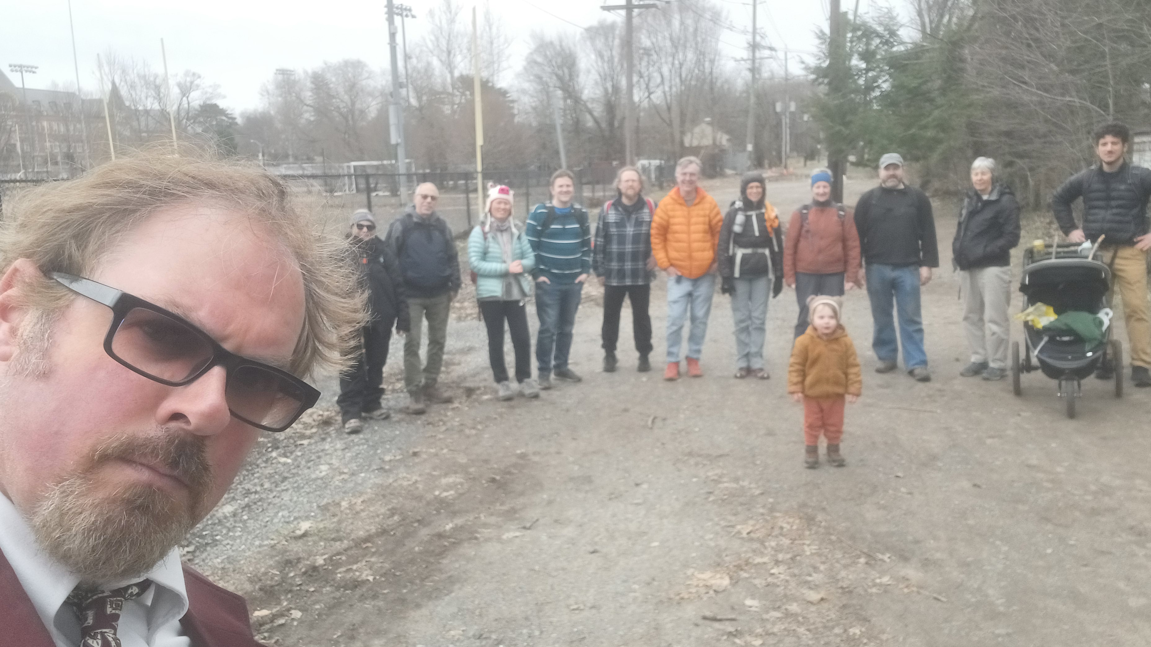
Hike #1591: 2/11/24 Hawthorne to Suffern with Jaquelyn Leon, Professor John DiFiore, Violet Chen, Cory Salveson, Eric Lipper, Rob Farrell, Jenny Tull, Robin Deitz, Kirk Rohn, Diane Reider, Stephen Argentina, and Everen

This next hike would be a point to point, this time with the theme of pretty much just tracing an historic trolley line, the North Jersey Rapid Transit.
I found out about this line a few years ago when I planned some area hikes, and a portion of it fit in rather well with a Saddle River Greenway hike I planned at the suggestion of Jason W. Briggs.
The section was really fantastic for something that really wasn't even a trail, and so I figured we could revisit this for other future hikes. We'd recently hit a part of it again, and I realized I needed to plan a hike that would focus on the entire historic route in one shot.

The first section of the line was completed from East Paterson (Elmwood Park) to Ho-Ho-Kus in 1909 with stops in Fair Lawn, Glen Rock, Ridgewood, and Ho-Ho-Kus.

It was extended after several land owner disputes to reach Waldwick, Allendale, Ramsey, and Mahwah, by 1911, and Suffern NY in 1912.
The trolley was heavily used by commuters and pleasure seekers alike. It was considered a good way to cool off in the Summertime, and even used as a nice date for couples.
In the first two weeks of limited operation, over 25,000 people rode this trolley. It was unlike others, made for comfort with larger than average size and weight. It was extended to Paterson in 1926.

PSE&G now owns the right of way. Service on the line ended in 1928, and the power plants on the line were closed on New Years Eve of that year. Power was only put back on to slowly remove tracks from Suffern down to Paterson.

The route of this thing seems pretty straightforward, but it was actually rather complicated to put the hike together. The beginning and end were both something that would require some looking in to.
I already knew the stretch through Ramsey was good trail, and the section from Glen Rock all the way to Waldwick was informal and passable trail, but the rest I had to make some plans on.
I also had to figure out beginning and end points. There wasn't a lot of good places to park, and I wanted to keep it as simple as possible.

Because Ev was still pretty small, and it's a hassle to deal with carrying him between beginning and end points, I wanted to try to work this out using public transportation as much as I could.

There is no train that goes directly between where I wanted to go, so I had to figure out a way of going between these places with as minimal extra stuff as possible.
I figured Suffern NY would be the easiest place to park, and it was the northern terminus of the trolley. If we took a train from there south to Hawthorne NJ, we would be pretty close to the former trolley.
I was not going to do the part into Paterson on this day, because most of that was on roads anyway.

From Hawthorne, we could get over to the trolley route in maybe a little over a mile. It really wasn't too bad.

Parking is usually one of the factors that come into play that are a serious consideration. I try to plan something where we can get away with parking after dark in a lot of cases.
This time, I looked at the Suffern New York station on NJ Transit. The passenger line operates on the original Erie main line.
I found my way to the station lot in the morning, but it looked like it was permit parking only closer to the tracks. When we arrived, I drove my car down to a lower lot a little bit of distance away, which had stairway access to the station platform and walked back. Jenny stayed with Ev while I moved the car with a little time to spare before our train came.

The platform is kind of neat, because it stretches over the road bridge.


On the other side, and in the middle of the circle where the off ramp from Rt 208 north is, we stopped.


Ev got out of his stroller a little further south near the high school, and continued to run happily along the right of way through this area. When he starts to get moody like he doesn't want to go on, I point out that there's a bridge or something ahead.
I didn't have to lie; there is another bridge on the north side of these fields, another historic trolley bridge still intact over the Hohokus Brook. This one is particularly pretty because it affords a view of the stone lined waterway through the park, and a small dam in the brook.

We skirted a parking area, continued north across Linwood Avenue, and then continued through the parking area, which is built over the right of way, to the north.

The Hohokus Brook bends to the west here, with an unpaved and pleasant looking pathway along the edge of it. I had run behind because Ev held up and I had to put him back in the stroller. By the time I reached this point, everyone had turned the wrong way somehow, and were walking along the brook upstream. I had to shout to them to come back, as they'd made it pretty far up.
This area is known as Graydon Park. Ev and I continued north through the parking lot up to Meadowbrook Ave, crossed, and then continued on the informal right of way again beyond.

This section was always close to houses, but still pleasant, unsurfaced right of way comfortable for walking. We crossed over Glen Avenue, continued north, and then paralleled and crossed Burnside Place.

Just beyond here, there was a slightly more complicated spot. There is a short missing bridge where the trolley line crossed over a small tributary to the Hohokus Brook, and only a couple of pipes span it now. I don't have a problem with walking pipes, but doing so with the stroller isn't so happy.
I brough Ev to the left and pushed him down and up through the small amount of water, and then back up the other side. We had to wait here for a little bit to let the others catch up and make sure they didn't make any other wrong turns.

We got across, then continued north between homes and eventually came out to a driveway on the left of the rail bed just before the Franklin Turnpike.

This was the former site of the Ho-Ho-Kus Station for the trolley. I had set up a then and now at this spot on the previous, more recent hike we did that included this bit.
One other interesting spot at this crossing was the sidewalk.
Of course, the nice sidewalks are not the original ones from the days of when the trolley was in service, but they oddly still have trolley tracks in them.

I found out that when the sidewalks were replaced, the local historic group had the rails placed back in them at the same spots for ambiance, which is pretty interesting. There are two sets at angles, because there would have been a siding for the station here.

We continued across here, then crossed over Sherwood Road, followed by Warren Avenue. Beyond that, the line started shifting to the left, northwest a bit.
We crossed Lakewood Avenue, then Elmwood Ave heading northwest.
At Sheridan Avenue, we cut across the corner of an intersection with Hollywood Avenue. To the right, there was a brick structure which I was told in the past had something to do with the railroad, either it was some sort of power house or another station stop.

After Hollywood Avenue, the right of way got rather steep, much steeper than what we would typically see on a regular rail trail.

I got ahead of the group in this section a bit. I wanted to get as much inertia behind Ev and the stroller and I as I could. Even though it was cold out, I broke a sweat on this one.
We continued along the steep grade and across Blauvelt Avenue, then continued uphill. On the left of the grade was the St Luke's Cemetery and Catholic Church on the way.
The rest of the group mostly got pretty far behind me on this bit. The right of way emerged in the back of the parking lot for Home Hardware in Waldwick, where I waited for the others to catch up.

This was at the crossing of the Franklin Turnpike. I brought up that this was a convenient area to stop for lunch if anyone was so inclined. It was decided upon not to stop at Franklin Turnpike, but to continue ahead a bit.

Some of the group wanted to get some sort of fancy thing, but I have to keep reminding them that we have Ev with us, and sitting for long periods of time where he might get rowdy limits our options more than it used to.
We continued straight across Franklin Turnpike, through another paved parking lot, and then onto one more bit of clear grassy right of way out to Walter Hammond Place. It went onto private property beyond this point, after the longest stretch we were able to walk continuously. We had to turn right on the road for just a little bit.

We turned left when we reached Prospect Street, and there was Natale's Pizzeria and Catering. We stopped there for a quick lunch break and grabbed some pizza slices.

When we were done eating, we headed west slightly to Harrison Street, where the trolley line crossed from a parking lot on the south to a lot by the Waldwick Auto Center to the north. This section was fenced off with chain link, so we would have to parallel the route on roads.
We had to take Harrison Avenue to the north for a bit on a parallel route, crossed the intersection with Frederick Street, and then continued to Walter Nightengale Place. We turned right here, and then immediately left on Franklin Turnpike.

I sipped a yummy maple bourbon barrel aged imperial stout from Long Trail in this section, which was quite delicious. I only really like the strong beers, and I've gotten snobby about it.

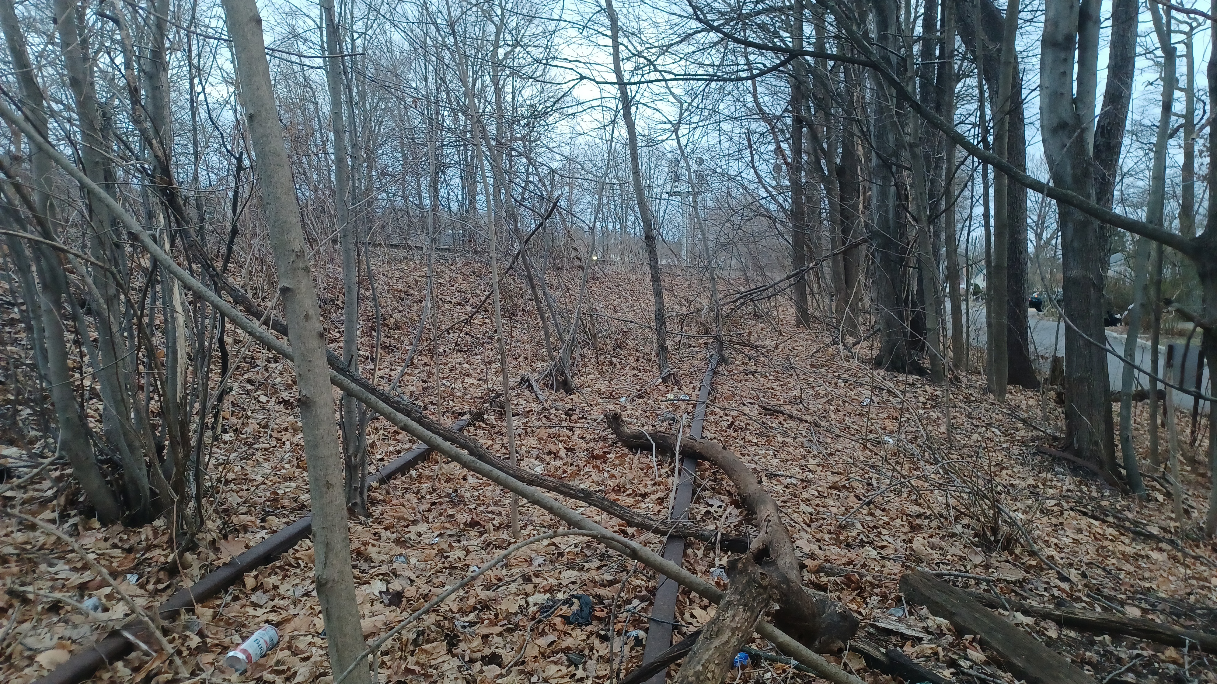
We continued to the north for just a bit, and then came to something very interesting that I was not at all expecting to come across.
On the left side of the road was a very big ditch with lots of water draining into it.
I stared at it a few moments longer for whatever reason, and realized that this wasn't a drainage ditch at all, but a railroad. It was a wye off of the old Erie line which is just to the west of this point, and it still had rails in place on all of it!

It was badly overgrown, and most people going by would never even know it was there.

I couldn't resist the temptation to look a little more closely. I had the others watch Ev for a few moments while I climbed down into the cut a bit.
The rails and ties were quite obscure most of the time, as it was hard to see them even in this Winter leafless time, but they were there, and enough so that I could walk on them.
I walked down these tracks a little ways, until the brush in them got to be rather impenetrable, and then I turned back to rejoin the rest of the group.

We continued a bit more on the Franklin Turnpike, and then I noticed Gearblock Brewing Company was out in a building at the end of a little strip mall. I couldn't walk by without checking it out.

I went on inside and asked about what they'd had. They actually had one strong thing that I was quite interested in, but not for the price it was being offered for. I had plenty of beer to last me for the rest of the day, so I wasn't worried about trying it that badly.
We continued back to Franklin Turnpike to the north, which moved off slowly farther away from the trolley bed and the active eight track former Erie yard to the west.
We continued on until we reached the intersection with Orchard Street by Allendale.

On the corner, there was a park known as Orchard Common in Allendale, which was preserved from development through grassroots efforts. It had some looping trails that headed gradually downhill through it to the west.

We went through the entrance to the park, then turned to the right a little bit to follow the section of the park to the north, further away from the road.

When we got toward the bottom of the hill, we were near to the edge of Allendale Brook.
I was hoping that there would be some sort of way across the brook that would be amenable for the stroller, and we took a right fork, where a section of trail actually follows a bit of the creek to the north, but there was nothing.
I was also hoping that maybe there might be something of a connection from the park to lots to the north, but there was nothing there either.
I decided I was going to just walk back out of the park to Orchard, and then cross on the nearby road bridge to get to the Acme supermarket parking lot, which the trolley once passed through.
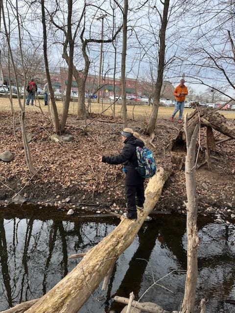
Most of the group bushwhacked on down to the edge of the Allendale Brook, and found a log that went across it. They all crossed on that, and I would meet back up with them in the store parking lot in rather short order.
I think I saw what I believed to be the old right of way just before coming out, but I'm not sure.
We crossed the access and went through the parking lot of the store heading to the north.


We then continued to Myrtle Avenue and started following it more to the north.
My biggest regret of this entire hike was the fact that I'd missed a substantial little piece of the right of way to the east of here. We followed Myrtle all the way to Crescent Avenue and turned right. We could have turned right at Pittis Avenue and gotten on the right of way sooner.
This had been an enjoyable enough hike that I might actually post it again in the future, especially if it is fully developed into a trail in the southern section, in which case I'll do this other section.
I realized I had made the mistake when I got to the corner of Ivers Ave and Crescent Ave, and I saw the clear right of way emerging from the woods to the southeast.
Google maps show that it is passable from a cul de sac called Grey Avenue all the way to Ivers, but street view shows that it might even be passable further to the south from there.

On the west side of Crescent, it is not accessible at first. It goes into back yards and such. It is recognizable as the right of way, but we couldn't get on it yet.
When we got to the intersection with Crescent Place on the left, we turned and went uphill just a bit.
When we reached the trolley bed, we could get back on it again, although only for a short time.
We followed it through woods, this time with lots of sticks and brush down, but still passable even for the stroller without much difficulty.
We emerged from here onto Heights Road, and the trolley bed continues as an access road to a power substation. We walked this for a bit to see if there was any possible way through.
The trolley bed ahead goes into Ramsey Golf and Country Club property. I'd have considered walking across this bit if it was wide open, but there were chain link fences all around it, so we just turned back out to Heights to continue.
We followed Heights Road back out to Crescent Ave, and turned left, heading north once again.

Soon, we reached and turned left again on Franklin Turnpike. I recall that this sucked a bit because of a lack of a sidewalk for a short time, but then improved.

I walked and chatted with Cory a lot in this section about life, happiness, the things we do to get by, and the friends who have had their ups and downs, and get in ruts they can't get out of.
The Ramsey Golf and Country Club property came out to the edge of the Franklin Turnpike, the most substantial part of which was the scenic Wyckoff Lake, which the road crossed on a sort of causeway and bridge.
The scenic little bridge was a sort of rubble stone material construction, built in 1911. The Wyckoff Lake is fed by the Ramsey Brook.

We continued uphill a bit from here on the Franklin Turnpike, and turned to the left when we got to Prospect Street.
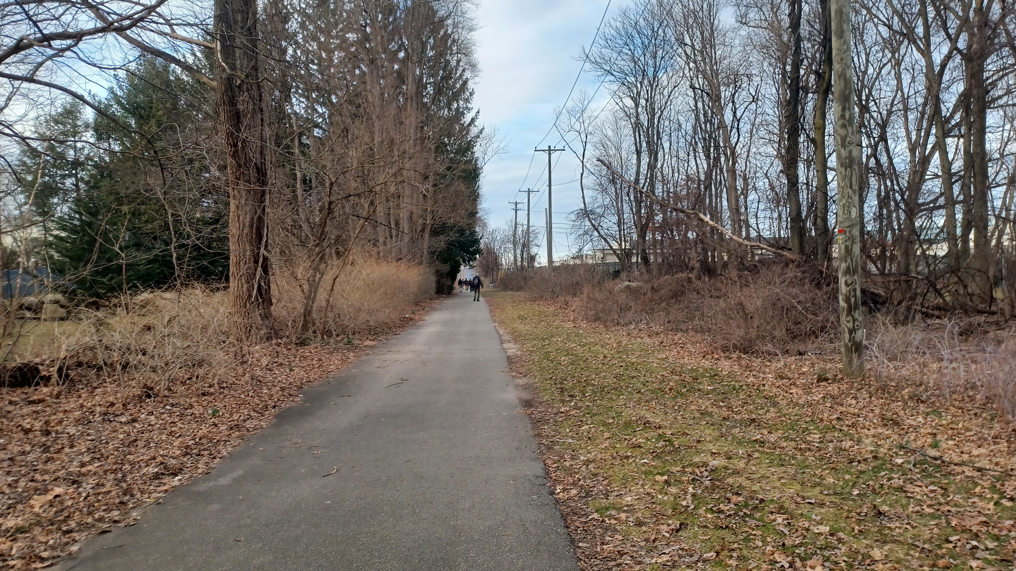
We went a little ways, and eventually came to the old trolley bed, where it is an official paved trail to the north known as Ramsey Bike Path.
To the south of this point, it was clear and looked rather inviting out into the golf course property, but there was a chain link fence and no trespassing signs all over it. They were quite serious, with large ones saying "keep out", and in addition to "no trespassing", there was "no biking", "no dog walking", and more.


The brick station structure is still standing along the north side of Prospect, and used as a sort of collectibles place advertising stamps and coins.
A second brick building to the right of the rail bed, opposite the station building, I understand was some sort of power building associated with the trolley.
I set up another then and now using an historic photo of the station building, and then we were back on our way to the north on the trail.

We soon crossed East Main Street, and then continued north to cross Arch Street. Carol Street came immediately after that.

We made our way north for a bit across Chestnut Street, and then Island Avenue.

The paved trail came to a sudden end at Addison Place, with lots of retail stores to the right in large lots.
Although the trail had ended, we were still able to trace the route by walking through the back of the parking lots parallel with it.
We passed by the rear of the Chipotle grill, and then cut into some weeds a bit at the end of the lot. Then, we continued through a grassy swath to come out at Rt 17 next to a BP station.

This was one of those spots I knew we would have to play it by ear when we reached it. It wasn't going to be super easy to get through, and there was absolutely no way of dashing across with median barricades. We would have to make our way to the nearest overpass, just a bit to the northwest.


Just to the northwest of the BP station we could see the overpass over 17. We had to look at it more closely to see if there was any way of getting up to the road. At first, I was going to try to find my way up a steep slope on the near side of the underpass.

We could have done it, and I think some of the group did go that way, but I went out onto 17 briefly, under the bridge, and then cut off to the left. There was an on ramp there right next to the "Old Stone House", which was something I wasn't expecting to come across.

The historic Westervelt-Ackerson House, known as the Old Stone House, in Ramsey, sits on the corner of Island Road and the connecting road over 17 that leads to Spring Street on the other side.

This is the oldest building in Ramsey, built about 1747 as per etching on a support beam. It reportedly served as a tavern in the 1700s, and Aaron Burr is said to have stopped here.
In the 1950s, the home was purchased by the NJ Department of Transportation, to be demolished in order to facilitate the then new Rt 17 overpass.
Fortunately, petitions by the Ramsey Women's Club and other organizations and individuals spared the structure. It's a miracle something like this actually was saved, because it always seems that when highways or whatever come in, the place is doomed.

We made our way up to the house to look around, and there was an historic marker about it.
We made our way from the old stone house to the overpass over Rt 17. There was a walkway on the northwest side of the bridge.
This highway has quite an interesting story, connecting Hackensack with the New York State line at Suffern.
Prior to colonization, the route of the Haginsack Trail, an aboriginal travel route, passed between these locations.

The Franklin Turnpike was chartered in 1806 to travel between these points. Typically, these colonial roads utilized and improved upon those existing routes.

The corridor was improved and rerouted, and Franklin Turnpike deviates from the modern highway route. Designations such as 17N and 2 were in place before the 17 corridor we know was developed.
Looking across the road, we could see the utility lines going across the highway, which identified for us the former route of the trolley line.
We continued across the bridge and then out to Spring Street. Here, we lost some of the group members to Wendy's, which was jus to the right off of the bridge. They'd end up Ubering out from that point.

The rest of us continued on along the lot at the edge of Ramsey Chrystler, because that's where the trolley line used to.

We emerged from the dealership onto Orchard Street. There, we were able to walk across and onto another swath of mowed grass next to a corporate building.
Unfortunately, we would not be able to continue following the right of way beyond this point. It reached a very weedy area with a small stream flowing between. I wasn't going to be able to easily get the stroller through any of that. We had to backtrack the way we had come to Orchard again.

We had to turn to the east on Orchard Street, eventually back to the Franklin Turnpike yet again.

We turned left on Franklin Turnpike, and I think some more of the group left at this point.
We ended up again going over the mileage I wanted to do, and I could feel it walking this road section. I would have been happy to be done around this time, but I was bent on finishing.
I think John and Jaqueline both walked a direct route on the road through this section as I recall.
I considered turning away from Franklin Turnpike into some of the large parking areas we could have gotten through on, which were on or close to the trolley bed, but at this point we were running behind and had to get a move on.

Ahead on the left, at a building for healthcare and fitness, there were 1906 "Tower Hall" labeled stone entranceway to the estate that must have been there earlier.

Although it leads to a healthcare facility today, historic maps show this as having been property of J. Crouther.

There were a couple more spots where I could have made a left and gotten closer to the old trolley bed, but at this point it was kind of a frustration and I didn't much want to bother with it. I hadn't had the maps of the exact location of it yet, and so I couldn't say for sure where it was until later.
It seems that after we passed the intersection with Airmount Road, the trolley line curved to the east a bit, skirted the present day parking lot for Starview Gardens apartments, and then crossed over the Franklin Turnpike again to enter the Cragmere Park development on the east side.

Soon, we passed by the old entrance to Cregmere, which had stone pillars, and the date "1909" placed into the one on the right.

The development began just after 1900, when the Van Fossen-Bugg Company planned for some 200 acres to be developed in a park-like character similar to old English estates.
The development had its own artesian water system and panoramic views of the Ramapo Mountains.
The location was perfect for New York City business men who required the nearby train to commute.

The development does retain much of its historic ambiance, although it is not what it was. The trolley line crossed and then passed through the western end of the development, and continued to parallel the Franklin Turnpike heading north.

For some reason, I assumed when we were walking that the trolley switched sides of the Erie Railroad again, and followed along the west side, but that was totally off, and so the rest of the hike would be me going the wrong way, but still seeing some great points of interest to make it all worth it.
When we reached Ramapo Avenue, we turned left, and soon passed beneath the Erie Railroad tracks to the west side, at the Mahwah Station.

On the other side, we saw the 1904 Mahwah Erie Railroad station, which replaced the original 1871 station that served until 1902, when the grade was raised and widened for safety of crossings.

The old station was purchased by A. J. Winter and used as a storehouse when the 1904 station went into use. The old structure was purchased by the Mahwah Historical Society in n 1965 and moved to it's present site in 1967 as a museum below the currently used NJ Transit station.

We had seen the original station, which is turned 180 degrees from the tracks on public land, from the train ride up.

A train was going over the bridge as we approached from the west.
We had a look at the newer station, and then went over to admire the older one.
Directly behind the station, under some restoration of some sort, was an old caboose.w
The Mahwah Caboose is a center cupola caboose built in Clifton NJ in 1929 by the Magor Car Co.
We walked around this as well, and then continued on North Railroad Avenue to the north.


Just ahead, there was a ninety degree bend in the road where it went to the left. I went into the weeds to see if there was any reasonable way through for a shortcut, but there was not.

What I did find that was of interest was a junction and abandoned and overgrown spur in the weeds. I understand this was the rail spur that served the Brakeshoe Foundry, which is now all out of business, and I think all of the buildings demolished.
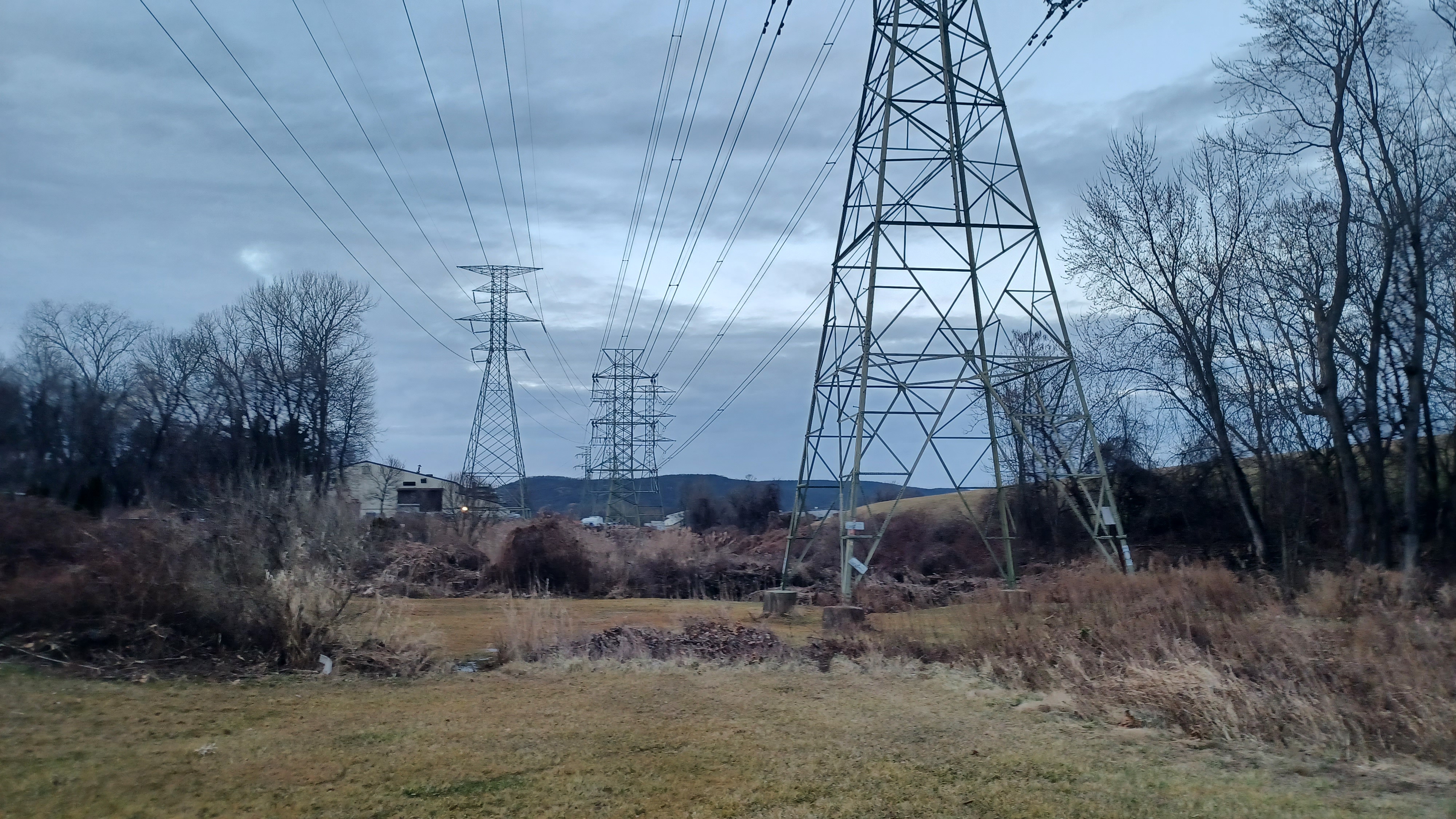
We continued to the west on Railroad Ave, and then crossed Masonicus Brook, followed by a power line. I foolishly considered that this power line might once have been the trolley line, but realized that error when I went back over maps later on.

We turned right on North Railroad Avenue, and then continued to walk the street through West Mahwah. We followed this to Rt 202/Ramapo Valley Road and turned right.

We continued a short distance to the Ramapo Valley Road Bridge, at the confluence with the Mahwah River. It was here in 1781 that General Rochambeau and his troops had to Ford the Masonicus Brook.

The American Brake Shoe Foundry, originally Ramapo Foundry, operated to the right of the bridge location from 1901 to 1983.

We continued up 202 to the north to North Ramapo Avenue where we turned to the left, north.

There was a whistle marker from the old Erie Railroad in front of one of the buildings as we walked to the north through this area. I had to look, but I don't think the railroad was ever down at this point. It looks like when the grade was raised, it was probably at the same location it is today.

It was starting to get dark at this point, and only a few of us were left, but it had been a pretty fun time.
It was about nine blocks to the north to reach the Suffern Station where we had met in the morning, and totally dark by the time we got there.
Some of the group was parked in that first station lot, which was apparently free on Sundays, but I hadn't seen any signs saying such, so I parked farther away down the hill to the north.
Historic Brakeshoe spur
We had to walk the rest of the way ahead, and downhill to this lower lot.
It was a lovely time to descend into this area as the last tiny bit of light was visible over Stag Hill just ahead.

I was glad to see that my car was still fine at this rather hidden location when we arrived.

I was quite glad when it was over this time, because it had gone over by quite a lot, and my feet were actually hurting a bit.
Initially, I was thinking I probably wouldn't be returning to this route for a long while, but there are so many more things to see through the area. I could easily do some of the bits of the trolley I had missed in the past, and incorporate other stuff I wanted to do like the Celery Farm preserve, which is pretty close by. That and so many other things are so easily accessible.
Also, an entirely different variation that focuses on the former Erie Railroad will be the subject of another hike. If I'm to cover all of the historic rail lines in New Jersey, I'll have to try to follow as closely parallel to that as possible, and planning this hike made me realize there were a whole lot more little parks and greenways in good proximity to make that worth doing as well.
If a trail is to be opened on this right of way, the experience promises to be entirely different, and I'll definitely do it again sooner. Maybe until then, I will focus on the infinite amount of other things I want to see.

No comments:
Post a Comment