

Hike #1594: 3/3/24 White Horse to Mercer Lake with Dan Asnis, Stephen Argentina, Jaqueline Leon, Vince ?, Sasha B, Sue Bennett, Robin Deitz, Sue Melnick Fajgier, R Fajgier, Galya, Violet Chen, Sam Chen, Brittany Weider, Justin Gurbisz, Professor John DiFiore, Snoop Dougie K (Doug Kiovsky), and Everen
This next hike would be a point to point trip down in Mercer County NJ. The inspiration for this one came from two places.

First, we had recently done the North Jersey Rapid Transit trolley line as a long day hike. The fast line trolley concept was the later trolley plan, where it had an independent right of way from the streets much of the way, allowing for quicker movement of passengers without other vehicle interruption.
The other inspiration was the fact that we'd hiked a little piece of it again recently on another Mercer County hike.
I had a whole bunch of stuff planned for this one, and I labeled it on Meetup.com as the "interurban lurkin' Mercer disperser hike". The main body of the hike would be tracing the historic route of the Newark-Trenton Fast Line trolley from Trenton to Mercer Lake.

In addition to that, I had to come up with other stuff that would connect with it, because the part where we were directly on the trolley bed or trying to follow close to it would only be a little over seven miles.

For the remainder of the hike, I had to come up with more of what I call "pedestrian salad", to get us to where we were going, and to include stuff I'd never done before.
Trying to find the right amount of stuff, and then finding good parking is where it becomes a challenger. This time, knew I wanted to do the seven or so miles of the the trolley bed, but I had to either find a bunch of stuff to go onto the beginning, or stuff to go on at the end.

Both would work, but I found more than enough at the beginning that I wanted to do. It was a bit of a challenge figuring out where we would park, but I settled on the Saint Raphael Holy Parish religous property lot.

I chose Mercer County Central Park at the meeting point near the boat house. That way, when we arrived near the end, the last part of the hike would be along the lake for a bit.
I hadn't seen Snoop Dougie K in years, and so to meet up with him again was really cool. He wasn't going to do the start of the hike with us, but he was going to meet up with us at some point shortly after we got on the trolley right of way.
We piled into as few cars as possible, and shuttled to the start point at St Raphael, which was located just off of Gropp Avenue. We did our introductions and started on our way.
 |
| January 1934 Trenton Sunday Times Adviser article on the Pearsons |

We walked to the south a bit on the road, crossed Broad Street, and then went into the Barclay Village Apartments. My plan was to skirt the backs of the apartments, and then cut over through the next apartment complex over.

Unfortunately, as soon as we got down in this development and started trying to walk through, we found ourselves behind chain link fences blocking off the next development. We had to walk all the way back out to Broad Street, turn left, and then left again into the next apartments.
Right after the first parking area, there was a sidewalk that continued to the south around some of the buildings, which made for a pleasant walking route.
We went all the way to the south side of the development, parallel with Interstate 195, and then turned to the right on a sidewalk heading to the west.

The walkway turned to the north, and then the west again, staying on the south side of the development, and then eventually cut hard to the right. We continued straight through the grass at the end of it, to the westernmost parking area in the development.

At the end of the lot, I pushed Ev's stroller up the steep slope and to the traffic circle at Bordentown Road and White Horse Avenue.

This area was the settlement of White Horse. The area supposedly got its name because George Washington rode his white horse through the community on his way to his inauguration. Just like today with our fancy cars, back then the modes of transportation too were indicative of our prestige.

We crossed the traffic circle, and then stopped in the Wawa directly across to get some food and drink.

I don't remember what I got to eat there, but I am pretty sure I got some of their double dutch chocolate milk for Ev and I to share.
From this location, we turned to the left on Pearson Avenue, which is now a dead end cul de sac with a sidewalk connection.
On the right, there was a church. This was the Pearson Memorial United Methodist Church, built in 1926. It is so named for the Old Pearson Cemetery behind the building.

We turned to the right at the church, through the parking lot, and to the old cemetery. This cemetery was at the edge of the much larger Colonia Memorial Park Cemetery.

The earliest burial in the Old Pearson Cemetery was Robert Pearson, who died in 1704. He settled in the area in 1681.
Robert Pearson's home once stood nearby to this site, as well as the home of Robert II. This started out as a family cemetery, but was soon expanded upon. The historic Pearson home was torn down by the municipality in the 1930s.
Some of the old cemetery was completely overgrown into the weeds to the left of us. There obviously hadn't been any effort to clear off some of those graves for years.

The Colonial Memorial Park was well kept by comparison. We had a look at the old graves, and then continued into the newer cemetery heading to the west.

There was an odd obelisk out in the middle of the cemetery, at the split in the entrance road, so we walked over to that to see what sort of memorial it was.
This was among the strangest things I've seen coming into a cemetery, because it bore no markings of being any kind of memorial. The structure was made of a sort of troweled mortar with no visible epitaphs, and there were bullhorns mounted in the upper end of it, like it was some kind of warning system.

The entrance road was quite beautiful, lined with Sycamore or London Plain trees.

From the obelisk, we headed to the southwest corner of the cemetery. We exited onto Hobson Avenue and walked three blocks to the south. We crossed Emeline Avenue, and then entered more preserved land toward the historic Pearson House.
This was the Isaac Pearson homestead, on a short drive from the road, in a lovely little unspoiled green setting.
The Georgian style Mansion house was constructed in 1773 of brick, with the build date ornamentally incorporated into the west peak of the structure. It was later covered in stucco, but the front of the building has been restored to its original look.

Isaac Pearson was murdered in 1776, under often questioned circumstances, by the Continental Army.

The execution is said to have been because of his failure to fully support the then new American cause.
The home remained in the Pearson family for about a century after the Revolution. It was purchased for preservation by Hamilton Township in 2000.
We walked around the east side of the structure, and the other side looked completely different, with the cracking and falling stucco revealing many sections of the original brick.
I went over a bit of the history of the home and the area with the group, and then we headed out to cross Hobson Avenue carefully.

On the other side of the street directly, we had to be careful on a hill, especially with the stroller, but then we were on the dead end of Morton Avenue. We continued ahead through a neighborhood for a few short blocks, and then reached Kisthardt Elementary School.

We turned to the right off of the road for a bit and walked through the school grounds at an angle. We came back to the roads at the northwest side, Baylor Drive near the intersection with Independence Avenue.
We continued northwest on Independence Ave, and then continued on the bridge over Interstate 295.
We didn't have far to go on the other side before the trail entrance on the left into Watson Woods. This was part of the larger trail system of the larger John A. Roebling Park at Abbott Meadow Marshlands.

The only hiking I'd done in the Abbott Meadows in the past was to the south along the canal and Camden and Amboy Railroad. This had been on my "to do" list a while.

The trail stayed along the height of some land near a new development, then moved off, and remained above a large wetland. 295 was in view just beyond it.
The trail eventually started to dip downhill. There were a few fallen trees over the section, which everyone helped me to cross, but other than that, it was pretty easy walking.
When we started heading more downhill, it got a bit easier. We passed by several lovely giant Beech trees in the Watson Woods, and eventually another trail went off to the left.

We weren't going to have the time to do absolutely everything, so I decided to save this first loop thing for next time.

We continued straight and soon came out to a gravel road. If we had gone right, we would have come to another parking area and the historic Watson House, but that was another thing we really didn't have the time for, and I wasn't sure what we'd come across, so I decided against it this time.

We continued to the north a bit along the trail after a barricade, where we were treated to some outstanding views of the Abbot Marshlands-Roebling Park wetlands.

The area is so named for Charles Conrad Abbott, who in 1860 discovered a great deal of aboriginal artifacts here.
Tens of thousands of artifacts were found around the site after that.
Soon, we got into a section of woods, where there was an odd stream flowing out through a sort of sluice, and some concrete structures. We continued past that to a trail intersection. A large causeway wrapped around an enclosed area of the wetlands known as Spring Lake.

We turned left at this intersection and started walking the trail that goes around the causeway to the west.

This area is the uppermost tidal fresh water wetland on the entire Delaware River.
This section of the park was a passive recreation area constructed in 1889 with an enclosure to the original Abbott marshlands.
This area was a passive recreation area until 1906, and then from 1907 until 1922 it was part of White City Amusement Park, dubbed the Coney Island of New Jersey. Apparently, different little amusements began springing up along the route, so it wasn't quite an overnight transition.

Some of the trails today utilize the paths that had been constructed in 1889.

The trail went southwest, and then had a spur that goes out to the end of a little peninsula. I had intended to follow this through to the end, where I understand there is a "hobo bridge" of sticks that goes across the wetlands to a point accessible from near Rt 29, although there is no official access.
We started following that trail out a bit, but then there were trees down over it, and I didn't want to bother with it as much. We ended up turning back to just follow this first loop. We headed west a bit, and then came to another spur trail and a foot bridge over a wetland to the left, to reach the island section of the marshlands.

This longer loop was one that I had factored into the entire hike, so we weren't going to skip this.

Ev had gotten out of the stroller in this pretty area and walked himself near a giant tree. There were fishermen around the area enjoying it as well. The land was much muckier after crossing the bridge.
We came to a trail intersection, the beginning of the loop section, and turned to the left.
This was a very pleasant section to walk, and Ev loved it. He walked and held either Stephen or Violet's hand through this part of it.
We continued around the height of the island land. It could be somewhat hard with the stroller because of all of the tree roots, but with Ev walking, it made it a lot easier.

We soon reached the far tip of the island, where the trail whipped back around to follow the west side back. A short side trail went to the end.

There was a little observation area at the end, like another "hobo bridge", made of sticks and such. There was another very nice view of the wetlands from there.
I walked out onto the thing a bit, and then we were all on our way around the west side heading back.
This was as pleasant a trail, and had some really nice side trails where we could view more of the wetlands. There are two resident swans in the area, and one of the spots afforded us views of them swimming around.
The area was also interesting because I noted some Yew trees growing out there, seemingly in the wild.
I doubt these uncommon evergreens were native to this little island, but they live thousands of years, so maybe?
It is most likely that they were planted in this golden age of parks when the island was developed with amusements and such, and it has just lasted since.
We got back to the bridge across from the island to the causeways, crossed, and then continued to the east a bit to reach the parking lot for the Roebling Park.
At this location, there were these glorious but mostly abandoned stairs ascending the bluffs straight ahead, and a mansion house to the left, with a woman working in the yard and on a pool.

The stairs were first constructed in 1889 by the the Broad Street land Association to reach their Spring Lake Park. It was designed to be a passive recreation park for romantic walks along the beautiful Abbott Marshlands, the uppermost freshwater tidal marsh on the Delaware River.
The house at the top to the left was known as the White City Mansion from some of what I read, but other sources are saying that the house that was known as White City was further back, but also still stands.
On the bluff is the 1820 Isaac Decou farmhouse, sometimes applied to the house we saw. I'm not totally sure which is which, but that one is also still standing. Decou sold the home to the Broad Street Land Association.

White City Mansion became the casino restaurant associated with the park. Today, it is a private residence.
The land below was purchased for park land with splendid trails, including those that were part of the original 1889 park.


This was a nice spot for a break. I got the feeling that the lady working on the pool on at the now private property didn't quite like having the park below us, because she was in plain sight.

I walked up a little bit of the steps, which are blocked off a little further up. I suspect all of the steps are still there, but only the lower portion of them are now visible. There is no longer access to the park from the bluffs like their was historically.
From here, the hike got a bit more boring. There was no good way of going on through like I wanted to the west, and there was a bit of a gamble involved in trying to follow waterfront.
We headed to the left, up the entrance road to the park a bit. This brought us up to Sewell Avenue.

Google maps shows that there is the "New Cedar Lane Park" at the end of Cedar Lane, the next cul de sac up, but street views show no access.

I was hoping there might be some sort of trail that led between Sewell and there, but there was nothing.
We turned left on McClellan Avenue, and walked for about a block. We then reached New Cedar Lane and turned right.
We continued up to Bow Hill Avenue. We turned to the left on this road, and would follow it for a while.
I had not intended to follow this road for so long. I was hoping that there would be some sort of trail along the water. Aerial images seem to show another trail going off of the cul de sac at the end of Annabelle Ave, but it must be on private property unless it's new.

I also intended to go down to Andrew Street and Barricklo Street, because there was a bit of open space I could get in on, but that would be out of the way for just one block.

I decided we would just continue down Bow Hill for a bit. I think somebody joined up with us at this point, but I'm not sure who it was that showed up late at this point. I think it might have been Kirk with his Saab.
We continued on down to the very end of the street. It led into an apartment complex that I think is called Lalor Gardens.
Stenton Ct was the main road going north and south through the complex. My plan was originally to get into Duetzville Park to the south of us.

From there, we'd have been able to walk right on through into Saint John's Cemetery and head north.

I figured we might still do some variation of this, and so we walked into the development to the south, to hopefully just connect into Duetzville Park.
There were concrete sidewalk paths through the development that were separated from the roads, so I thought that would be a nice connection.
To my surprise and disappointment, there was no connection from this development to the park. There was chain link fence blocking off all access to it.

We skirted from south to west side of the complex looking for a way through. Stephen went and checked along the fence line further down to see if there might be something we missed.

There was nothing, and in fact, we ended up having to come back east a bit because there wasn't even a good way of following the fencing.
We skirted the cemetery inside the apartment complex fence, but there was also no way into that. It was all gated off completely.
It's always shocking to me that there are places where so many people are living, and there are no access points to parks that share a common boundary. I suppose I can somewhat understand a cemetery, but not a park.
We continued to the north, and emerged from the apartment complex onto Lalor Street. I didn't want to backtrack to walk through the cemetery really, because from this point our route to the end would be pretty direct.
Liberty Street intersected at an angle from here, heading to the northeast. The first part of Liberty was not the route of the trolley, but that would join a little further up from where we turned.
We started walking up Liberty for maybe five blocks or so before we came to where the trolley used to join Liberty Street, at the corner of Grand Street. Actually, parallel Grand Street and Adeline Street both reportedly had trolley tacks up them for opposing traffic.
 |
| 1941 Duke University Libraries Collection, Liberty Street |
The Newark-Trenton Fast Line, operated by the Public Service Railroad, was a subsidiary of the Public Service Corporation of New Jersey.

This was an amazing interurban trolley between the two cities, which first opened for regular service in 1904 as the Newark and Trenton Railroad. Public Service Railroad consolidated and extended on it offering lots of service around New Brunswick and through from Jersey City to Trenton, and more.
Unlike many first impressions of trolleys that come to mind, the Newark-Trenton Fast Line was mostly “cross country”, meaning it was not a street car, but rather its own electric railroad right of way.
The trolleys overcame elevations a bit more than regular railroads because their light weight would allow for such. It makes walking the lines a bit different but as interesting.

Like most of the lines, trolley mania only lasted a few years, and by the end of World War I in 1919, it was already on fast decline. It limited service for several years before the main route discontinued service entirely in January of 1936.

The last section in New Brunswick closed in 1937. Shortly after, high tension wires were placed on the right of way, and later a gas line utilized more of it.
The first section of the line was from Trenton to Milltown opened in 1902 by the Trenton and New Brunswick Railroad.
New Jersey Short Line Railroad opened in 1913 from Milltown to Elizabeth.
New York - Philadelphia Company was a consolidation of these lines with the Camden and Trenton Railway. Elizabeth and Trenton Railroad took over operations north of Trenton in 1910, and the Public Service Railroad leased it in 1913.

Although it was mostly "cross country", street railways were of course used through the Trenton area. The route started at State Street and Warren Street, then used Warren Street, Bridge Street, Union Street, Federal Street, Lamberton Street, and Cass Street before reaching Union and Adeline.

The neighborhoods weren't bad that we were walking through overall, but it was definitely not a route that one would typically be walking down. We certainly got some looks.
Even with the stroller, it was also the kind of place that no one cared about pedestrians. Crossing the street would be a risk, because they were stopping for nothing. The biggest crossing we had to make was Rt 206 along the way, and I was careful about it.
We crossed over Vroom Street eventually, which we thought was a funny name, especially as people were revving their show off engines going by us.

Just after this crossing, we came to Mauceri's Pizzeria and Hispanic. This looked like an interesting spot to have our lunch, so we went on in.

Ev was tired and already falling asleep by the time we got there. I hoped he would stay awake as I got a couple of slices of pizza for him, but he was out cold for he entire time we sat in there.
The food was quite good. I was really happy with it. While we ate, I chatted with Sue about all sorts of stuff from politics, to the environment trails, and frustrations.
It turns out, we had already talked years before. She called me up for an interview on something in the past. She's a well known writer/columnist, and I didn't know we'd previously been acquainted!

She had interest in doing more stories on what we were doing, but I haven't heard back from her yet. Her and her husband were refreshingly open and independent thinking. I always love meeting people of a liberal mind who do not tow party lines when it comes to all issues. I very much appreciate people who can have a discussion about hot topics without getting into some sort of angry, rigid stance.

When we were all finished eating, Sue and her husband cut out early. This was probably about the halfway point of the hike, and the remainder was pretty straightforward.

We made our way northeast a bit, across Olden Ave, where Liberty Street turned very slightly to the right. Just a little further ahead, past Sylvan Ave, the trolley bed diverged from State Street to the right.
We turned right on the clear right of way to the intersection of Partridge and Wesley Avenues. From there, we had to go right, then left on Beal Street, and then left on Newkirk Ave.
The trolley bed from the crossing up there is now the grassy median in the middle of Camp Avenue.

We continued across Mason Avenue, and then out to Steward Street, but then it gets a little complicated. The trolley bed continues up Camp, but then reaches the Pond Run. There is no bridge remaining of this stream, or the East Branch of Pond Run just a little beyond.

Because of this, we would have to take a detour. Fortunately, I had already gone over all of this, checked all of the street views ahead of time, and was ready for where to direct everyone.
We turned left of Steward, and then reached Liberty Street again where we turned right briefly.
Soon, we reached the intersection with Hamilton Avenue, where the intersection was Camp Olden Park, of Hamilton Township.
This tiny triangle park is a preserved piece of Camp Olden, a 140-acre Civil War training camp that opened in 1861. It was NJ's first training camp set up during the War, named for then NJ Governor Charles Olden.

In addition to Liberty Street, Newkirk Ave and and Kuser Road made up camp boundaries. I assume that the Camp Avenue we had just followed a bit earlier was also something to do with historic Camp Olden.

We continued right, and Kuser Ave crosses over the trolley bed, but does not provide access to the right of way because it's still where the Pond Brook cuts it off.
We continued ahead on Hamilton Ave until we reached Brook Lane to the right, which has a bridge over the east branch of Pond Run.
The road leads to a small ball field park known as Brooklane Field. Just before that, the trolley bed crossed. We turned left to begin following it once more.

The right of way soon crossed over Pope Avenue and Bentley Avenue. These were sort of awkward crossings because the trolley bed was basically to someone's back yard, but we hurried through.

We continued out to cross Cypress Lane, and the right of way got a better surface, and looked more like a railroad bed.
We walked along this, and there were a couple of driveways that were going across it. There was a guy out playing with his kid on the right of way as we went by, and we stopped to chat with him a bit.
He was very interested in where we were going, and he had no idea that any of this used to be any sort of rail. I gave him some of the history of the trolley, and he was very thankful to have talked to us about it.

The walk was pleasant through here, and got a bit narrower as we headed out toward Klockner Road. To the right, there was a substation and a large building with a high garage bay. I couldn't help but wonder if this building originally had something to do with the trolley.

When we got to Klockner, we had to turn right because the right of way was severed by Interstate 295. We'd have to use the road to walk over that.
Snoop Dougie K joined us with the group at this point. He'd been in touch with me on where to park his car, figured something out, and walked to meet up with us.
On the left side of the road was a vacant lot with a single stone standing in it. It looked like it should have had some sort of epitaph on it, but there was nothing. It just seemed like a really strange property at first. Someone went over to see if it read anything else, but there was nothing.

Then, just ahead, on the left was the Pet Meadow, a cemetery for pets. It seems the vacant field area was probably intended to be an addition to the pet meadow that hasn't been developed yet.

We cut to the left through a bit of this pet cemetery, and then made our way out to Estates Blvd next to the branch of Pond Run we had been parallel to. We turned left, and then left again into the Princeton Court Apartments complex.
We made our way to the north side of the apartments, where it paralleled the power line/trolley bed, and began walking to the east on it.
We cut through grass at the end of the complex to come out through offices onto White Horse Avenue ahead. I pushed Ev to the left just a bit, reached the former trolley crossing, and crossed quickly.

Some of the group did not go the correct way, or at least the way I went, and so we had to wait just ahead for all of them to make their way back to the trolley bed.

Rt 33 was next up pretty soon, and there was a McDonalds on the right side. Some of the group stopped in there for restrooms or something, but Ev and I waited outside.
We got moving, headed north a bit more, and soon crossed over Nottingham Way. A very short distane further and we crossed Hoover Ave.
Wilson Avenue, Marshall Avenue, and McAdoo Avenue came next, and only toward the last part of that was there anything that was really too stressful in my opinion, but I did end up going around.

At Marshall Avenue, split rail fences on the right of way block it, but can be gone around. Still, I didn't want to do that simply because it put me right into the driveways of the neighbors to get out.

I pushed Ev to the left on Marshall, then right on Baker Avenue, and right on McAdoon, where I got back on the clear right of way. I should have just gone through because the others were doing it with no problem at all.
The right of way skirts some preserved land, and then crosses Mt Drive. Next, we crossed Paxson Ave, followed by Edinburgh Road.
We had to turn right here, because of another little missing bridge, this one over the Miry Run.

From Edinburgh Rd, we turned left on Flock Road and then right back onto the rail bed.

Ahead, we crossed University Drive, followed by Jenny Jump Drive. Hughes Drive was just about the last one before we entered all public property.
We went over a corner of the Mercer Elementary School here, and then crossed over the main access road to the Mercer County Commuity College. The first bit of official trail followed along the right of way from this point, although it soon turned away ahead.
We continued walking through woods on the right of way from here, which was quite pleasant.

Along some of the final stretches we walke,d there were pipes beneath the rail right of way, which was now more obvious, and might have been left over from rail days.

It was a curiosity that there was really almost no infrastructure from the trolley line remaining. It's no wonder so few people know it was ever there.
The landscape opened up, and we passed an area of nine soccer fields, which were actively being used to our right. A disc golf course is along the right of way ahead on the left.
Ahead, we reached and crossed Paxson Avenue, the main access road to the park. From here, the right of way starts to go gradually downhill a bit.

Somewhere in this park stretch, Sam was sitting against a utility pole waiting for Violet to go by. I just saw im last second, and shockingly said his name. I think maybe he was trying to sneak up on Violet and I blew his cover, because he was hidden well behind the pole when I went by.

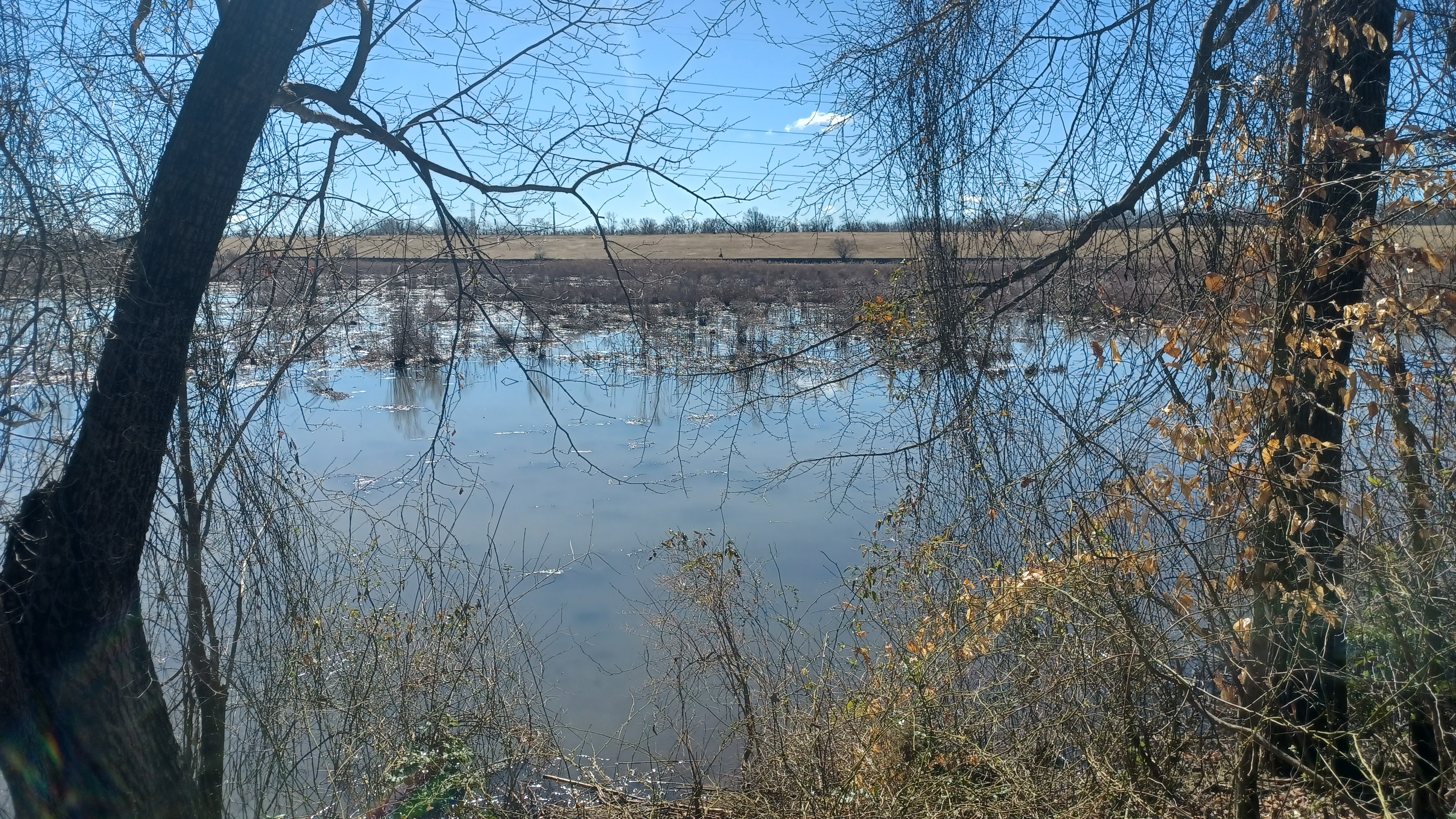
We made our way through the woods, near the West Picnic Area, and soon Mercer Lake came into view.

The Lake was created for flood control in 1975 by the same crew that was building Interstate 95, at no added cost.

By building the lake, some of the trolley line was destroyed. I'm not certain whether the original trolley bridge that had carried it across the Assunpink Creek beyond was still in place at the time, but they most certainly removed it prior to the lake.

We headed down to reach the lakeside, which had some really beautiful views. I decided we would wait here for a bit, for the rest of the group that had fallen way behind those of us in the front.

This was a crazy difference coming to this park after everything else we had seen all day.
There had been a few people walking around at the Abbott Marshlands, a few on the streets, and then barely anyone on the entire stretch of the trolley line, but now there were hundreds in view, probably thousands in proximity.
The line of walkers coming down the paved path was incredible.

I think there were still a couple behind when we finally decided to turn right and follow along the lake.

I let Ev out of the stroller to walk, and he was quite happy. We weaved around a corner and crossed a foot bridge over a small inlet stream.


The sun was starting to dip down lower in the sky, but there was no worry about getting out of here. This park was so mobbed, there was no way anyone was getting out for the next couple of hours.


By the time we reached the parking area, the sun was setting beautifully behind us. We actually got off of the paved trail and walked across a large open grassy field because there was just too many people to casually walk along the pathway.

We reached the parking area, and figured out how we were going to do the shuttles back to cars. We had Dougie and Kirk I guess it was at different locations, and a few of us at the start point at the church. Galya had a car seat in her car to take Ev and I back, and we were good to go.
It had been a really fantastic and very different hike. With this hike, we had completed the biggest chunk of the remainder of the Newark-Trenton Fast Line. I still haven't walked the road section above Liberty Street in Trenton which I don't really feel is as necessary, but I may eventually do it just to be complete.

Going to the north of Rt 1 on the line looks to be much more inaccessible, but maybe one day I'll give that a try as well. Until then, we've covered the most substantial sections that are most worth walking.
No comments:
Post a Comment