

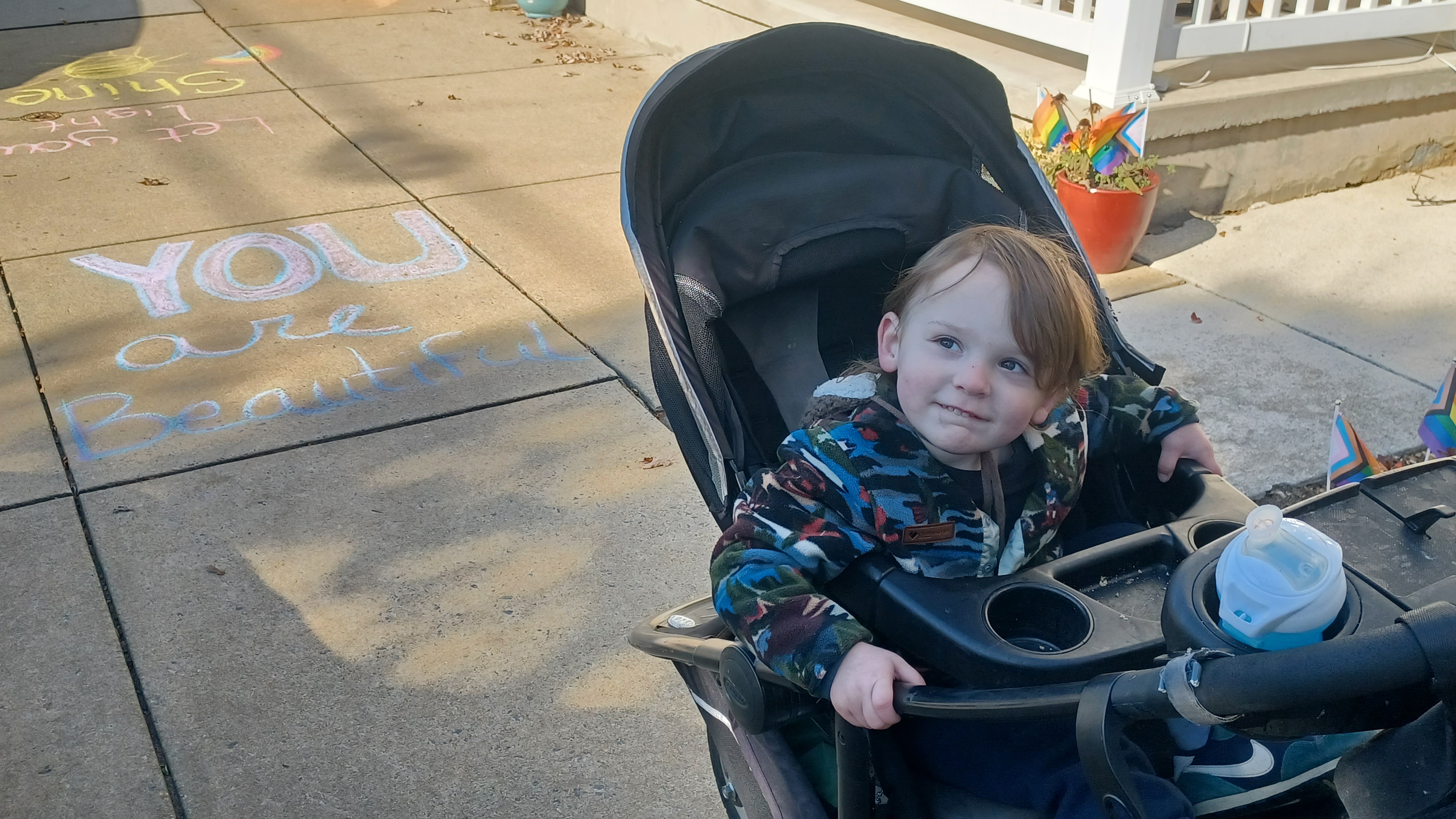
Hike #1579; 11/19/23 Speedwell Forge to Ephrata with Jenny Tull, Professor John DiFiore, Evan "Joe Millionaire" Van Rossum, Pete Fleszar, and Everen
This next hike would be a point to point focusing on the historic route of the Reading and Columbia Railroad as well as a couple of other little connections that fit into our Conestoga Trail series in Lancaster County PA.

The plan wouldn't quite play out the way I was anticipating it would, and we'd end up doing a bit more mileage than I was planning initially, but fortunately we were bailed out on it.
The hike came about a couple of months earlier when I was doing my Conestoga Trail hike through the area to the south.
I wanted to cover that entire trail, or at least the parts that were stroller friendly, again since I had not done it in so many years. There are actually a lot of reroutes.
Since the first time I did that trail, the former Reading and Columbia Railroad, later a branch of the Philadelphia and Reading Railroad, had been turned into a trail between near Lititz and Ephrata.
I wanted to hike that entire trail in addition to the others in the area. In fact, I wanted to hike the entire branch.
I had already been on bits of this before. On the previous Conestoga Trail hike, some of that trail had been rerouted onto the rail bed, and we did part of it besides that as part of a loop hike.

However, on that trip, it poured rain heavily on the entire rail bed section of it, so I couldn't really get any good photos. It was still enjoyable, but I wanted to get a better look at it. It was worth doing over.

I had already walked some of the active section of this in the past, from the station at Reinholds down to Denver on one trip, and on another, from downtown Denver up to the Horse-Shoe Trail. Both of those hikes were part of my past Horse-Shoe Trail series.
So, I already had this invested interest in this line, so I might as well do the entire thing.
I planned out a hike that would end near Denver PA, and I made the meeting point the Cocalico High School ball field lot on South 4th Street out of Denver. This would be the planned end point.

We then shuttled to a start point where we had previously been on the Conestoga Trail at Speedwell Forge Lake.

I planned a route that would take us to the greenway we'd followed on the Santo Domingo Run into Lititz previously, pick up some trail stuff we hadn't done before, and then trace along the old railroad line to the east from town.
The weather for this one was just about perfect. Not too hot, not too cold. Perfect for a suit. I wore a black one, actually a tuxedo, that I'd picked up randomly for my friends Kat and Kevin's wedding, which I was officiating.
I was on the way to it, and stopped to get a dress shirt at a thrift store on my way there, but then realized there was this nice tux on sale. I ended up getting the entire new tux for the event.
The icing on the cake for this one was that I wore my straw hat. I would fit in well with the Amish and Mennonite folks who wear these hats regularly, plus I had the black jacket and pants to go with it.
After meeting at the school, we shuttled with as few cars as we could to the west, to a parking area at the boat launch area at Speedwell Forge Lake, off of Zartman Mill Road.
The Conestoga Trail passes through this lot, and the area from there is pretty easy to do with the stroller.
We went from the parking area to the right along the lake, up a bit of a slope, then to the view of the dam that holds the lake back. We descended past that, and then on a lovely section of trail heading downstream from the lake.

After a bit of weaving around, the trail came out on a road known as Old Pike. Conestoga Trail used to turn hard left there, across the Hammer Creek, and then right into the woods, but private land owners had it closed. It is now a road walk from there.

We turned right on the Old Pike, past some lovely old homes.
This area, and the area immediately upstream on the hammer creek, was once a community known as Brubaker. Family names such as Brubaker, as well as Snavely, and Hess settled in this area. There was an early dam on the Hammer Creek near the site of the current Speedwell Forge Dam, and it appears several homes in the community were eliminated in that area.
We turned left on Zartman Mill Road, following the Conestoga trail route at first. When the trail route turned left, we continued on Zartman out to Rt 501. We continued straight on this busy road, and then soon turned to the left onto Loop Road.

This was a serious climb uphill, and rough with the stroller, but I got through it. I powered ahead of the others and tried to be really fast about it, because I knew if I slowed up, it would just get harder.

I pushed to the top of the hill, and then waited for everyone else to catch up. There was a chill in the air in the morning, but it warmed up pretty quickly.
A collection of homes at the top had one of the keystone historic markers noting this location as a settlement called Lexington, but formerly known as "Dundee", renamed for the Battle of Lexington, with 1806 at the bottom.
When everyone caught up, we turned left on Chestnut Street and soon passed the New Mennonite Church, then soon turned right on Union House Road.

This neighborhood was all pretty new homes. We passed through some farmland on Union House, and then reached Snyder Hill Road where we turned left. We went around a curve and soon came to more new homes again, and turned right into another development with ladies' names.

Sue Drive and Tara Drive came together, and we continued on Tara Drive to the dead end. This was where we had come into this property on the previous hike. That time, it had just started raining before we got there, and so we were not going to be noticed.
I am unclear on whether this is public land or not, but it seems so. There are no signs saying to keep out, and no purple paint on trees, which is a relatively new thing. Private landowners paint purple paint on trees to denote private property boundaries.

We walked beyond the end of the road on an old farm lane, and there was an old ruin of a barn foundation on the right, as well as a silo.

We were able to walk a sort of farm lane along to the tree line, and then turned to the left. This was far enough behind the new houses that it didn't seem like any intrusion. It passed soon beneath power lines, and then dipped down into a more wooded area. The route taken was pretty obvious.

Eventually, the trail dipped down into the woods, into a cut along a tributary of the Santo Domingo Creek, and then came to a blockade and sort of paved trail cul de sac.

I let Ev out of the stroller here to walk on his own, which he was quite happy about.
The trail weaved around slightly through young woods with no shade, and then split where to the right led to a parking area, and the left was the through route.
We soon came out to the old former alignment of Newport Road, which is cut off and to the right is parking, to the left is a driveway that serves one old stone house and out building. The new road is just ahead, and the trail weaves around a weird switchback and goes through a tunnel beneath it.

The tunnel is shared by Santo Domingo Creek, which makes it a really cool little spot.

The old stone house, on the 1875 Everts & Stewart Atlas of Lancaster County, was the home of Cn Snyder.
The previous time we hiked through here, we took a long break under the bridge because it was pouring so hard. This would be much more pleasant.
We passed through the tunnel, which Ev loved, and he made lots of echoes. We continued south on the paved trail and reached Laurie Lane, turned left, and then right onto the continuation of the trail into Dean L Saylor Park.

After a short bit of walking this trail, there was a side trail to the left that went out to a pier over the wetlands of the Santo Domingo Creek. We took that side trip.

Ev ran out ot the pier at the end of it excitedly. We then backtracked to the main trail and continued south a bit to a fork.
We took the left fork, because that way had a playground where Ev could stop and have some fun, but of course it wasn't just him. Everyone ended up on the things.
We hung out there for a little bit, and then continued along the trail through the park to the south. This brought us out to Market Street, at a point we had been to previously when we walked through, but that time we went to town a different way.

This time, we turned left on Market, and then went straight across the intersection with Cedar Street to Water Street and turned hard right.

We crossed over Noble Street, and then reached New Street Park Nature Trail, which is another greenway bit that follows the Santo Domingo Creek (speaking of which, I don't know how a Spanish name for a creek came to be in this middle of Lancaster County town).
This was just a narrow little footpath, but it was still pretty easy to push the stroller through. It seems a sanitary sewer had been placed beside the stream, which is why there was a public right of way for the trail.

We continued along this trail behind homes and through light young woods until we got to New Street Park, which is also labeled on Google maps as Sertoma Park.

There was a foot bridge that took us across the creek just before reaching Locust Street there.
We headed south a bit on Locust Street, and then turned to the right on Front Street to head west.
This was a nice little neighborhood, usually with a good sidewalk all along the way, and some nice old buildings.
This settlement of Lititz was first settled in 1756 by Moravians, and so named for an ancient Bohemian castle called Lititz. The settlement grew much more quickly after the railroad arrived in the the 1860s.

We continued along the street, and there were some sidewalk chalk inspirational sayings scrawled all over the place. We eventually reached Broad Street in the middle of the downtown, and turned to the left.

This was really a lovely little downtown, and I'd love to go back and just hit all of the little parks through the town rather than a through route one day.
The railroad tracks are still in place, although apparently no longer used at this time. They are active just a little bit to the west.
This was a really cool little area, with the tracks on the edge of the Lititz Springs Park. This is a privately owned park, historically maintained by the volunteers affiliated with the Moravian Church.

The walled improvements around the large springs in the center of town have served the community for centuries. Development of this infrastructure began in 1792.

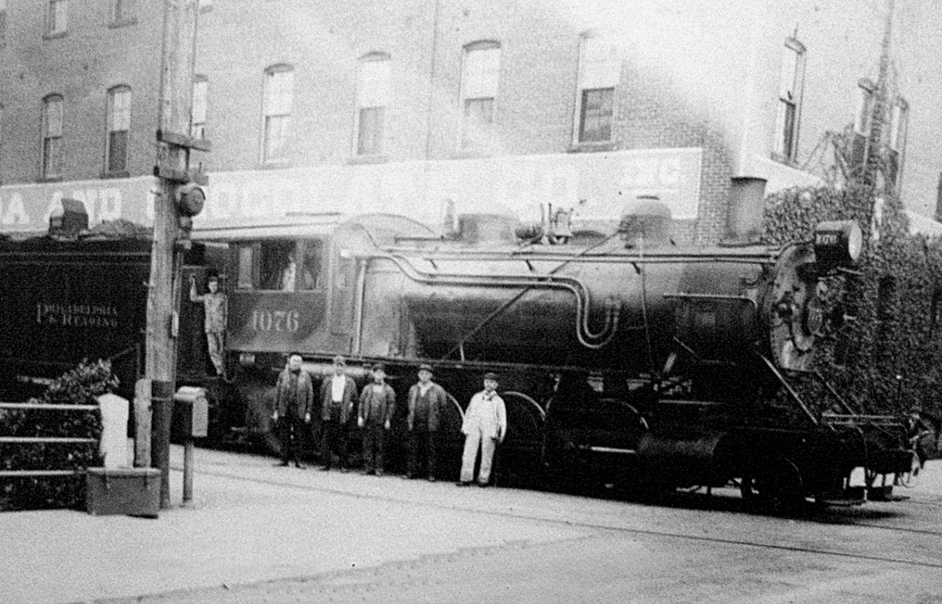
Right next to this little park is a beautiful railroad station on the former Reading line.

 |
| John Musser Collection 1952 |

Greg Pawelski has an amazing collection of stuff he's done of this line over the years, but I wanted to get my own versions of the historic shots. There were so many that I tried to go fast.
 |
| Lititz Historical Foundation |

The first one I got featured what was thought to be the last passenger train to operate through Lititz, the Adlai Stevenson Special, in 1952.
 |
| 1920s |

It was shameful that the original station was torn down, but the town deserves a lot of credit for realizing the importance of the historic stations to these towns.
 |
| Randy Miller Collection |

Many towns have seen fit to completely reconstruct their historic stations on the same footprint, including Riegelsville and Sparta NJ.
 |
| 1948 RCT&HS Collection |

Then, you have other idiot towns such as High Bridge NJ, who voted to have their 1869 station, in perfect shape, demolished, for a new apartment building.
 |
| John D. Denney Jr Collection |

There were images of across the street, of an old hotel building that has long since been destroyed by something. The station was represented at seemingly every angle.
 |
| 1918 Cory Brookhoven Collection |

Even I'm surprised at how many of these things I knocked out at one time on this trip. I eventually got done with all of the shots, and we got back together to move along.


We went directly across onto a path that led us into a very large parking area. We crossed this directly, and then pretty soon the outflow of the Lititz Springs, Lititz Run, passed into the lot in a concrete lined trough.

The stream was completely withheld in this sluice thing, and it reminded me of seeing the LA River in California, which is just a tiny flow, but because it is surrounded by pavement, gets really bad in storms.
 |
| 1950s Dan West Collection |

The last time we had been out to this area, the Lititz Run was getting really high into flood level from all of the rain.
 |
| 1957 |

That last time, we didn't walk the way we were walking now. I had never been over to this area yet, and it got to be rather interesting.


Susquehanna bank had built a complex over the stream years ago, which was very interestingly done. The stream went beneath this building, and occasionally had openings to the surface.
 |
| 1950 John D Denney Jr, Lancaster History collection |
 |
I was surprised that a stream so prone to flooding could be covered over so much, but this was probably in the years before such environmental concerns were prominent.
 |
| 1905 |

There were murals and such on the walls inside this place, and stairs up and such. We simply went through the building the most direct way, and as close as we could stay to the creek.
 |
| 1884 B Frank Saylor |

We exited the other side, and then crossed North Cedar Street.


There was a distillery on the left there, and the community has quite a few of these types of places. I figured it would be good to stop in and sample something, but I did want to get a move on.

I pushed Ev up the ramp and into the place, and asked about the stuff. Everything was all quite expensive, so I chose not to pick up anything this time.
We cut through the parking lot to the east, and then came out to Water Street. We went to the south side of the brook, and then there was paved trail turning off to the left, continuing to follow the stream to the east.
This was where we picked up the creek greenway on the previous hike in the rain, where it was flooding.
We followed the trail parallel with North Lane for a bit, as the creek started to move off farther away from the road. We didn't continue on it too far last time, because it went underwater.


This time, I figured we'd follow it and it would probably take us on through.

That was not the case; we followed the trail, and it took us to a dead end at someone's back yard. We had to backtrack a bit and then come out to a parking lot off of North Lane, then head east.
After the one private house, there was a large parking area directly across the street from Zareba Systems, which had its own foot bridge over the creek on the west side of the lot.
We went over to the bridge to have a look, then skirted the north side of the lot, heading east along the creek.
Pretty soon, the parking lot ended, and a walkway continued along the creek east from the end of the lot to North Locust Street. We crossed the stream, and reached the tracks.


The building on the east side of the road was the old animal trap factory, or "mouse trap factory" as I've heard people refer to it.

I got one more comparison shot there featuring that building when the line was still active.

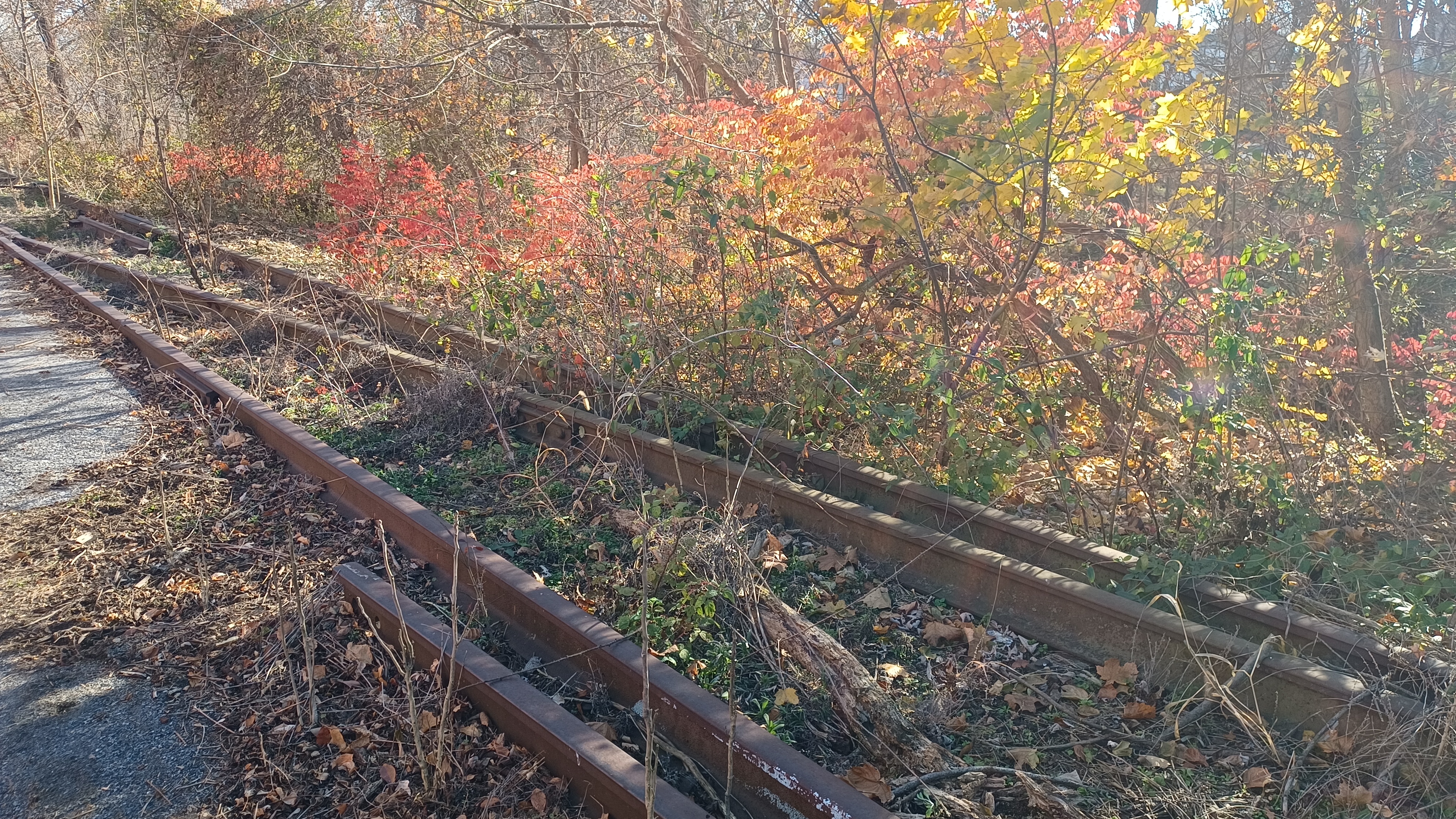
The tracks were gone it seemed just to the west, and then we saw some in place just to the east, but it has been a while since any trains have served the site.
We began walking along the edge of the mouse trap factory to the east for a bit. Some rails began to show themselves through the weeds a little bit, but badly grown over.
We entered woods at the end of the clearing, and there was a foot path beside the old railroad ties, at a slightly lower level. The creek was to the right, and I had to be careful pushing the stroller through.


The section was pretty pleasant, and I could see it turning into an extension of the rail trail in the near future. The bucolic nature of the site will seriously be harmed if that is done, so I'm glad we saw it as it was.

We continued through this section, and came to a small tie bridge over the Santo Domingo Creek.
Just on the other side, we reached the former junction point where a siding or spur served the industry here. I had another then and now to set up here.
The rails were still in place along the parking area access road here. There was also some remnants of the spur junction covered in the weeds in the section. We continued to follow the tracks to the east, out to North Oak Street, where the Warwick-Ephrata Rail Trail officially begins.
 |
| 1942 Marjorie Collins |

There was a little wetland viewing area on a side trail to the right at the road crossing.

The trip was pretty relaxing from this point on. The trail is paved at first, which I'm not a big fan of because it's no good on the knees. It was still relaxing overall.
The trail immediately took on a more suburban feel. We were not far away from development just yet, but it was quieter. Soon, there was a development on the right side, with several pedestrian accesses to it.
To the left, there was the spur trail known as the Newport Square Trail. I had originally considered this trail for part of this hike, as well as for the previous one, but never got around to it.
 |
| Cory Van Brookhoven Collection |

There were other things to see, and I figured I might one day do a hike focused specifically on Lititz, so I shelved using it for this time.

We came out to Clay Road, and the trail deviated from the rail bed a bit. It turned right, skirted a parking lot and turned left, and then came up along ball fields where Warwick Township has its municipal complex.
We turned right away from the rail grade yet again, and then left to return to it again beyond where what appears to be a salt shed is built directly on top of the right of way.
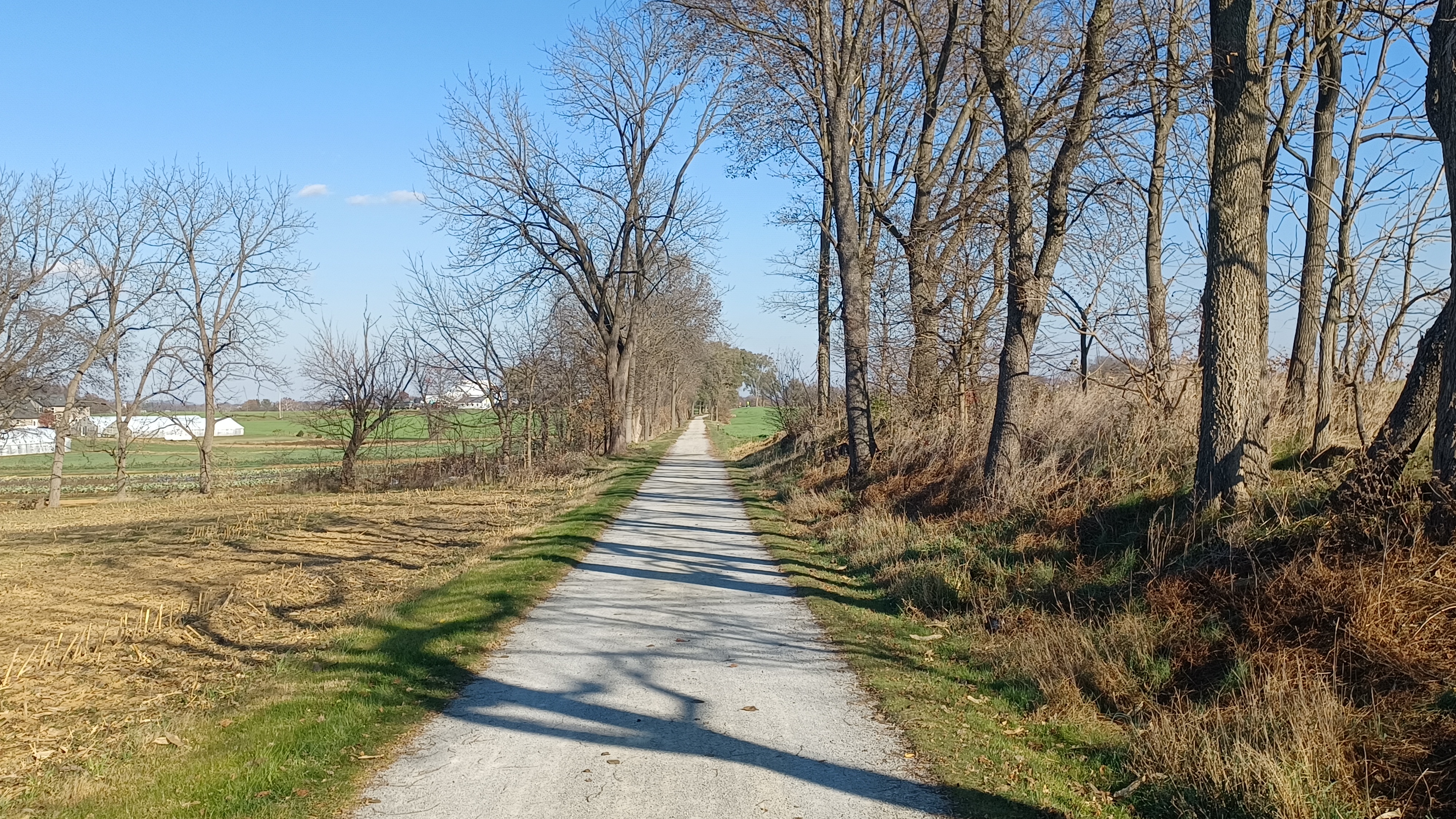
Beyond this point, the trail switched from being paved to crushed stone, and it became much more comfortable.


We continued to the east a bit, and somewhere in this area is where Pete caught up with us. The trail becomes much more rural at this point, and at first stays within a tree line.


After a little bit of time, we were out in wide open ground with no shade at all. It was good not to be doing this hike in the middle of the Summer, because it'd have been way too hot.

At this time, it was really quite pleasant. We approached Newport Road, and I got another then and now using a photo of the line from the sixties.
The line climbed onto a slight fill beyond the road, and traveled only a short distance before coming to the little settlement of Rothsville, at Rothsville Station Road.
This former station site is now home to Lititz Collision and Repair and Cedar Run Construction. No rail era stuff seems to be remaining here now.
 |
| 1960s Tom Horst |

The site was once home to the Wallace M. Zook & Son Warehouse, which specialized in coal, flour, feed, grain, fertilizer, and cement. A fire broke out in 1932 which claimed much infrastructure including homes and warehouses.

I missed getting any good then and nows at Rothsville, and we continued on through. I let Ev out of the stroller to run around, and he had a good time on the sections here.

The segment was very much in the middle of farmland and quite pleasant.
Soon, we came to the crossing of Picnic Woods Road. Here, the Conestoga Trail joins the rail trail to follow it to the east.
Before it was rerouted, the trail followed Erb's Bridge Road, Millway Road, Meadow Valley Road, Cocalico Road, Rothsville Road, and another Millway Road. That was the route I took when Jillane and I backpacked it back in I guess it was 2023.


While I love the rail trail route, and it is off road, they were some nice back roads to walk.

The rail bed remained out in the open fields for a bit, and came close to Millway Road without crossing it. It then weaved east southeast for a bit before emerging in the little community of Millway.
At East Meadow Valley Road, we came to the former station stop.
On the left was the former J. H. Reitz Company warehouse building. The business thrived on the route of the railroad, and the original building here actually served as the first station.


In fact, one of the themes I have found with the Reading and Columbia is that several other privately owned buildings served as or doubled as railroad stations in its early independent line days.

When the Reading took over the line, it seems that they started constructing their dedicated station structures.
So, the original J H Reitz warehouse doubled as a station building until their own was built, I think in the 1880s. The original Reitz structure burned down in 1907 and was replaced by the structure that still stands today.
Moore and Reitz's Coal Yard was on the north side of the tracks at the approach to East Meadow Valley Road.
 |
| Early 1900s Dan West collection |

 |
| Marlin Holland photo |

 |
| Richard Reitz, 1907 |
There were houses lining up along the road uphill, and a house stood where a coal shed once stood for the coal yard. I doubt any of that original structure is incorporated, but it's not impossible.


Reportedly, the Reitz family sued the Reading and Columbia Railroad in 1908 for having trains go by without spark arresters installed, which would have likely avoided the fire that destroyed the building.
 |
| John Denney Collection |

 |
| John D. Denny Jr collection |

The Reitz business remained in service until 1964 and the property turned hands. I don't recall what is in there right now.
 |
| Marvin Sauder |

Once I was done, we continued along the right of way to the east.


We passed where the station siding ended, and the right of way narrowed again.


The way the sun was casting the shadow of the protective split rail fences on the edge of the trail through this section almost made it look like railroad tracks laying in the trail.

We continued ahead and crossed Rothsville Road at grade. Shirly Lane paralleled it at this point, and it was the access to the Southern Pipeline Depot.
The National Transit Pipeline Company put the line through from Milton PA to Baltimore MD, and removed it in the early 2000s after 120 years of use.
I peered down to the site to have a look for a distance if any of the infrastructure remains today, and it seems like only one of the brick buildings down closer to the Cocalico Creek might be original.


We continued on the rail bed ahead, and soon reached the Cocalico Creek bridge.

Originally, this was a deck style Burr-arch truss wooden structure that carried the railroad across. It was replaced by the current deck girder bridge with concrete abutments and arches in 1909.
We continued across the bridge, and then on the right was the former right of way of another forgotten little line.
The junction with this spur line was pretty obscure, but the right of way was recognizable just after stepping off of the bridge, ascending slightly to the right from an area where there was a bench.

This line was intended to serve a quarry in Brownstown some 3.1 miles away. I understand there were talks of extending this line beyond there as well, but none of that ever came to pass.

The route can be traced pretty well on aerial images, but it's still pretty obscure and unknown.
Work began on this line in 1909, and by 1910 reached the Christian Wenger Farm. It never did make it to Brownstown at the total 3.1 miles.
We continued ahead from here, and soon began to ascend a bit. The railroad bed was filled in where a bridge once carried Millway Road over it.
We continued up to the crossing and the parking lot and took a brief break there. I'd done this bit before, but never anything to the east of this spot.


This was also where the Conestoga Trail left the railroad right of way and continued south on Millway Road where I'd hiked it before.


I got another then and now of the bridge that used to carry the road over, and then we continued ahead to the east.

After the bit of descent, we were surrounded by farmlands once more, but not for very long. We were coming to where the entire character of the right of way would change entirely.
We passed a group of Mennonite girls just before the change, and some really nice farm views.
There were soon homes on both sides of the trail. First the right, then the left. Also, we started seeing overhead lights along the trail, which we hadn't seen anything like before. They put some serious money into this one.
 |
| Marvin Sauders, 1980s |

We approached Main Street in Akron, at a point where again there had once been a bridge.

We descended a bit through the north side of the settlement of Akron, and then paralleled Front Street for a bit.
One of the odd but common things we find on rail trails is displays of little Gnomes.
When I first started government work, in Hunterdon County, the busy rail trail there was completely covered in gnome homes, to the degree that the park rangers had to come by and dispose of all of them. There got to be just too many, and it was ridiculous.
I found out over time that this was not an isolated incedent, and found more in other places, even out on the NCR line in Maryland.
On the left side of this trail, there was a very large and tasteful display of gnome things.
Pretty soon, we came to the former site of the Akron Station.
Like other stations on this line, the dedicated station structure did not come until later.


In this case, the Akron Feed Mill served as the station building with its own platform until the separate station was built.
 |
| Marvin Sauder 1940s |

The feed mill building still stands today, and has been converted to apartments, but the dedicated station is long gone.
 |
| W J Wike collection |

As in many spots, I had tons of then and nows I wanted to set up at this site, so I started running around like crazy trying to get them.
 |
| Late 1800s Journey Through the Past collection |

This time, I didn't really have the help of everyone to get them done, so Ev had to stay with me. I pushed the stroller all over around the site, or just ran a few feet away from him here or there.


Before too long, I got almost all of the historic photo compilations of the site that I'd planned. I actually missed one or two I needed of this one.

I came up to Front Street, and still have a few more to get once I crossed over. I got them, and then quickly moved along the trail to the east a bit.
The others were just about out of sight at this point.
We skirted the Colonial Park and some buildings a bit further back from the right of way ahead in this area.
We then entered a line of trees, and soon passed beneath 7th Street, Route 272, by way of a concrete culvert underpass that had replaced the original railroad bridge.
The rail bed curved to the north a bit, and then went from being in a bit of a cut to on a fill, with a few more trees around us.
We crossed over Parkview Heights at grade, and continued a little more to the north.
In this stretch of the trail, there was a lot of art painted on the sides of the buildings facing toward the trail.

This was not something that could really be classified as graffiti, because it came across as very sanctioned, or even contracted.
The people creating these pieces were actually on sight with ladders and paints as we went by, in broad daylight, and there was nothing that came across as surreptitious about this.
We curved to the east a bit, and then crossed over the end of Lemon Street, where there were accesses to more parkland uphill to the right.
I had wanted to see more of all of this property, but at this point in the day, it was becoming obvious that we were going to have to amend the hike a bit.
We were not doing totally terrible on time, but we still had a good distance to go if we were to make it back to Denver, and it would put us at over twenty miles.
I figured we were going to have to try to cut this short somehow.
 |
| 1976 Paul Kutta |

We continued ahead a bit, and then crossed East Queen Street at grade, up on more fill.
 |
| 1950s Marvin Sauder |

We made our way across, and then through another tree line to the east, past an elementary school, and to Fulton Street.
 |
| Dan West collection |

The trail continued from here, and then disappeared into parking areas as we approached Rt 322, Main Street through the center of Ephrata.

Directly across the intersection from here is the railroad station, which I think was built in the 1880s. I understand that at this location, an old hotel that used to stand to the right of the station was originally used as a station stop before the current structure was built.
I immediately started trying to get the then and now compilation photos of the many of them I had of this structure.
During the process of trying to gather these photos, it was discussed that Pete had his van in Ephrata, and that it was large enough to hold all of us. He could drive us all back to where we had started the hike at Speedwell Lake, and then we could get rides back to Denver.
We were not going to make it to Denver before dark this time for certain, and I didn't even want to because we wouldn't have been seeing all of the stuff I wanted to see.
We had already just about hit fifteen miles, so I felt like my requirements had been met.

I continued getting more shots, and we decided we would have dinner at a Mexican place just up the street. I think it must have been Tacos El Gordo.
I made sure I got all of the compilation shots I wanted to get (again, I missed a couple) at this point, and then headed up to the place to have dinner with the group.
I was really happy with everything I had accomplished on this one. We had done the mileage I wanted, and thanks to Pete, finished way before dark. We got to stop right at the point where it was still comfortable and enjoyable.
On top of that, I had put together 56 then and now compilations, making it the most I'd ever put together in one day to this point.
I have so many things to present in the Lancaster area, and I have so many of these compilations ready to go, it seems like it'll be forever before I even get to these ones.


The place had pretty good food, but I seem to recall things were a little off. I don't think the place had any cheese on their dishes that would normally have a good amount of it.


While sitting in there, I went over maps, and I think I had pretty much figured out what the next hike in this little series was going to be.


All of the other stuff ther is to see in do in Ephrata could fit into that hike, and and then we would trace the railroad line to the east and finish in Denver.


It would work out perfectly, because I had the next Horse-Shoe Trail hike planned and ready to go, and the rail bed one could serve as a backup to that one if we had inclement weather.
 |
| Ephrata Review 70s |

 |
| Walter Schopp photo |


 |
| 1983 Gregory Pawelski |

 |
| Kerry Glenn |

 |
| R B Hain |

 |
| Bree Jayla Kramer |

 |
| The last train 1985 |

I'd love to walk more of this line as well, to the west of Lititz and further east than where I'd done it from in Reinholds, but that would not be stroller friendly and I probably have a few years before that.

We left the restaurant and meandered through an alley somewhere nearby, and followed Pete past a sort of garage building. I wondered if maybe it had something to do with the trolley lines or something that used to go through town here starting around 1914, but I don't know much else about it.
Trolley service north out of Ephrata ended in 1931.
Soon, we were to Pete's van, and he had us on our way back to Speedwell Forge Lake. It was just about getting dark by the time we got back to the cars.


It's really odd I suppose that we're milking so much out of Lancaster County in particular, but I've really loved all of the stuff we've been doing out there. It won't be all that long before we'll have done just about every major trail in that entire county, as well as all major connectors.

No comments:
Post a Comment