

Hike #1587: 1/14/24 Whiting-Woodmansie-Kelsonville with Jack Lowry, Sarah Jones, Brittany Weider, Galya, ?, Professor John DiFiore, Jaqueline Leon, Alyssa Lidman, Evan "Joe Millionaire" Van Rossum, Mike Heaney, Jenny Tull, Serious Sean Dougherty, Carolyn Gockel Gordon, Robin Deitz, Diane Reider, Jerry Scanlan, Voilet Chen, Sam Chen, Justin Gurbisz, Kevin Kowalick, Kathryn Cataldo, Shane Blische, and Everen

This next hike would be a point to point I threw together based on the new opportunities surrounding the new home of Jack and Sarah at Kelsonville in the Pine Barrens.
Jack had been running Strikesound out of Linden, a music and event supply rental company, and went into semi-retirement. He kept the business name and allows himself to take certain fun jobs he wants to do, but other than that, he would be free to go where he wanted.
He started looking for homes in New Jersey to move to, and all of a sudden had this place in this hidden little village known as Kelsonville, a small development separated from the others in the area of Presidential Lakes Estates.

The little community is less than twenty homes, completely surrounded by undeveloped land, and with direct trail access from different directions. This is a great jump off place for hikes.

Jack asked me if I could come up with a hike hosted out of his home location, so I started looking over the maps at what the possibilities were.
I immediately came up with about four different possibilities from different angles, but had to try to figure out which would be the most appropriate to do.
I decided on one from the east a bit, to tie together another bit of old railroad line I had yet to walk: the former Central Railroad of New Jersey line that went down through the pines.
 |
| Sept 1955, Thurlough C Haunton |

I had several points I wanted to visit, from the railroad to a route into Brendan T. Byrne State Forest. There are sand roads and trails from the area of Woodmansie all the way back to across from Jack's house, so things were looking good.

Still, I did not choose the easiest hike to plan. The railroad one had a lot more complication than the other options, but I also thought it was most exciting for me at the moment, and fit into some other series we'd been working on.
I hadn't had as much interest in doing the hikes down in this area as of late, because we'd already finished hiking both the Pennsylvania Railroad's Atlantic Division and the Tuckerton Railroad. I hadn't done the Central Railroad of New Jersey because so much of it was tracked still.
I also wasn't nearly as excited about the trails around the Pine Barrens area, so I hadn't bothered looking at much of it beyond what I'd already done lately.
When Jack suggested it, I started looking in greater depth, and my interest in the area was firmly rekindled.
The meeting point would be Jack and Sarah's in Kelsonville, the end point.
I drove down with Ev early in the morning, and no one carpooled with me this time. I allowed for enough time that I could pull over in South Pemberton on the way to get a then and now compilation.
When I arrived at the house, cars were already parked along the sandy edges of the streets, and many were inside.
Jack had had a party the night before, and everyone was up late jamming and making music. I wish I could have attended that, but it's very hard with Ev, and his mom won't support me attending anything.

Jack has had parties every year at Strikesound, and I never missed one from around 2009 or so until the very last one before he sold his warehouse. I felt like this was sort of the continuation of that, and I missed it. Hopefully I'll get back to that soon.

We convened inside, and Ev ran around like a crazy boy for a bit while we prepared to shuttle to the start point.
It wasn't too far a trip to the start, maybe seven or so miles driving.
Our start point would be Whiting, at the Whiting Town Center shopping area. There is a giant parking lot there.
We headed to the south from there, and I let Ev walk the first portion of it all. We wandered from the mall across Diamond Road, to the area of the former railroad junctions.

This road is called Diamond Road because this was the diamond where three different railroad lines converged. The station which served the Southern New Jersey Railroad and the Tuckerton Railroad, and was also on the Pennsylvania Railroad's Atlantic Division.

The tracks of the Tuckerton and the Pennsylvania Railroad are both long gone. Diamond Road is partially built over the PRR Atlantic Division at this point.
The old railroad station site is just to the south of the road, and the foundation is surrounded by a while fence that delineates its former location.


We had actually been down to Whiting for hikes three different times previously. The most recent was to hike the old Tuckerton Railroad to the south.
Previously, the Pennsylvania Railroad series brought us here as we ended one from Pemberton in this area, and we began the last one out to Ocean Gate at the beginning of the pandemic.
It seemed to make sense that we could cover the former Jersey Central line to the south and to the north out of two more trips from Whiting.

I had already hiked the entire Central Railroad Southern Division from Woodmansie south to Atsion, and some of it beyond Atsion but not all connected. I'd love to be able to hike the entire branch.

I couldn't help but wonder if maybe one of my times down that way I might run into the guy that keeps copying off and taking credit for my then and now compilations.
I have thousands of them published through the Metrotrails facebook page, and and I get these old guys with nothing better to do who come along and copy the work I've done.
A guy named Raymond Storey started copying and reposting my stuff, and the old photos I can't say much about because I don't own most of them myself, but when he's copying even my modern shots, and giving no credit for what I've done, it gets bad. He apparently just sits at the computer, copies, and reposts my stuff, omitting all text except basic name of the location.
I get really irked when I see people commenting on what wonderful work he's doing, and how talented he is. I asked Mr. Storey to please stop doing this, or at least just give me credit for it. All of the Metrotrails posts are fully public, so there's no need to copy and repost.

Rather than be civil about it, Storey blocked me from all social media and continued to do it. I went from thinking he was an innocent old guy without a sense for etiquette online, but he turned out to be an attention seeking jerk.
It happens all the time, and now there's a guy named Bill Holzchuh that's been doing not only the same as what Storey was doing, he's copying all of my text, and omitting the part that says "Metrotrails Then and Now Series". He even leaves the stuff in about "our recent hike", as if he is the guy leading the hikes.

The Vintage New Jersey facebook and Instagram page has also copied off my stuff with no credit, and was showered with compliments for the good work.

It didn't used to bother me quite as much until Facebook started paying out the way youtube does. Having a friend making thirty thousand dollars in a year off of youtube, and with the popularity Metrotrails is getting on that and other platforms, I could be raking in a good amount of money to do more with the organization. Every time someone takes and claims credit for my work, moving forward, that could potentially be taking money from the organization.
We walked around a bit at the former station site and I got my photos, and then we made our way to the former Jersey Central tracks heading south.

The first section skirted some homes and paralleled Cherry Street for a bit, then entered some more deep woods.

Pushing the stroller along this was really tough for a bit. I tried staying to the left of the tracks some of the time, but then other times, it was better to just push it over the ties in the middle.
I knew based on aerial images that just a bit south of Whiting, there was a parallel sand road next to the tracks most of the way, and we wouldn't have so much trouble, so it was just getting to that point.
It was too hard to push the stroller with Ev in it weighing thirty something pounds, so thankfully Joe Millionaire helped out by carrying him on his shoulders, or walking with him much of this time. Some of the others helped me to keep the stroller going when it got to be tougher.

We soon approached the Rt 539 crossing. I knew it was only a little ways past that where it would get a bit easier. I could see the cars crossing for a while, and it seemed so far away.

The tracks and right of way were well cleared for a good distance on either side of the crossing, which is apparently a rule.
We crossed over a little bridge on the other side of the road, and Joe Millionaire continued to help carrying Ev for just a little bit longer until we got to a point where the sand road I had been anticipating was obviously to the right.
I got the stroller through and onto it, and it weaved out and away from the tracks for a bit. Several in the group opted to stay in the tracks for a bit longer, because it was actually a bit easier at first.
 |
| Abandoned industrial locomotive in Pasadena NJ. From left, Henry Beck is in he cab, Charles Remine, and Warner Hargrove, with Hargove's dog, "Tip". |
Of course, for me, with the stroller, the tracks were certainly not the easiest option.

Pretty soon, the pathway reached a wider sand road coming from the north, and the path got a whole lot easier. From here, the hike got to be a much more relaxing thing.
We had some Dragon's Milk red stuff, which I think Sean might have brought, as well as some wine I'd gotten on sale through this section.
It was great to have such a big group out wandering through the pines, and I'd hoped that this would be an indication of the return to the somewhat bigger groups following the pandemic.

The pathway beside the tracks went up and down slightly as the right of way maintained the same elevation, and we sometimes had better views of the tracks than others. John stayed on the tracks much of the time, as did Shane.

We crossed other sand roads along the way. The extension of Filmore Street, St. Mary's Ave, and Buckingham Road (which went to the Buckhingham Station on the Pennsylvania Railroad).

At this point, the path along the north side of the railroad tracks disappeared, and it would have been rough going along the tracks ahead. It also went a little close to someone's house, and I didn't want to mess with people in the pines too much.
I decided at this point that we would follow some of the parallel sand roads to get through to the next bit.
We turned right on Buckingham Road, and then came to an intersection with another sand road that went to the left. We turned there, and headed further into the pines.

A side road to the left led to one house, and I felt better after we passed that. The road got to be quite a lot smaller, where no one would really be driving down it, and we crossed the North Branch of the Mount Misery Brook.

We continued from here, and a left fork led us back out toward the tracks at the rather forgotten little settlement of Pasadena.
This was once a station stop on the line, and there are only maybe four or five homes left there. This was an industrial siding associated with the sand industry, where little narrow-gauge lines traveled through the properties.
We crossed Mt Misery-Pasadena Road, and continued on the north side of the tracks on Railroad Avenue. The tracks got to be a bit overgrown, and we had to cut over to the south onto Pasadena-Woodmansie Road, which is a much bigger paved road, parallel with the tracks.

We continued on the road to the southwest until we got to where the clearing for the private yard parallel with the tracks ended. We then made our way to the right, back over to the tracks and the next bit of abandoned Railroad Avenue heading southwest.

We didn't have to go very far on this before our next turn. I held off for everyone so they didn't miss it.

I had a side trip planned to visit the old Brooksbrae Brick Factory. I had been here once before, but in the middle of the night, after doing a hike in the Pine Barrens. Lerch (Michael Clark) had been there many times, and wanted to show it to us.
I had since wanted to come back in the actual daylight to get a good look at the place, and it was one of the factors I considered when I wanted the first hike down this way since Jack and Sarah moved to be a good one.

The clay soil was harvested in this area for years before, but this industry began major development in the very early 1900s to capitalize on it.

However, in the case of the Brooksbrae Brick Factory, it didn't have as much a chance to be successful. Before completing, the company's owner, William J. Kelly died in 1908.
Kelly's assets were frozen, and production had to cease at the site.
Central Railroad of New Jersey workers went on strike nearby in 1915, and so a caretaker was assigned to live at a residence on the property to see that the buildings were not damaged.

The caretaker of the site died in a house fire, reportedly because the flue in the fireplace hadn't been cleaned. Naturally, locals began speculating that the strikers were behind the fire.

Even after Kelly's estate was settled, the factory never opened. It is said it was because of the deaths on the property
There is much folklore surrounding this area of the Pine Barrens, often described as sort of "off the grid".
Whatever the truth might be, the graffiti covered ruins are an interesting spot to visit, especially with the weird concrete tunnel features I'd explored on my previous trip there.
We walked into the site via the side sand road, and could see the ruins even before we reached them.

We reached the site and had a nice long break. I went with Kirk and Sean into one of the tunnels beneath the facility, but I didn't see another way out. When I had been there previously, Lerch had dug out something where you could go in one way, and then barely squeeze out another way. It was a tight fit for me, but Lerch got through it easily because he's so skinny.

I couldn't figure out where he'd gone that time, and I wasn't going to chance getting stuck either.

Beyond the initial spot where we all sat down, there was another through tunnel, which came through to a spot where it looks like demolition of the site was attempted and halted. The roof of one of the tunnels was smashed in, but only at the west end.
While we were hanging around, to our surprise, a car pulled up to the south of the site. I think it was white, because I recall thinking it might have been a state park patrol. I think this section is now annexted to Brendan T Byrne State Forest.
The guy sat in the car for a while, and our group was littered throughout the ruins, just sitting around eating our lunches.

The guy was in fact not a park person, but someone who was there to meet a friend, and for some reason decided to follow a GPS on how to get to the site. He'd driven his car in one of the sand roads on a ridiculous route thinking it would be a normal park.

We chatted with him for a bit and told him about our group. I gave him one of my business cards for Metrotrails and told him to get in touch if he'd like to join any of the hikes. He managed to get back out the way he came in, and we all left the site together.
We turned right on Railroad Avenue, which was just a sand road at this point, and continued following it parallel with the tracks to the southwest. Sean had his guitar, and was serenading us with some songs, to which we would occasionally sing along. It was his small electric, so it had a really great and interesting sound out there.

Soon, the old road emerged into a clearing with a house on the right. It must have looked weird, if they even noticed, that this large group came walking out of the woods there.

We continued ahead, and then had to cross the tracks at a grade crossing to the left, on a road known as Broken Arm Road.
The Railroad Avenue did not continue beyond this point, so we went back out to Pasadena-Woodmansie Road, which had a very wide grassy area beside it, and followed that on the opposite side of the tracks heading southwest.
A short distance ahead, the paved road turned hard right and then left, across the tracks, and continued parallel on the north side. It changed names to Savoy Blvd.

Straight ahead and into the woods on the south side of the tracks, the Pasadena-Woodmansie Road continued as a sand road, out of sight of the main road. Of course, this is the route we continued on.

The route was quite nice and well graded, high above a wetland that we soon skirted on the left. We crossed a bridge over the outflow, the South Branch of the Mt Misery Brook. It looked to me like this right of way might have once been another railroad siding, but I'm not sure.
We continued on this grade for quite a while longer, and eventually came to where there was definitely a second obvious railroad right of way. The ties were still in place to the right of us, between us and the set of extant tracks. Just a little ways ahead, another track bed, obvious with ties in place, broke off to the left and continued south.

This was the former Woodmansie Runaround, a loop track that served the sand industry there and came back to connect with the main line just ahead.

When the CNJ was taken out of service beyond Woodmansie, this was how the trains weaved around for the return. It was obvious to note as we continued ahead, the tracks to the southwest of the crossing at Woodmansie were overgrown with large trees, while everything we had been walking was somewhat clear.
We continued on the path to the side, until we came to where the runaround came back on the left. There, we descended to the edge of the tracks again and continued to the crossing at the entrance to the sand place. I got our group shot there.

Although there were no signs saying to stay off of this section of property, after I posted my photos on the Metrotrails facebook, a manager of Seashore Lines, which maintains the right of way, emailed me to let me know that walking this right of way is not allowed without consent, and that it is regularly patrolled.

He went on to say that he understands and respects the passion for the history of these lines, but kindly asked that in the future, if we wish to visit any Seashore Lines properties, that I should to through their security.

I was rather impressed with the professional and understanding approach taken with this email. I apologized for any inconvenience and assured him it would not happen again. We had a pleasant couple of exchanges of e mails, and I may reach out to get officialy permission to try to follow the line to the north in the near future.
From this point, the right of way was not stroller worthy at all. It was barely even walk-worthy, so we turned to the right, and then left on Savoy Blvd to follow it parallel to the southwest.

This was paved road and not particularly pleasant walking. and cars move by at a rathe ridiculous clip for it being so narrow.

There was one little jog right and left in Woodmansie, where visibility of pedestrians was not quite as obvious, and some of these hicks flying by in their trucks were taken rather by surprise by this large group of people walking the road through the area. It must have been doubly funny since I was wearing my suit and tie.
My route plan for this trip was to follow Savoy Blvd to the southwest, parallel with the railroad, to Coopers Road into Brendan T Byrne State Forest. That is where the last loop hike I'd done including the railroad turned back to the north, so I wanted to reach that spot.

We continued walking and got to Coopers Road. We paused to let everyone catch up, and then I started heading down the road, which was pleasant and easy to push the stroller through for the most part.

I didn't realize it right away, but Jack, Sarah, Kat, Kevin, Dan, Shane, and I'm not sure who else all called an Uber to get out at this point. It wasn't really a terribly long distance back, but they were done.
Coopers Road was a road, but it was more like a trail than anything else. In fact, after walking for a little ways, one of the trails, the green one known as Glassworks Path, is routed on old Coopers Road.
When we got to the bits where the trail was co-aligned, it had nice bridges and boardwalk sections.

Brendan T. Byrne State Forest was originally known as Lebanon State Forest, but it was renamed for former two time governor Brendan T. Byrne, who championed the Pinelands Act.

The forest was originally Lebanon State Forest, so named for the Lebanon Glass Works, which operated between 1851 and 1867.

Byrne was governor from 1974 to 1982, and I got to hear some really interesting stories about him when I worked with one of the guys who worked under him.
I heard of crazy stories of parties, and nude swimming pool things, sneaking ladies through windows, and all sorts of other craziness, because apparently he maintained a house in the Pine Barrens, or as Byrne insisted on referring to them "Pinelands". I don't see Pine Barrens as being offensive or inaccurate. There's really nothing there, so other than the pines, it is quite "barren".

One of the good boardwalk bridges was over a stream known as the Cooper Branch.

We continued on the paved path until we approached the state forest campground, where it became paved. We then continued on the paved road for a good distance ahead, which had barely any traffic on it.
I had initially wanted to take a break in the campgrounds and use their shower, but at this point I just wanted to move on along.
We continued walking down the paved bit of Cooper Road for a while, until we got to where there were some picnic grounds on the right side approaching Pakim Pond.

The pond historically had a sawmill on it back in the old days. We were able to walk through the picnic grounds right along the edge of the lake and curved to the north.

Going this way, we missed the next intersection with roads and cut a good corner. Cooper Road turns to the right and becomes a sand road again, so we got back on it at that point.
We continued on Coopers Road ahead for a while, heading northwest, and came to the intersection with Muddy Road, which is part of the white blazed Mt Misery Trail. We turned right and followed it over the wetlands of the Cooper Branch.
Muddy Road continued to the right, but we turned to the left on another road, which is part of the Mt Misery Trail.

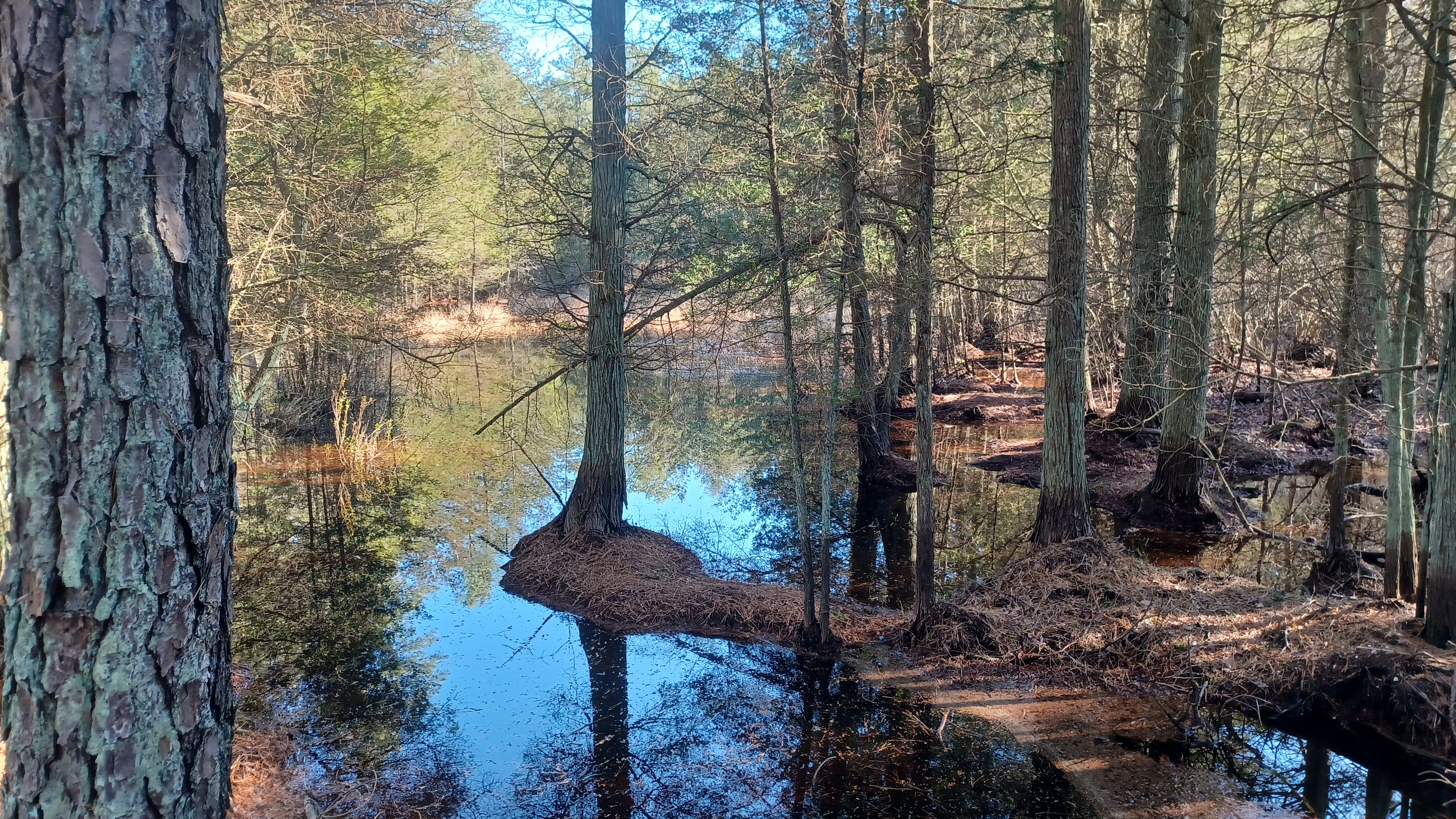
The trail goes through an Atlantic White Cedar Preserve that had been the Reeves Cranberry Bogs.

This next section was particularly beautiful. It got to be pretty wet going out across this wide open bogs. There were some little bog bridges in these sections that were a bit tough to get across without getting wet. I had no choice because I had to get the stroller through.
The trail took to beautiful causeways that were over the bogs fed by a stream known as the McDonald Branch.
We continued north across these, then turned ninety degrees to the left on the north side. The sun was beginning to go down, and it was all stunningly beautiful.


We continued on this until we got out to Woodmansie Road, a vehicle accessible sand road.

From here, my plan was not to use the official trails, but rather what I could see through aerial images form here to Kelsonville.
Directly across Woodmansie Road from where we came out, an ATV path went off into the woods. We followed that on somewhat uneven terrain to the north through the woods for a bit.
After a short while, we reached a wider woods road. We turned left to follow that, and my intent was to follow another path that broke off of this to the right up toward Kelsonville.
I accidentally passed the trail I had wanted to turn right on, and came out to the Reeves Road, so I decided to backtrack. This was a last gamble for the day, but I figured it would be okay. We had just eough sunlight remaining.


We didn't go all the way back as far as I initially intended to go, and instead made the left turn north on a trail parallel with the one I was originally intending.

This worked out pretty much just fine. I had to get a hand to go over a couple of fallen trees, but it wasn't all that bad.
We came out of the deeper woods, to another woods road. We turned left, and then hard right onto another sand road known as Parkway East.
As we were heading along, and before we made our next turn, there was a sort of monument block with memorials and a flagpole on it. It looked old, and had several little memorial stones along it, but there was nothing that looked particularly official.
Thanks to the hive mind of Facebook, a man named Wil Dirkin shone some ligh ton what this was.
It was formerly a building owned by the 13 Gun Glub. He explained it was demolished in 2018, after asbestos remediation, and that several memorial stones were built into the foundation of the building.
When the building was demolished, the memorial stones were placed around the old flag pole.
Soon, we turned left again, and headed out across Rt 70/John Davis Rockefeller Memorial Highway, and then almost went right across into Kelsonville Road.
Most of our cars were across from Jack's on Wispering Pines Blvd, and we finished the hike here.

It was a really nice time, and we hung out at Jack and Sarah's for a while, having some food and enjoying some music fun.

It looks like there are years of hikes available all around the area, with many of them ending right in Kelsonville. This could be the start of a lot of fun Pine Barrens adventures.
HAM dinner
No comments:
Post a Comment