

Hike #1585; 1/1/24 Harmony Ridge to Pohatcong with Violet and Sam Chen, Justin Gurbisz, Eric Lipper, Steve Sanbeg, Timothy Kovich, Sue Bennett, Sev ?, Professor John DiFiore, Diane Reider, Jenny Tull, Carolyn Gockel Gordon, Judy Betancourt, ?, ?, ?, Brittany Weider, Mike Piersa, Serious Sean Dougherty, and Luke Freselone
It was time once again for my annual New Years Day "First Day Hike", which I also post through the job.

Things didn't quite work out as I was planning right away. I was going to have my coworkers on board for this one, and one was going to help with the car shuttles for some of the group wishing to do an early out. Unfortunately, he got sick, and then my second near coworker got sick, and so I didn't have any extra help for this one.

What I decided to do to make this one better would be to include the pump house in Phillipsburg into the trip. My Board of Recreation in Warren County is over the site, but it is officially leased to the Friends of the Transportation Heritage Center in Phillipsburg.

There are complications with some of that now, because the couple who had been managing it for so many years, Ken and Ann Miller, are unable to do the incredible amount of work they had done. Ann recently passed away, and Ken has had issues where he can't get in there easily.
Because of this, I have been trying to encourage a relationship with that group and the National Museum of Industrial History out of Bethlehem, with whom I've got friends as well.

I arranged that the place would be unlocked, and we'd have a tour of the site, around the mid way point of the hike. The first part of it would showcase some of the great sections of the Warren Highlands Trail, and the second part would move on to the connections to the Morris Canal Greenway in Phillipsburg.
I was looking forward to this one more than some of the previous years, because there was so much cool stuff coming up as part of it.
The meeting point would be over by the Burger King in Pohatcong Township, on the strip of Rt 22 east of the old Phillipsburg Mall, and near the Walmart. I can't use the Phillipsburg Mall lot any more really, because it is scheduled to be demolished, and they have had a guard watching over all of the huge lot.
The starting point would be at Brittany's house on Ridge Road, a short distance from the trail.

We shuttled up there, and only a couple of people went to the early out point. Two new girls showed up that really liked the hike, but still went for the early out. I guess Judy was one of them, and I don't recall what the other girl's name was.
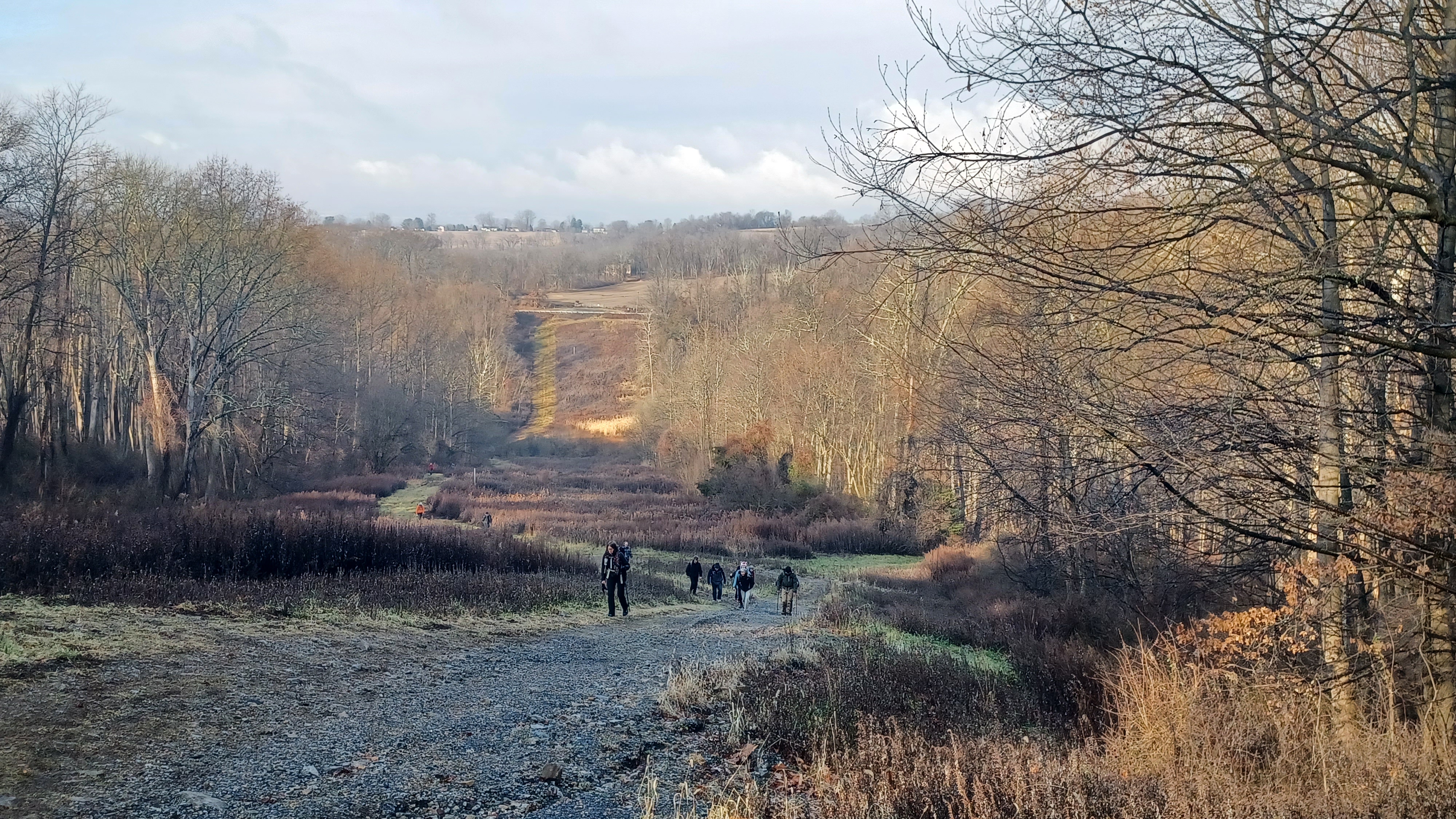
Everyone was parked on Brittany's yard or driveway, and we got moving somewhat quickly. We walked down Ridge Road to the Warren Highlands Trail crossing, and turned left to the Merrill Creek access lane. We took the side trip up to the giant mound on the access, which is kept mowed.

The view was pretty awesome for the early day fog and such.

We then continued along the trail downhill, across a little tributary of the Lopatcong Creek, and then back up into the former Miller Farm, as per the 1874 Beers Atlas of Warren County.
The trail turns right where the buried utility for Merrill Creek goes over a knoll, and passes through the farmstead where there is still a stone bank barn frame, silo, and corn crib. A house used to stand in this area, but is long gone.
Someone had spray painted "time machine" on the access to the silo in from below.
We followed the trail from there along the old farm lane out to Harmony-Brass Castle Road, where the trail crosses and then turns left and right onto the rest of the utility on Merrill Creek property.
I was very irked when I saw that the trail blazes on both the state land and on the rails going to Merrill Creek property had all been painted out. I had assumed that the trail had been closed for the work they have coming up in the near future, which will require a temporary closure.

Later on, when I went back to pick up trash at the parking lot, I noticed that the trail had not been closed or vandalized, but rather, Merrill Creek had moved where the trail came out to the road to a more gentle slope, and where there was a better line of sight.
In doing so, the state needs to move its own access as well, because now there is nothing to show where the trail should go once entering the property. Six months would pass by and still nothing has been done about it, but that is not the fault of Merrill Creek.

We descended and reached the Lopatcong Creek at the bottom. Here, it is a rather difficult crossing because the bridge I built several years ago with Matt Trimmer has been almost completely washed away. Only one board and the chain I stuck it to the tree with remains in place.
It's pretty much necessary to wade or to make a good jump to get across at this point, but it's doable.
This would probably be the roughest part of the entire hike for sure.

Not only was it the big jump we had to deal with, it is really super steep on the other side. We made our way up the hill, but it always kills me every time.
We reached the point where the paved road access comes in from the top, and the ascent becomes more gently. As we headed up and made the next hairpin turn on that, the abandoned former Allens Mills Road goes off to the right, and I gave everyone the history on it.
Currently, Allens Mills Road comes to an end to the east of the reservoir, but it used to go through to the little settlement of Allens Mills, which was where it joined present day Harmony Brass Castle Road. The mill dam s purged, but buildings are still there and occupied.

When the reservoir was built, several roads were rerouted or closed. Allens Mills Road was closed on the east end, and some of it used to go under where the reservoir is a bit. The sections that remained or realigned were renamed Fox Farm Road as an extension of that. General public today do not realize that Allens Mills Road does not go to Allens Mills.
We continued the climb up, and then crossed over Fox Farm Road to the parking area for the reservoir, where there is a porta john. I decided to head over to that so people could use it rather than use my shortcut up the one levee that I usually do.

From there, we turned onto the co-aligned Perimeter Trail and Warren Highlands Trail to the right across the levee.
The reservoir was completed in 1986ish, and is not actually a park. It is private property owned by a consortium of power companies.
I was hoping that we would be able to use more of their property for trail extensions, but where previous management was amenable to it, the new management is not.

The property has been under major scrutiny for a huge logging project that took place along Fox Farm Road just to the east of where we were standing. They apparently cut off some old growth forest on north facing slope that had been set aside in some sort of Highlands regulations years ago to remain untouched. The map I saw showed an "L" shaped piece of old growth to be preserved, but now it's gone.
We continued around the perimeter, on nice easy trail, to the turn off for the parking area on Fox Farm Road. We turned here, and made our way out to the road, then went left. The Warren Highlands Trail is routed on Fox Farm Road from this point to the intersection with Western/Decker Road to the west.

We turned to the right onto the trail route through the fields. Neighbor Bill Cortese often greets us as we go by, but we didn't see him this time.
We headed out into the fields and made the left turn, and passed the hawk banding station. It was obvious that the place had been pretty active lately.
In recent years, the shelter building there was in rough shape and looked unused, but this time it was refurbished and very active.
We took in the great view of the Delaware Water Gap from the fields, which were previously owned by Oswald Stecker, so they were known as Ozzie's Fields.

We continued along the field edge where there were lots of new no trespassing signs on the boundary.

I had found out recently that there is a guy that has been trying to get a hold of a land manager, but I don't know where he's from. I assumed a little while back that he was upset that the Warren Highlands Trail came too close to his property, if his is the place close to the end, so I spent some time clearing out the end of the field and making the blazing more obvious. I haven't heard anything back, so I'm assuming that was the problem and he's happier now.
We continued into the woods onto the property that had belonged to Bob Shandor, which was his favorite hunting spot. I've renamed the property "Shandor Summit", because just having a second peak of Scott's Mountain seems just too generic.

Shandor, when he was a boy, climbed to this point with his friends and proclaimed that one day he would own it, and then he actually ended up owning it.

This summit was withheld by Shandor when other property was transferred to the state, but after he died, I worked with his son to try to get it preserved for him. We got the trail through before the state got it and avoided having to do Land Management Review.
We descended from this point, through the woods, very steeply. We then turned right at the bottom of the first slope, and used old woods roads on the trail as they switch backed down toward Harkers Hollow Golf Course.
This was a pretty easy section of the trail to route because of all of the logging roads through these properties.
Before we came out to the golf course, we could see that someone was walking the wrong direction for the trail because trees had fallen over it. I really need to get back out there to clear some more because the route they are taking goes onto private land.
Neighbors had often given us trouble walking out of the woods in this sections, but everything was quite this time.

We continued onto Fairway Road and then down to Rt 519. We turned right, and then left across a swath of grass to Strykers Road, and then stopped by our friend's house on the left.
I feel really bad because I can't remember her name, and this was her first actual hike with us. I can't find my list of participants for the first day hike to get them all down that came.

The cool thing was, we met her on a hike on this trail over a decade ago. We had been walking the other way, and she was interested in selling an easement across her land for the trail at the time. Farmers Fairgrounds was supposed to provide a route for the trail through their land which would eliminate most of the road walk here, but that never happened.
Her boyfriend was there working on something around the house, and they offered us drinks and snacks, so it was a pretty nice little break along the way.
We got to pet their animals they had in the back of the property during the break, which added another level of fun and interest to the trip.
We made our way from here along the trail route, which is Strykers Road to the field section where Warren County obtained an easement.
We turned right along the trail route along fields, continued to a tree line, cut through, and followed basically the right sides of fields.
There was a lot of standing water on these field edges this time, more than usual. It had been a pretty wet previous season, and I had suggested that these areas, at least on the county owned bits, would make good wetland restoration projects. Maybe one day.

We continued into a swath of woods, where a foot bridge built by Matt Davis and volunteers including me, had been washed out recently. We managed to get down and up there, and through the weedy woods bit onto county park land.

Carolyn met us in this area. She parked her car in a nearby development and walked Belvidere Road to catch up with us, just in time to head up into the Marble Hill properties.
We followed the field edges out to Belvidere Road, and I made sure to point out the great view of the Shandor Summit from the end of the fields.
We walked the 0.3 miles of Belvidere Road to where the trail makes the abrupt turn onto state land heading up Marble Hill.
As we were heading up, L Scott Smith, the volunteer who maintains it, was out cutting wood in his yard. It was great to be able to introduce him to the group, because he does such a great job on it.
We continued on uphill where Mr Smith mows everything, and I pointed out building foundations and where there used to be a spring house back in the day.
There used to be a farm house in this section as well, and the double corn crib only just collapsed in the past few years.
We continued gradually uphill to the ninety degree bend in the trail, and I had everyone look off at the view of where we had just been. We could see out to the ridges and through Harmony Township to put into perspective much of the hike. It's one of my favorite spots.


From this point, I like to skip the Warren Highlands Trail on through hikes, and take the Iron Mine Trail.
I laid this trail out to showcase the different mining remnants of the area. From the east, it first goes along several prospect pits, then ascends slightly to follow the edges of the mining holes in the ore vein. It then continues to a flat area, and on a woods road to the main Fulmer Mine entrance.
This is always a cool spot for everyone to see, and the ice stalagmites are always pretty impressive inside in the winter. The locals know it as the "ice cave".
After checking out the mine, we descended a bit more past the foundations of the mining buildings, and reached Warren Highlands Trail where we began to descend.
As we were walking down the trail from here, Serious Sean finally was able to meet up with us.

We all headed downhill on the trail, and then left the official route to the right when we got to where it came to the bend in River Road. We then went down the driveway to the Phillipsburg Pump House.

We soon approached the building where we met up with some of the volunteers at the place. They'd already invited some of their own group to tour the building, and everyone was milling about.
We entered the place, and saw "Big Allis", the Allis Chalmers pump engine built in 1913 to serve Phillipsburg's water supply needs.
The pump is said to be the largest of its kind possibly in the entire western hemisphere. It served the town of Phillipsburg until 1979, and then was ran regularly through the 1980s, to keep it operable as a backup. When the last guy with institutional knowledge on how to operate the thing was gone, it sat derelict for years.

The roof was in deplorable shape, and it was in danger of destruction, but the county replaced the roof, and Ken Miller and his group put in incredible amount of work into the place.

I was fortunate to be at the first grand opening of the place back in 2001, as I was invited by my friend Bob Bodenstein to see it.
There was a metal sign in the front of the place that reads "only he who attempts the ridiculous achieves the impossible". I recently found that sign in the front of the place again, and showed it to the group. Somewhere, there is a picture of Bode and I holding that sign in 2001.
After I joined the Board of Rec, I got to tour the place several more times, and even got to get into it on other occasions for tours that were not really part of Metrotrails events. I really wanted to eventually have something like that, so it was great to finally be there.
The pump was considered inoperable for a while, but volunteers worked on it. In 2018, they got the thing running again.
After they ran it, the video of the operation was posted on youtube and other stuff, and it caught the attention of the state, which abruptly wanted to inspect and caused some issues.
I understand through the grape vine that there is someone also very interested in the pump and its components, and would like to get in there and abscond with some of the components or something, so they have to be careful about running it or causing any kind of fuss about it.

Sometimes I don't realize the reach I have with Metrotrails, and so when I posted the photos of this initially, it caught some county attention that was not too happy.

I didn't realize that they didn't want anyone walking on the walkways around the thing, and that everyone was supposed to be wearing a hard hat in the building. I had mentioned that I was doing a tour there at the previous Board of Rec meeting, but some parties were absent, so I didn't really get any guidance on that.
I apologized for the issue, promised it wouldn't happen again, and things were okay.
The site has really flown under the radar for many years, and it really needs to sort of continue in that way as we work slowly toward getting it up to code or whatever that it should be. Warren County has been sort of back woods "old west" style of government for a really long time, and while that is really nice, there are some things that could potentially be huge and costly problems down the road if not addressed. Fortunately, we have good people working on all of that.
We got a nice lecture on the site, and how it all worked. When we were finished, we climbed all over the thing quite a lot. I was glad to get that out of the way since we'll never be able to do it again. At least we got in there once and had a field day.
Once we were done at the place, I tried to get my coworker Brian Tortora to go with us, because I sort of connected him with the guys at the museum and he's been volunteering there. I figured the remainder of the hike was a lot of industrial archeology, and he would be really into it, but he wasn't into hiking at that moment.

It was nice that Mike joined us however. He hadn't been out on one of the hikes in a while, and he keeps so ridiculously busy at the museum, it was nice that he could join for just a bit.
We left the pump house and checked out some of the artifacts outside of it. I looked on at where the old farm house used to be just beyond, and everything was gone. This was sad to see.
A 64 mile marker from one of the railroads, I'm not sure which one, someone had graffiti'd with the word "Nintendo" above the numbers, which somehow didn't bother me much.


We headed across the tracks of the former Bel Del Railroad, down to the edge of the Delaware River, and turned to the left for a bit. I convinced most of the group, even those who were going to cut out early, to at least do this last bit with us.
We followed the river downstream until we got to the water authority outflow pipe to the Delaware. I've loved bringing people through this crazy thing ever since the first time I did it back in 2005 or 6.
We went into the pipe, and I forget what thing I was singing going through it. I think it must have been some Sinatra thing or something. I've been having a lot of congestion, and those are usually easier for me to do.


I seem to recall that I was doing "My Very Good Friend the Milkman" by "Fats" Waller. I grew up with a lot of these old tunes because my grandfather would sing them with his Barbershop chorus.

They would be quite different in the versions I heard, as arranged by an amazing talent named Ed Waesche. The tags on Barbership numbers are always complicated. I didn't care for the tags as much as the melodies, but either way, creating bass, tenor, and baritone vocal lines for the existing leads takes an incredible amount of talent.
I was fortunate growing up to have a great respect for the famous tunes of the earlier 20th century, where most of my peers had only heard back as far as doo-wop in the fifties and not much more. My generation grew up with Nick at Nite, so there was a lot of that generation we were exposed to, but not much earlier.

We continued through to the other side of the giant pipe and emerged on River Road. Those that were cutting out at this point turned to the north on the road, back to the parking area for the county side of Marble Hill, and the rest of us turned to the south toward town.

We continued through to Union Square, where the old Bel Del Railroad crosses Northampton Street, at the former station site. The Sand Bar is built on just about that location in a style that emulates the old station. I took a then and now comparison shot, I think using one from the fifties that seems to show a Brill Doodlebug train passing through. I think the last passenger train passed through in 1966.
We continued past this, then down along the tracks and on the platform for the passenger excurisions that run through here to check out the Morris Canal Arch, the western terminus of the canal. The arch was where boats flowed by ferry across the Delaware River from an outlet lock on the Delaware Canal, to the NJ side and up into Inclined Plane #11 West.

We went out onto the the top of it, where we could see the three bridges over the Delaware: the former Central Railroad of New Jersey in the middle, Lehigh Valley Railroad to the south, and Lehigh and Hudson River Railway to the north.
This was always the best place for a transportation heritage center, because so many types of transportation came together right here.
My idea for that is not one single museum, but to showcase the town itself. Put pieces throughout the town. Let the town be the museum. Maybe one day.

We continued from here up the former inclined plane, back across the Bel Del line, and then up to the top of where Plane 11 was. I pointed out where the power house was, and that the entire large field where there is now a skate park in the middle used to be a canal basin, a sort of parking lot for boats.
In the years later, it was the town dump, and then the park after being capped.
We headed across, and then onto the abandoned tracks that pass through the Mt Parnassus Cut, which connected the Lehigh Valley Railroad with the Kent Yard and the Bel Del line further on.

We hiked through on this, and then just continued on along the right of way to the east. The canal was down below this to the right, but it was starting to get dark and I wanted to keep on moving. I had a lot of other things in mind that I wanted to do, such as climb to the top of Parnassus, but we really didn't have the time to do it this time.
Luke Freselone also joined us for the latest portion of the hike, somewhere there toward the end.
We continued on the right of way through an area that seems it is inevitable to be developed in the near future. There are talks of another warehouse going in, but the streets off of South Main in Phillipsburg are really not amenable to tractor trailer traffic, so it shouldn't happen.

We exited through an opening in the fences onto the streets of Phillipsburg, and emerged on McKeen Street. We followed that north, passed under the former Lehigh Valley Railroad main line, and then turned right on Mercer Street parallel with that right of way.
We got to South Main Street, turned right under the Lehigh Valley line, and continued a little bit to the east until we got to the Andover Morris School, which sits in the area that was a former ironworks.
The Morris Canal went through the front lawn of the school, and I pointed out the shape of the grass where the canal had been filled in. We continued out to the road known as Morris Canal Way, which is built on the canal.

I giant concrete slab is all that remains of the former industry ahead. We passed that, and crossed Sawmill Street. The canal greenway was better delineated here than I'd seen it in the past. They sort of had it feeling unwelcoming in the past, but it was better this time.
Just ahead, the only remaining aqueduct on the entire 102 mile canal that carried the waterway over a road still stands, mostly filled in.
The top of the arch is visible, and homeless people often sleep in the tight space that is still open. Luke climbed in for a photo as we went by.
The greenway took us back out to South Main Street, and then it parallels it beneath Greens Bridge, where both the CNJ and LV lines both crossed. Only one is active (LV at this point). Lock 10 on the canal was beneath it.
We turned left on Lock Street, which is built on the former canal much of the way, and I pointed out the sites of locks 9 and 8. The lock houses are both still standing as private residences here.
We continued along Lock Street all the way to the new development below Phillipsburg Mall. This brought us by the old Inclined Plane 10 West, and then the earlier plan that is now a driveway.
We cut up into the development, and then into the mall parking lot. Since it was dark, we figured we could walk right through the demolished Bon Ton I think it was. I could see the security guard lights off in the distance, so we skirted the edge of it without lights, then cut up to Foch Blvd. We walked that a couple of blocks across James Avenue and emerged at the Burger King where several of us stopped to sit and relax for the end of the day.
It was a really fantastic start of the year, and I was glad for what an interesting trip it had been. I knew this year was going to be amazing.
No comments:
Post a Comment