

Hike #1611: 6/30/24 Paw Paw to Little Orleans with Jenny Tull, Evan "Joe Millionaire" Van Rossum, Alyssa Lidman, Kirk Rohn, Professor John DiFiore, Carolyn Gockel Gordon, David Adams, and Everen

This next hike would be one I'd been planning for quite a long while, the next in my Chesapeake and Ohio Canal series.
This all came about as part of my 911 National Memorial Series I had started just after finishing the Perimeter of New Jersey series.
It was my thought that doing that series would continue to popularize the group even more, but it didn't pan out the way I'd thought it would at all.
The groups were pretty good until we got across Morris County NJ, and then they dwindled more and more each month. Normal to small size groups brought us all along the rest of the route until we reached Johnstown, the farthest west we connected on the 911 Trail.
We did the entire Great Allegheny Passage as a series, and then did the Chesapeake and Ohio Canal for two days last Summer. I was looking forward to continuing the series this Summer with this two days of hiking using Little Orleans as a home base.
I started looking for something that would suit the group well. I pretty much knew Ev's mom wouldn't want to come out with us, but wanted to have someplace she'd like to stay in case she decided to come last moment.


The only place to stay along the way other than the campsites was Ridge Rider Campground in Little Orleans, just a short distance off the canal towpath as well as the Western Maryland Rail Trail.

I went over the campgrounds and cabins to see what was available that would suit us. I asked first in the Metrotrails chat group who was interested in attending if I put this trip together.
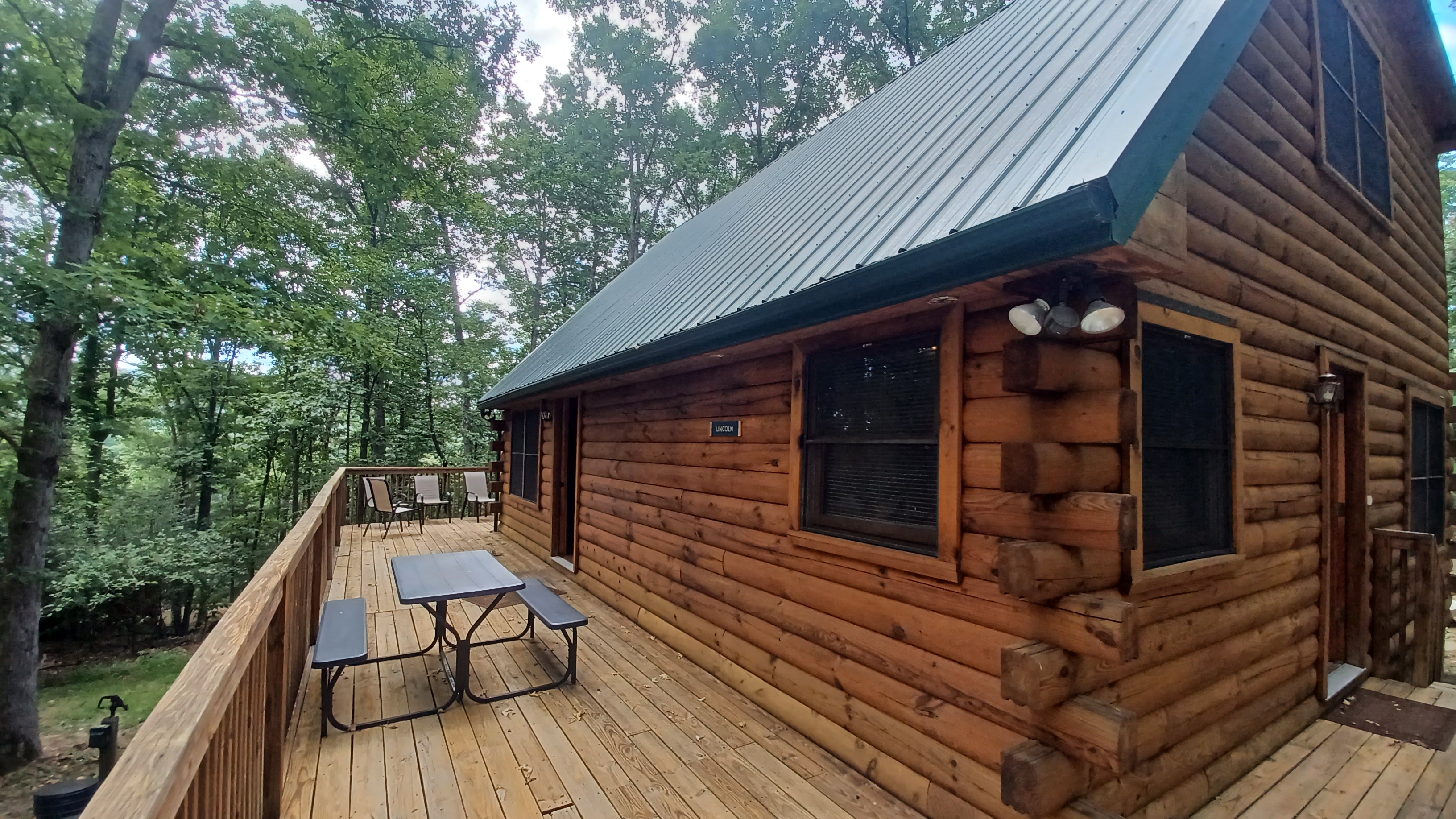
I was overjoyed and surprised that so many showed interest in this trip. Based on the numbers it was looking like, I found a very large cabin called The Lincoln.
This building slept about twelve people counting the couches. It had several rooms, and three bathrooms with showers. It was perfect for what we needed. I wish we'd been able to stay a little longer at the place.


There was one separate, more private bedroom, which I was going to claim at first, but when Jillane said she for sure was not going, I decided to give it to Joe Millionaire and Alyssa, being the only couple there the first night, and I'd just take wherever else.


I was very happy that so many showed up for this trip. A lot of these trips in the past were smaller groups of us, and during the most recent one, only Joe Millionaire, John, and myself were there.

It was a pretty long drive down. On the way, Ev was saying something about going home, but I tried to get him excited about the cabin. He didn't really have a frame of reference for what it was going to be.
I made it to the cabin before dark, which I was thankful for. It was brutally hot and humid out, and was thankful I had the air conditioning on the way down, and more thankful that it worked so well inside the Lincoln Cabin.

Most everyone was already there except I think Carolyn at this point. I put Ev on the porch, and he immediately began running around exploring. All of the worry about going home was gone once we were there, and all of our friends were recognized.

The drinks were already pouring, and the TV never went on. Everyone sat around chatting and having a nice time.

I was just ecstatic to finally be getting back to where we left off on something farther away. Ev was just happy to be running around.
The porch wrapped almost entirely around the building, and he was able to run that, as well as down and around the outside of it. By the time we were all ready to turn in for bed, he slept very well.
We went to some bunks in the lower floor and passed out for the night.

In the morning, we had to shuttle to our start point. The second day was going to be a loop, because the Western Maryland Rail Trail was parallel with the canal the entire way to the east, but the first day, that line was not yet trail, was not clear, and had many undecked bridges. The first day would have to be a point to point.

We discussed the night before that it made the most sense for Jenny to drive to the start because her car could carry more people than my Element, and then we would shuttle back at the end to get it.

Most the entire route to get to the start was upaved road. Oldtown Orleans Road was one, and Malcolm Road was the other. We'd have to take that to the settlement of Paw Paw to start, and it was rather slow going all through Green Ridge State Forest.
This was a pretty amazing little drive, and we even took a side trip out Carrol Road briefly to check out a little overlook of the Potomac River valley.
I wouldn't mind doing a hike that just featured the dirt roads in the state forest. I also understand that some of these used to be logging railroads, as loggers from Pennsylvania made their way down here after exhausting some of the Pennsylvania resources.

We crawled along on these roads, and Jenny was dreading the drive to pick up her car at the end. She proclaimed that she was having a beer on the way back because there was literally no one out there to care, and didn't know how she'd get through it otherwise!

True, this was a different culture. When I first got off of the highway exit, there was a pickup truck with a group of guys riding in the bed, flying down the road. It was quite a lot like what one might expect going below the Mason Dixon Line.

We eventually reached the Paw Paw trailhead. The former Western Maryland Railroad crossed over the highway 51 just to the east of the entrance to the lot, and it crossed over the Potomac River within view from the lot.
There was a ramp sort of up from the parking area and campground to the left. Once everyone was ready, we started heading up to the towpath.
It was surprising that there were not more people approaching the tunnel ahead. It's probably the most popular place on the entire canal, but it was also incredibly hot out, so that probably explains a lot of it.


This canal, or rather its predecessor (some of the lower sections were re-used) were part of George Washington's Ohio Company plan to put a canal up the entire Potomac River and connect out to Ohio. Of course, Washington never lived to see more than a fraction of this done, and even the canal never made it to that destination.

Much of the lower portion of the canal was in service for years before it was completed, but some obstacles, such as the Paw Paw Tunnel, stood in the way of it reaching the Cumberland destination.

Although the canal had the head start on the railroad, the Baltimore and Ohio Railroad ended up reaching Cumberland before the canal.
We continued the short bit out to the mouth of the Paw Paw Tunnel. We had visited here on the previous trip, but that time, the walkways on the east side were under reconstruction.
This time, it was open clear on through.
Carolyn brought her bike rather than walk the entire thing. I told everyone to hold off at the mouth of the tunnel so I could go over some history, as well as get some then and now photo compilation shots.

Although the tunnel was bored through about 1840, took until 1850 before it was open to traffic due to constant rock fall issues, workers on strike, and financial struggle. The 3,118-foot-long tunnel was always a bottleneck for the canal; boats could not pass one another, and there are legends surrounding the conflicts that ensued. By the 1870s, a semaphore was installed.

The tunnel cut off about 6 miles of travel that would have been necessary if they had built the canal directly along the Potomac River.
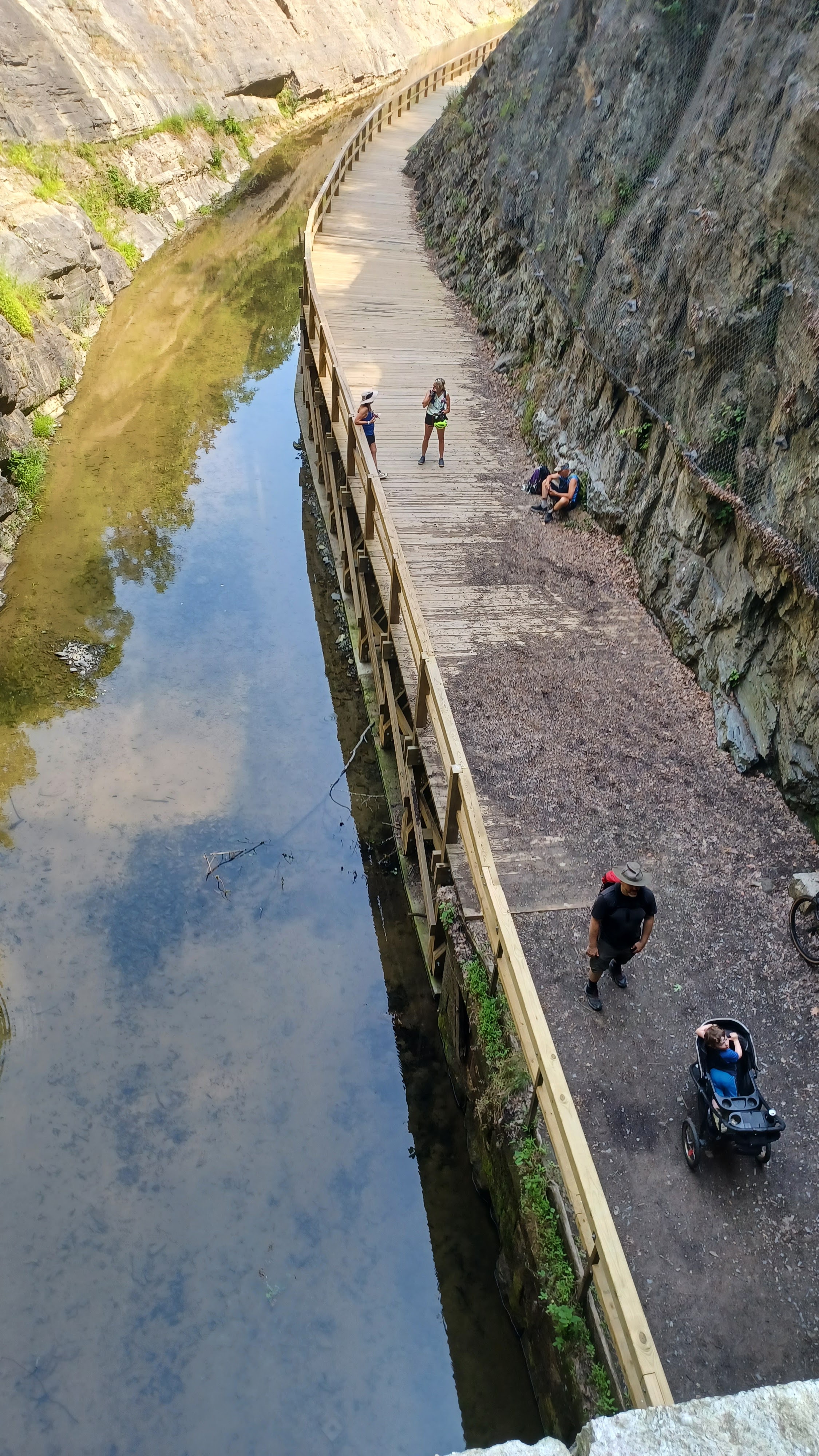
We walked through the tunnel, and it was just incredible to be on a towpath that is right through a mountain. There were bricks lining the roof through this area, which were reportedly manufactured along the canal nearby to the west.
Some bricks were reportedly inferior quality, which was yet another reason the work was held up at the site.
While we walked through, there were people that were trying to go the opposite direction of us. That required some getting off to the side, and there was barely enough room for the stroller and the bicycles to go through, but we made it work.
There were also some kids, young Christian girls I think, who were singing while going through, and it sounded somewhat creepy.
When we were here before, Ev slept through almost the entire tunnel and woke up inside, but he wasn't scared. We have since gone through many tunnels together, and he loves them. He wanted to walk through the entire tunnel by himself, and so we let him walk. I was pushing the stroller, so he took Joe Millionaire's hand going through most of the way.
He started getting a bit scared when we got toward the other side, and asked to sit in the stroller then.

We made our way out of the tunnel, and onto the incredible wooden walkway that had just been redone recently. The cut was more dramatic from the outside than I remembered it looking.

We paused here, and the mouth of the tunnel was like stairs, so several of us climbed up on top to look over the edge. Some of the historic photos of the site also show people on top of it, so this was a good opportunity to get some of that to emulate the historic view.
It was the perfect spot for a group shot.
The view through the Tunnel Cut eastbound was pretty dramatic. I was glad I went up to it. I made Ev stay in the stroller with some of the others below, because I didn't want him climbing these steps into the dangerous area.


We savored the moments at the tunnel, and then began to move on through the cut to the south, which was really just as interesting.

The walls of the cut were such brittle material, it is amazing it is not completely shut right now. Apparently, before it opened to public as a trail, it was nearly totally shut from such rock slides.
I had one more then and now to try to emulate on this section, looking eastbound, and we were on our way along the trail.
The wooden walkway did a pretty good job of emulating the historic stuff, but what I find very interesting is that supposedly all of the wooden railing on the inside of the tunnel is original to the canal days!

As we made our way further toward the end of the cut, the Tunnel Hill Trail descended from the right. The trail goes over the top of the tunnel for use during times that the tunnel is closed.

On the other side of the tunnel, it is a trail that was simply built for the use of going over the tunnel, but on the side we were on, it is actually an old haul road built in the 1830s and 40s for the purpose of hauling out tailings from the work going on in the tunnel and cut.
The trip didn't all of a sudden get to be simply walking through the woods. This was an area of a lot of history, and next up was a flight of locks on the downstream side of the tunnel. It is particularly amazing the frontier that this canal went through at the time of its completion.

Just as we were getting out of the cut, we approached Lock 66. This was what my guide books referred to as "economy locks", because they were built more cheaply than some of the others.


Rather than fine cut stone, these ones were more of composite construction, and then lined with kyanized wood afterwards. These ones in particular were then lined with concrete in the early 1900s.

It's sort of a statement on how the canal was failing, and the railroad was catching up, and they had to cut costs wherever they could. This story continues to get better though.
While the tunnel was being built, they were already working on locks on the opposite side in the section toward Cumberland.
Lock 66 was in pretty god shape, with the gate pockets most notably lined with concrete. The old lock house associated with this one is long gone. There was also a carpenter's shop on the edge of the lock.


Obviously, with wood lined locks, having an on site carpenter, especially when there was a flight of locks so close together, was a big deal.

The amount of wood needed to constantly replace damages on the wood lined locks was probably quite a lot. Sadly, the carpenter's structure burned down some time in the 1960s.
Each one of the locks had a very nice metal sign denoting the lock number at the site. There was also usually a bridge over the lock, even though there was nowhere to go on the other side.
I also noticed that the upper end lock appeared to be a drop gate style. Originally, all of these canals had miter gate locks, which opened like the doors we're used to seeing, with wickets in them.


In the later years, and on many of the canals I am closest to, such as Morris Canal, Lehigh Canal, and Delaware Canal, having the drop gate at the upper end expedited the time for locking through a lot.

I had not been aware that this was implemented on the C&O as well, but it was cool to find out it was.
Another interesting fact that helped me to remember the details on this canal, was that it was abandoned the same year as the Morris Canal, 1924. A major flood that year damaged the canal causing its closure.
Another flood came in 1936, which was sort of the nail in the coffin for the C&O.
Rather late for a canal, it left it much intact into the 20th Century, bypassing some of the industrial destruction that happened with so many other canals.

Senator William O. Douglas let a hike to preserve the historic route, but the area through Cumberland was messed up, much obliterated through flood mitigation project work in 1958. This is why the Douglas hike began about 10 miles downstream from Cumberland.

There had been talks of putting a large new highway over top of the route between Washington DC and Cumberland, which would have destroyed countless miles of bucolic settings.

This canal was preserved. The Douglas involvement is yet another connection to the places I grew up with back home.
Senator Douglas had led a similar (but much shorter) hike in present day Worthington State Forest to preserve Sunfish Pond, when it was proposed to be enlarged for a pumped storage facility. That plan too was thwarted, and the reservoir was built in a swamp area to the north. The woods road used by the senator was named Douglas Trail.


We walked a short distance, and reached lock #64 2/3.


There was no Lock 65, so builders numbered locks with fractions in a couple of locations! It was apparently too complicated to renumber locks already under construction to the west of the tunnel.

Locks 62, 63 1/3, 64 2/3, and 66 all have a lift of ten feet rather than the average 8. This allowed builders to skip building lock 65 altogether.
This one was a composite lock, which my guide books sometimes refer to as "economy locks", where wood lining was used. The cheaper lock still had a little bit of wood remaining that could be seen.
Other portions of this lock were outfitted with concrete in 1919 to replace wooden sheathing.

A local legend has it that in 1890, the lock tender at this site, a very isolated location, was murdered for his collection of rare coins he was known to have. His body with crushed skull was found in the burned ruins of the original lock house.

Sometime later, a man was found in Shanty Town near Cumberland, buying a drink with a rare coin. More were found in his pocket, and other businessmen of the area claimed he had also purchased using peculiar coins. He was convicted and hanged for the murder that occurred at this site.

There is no lock house remaining a this site either, but there are a corner and two walls of a foundation off to the side of the towpath that is the likely site of a lock house. Certainly, if the original burned in 1890, it would have been replaced.

We walked on down the canal from here, after checking out both sides of the lock, to the next, Lock 63 and 1/3.

This one was very similar to the previous two, another cheaper "economy lock", where wooden sheathing was used. Also similarly, this one was outfitted with concrete to replace some of the wood in 1910.
Again, there was no lock house remaining here. I'm not sure where it stood, and I don't recall seeing a foundation for this one.
The canal beyond this lock widened a bit into some basin areas. This was of course necessary because boats would need a sort of "parking lot" to allow for the passage of other boats through the locks.

In this stretch between locks, we passed by a rather elaborate spillway waste weir.

Waste weirs allowed water to flow over in controlled locations during high flow rather than cause washouts. This one, similar to some used on the Erie Canal in NY, has two channels routed to a common exit. This one was rebuilt by National Park Service in 1979.
In a short distance, we reached lock 62, the last one in the tunnel flight of locks east of the tunnel. Just like the previous ones in the flight, it was another composite lock that had been wood lined, and then replaced with some concrete sheathing in the early 1900s.

This one was also uncommon in that it also got a new lock house around that time. We know that this lock house was newer because the entire concrete foundation remains intact and well cleared off of vegetation.

In a lot of ways, this maintenance was pretty good, because it would take a lot of effort to keep all of these structures clear.

Like before, we checked out all of the details of this lock, over the bridge and such. I let Ev out to run around at these sites, and just made sure he didn't get too close to the edges of the locks.
Just beyond the lock was Sorrel Ridge Campsite. These camp sites are located about every eight or so miles along the canal, which is really cool for overnighting on the trail. The Great Allegheny Passage on the rail beds was not nearly as easy to follow through because the distances between them was so great. It's really only geared toward people mountain biking it unfortunately.

We stopped for a good break here, where there was a reasonable access down to the Potomac River.

The slopes were rather steep, but good enough to go and get in.
I found the best way to get down and got into the water, which was hugely refreshing. The only problem with this site was that it was very mucky immediately going in from the shore. I tried to go in at a spot where it wasn't so terribly bad, but I think Joe Millionaire went in at the squishy spot.
Several of us got in the water after I got in. Ev played at the top of the slope with Dave for this one, because we found a fisherman's snag line tied to a tree or something that he could pull around.

Those lines are almost invisible, and Ev was having a good time pulling it around and playing some sort of tug of war with Dave.

It had been so humid, we would have to stop and cool off multiple times before the day's end.
Joe Millionaire needed to de-stress something terrible on this day, so we made sure he had plenty of good drinks and relaxing times.
When we first started on this trip, he got a phone call (when there was any service) that a pipe had burst at his house and there was water all over.
He had somebody going in to take care of his dog. His aged father is no longer able to take care of things while he's away, and so this led to several phone calls trying to get things straightened out.

On this day especially, there was no getting out early. This was the day that crossed no public roads for the entire distance of the hike. Whatever way there was, would require a climb and then no service.

Thankfully, he was able to get someone to go to the house and check in on it, and close a valve to keep it from further damaging any of the lower floor of his home.
The damage turned out to be so bad that he ended up having to miss some future hikes, and spent the remainder of the Summer living in the upper story of the house because of all of the mess.
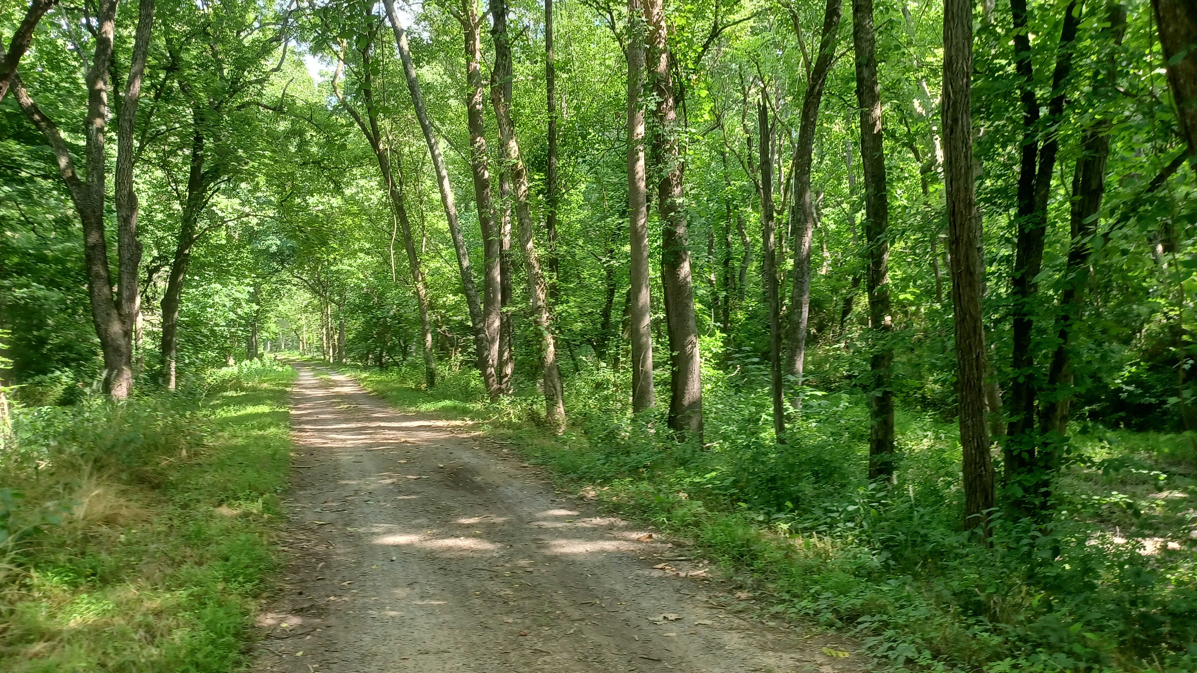
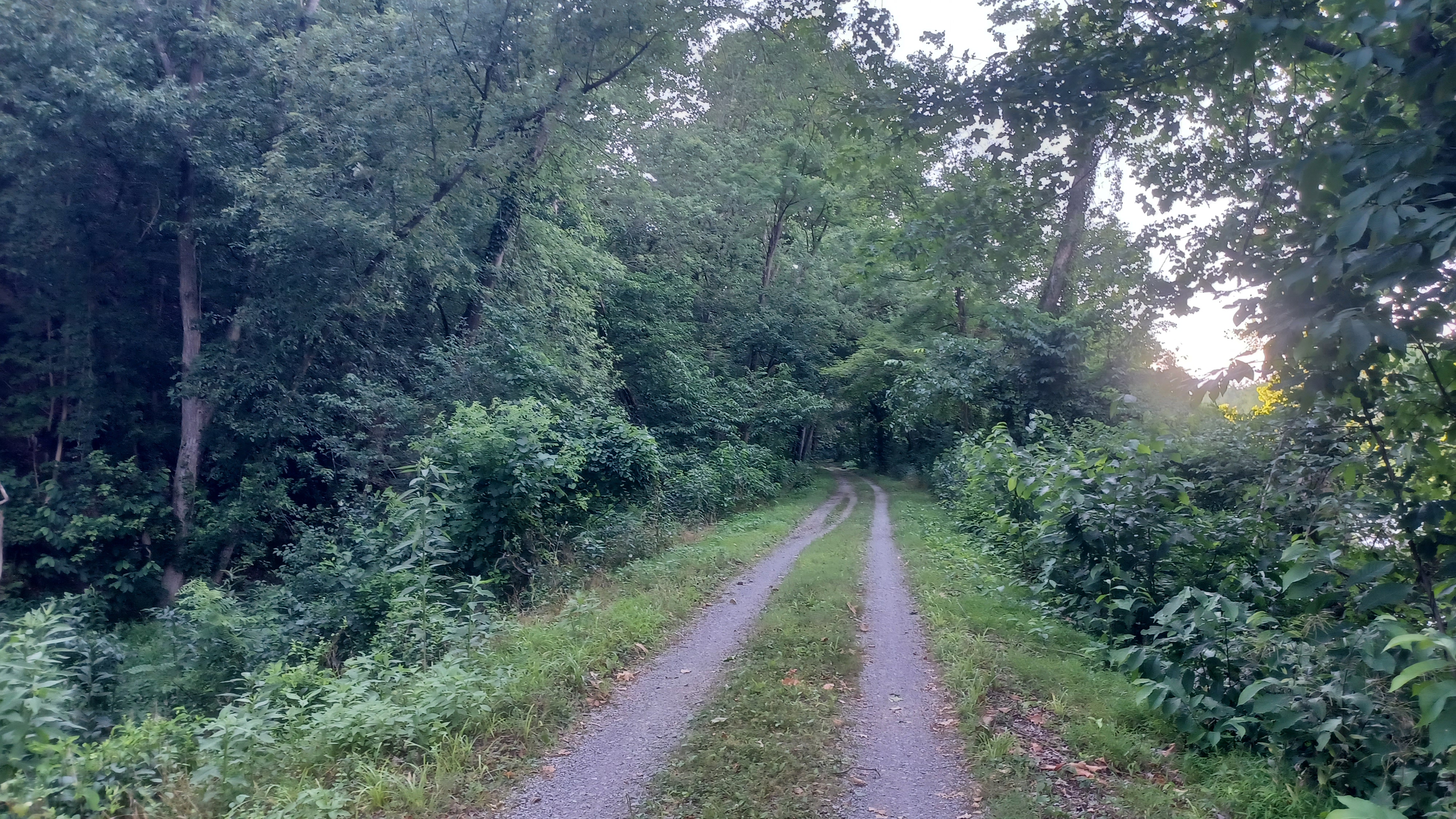
After a good cool off, we headed back onto the towpath, in this area known as Sandy Hollow Flat, to head eastbound.
At this point, we were heading north on the canal. The prism of the canal was almost completely dry through this entire area, and silted in a bit. The towpath was perfectly clear however, and very pleasant to walk. Thankfully, we had a good degree of shade most of the day.
In a little while, we reached the lower end of Gross Hollow, where to the left, the Great Eastern Trail joins. I don't recall there being any specific sign at this point, but it is where the trail joins the C&O Canal from Green Ridge State Forest.
I had wanted to do this trail section for quite some time, and had even considered making it part of the trip for this time, but that would have been a lot of extra effort.

The Great Eastern Trail piggybacks on several other trails throughout its length, which one day might connect Maine to Florida, dwarfing the Appalachian Trail.

I love the route, and I've already covered a very substantial portion of it, or trails that connect well to it. I've done several hikes on the Finger Lakes Trail in New York, and then there's the Mid State Trail in Pennsylvania.
I've hiked the entire southern half of the Mid State Trail from RB Winter State Park PA to the Maryland border, and then Great Eastern Trail to Flintstone MD where it turns toward Green Ridge State Forest.
I'm missing in that bit only maybe a day of hiking from Flintstone to the C&O Canal.

The trail follows two routes from Mid State Trail. The other alternative is it turns from Mid State onto Standing Stone Trail, and then takes that south to Tuscarora Trail. It then follows Tuscarora Trail to the C&O Canal. I've also done all of that. I just hadn't done any of the section that is coaligned with the C&O.

On this trip, I would do the first of those sections, starting from this point we had reached.

It would probably be a pretty rugged hike to go over Green Ridge State Forest, so it's nothing I could bring Ev on at this point.
I was hoping Jillane would come on a trip and stay with him so that I could do the one day without him to complete the section, but it is looking more like I will do it in the future when he's able to do it himself.
In the meantime, I will be able to do at least these easier connections, and I'm good with that.

There was some pretty rock strata along the inland side of the canal as we walked the section ahead to the north.

We next passed through an area known as Twigg Hollow, and then reached lock #61. This was also another composite lock, with a lot of rubble and such in the canal at the approach.
Just like the other economy locks, this too was lined with concrete to replace the wood lining in the early 1900s. The foundation of the lock house is all the remains of that.
Lock tender Joe Davis and his wife died in a fire that destroyed the lock at this location I read in one of the guides.

There is a four mile level between locks 61 and 60, in a very secluded area with lovely rocky cliffs of Green Ridge State Forest on our left.

This adjacent 44,000 acre Green Ridge State Forest was in the early 1900s a subdivision plan for the largest apple orchards in the world, and getaway homes for city elite.
The Mertens family of Cumberland undertook clearing and development, but the plan was never a success, and the state began purchasing and piecing together the properties for the state forest in 1931.
They say the occasional fruit tree still exists in these woods.
We soon approached the trestle that carried the Western Maryland Railway over top of the canal and the Potomac River. Some of the group who had gone ahead waited under the bridge for us.

The rail line had three crossings of the Potomac River in the previous sections of the canal we had done. One of them we were able to walk across as Carpendale Rail Trail. The others were completely undecked.

The Western Maryland Railway was built through this area in 1906, in direct competition with the earlier Baltimore and Ohio Railroad.

While the B&O was not as straight in many places, the Western Maryland had more bridges and tunnels, which of course require a great deal of maintenance. The B&O ended up taking over the Western Maryland, and eventually took much of it out of service. The Connellsville Extension of the line is now the Great Allegheny Passage at its eastern sections, and some of it is now an excursion line between Cumberland and Frostburg, rail with trail.
The Western Maryland from Cumberland east, with the exception of a few little bits, is undeveloped and grown over pretty badly.

If it is ever extended through as rail trail, I will certainly have to return to do it. Some sections are very newly done, from Little Orleans east, which is why the second day of our trip would be a loop utilizing it.

The Western Maryland was single tracked here, but the bridges were built so that if they wanted to make them double tracked one day, it wouldn't be so difficult to do. We could see that in the piers on the deck girder bridge that towered above us.
On the north side of this bridge was the former site of the Green Ridge Station, and just beyond that, the abandoned Stickpile Tunnel. I'd have loved to go on a side trip to see it, but the canal was fully watered, and there was no good way to get over to it.

We continued on from here, and the path was completely loaded with Japanese Wineberries. We ended up taking a ton more time than this would have taken because Joe Millionaire, Alyssa, and I stopped to pig out on them.

Ev ate a couple, but I was amazed he was not as into them as he was the previous year. This year, he was more into the mulberries, which I like too, but I don't think they're quite as good. They also tend to have little worm things in them.
A little after the trestle and passing by Roby Hollow, we reached lock #60.
Again, this was a composite lock done in economy fashion with wooden kyanized sheathing, replaced in the early 1900s with concrete.

There was no lock house at this site as well. This western end of the canal wasn't just cheaply done with the locks. Rather than stone, the cheaper wooden lock houses often are missing for that reason.

In this case, we had a little of the foundation still remaining in sight.
This lock had apparently been lengthened in later years of the canal to accommodate two boats locking through at once.
We could still see a little wood remaining in the lock from the sheathing.
We soon reached Stickpile Hill Campsite where we paused for another break and a dip in the Potomac. This one had a much gentler approach, and so everyone could hang out on the stony beach.

Even Ev could come down and wade in the river a little bit safely. The water was beautiful and clear.

I had to see how deep it got, and if I could wade all the way over to the West Virginia side.
Getting to West Virginia was easy. It never really got much deeper than knee high, and so Joe Millionaire, Kirk, and myself all tagged West Virginia.
After getting well cooled off, we headed up. I think Jenny and John were powering through on this section, because I recall they were just leaving the site as we had arrived to swim there.
I didn't really see the need to be speeding through the day, but it was indeed extremely hot out. I think those of us who did the best on this one were those of us who took dips in the river along the way.
Along this section, we were somewhat closely parallel with Kasecamp Road, which has some vehicular access. We had crossed the gravel Bonds Landing Road, which is not really easily accessible. This was the most of that access we'd see all day.
We came around the Stickpile Bend and there were more meadows and such, and some pretty views across the canal.
As we walked, I watched the left side, and then there was an old, abandoned house sitting on the berm side. Just beyond, there was an earthen fill over the wet canal.

I had the group wait with Ev on the berm side while I went over to investigate it a bit more.

The guide book noted that this was formerly a property of Joseph L. Higgins.
Higgins was a section foreman on the canal, and also boarded mules here. His wife was a cook on her father's scow.
When Mr. Higgins died in 1918, his remains were floated by boat to Little Orleans.
I approached the house on the road, and found it was wide open in the back, so I went on in to have a closer look at it.

The main floor was in many places collapsing. It was obviously not often seen. There were still bed frames and such strewn about.

Most people going by would not have even noticed that there was a house on the edge of the canal.
This goes back to one of my arguments for walking rather than biking these routes. We miss so much flying by on a bicycle, and we have to pay closer attention not to crash. If I had biked the Great Allegheny Passage, much of the amazing things we saw would have been missed entirely.
I exited the house, and decided to look a little further up the road in case there was anything more.

I was glad I did, because there was a beautiful, larger house, still in rather good condition there.

I am of the opinion that this other house was likely the one belonging to Higgins, and this front one was probably a worker's house or something. I cannot know for certain.
I made my way back down as not to invade any privacy, because this other house was obviously kept up.
I crossed back over the canal, and we continued on our journey eastbound on it.
The canal remained watered for a bit, and there was a stretch with no shade at all, but fortunately that didn't go on for very long.

Soon, we came to the next crossing of the Western Maryland Railway, a deck truss structure completed about 1904.

There was no good way up onto this bridge either, and I think at this point, we were happy to just stay in the shade ahead.
The Western Maryland Railway crossed to the West Virginia side to go around the next bends on the river, where we wouldn't see it.
The Baltimore and Ohio Railroad was also on the other side there, and tunneled through on the opposite side from us.

We continued on ahead a little more, and soon approached Lock #59. Once again, this was another more cheaply done composite lock that had been lined with wooden sheathing.

Unlike some of the other composite locks, this one only had a little bit of visible concrete covering I recall, capped where one of the bridges would have been across it.
Also similar to the other economy locks, this one was missing the lock house. The foundation was clear and in good shape, made of stone to the right of the towpath, but it was likely another wooden structure that did not last the test of time following the abandonment of the canal.
This area of the bends in the Potomac is known as the Devil's Alley, and we continued around in close proximity to the river, sometimes with lovely views.

We stopped for another break when we reached the Devil's Alley Campsite.

Each one of the campsites also has an old style water pump, which is great. Ev got to try these out each time we went by one.
The things say to treat the water before drinking it, but I didn't bother at any of them. I wonder what the issue is with these things that they don't think it's safe.
The pump reminds me of growing up and the one we used to use to get water every time we went to Dunnfield Creek at the Delaware Water Gap.


We went down to the edge of the river to take another dip, at another very stony spot. This would be our last group swimming spot for the day.
The group had become pretty segmented, and I think it was only Joe Millionaire, Alyssa, Kirk, and I remaining at this point.
Dave and Jenny were up front at this point, and John I think was moving along fast. He had done a very long trip out further west, and drove insane hours to be able to meet up with us for this one.
We had a really nice dip in the river, and made our way back up to the towpath to continue to the east.
It wasn't too long before we reached Lock #58. This was the last of the composite "economy locks" on the trail that used kyanized wood lining.


There were a total of 13 locks on the C&O Canal that were built more cheaply, along with their lock houses.

This one had a whole lot of concrete on its edges, which were changed to that some point after 1891.
On this one, unlike some of the other ones, the concrete improvements were on the length of the lock walls, while the gate pockets remaind stone lined.
The other odd thing on this one was the existence of a remaining lock door hanging from the upstream side, although in pretty poor condition. It was still recognizable.


The stone basement to the lock house still remains on the edge of the towpath, but of course the house itself is now gone.

I had one more then and now to do of this lock. The canal below the lock was still beautifully watered and provided for some good views.
We continued ahead, and soon passed beneath the final bridge crossing the canal and the Potomac on the Western Maryland Railway.
This was another deck girder bridge, which was built between 1904 and 1906, and then rebuilt in 1917.
The water in the canal began to disappear at about the bridge spot, and we knew there was some kind of access because there had been people kayaking in the canal at about this point.


Soon after the bridge, Joe Millionaire, Alyssa, and Kirk saw a way of getting across and up to the railroad bridge.

From there, it was only a short distance on the rail bed to Appel Road, which was the easiest way to get to the Lincoln Cabin.
I was not going to skip any of the towpath from this location, so the three of them left me, and Ev and I continued on ahead on the towpath.
The railroad bed becomes the Western Maryland Rail Trail just beyond the bridge above to the left.
After they had bushwhacked uphill, there was an official connecting trail just beyond to the towpath!


The towpath brought us around a final very sharp bend approaching the town of Little Orleans, with occasional views out across the Potomac.

We knew we were coming into Little Orleans when we reached the Fifteenmile Creek Aqueduct.
The 110-ft single span arch aqueduct was completed in 1848-50 in the final stages of canal construction.
The aqueducts are no longer holding water today, and for management, the roadways that vehicles can drive are down through what was the trough of the aqueduct. Most cyclists and such would go down into that, but it is still open to walking the towpath along the top, which is what I always prefer to do.


There was a good view out to the Potomac from that spot, and in the other direction, we could see the bridge that carried the Western Maryland Railway over the same creek.

The rail bridge was a double concrete arch.
There was also an historic marker denoting a riot that ensued in August of 1839, when Irish workers on the canal attacked German workers in their tents and threw some of them into a fire.
There was a boat launch out into the Potomac by the Fifteenmile Creek, and so we descended to the right to get a better look at it and the bridge.
It was really the best place to view the aqueduct, and I got a fantastic shot of it from there.


I think I also took a final dip in the creek at this spot while Ev waited on the shore. I didn't get far from him.

We headed back up to the canal, and the boat ramp road crossed over it where it had no water in it. This site was also the Fifteenmile Creek camp site.
We left the canal, and soon intersected with High Germany Road. We turned left, and immediately passed beneath he concrete culvert carrying the former Western Maryland Railway overhead.
The famous "Bill's Place" was on the right as soon as we came out from under the culvert.
I didn't bother stopping for a drink, although I probably would have if the rest of the group had been with us at this point.


Little Orleans barely has anything left of it except for Bill's Place these days. Very few homes are left at all, and there is the campground we were staying at up the hill.

Bill's Place was originally a canal store, and when the Western Maryland Railway came in, it had to be lifted up and moved farther up the hill. This happened just after 1900.
This settlement was once an important travel route on a couple of different major roads, and the Kings Tavern opened here in 1795. Mrs. O'Queen's Tavern was here in 1841.
Bill and Ethel Schoenadel purchased and ran the store starting in 1969. Bill was known as one of the great characters along the route, with countless stories.


The old building burned down in 2000, but was rebuilt.

Bill died in 2013, but Bill's Place is an extremely popular stop for those on tracing the canal today, and after having read about his story, I wished I had stopped for a drink on the way through.
Bill's Place had an extra outdoor bar on the left side of the road, and the main building was on the right. It definitely looked like an eccentric type of place.
Ev stayed in the stroller. I pushed him ahead, past the only other house on the short stretch of "downtown" on the left, and passed the intersection with Orleans Road on the right.

We continued on Orleans Road to the left, which weaved around and then went hard to the right, downhill rather steeply.


We passed by some entrances to some camping areas. When I was planning this hike out, I was looking at all of that and where we might be able to cut a corner, but the topography wouldn't have allowed.

There were signs for Ridge Runner Campground, and then lettering reading "no trespassing", followed by "what would the folks think?". Yes indeed, we were below the Mason Dixon line.
We continued down and soon crossed over the Fifteenmile Creek again, which was much smaller at this point, just before the intersection with Appel Road. We turned right here.
We only followed this for a short distance, and then turned to the left on St. Patricks Road.


This was a rather steep hill, but not all that terrible. As we made our way up, there were some splendid pastoral views off to the left, back over the valley of the Fifteenmile Creek we just crossed.

Just ahead on this road, we reached the St Patrick's Catholic Church on the right. I had thought we migth hike to the right and actually go through the cemetery behind this, but at this point, I was ready to just continue on toward the end. It was certainly a beautiful church however.
The cemetery around the church has burials dating back as early as 1802.
A log church was erected here about 1808, and was replaced by the current structure in the mid 1800s.

This was likely an important spot for the Irish workers during the time that work stalled on the canal between 1836 and 1839, when the contractors could not pay off their employees.

We made our way to where the road leveled out, and then onward to the entrance to the Lincoln Cabin on the left.
We made our way up the driveway and into the place, where I think it was Joe Millionaire had already just about had burgers ready for us. I was definitely starving from all of this. I think we had hot dogs too.
I handed one to Ev, and he just casually ran around, inside and outside on the deck, gnawing away on a cheeseburger.


It was so hot and humid out, we absolutely had to keep the doors shut. The place had a beautiful outdoor fire pit, but it was just not comfortable enough to be sitting out there.

Jenny and Carolyn were gone for a while getting their cars, which I felt kind of bad about. She definitely didn't cool off enough all day, because she wasn't in the shape to be hiking the next morning, and that's way out of character for her.
It was a really great but tiring day, and even Ev told me when he was ready to lay down and go to sleep.
Jack and Sarah showed up at the place late, and most everyone stayed up late having heated but friendly debates about stuff. I wish I could have partaken in it, but I was so tired that when I took Ev down to bed, I fell asleep myself.


I came back upstairs only briefly and knew I needed to get back to sleep somewhat soon.

The heat of the day really got to more people than I thought it would. It ended up being only Kirk, Ev, and I out for both days of the trip. Jack and Sarah were the others that did the entire next hike also, and Carolyn joined us for it as well on her bicycle.
I was glad as many did this first day as they did. It had been absolutely fantastic for me, and the next day would be an entirely different hike. I wasn't nearly too burnt out to do it.
We have so much more to do in order to complete the entire C&O Canal, but we'd been off to a great start. If I could do a trip like this once every couple of months, I'd be ecstatic.

As long as I could reach the point I wanted to reach on this second day, I would be ready to go on the next trip, out of Hancock MD, where we'd do two loops right from the hotel in the middle of town.
No comments:
Post a Comment