
Hike #1619: 8/18/24 Hickory Run State Park West with Robin Deitz, Jenny Tull, Professor John DiFiore, Dan Lurie, Evan "Joe Millionaire" Van Rossum, Alyssa Lidman, James DeLotto, and Everen

This next hike would bring us back to Hickory Run State Park PA, where we had had a somewhat recent hike over the Summer.

I knew after that last hike that I needed to come back soon, because the way that day played out, it did not connect with any other previous hikes I had done. My main initiative was to make sure it connected.
Also, the previous hike through this park was such an overall pleasant experience, my feeling that most of the trails might be like that would mean that a re-visit would be similarly easy and relaxing.
The only part of Hickory Run State Park I had been through previously had been the Fireline Trail, on the far west side of the park above the Lehigh Gorge.

I did that hike several years ago while tracing the former Lehigh Valley Railroad and Lehigh Canal Upper Division, in an effort to follow old alignments and historic long abandoned locks.

Alyssa had been with me on that one, but no one else in this particular group was there that day.
My intention on the previous trip was to reach the Fireline Trail, and then head back to close in a loop, but we ended up going over the miles I planned to do, so we had to change it up and I planned this second one.
I knew that there were good swimming opportunities in Hickory Run, and so that was another reason for planning this one out.

On that previous trip, we had met at the far west side of the park, but this time, my plan was to start right at the main park office and do a long loop.

This was a really nice building with a good restroom, museum, and such. I wouldn't check it out in detail until the end of the hike, however, beyond the restroom.
In the front of it was a giant map of the park designed into the concrete walkway.
The visitor center is actually a good jump off point for many of the trails within the property, which tied in very well to what we had done previously up there. It was near the middle of the camping area, and had a connecting trail to their beach swimming area at Sand Spring Lake. That was my planned last swimming spot for the day.

Like the previous time, things would not at all work out as planned, but it was still a good and interesting day.

The park was once home to the communities of Hickory Run and Sailorsville, and their associated logging and milling lands.
Today, Sailorsville is only foundations, and only two extant structures remain of Hickory Run (Samuel Gould Manor House and the church, which we visited on our previous hike out here).
The area of the park was once known as the "Shades of Death", because of the unforgiving rocky, and agriculturally useless lands. It also apparently has some sort of biblical connotations, which is why we see the term used both at this Pennsylvania location as well as in Great Meadows NJ.

Property here and throughout the Poconos was given away after the Revolutionary War, but most grantees didn't bother to try settling here. Robert Morris purchased much of it in 1793.

When the Upper Division of the Lehigh Canal was completed just to the west in 1838, the logging industry at Hickory Run grew. Six sawmills were built through the area on Hickory Run, Mud Run, and Hawk Run (then Dirt Run). Long gone towns of Hickory Run and Sailorsville were successful for a time.
The clear cutting of trees led to major flooding, which contributed to the fall of these towns, and destruction of the Upper Lehigh Canal, which was not rebuilt after 1862.

I know logging railroads were in use through these lands, but I have never seen any maps that show where these lines used to traverse.

The scrubby young vegetation was prone to forest fires that stretched across the county and destroyed mills and homes.
In 1918, Millionaire businessman and philanthropist Harry C Trexler began purchasing properties to piece together as a new state park. He invited public to hunt and fish, and 1000 acres were fenced foe propagation of animals.
In 1935, National Park Service purchased the land, and it became Hickory Run National Recreation Demonstration Area. Works Progress Administration began building trails and camps in 1936, and Camp NP-6 of the Civilian Conservation Corps was established in 1939, and work on trails, roads, and facilities continued.

The National Park Service conveyed the land to the Commonwealth of Pennsylvania in 1945, as Hickory Run State Park.

The 15,990 acre park today has over 40 miles of trails, much of which we had already seen with the waterfalls, campgrounds, camp store, and so much more on the previous trip.
After meeting at the visitor center, we got our stuff together to go on the odd route that I'd planned to traverse the campgrounds and such to make it a more diverse trip.
I seriously ended up adding on miles because of my oddball start to this trip, which I suppose was fine, just a little bit off from what I was planning.

While I was getting my stuff together, the others took Ev into the visitor center for a bit too.

I think while he was with me, he left his bottle full of chocolate milk on the shelf with the brochures.
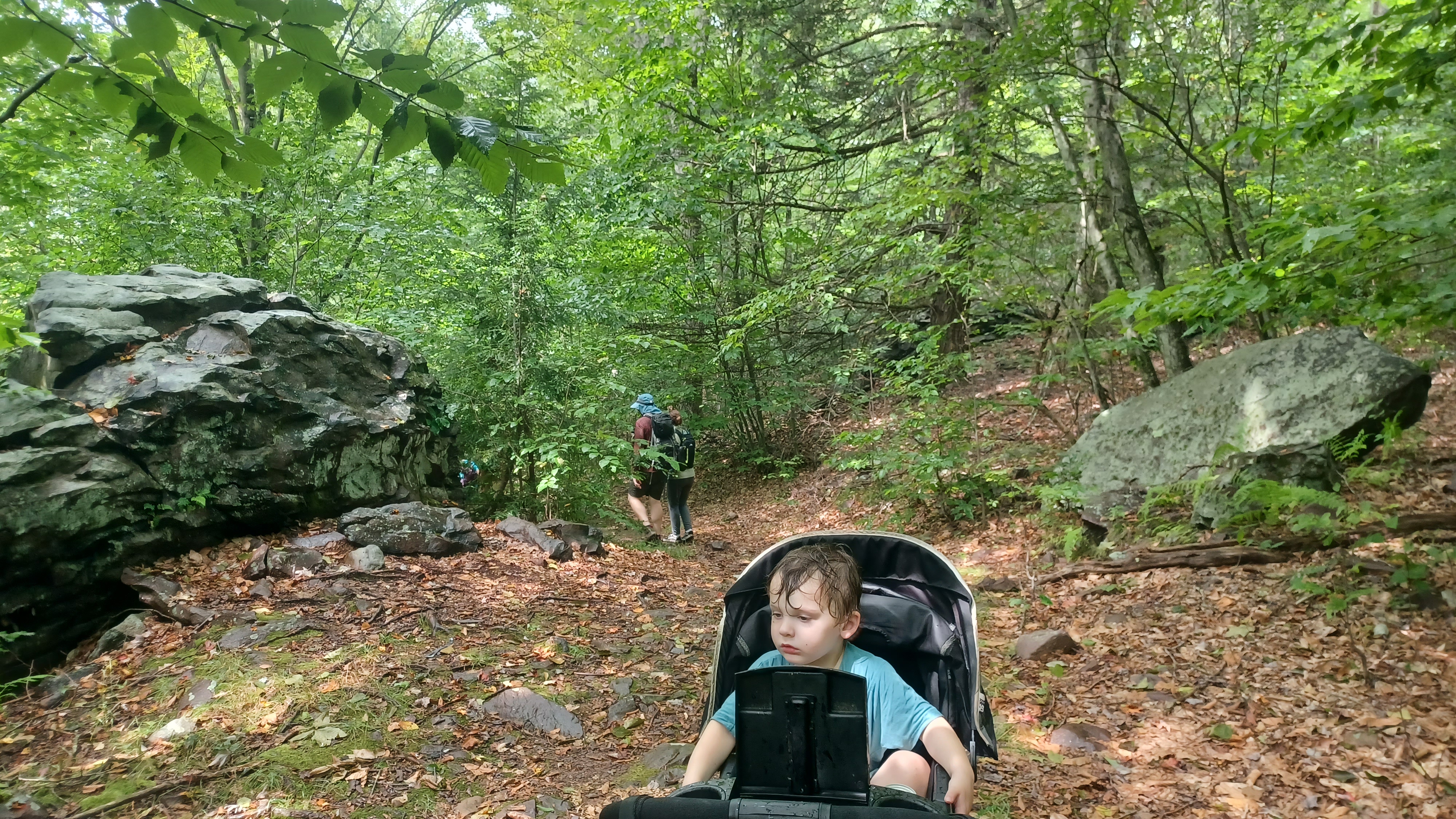
We started walking to the south, and got across the Family Camp Road through the park into the campsites. We started on the first of the camp loops, to the east of the camp store area, and then cut to the right, past a restroom, which took us onward into the next loop of campsites. I figured doing this would get us through all of these loops without having to be on the busier (but not by much) family camp road.

After the second loop, there seemed to be a path going off of the south side of camp area, which I thought might be a parallel trail through the woods to the next campsites to the west.

This turned out not to be the case, and we had to backtrack through the camping area. A lot of people were packing up and leaving, and so there were more than the average cars going through. We had to watch Ev closely to be sure that he wasn't in anyone's way.
Heading back toward the Family Camp road, there was no other trail this time going into the next loop of the campgrounds. We would have to go back to the Family Camp Road and cut over to the next one.
It was just before this point that we realized we left Ev's sippy bottle of chocolate milk back at the visitor center. He was upset about it.

At the road, Joe Millionaire and Alyssa started running back toward the visitor center apparently to get it. I'm not sure if there was anything else they were missing, but I amended our course here. By going almost straight, there was a connector to the Shades of Death Trail, which goes along the Sand Spring Brook to the west.

We had done almost all of the Shades of Death Trail on the previous hike, but missed the section closest to the visitor center. I figured the section would be very easy, so we headed down toward that, and then to the right, toward the back of the visitor center.

Joe Millionaire and Alyssa emerged after I texted them to just come around the back side of the visitor center to meet us, with Ev's bottle in hand.
Together, we all made our way down the Shades of Death Trail, from the routed wooden sign, to the Dam No. 5. This was apparently an old mill dam.
I'm not sure the history of the dam, but it could be a very old one associated with some of the old mills of the area. It had a sort of concrete cap in the middle of it, so it was certainly refurbished for park use either way. From the top of this dam, looking upstream, there was a good view of the arch bridge that carried Rt 534 over the creek.

Ev was out of the stroller and headed across the dam and back, but then the Shades of Death Trail went on the south side of the stream, though woods, and then down a series of stone steps to a nice path closer to the stream. It was a tough area for the stroller, but I had help going through it, and Ev was either being carried or holding someone's hand.

He was having a bit of a fit because he wanted to stay closer to the dam, but it had no railings, so it wasn't too safe for him.

We got down below the dam, at a very pleasant site, and then walked downstream for just a little bit to reach a nice footbridge over to the north side. We got across this, ascended a bit, and then picked up an old woods road that headed downstream on the other side.
This was a very level grade along the stream. I wonder after walking some of these, if they could have been parts of logging railroads. I have no clue how far into the current park they traversed.
We continued along this rather easy path for a bit, and then passed along the north side of the CCC Lake. We continued to the west end of this, and then descended to cross the dam to this lake. We left the Shades of Death Trail here.

Views of the body of water and dam were quite beautiful. Water spilled from the dam on a protruding flume of sorts, away from the dam.
There was an outlook area just a little further to the east, along the south side of the pond, so I headed to that next. Above us in an open grassy area was a nice looking playground. Ev went up to play in that a bit.
I went over the maps a bit at this point, and I was glad we grabbed some hard copies of them at the visitor center at the start, because it was so much easier than the PDF on my phone.

We made our way from here uphill slightly and into a portion of the campgrounds. We came to the same spot we had emerged from Shades of Death Trail on the previous hike.

We headed through this bit of campgrounds to the south, to Family Camp Road again. In this area, I knew that Sand Spring Trail was supposed to begin, and it looked to me like it should have started near the end of the Family Camp Road.
The inset of the camping area on the official state park map seemed to show that it should have gone into the woods directly off of the corner of a camp road loop, and directly across from where we emerged on the Family Camp Road.
There was nothing there, and so we walked to the right, to the end of the Family Camp Road, where a clearing continued into the woods, apparently a utility line. This certainly did not look like it; it was too overgrown.

We headed into a small campsite area off of the road where it looked like the trail should go, and this sat close to a small tributary of Sand Spring Run.
Joe Millionaire spotted a faint path off of the end of some of this area, which went down and over the small stream, beneath a low canopy of Rhododendron. He went to scout some of that, and I scouted upstream on the near side with the stroller. When I didn't find anything, he was way off in the woods, and the rest of the group was with me. We headed back out to the Family Camp Road and walked back the way we came a bit, then turned around and went back to the east again to look there.

I couldn't make any sense of this, and so we just decided to continue to the east a bit more to have a look. This was what we needed, because we soon reached the trail turning in to the right, at the corner of a campsite that looked like it was a bit further east of what was shown on the map.
I shouted out to Joe Millionaire that we'd found it. Alyssa apparently found her way to him, and I sent him a text message on what we had found. I might have called too.
The trail entered thicker woods of Rhododendron, and then crossed the small Sand Spring Run tributary with piles of rocks to get across. I was able to just push the stroller through with Ev riding.

On the other side, it continued as an old woods road without too much difficulty through the woods, parallel with the stream heading west. Pretty soon, we could see Joe Millionaire and Alyssa ahead. They had taken what was shown as an "official" trail, but so was what we had taken.
Together, we all continued along this trail to the east, along a height of land for a while. A couple of fallen trees required some help with the stroller, but it wasn't too bad. It was not nearly as easy as the Fourth Run Trail we had done on the previous Hickory Run trip, but it was still pretty good.

The trail made its way to more of a shelf area, and passed a pretty cascade on the left side. We then hugged the slope of the hillside with the larger Sand Spring Run below.
On the right of the trail was a giant wooden water tank, which I had missed, but some of the others in the group had noticed. This was a water tower built by the Civilian Conservation Corps in the 1930s or 40s to serve the then new park, and the Sand Spring Trail around this area became more level, as it is the route of a buried water line also created by that group at the same time.

It was amazing to me that the wood holding this water tower together has held up so well for close to a century. It's probably because it's so shrouded by Rhododendron I suppose.
The trail continued along the high slope, and then switched back to the east a bit for a more gradual descent toward the Sand Spring Run. Once it got down closer to it, it shifted back to the left again, and followed another apparent woods road above the creek.
None of this was particularly hard, but again still harder than what we'd done the previous time save for the Shades of Death Trail. We continued on, and then descended somewhat to get closer to the run itself. At a point on the way down, I noted a grade coming in from the right that was much more level than what we were following before, and at a lower elevation than the water line.

I wondered immediately if this could have been one of the logging railroad rights of way. If it pierced this far into the state park land, that would be particularly interesting.
As we continued on, the trail started going slightly uphill to the left, but still parallel with Sand Spring Run, and the grade the trail had been following remained somewhat lower. I was pretty convinced at this point that this could have been the logging railway.
We continued along the trail for a bit, and looking over the sides to the right, I could sometimes see more remnants of this grade.

Soon, the trail turned harder to the right and descended. It crossed this grade again on the way down, and I could see it continuing to the west, along the south side of the Sand Spring Run. Sand Spring Trail continued along the south side, but we turned right on a connector to the Hickory Run Trail on the north side, to a handsome foot bridge across the creek in a pretty little section. I had begun sweating like crazy from pushing the stroller through the mess, so I took the opportunity to lay down completely in the water while the others made their way across the bridge. We took a little break here.

From this point, the trail followed a rather rough shelf along the edge of the creek for a bit, which required some help with the stroller. Fortunately, Ev was happy to get out and walk from the point of the bridge for a while.
As we walked this bit, I watched the grade we had seen before making its way along the south side of the creek edging closer to it until reaching a point where it looked like it used to cross. That grade continued on, and I guess we joined it at some point.
The Hickory Run Trail followed the level grade for the remainder of the time along the creek. At times, it looked rutted on the right, so it was possible that this could have been a mill race at one time, but to me, it looked more likely to be a rail grade that simply got somewhat washed out.

Ev continued to walk with the others in the group through this, and I carefully got the stroller through. It wasn't really terrible, but it would have been tough if Ev was sitting in the seat.
As the yellow blazed trail got farther along, it absolutely was a railroad bed. There is no question of that, because we have historic circa 1890s USGS maps that show the Lehigh Valley Railroad had a spur that went a bit up the Sand Spring Run to serve some milling interests. There was a dam and a small impoundment through this area historically.

If there was in fact a logging railroad that continued on, it makes sense that it was a privately owned continuation of the grade where the Lehigh Valley spur terminated. I understand there is a Thomas Tabor book on the logging lines of this vicinity, but it's out of print and I don't know anyone who has this one. One of these days I might find out for sure what it was we were looking at.

The Hickory Run Trail ended, and the Fireline Trail continued to the right. We could see out to the active tracks of the former Lehigh Valley Railroad, now part of the Reading and Northern system. This location and junction was once the site of the Hickory Run Station.
The clearing where we could see the tracks was where I had come up on a previous hike. While the rest of the group hiked the tracks, I got up on the Fireline Trail, and was so impressed with it that I couldn't wait to bring the others back.
Just about a week or so earlier than this, I acted as a guest narrator on board the Reading and Northern excursion along this line, interpreting the historic sites through a speaker during the course of the trip. My friend Mike Piersa asked me to do it, and so I got a free ticket for myself and Ev out of it. I got one for Jillane too, and she almost didn't go, but I thought it was a great little trip.
I pointed out to Ev that these were the tracks we had just taken the train ride on.

I remembered it being really rather easy and mostly good to get the stroller through, but clearly my memory was flawed. This was a very difficult mess, and a rough climb over washed out rocks that I would not have wanted to do with the stroller if I'd known just how bad it was.
Fortunately, Ev was still okay with walking, and Jenny and I kept him mostly moving along on the trail. He climbed the entire way up from the trail along Sand Spring Run to the top of the rise by himself. Not until we got to the near top did he begin getting fussy, and at that point I could do some with the stroller.

He did get back in and out several times, which afforded me the luxury of easier navigation with the stroller. I really needed it, because this was tough.
The height of the land, with only low, scrubby vegetation, provided us with stunning views of the surrounding mountains and the Lehigh River valley below. The area is unlike anything else around the area, and doesn't even feel like the same state.
The scenery was probably what got me through so much of this without regret, because I was constantly in awe of how beautiful it was.

Ev fell behind a bit at one point, and Alyssa carried him up to perhaps the best view of the middle section of this trail. We all continued on over most of this, and then dipped down through some woods to where it joined a better woods road. Most of this trail was built as a woods road fire line for the park many years ago, but the first bit doesn't look at all like a road. Once we got into the woods a bit more, the treadway improved a bit.
Jim DeLotto was planning to meet up with us, and I tried directing him to roughly where we would be. I lost all cell phone service down along the Sand Spring Run, but gave him the general area, and he was able to find us by parking and walking the Gould Trail to the Fireline Trail.

At this trail intersection, we stopped for a break, and I could finally get a drink. They terrain was not amenable to sipping anything up until this point, and it was good to relax a bit.
From here, we continued along Fireline Trail to the north. The last time I was out there, I took the more scenic bypass to the Fireline Trail, known as the Skyline Trail, but that was not going to be easy with the stroller, so we stayed on the upper Fireline Trail.
The route took us up and down a bit, at one point pretty steep between a couple of large boulders, and then steeply uphill again. As we got closer to access points, we started seeing more people walking the trail. Many of them looked shocked to see the conditions I was pushing the stroller through. I know that so often, people just think I'm crazy, and might walk away talking about how stupid I am for trying this, but they're completely unaware that I do this every week, and still cover probably more mileage than they are even capable of walking in normal conditions.

Soon, we reached the main overlook at the northwest portion of the Fireline Trail. This really cool spot affords views upstream on the Lehigh River, with a prominent single pier of the former Hays Creek Branch of the Lehigh Valley Railroad in view.

A large deck girder trestle once spanned the river at this point, built in the early 1900s by the Lehigh Valley Railroad as a northbound bypass to using the antiquated Penn Haven Planes. It was a very well built route, but it outlived its usefulness, and was abandoned in the 1960s.
The overlook we were seeing was growing in a bit. It was much clearer the previous time I had been up there.
From this point, treadway got really easy for a while. We had to follow the trail as a better woods road to the east from this point, and it was a more hard packed road. There was some uphill elevation, but nothing I couldn't handle at this point.
We came out to Rt 534 where there was parking. The sky was starting to get a bit cloudy, and DeLotto decided he was going to hoof it up the highway to the east to get back to his car. He hadn't been hiking with us in a while, and didn't want to over-extert, plus he was working some really difficult and weird hours, so we said goodbye to him, and he'd try to meet up with us again in an hour or two.
We crossed over 534 directly, and my plan was to use the Manor House Trail from here. This trail was shown as a multi use one in the same font as the splendid Fourth Run Trail we had done previously, so I had high hopes that it would be as easy as that one was. Unfortunately, this was not the case.

The trail makes its way over a rough spot almost immediately form the road, through woods and over the Irishtown Run as a quick ford. The treadway was often rocky, and it required some help to get the stroller through.
The rain started coming down very soon after we got on this trail, and got rather heavy. I did not have the stroller cover to go over Ev, because his mother had borrowed it and not given it back yet.
It was fortunate that it was such a brutally hot and humid day, because he did not complain one bit about it. We put the top over the stroller so he wouldn't be hit with the heaviest of the rain, but he was still soaked, and was probably as relieved as I was with the cool off.

I was really struggling at one point on this. The trail follows the northwestern reaches of the state park and skirts the boundary of State Game Lands 40. It eventually goes up a steep bit of hill, and then intersects with a woods road coming out of the game lands and turns harder than ninety degrees to the right, back into the most secluded bits of the park. At that point, it all got far easier.
The woods road was almost as pleasant as the one the Fourth Run Trail follows. It is called teh Manor House Trail because it intersects with the Fourth Run Trail near the Manor House, also known as Gould House, near the former site of the community of Hickory Run.

The rain had gotten really very heavy, and there was quite a good amount of thunder and lightning, some of it quite loud. When the sound of thunder was much after the lightning, I explained to Ev that it meant it was no longer very close and it would be okay. I suppose if we were all panicking a bit, he might have, but he stayed amazingly cool through the entire thing with pretty much no fear of the thunder.
While on the pleasant segment of the Manor House Trail, the rain stopped, and pretty soon, the sun came back out. It was a pretty great feeling.

We continued down the trail rather easily to the intersection with the Fourth Run Trail where we had been on the previous hike, and turned right toward the former location of the Hickory Run village.
The last time we came down this way, we turned to the right, down toward the church and the manor house. This time, I had considered going to the left on on Ridge Trail, which makes its way along the HIckory Run uphill parallel with Scenic Drive, on the opposite side of the stream from the road, but I decided we would just follow Scenic Drive to the north instead to have an easier time.

As it turns out, Scenic Drive is closed to all vehicular traffic now, so this made it a really great route to follow! I just didn't know how great it would be until much further along.
We started following the road, which was quite pleasant. I wondered if any logging rail lines went up along the Hickory Run, but again I have no information on this.
We continued up the road, and the Hickory Run had gone under the road to the left side as we continued gradually uphill.

The road eventually descended slightly and crossed over the Hickory Run again at a dam and fordway. In this area was once a double sawmill and splash dam.

We took a nice little break at this spot. It was really interesting, because the stream flows beneath the road via a pipe or culvert, and only flows over the road, making it a ford, at times of high water. During those times, an attractive footbridge is constructed over the upstream side.
There was a pretty heavy cascade on the downstream side, and I stood in it and walked around for a little bit. John also went in.
While I was doing this, Ev was running back and forth across the footbridge on the upper side.

It was a really nice break, and we soon headed uphill a bit more on Scenic Drive, which got to be much more steep. I was prepared for a car to pass by at any time, and was surprised when none came.
While we were taking our break, the clouds started to get darker. I had figured that after the huge downpours we had earlier, we would be done with all of this for the day. But I was wrong.
While we were climbing on Scenic Drive, the clouds let loose with another major downpour, maybe even heavier than what we dealt with before.

At least this was very easy terrain to walk on. At this point, it was just kind of a drag to go through.

The steep road continued with some cascades on the creek to the right. We soon approached the old Saylorsville Dam (sometimes spelled "Sailorsville"), which I guess dates back to the time of that community, and then came to a gate in the Scenic Drive. We went around it and came out to an intersection with the Group Camp Road. This intersection was the former site of the center of Saylorsville.
I wished it wasn't raining so much, because I wanted to get some photos of the site, but it was coming down too hard to get anything with my phone. Even just the dam was really amazingly beautiful old stone work.

The road at the intersection was apparently once the Stage Road. This was once the main road from Bethlehem to Wilkes-Barre, and much of it is now Stage Trail through the park. We used a lot of this on our last visit to the area and found it quite pleasant. Today, the route is severed by the Pennsylvania Turnpike further up.
We turned right here, crossed over the Hickory Run, and continued gradually uphill a bit.
As we got further uphill, past a camp area known as Daddy Allen, we could see the Stage Trail going right while the road went left a bit. Rather than continue on the trail, to make it easier, we just kept on the road ahead to the intersection with Boulder Field Road. We turned right, and immediately crossed Stage Trail here.

There were occasional cars on this road, but not too many. We kept on this, from the top of the hill, and had some gradual descending. The rain started to die off, and things started becoming more pleasant.
My plan had been that we would make our way to Sand Spring Lake from this area, on back roads and such, but we were all so soaked that no one was really feeling going into the lake at this point. DeLotto made his way there and was going to wait for us, and I tried texting him that we really needed to just start making our way toward the end after all of this.

The trail was rather pleasant, and only had a little bit of rocks and elevation. Otherwise, it was quite an easy walk. We came out to Rt 534 close to its bridge over Sand Spring Run above Dam No. 5 where we had been earlier in the day. Some of the group went onto some more trail, but I had to cross the road bridge, and then pushed Ev in the stroller up a steep slope through the grass into the field approaching the area behind the park office and visitor center where we had started.
The others went around one way, and I ended up walking around the building clockwise with just Ev, and reuniting with the others on the other side.
The final thing we did, while I was trying to get the stroller and such back into my car, was to check out the museum inside the visitor center. It was quite impressive.
.jpg)
I was awes truck when I saw a Lehigh Canal lock inside, a depiction of the Upper Division Lehigh Canal. I wondered if they'd dismantled one and moved it there, but when I asked the girl at the counter, she told me it was a reproduction.
I had taken Ev's pants off, and so he was running around in a diaper following Joe Millionaire and Alyssa, so I needed to get him out of there and into the bathroom to give him a final change before we headed home.
I could have easily spent a good amount of time in the musem area, but the good news is, I have a lot more stuff to do within Hickory Run State Park. We've done two full hikes, but that is only the beginning, and there are tons of State Game Lands that branch off of that we'll do in the future.

DeLotto came over to the main parking lot to greet us before we went, and he'd had his own fun adventure at the lake making friends, so it all worked out well in the end. I felt bad that we didn't get to spend so much time with him, because we missed out on spending time with him on the Musikfest one as well.
On the way home, I stopped at the old church we had hiked by on the previous trip, which served the area between Mauch Chunk and White Haven in the mid 1800s, because I had one historic photo I wanted to emulate of the site. A positive end to a very interesting day of history, questions, and excitement.